THURSDAY |
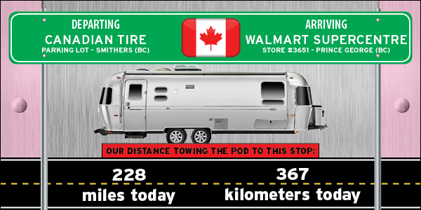
WALMART SUPERCENTRESTORE #3651 - PRINCE GEORGE, BC |
 BRITISH COLUMBIA BRITISH COLUMBIA |
DESTINATION: THE LOWER 48
| 62% | 38% |
|---|---|
| COMPLETED - 834 miles=(1342 kilometers) ⟺ 515 miles=(829 kilometers) - STILL TO GO |
|---|
Yesterday, after completing the Cassiar Highway, we made a left turn and began traveling east on the Yellowhead Highway for the remainder of the day. Today we'll be traveling another 200+ miles easterly on the Yellowhead Highway until we reach the large city of Prince George, BC.
Did you know the city of Prince George bills itself as the "unofficial Northern Capitol" of British Columbia. Victoria is the "official" capitol which is located on an island near the U.S. border and Seattle, WA.

- - Excerpted from Wikipedia - -
Today we crossed more than half the entire width of the province of British Columbia. We left the Coast Mountain Range behind and the last hour or so of the drive today we could see what I believe to be the Canadian Rocky Mountain Range looming on the far horizon in front of us.
It must have not been too exciting of a drive for us today. Want to know why I think that? Well one of us fell asleep for the last 30-minutes of the drive.
I'll let you figure out which one of us it was! Now I'm kinda glad it was me . . . even though he's making fun of me!! The alternative would have been horrifying and disasterous!! - T
I knew that would invariably elicit a comment from her. - Phil

There were lots of cows in the green pastures. These are just a few of what we saw.

No horse pictures, they were all on my side of the highway, but here's some more cows.

There were lots of these hay bales just waiting to be put undercover for the winter season.
They could have been bales of straw or alfalfa too, I can't tell the difference.

Home for the night! Another night of FREE camping.
Would you like to be notified of new blog posts?
We encourage everyone |
Until next time
TWO PEAS


