


We arrived here at Kartchner Caverns State Park to check out what is supposed to be a TOP TEN cave in the United States. We've scheduled to do both tours they offer, each located in total opposite ends of the cave.
This will be our 58th cave tour and for the very first time no photographs are allowed, not even cell phones. When I asked a Park Ranger why the "no photo rule" I was told because too many people in the past have lost the phones and cameras over the railing and it was interfering with the tour schedules by people taking way too many photos and holding up the tour.
I suspect it could be a marketing strategy to increase the number of people willing to spend $125 to take their "once a month" special 2-hour Saturday afternoon tour catering to "photographers only". No thanks! I'll just enjoy my $23 1-hour tour without my camera or phone.
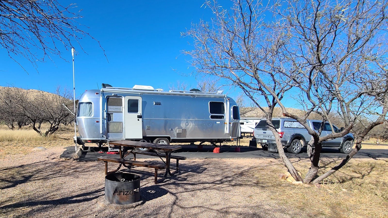
This morning we "hung around" our campsite at Gilbert Ray Campground until the "official" check-out time of 11:00AM, then we dumped our tanks, drove 7-miles to the Interstate at 35MPH, then traveled east for 50-miles at 60MPH (when the speed limit was 75MPH), got off the Interstate and stopped to eat lunch at the KFC/Taco Bell in Benson, AZ before driving the final 7-miles to the park's entrance gate.
So at 1:15PM we arrived at Kartchner Caverns State Park, after check-out time, but 45-minutes before the 2:00PM check-in time. We were directed where to park in the overflow camping parking lot until check-in time arrived at 2:00PM. That's similiar to what happened to us in the California State Park earlier this month.
Sorry, there's not too much else we could do to avoid this!


 |
KARTCHNER CAVERNS CAVE TOURSRotunda/Throne Room Tour |
 |
Each of our first two mornings here we scheduled a cave tour.
The first day we explored the Rotunda/Throne Room Tour which was highlighted by a show where you are seated and a Native Chant style music is played while spotlights are turned on and off spotlighting the numerous formations that are seen in the Throne Room.

The second day we explored the Big Room Tour. This tour is only offered mid-OCTOBER through mid-APRIL, the rest of the year there are bats present in this section of the cave and it is closed so as not to disturb the birthing and rearing of the new baby bats.
After experiencing both tours they offer I feel pretty comfortable recommending the Big Room Tour over the Rotunda/Throne Room Tour if you're here in the winter and if you only have time to choose one tour. There are many more beautiful formations in the Big Room, but the Throne Room is where you'll find the 58' tall column formation nicknamed "Kubla Khan".

a.k.a.
“The Town too Tough to Die”
Home of the OK Corral and Boothill Graveyard
Immediately following our cave tour this morning we drove 29-miles south, and then west, to the Historic District of Tombstone, AZ. First thing we did was to grab a lunch at the OK Cafe located right across the street from the site of the Gunfight at the OK Corral.

I got back to the cafe just as our food was being served. Tricia ordered the Buffalo Burger with mushrooms and swiss cheese, plus a side of french fries, while I ordered something called the "Chili Size". The menu described it as a "½-pound all beef burger on an open bun, smothered with chili, shredded cheese and chopped onions. I instead opted for a cup of the Corn Chowder instead of fries for my side. All the food was delious!
After lunch we had just enough time to walk next door, check out the "actual location" of the famous gunfight in the OK Corral before the re-enactment began promptly at 1:00PM behind a 10-foot tall wall. There was bleacher seating and we headed straight to the top row for the best viewing of the gunfight.
which enabled Virgil Earp to become Police Chief of Tombstone.
The re-enactment of the famous Gunfight at the OK Corral (October 26, 1881).

We opted for nothing more than a stroll up and down the street before heading back to the truck to explore the other destination on our list today, Boothill Graveyard just a ½-mile away.
for as long as you want, that is until 6:00PM when they close.


is buried next to his son, 19-year old Billy Clanton.

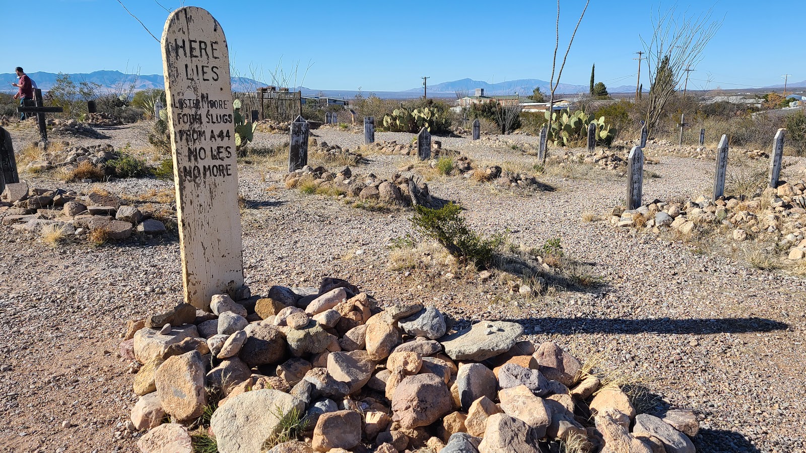
In case you can't read it in the photo, here it is:
Here lies Lester Moore
four slugs from a 44
No Les No More
Are these people really buried in the Boothill Graveyard? Or is this just a tourist trap?
Here is the link to a great newspaper article that answers just that question: LINK

a.k.a.
“Queen of the Copper Camps”
Home of the Copper Queen Mine
Our day began with a pretty wonderful sunrise, and with nearly perfect weather, if you ignored the fact it was only 29°F outside this morning. I'm glad it was 64°F inside!


Located 23-miles south of Tombstone (pop. 1308) on AZ-80, and just 12-miles from the Mexican Border, is the town of Bisbee, AZ (pop. 4923).
When you approach town from the southern end there is no doubt this is was a mining town. The Lavender Pit Copper Mine (active 1917-1974) is impossible to miss at 4000' wide, 5000' long and 850' deep.


In the 1880s underground mining was the only method used to extract the minerals from deep underground. By the 1920s surface mining was taking the lead because it was the faster and cheaper way to go about the task.
In the late 1800s huge amounts of copper were needed to build the telegraph, and later telephone lines all across the country. Also copper wire was used to power incandescent light bulbs in homes all over the country.
The Copper Queen Mine was in operation for 97-years, but it too ceased operations in 1974 when the price of copper dropped so low, due to low demand, that there was no profit to be had in underground mining.
Today of tour was lead by a person who used to work in this mine until it closed. He then became a high school history teacher for 30 years and now in retirement he chooses to be a tour guide several days a week.


The residents of Bisbee, AZ are all vertically challenged. I'm not saying they're all short, just that if you need to visit your neighbor to borrow a cup of sugar, be prepared to walk up and down several 100 stairs to do so.
The business district of Bisbee is mostly located at the bottom of the town all along one road called Tombstone Canyon. The residents mostly live on a maze of dead end roads that climb up onto the hillsides that surround the town on two sides.
Since the mine shut down in 1974, and most of the mining residents left to find work elsewhere, the town has turned into a mix of younger artists, musicians and free-spirited individuals. The current population is just short of 5000 people, with most being in the hospitality industry like bed & breakfasts, restaurants and bars.
It reminds me a lot of Key West, without the homeless population. Also like Key West the town seems to have a big festival event every other weekend throughout the entire year, with more than a handful geared towards the LGBTA community, also like Key West.
BISBEE, AZ
|
||||||||
 Businesses down below and residents up above.
|
||||||||
 Most of the homes appear to be over 100 yers old, but very well maintained.
|
||||||||
 Most of the larger homes are boarding houses from the mining days.
|
||||||||
 The town center with the church and courthouse.
|
||||||||
 One of the largest boarding houses is located down in the business district.
|
||||||||
 Downtown Bisbee
|
||||||||
 The quieter side of town
|
||||||||
 Time to head north and leave Bisbee behind.
|
||||||||
 Just outside of Bisbee to the north you'll find the Mule Pass Tunnel.
|
||||||||
 North of the tunnel the natural enviroment returns and all evidence of mining disappears.
Before we left Bisbee we stumbled across the small ghost town of Lowell, AZ located just south of present day Bisbee.
Back in the late 1800s and early 1900s Lowell is where the foreign miners from places like Finland, Serbia and Montenegro lived while working in the Lavender Pit Mine.
Today it is just a few blocks of small businesses, but they have some pretty unique automobiles parked up and down the storefronts.


Also located in Lowell is this rather unique trailer park. The Shady Dell Vintage Trailer Court is where for just over $100 a night you can rent a room (i.e. trailer).
Also located on the property is Dot's Diner and Dashes Bar. On the weekends they are open to the public for your dining and drinking pleasure.
Shady Dell Vintage Trailer Court
|
||||||||
 The town charter of Lowell, AZ was dissolved sometime in the early 1900s
and then reincorporated into the larger nearby town of Bisbee, AZ.
|
||||||||
 Looking down the row of trailers for rent in the park.
|
||||||||
 I believe this one is the 1950 Hollywood Spartan trailer.
|
||||||||
 This may be the park owner's personal residence, I don't see it listed for rent on the website.
|
||||||||
 This one is a Silver Streak Rocket edition.
|
||||||||
 A 5-window Ford Econoline pickup truck (1961-67) can be seen on the property.
|
||||||||
 A Nash Metropolitan, Checker Cab and vintage pickup outside of Dot's Diner.
|
||||||||
 We just couldn't resist and ordered a Chocolate Shake to share.
|
||||||||
 This 1955 Airstream might look like one of the rental units...
|
||||||||
 ...but it's actually the Dashes Bar located right next door to Dot's Diner.
The youngest trailer in this park was manufactured in 1959. That puts them all in the senior citizen category in my book.
If you are interested in renting one of these vintage tailers, or just curious to identify the make and model of each one seen in the photos, check out this LINK.
Would you like to be notified of new blog posts?


