

On the way out of town we stopped at Jim Gray's Petrified Wood Company in Holbrook so Tricia could shop for a small piece of petrified wood to add to her curio cabinet full of souvenirs.
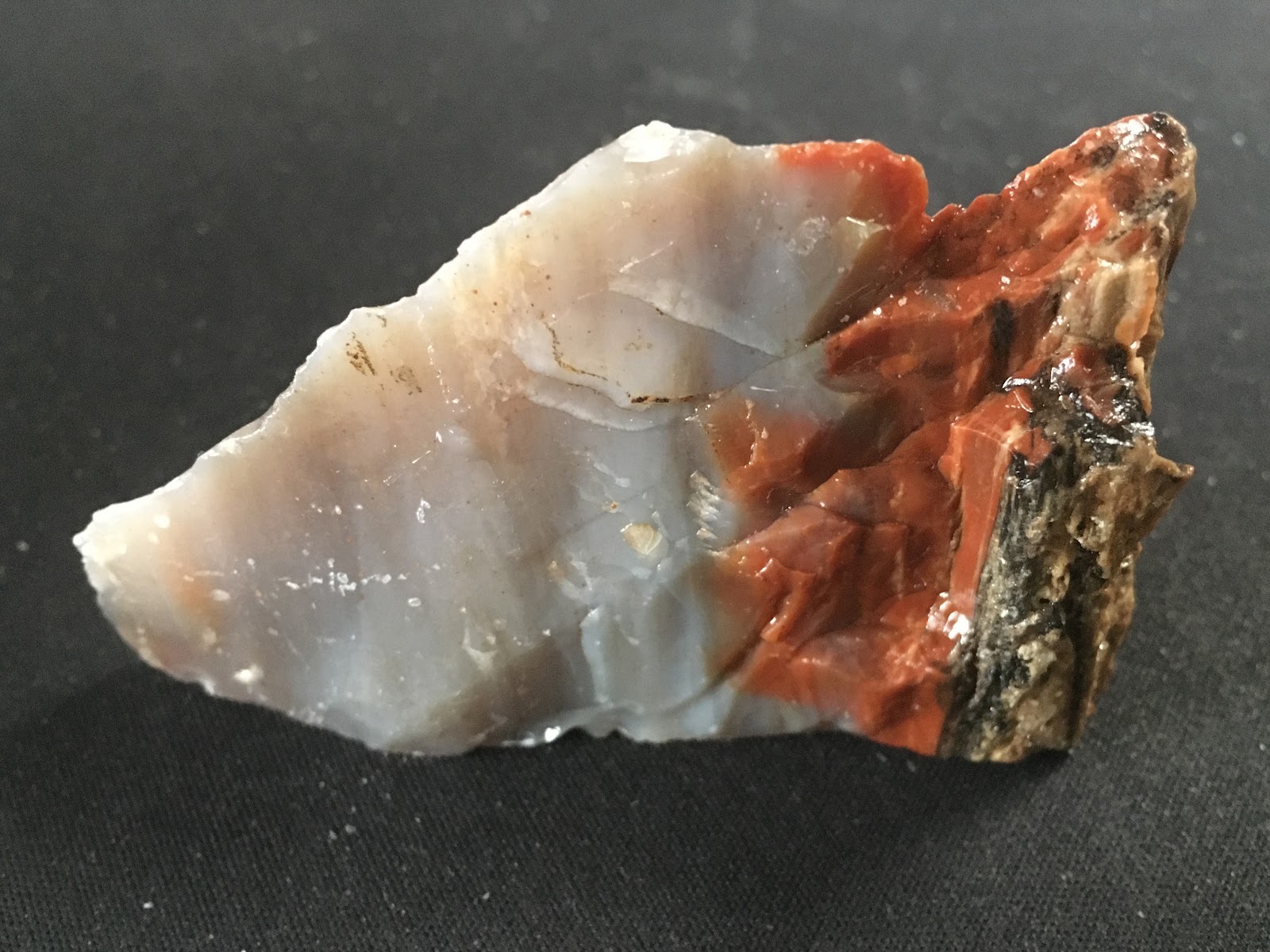
The two museum/gift shops where we were camping both had some beautiful pieces of petrified wood, but they were large and expensive, not what she was looking for.
Just a short 30-miles west of Holbrook on Insterstate 40 is the town of Winslow, AZ (pop. 9005) and where we will be visiting for the next week. Homolovi State Park is the perfect location for visiting Winslow and the sightseeing locations we have planned.

Today our friend Heather arrives at the Flagstaff Airport after driving a rental car all the way from the Phoenix Airport (144-miles) where her flight from Jacksonville, FL landed. We drove from Homolovi State Park in Winslow to the Flagstaff Airport (68-miles) to pick her up.
The first thing we did was locate a diner on Route 66 in Flagstaff where we ate dinner. After a long travel day for Heather, and a busy day for both Tricia and I, we were all ready to "hit the sack" upon arriving back at THE POD an hour later.

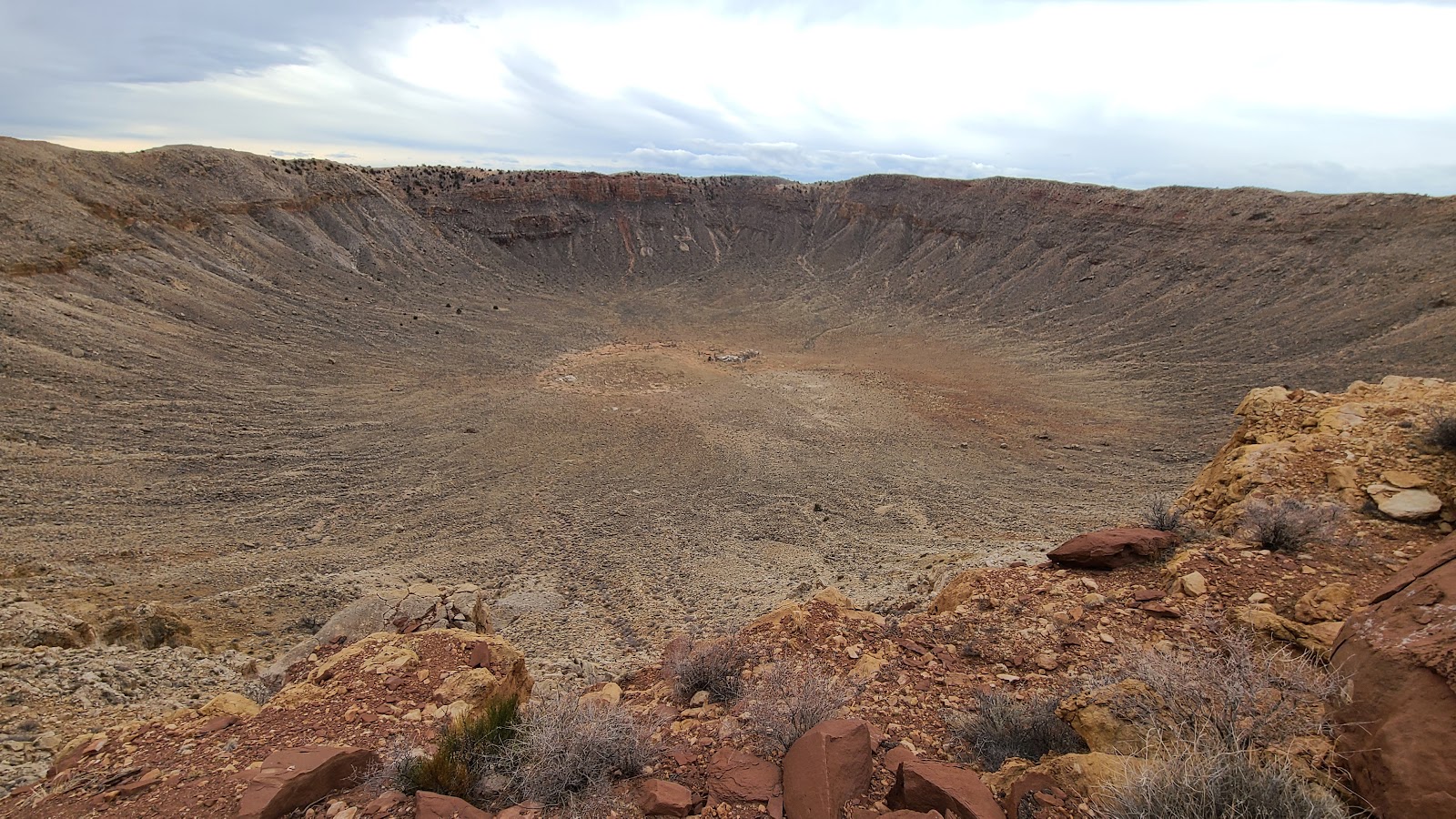
First up on our sightseeing adventure today is to visit Meteor Crater which is located some 33-miles west of Winslow off of Interstate 40.
50,000-years ago a 150-foot wide meteor stuck the earth at 26,000MPH and instantly created a crater that was 700-feet deep and 4,000-feet across. What does all that look like?
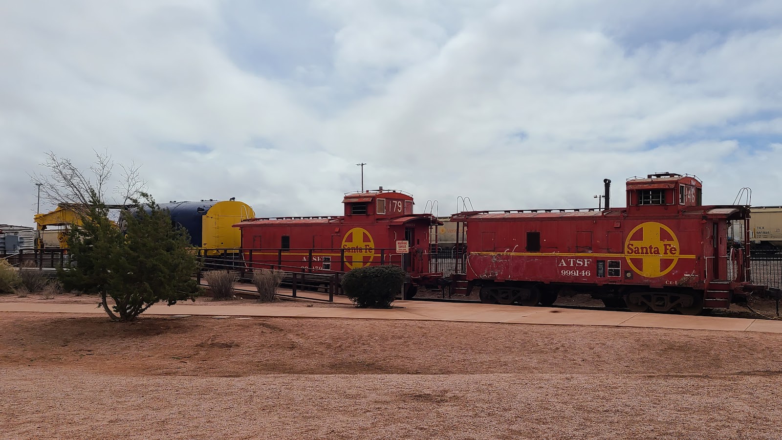
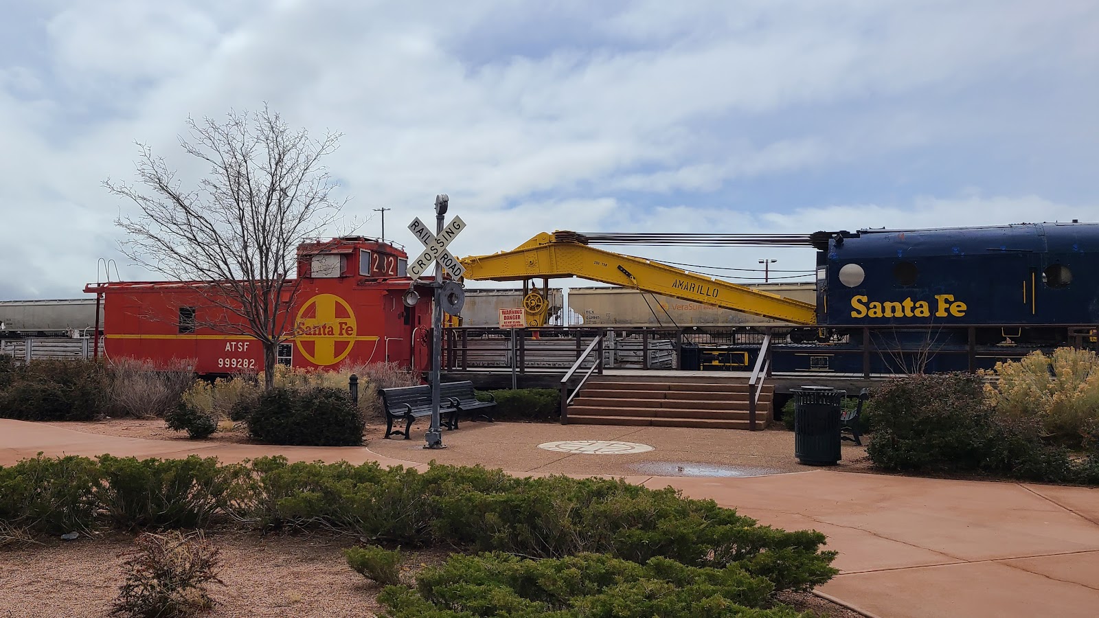
Next up on our sightseeing adventure is what most people come to Winslow Arizona to see.
If you're familiar with the 1972 song "Take It Easy" by the Eagles, then you'll already know the lyrics of the song written by Jackson Browne and Eagles band member Glenn Frey, who also provides lead vocals on the Eagles debut album.
And such a fine sight to see.
It's a girl, my Lord, in a flat-bed Ford
Slowin' down to take a look at me.
Come on, baby, don't say maybe
I gotta know if your sweet love is gonna save me.
We may lose and we may win
But we will never be here again
So open up, I'm climbin' in to take it easy.
In September of 1999 the "Standin’ on the Corner Park" became a reality. Since then the town has seen hundreds of thousands of fans visiting every year and each September there is a benifit concert featuring an Eagles Tribute Band.


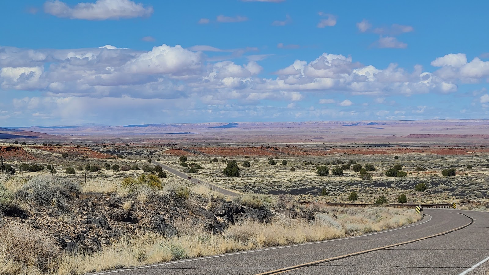
Our third and final sightseeing location for the day is just 15 miles north of our campsite. This is an abandoned county park called Little Painted Desert Park, where you'll find a potholed road leading towards the rim of this gorgeous scenery.


It wasn't until almost noon that we were able to get out of THE POD and begin our exploration of the Homolovi Ruins that are found here in the park.

There are two locations here in the park where 700-year old pueblo ruins can still be seen. We checked out the larger of the two locations today.


The Ranger told me that this is not done by the Park staff, rather it is done by visitors who don't abide by the park rules to not leave the walkways or disturb anything found on the ground. OOPS!
At least people didn't put them in their pockets and take them home. For several decades before this area was designated a State Park that is exactly what was happening. Pottery thieves were constantly digging up these sacred grounds and stealing the ancient artifacts.
That is why in 1986 the Hopi Tribe was very much in favor of this area becoming a State Park, to hopefully stop the desecration of these ruins and preserve what is left of their ancestors homes.
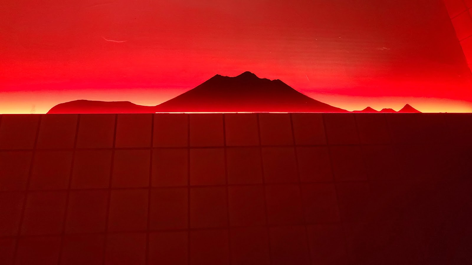
I don't usually share photos from the inside of a restroom, but here at the Visitor Center they have cleverly used indirect lighting to display a cutout of the mountainous horizon of Flagstaff, AZ as seen from the park.
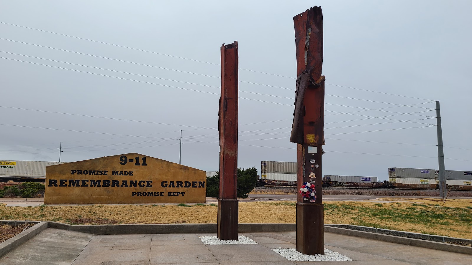
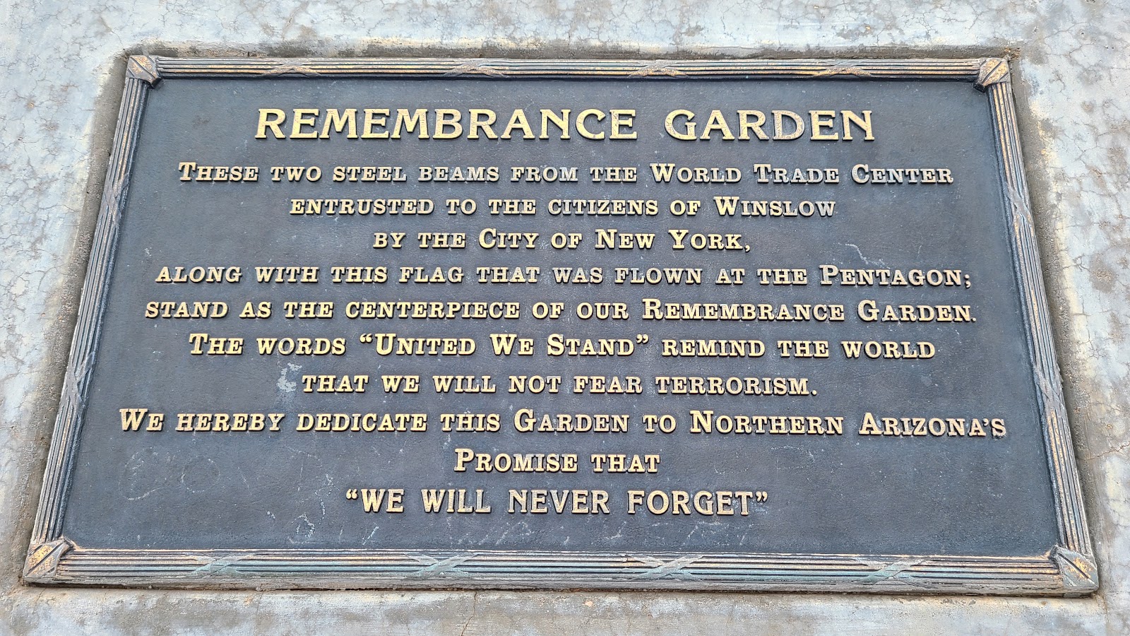
After visiting the ruins we headed outside the park to visit McHood Park on the outskirts of Winslow. On our way there we passed by Winslow's 9-11 Remembrance Garden adjacent to the railroad tracks that pass through town.

Right around 10:00AM the rain finally subsided and we got busy moving THE POD. We originally planned to visit here at Homolovi State Park for just four days, but it's so centrally located among all the sightseeing we're going to try and accomplish while Heather is here we scheduled another four days. Unfortunately, we'll have to change sites today, the end of our first four day reservation.
By 11:00AM we were on the road to go visit not one, but two of our National Monuments today. There is also a third one in the Flagstaff area, but with such a late start we'll never be able to make it there before it closes for the day.
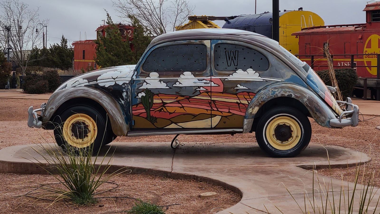
Before we head down the Insterstate towards Flagstaff we need lunch. With a quick stop at Sonic Hamburgers in Winslow for lunch, we parked in front of a couple of spots listed on Google while we ate our lunch. The first is identified on the Atlas Obscura website as HGTV Art Cars.


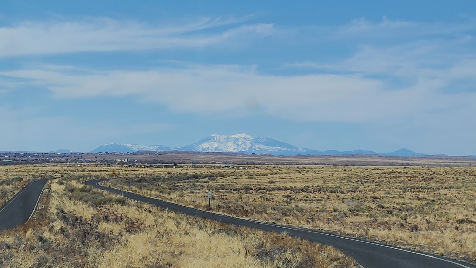
While traveling west on I-40 we couldn't miss seeing the San Francisco Peaks that loom over the town of Flagstaff. The highest six mountain peaks in Arizona can all be found right here. Humphreys Peak is the tallest at 12,633', but the next five tallest are all above 11,460'.
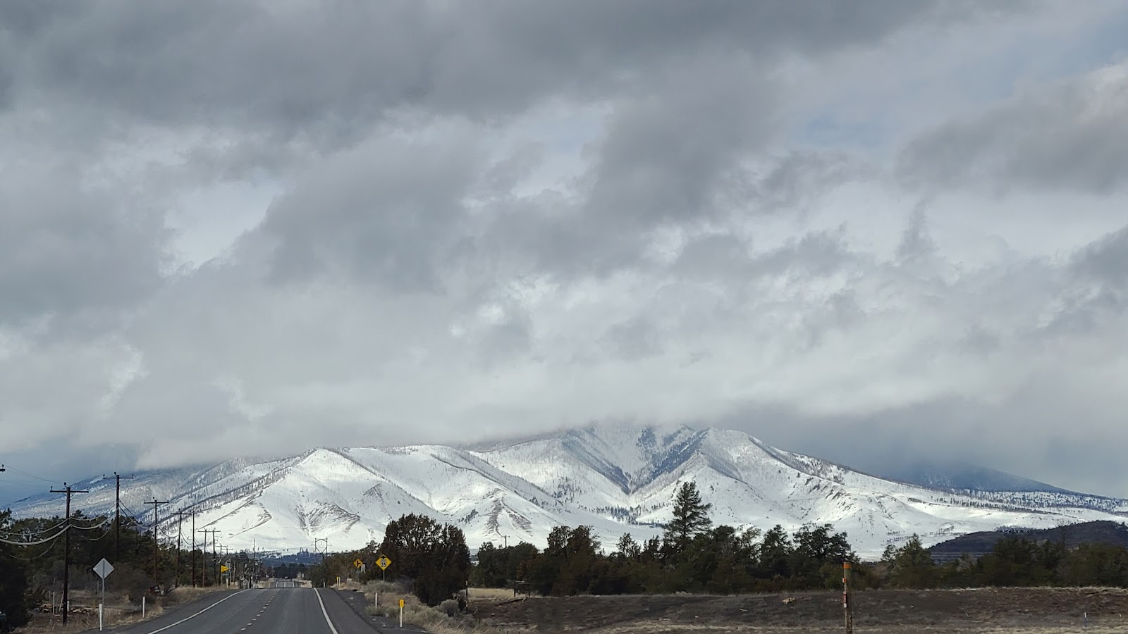
After we got off the Interstate and got closer to the mountains the clouds seem to be decending lower and lower down the mountain face.

Then just a ¼-mile from the entrance to the National Monument, you can actually see the brown sign on the side of the road up ahead, we got held up by a road crew that was pumping water across our travel lane.
We were the fifth car in line on this very busy highway, so I figured if we would have been just 2-minutes earlier we would have been past here before they started pumping.
About 15-minutes later they turned off the pump, picked up the hose, and let traffic pass by. I couldn't even see the end of the line of vehicles behind us in my rearview mirror.
Sunset Crater Volcano National Monument and Wupatki National Monument are sister parks due to their tightly intertwined history and the fact that their Visitor Centers are less than 20-miles apart.
SUNSET CRATER VOLCANO
NATIONAL MONUMENT
|
||||||||
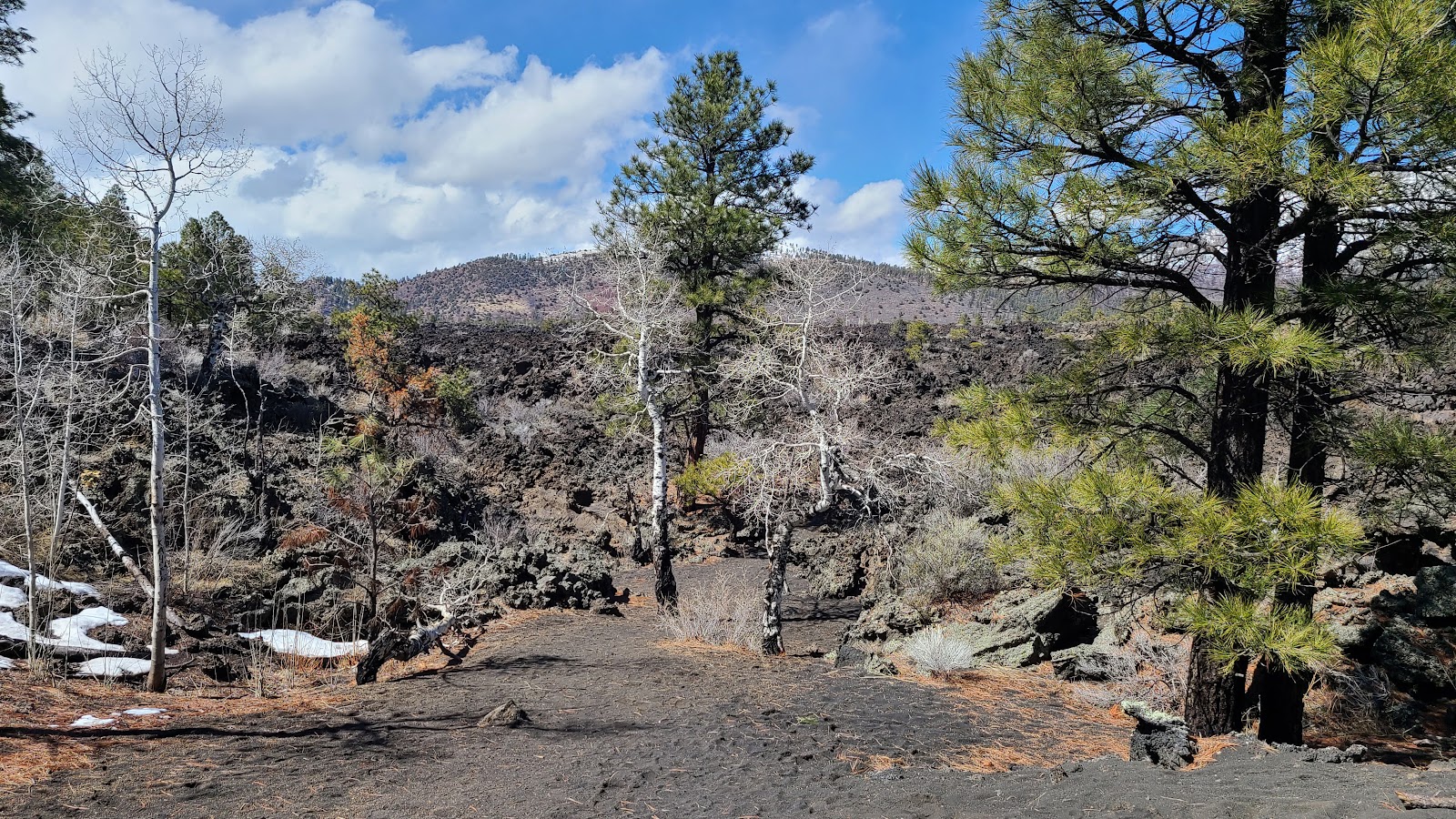
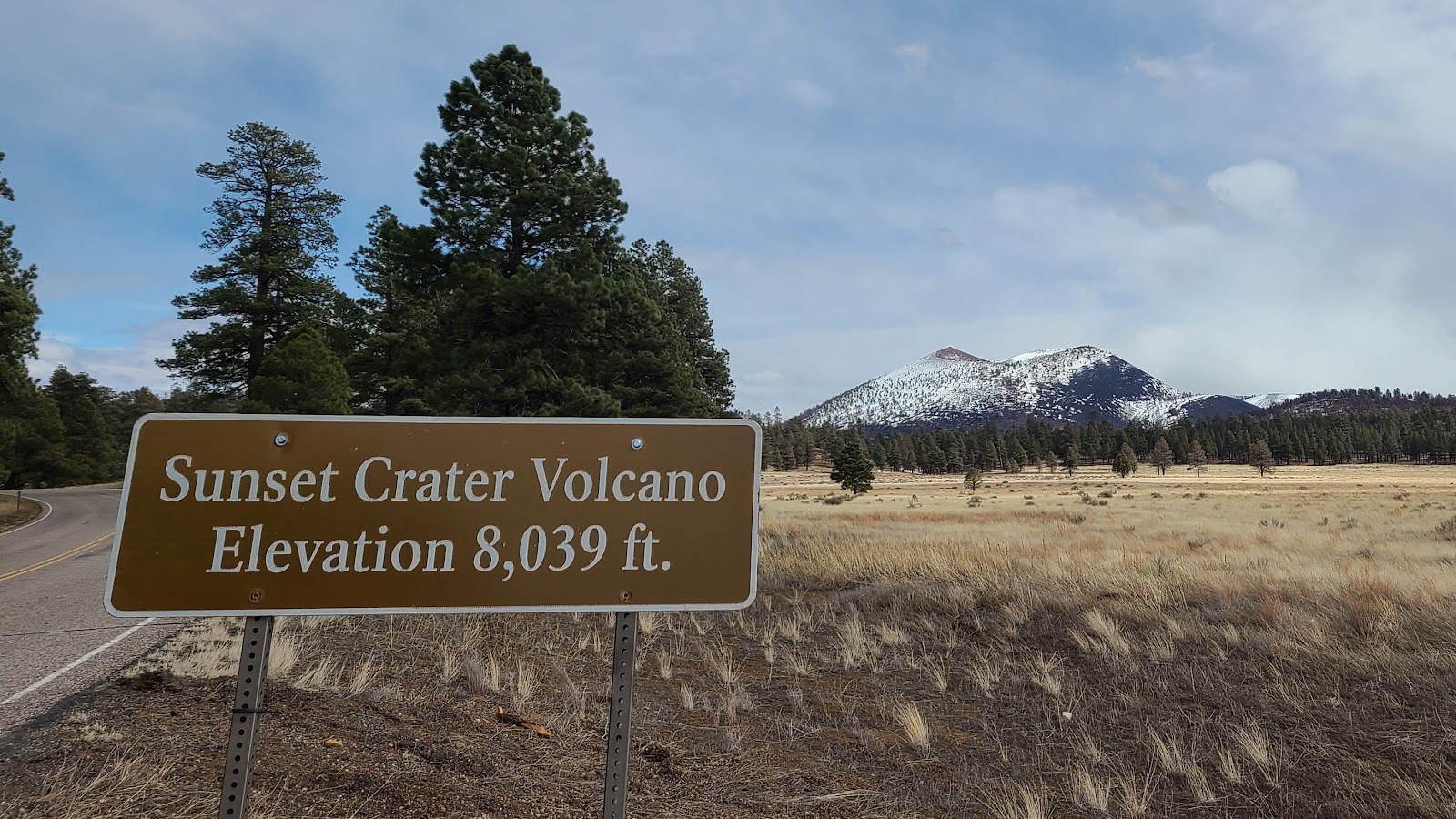 That elevation is at the top of the volcano, we're well below that.
|
||||||||
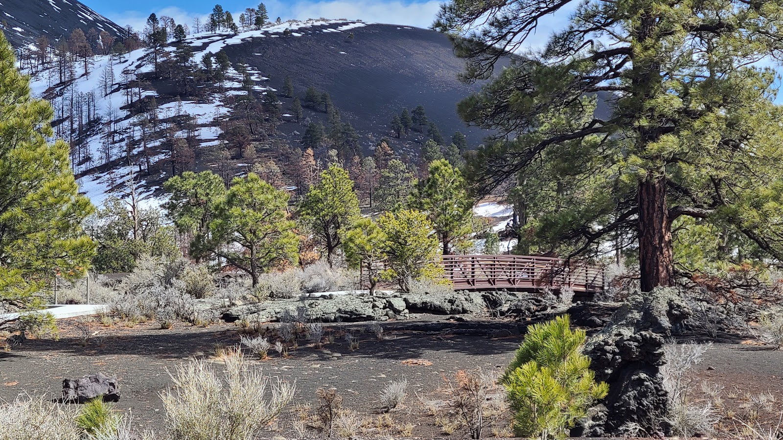
 The short A'a Trail lets you hike right on the lava bed.
|
||||||||
 You don't want to stumble out here, the lava rock will cut you to shreds.
|
||||||||
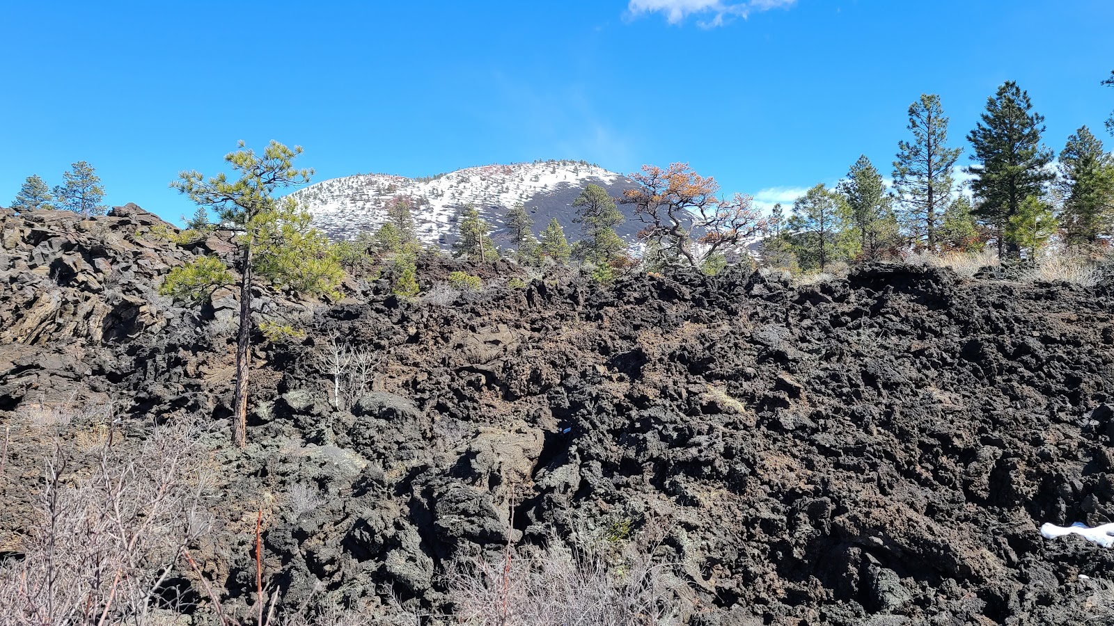
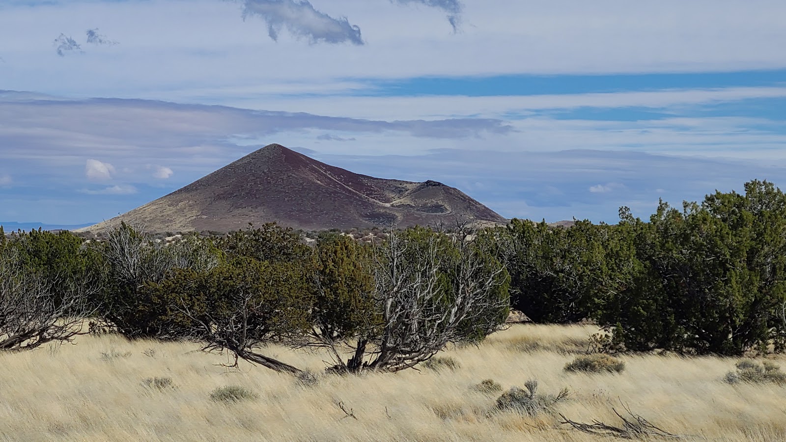
 Sunset Crater is the largest of several volcanos in this area.
|
||||||||

|
||||||||
After exiting the Sunset Crater Volcano National Monument boundary we had 13-miles of scenic backroad driving to travel before we reached the boundary of the Wupatki National Monument.
WUPATKI NATIONAL MONUMENT
|
||||||||

|
||||||||
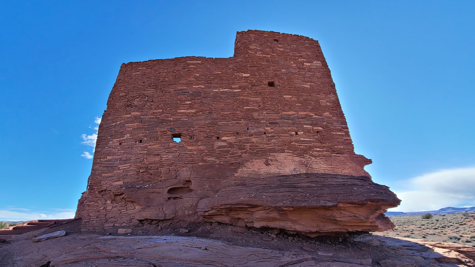
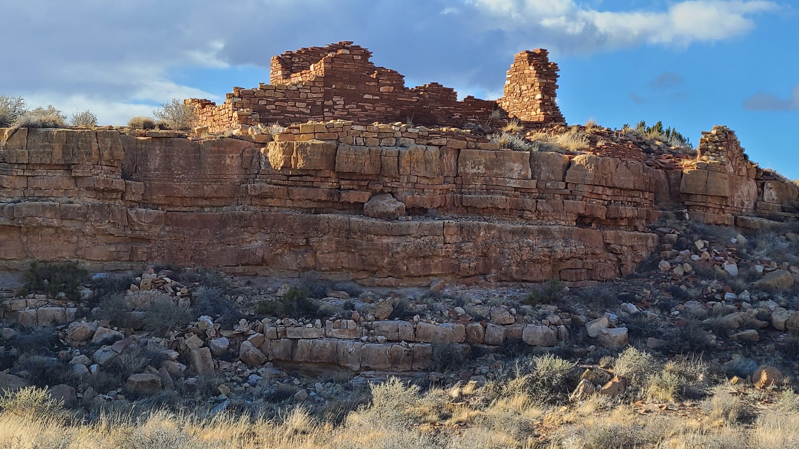
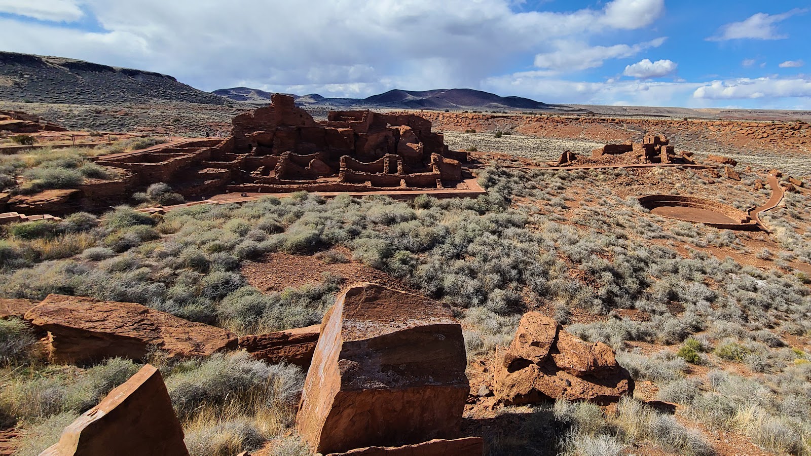 First look at the Wupatki Pueblo located behind the Visitor Center.
|
||||||||
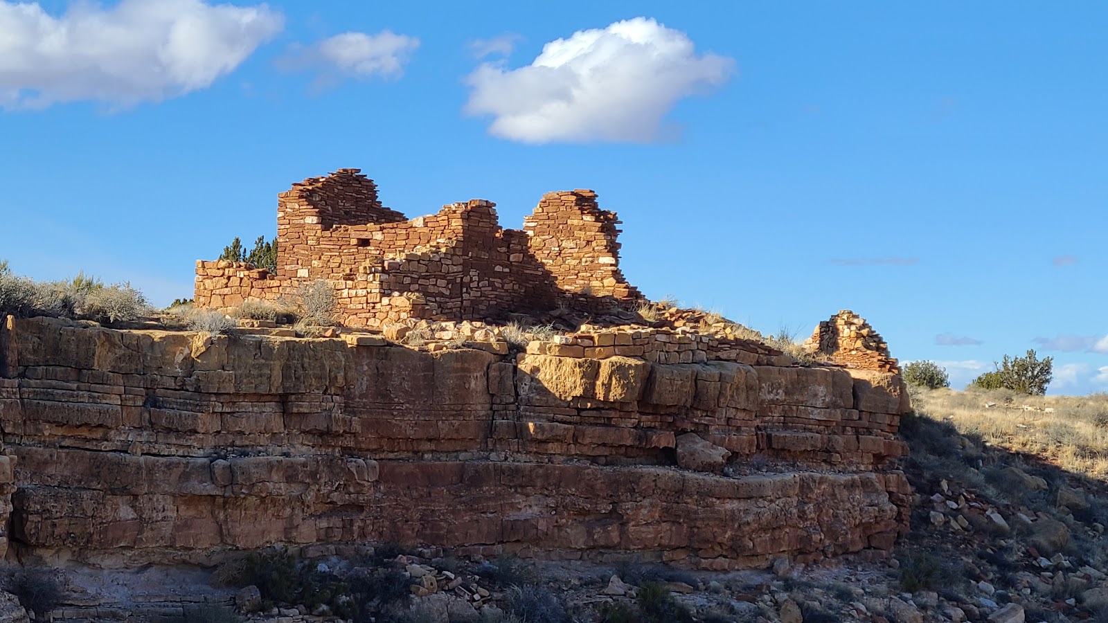
 Again we see the multi-storied pueblo construction.
|
||||||||
|
||||||||
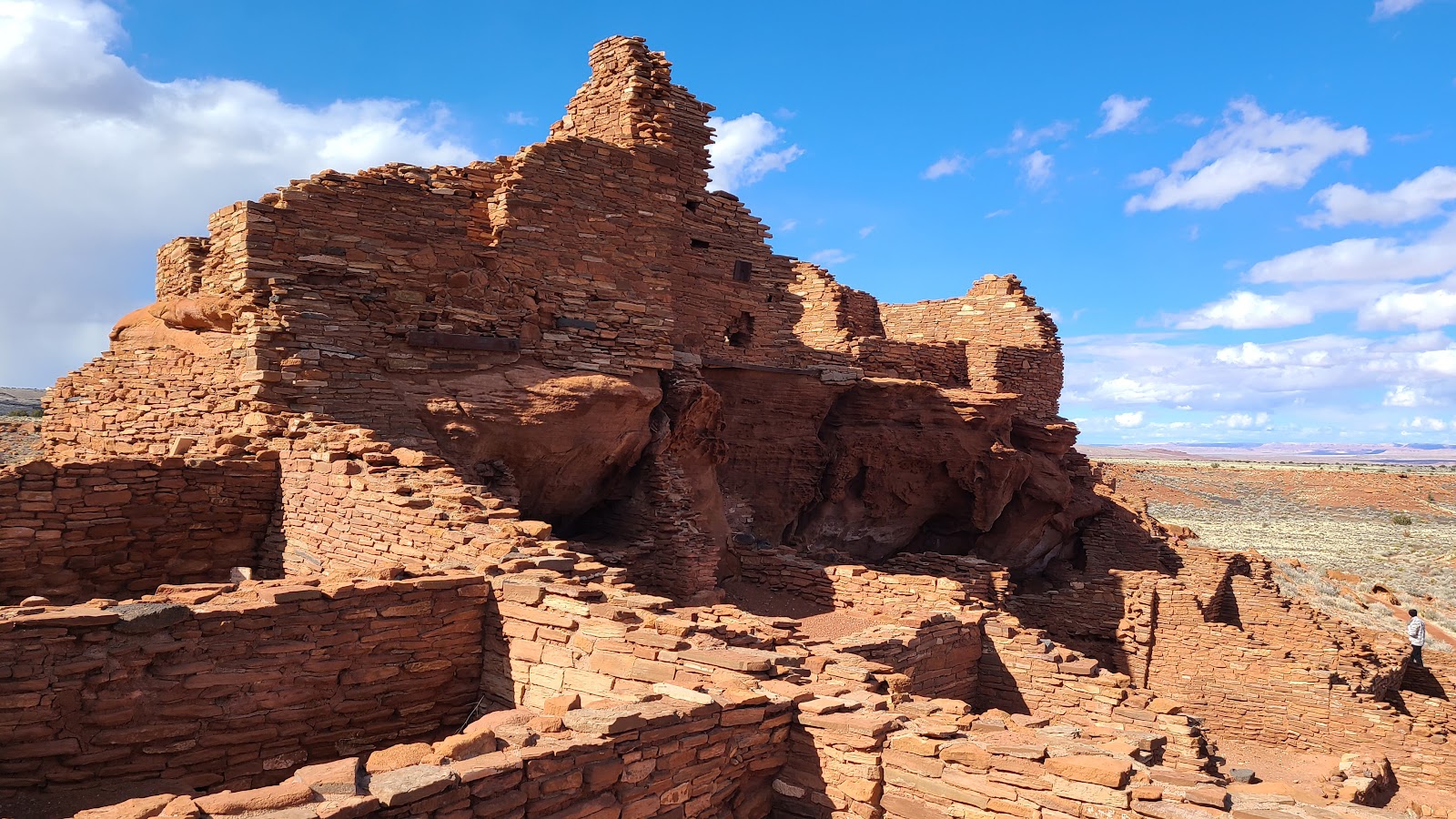
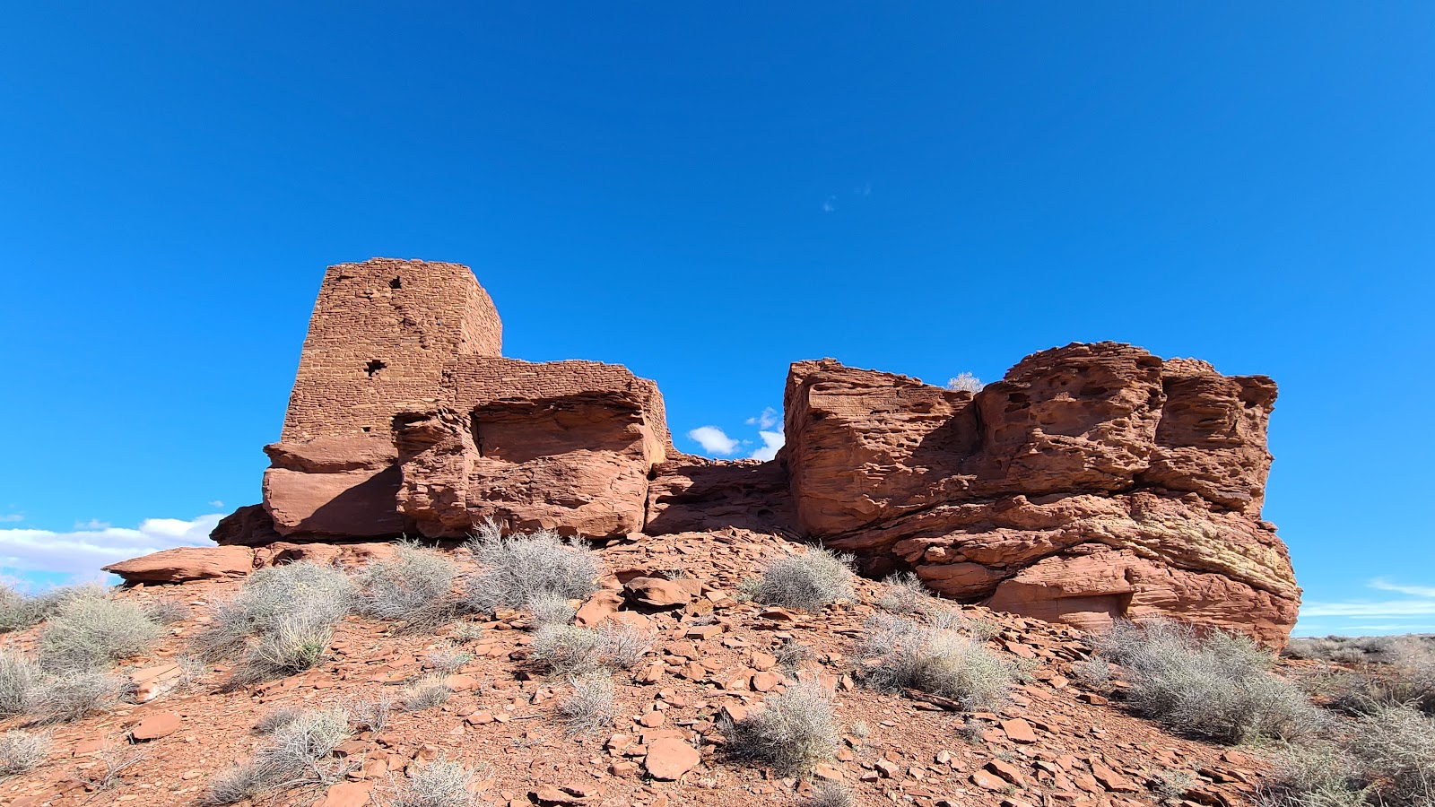
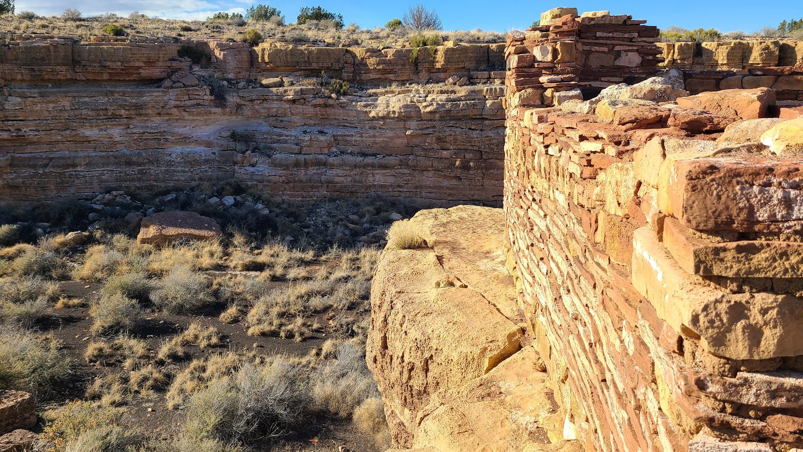
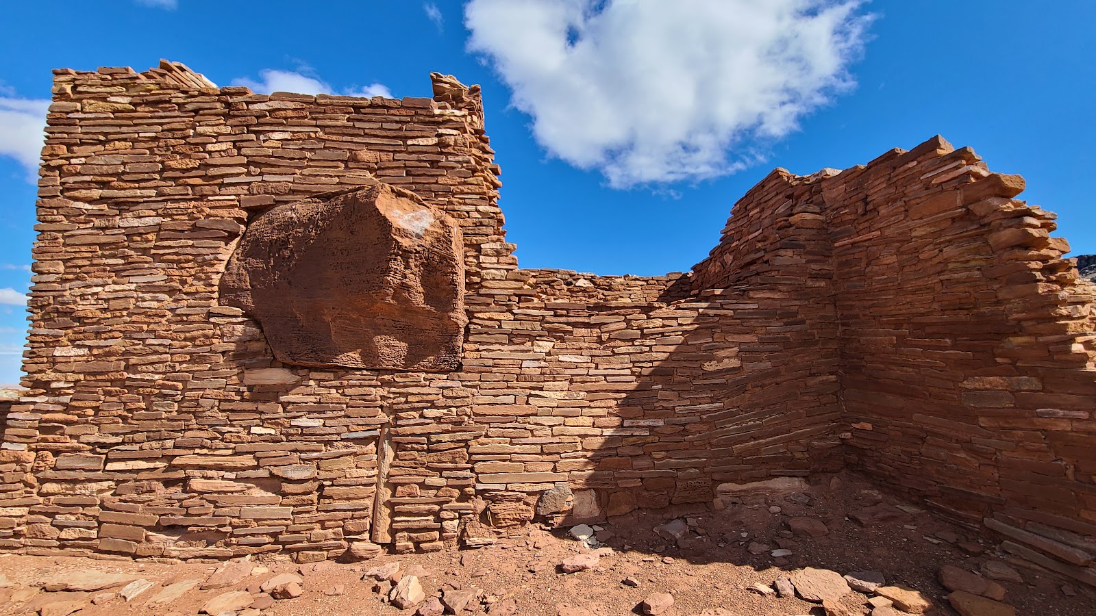 This pueblo was built incorporating the existing stone outcroppings.
|
||||||||
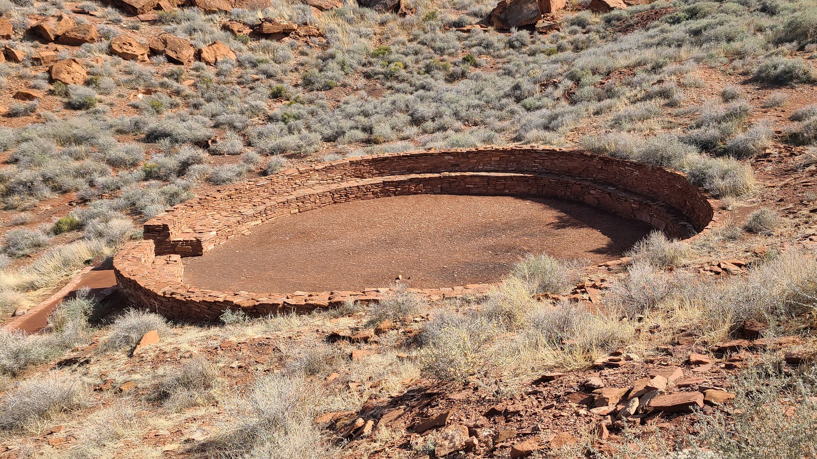 This was the locations for their ceremonial affairs.
|
||||||||
|
||||||||
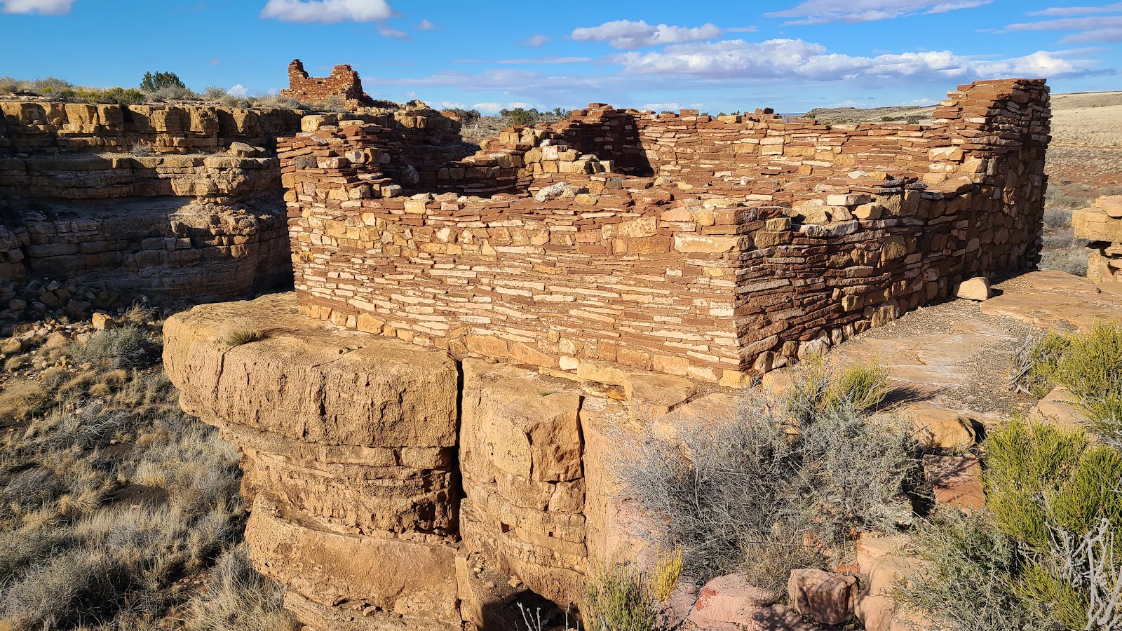
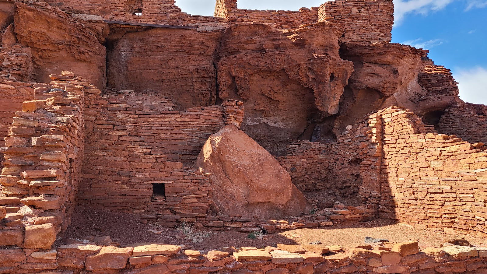 Here you can really see how the terrain was built into the structure.
|
||||||||
|
||||||||
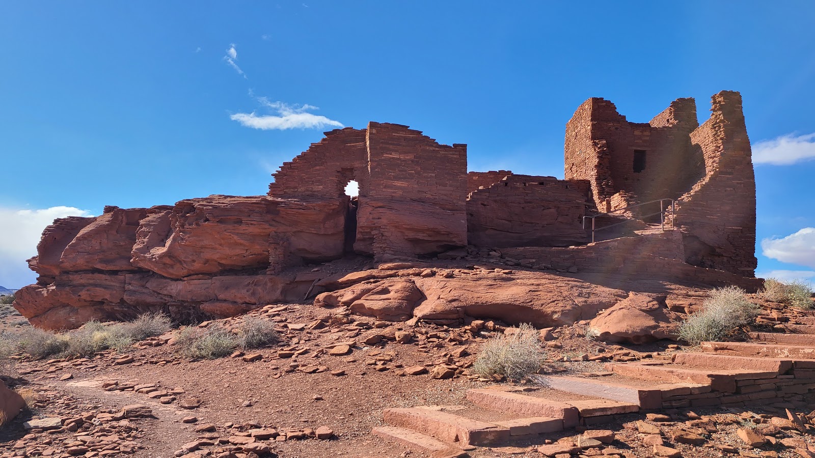 Approaching the Wukoki Pueblo.
|
||||||||

|
||||||||
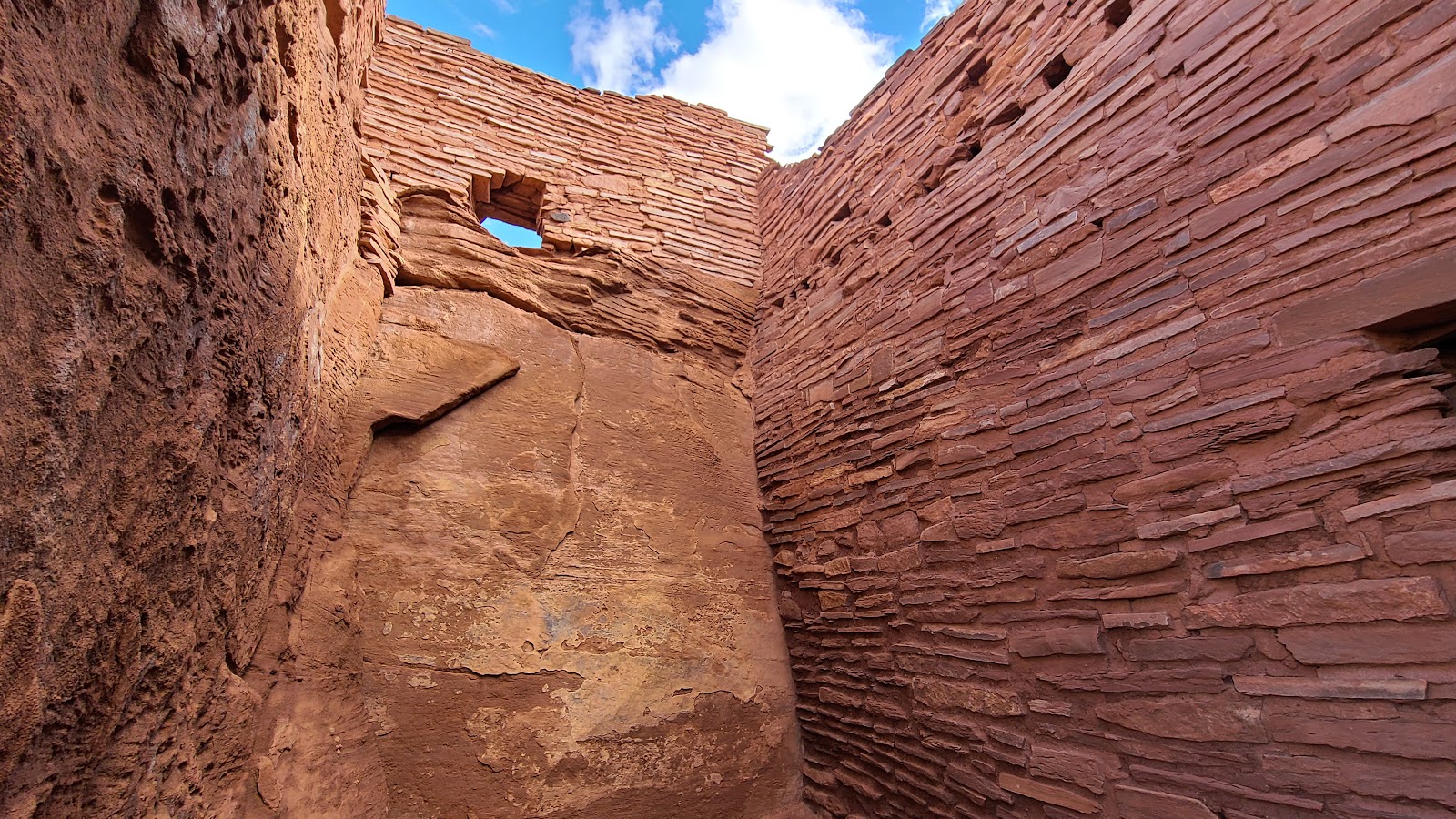
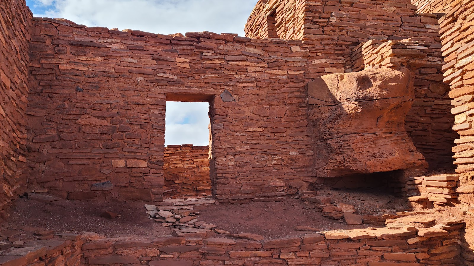
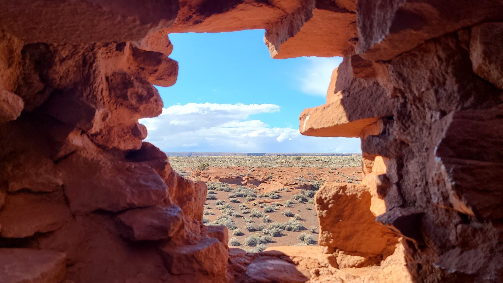
 Short passageways connected the internal rooms.
|
||||||||
 As you'll soon see this one is perched on the edge of a plateau.
|
||||||||
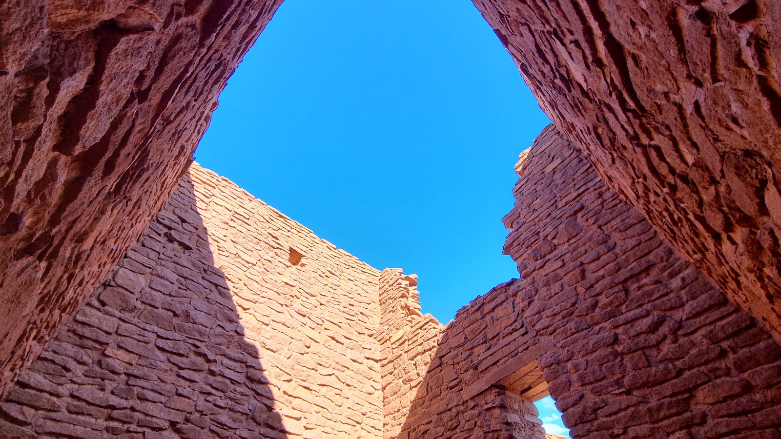 Three stories tall and built using irregular stones.
|
||||||||
 Here you can still see the 1000 year old timber floor joists.
|
||||||||
 The northern side of the pueblo.
|
||||||||
 The western side is not so well preserved.
|
||||||||
|
||||||||
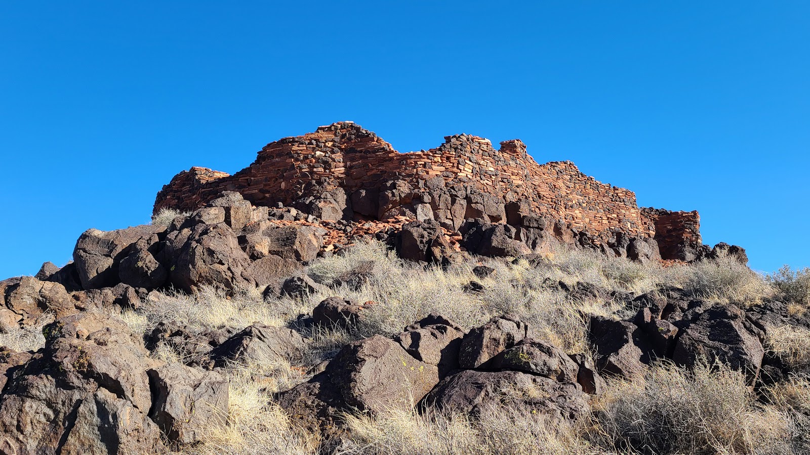 The Citadel Pueblo is exactly that, a citadel high on a perch.
|
||||||||
 It was constructed high on a bed of lava rock.
|
||||||||
 Smaller boulders of lava rock were even used in the lower walls construction.
|
||||||||
|
||||||||

|
||||||||

|
||||||||
 The crumbling walls have left a debris field around the outside of the pueblo.
|
||||||||
|
||||||||
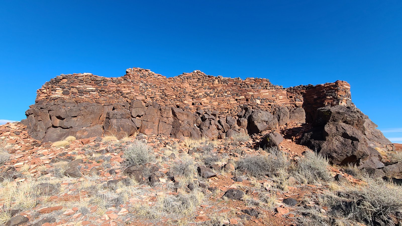
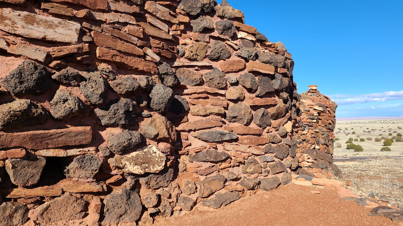
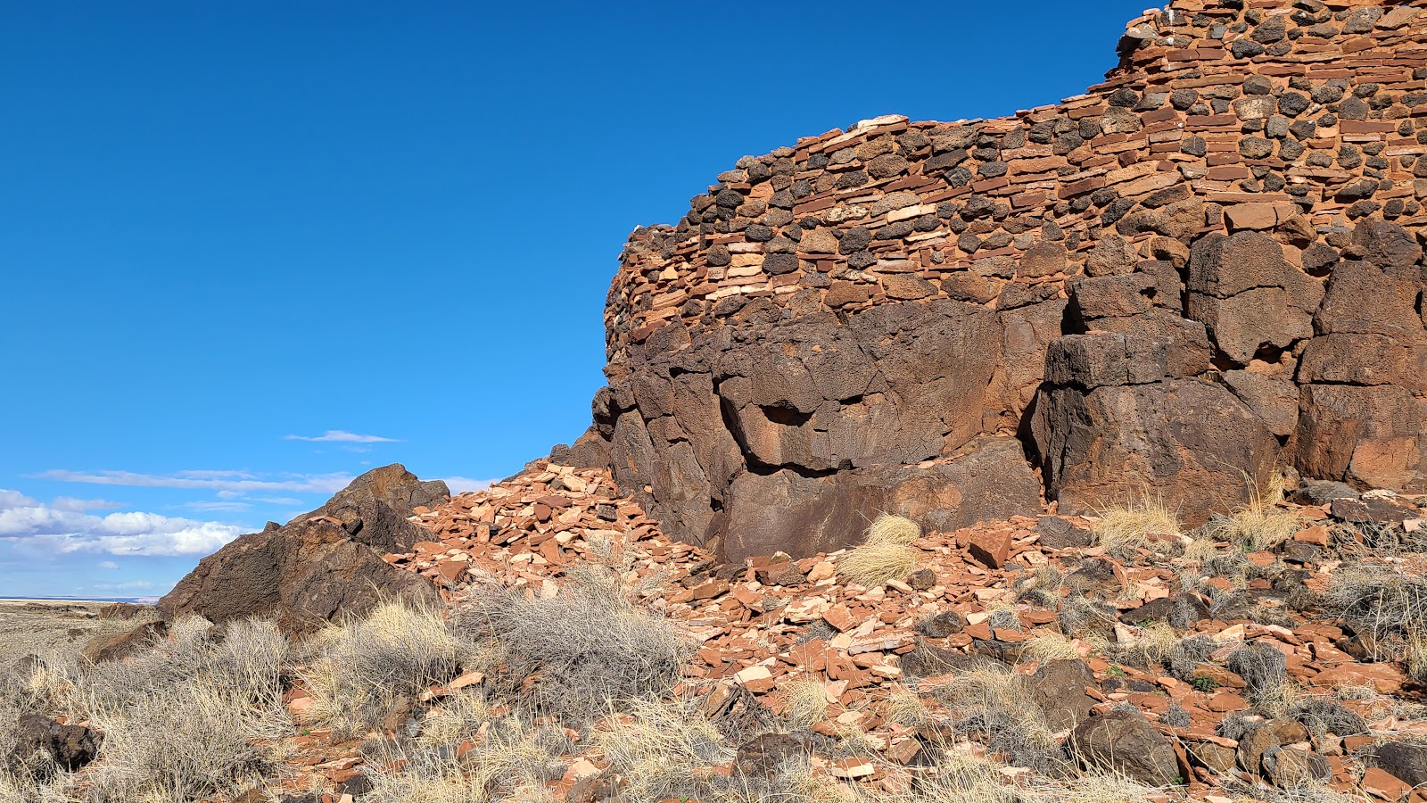
 The Lomaki Pueblo is located high above a box canyon floor.
|
||||||||
|
||||||||
 Here you can see just how precariously close it was built to the edge of the cliff.
|
||||||||

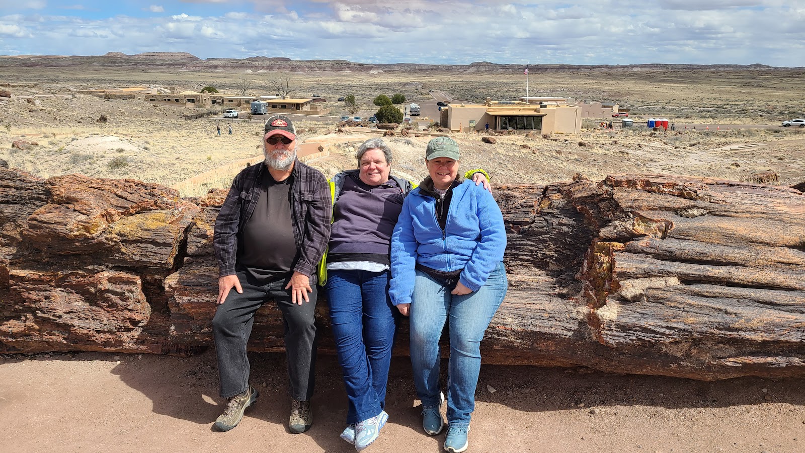
Well it's the same one we enjoyed so much last week, Petrified Forest National Park. We already know where to concentrate or time and energy, and which trails could be skipped and not really miss that much.
Since we already shared so many photos of the park last week, we'll only share one this time.
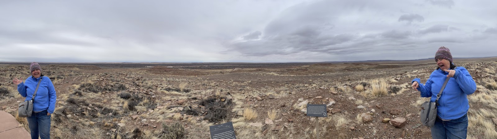
Here's a 2nd photo with Heather and Tricia having fun with the panorama feature on her phone.
Oh no, two Tricia's?
After visiting the park and a trip through the drive-thru lane at the Dairy Queen we stopped to check out two Atlas Obscura destinations on the way home.
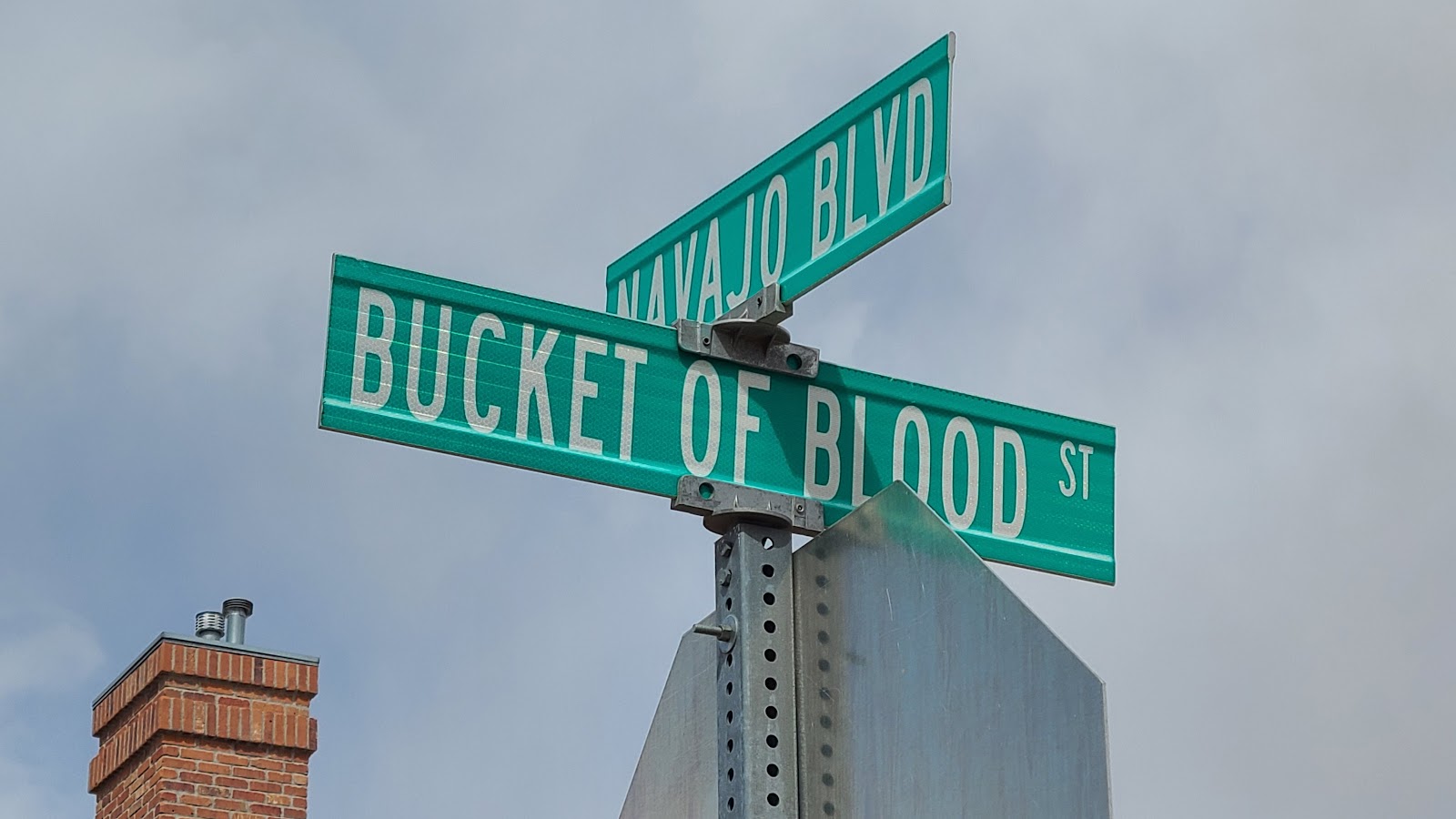
The first is the Bucket of Blood Street in Holbrook. In the 1880s the Terrill’s Cottage Saloon changed it's name to Bucket of Blood Saloon because so many gunfights either ended in the saloon, or out front on the street.
The saloon was open as a Route 66 tourist destination until recently, but eventually it was boarded up and closed as so many others have been. According to the signs on the building there are efforts to reopen the saloon, but I don't see that happening anytime soon.

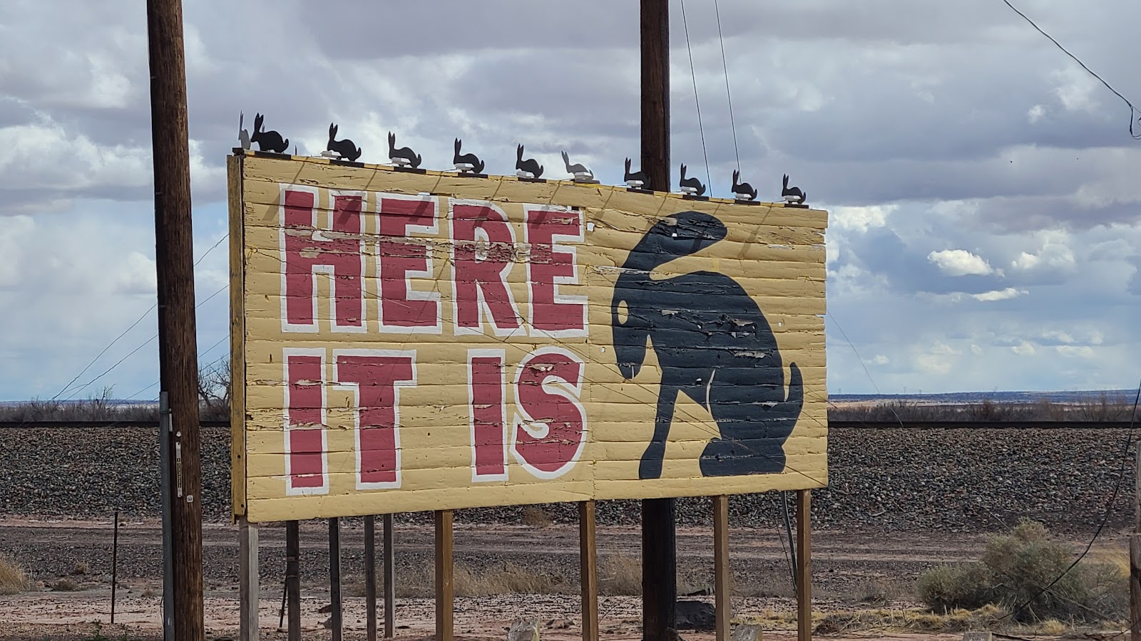
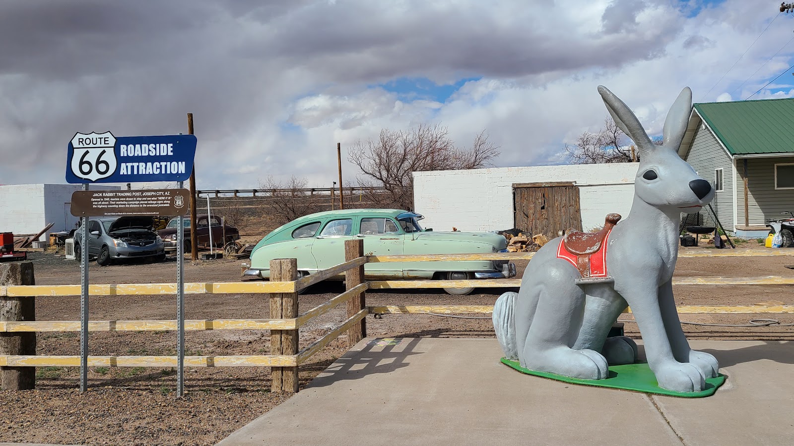
The Jack Rabbit Trading Post is the second Atlas Obscura stop for us today. Like so many of the Route 66 Attractions this one has seen better days. Today the "Trading Post" appears to be no more than a rundown liquor store.

Today however we've all decided that "enough is enough" and are going to take what we call "a down day". Not one of us left THE POD until dinner time when we all piled into ROVER and headed into town for Chinese food.
If you ever find yourself in Winslow, AZ and are looking for some delicous Chinese food then China Feast is your place to go. Also they live up to their name, we received enough food for three meals, even with my healthy appetite!
Don't let the outdoor appearance turn you off, or even the stark interior, the food is fresh and authentic.

The day starts at 1:00AM when all of our phone alarms are set to wake us up. Not one was needed however as we were all awake before that.
Heather has a 2:10AM Greyhound Bus to catch in Holbrook that will take her 233-miles to the Phoenix Airport where she has a 10:00AM flight to catch. We had all loaded into ROVER and were only about 2-miles into our 33-mile journey to the bus stop when Heather double-checked her departure time and found the bus was running 2-hours late.
We quickly weighed our options, just before entering the on ramp for the Interstate, and decided to continue on to Holbrook and possibly find a Denny's or something similiar that was open at this time in the morning and pass the time in heated comfort, it was in the lower 30°F afterall.
We were halfway to Holbrook (pop. 5053) before realizing there are no 24-hour restaurants in the town. Luckily the bus stop was at a Circle K Store so we at least would have bathrooms and snacks during our 2-hour wait.
We all got excited when a Greyhoud Bus pulled into the Circle K around 3:00AM, but were soon disappointed to learn it was headed eastbound for Albuquerque, when Heather was headed westbound for Phoenix.
Right on time (it's newly scheduled time) at 4:07AM Heather's bus pulled into the parking lot and a mere 4-minutes later pulled out with Heather and two new passengers on it.
We followed the bus out of the parking lot and onto I-40 where the driver was traveling 68MPH when the speed limit was 75MPH. After a few miles we passed them up and returned to THE POD and went right back to bed.
Heather kept us informed all day long of her progress of getting back home. Bus to Phoenix, flight to Chicago, flight to Jacksonville and finally around 10:30PM we were glad to hear she had arrived safely back home.
P.S. Heather - Thanks! Your Sesame Chicken was also delicious the second time around!

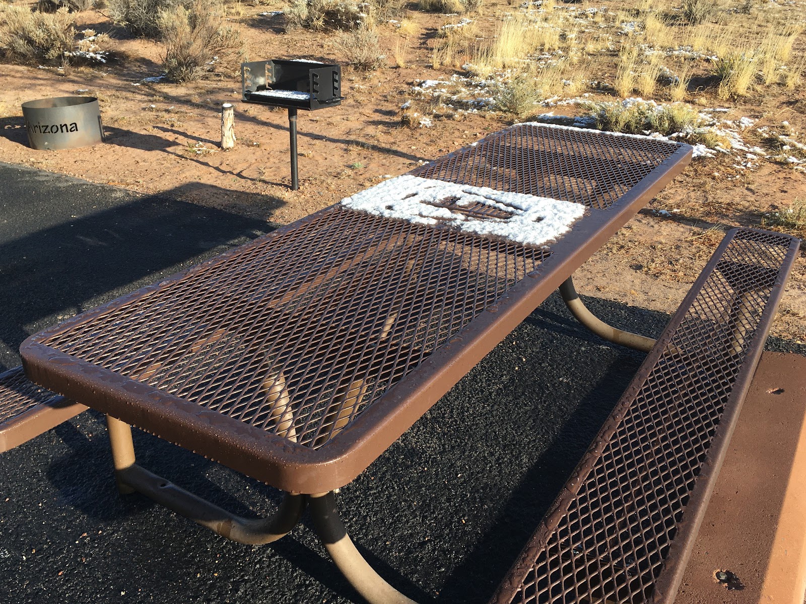
Most of the week it has been raining on and off here in Winslow (elev. 4,869′), while it has been snowing in Flagstaff (elev. 6,909′) located just 65-miles away.
Well this morning our luck finally ran out!
This was the snowy scene outside of THE POD when we awoke this morning.

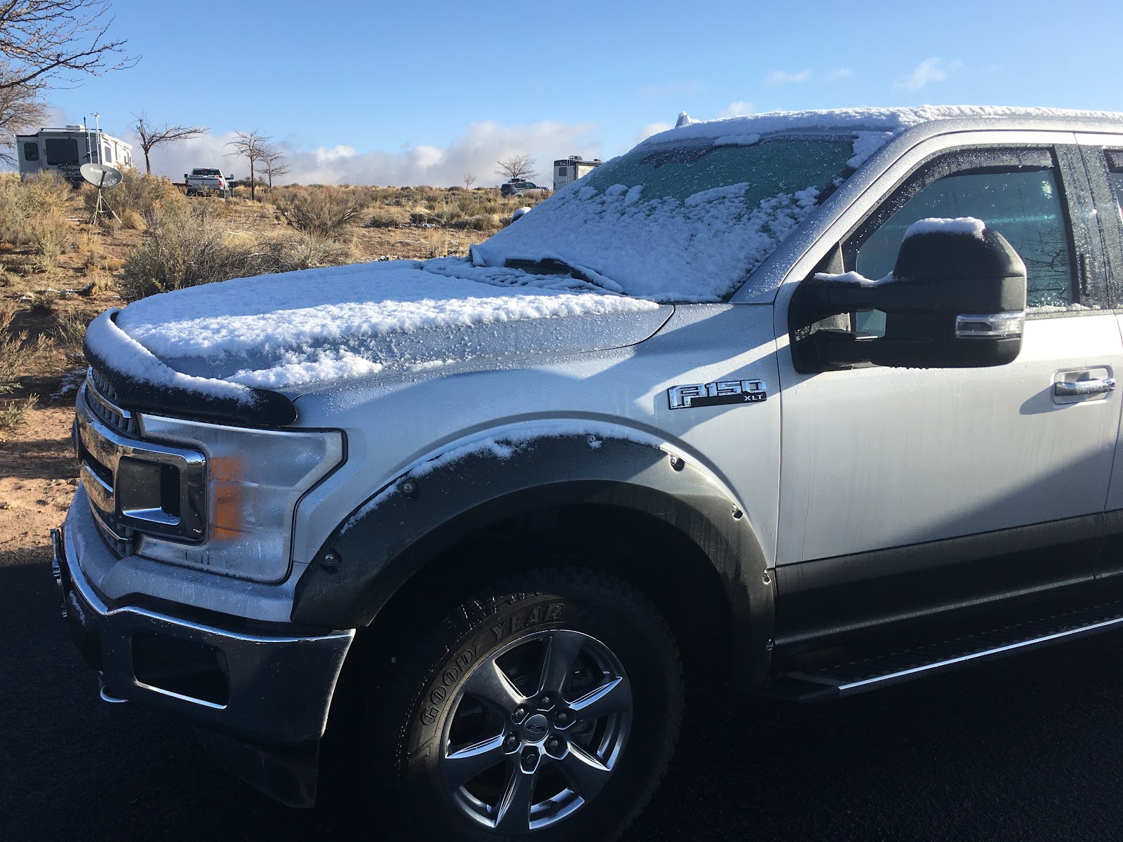
After 1781 days on the road this is only the 11th time we've awoken with snow outside.

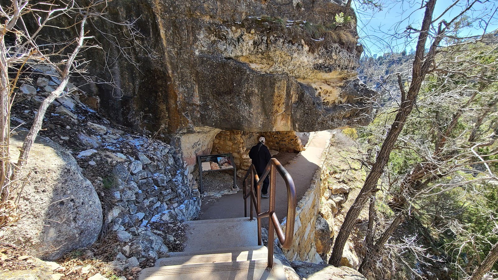
The Island Trail at the Walnut Canyon National Monument outside of Flagstaff is a 1-mile long hike that decends down 185-feet into a canyon where you'll find 25 cliff dwelling rooms built into the canyon walls.
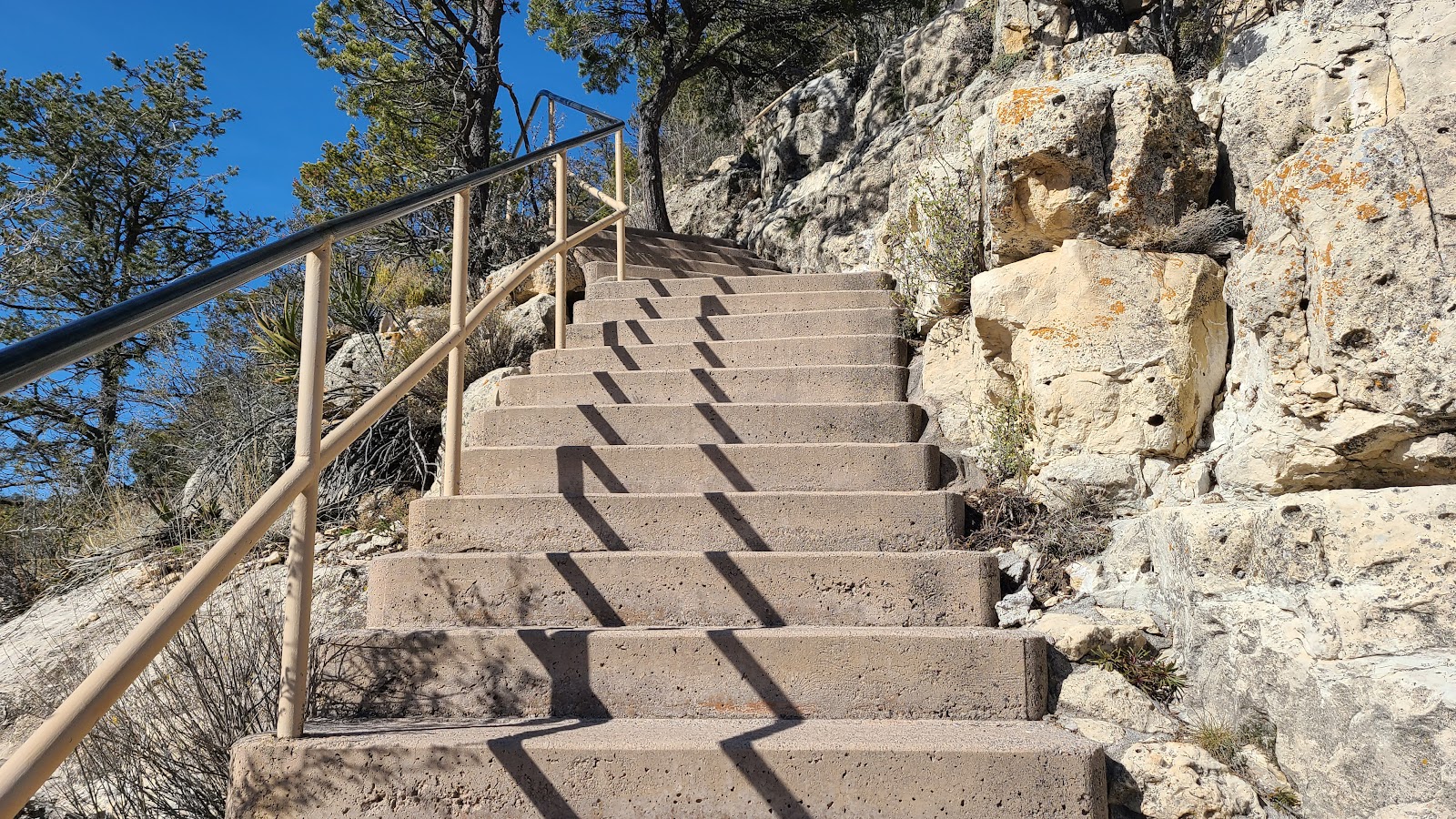
There are signs reminding everyone they are at an elevation of 6690' here. There are 273 stairs steps leading down to the loop trail portion of the hike and consequently there are 273 stair steps leading up to the Visitor Center. If that's not enough there are another 190 stair steps along the loop portion of the trail.
And as a final warning the signs mention that going down is optional, returning is mandatory!
So far all the locations we've visited with ancient pueblo buildings, they are built either standing alone or use the surrounding terrain as part of the structure. These however are a little different, because here the canyon wall serves not only as the roof, but also as the back wall of all the rooms.
THE ISLAND TRAIL
WALNUT CANYON NATIONAL MONUMENT
|
||||||||
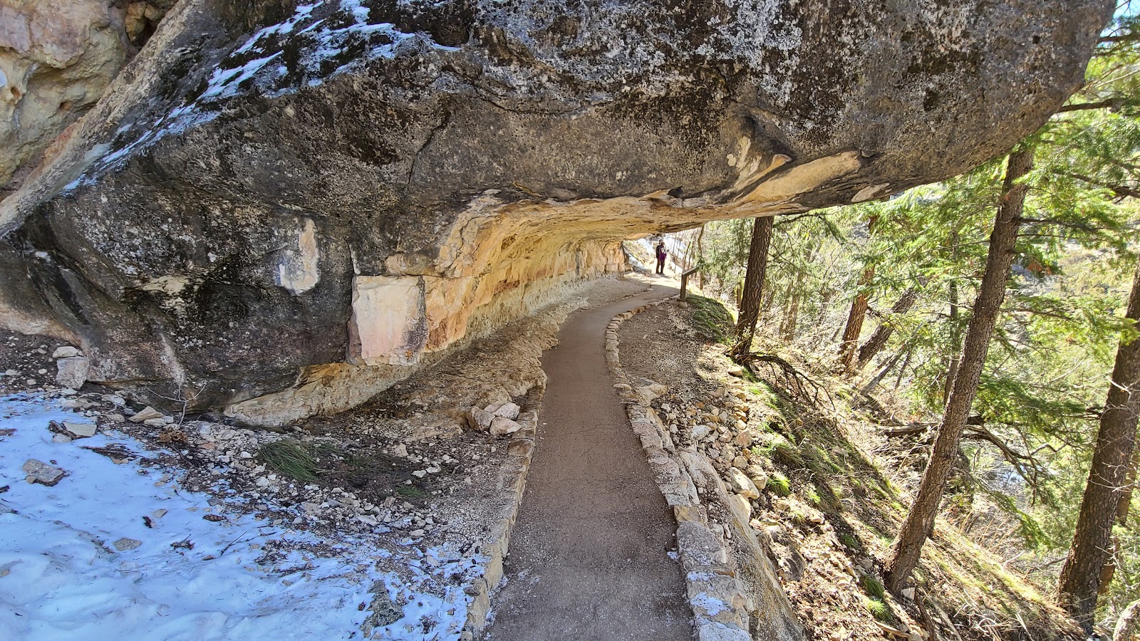
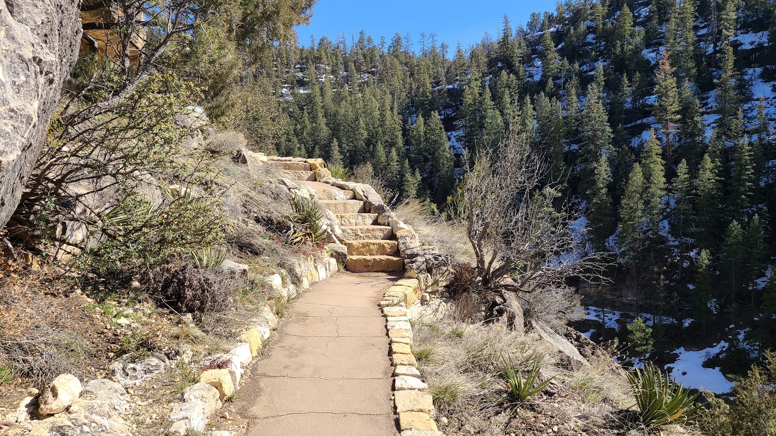
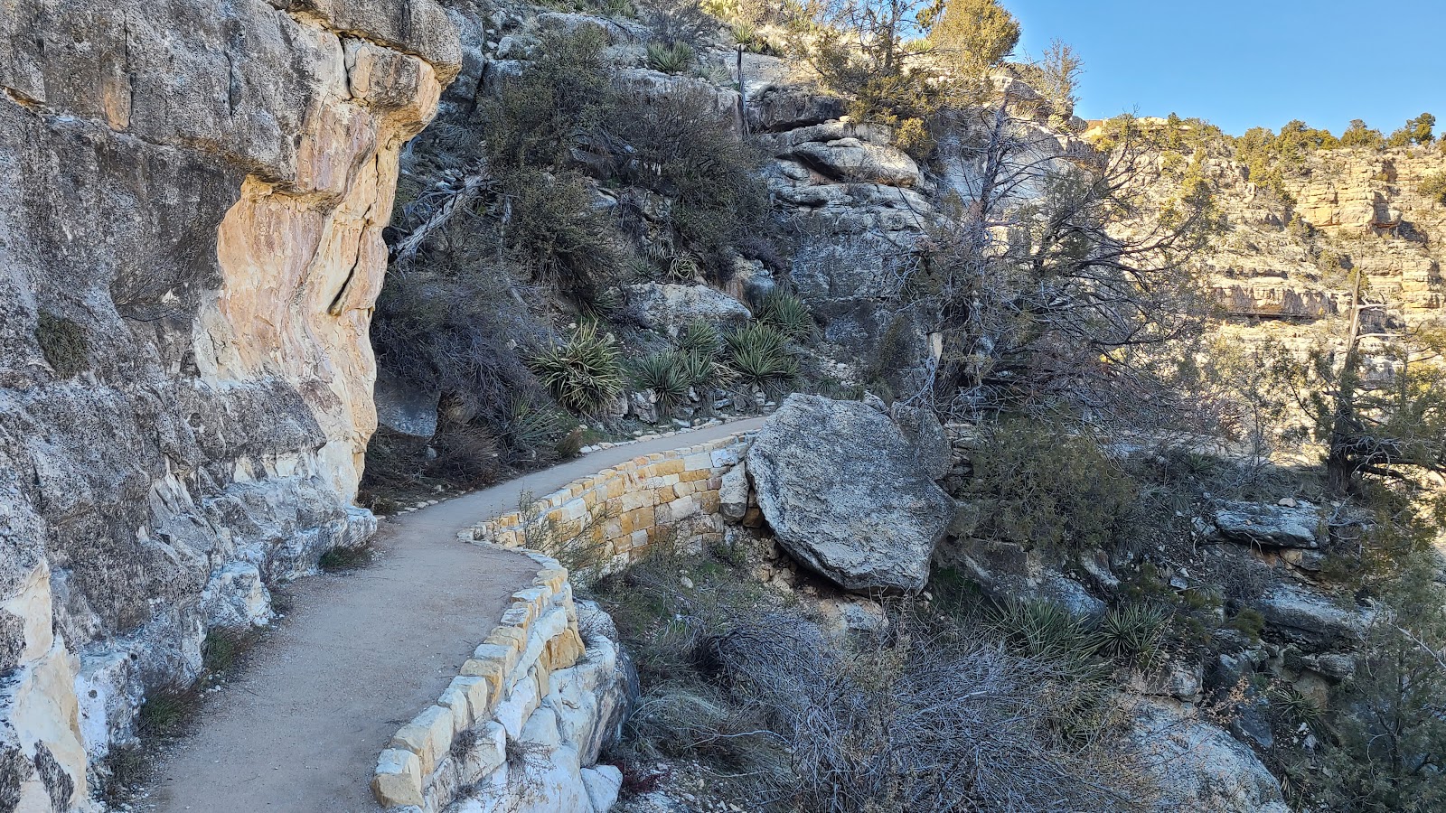
 After decending 273 stairs you start the loop where the cliff dwellings are located.
|
||||||||
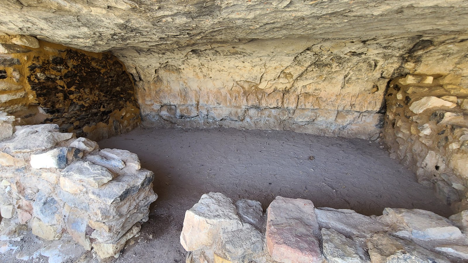
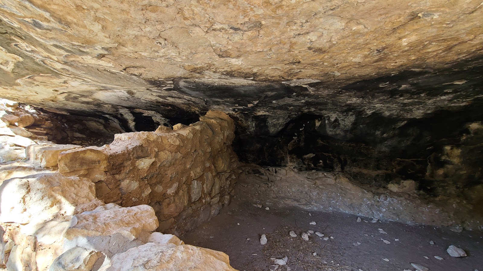
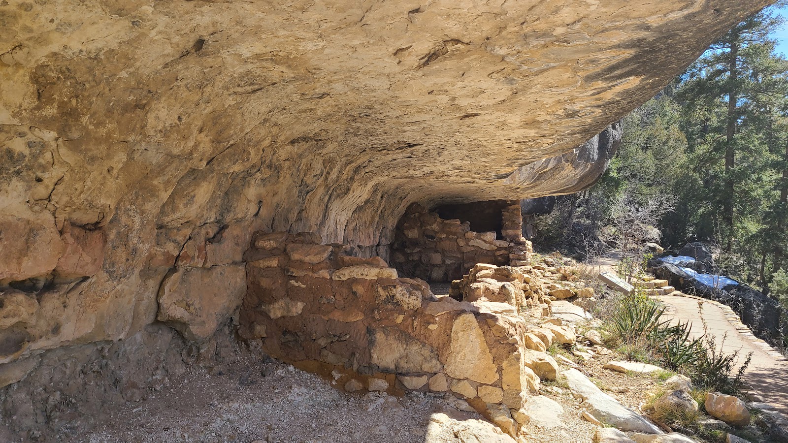 The rooms weren't very deep, but they were wide.
|
||||||||
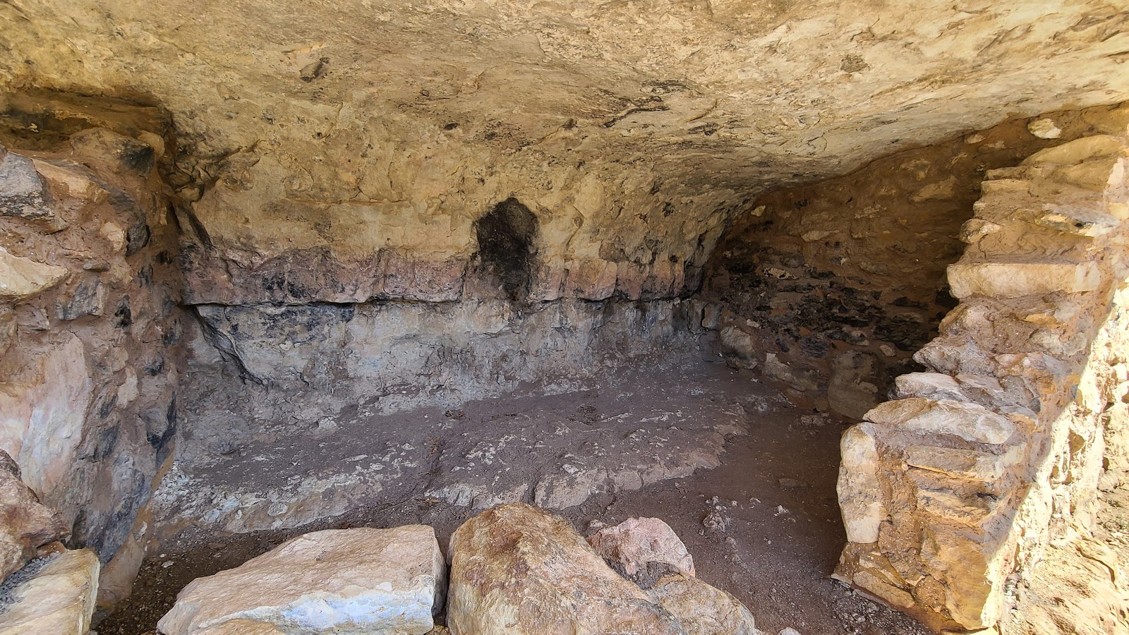 Here you can see black soot on the wall and around the vent hole.
|
||||||||
 Two days ago this trail was closed, the piles of snow nearby are the reason.
|
||||||||
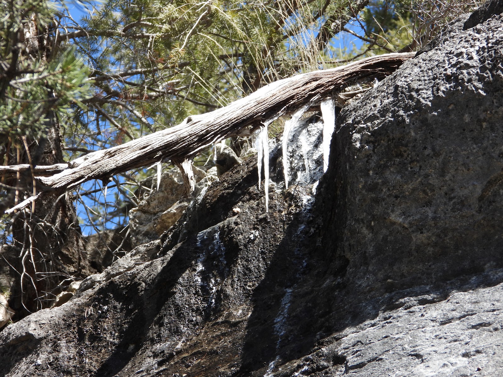 There were plenty of icicles still around on this sunny 40°F afternoon.
|
||||||||
 Here the rooms have been completely removed.
|
||||||||
 The canyon walls themselves were interesting to look at.
|
||||||||
 More icicles and dripping water along the trail.
|
||||||||

|
||||||||
|
||||||||
|
||||||||

|
||||||||
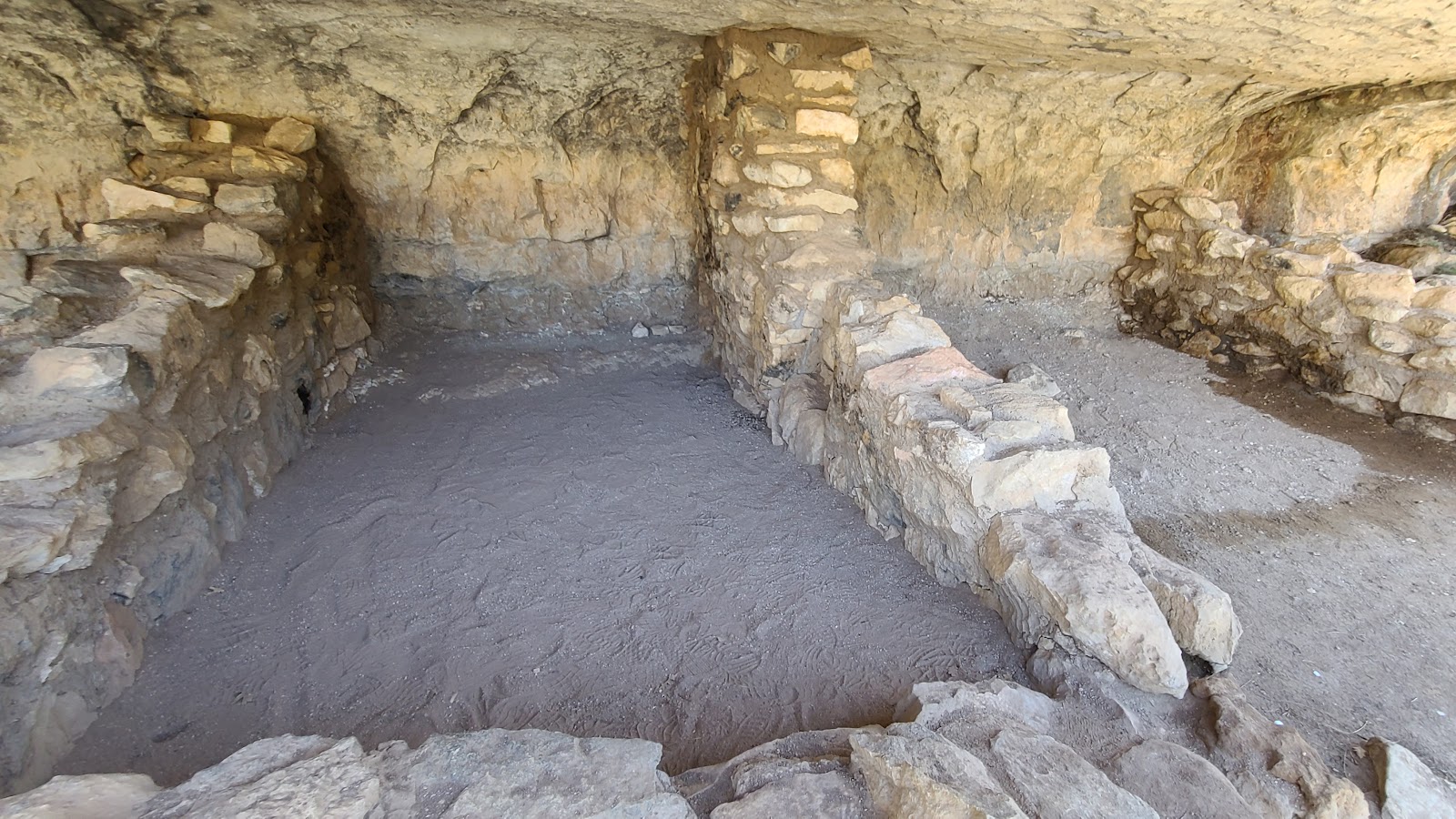
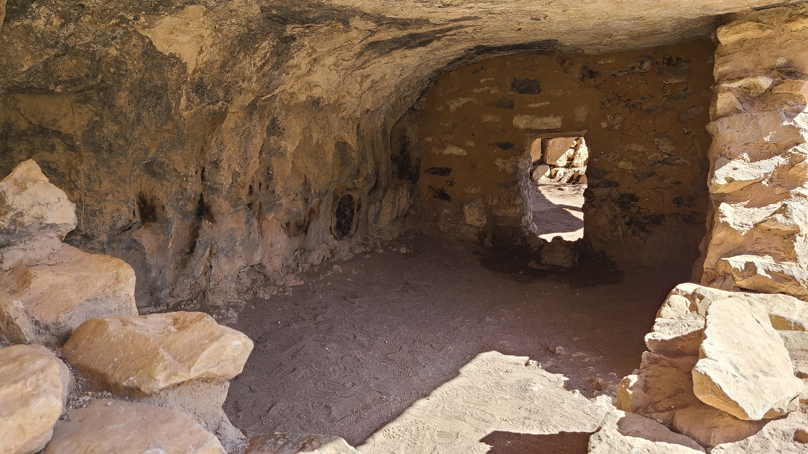 These rooms had interior passageways between them.
|
||||||||
 These are some on the TALLER stairs we had to climb.
|
||||||||
 That much soot probably means this room was used as a kitchen.
|
||||||||
 Here the National Park Service has epoxied a crack in the hanging rock to stabilize it.
Otherwise water could seep into the crack, then freeze and possibly drop the entire bottom half.
|
||||||||
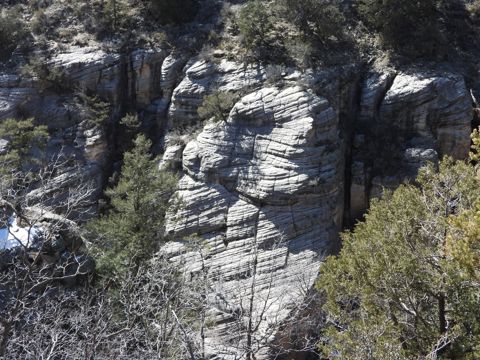
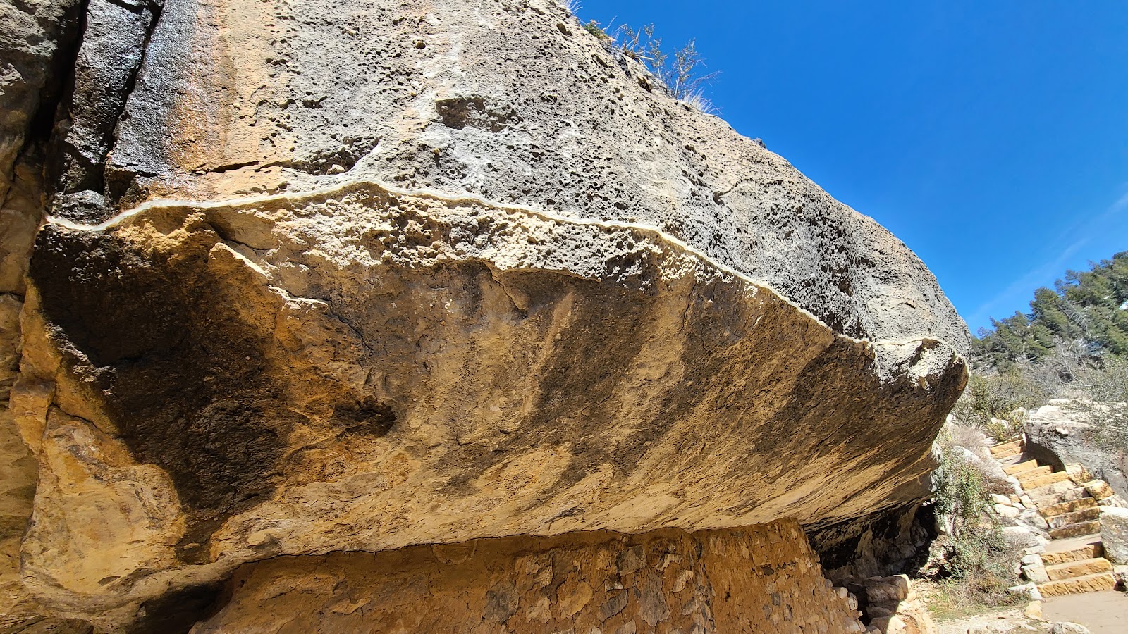
 The striations in the rock are caused by wind and water.
|
||||||||
 A lot of the rooms were looted and destroyed in the early 1900s before this became a National Monument.
|
||||||||
 Now we begin our ascent back towards the Visitor Center.
|
||||||||
 There were a few obstacles that determined the route of the trail.
|
||||||||
 I wonder how recently that big rock dropped from above?
|
||||||||
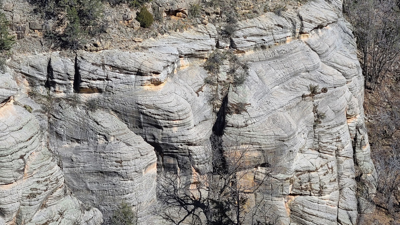 More of the striated canyon walls.
|
||||||||
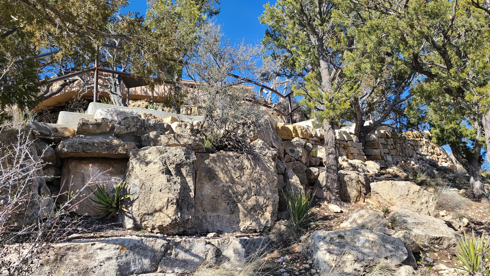
 We can see the Visitor Center high above us. Time to start the climbing.
|
||||||||
 There are six benches along the 273 stairs leading up/down from the Visitor Center.
|
||||||||
 How do I know? Because I stopped to rest on every single one of them.
|
||||||||
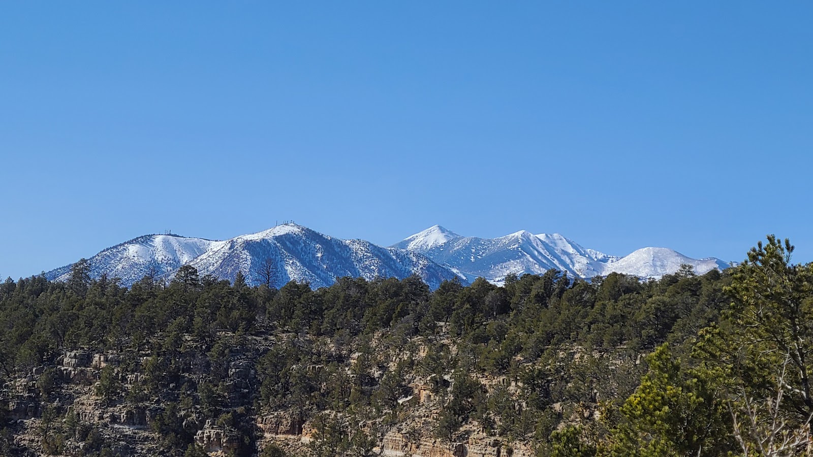 A view of the nearby San Fransico Peaks from the trail.
|
||||||||
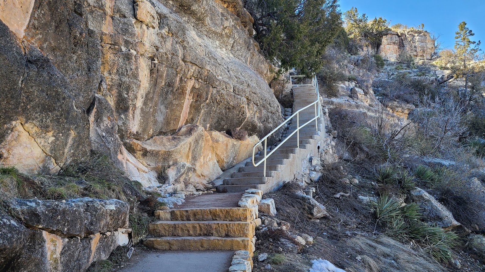
 Just a few more stairs and we're back at the Visitor Center and the parking lot.
our next stop be be something GRAND!
Would you like to be notified of new blog posts?


