

With 10-days at Zion National Park it would have created a very long post with way too many photos to view in one sitting.
Today's activity includes a 4.2-mile hike with 1000' of elevation gain to Scout Lookout on the West Rim Trail. This will bring them to the base of the "Angel's Landing Trail", probably one of the two most famous hikes here in Zion National Park, the other being "The Narrows".
Tricia and John will be doing this hike by themselves, but they won't be alone, there will probably be 100 or more other hikers on the trail with them.
Katherine will be staying behind to get caught up on some pressing situations with her clients and for me, my legs are still not feeling 100% after the enjoyable, but grueling (for me anyway) 7+ mile hike to "The Wave" last week.
We learned afterwards that their day also included a trip to the Zion Lodge to reward themselves with soft-serve ice cream cones. If I would have known that, I may have attempted the hike too, NOT!
SCOUT LOOKOUT
|
||||||||
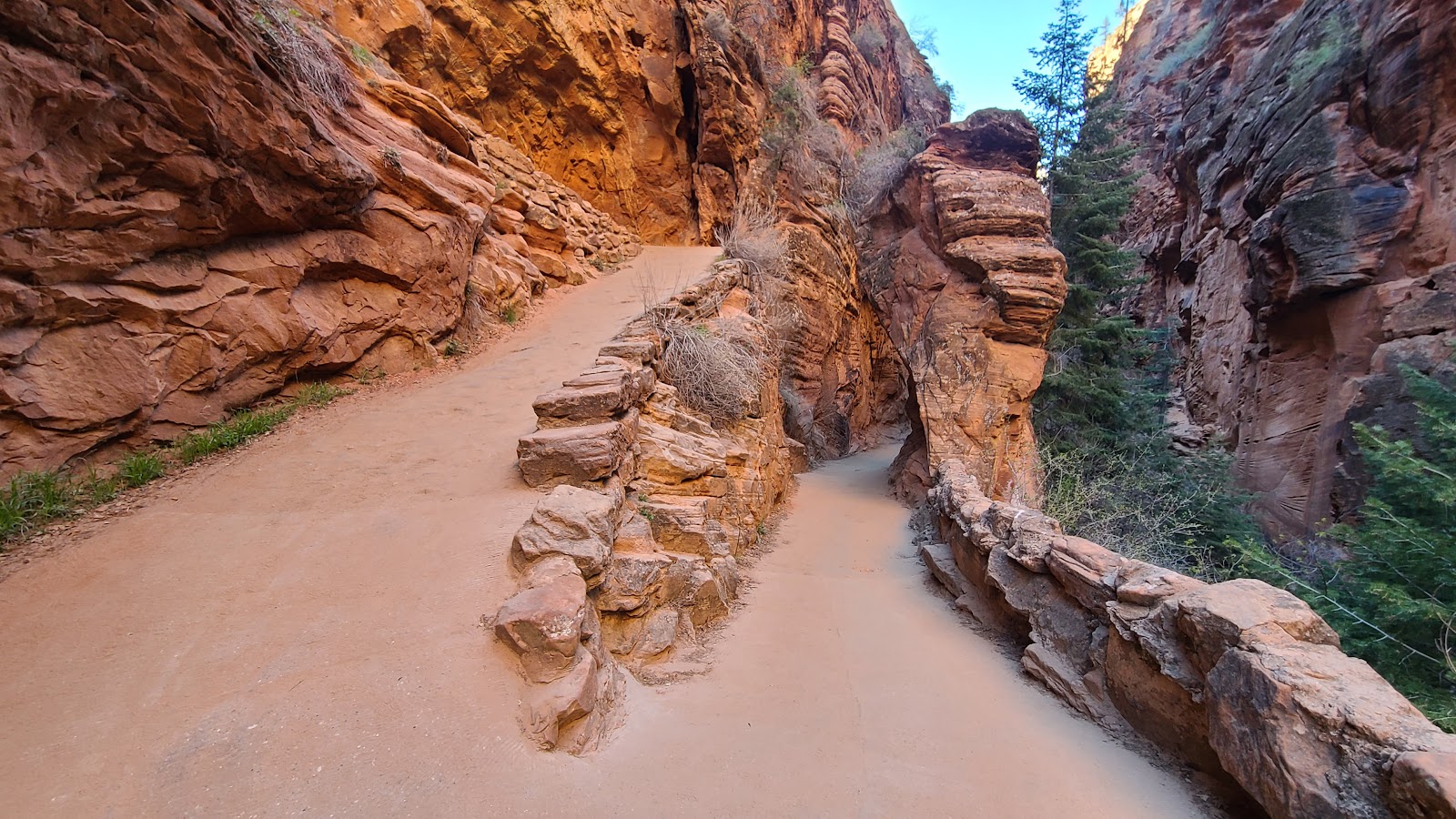
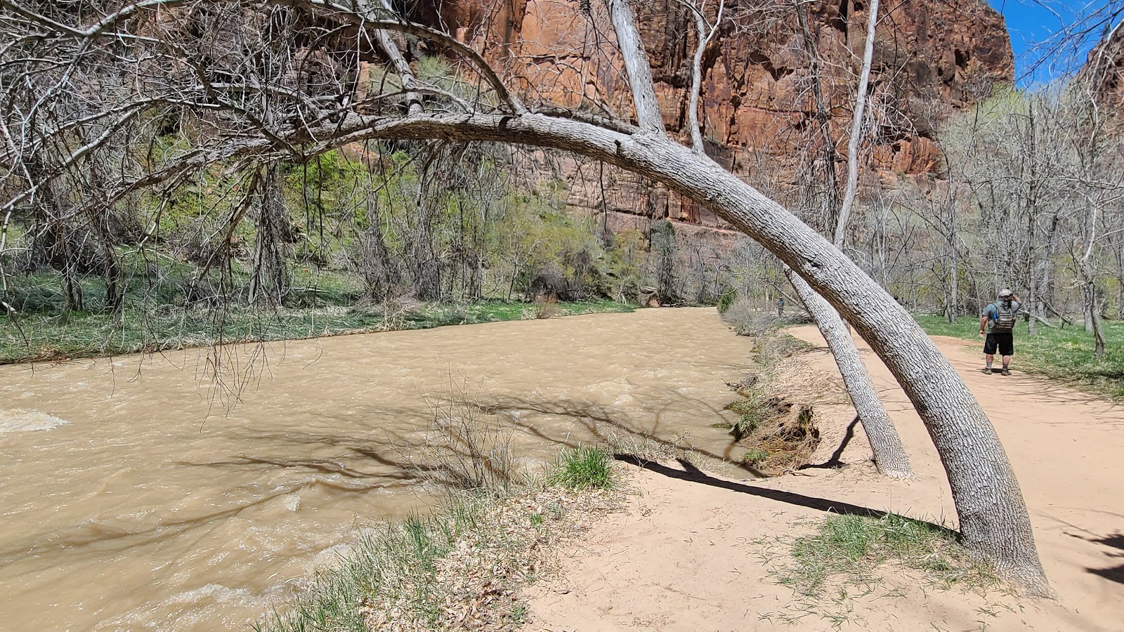
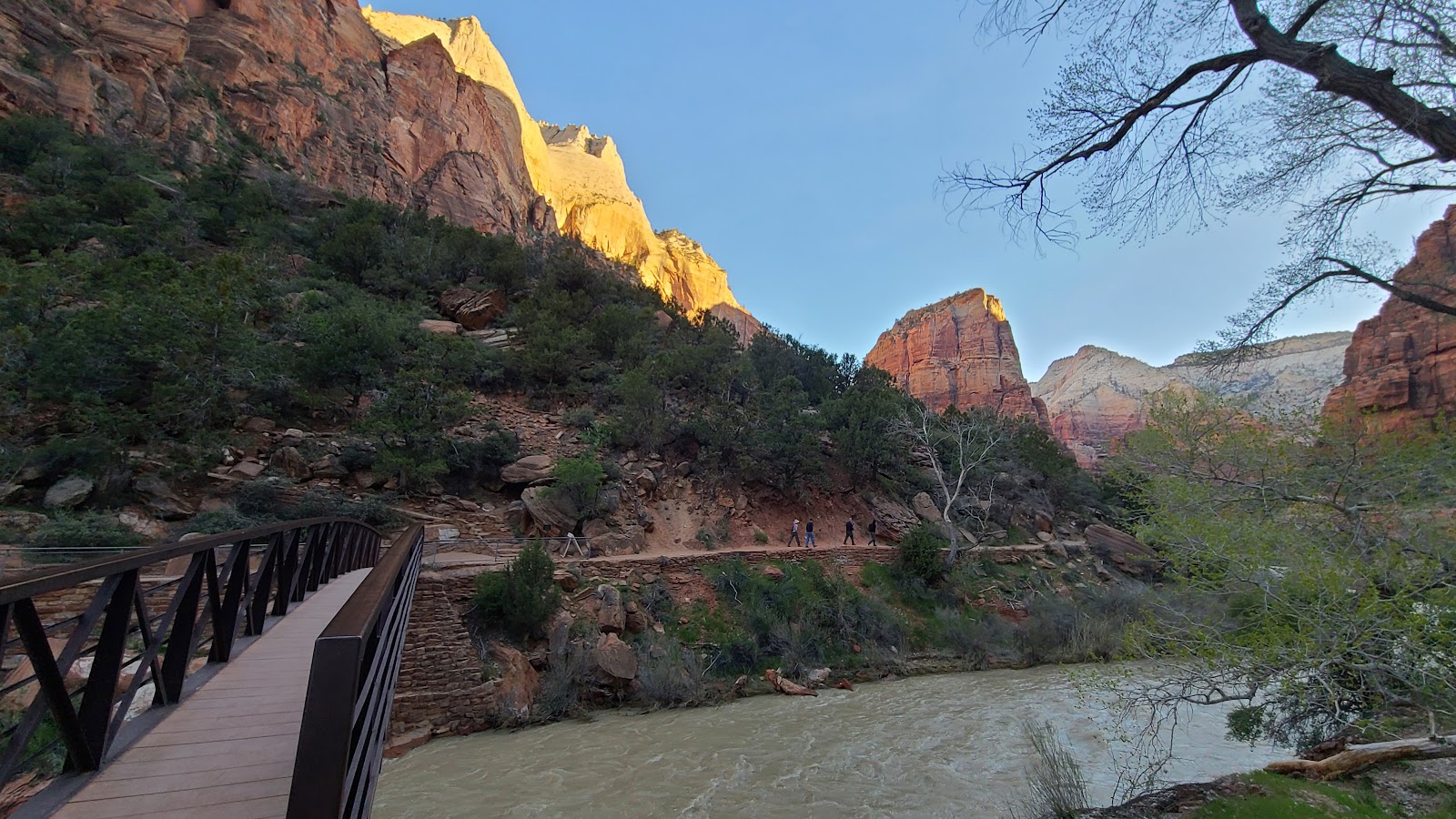 This trail also begins by crossing a pedestrian bridge over the Virgin River.
|
||||||||
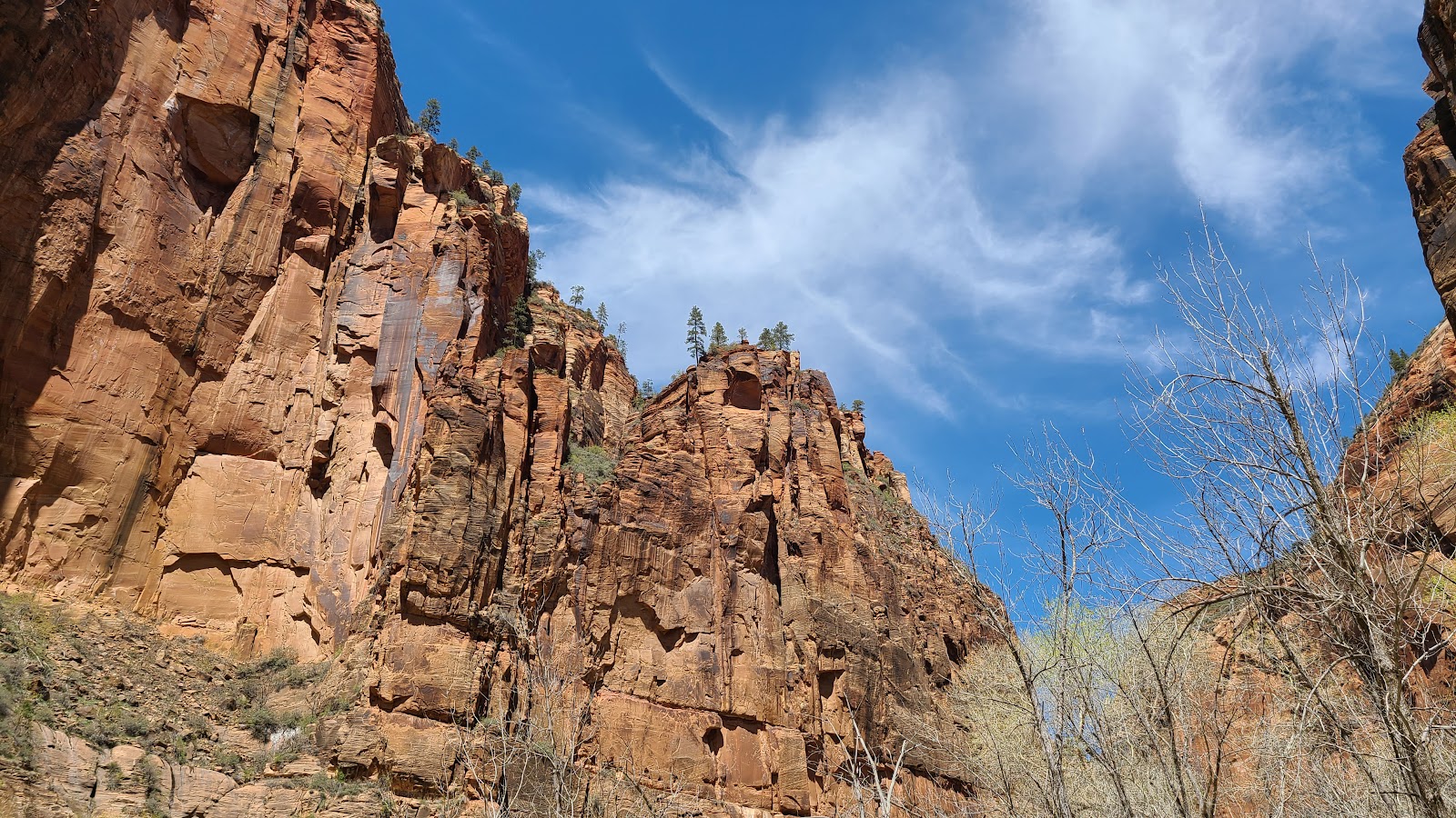
 Angel's Landing is atop that tall solitary peak in the center of the photo.
|
||||||||
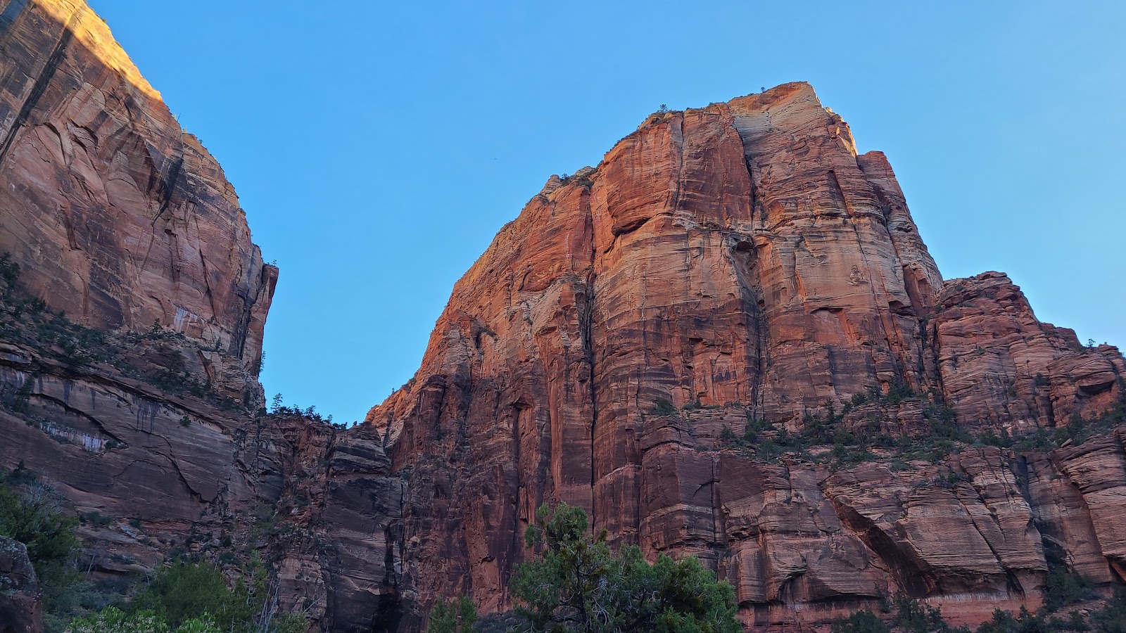
 Here is a closer look.
|
||||||||
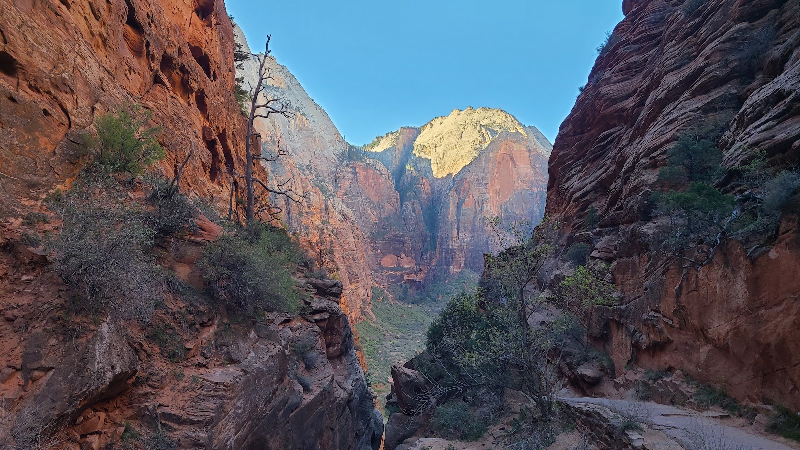
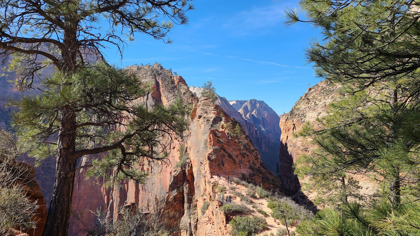
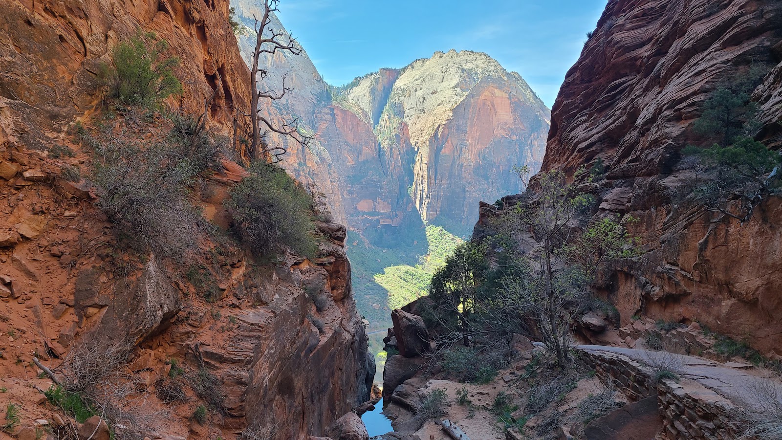
 That gap between the mountains is where Tricia and John are headed for.
|
||||||||
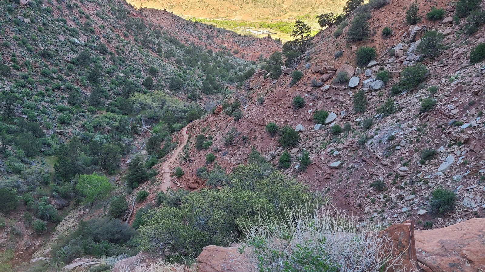
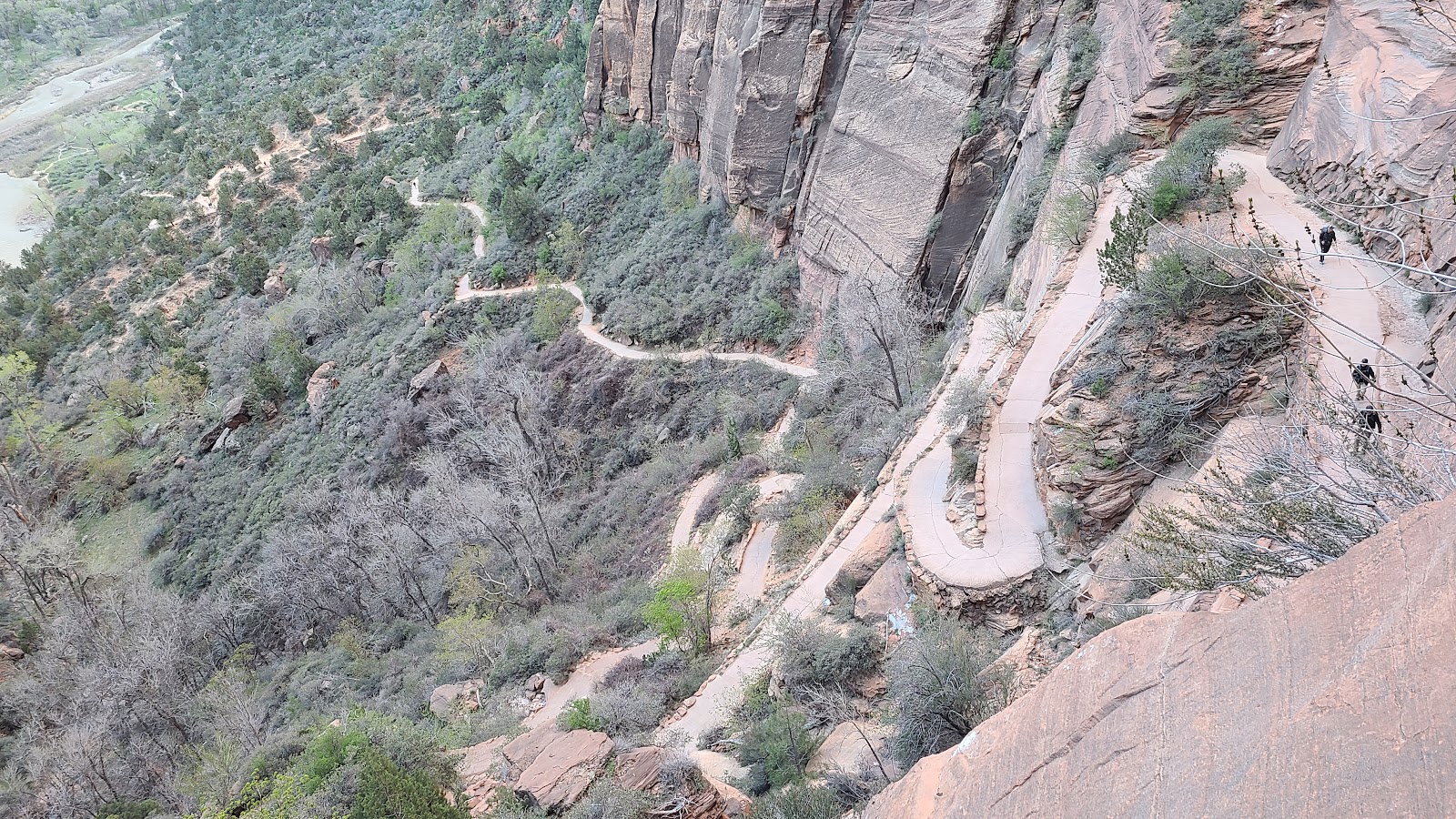 Up at the gap and looking back down at the switchback section of the trail.
|
||||||||
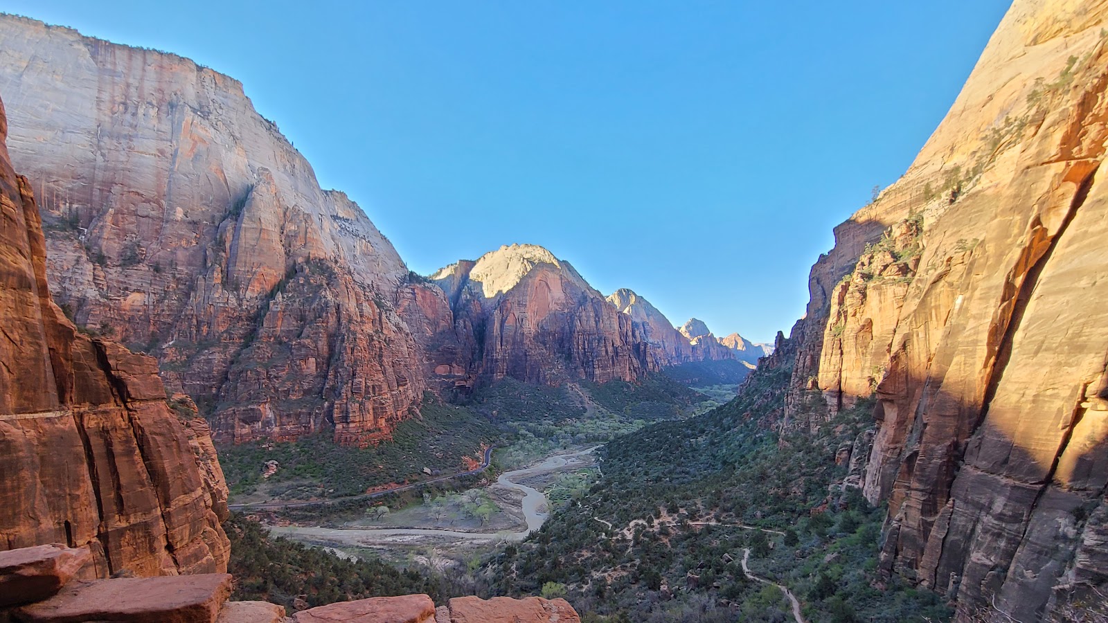 Here is the view from the gap.
|
||||||||
 Just a little further up the trail is this view.
|
||||||||
 Now it's time for some more climbing.
|
||||||||

|
||||||||
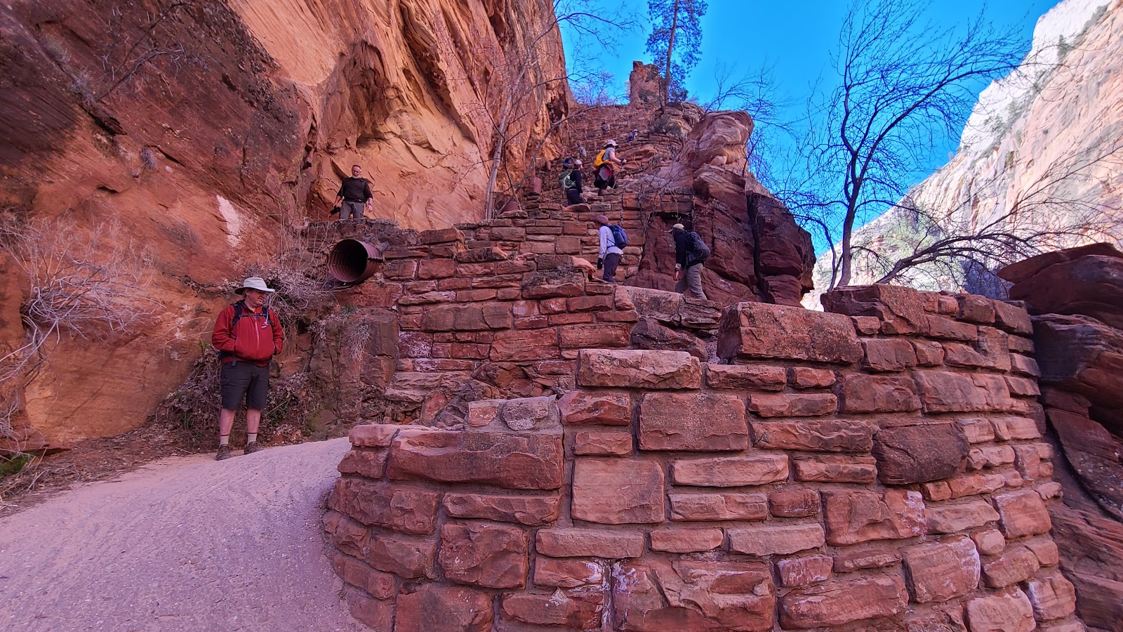 Here's John waiting for Tricia, the photographer, to catch up.
This section is called "Walter's Wiggles".
|
||||||||
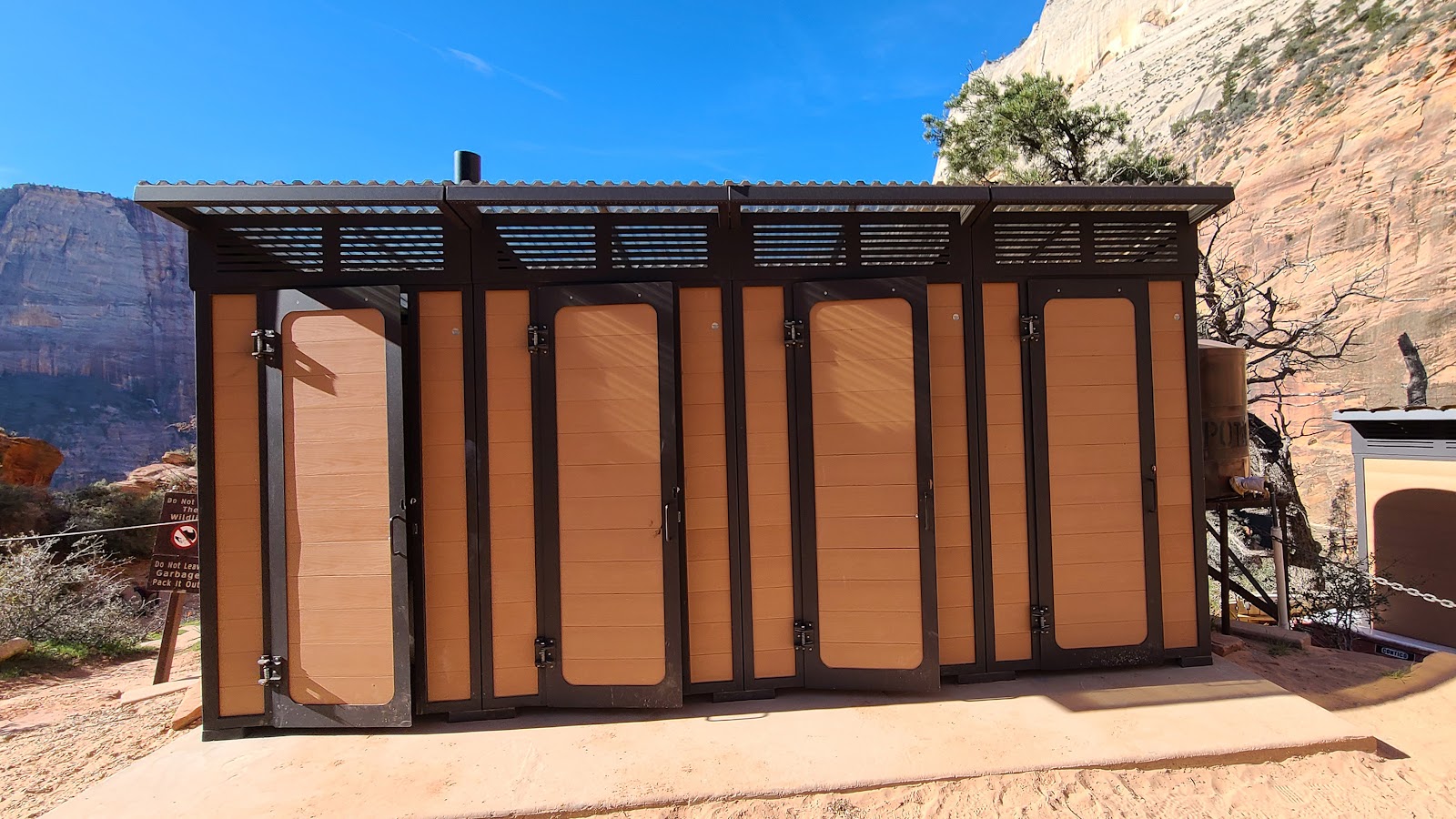 Something nobody expected to see near the top of the trail were these bathrooms.
|
||||||||
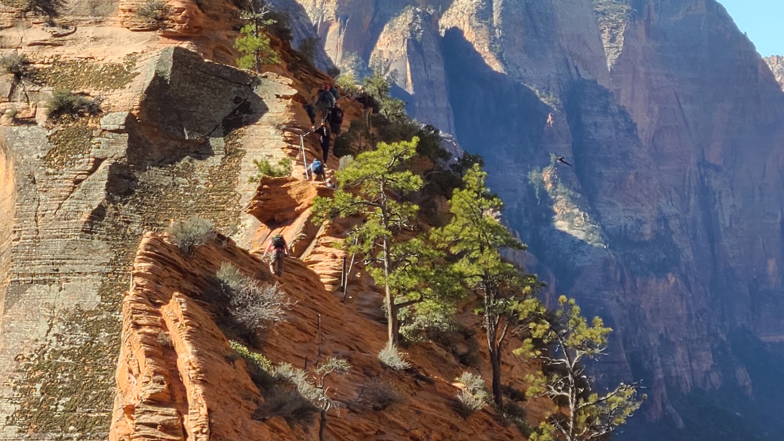
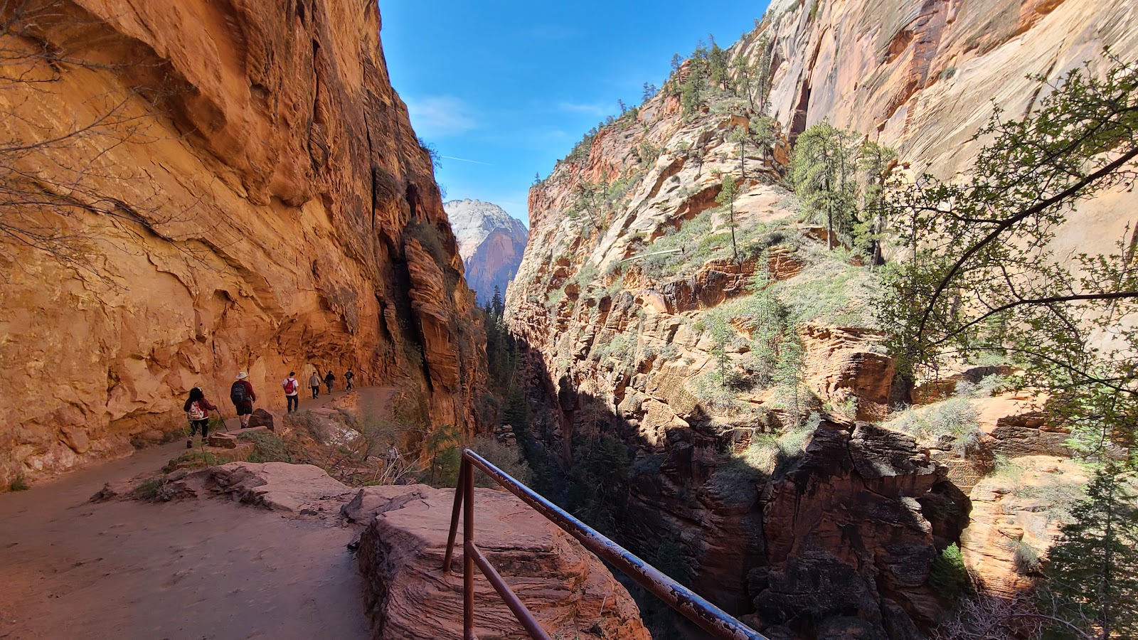
 Some people can be seen on the backbone section of the Angel's Landing Trail.
|
||||||||
 Here is a little bit closer view of the backbone section.
|
||||||||
 There is still more to climb before the trail widens near the top.
|
||||||||
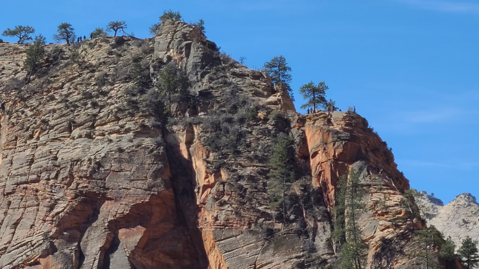 The uppermost sections of Angel's Landing.
|
||||||||
 The people look so tiny up there. Can you spot them?
|
||||||||
 Here's John atop Scout Lookout looking towards Angel's Landing.
|
||||||||
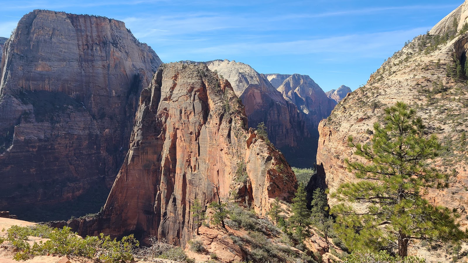 Another view of Angel's Landing.
|
||||||||
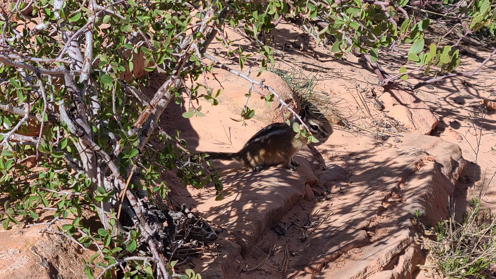 John and Tricia stopped for lunch, but didn't realize they were being watched.
|
||||||||
 Nothing to do now except start the long hike back to the valley floor.
|
||||||||
 One last view of the trail back towards home.
While Tricia and John were out hiking, and Katherine was taking care of clients needs, it left me free to ride the Shuttle Bus up to the Zion Lodge and check out their "All-You-Can-Eat" Breakfast Buffet.
At $10.99 it's the best deal in the park. On the buffet you'l find Pancakes, French Toast, Maple Syrup, Berry Compote, Biscuits & Gravy, Corned Beef Hash, Country Potatoes, Bacon, Sausage, Scrambled Eggs, Cheese Omelets, Granola, Yogurt, Mixed Fruit, Oatmeal, Cold Cereal and Assorted Pastries.
They had me interested in checking it out when I heard Biscuits & Gravy were offered. I tried a little bit of just about everything and nothing offered was less than delicious. I don't think I'll have any trouble talking the rest of the gang into another breakfast here before we leave next Thursday.
After breakfast I returned to the Shuttle Stop and boarded a bus back to the Visitor Center. I arrived with plenty of time to spare before the 10:00AM Porch Talk began, so I sat down and began the process of digesting that huge breakfast.
Right at 10:00AM, as the talk was beginning, up walks Katherine with Luca and Lacie leading the way. Taking a short break from work she also decided a Porch Talk was just what she needed. These Porch Talks have all been very well prepared and presented and we try not to miss any of them, at least the 10:00AM ones. The 2:30PM talks usually occur while we are out and about in the park.
After everyone was well rested we went over to their campsite for dinner. John had his Blackstone Grill out and had enough room to cook his Pork Chop, Katherine's vegetables, Tricia's steak and my Salmon all at the same time. Tricia had baked some Peppers, Onion and Potatoes for me and Mushrooms and Onions for herself in our oven before we when down to their site for dinner.
A couple of days ago when the three of them were hking the Middle and Upper Emerald Pools Trail I walked into town and purchased two bundles of firewood. So after dinner we sparked up a good sized campfire while we enjoyed the Mixed Berry Crumble that Katherine had prepared.
It was a great way to end the day, with friends around a campfire after sharing a delicious dinner outdoors.

Today is the beginning of National Park Week and that means it's free entry into many of our National Parks today.
What does that mean to us, already here in Zion National Park? It means that today it is going to be VERY CROWDED.
Not crazy crowded like it is here in July, but definetly it will the busiest day of our 10-day visit.
We should have known better, but after our 10:00AM Porch Talk all about the geology of Zion from a different perspective than the talk we had before, we planned to hike the 2.2-mile round-trip Riverside Walk Trail at the very end of the Shuttle Bus Route.
Normally, this is the trail you would have to hike to get to the start of "The Narrows" hike. The Narrows hike is in a 20-foot wide canyon (at some spots) with 2000' foot high walls. That's why The Narrows is one of the Top Two hikes in the park.
Not nearly as dramatic as The Narrows, we hiked the very busy trail to the north end of the park along the Virgin River.
The Narrows hike is "IN" the river and with the river currently flowing at between 750-1000 cubic feet per second that is not possible. Routinely when the water declines to 150 cubic feet per second the park considers opening the 3.6-mile hike upstream. Usually a measure of 120 cubic feet per second is more desirable for even the more avid hikers to attempt the trail.
RIVERSIDE WALK TRAIL
|
||||||||
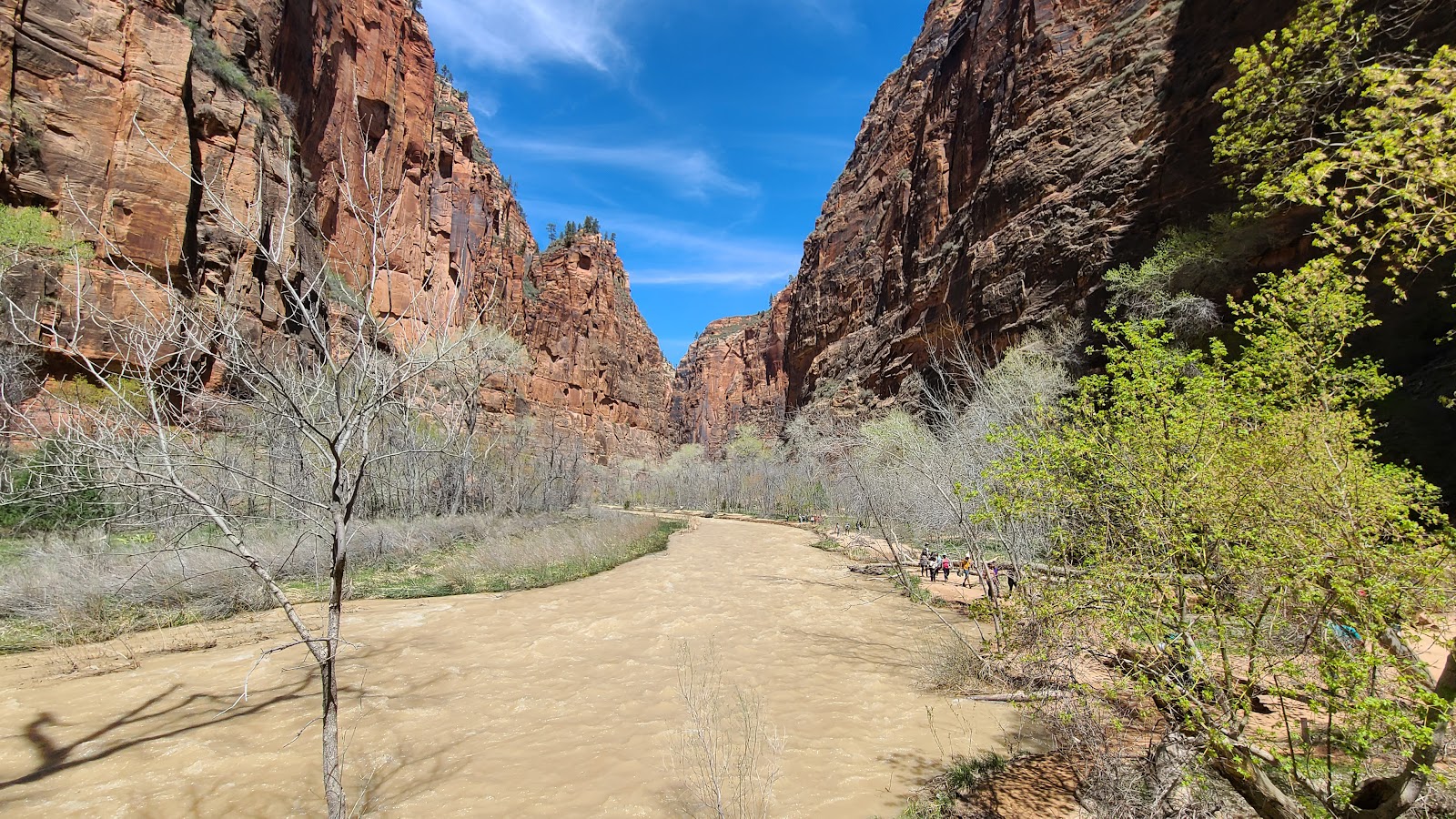 All of today's photos will have one thing in common, the Virgin River.
|
||||||||
 Seasonal flooding of this river has left some of the trees along the banks very misshapened.
|
||||||||
 Believe it or not some of those pine trees on the rim are over 70-feet tall.
|
||||||||
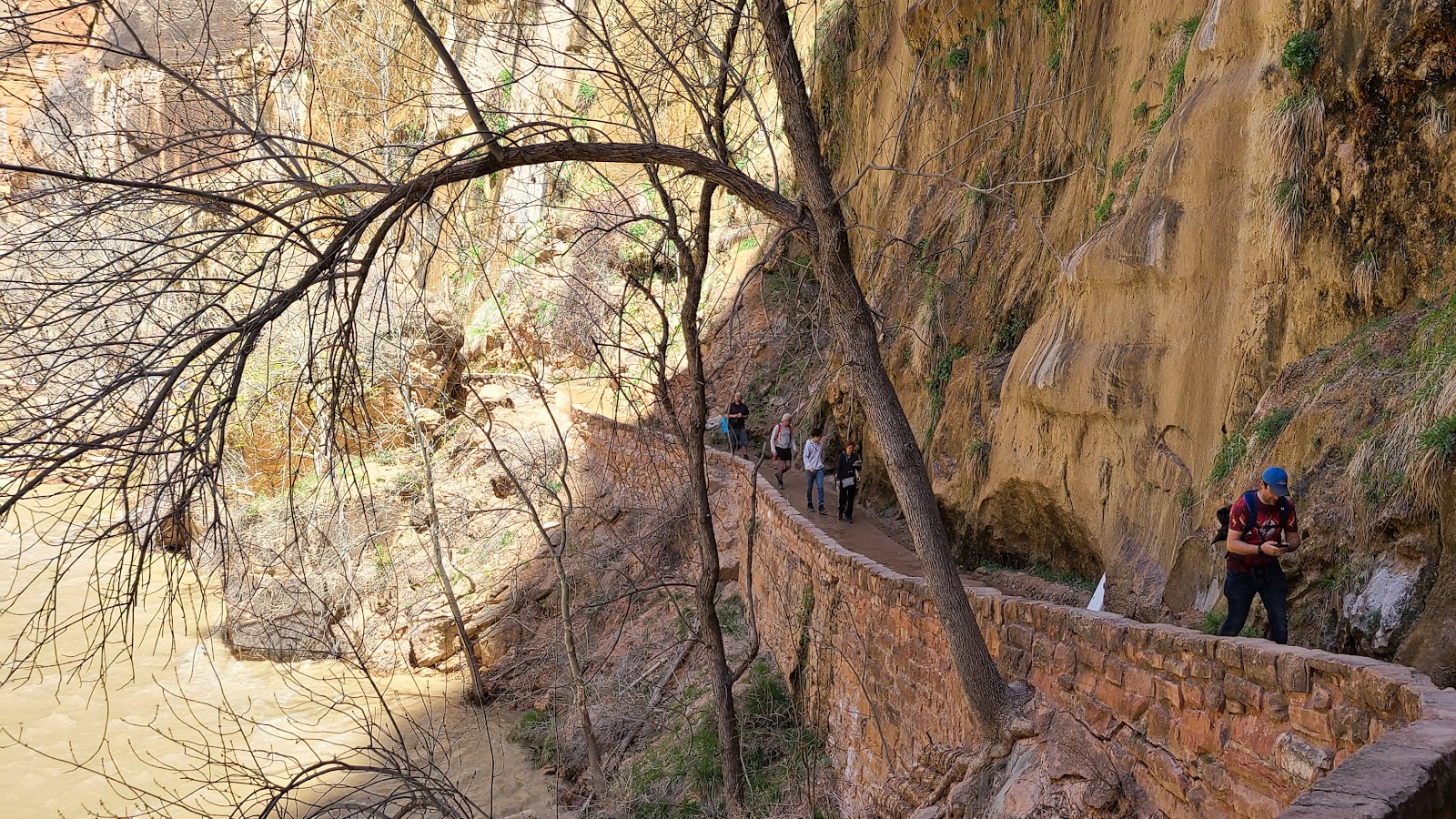 Most of the trail is elevated far above the fast flowing river.
|
||||||||
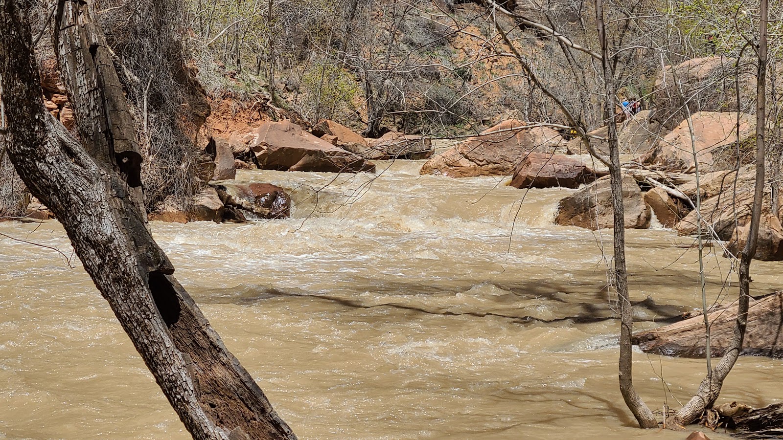 In several places the water gets "pinched" into flowing between boulders.
|
||||||||
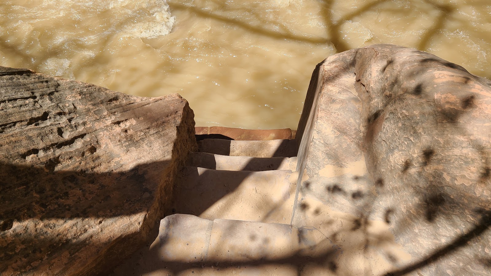
 This is the end of our trail. The Narrows Trail starts just around that corner.
|
||||||||
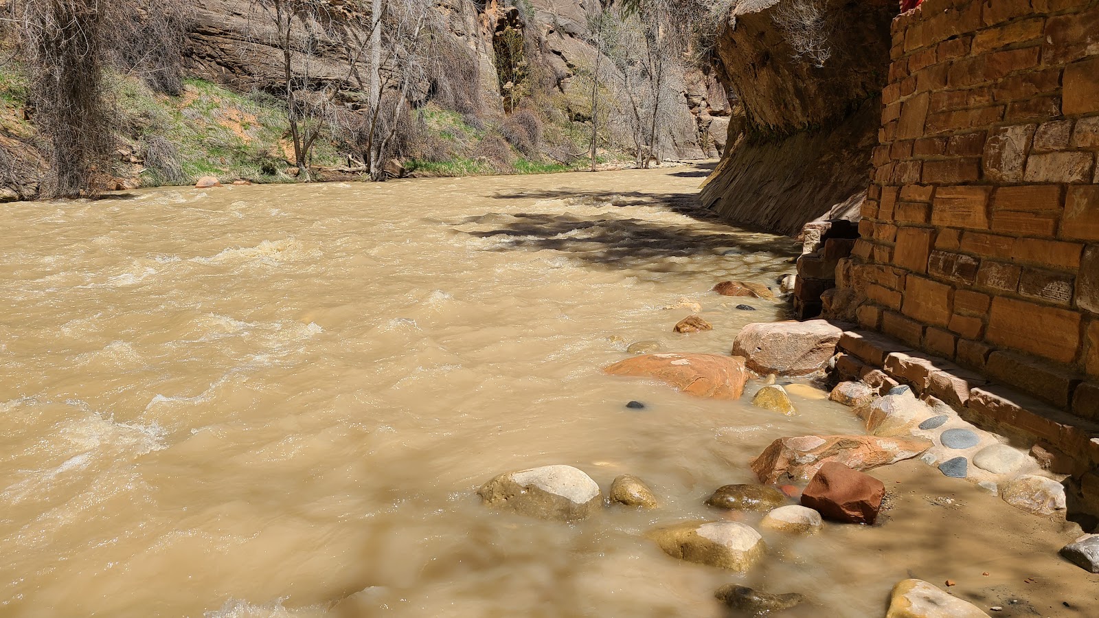
 Here is where you would normally gain entrance into the river, but not today!
|
||||||||
 Nothing to do now except hike back to the Shuttle Bus Stop...
|
||||||||
 ...where you'll find this stunning waterfall.

After the 10:00AM Porch Talk we all went back to our trailers and began packing a picnic lunch. With it still being the weekend and the crowds of people still using the Shuttle Buses and hiking the more popular trails, we decided to take the Rangers advice and go visit the Wildcat Canyon section of the park and leave behind the crowds in the more popular section of Zion Canyon.
In order to get to the Wildcat Canyon we had to exit the park, drive back down UT-9 for 13.5-miles to the town of Virgin where we left the highway behind at Kolob Terrace Road.
We traveled UP Kolob Terrace Road to an elevation of nearly 8000' before we arrived at a gate across the road saying it was closed to further traffic. So we turned around and less than a half mile later we found a spot to enjoy the view and our picnic lunch.
We didn't see more than a couple dozen cars on the entire drive and the scenery was every bit as stunning as it is over in Zion Canyon. Twice the Kolob Terrace Road enters and exits the National Park boundaries on it's winding journey up onto the plateau.
WILDCAT CANYON
|
||||||||
 At 3700' of elevation we were just getting started going UP the road.
|
||||||||
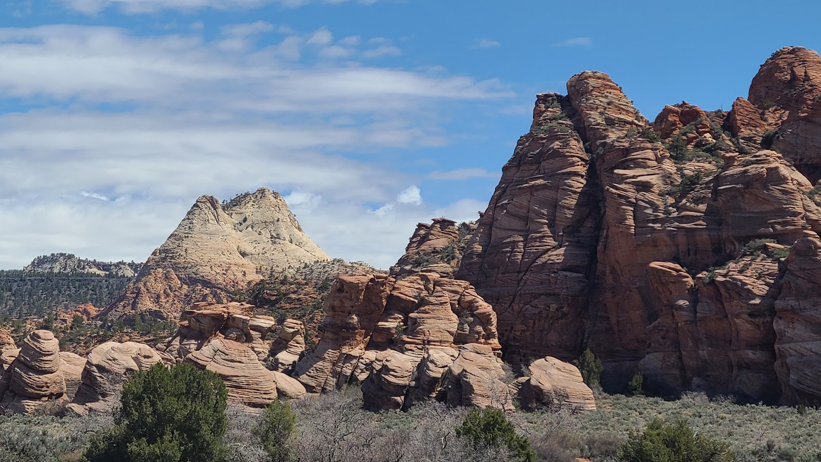
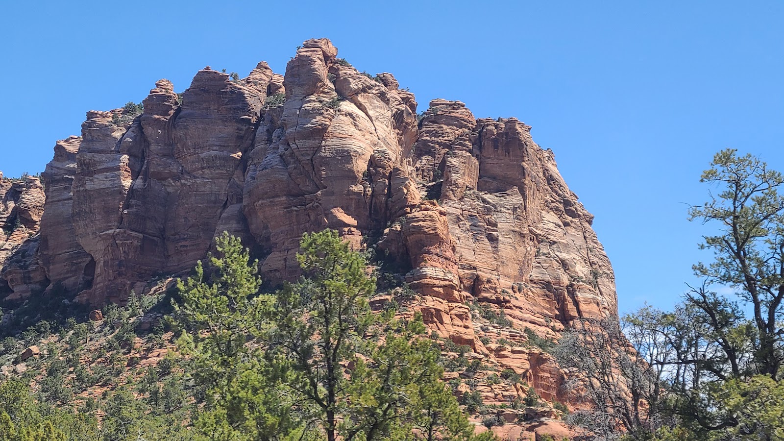 The rock formations here aren't nearly as vertical as those found in Zion Canyon.
|
||||||||
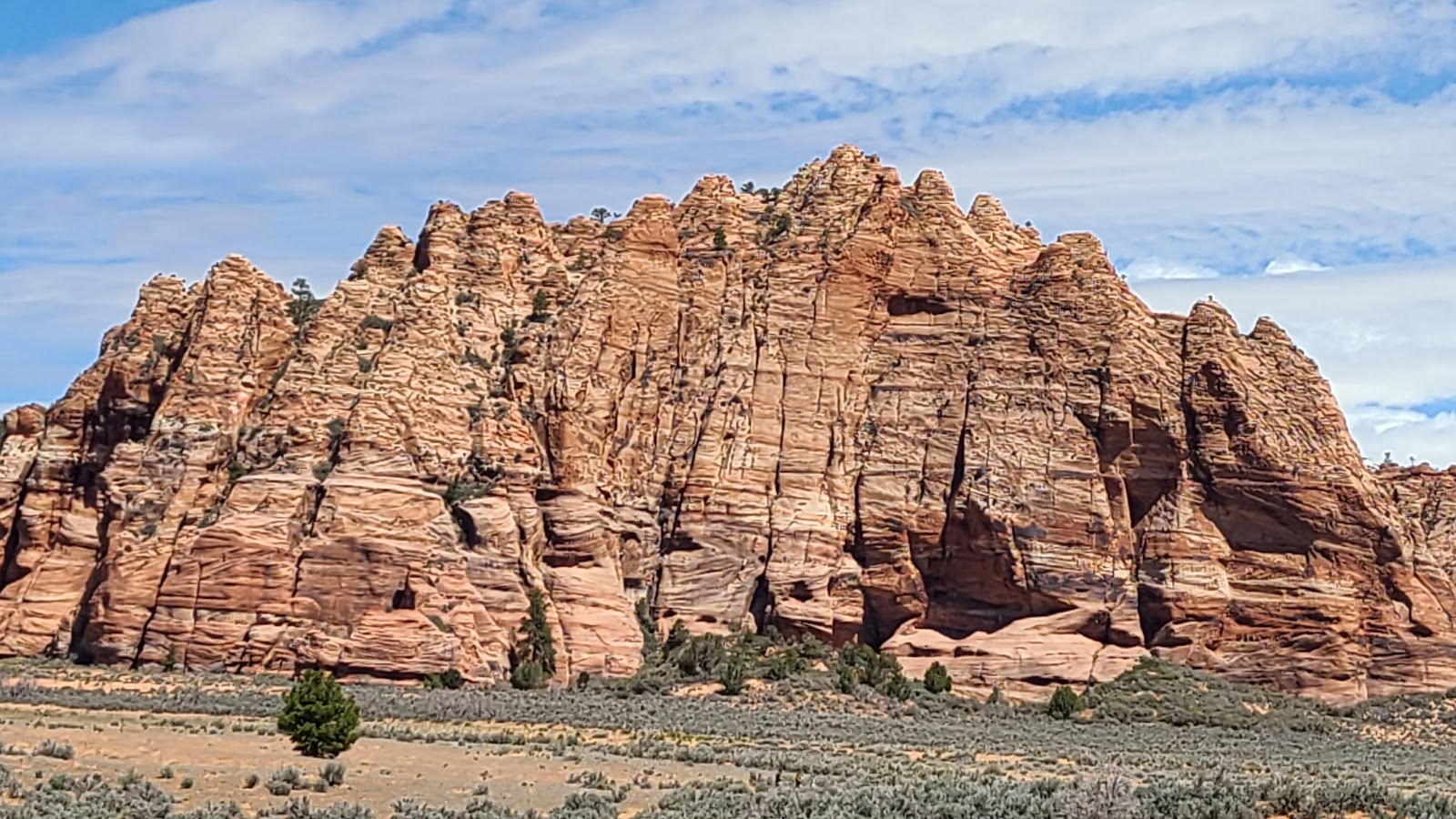 That is until we drove past this monster sized rockface.
|
||||||||
|
||||||||

|
||||||||
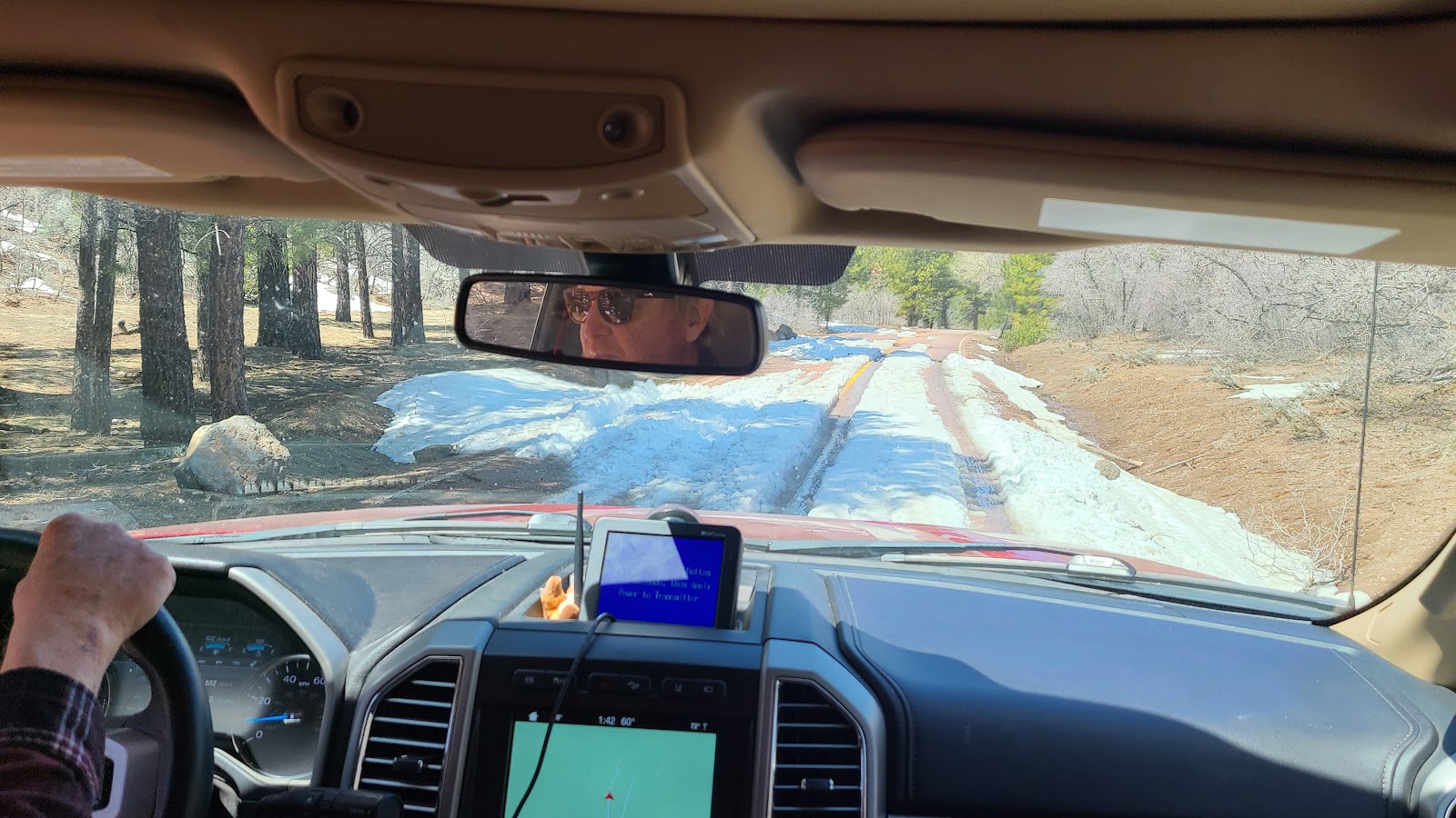 After reaching 7000' of elevation we started seeing more and more snow across the roadway.
|
||||||||
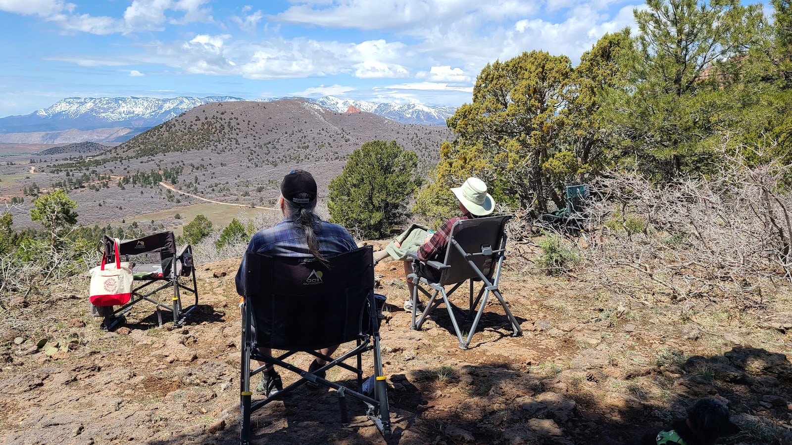 After turning around we found our perfect picnic spot at 7250'.
|
||||||||
 There were still a few patches of snow on the ground while we ate lunch nearby.
|
||||||||
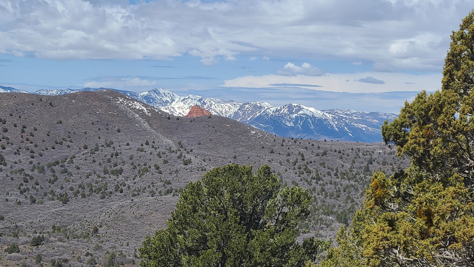
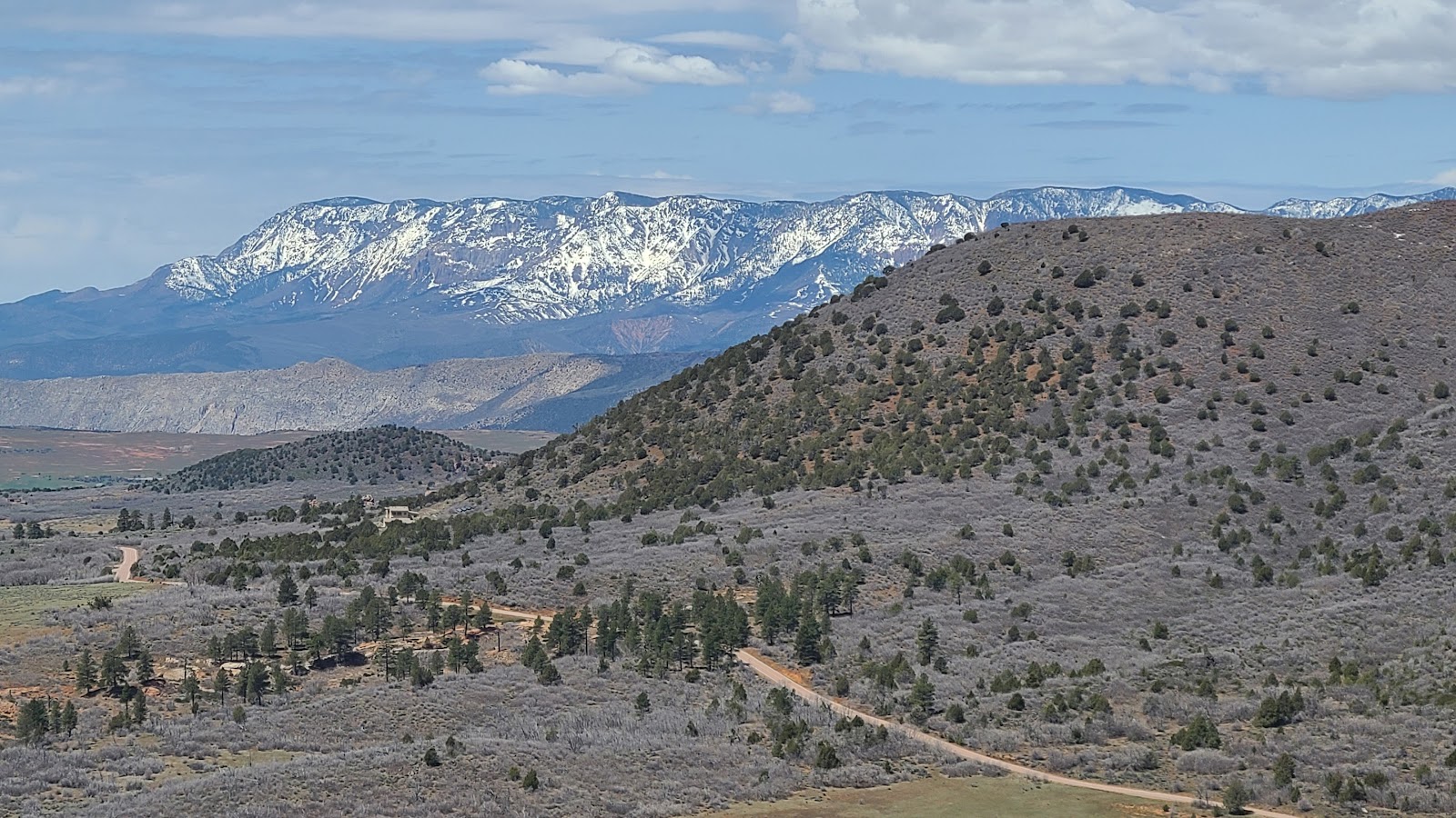 But the views were far reaching to the valley below.
|
||||||||
 We spent nearly an hour enjoying our picnic spot before leaving.
But we're not done sightseeing just yet. On our way back to camp we stopped in to visit the old ghost town of Graphton, UT. Graphton was established back in the 1860s by Mormon settlers, but by the 1880s drought and disease forced them to move to more hospitable locations.
All that's left of the town today is a cemetery, a half dozen buildings in various degrees of restoration and a handful of storyboards explaining the history of Graphton.
GRAPHTON GHOST TOWN
|
||||||||
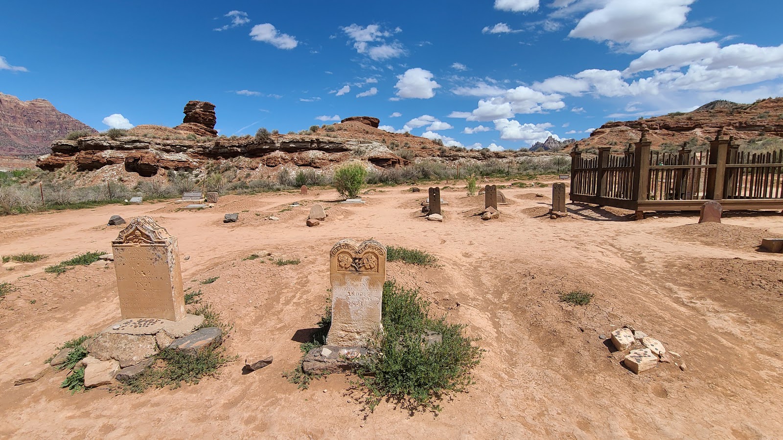 This modest cemetery is located about ¼-mile from the center of town.
|
||||||||
 This was the center of town activities.
|
||||||||
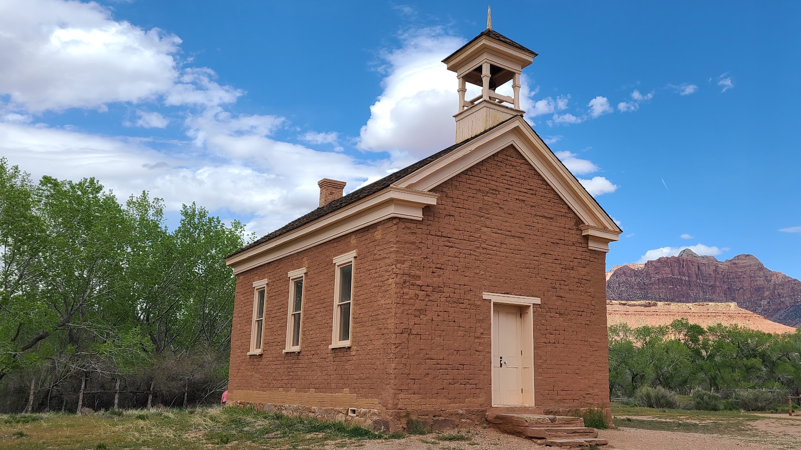 The church has seen the greatest amount of rehabilitation efforts.
|
||||||||
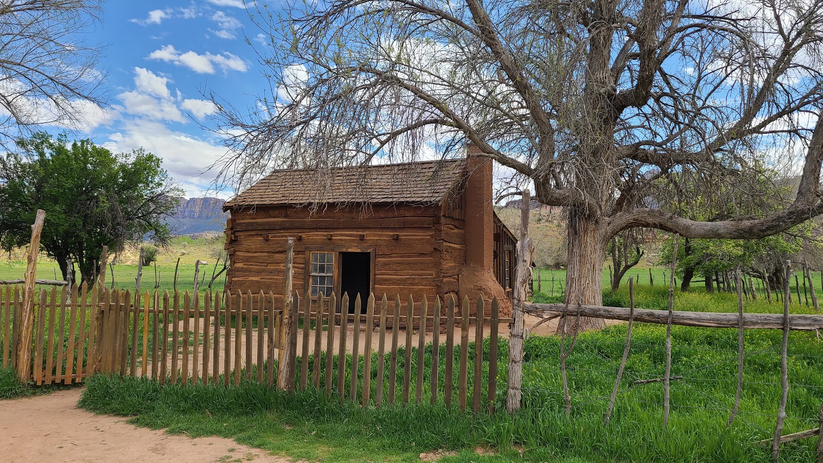
 Followed closly by the Russell Family home.
|
||||||||
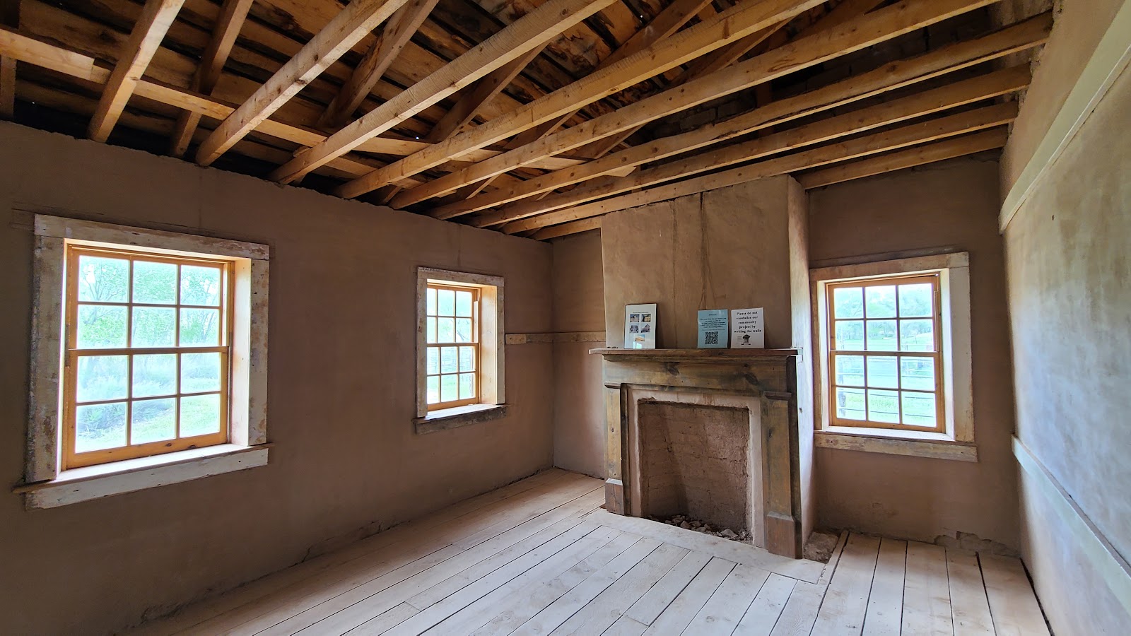
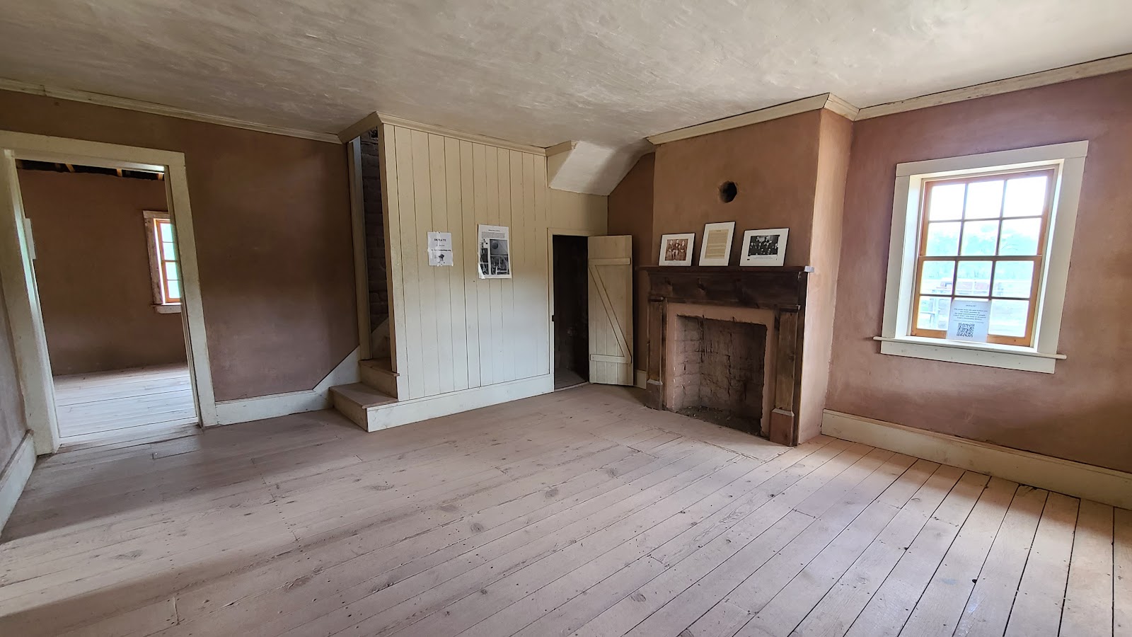 The downstairs living room of the Russell Family home.
|
||||||||
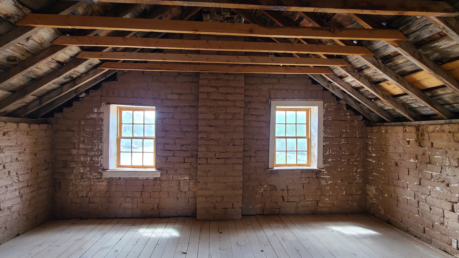
 One of the upstairs bedrooms in the same home.
|
||||||||
 Possibly an upstairs playroom for the Russell Family children.
|
||||||||
 Across the street was this home, also part of the extended Russell Family.
|
||||||||
 It was considerably more modest than the two story home across the street.
|
||||||||
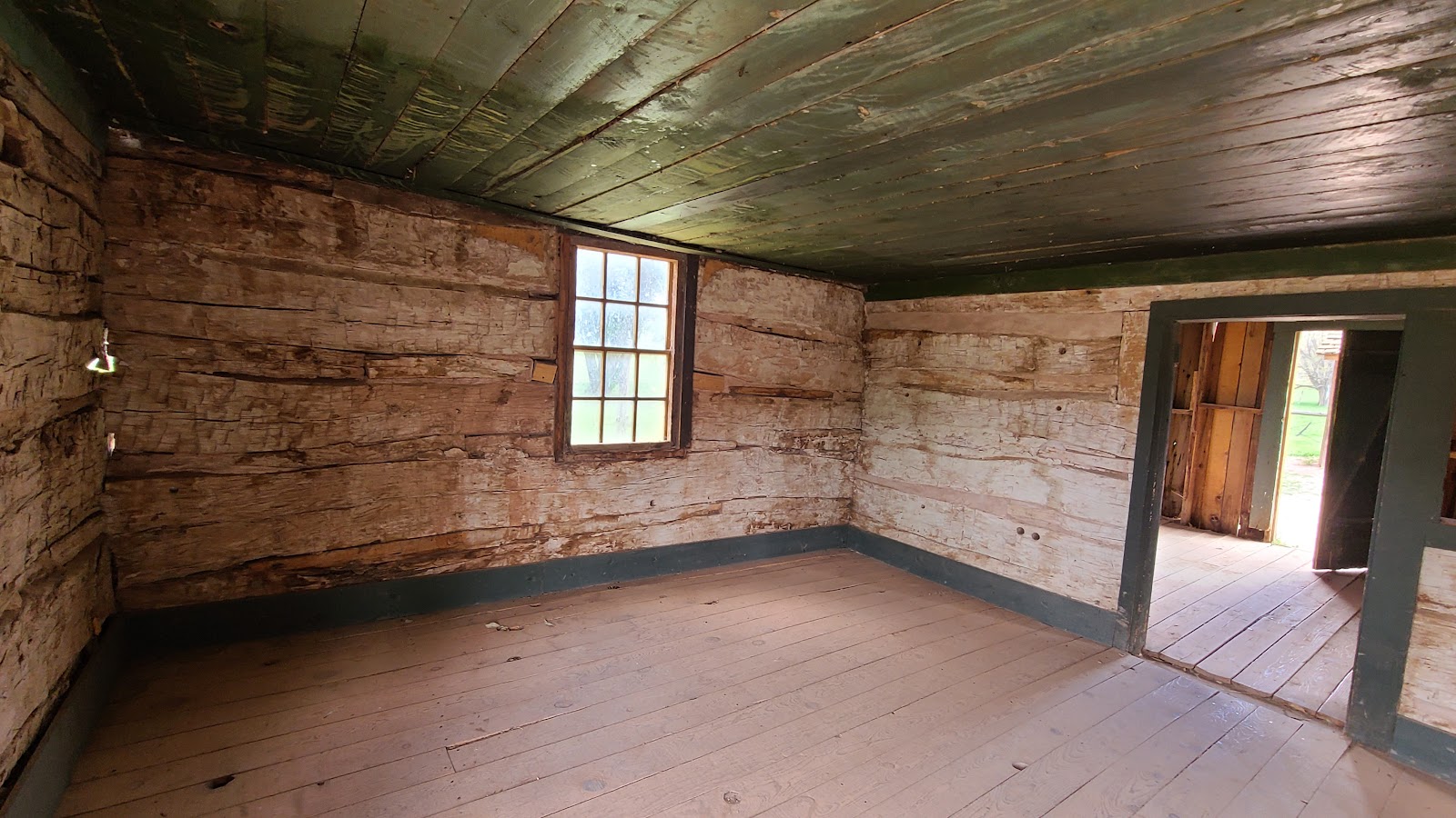
 Just two rooms in the entire home.
|
||||||||
 But it did have a rather large fireplace for such a small home.
|
||||||||
 Out back was a storage shed of some kind.
|
||||||||
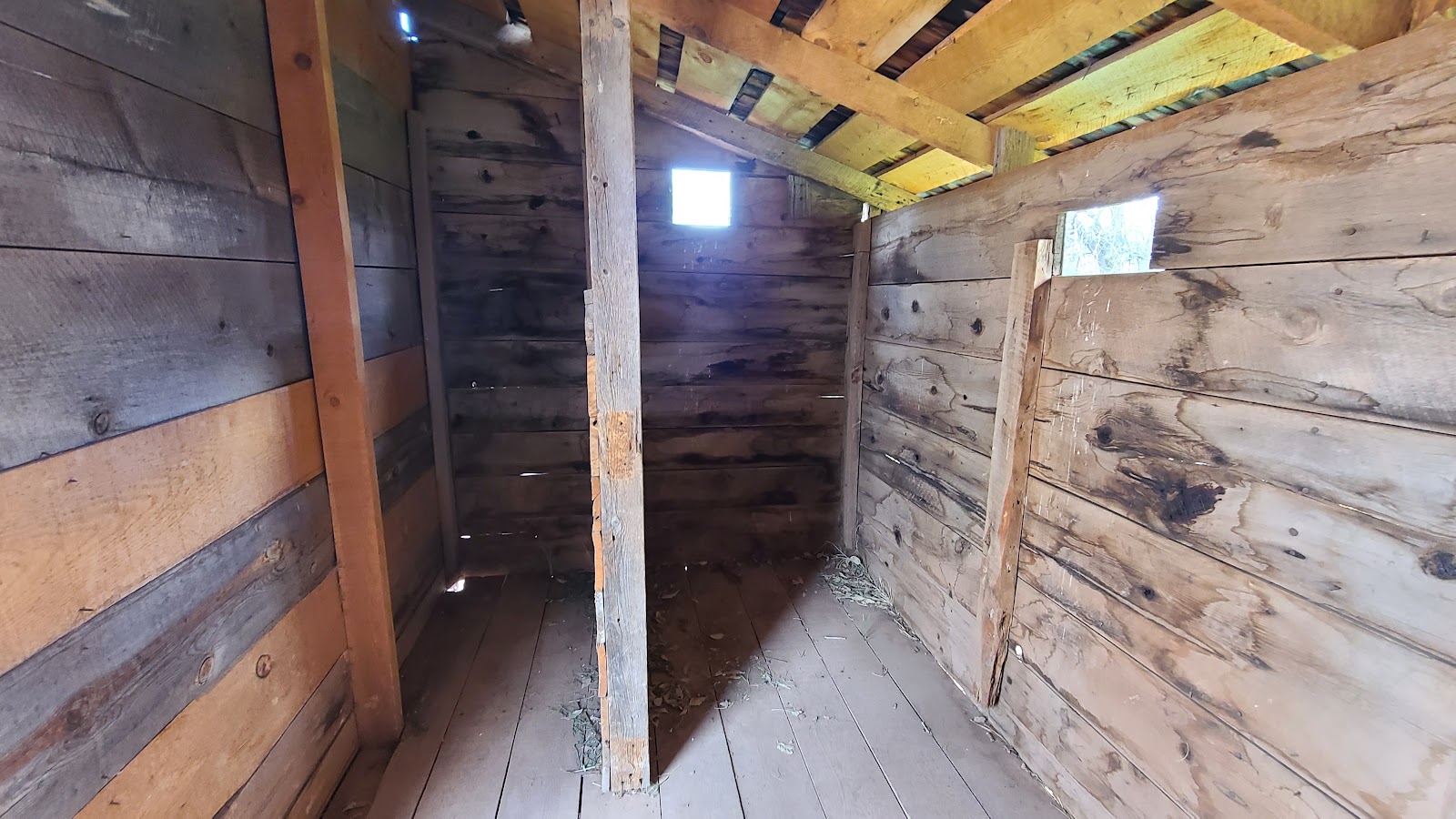 As you can see there wasn't much to the inside of the shed.

John, Tricia and I boarded the 7:30 Shuttle Bus and rode it "up canyon" to the Zion Lodge (Stop #5). It was only slightly more crowded than the day I previously ate breakfast there.
Katherine had a video court appearance she needed to be at so she remained behind.
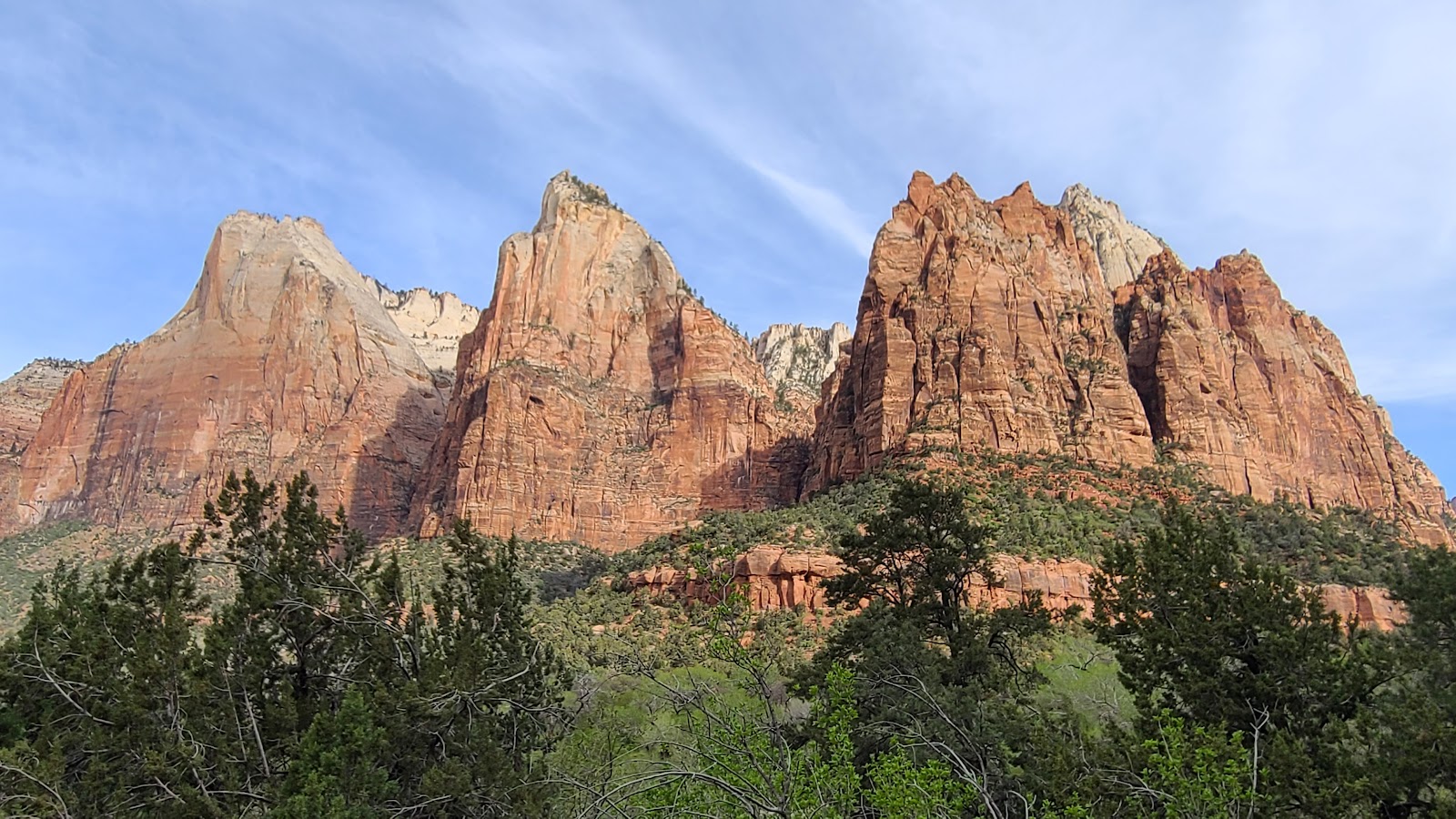
After breakfast we returned to the Shuttle Stop and boarded a "down canyon" bus to return to the Visitor Center. On the way we stopped at the Court of the Patriarchs (Stop #4) and climbed 150' up a steep path to grab this photo of the three prominent rock formations found there.
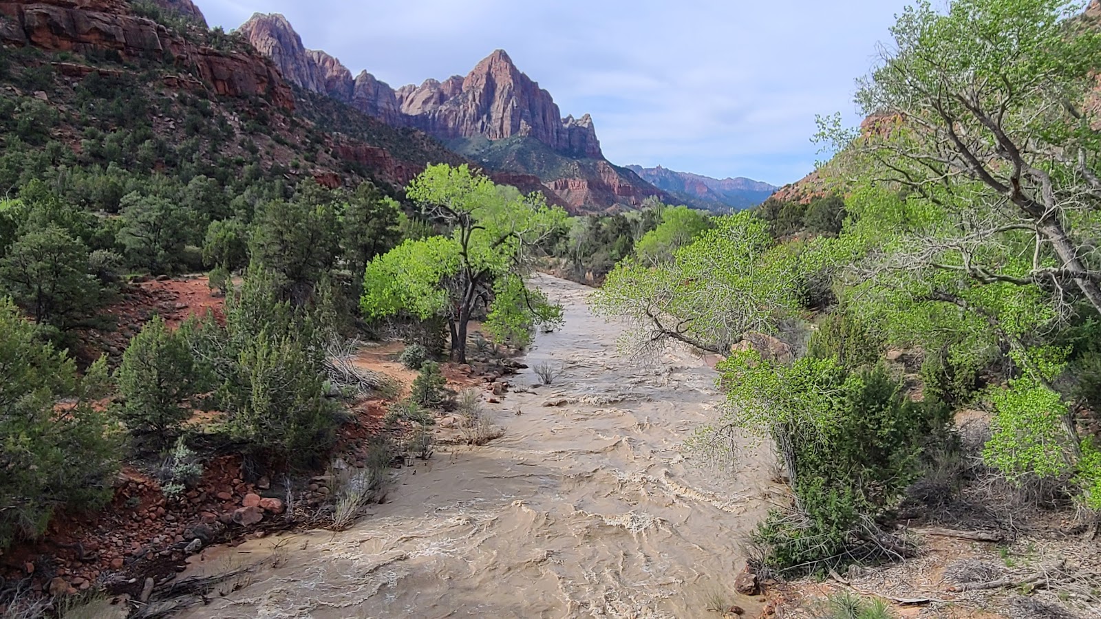
Then it was back on the bus only to get off again at Canyon Junction (Stop #3) just a little way down the route. Here we walked a short distance to grab this iconic photo of the Virgin River with Watchman Peak towering over the valley below.
We arrived back at the Visitor Center with time to spare before the 10:00AM Porch Talk which allowed John to walk back to his campsite and retrieve his two precious puppies, Luca and Lacie.
We learned more about the Geology of Zion Canyon before going our separate ways and returning to our campsites. I think everybody is pretty worn out by the activities from this past week and needs a little recovery time before we have to start thinking about leaving on Thursday.
John and I both took a little trip up to the campground check-in station where John was able to get a $15 refund for his last reserved night here in the campground. They'll now be leaving the same morning as we do, only they'll be heading south along the same route we both came in on.
We'll be heading east out of the park via the Zion-Mount Carmel Tunnel. Our combined length is just over 49' and there is a 50' limit for anyone wishing to pass through the tunnel. John and Katherine's combined length is closer 53' so they really don't have much of a choice.
We will have to pay a $15 fee to have the Rangers hold up traffic while we pass through the tunnel, driving down the center line because we're so wide, but I'll save more than that on gasoline by taking the short cut to our next stop. Besides, it'll just be more fun!

Tricia, Katherine and John all went on a short, but steep, hike at Shuttle Stop #7. The Weeping Rock trail is only .4-mile round trip, but there is an elevation of nearly 100'. That's like walking up and down the stairs of a ten story building.


Due to it's length and an elevation gain of 368' it's listed as a moderate hike in the park brochure.
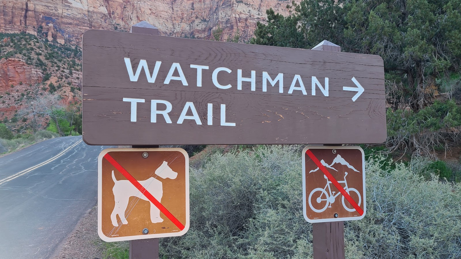
WATCHMAN TRAIL
|
||||||||
|
||||||||
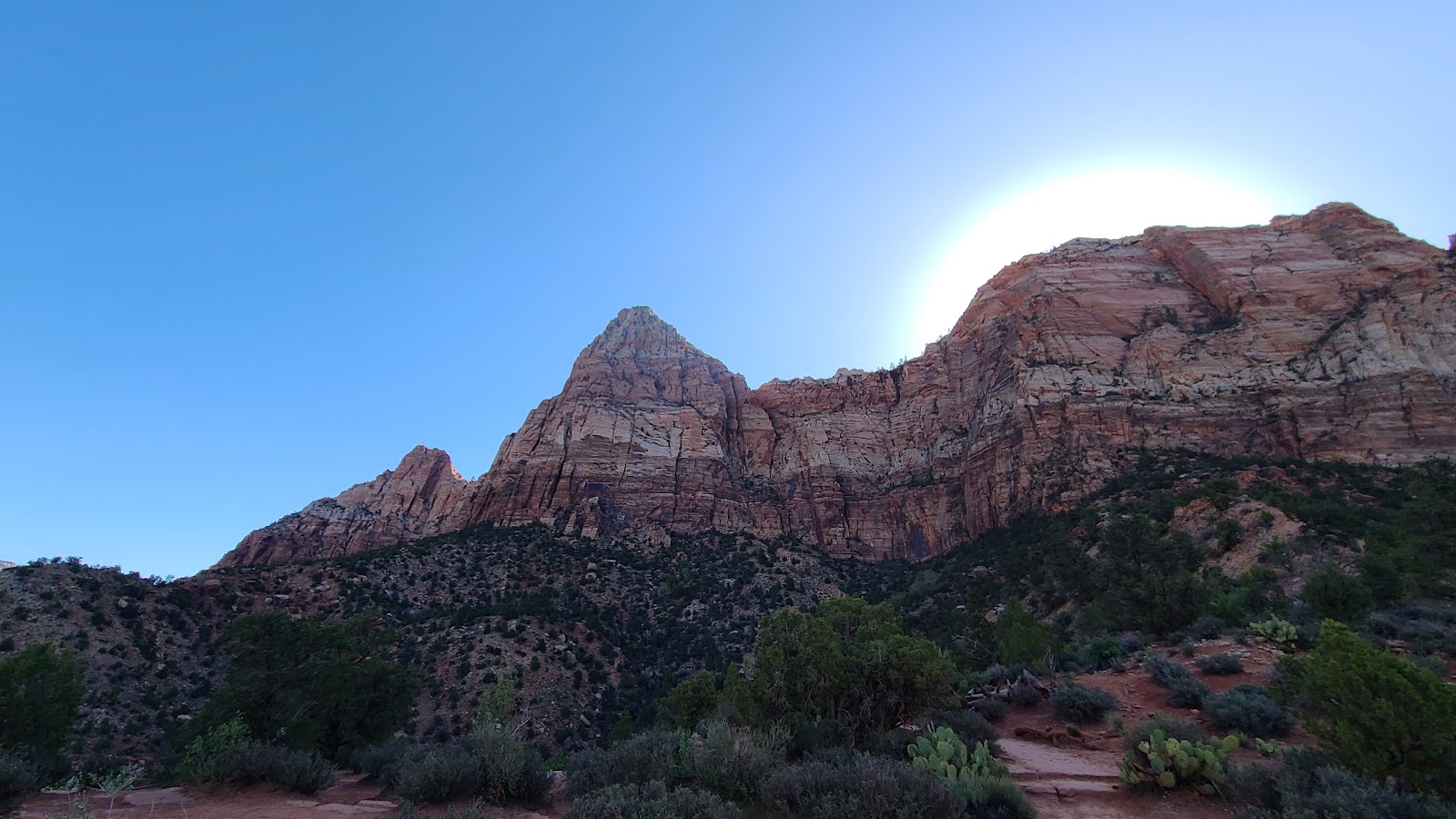
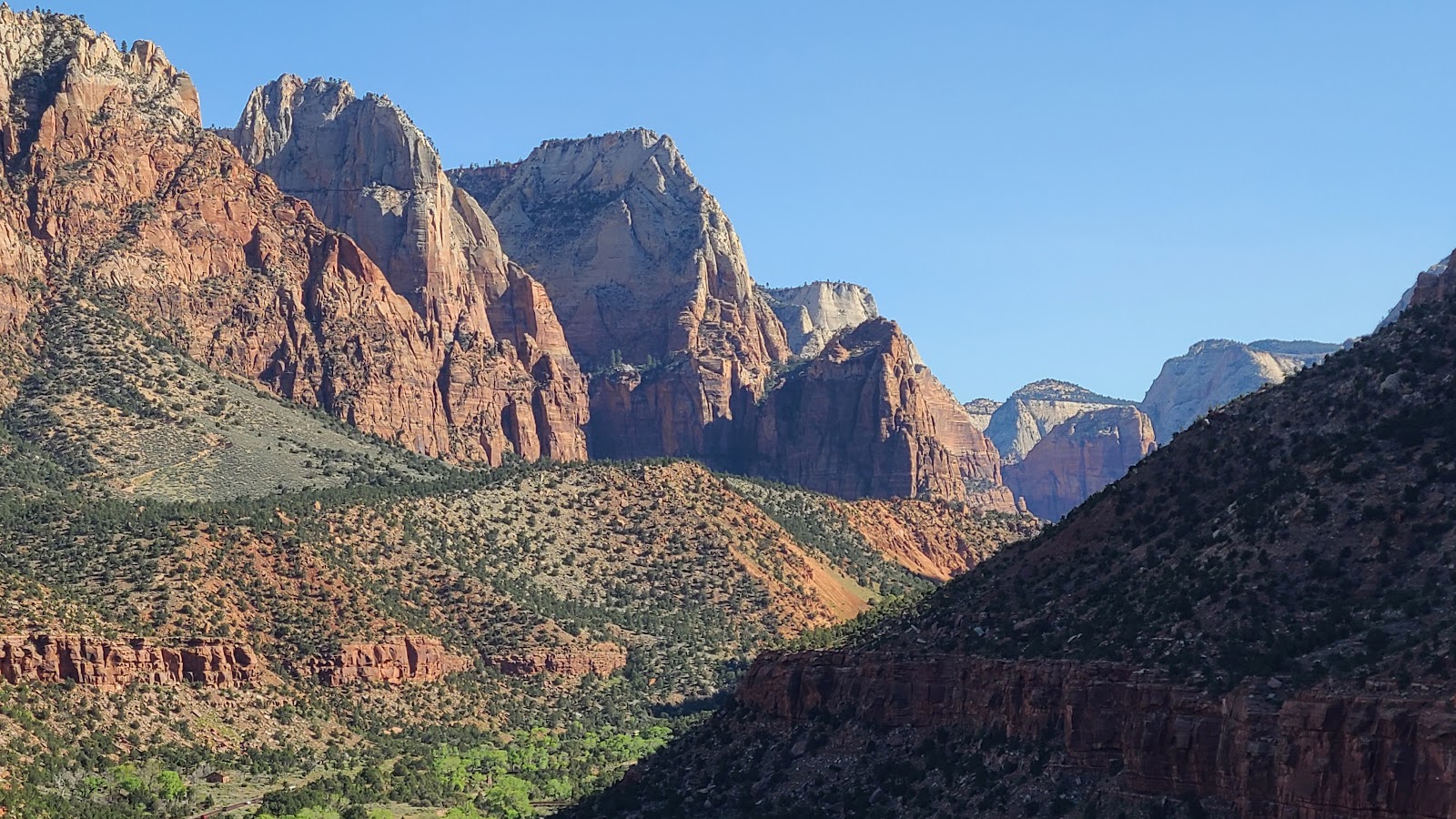
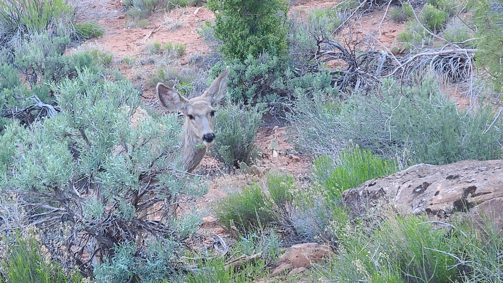 When you hike in Zion you always have the feeling you're under surveillance.
|
||||||||
 By 8:15AM the entire west wall of the canyon is under full sunlight...
|
||||||||
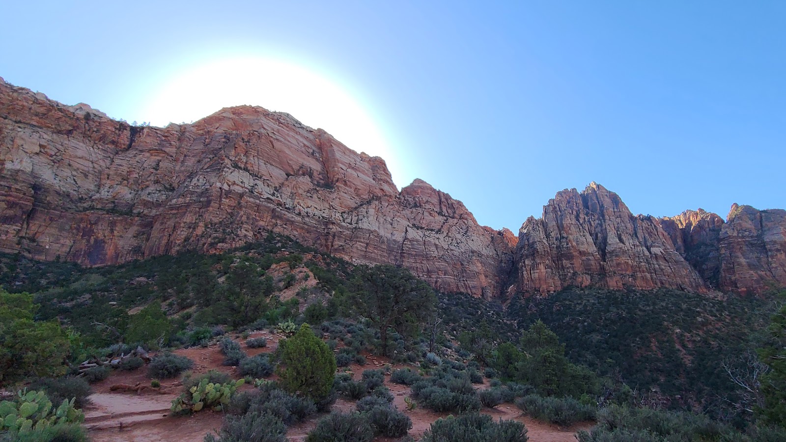
 ...while the east wall is still in full shadow.
|
||||||||
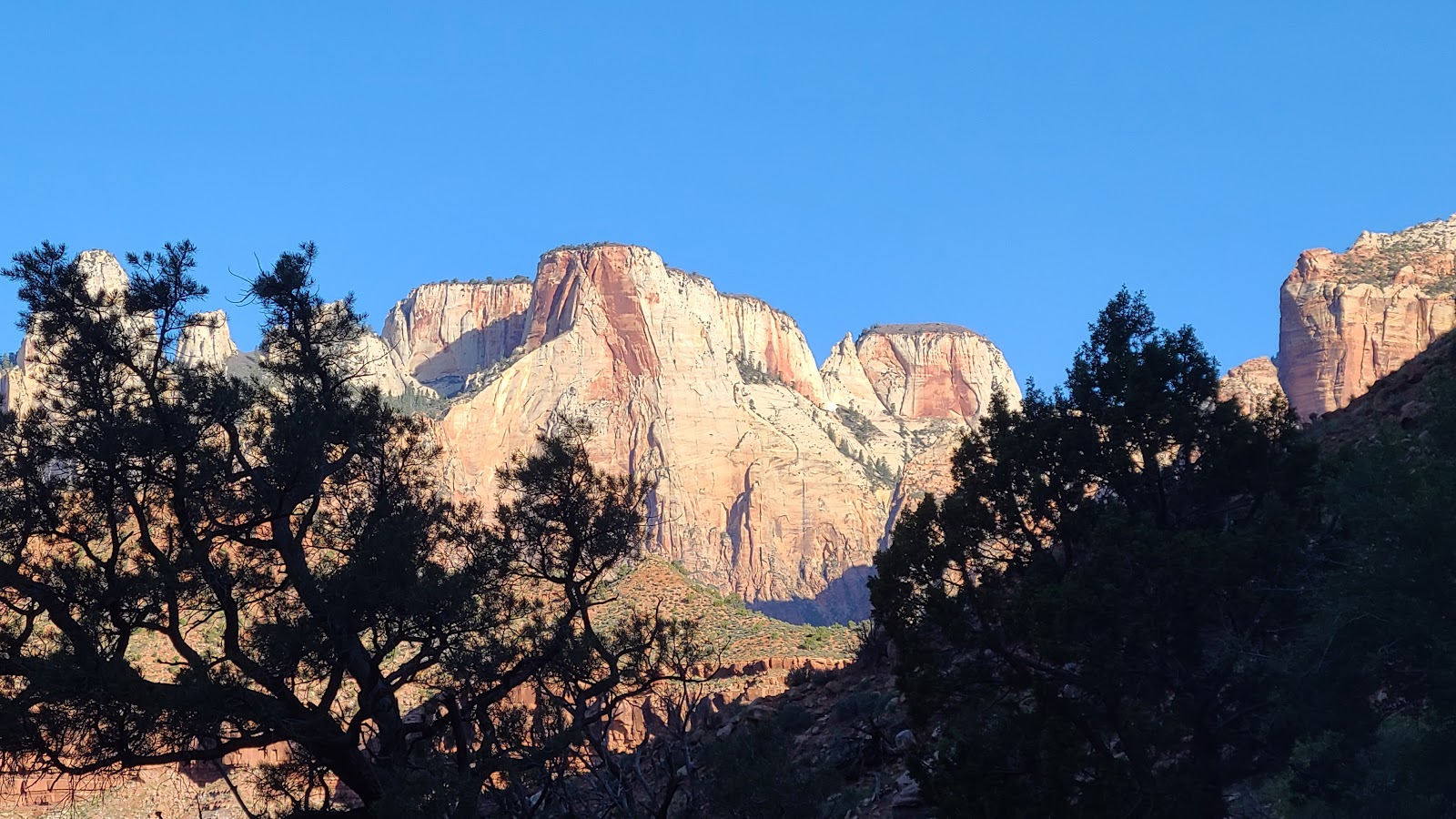
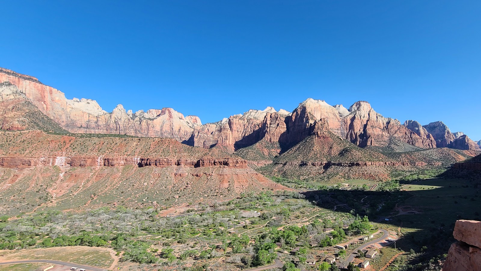
 At the halfway point of the trail looking back down towards the canyon.
|
||||||||
|
||||||||
 The sun should be popping up over the east rim any moment now.
|
||||||||
|
||||||||
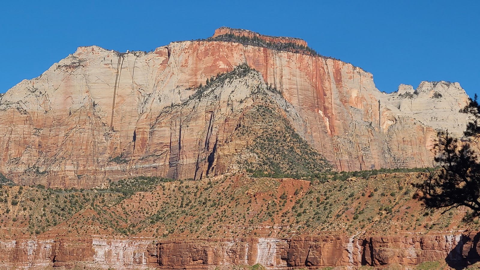
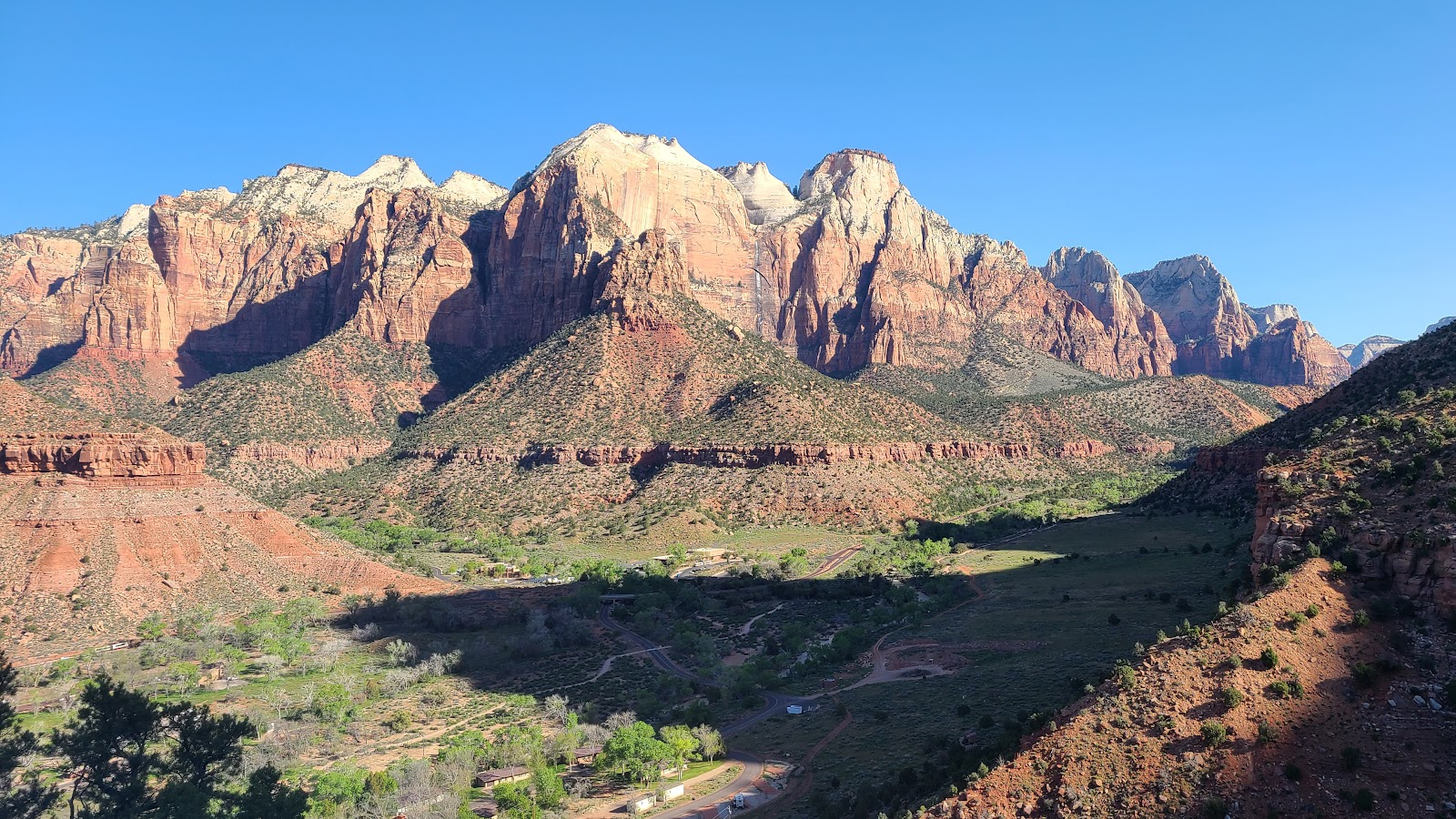
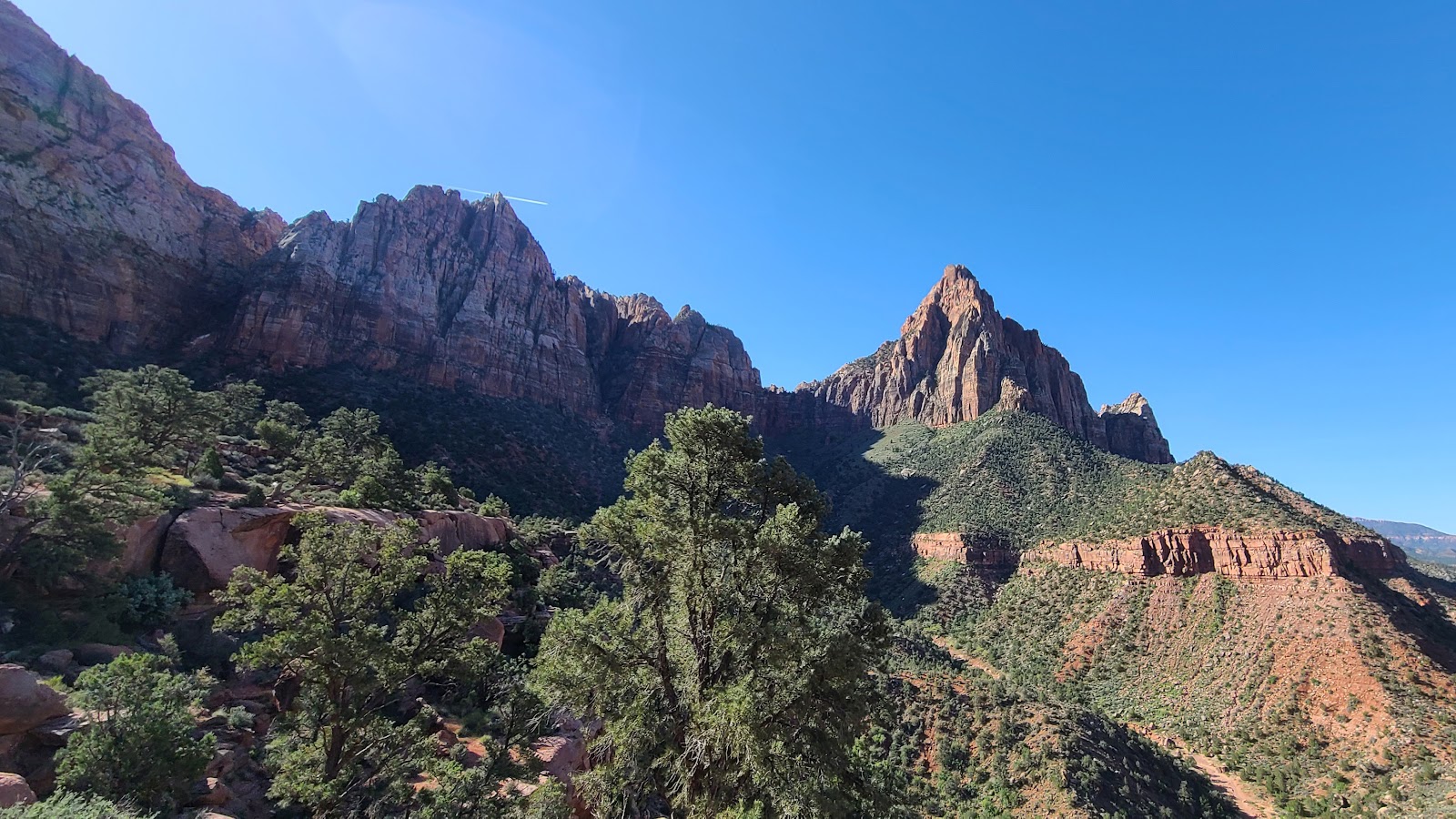
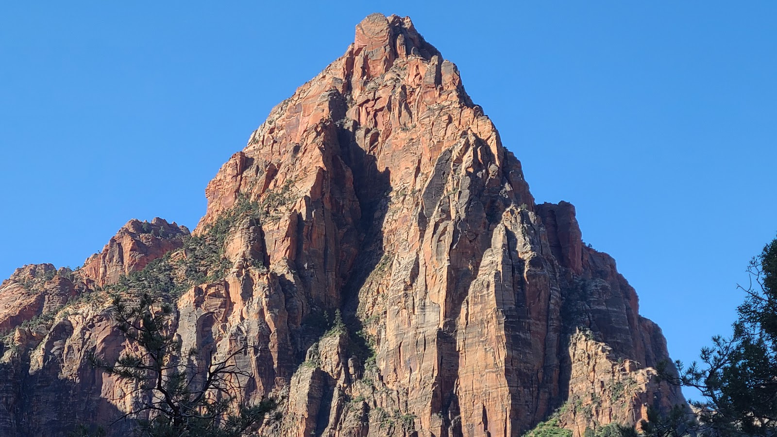 One of the Towers of the Virgins peaks, which one I don't know!
|
||||||||
|
||||||||
 The canyon floor is finally coming out of the shadows.
|
||||||||
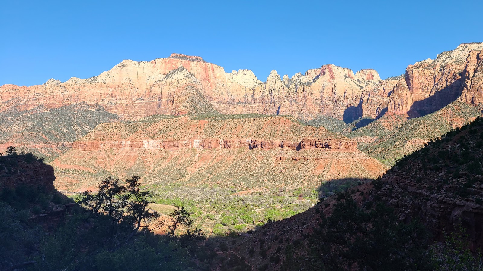
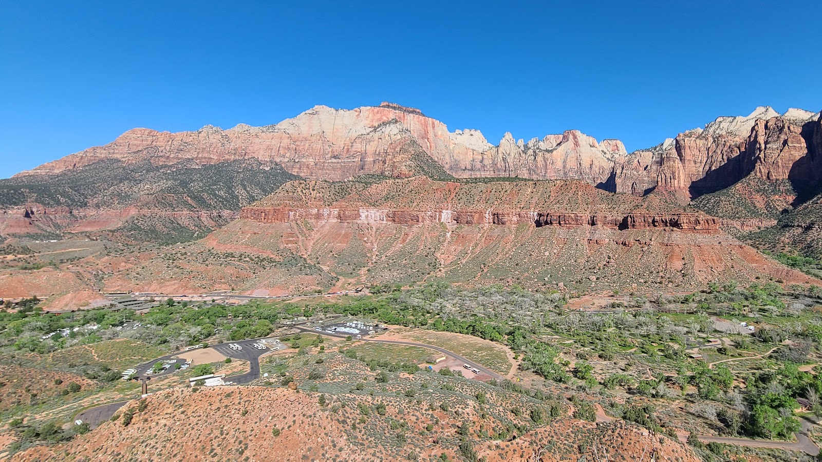
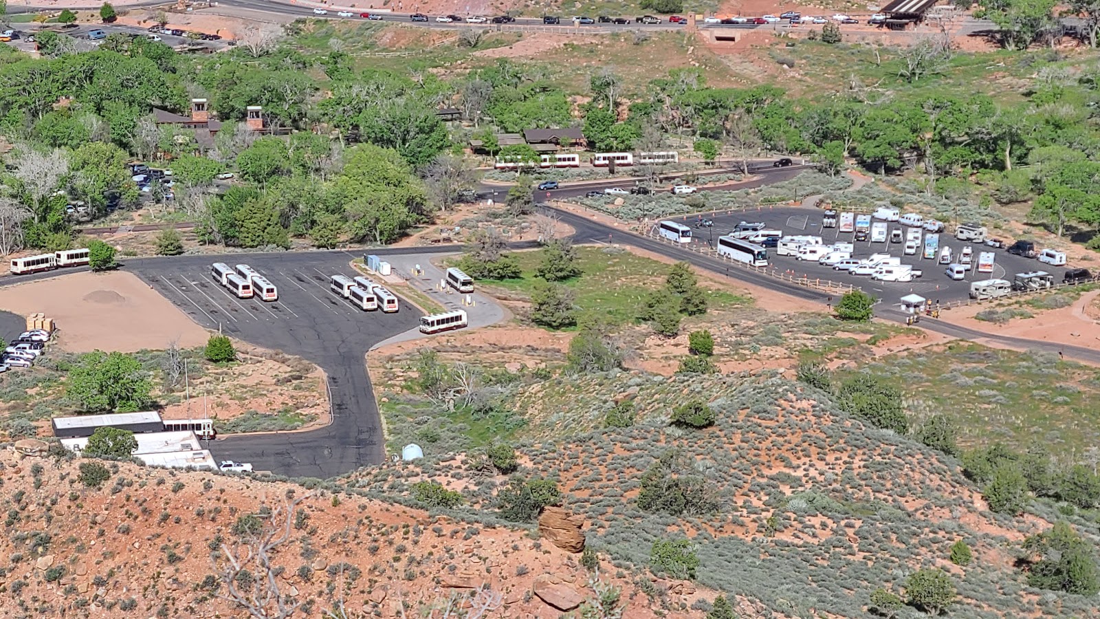 The very top edge of this photo shows the line of cars entering the park.
|
||||||||
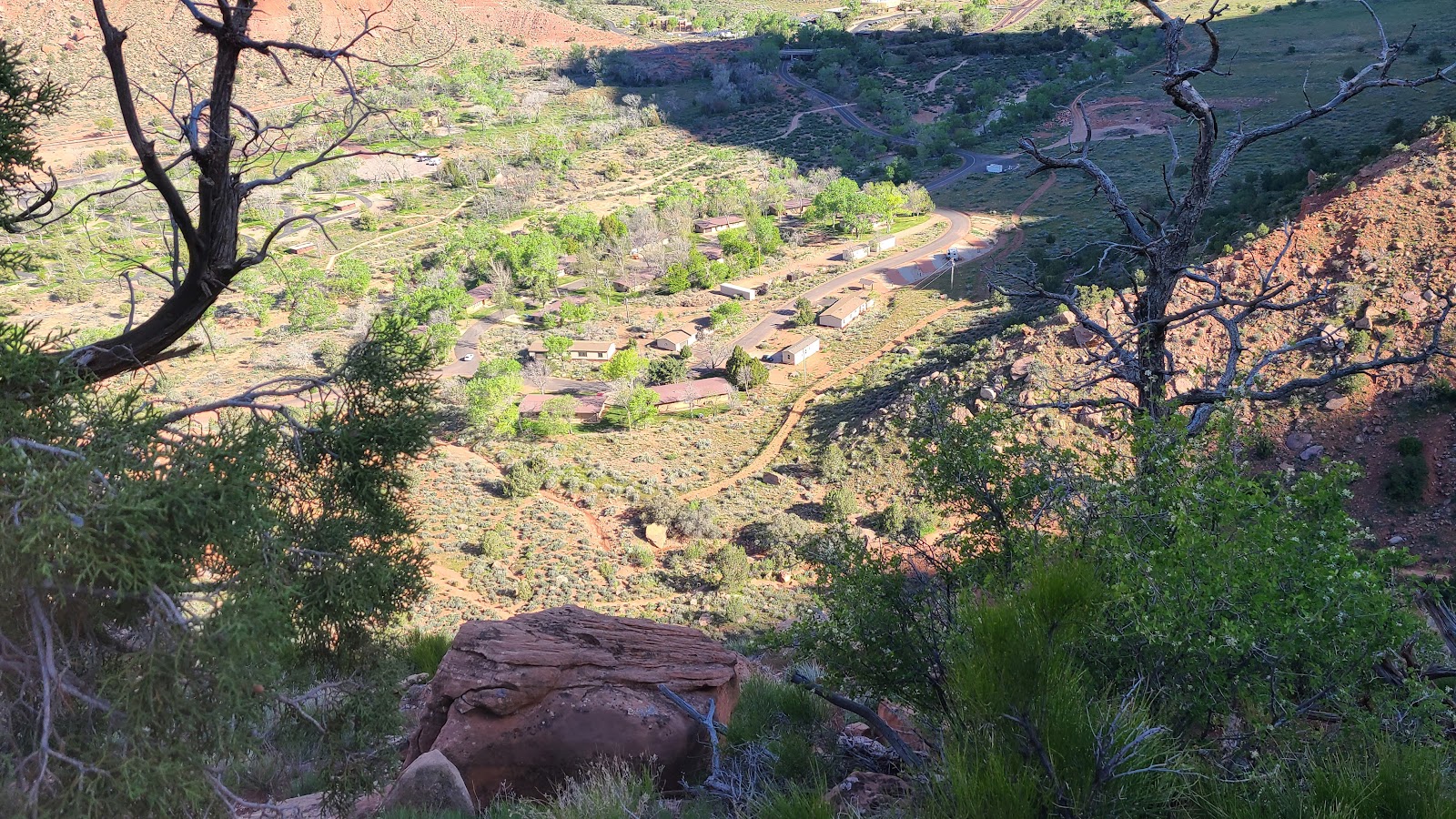
 The main parking lot under the trees and the town of Springdale in the background.
|
||||||||
|
||||||||
|
||||||||
|
||||||||
|
||||||||
 Farewell from the overlook at the end of the Watchman Trail.

The five parks are Arches, Bryce Canyon, Canyonlands, Capitol Reef and Zion, collectively they have been dubbed "The Mighty 5".
The campaign was so successful that Zion National Park is now the 2nd most visited park in the U.S.
It sure piqued our interest and we intend to spend 7-14 days visiting each one of them between now and the middle of June, so stay tuned.
Would you like to be notified of new blog posts?


