


We are still camping within the Glen Canyon Recreation Area, but this time we're located at the Lone Rock Beach Primtive Camping Area. That's just another way of saying there are no assigned campsites, just pick your spot on the beach and set up a your camp.
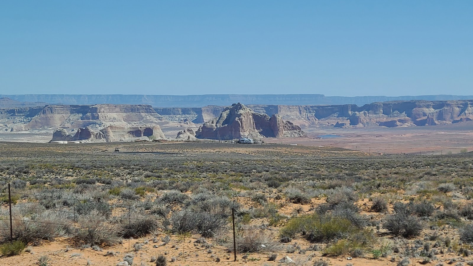


As sad as the situation was at ground level, when we drove up to get a look from the nearby Wahweap Overlook it appeared even more bleak.


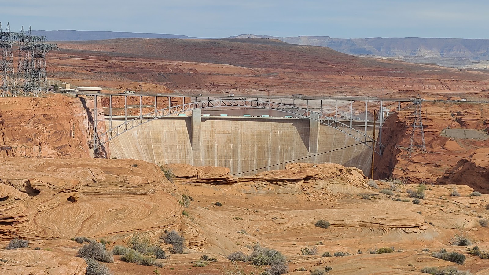
Since the Glen Canyon Visitor Center is closed on Tuesday and Wednesday we did the next best thing to get a look at the large Glen Canyon Dam. In the town of Page there is a short trail that leads down to an overlook of the dam.


At the end of the day we had all arrived at Lone Rock Beach and set up our campsites all in a row. We each have a different style rig.
Rod and Sharon chose to purchase a 26' Class C rig and tow their 4x4 Jeep Compass behind it. We chose to purchase a 28' travel trailer and tow it with our 4x4 pickup truck. Winston and VerJean chose to build their own 20' Class B van and very nimbly have criss-crossed the United States several times over the years.
Each style of travel has it's advantages and disadvantages, neither one is right or wrong, just different.


Rod and Sharon did what they typically do, they went on a hike. They even had Winston join them on the trail while VerJean remained in camp and did some knitting. Tricia and I got our laundry done, refilled a propane bottle, purchased gasoline and groceries. Sound familiar?
I browsed around the Ace Hardware store and visited the Chamber of Commerce office in town. I inquired about the road conditions that leads to the remote area where we have planned our "special activity" on Friday.
It wasn't good news I received about the current road conditions. There are only two ways to get to our destination on Friday, approach from the north down an 8½-mile long gravel and dirt road, or approach from the south along a 21-mile long gravel and dirt road.
It seemed like an easy choice! So we all moved campsites to be close to the northern approach. Unfortunately the road leading in from the north has a very muddy and not easily passable section just ¾-mile from the final destination.
That's what I learned at the Chamber of Commerce office and what Rod was told by a couple of Park Rangers while out on his hike. Hoping everyone was wrong and it wasn't really that bad, we decided to take the 120+ mile round trip to go check it out. Son of a gun, they were all correct, we'd have to approach from the south!
On the way back to camp we discussed our options. Option 1 was to stay camped where we were and have a 2½-hour drive to get to the event early Friday morning OR Option 2 was to return to Lees Ferry campground and reduce our early moring travel time by just over an hour.
Since the winds had increased to 35MPH and sand was blowing EVERYWHERE at Lone Rock Beach, once again it was pretty simple decision, tomorrow morning we move back to Lees Ferry campground where everyone was happy.

Rod and Sharon were the first to leave, followed by Winston and VerJean with us bringing up the rear. We all agreed to regroup in the Safeway Grocery Store parking lot which is located just across the street from the Chamber of Commerce Office in Page, AZ.
We have an orientation meeting to attend there at 8:30AM in order to prepare us for our "special activity" tomorrow morning.
OK! Enough is enough, I'm getting tired of typing "special activity" and the suspense is probably all but gone by now.
Back in December I paid $10 to enter a lottery with the BLM Office for a hiking permit to visit "The Wave". I figured nothing would ever come of it, so I asked for the maximum of 6 tickets, further decreasing my chances of being chosen.
On January 1st, 2023 while we were at the Rose Bowl Parade Rally in Pasadena, CA I received an email informing me that my entry was selected and I was awarded my first choice date of Friday, April 14th. I hadn't told anybody, not even Tricia, because I didn't think anything would come from it.
I had just three days to accept the permit and pay the $7 fee for each hiker going on the trip. One important caveat to the whole process was that I had to provide the name of each of the six hikers and once that was done I wouldn't be able to change them, only drop them from the permit.
I immediately realized what a conundrum I had put myself in. Trica and I are both going, that was a given. That leaves four tickets unclaimed, but four couples we've met on the road came to mind.
Katherine and John from Colorado, whom we've camped with in TX, KS, MS and Alaska, since meeting them back in February of 2020 came to mind, but they have both already hiked "The Wave" and have planned a rafting trip down the Grand Canyon during the same time frame. Plus we'll be camping with them again next week, in UT this time.
David and Barb from California, whom we camped with in TX and NM since meeting back in April of 2021 came to mind, but he has already planned an epic trip to Florida for this time of the year, including some family gatherings. Although it would have been nice to finally meet his wife Barb.
Rod and Sharon from Pennsylvania, who we just met last summer in British Columbia and Alaska, are both avid hikers and you've recently heard about them in this blog. I called and asked if they had ever hiked "The Wave" and the answer was no. I immediately extended them an invitation to do so and fortunatley they were able to adjust their plans for the year so they could join us.
Last, but not least, was Winston and VerJean from Michigan whom we've camped with in VA, TX, SD, British Columbia, Yukon Territory and Alaska since meeting them in September of 2018 when we were first starting out.
Anyway, that's why the six of us are back together again, in Arizona and Utah this time, to hike "The Wave". Those of you who know what "The Wave" is know just how special this is going to be. Those of you who aren't familiar will be by the end of this post.
After our orientation meeting this morning Tricia and I went back down the road a couple of miles to the Glen Canyon Dam to get a closer look.
With the Visitor Center now open I was able to get my Passpost Book stamped and check out the view from the Observation Deck. There is also a little museum inside explaining how, when, and why the dam was chosen to be located here.
We parked on the eastern side of the bridge over the Colorado River and walked across to the western side where the Visitor Center is located. It would have been a little tight getting THE POD and ROVER into and out of the Visitor Center parking lot.


temporarily closing it to two-way traffic.


It's time to go hike "The Wave"!
"THE WAVE"
|
||||||||
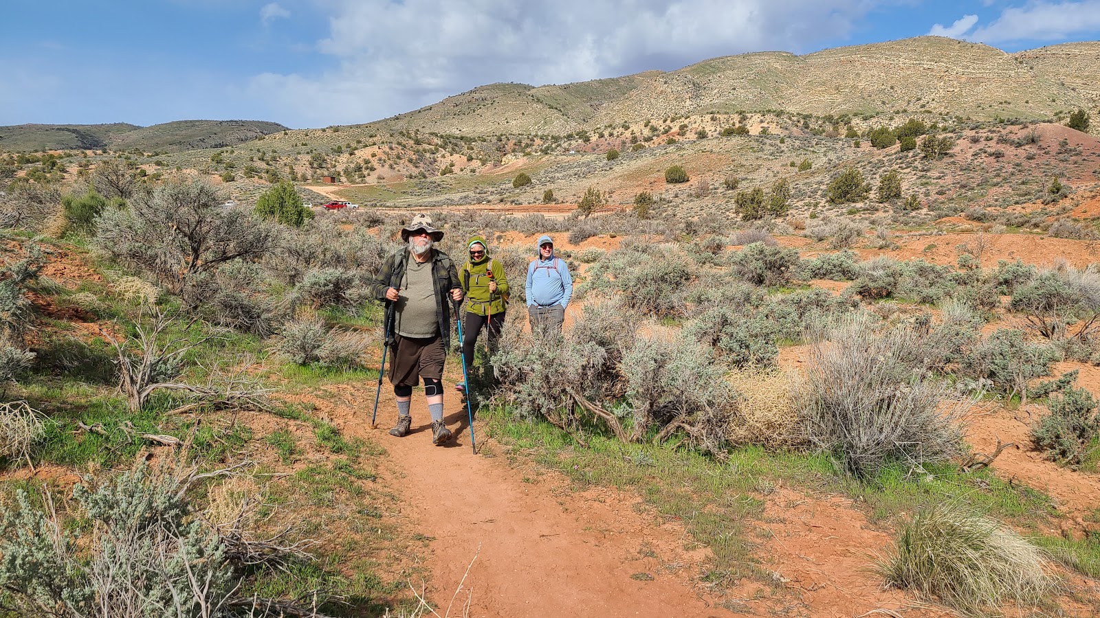 The trail started out simple enough, up and over a little sandy spot.
|
||||||||
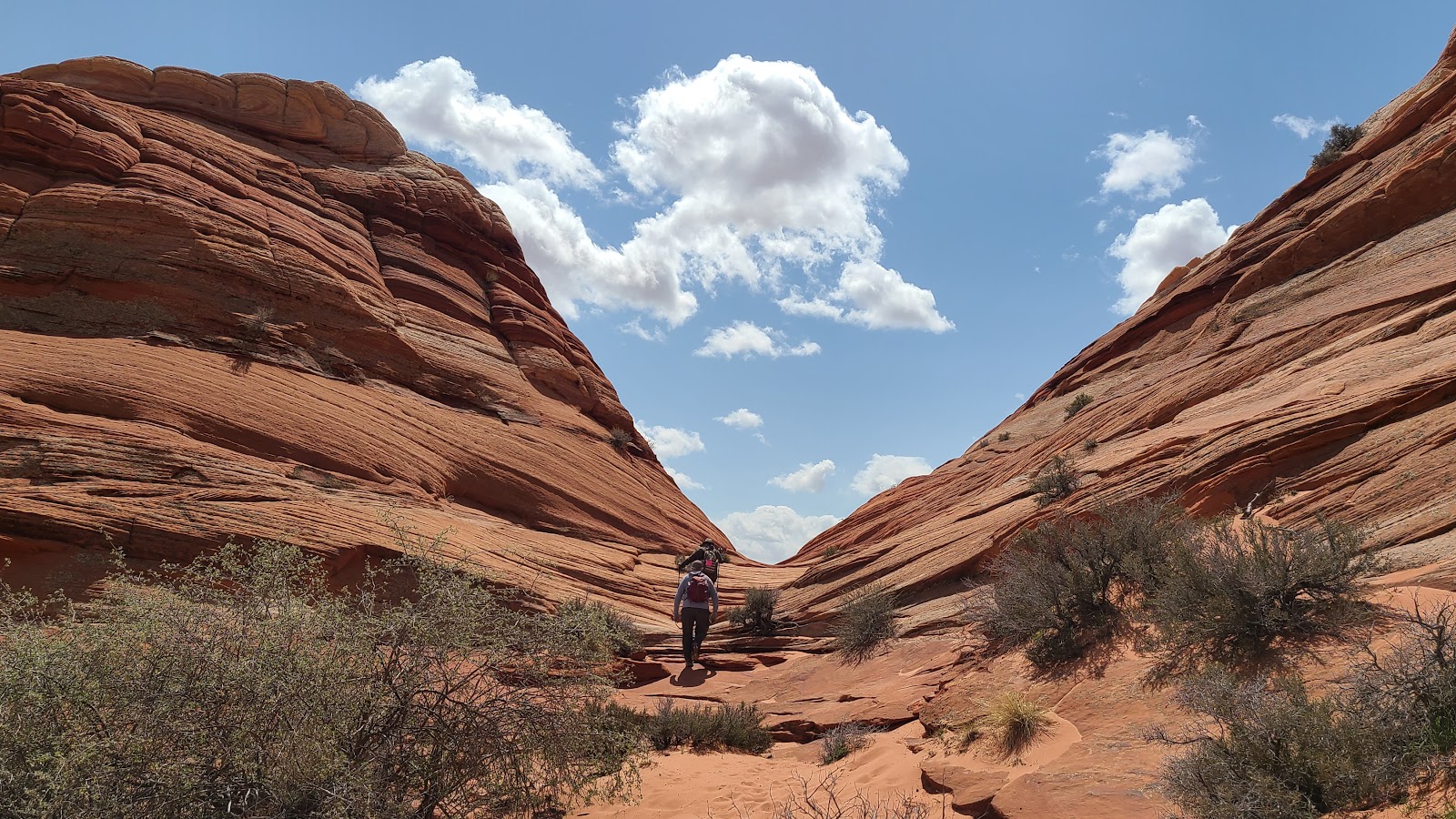
 Next we found ourselves hiking in the bottom of a gravel wash bed.
|
||||||||
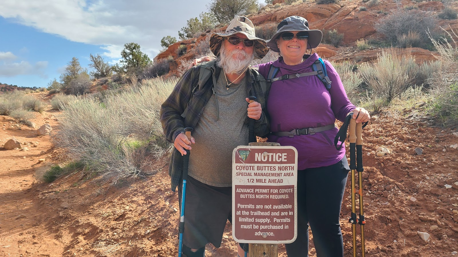 A half mile later we found the sign we were looking for.
|
||||||||
|
||||||||
 It's rumored to be a $10,000 fine if found hiking without a permit.
|
||||||||
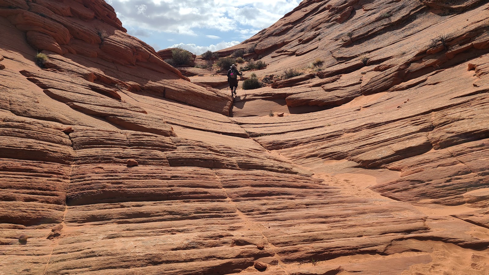
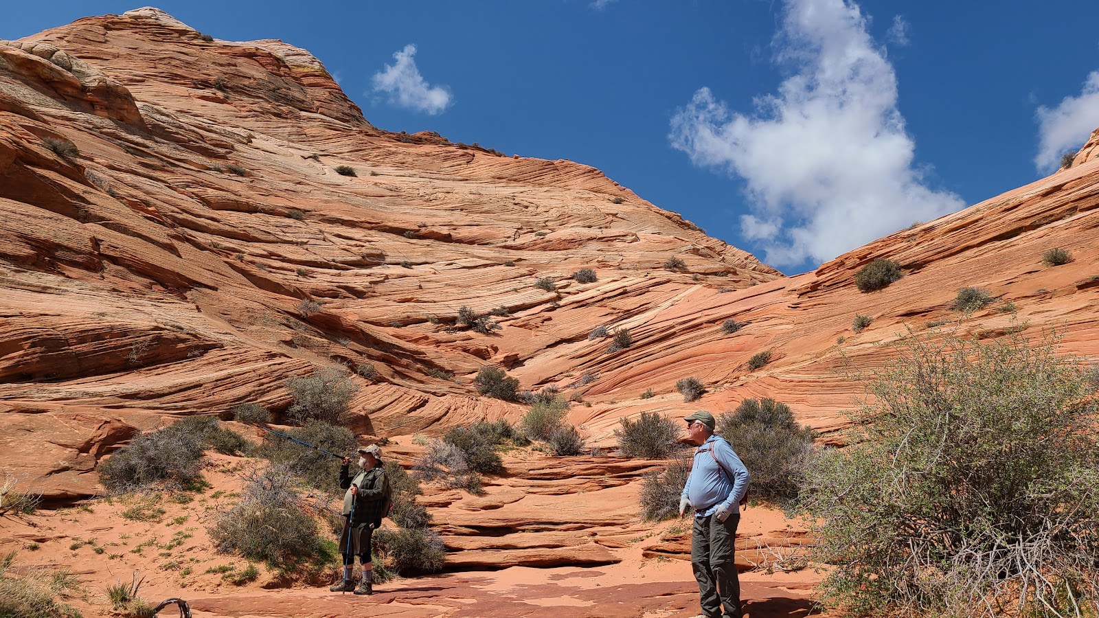
 The first of many up and over climbs on the trail.
|
||||||||
 Still going up. See my "pink permit" displayed on my pack?
|
||||||||
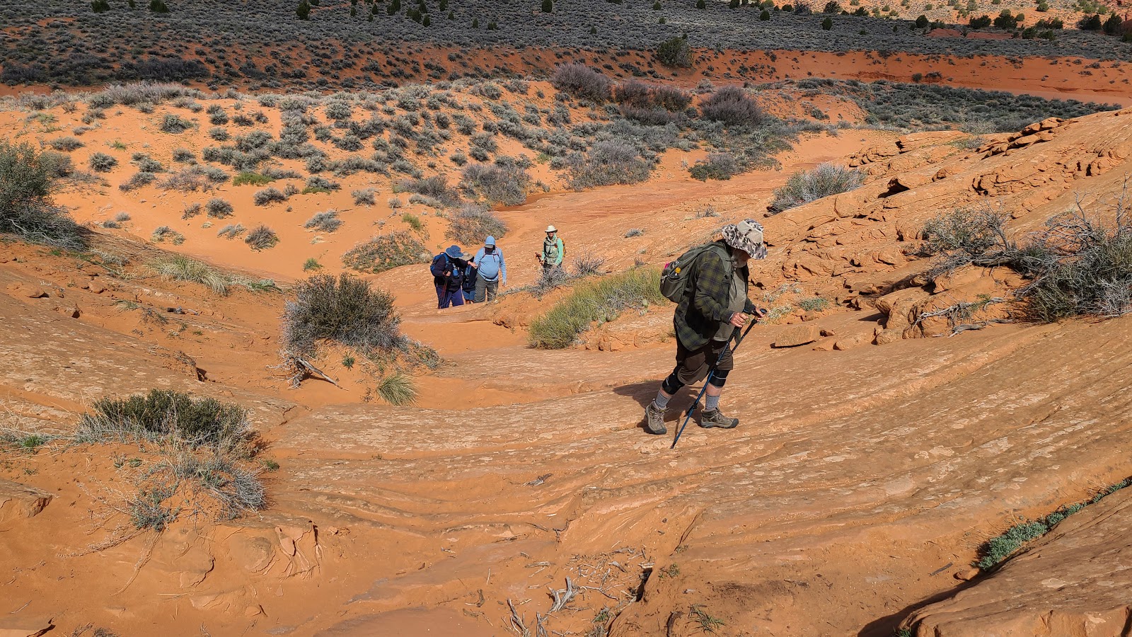
 Rod and Sharon locating our next landmark off on the horizon.
|
||||||||
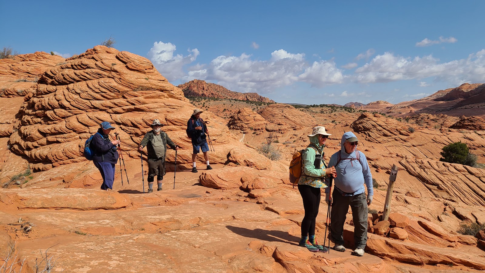 Everyone on their feet and ready to go again.
|
||||||||
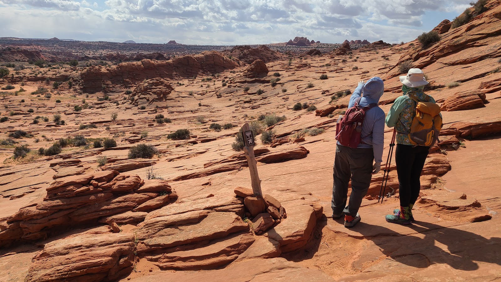
 Those are our landmarks for this leg of the trail.
|
||||||||
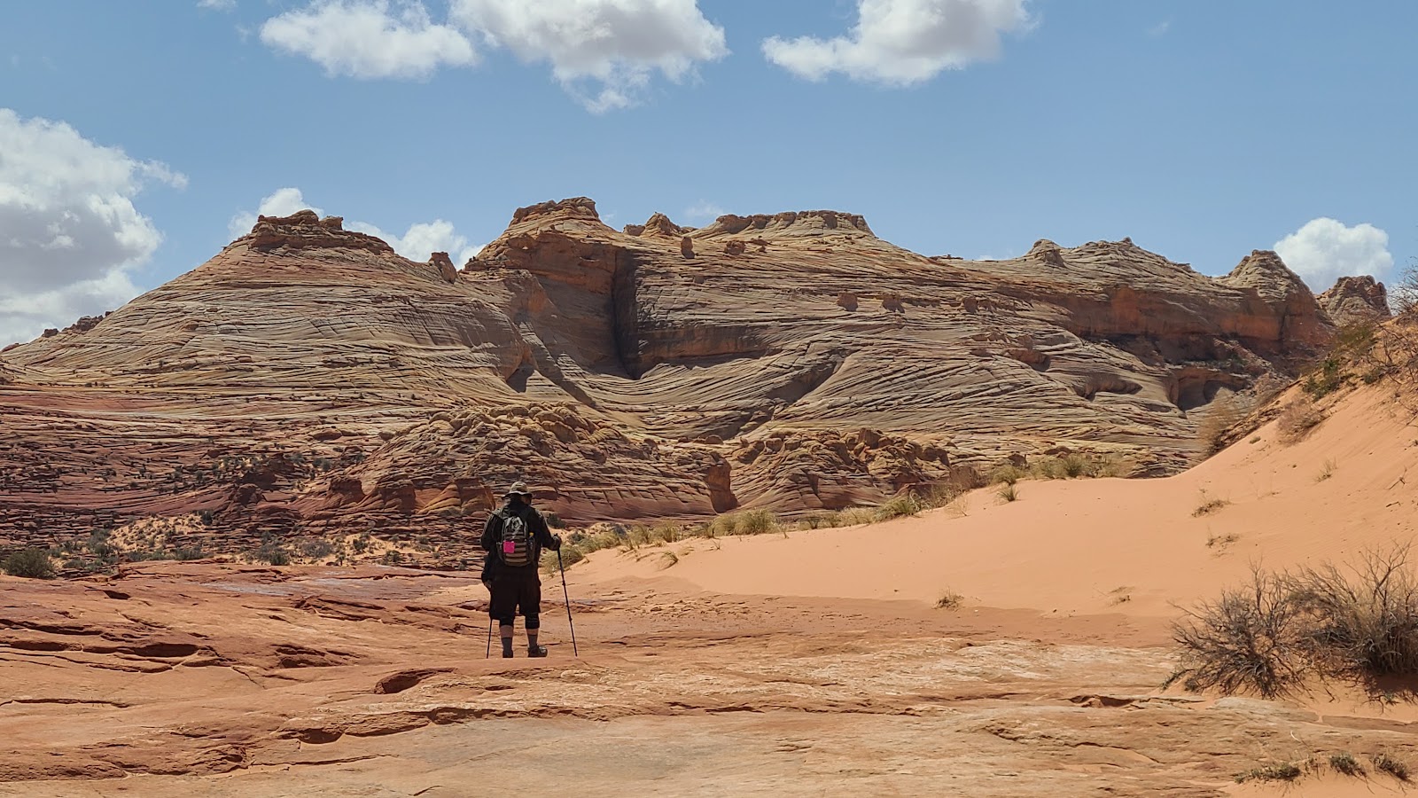
 Our first snack break along the trail with two miles still to go.
|
||||||||
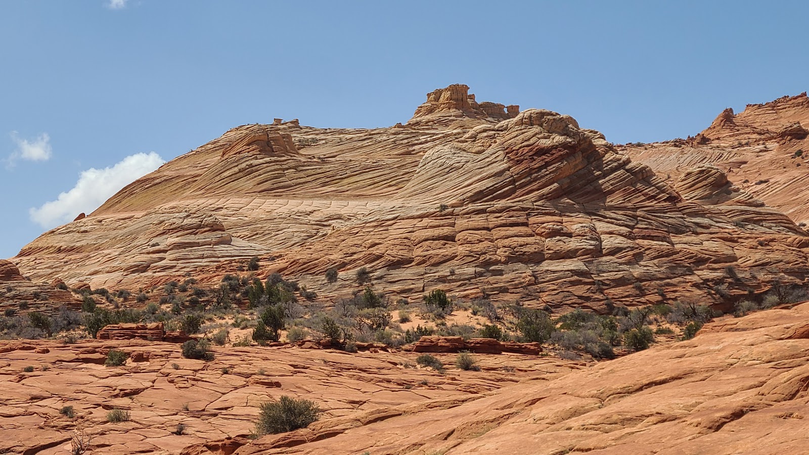
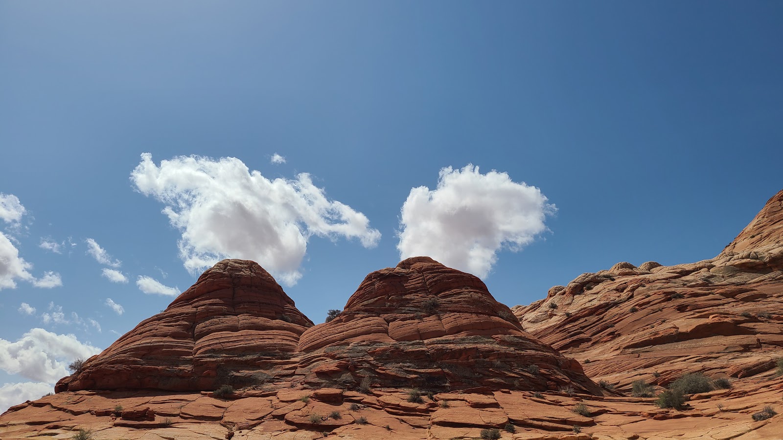 Don't these two stacks look like a couple of volcanos?
|
||||||||
 I'm pointing towards our next landmark.
|
||||||||
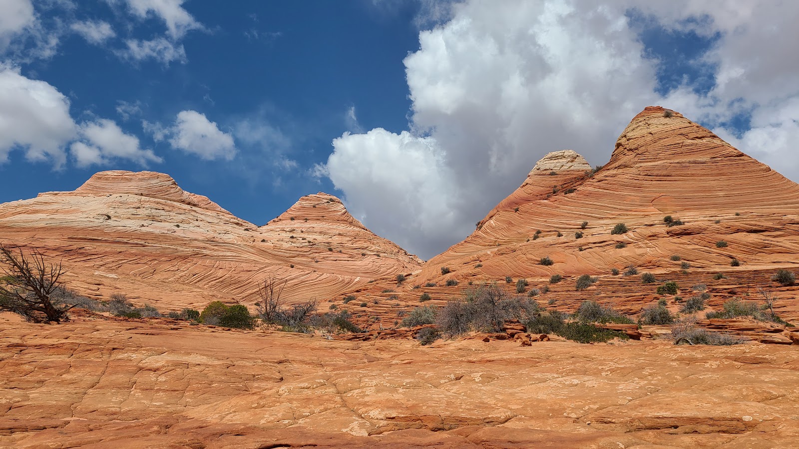
 A saddle between two peaks.
|
||||||||

|
||||||||
|
||||||||
|
||||||||
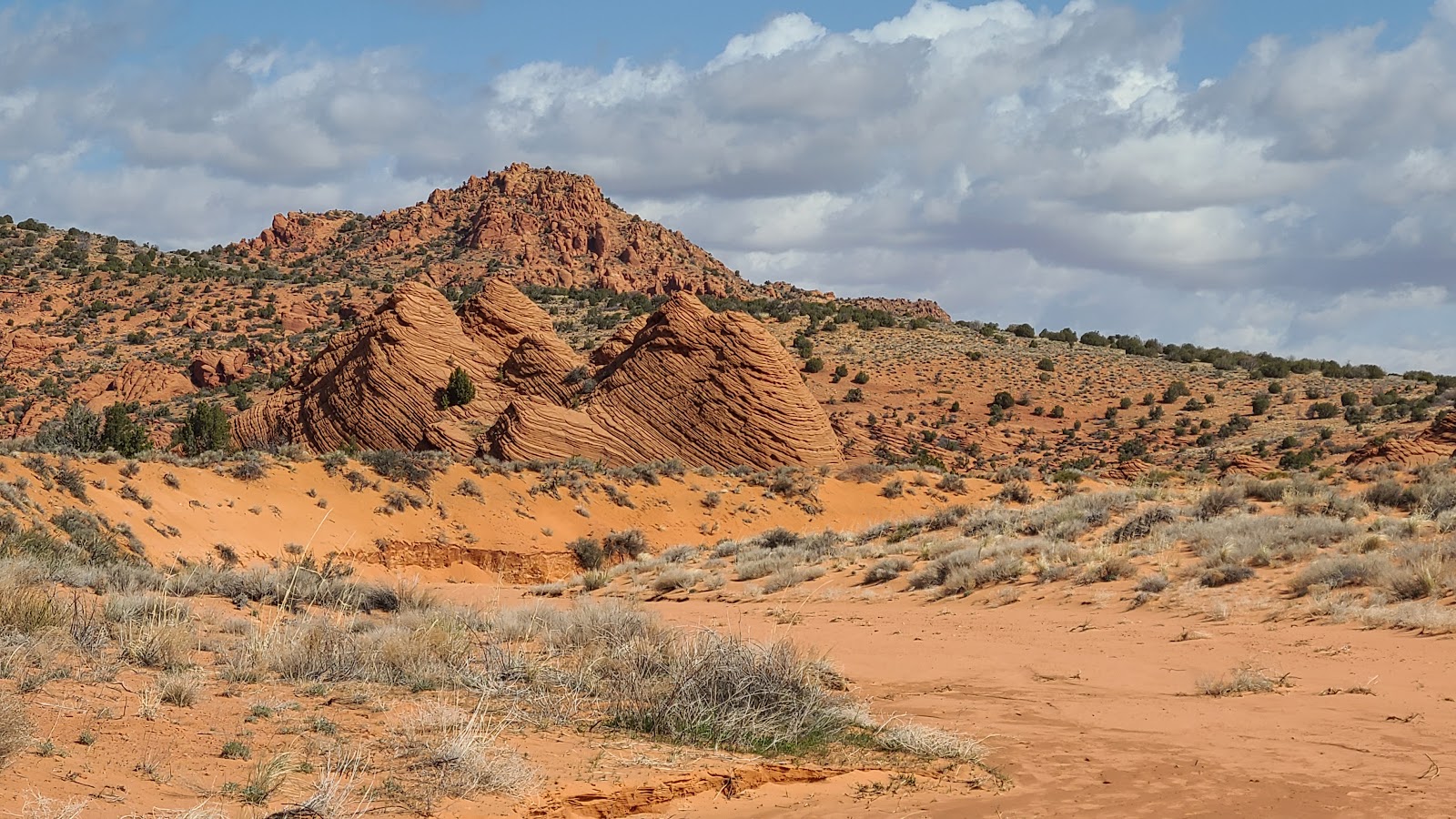
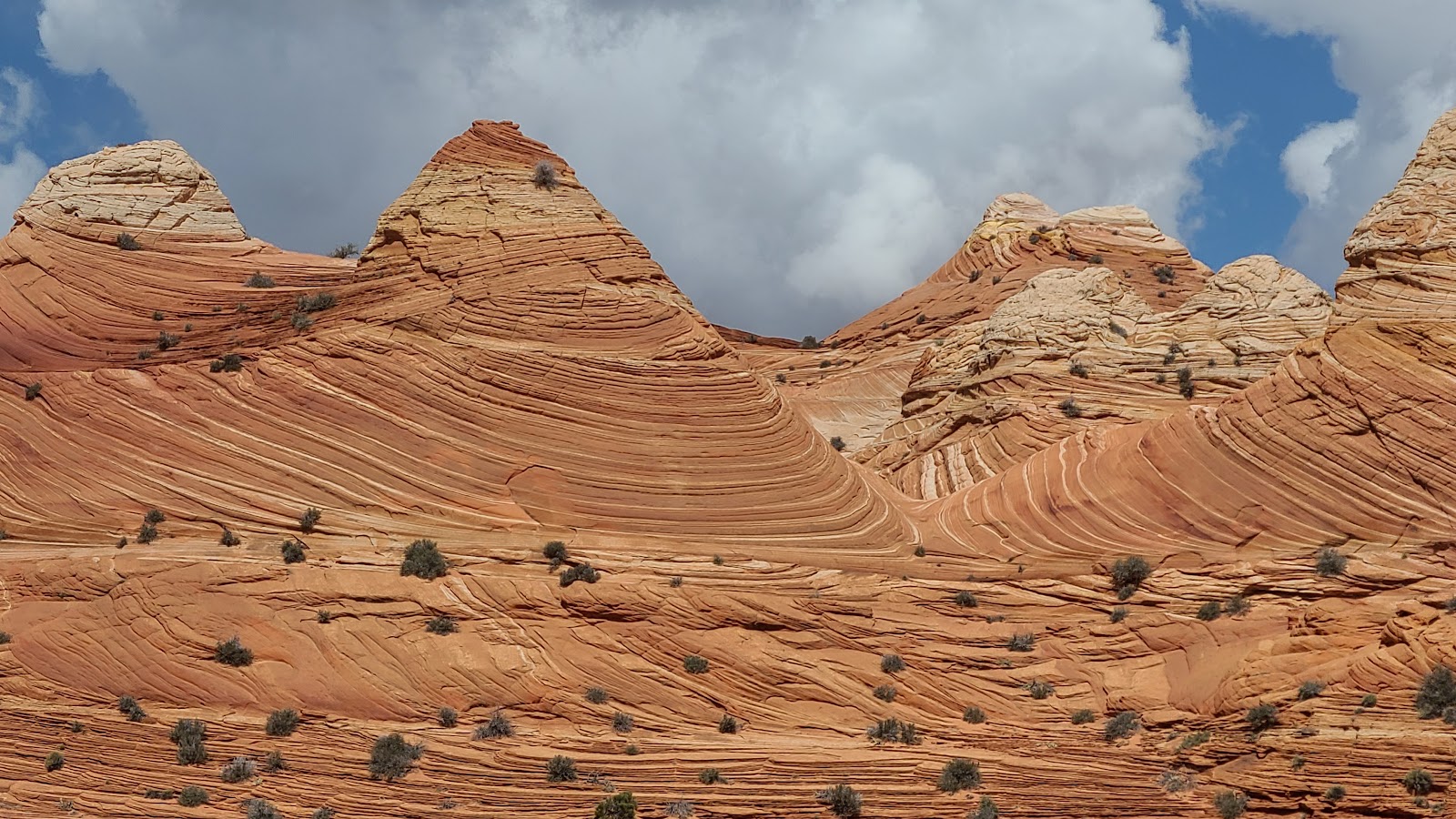
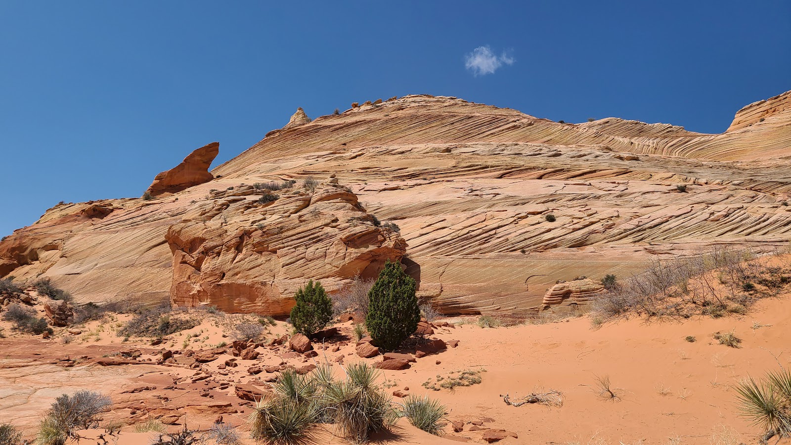
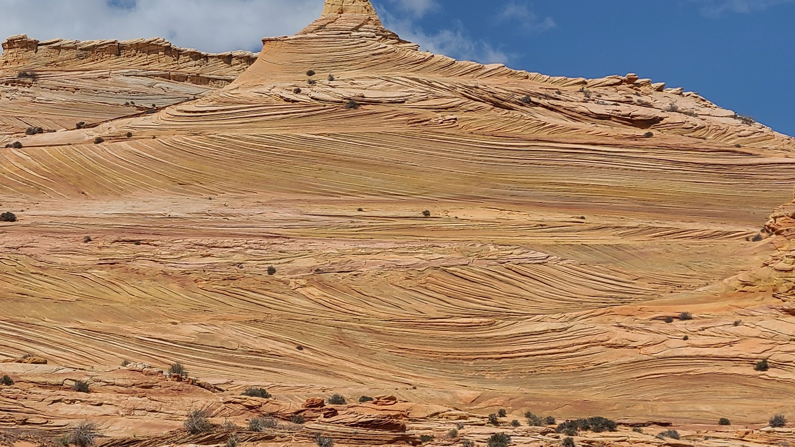
 There's just so much texture and color in the rocks here.
|
||||||||
|
||||||||
 And we haven't even gotten to the "good stuff" yet!
|
||||||||

|
||||||||
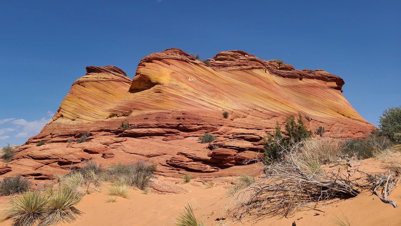
 See that dark verticle crevice half way up the rockface? That's our next landmark.
|
||||||||
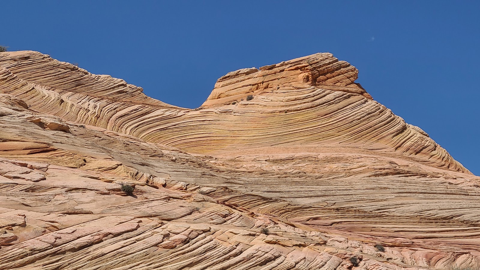
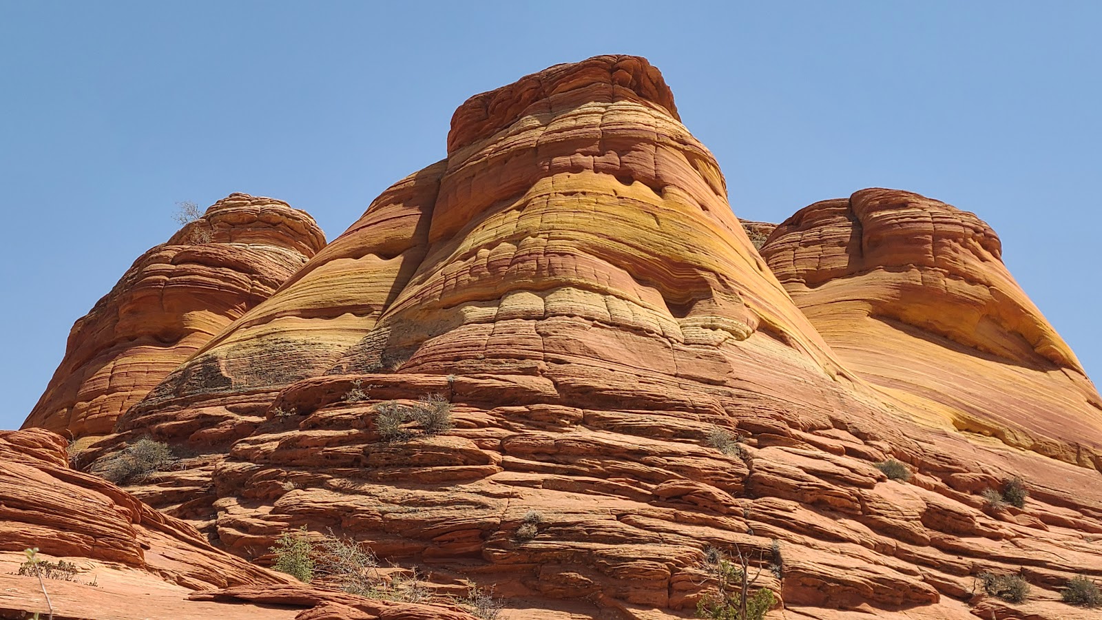
 Doesn't that look like a shark's fin up there?
|
||||||||
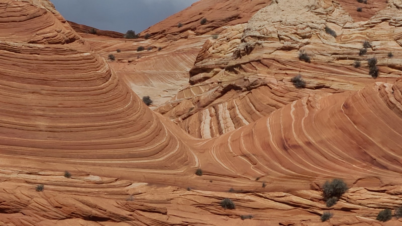
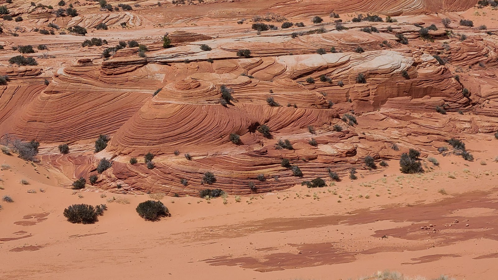
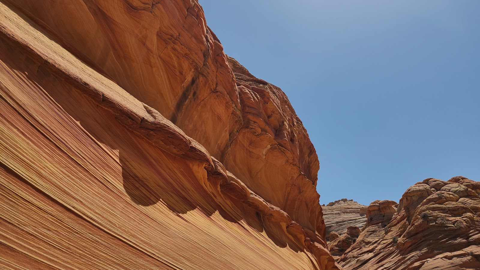
 The scenery is taking on another worldly look.
|
||||||||
|
||||||||
|
||||||||
|
||||||||
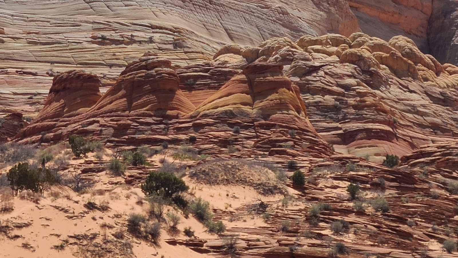
 Look at all those colors.
|
||||||||
|
||||||||
 Almost there now.
|
||||||||
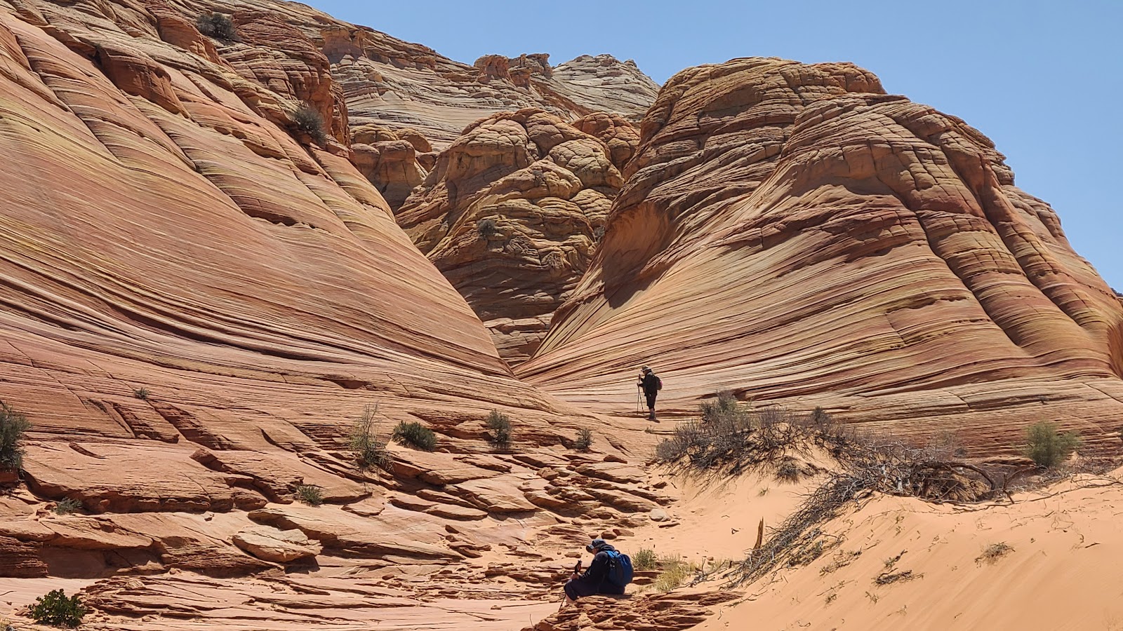
 Me standing at the opening of The Wave.
|
||||||||
 Wait until you see what's around this next corner.
|
||||||||
 But first a couple photos of your favorite bloggers.
|
||||||||

|
||||||||
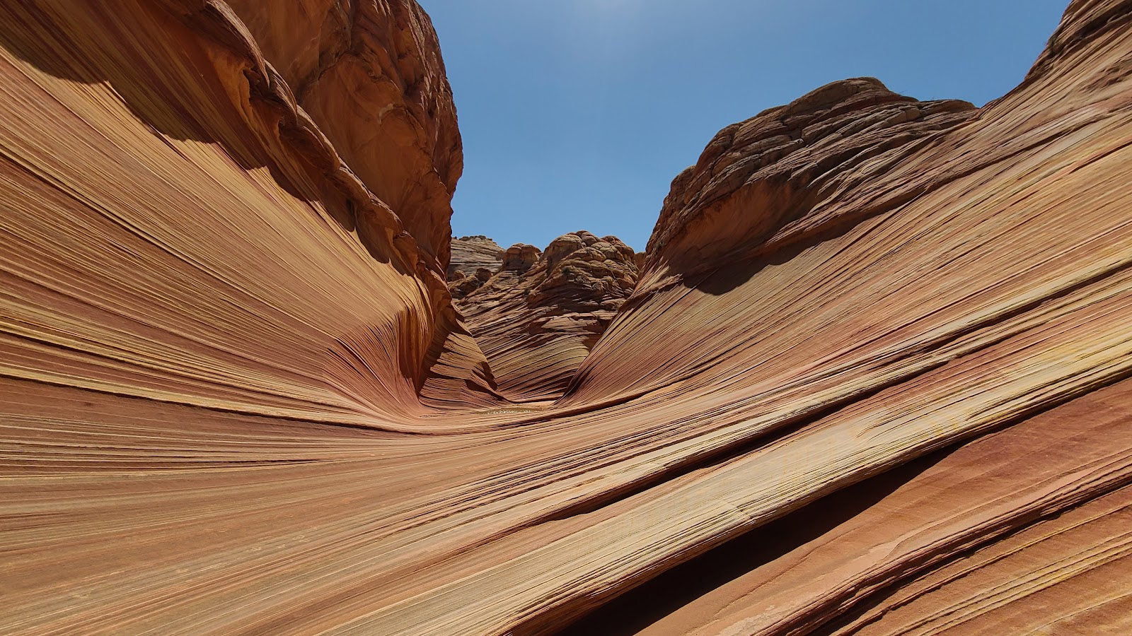
 Entering "The Wave".
|
||||||||
|
||||||||
|
||||||||
|
||||||||
|
||||||||
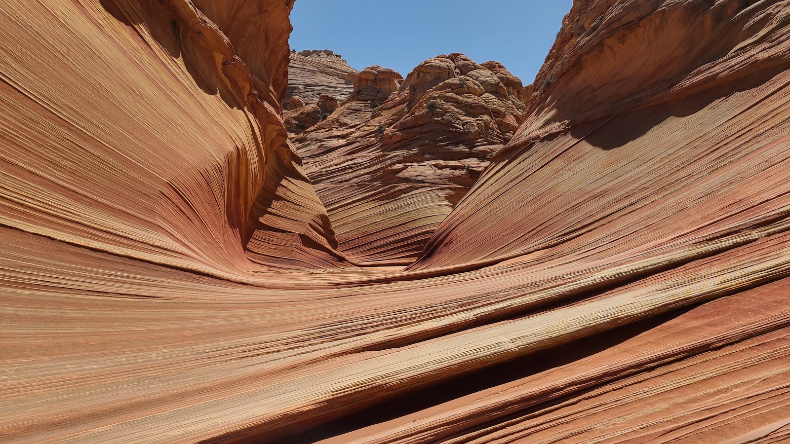
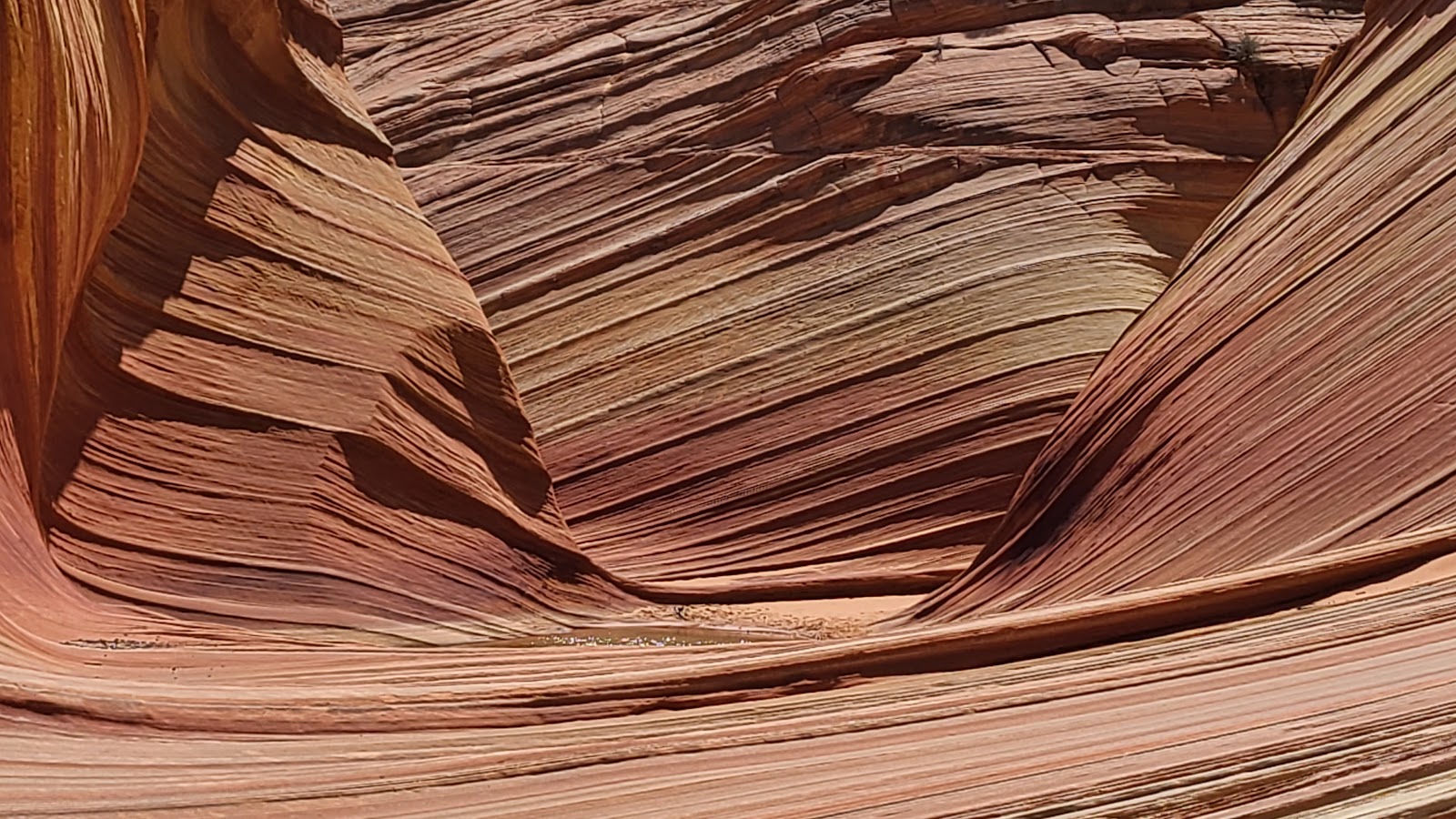
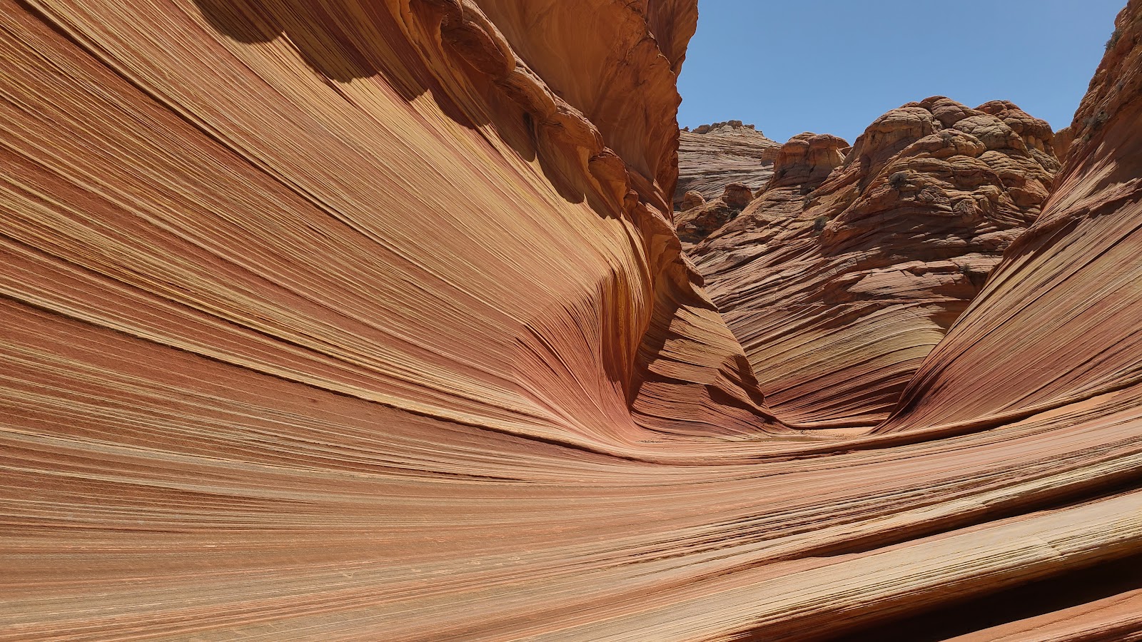
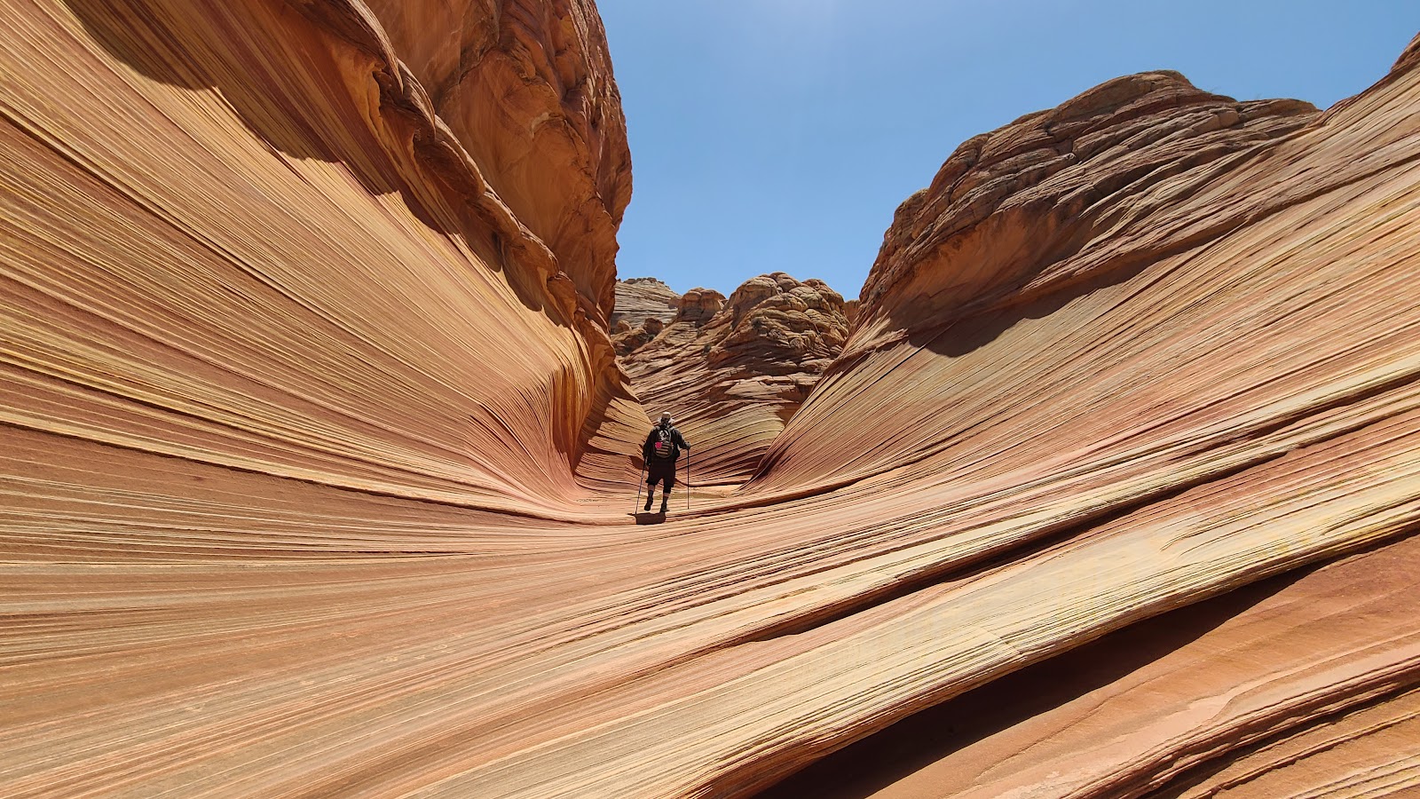 There's plenty more to see inside.
|
||||||||
|
||||||||

|
||||||||
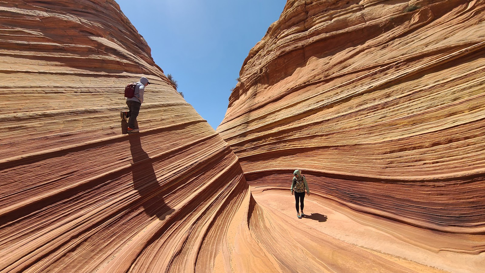 That's Rod imitating a mountain goat and trying to surprise Sharon.
|
||||||||
|
||||||||
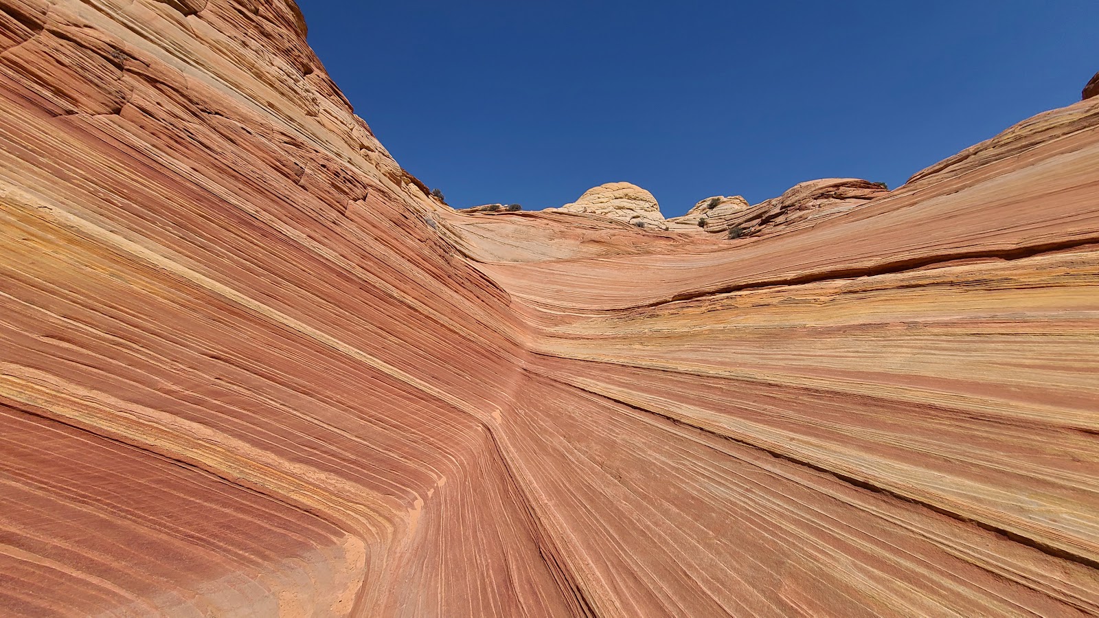
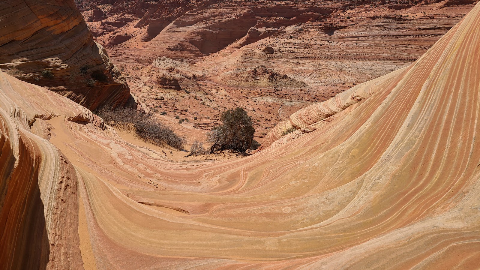
 It just keeps getting better.
|
||||||||
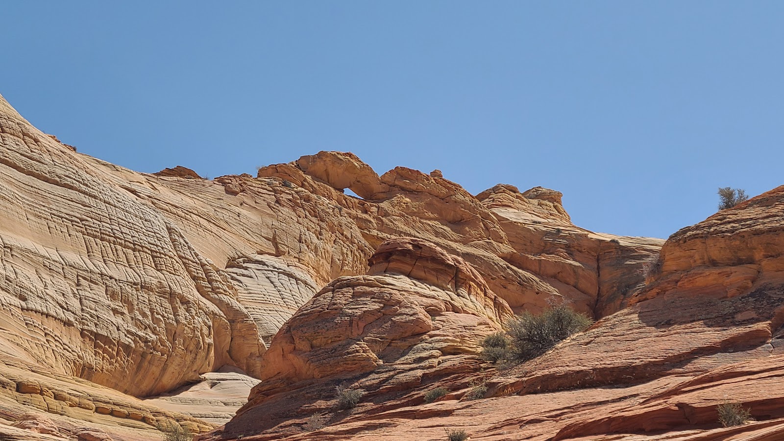 There's even an arch on top of the back wall.
|
||||||||
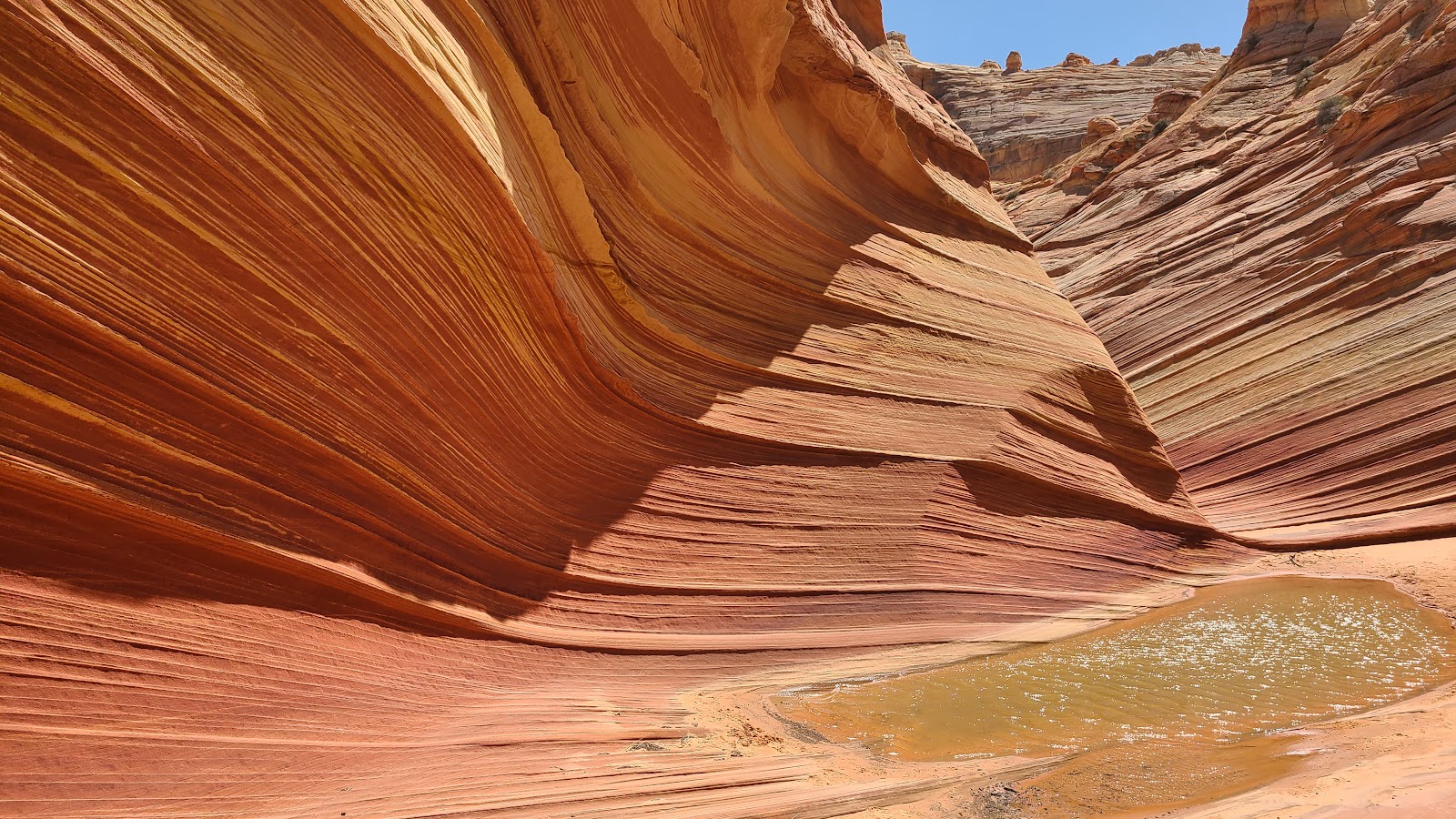
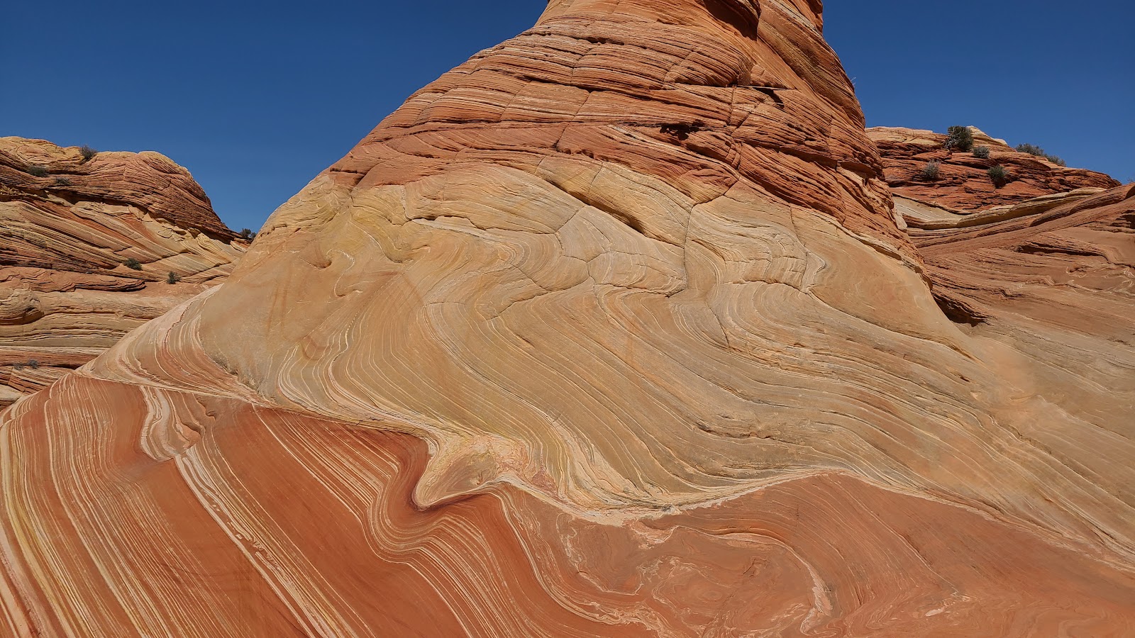 The rocks look just like melting ice cream.
|
||||||||
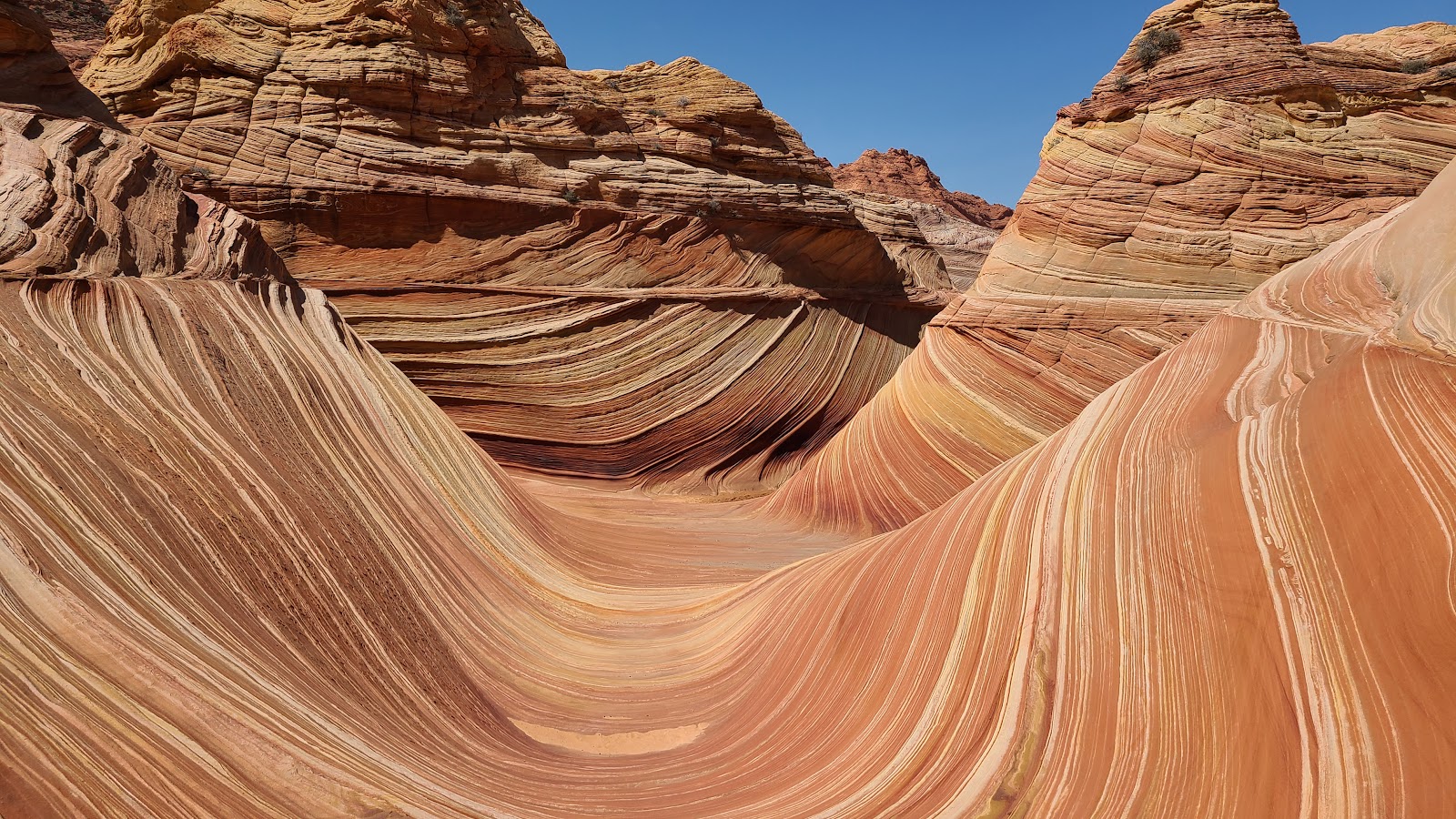 This is the iconic photo that was used by "Windows 7" as a screensaver back in 2009.
|
||||||||

|
||||||||

|
||||||||
 Time to head back to the parking lot if we don't want to hike in the dark.
|
||||||||
 Goodbye "WAVE"! Maybe we'll meet again!
Would you like to be notified of new blog posts?


