TUESDAY - We had planned to be on the road by 9:00AM, but it was nearly 10:00AM before we left the campsite.
After dumping our waste water tanks in the park and filling up with gasoline in Winslow we headed west on Insterstate-40 towards Flagstaff. We've made this same trip at least four times over the last week and are now very familiar where each of the larger potholes are located. Even the 18-wheelers were changing lanes just to avoid the larger ones.
Once we got west of Flagstaff the road conditions improved immediately, because all the large truck traffic turned south on I-17 and headed for Phoenix.
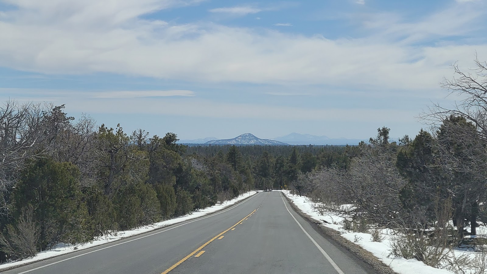
We were humming along at 65MPH on the smooth roadway until we reached the town of Williams, where we turned north on AZ HWY-64 and once again the road conditions turned poor. For 50-miles we dodged potholes until we arrived in the touristy town of Tusayan.
The northern edge of Tusayan is just 1-½ miles from the South Entrance Gate of Grand Canyon National Park.
With just 1-mile to go we ran into a bit of a traffic jam trying to enter the National Park.
30-minutes later we slowly rolled past the Grand Canyon Entrance sign.
But it was 30 more minutes before we caught sight of the five actual Entance Stations.
Before we checked in at the campground we needed to fill our fresh water tank with 29-gallons of water to last us the entire week of our visit.
We pulled up to the spigots next to the dump station only to find one was broken and the other one was turned off for the season. It didn't mention that anywhere on the National Park website and this moring when I tried to call to ask that very question I couldn't get a "live person" to pick up the phone.
We then proceeded to the check-in station where I asked about where I could fill our water tank. I was told there was an RV park back in the town of Tusayan (outside of the park) where I could fill 15 gallons for $10 or $20 if I needed more.
I told them no way was I waiting in line for an hour to get back into the park, certainly there must be somewhere inside the park to get water. When I asked about the full hookup RV park right next door that is run by a private company I was told the park has no control over their operations. I figured if I asked them nicely all they could do is say no.
We towed THE POD over to the check-in station at the private RV park and asked about filling our fresh water tank, I also mentioned that I would be spending a few nights there next week.
The young man told me to go ahead and pull into any empty campsite and fill up, but to be quick about it! I thanked him profusely and left the office before he had a chance to reconsider his decision.
With enough water now to last us a week, we returned to Mather Campground and quickly got set up on our "just large enough" campsite. Like most of the original National Park Service campgrounds, these sites have no hookups and tend to be on the smaller side. I guess RVs just weren't that big back in the 1940s and 50s.
Mather Campground just started taking reservations 3-weeks ago.
From looking at these photos I bet you can guess why!
All settled in at Grand Canyon National Park for the next week.
An hour and a half after we finished setting up and grabbing something to eat we climbed into ROVER to go check out what the big deal was about this "Grand Canyon" we keep hearing about.
Before we even got out of the campground we were stopping to take photos. It seems the non-native elk enjoy eating the greenery found here in the campground area as apposed to anywhere else in the park. Or maybe they just enjoy the human interaction? I hope people are smart enough not to be feeding them!
After finally getting out of the campground we headed to the closest overlook to get our first glimpse of the canyon.
Tricia's very first view of the Grand Canyon, I was here once before when I was thirteen.
That's Mather Point over there. Let's go check it out!
That's our shadow on the rock at Mather Point.
The shaded South Rim of the Grand Canyon at Mather Point.
That's it for today!
I'm sure there will be daily slideshows filled with photos as the week progresses.
WEDNESDAY - Today we're going to get a broader view of what this canyon has to offer by experiencing it from multiple overlooks all along the South Rim of the canyon.
To do that we're going to use the park's Shuttle Busses to reach locations that only the busses are allowed to go, such is the case with our first two stops today.
After departing the Grand Canyon Visitor Center eastbound aboard the Kaibab/Rim Route Bus (Orange route) we arrived at the South Kaibab Trailhead.
From this trailhead you can either hike down into the canyon on the South Kaibab Trail or hike westward (since this is the eastern terminus of the Rim Trail) along the rim on the 12.8-mile long Rim Trail.
With high temperatures in the mid-50°Fs today and sustained winds of 25MPH it doesn't seem like tolerable conditions to be hiking along the edge or down into the 1-mile deep canyon. We'll wait for some better weather conditions before attempting that!
The second stop however is at Yaki Point. Here we did disembark the bus and walk the short distance along the sidewalk to the overlook for a view of some of the prominent formations found on the Grand Canyon's North Rim.
YAKI POINT
 (L to R) The 3 prominent features are Cape Royal - Wotans Throne - Vishnu Temple
 (center) Here you can see the Clear Creek Trail that decends down to the bottom of the canyon.
Since the buses are arriving and departing this location every 10-15 minutes it wasn't critical that we catch the very next bus that arrived. However, with the wind and chilly air I believe we did.
Yaki Point is the easternmost stop on the Orange Route, so we started heading west back towards the Grand Canyon Visitor Center. There is one stop before arriving there and that is the Pipe Creek Vista, but that stop is accesible by private vehicle as it's located on the main east/west road through the park, Desert View Drive (aka AZ-64).
We'll check out later today when we drive ROVER to the far east side of the National Park.
Once back at the Visitor Center we had the option of staying on the bus and traveling further westbound or get off and explore the Visitor Center Complex. Even though the Visitor Center is closed on Tuesday and Wednesday during our visit, the Bright Angel Bicycles and Cafe is open and it is getting close to lunchtime. Guess what we did?
That's right, we got off the bus and ate lunch. Two cold prepackaged sandwiches, two bottles of water, one muffin, one big dill pickle and four energy bars (for later) set us back $46.50, welcome to the National Park concessionare pricing. I guess they do have to make a profit?
After lunch we got back on the Orange Route Bus and headed westbound out of the Visitor Center. There are only two stops westbound and the first one is Mather Point, which is basically on the other side of the Visitor Center from the bus stop.
We didn't get off because we're headed to the second stop which is the Yavapai Point and Geology Museum.
Inside the Geology Museum we learned all about how the Grand Canyon was formed and what kind of different rock layers can be found here.
The western side of the Orange Route is all accessible by driving your own vehicle, but why do that when the bus ride is free and you don't have to worry about finding an available parking space when you arrive.
YAVAPAI POINT
 The view from Yavapai Point.
 Tricia zoomed in and spotted what appears to be a shallow cave in the wall of the North Rim.
 She also spotted a bridge hikers use to cross over the Colorado River to reach the other side.
Additionally there were three rafts full of people resting while taking a trip down the river.
 The snow capped North Rim which is 1200' feet higher in elevation than the South Rim.
 You can just barely make out Mt. Trumbull which is 62-miles north of the Grand Canyon.
After visiting the Geology Museum and Yavapai Point we once again boarded the bus to return to the Visitor Center where we left ROVER in the parking lot.
Once inside of ROVER we headed east on Desert View Drive for 22-miles to the eastern edge of Grand Canyon National Park.
As you can see there is no shortage of snow on the ground in this area of the park.
Upon arriving at the Desert View Complex you'll find a campground that opens later in the season, the only gas station in the park, a picnic area and restrooms, a market and deli serving hot food, a trading post (ie gift shop), another Visitor Center which includes the star of the show, the 70' tall Desert View Watchtower constructed in 1932 by the Santa Fe Railroad. It includes a 40' round room which is designed like a kiva with a hole in the roof.
DESERT VIEW VISITOR CENTER AND WATCHTOWER
 The Desert View Visitor Center and Watchtower
 The view looking north from the observation deck.
 Upon entering the Visitor Center we learned they are currently allowing
25-people every 20-minutes to climb up to the top of the "CLOSED" watchtower.
 Once inside we immediately climbed the 85 stairs to the top (4th) floor of the tower.
 Out on the horizon are the San Francisco Peaks outside of Flagstaff.
 From up here you can actually see the muddy Colorado River in the bottom of the canyon.
 Here is a closer look at what I'm talking about.
 That's the 40' round Visitor Center roof which is closed (no access) today.
 Cedar Mountain has a gravel road that goes around it from the Visitor Center
which I believe is only open in the drier early summer months.
 The top floor is all windows, but the bottom three floors are all about the artwork.
 The artwork is a modern representation of petroglyphs from the 11-tribes of this region.
 Every where you look you'll find more artwork.
 I liked how they used pottery as wall sconces for the light fixtures.
 This small wall cabinet contained small artifacts found on this site.
 Time to say farewell to the Desert View Watchtower.
Before leaving the Desert View Complex we did go into the Trading Post where they sell ice cream and coffee. We each had a huge scoop of ice cream before leaving and Tricia purchased a small Native American handmade dreamcatcher to hang inside THE POD.
We checked out the one and only gas station inside of the park and were pleased to find the prices were comparable to what you find outside of the park. So we filled up with 19-gallons of the $4.39 gasoline. They could have easily marked up the gas because no one wants to drive outside the park and have to wait in line to get back in. Of course if you go very early in the morning or very late in the afternoon the lines are much shorter.
Once back on the road and headed west towards the campground. We only had a short distance to go to reach Navajo Point and another great lookout over the canyon.
NAVAJO POINT
 Again you can see the Colorado River one mile down below.
 Can you spot the watchtower on the edge of this photo?
 Here is a much closer look.
 We need to get moving! It's 4:00PM here and we're already running out of daylight.
Next stop is Lipan Point. We didn't take many photos here and Tricia spent some time on a Zoom Call with family back home while we sat in the truck looking out over the edge.
LIPAN POINT
NO CAPTIONS - JUST PHOTOS
This is the next to the last stop for the day, I promise!
Moran Point is named after artist Thomas Moran (1837-1926) who was a well known painter of American landscapes. Moran's brightly colored paintings of the Grand Canyon helped to bring tourism, when before only black and white photos were used.
MORAN POINT
The final stop for today is the Grandview Point and Trailhead. The Grandview Trail is one of the more difficult hikes that will take you down to the bottom of the canyon. It's steeper and less developed than most of the other trails in the park.
GRANDVIEW POINT
Well that about covers the entire eastern side of the South Rim of Grand Canyon National Park.
We'll probably take it easy for the next couple of days before we start to explore the western side of the park. That will have to be done entirely using the Red Route Shuttle Bus because the road is closed to personal vehicles.
Our picnic table at 6:30PM tonight, so we could compare it to tomorrow mornings photo?
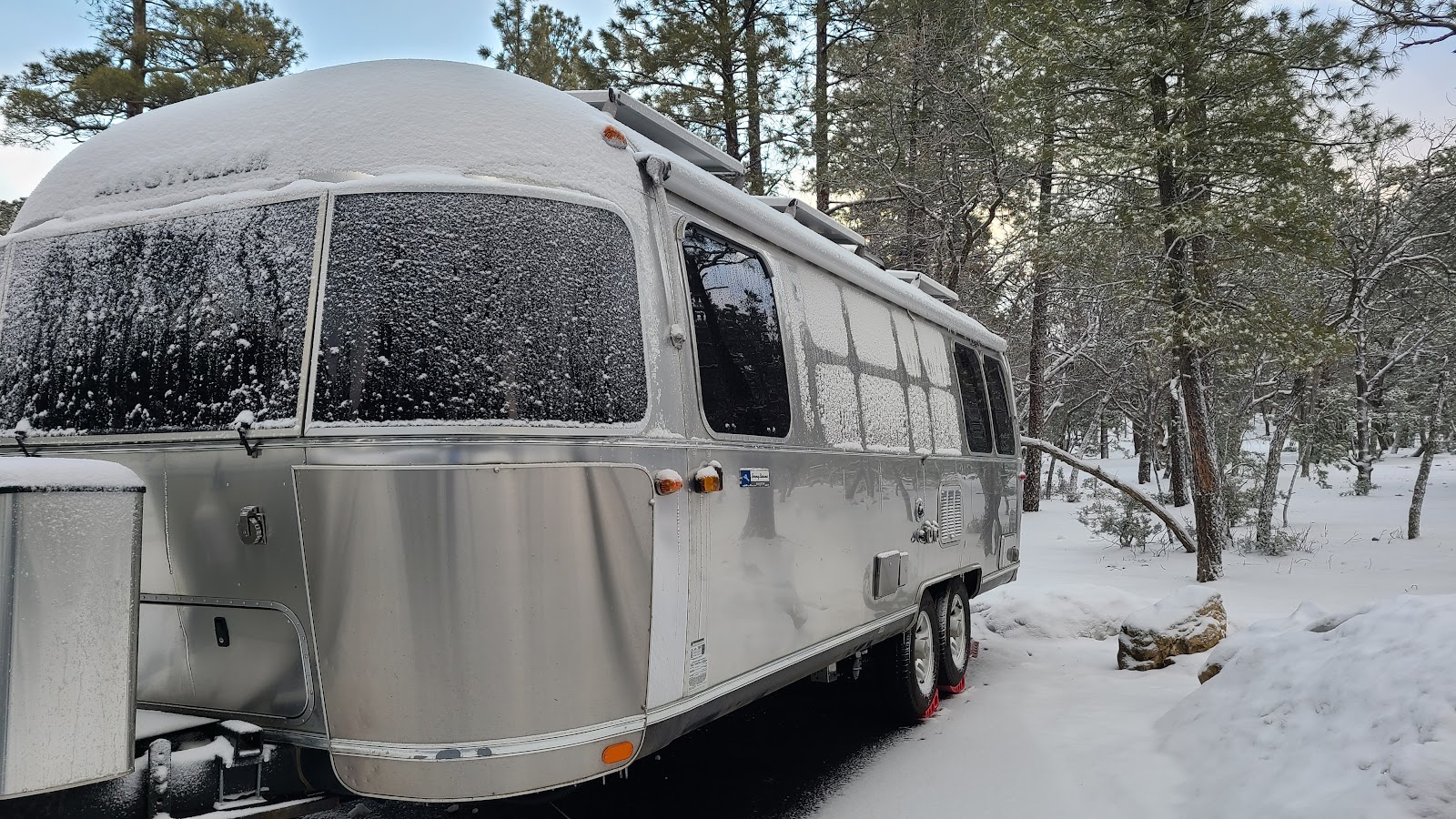
THURSDAY - Well the weather forecasters sure got it right this time.
They predicted 2" of snow by morning and judging by what I see on top of our picnic table I'd say 2" was right on the money.
Our picnic table at 6:45AM this morning.
The bad news is it's not done snowing yet. More snow is predicted for mid-afternoon and again overnight. I guess it could have been worse, we could have been our college spring break neighbors across the street who were sleeping in their tents.
SNOW AT THE GRAND CANYON
 By 6:45AM this morning someone has already walked down the street
to the bathroom and driven a car down the road.
 I guess the insulation in the walls is better than the aluminum studs holding it all together.
 The windows don't seem to be any better at keeping the warmth inside.
 Poor ROVER didn't have any heat at all last night!
 Tricia got busy sweeping a path along the outside of THE POD...
 ...and all the way to both doors on ROVER.
 I hope our college spring break neighbors...
 ...are safe and warm inside of their canvas igloos.
I got a text message this morning that my General Delivery mail had arrived at the U.S. Post Office located here in the park, so around 11:30AM we climbed into ROVER and drove the half mile to go pick it up.
Also while we we're out, I need to go over to the Visitor Center, now that it's finally open today, and get my Passport Book stamped and maybe watch the movie they offer all about the park.
Well I got my Passport book stamped, but they had already started the last showing of the movie for today because they close at noon. Open at 8:00AM and close at noon, now that's a shift I would like to work.
While Tricia wanted to go out to Mather Point to see what the canyon looks like after a snow, I elected to go warm up the truck for her, nice guy that I am!
Here is what happened when Tricia tried to go see the snowy canyon.
That's hail all over the sidewalk...
...and Tricia's sleeve is covered in pea-sized hail too.
Time to get back into THE POD where we'll be safe and warm.
FRIDAY - With yesterday's snowy weather behind us we finally got out and drove over to the Visitor Center to catch the last showing of the documentary film all about the Grand Canyon National Park.
After the movie Tricia walked back out to Mather Point to see just what all that snow would look like in the canyon.
To me it looks just like it did two days ago. I didn't think much would have changed over the last few days, although it is a lot sunnier out today.
YESTERDAY'S SNOW ON MATHER POINT
SATURDAY - Today we're out to tackle the entire west side of the park which can be found on the 7-mile long Hermit Road. That's means we were up and out of
THE POD by 7:30AM so we could drive to the Visitor Center where we would catch the
BLUE ROUTE bus that would take us west to the transfer station with the
RED ROUTE bus. You got all that?
It's a necessary evil you must go through because without a Special Permit you're not allowed anywhere on the west side of the park with a personal vehicle. You can bike or hike the west side, just not drive.
Before we go anywhere we'll have to wait for ROVER's windshield to defrost, afterall it is only 24°F outside this morning. At least it's not snowing!
FIRST STOP
BRIGHT ANGEL TRAILHEAD
 The first and last stop on today's route. (P.S. Ignore the photo bomber. He wouldn't move.)
 This is one of two trails that lead to the bottom of the canyon.
 I hope this group knows what lies ahead for them!
 That's the end of just the first plateau leading to the bottom.
 I think we can see some hikers already on the plateau.
 Yep! Two of them are heading back, now for the hard part, climbing back out.
SECOND STOP
TRAILVIEW OVERLOOK
 This is the only location where a novice hiker can get 50' below the rim of the canyon.
 You're looking at the back side of the Bright Angel Lodge where the trail down begins.
 You can barely make out the snowy trail going down the cliffside.
 Here is a little bit closer shot so you can find the trail I'm talking about.
 I wonder if they're part of the group we saw earlier beginning the trail?
 Now you can start to realize exactly what's in store for them.
 This is the flat easy part of the trail that leads to the edge of the first plateau.
THIRD STOP
MARICOPA POINT
 A few of the knarly juniper trees found all along the rim of the canyon.
 This thin wall of hard rock somehow managed to escape the forces of erosion.
FOURTH STOP
POWELL POINT
 This stop includes a memorial to the first explorer of the Grand Canyon.
FIFTH STOP
HOPI POINT
 The juniper trees are bent and twisted by the winds and harsh enviroment.
 A small section of the muddy Colorado River can be seen in the center of this photo.
SIXTH STOP
MOHAVE POINT
 I can see why this stop is one of the favorites for sunset photo locations.
 It has a very LONG view down the length of the canyon.
 And once again a glimpse of the Colorado River below.
 The walls on the canyon's South Rim tend to be steep drop offs toward the canyon floor...
 ...whereas the North Rim has many terraces to overcome on it's journey to the canyon floor.
 A picnic table with an amazing view.
SEVENTH STOP
THE ABYSS
 Even with the Grand Canyon in the background my focus seems to be on the twisted trees.
EIGHTH STOP
MONUMENT CREEK VISTA
NINTH STOP
PIMA POINT
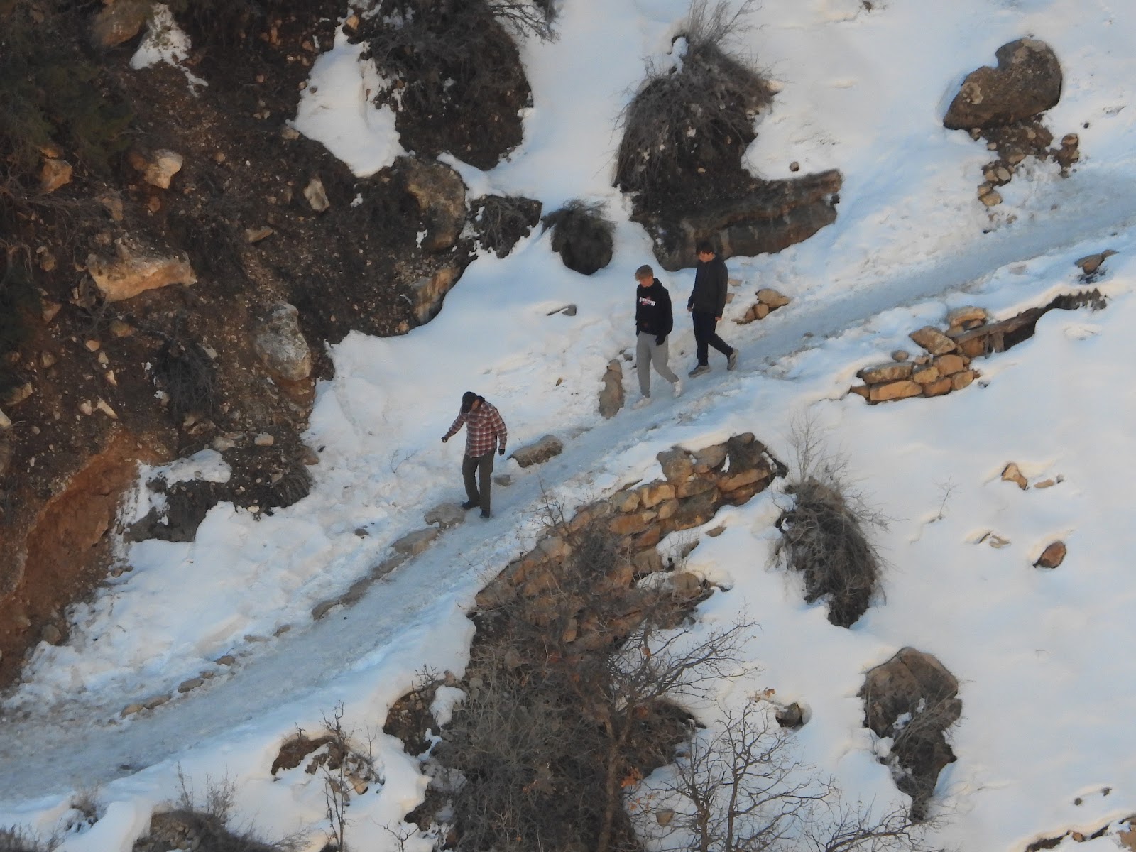
 Let's play a little game with this slideshow.
 I like to call it "Spot the Hikers"!
 Let me know when you spot them.
 HINT: There are two solo hikers, probably a half mile apart, in the photos.
 There's one with a blue overnight backpack.
 Ready, one more time, now "Spot the Hiker"!
 This one's easy.
 Same backpack, different person. They must be rentals.
 New game, "Spot the Rapids".
 That was too easy..
 There's more on the other side too.
 No more games. Just enjoy the photos.
TENTH and FINAL STOP
HERMITS REST
 "Everyone gets their photo taken standing under the tons of balanced rocks".
That's what the bus driver said, so we did!
 The 100+ year ld Hermits Rest building.
 Complete with a giant sized wood burning fireplace for those long winter months.
 Even the ceiling beams above the fireplace seem to have some soot stains on them.
 Again, just look at how twisted that limb is. Unreal!
WOW! That was a lot of photos for one day!
You're lucky I only shared half of the 169 photos Tricia took using her cell phone and camera.
Now that March is complete, and the data has been collected, I'm sad to report that we've once again, for two months in a row, broken another
TWO PEAS AND THE POD record.
Last month was our coldest month on the road, that was until this month! We dropped our average high temperature by a full 4°F to just 54°F and the overnight lows have dropped 2°F to just below freezing at just 31°F.
We've been burning through a lot of propane lately to keep the holding tanks from freezing overnight, but other than that we're keeping ourselves warm by layering up to get outside and enjoy the locations we've been visiting (P.S. This is no April Fools joke).
MONDAY - Nearly every single day since we arrived here the campground has been visited by a half dozen elk.
They don't harm anybody, and as long as the campers keep their dogs on leashes, instead of running around free, they usually just munch on grass and then move on.
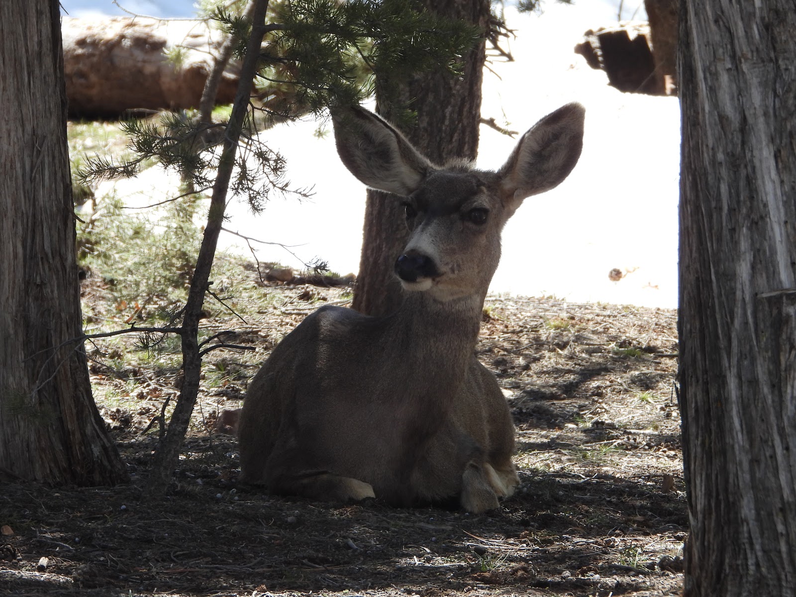
Today was different! Today we were visited by two large doe mule deer and their six fawns.
They walked into the campground and then right outside of THE POD they bedded down in the shade and cover of the trees found inside the campground loops. I think they may have come into the campground to escape the high winds we are experiencing today.
Anyway, they hung around for more than an hour, undisturbed, and then for no apparent reason, one by one, starting with the does, they got back on their feet and just moseyed away.
Would you like to be notified of new blog posts?