Want to see our Visited States Data, our State by State Bucket Lists or our Visited Parks and Campground lists?

Then click on the image above to go to our other website.

💯DAYS in AK💚CHISTOCHINA RIVER PULLOUT💚


MONDAY

ALASKAN STOP #2


Chistochina River Pullout

OUTSIDE OF CHISTOCHINA, AK


Today was all about getting from Point A to Point B with a pitstop in between.

Once we got near the midsized town of Tok, AK the road conditions improved greatly. Tok is where the Alaska Highway (officially Alaska State Highway 1) meets the Glenn Highway (officially Alaska State State Highway 2) which runs south down to Valdez, AK.

We stopped in a truck stop in Tok so I could upload the previous two blogposts. There is excellent cell signal in town, but just outside of town it's nonexistent. While I worked on the blog, Tricia spent $5 for a private hot shower. Later she managed to launder two loads of clothes while I finished up posting and took my shower.

We ate lunch in THE POD and filled ROVER with $5.20 gasoline, before driving a mile further into town to find the turnoff for the Glenn Highway. We left the Alaska Highway in the rear view mirror for now, we'll return to this exact intersection in a week or so to pick up where we left off and finish the Alaska Highway.


SCENES FROM TODAY'S DRIVE


The 10 Highest Mountains in the United States are all found in Alaska. This snow covered mountain is #6, Mount Sanford in the Wrangell Mountains (16,237 feet).
The best thing about tonight's campsite, other than it being FREE, is that it has strong Verizon coverage so I can upload a post tomorrow morning before hitting the road again.
Oh yeah, it also has an outhouse nearby if needed.


OUR ALASKAN CHALLENGE:
TO VISIT FOR 100+ CONSECUTIVE NIGHTS


COMPLETED

PROGRESS BAR

STILL TO GO
2 98


Would you like to be notified of new blog posts?


We encourage everyone
to leave their comments
in our Facebook Group!


We would really like to hear from you!


Until next time

TWO PEAS


💯DAYS in AK💚WE'VE MADE IT TO ALASKA💚


"The Last Frontier"
is our 39th visited state

HERE'S A FUN FACT ABOUT ALASKA

Not only is Alaska the largest state in the country (more than twice the size of Texas), Wrangell–St Elias National Park & Preserve covers a larger area than nine US states.


SUNDAY

ALASKAN STOP #1


DEADMAN LAKE CAMPGROUND

TETLIN NATIONAL WILDLIFE REFUGE

OUTSIDE OF NORTHWAY, AK


On today’s travel we encountered some of the worst road conditions along the entire Alaska Highway, but also some of the most spectacular scenery.

In Canada it was like a bumpy roller coaster ride over the frost heaves where I swear we went airborn a few times. In Alaska it was time to play, "Dodge That Pothole" for most of the day.


Another roadside pullout with a view.


We received a Canadian farewell from these two moose
just before crossing the Alaskan border.


At 11:26AM we arrived at the Welcome to Alaska Sign, a must do photo opportunity.


ROVER and THE POD are anxious to continue down the road.


The border between Alaska and the Yukon is nothing more
than an unguarded swath mowed through the trees.


Here we are with our left foot in Yukon Territory of Canada
and the right foot in the United States of America state of Alaska.


Just a short 26 miles from the border is the Tetlin Wildlife Refuge campground on Deadman Lake. It's free to camp here and apparently a lot of people like FREE.

When we arrived around noon time only half the sites were occupied, but when we left early the next morning we noticed every single site was filled. Even the cleared area they use as a place to store down trees and other debris had a van parked in it. There are only 15 sites here so it doesn't take too many campers to fill it up.


We chose Campsite #9 as the best of what was left when we arrived
on Sunday of Memorial Day Weekend.


There is a shallow boat ramp were you can launch your own canoe, kayak or small motor boat.
They even have several canoes on site for campers to use for FREE.


Someone was out enjoying a day on the water.


This overlook awaits anyone who ventures to the end of the short boardwalk trail.


OUR ALASKAN CHALLENGE:
TO VISIT FOR 100+ CONSECUTIVE NIGHTS


COMPLETED

PROGRESS BAR

STILL TO GO
1 99


Would you like to be notified of new blog posts?


We encourage everyone
to leave their comments
in our Facebook Group!


We would really like to hear from you!


Until next time

TWO PEAS


CANADA: Congdon Creek Territorial Park, YT


CANADIAN STOP #11
(OVERALL STOP #302)

CONGDON CREEK CAMPGROUND
OUTSIDE OF DESTRUCTION BAY, YT

YUKON TERRITORY

DESTINATION: THE ALASKAN BORDER

94% 6%
COMPLETED - 2433 miles=(3915 kilometers)153 miles=(246 kilometers) - STILL TO GO


We were up and leaving our campsite in Wolf Creek Campground at 8:00AM this morning, headed towards Congdon Creek Campground to stay for two nights.

I didn’t mention in the last post that Winston and VerJean will be parting company with us for a short time while they take a side trip to visit the city of Haines, something we will be doing on the way south in September.

Also not mentioned in the previous post was the fact that when we returned from sightseeing one day we noticed two Airstreams camping across the road from our site. Turns out one belongs to Ursula and Tim who are from Hawaii, the other is Karen and Lenny, with their daughter Lilia, who are Missouri residents. We first met all of them last September while we were at the Airstream Factory in Jackson Center, OH getting repair work done. Then we all stuck around to enjoy the week long Alumapalooza Rally held there each year.

While passing through the town of Haines Junction we stopped in the Visitor Center and asked, "Where can we find the best Cinnamon Bun in the Yukon"? Without hesitation she answered the Village Bakery, right here in town, but we already knew that and were just trying to get verification from her.


Sorry, the cinnamon bun it didn't last long enough to take a photo for you all.


Arriving at Congdon Creek Campground there were very few sites with unobstructed views of the lake, but we found one with a decent view to pull into. Turns out there was another Airstream in the campsite next door so after we got all set up we went over and introduced ourselves. Their names were Pat and Bill from southwest Georgia.

For the last fifteen years they have made the trip from Georgia to Alaska to visit family and friends. They had some very valuable information to share with us about were to camp, and where not to, all along the route we have planned for returning home to the Lower 48 in September. Also which Alaskan sightseeing attractions are worth the money and which ones were nothing more than a “tourist trap”.

It’s always great to receive good local information when you can.


NOTE: With the rain and cloud cover we didn’t worry about taking to many photos today, knowing the forecast for tomorrow is clearer skies and no rain. The following photos were all taken on Saturday.


The playground in front of our campsite has a stunning view of the Kluane Mountain Range.


We were surrounded by the snowcapped mountains.


Right behind our campsite is the shoreline of Kluane Lake.


SATURDAY - Today we unhooked ROVER from THE POD to go back up the road a short distance to grab the photos we didn’t take yesterday, and I’m so glad we did.

While we were stopped in a large pullout on the side of the road taking photos of Kluane Lake, I saw two Airstreams making their way around the lakeshore. As they got closer I recognized them as our friends from Alumapalooza. We waved and flashed our lights as they went by at 55MPH and silently wished them safe travels. They of course saw us and waved back!


I think we might camp in this spot on the way south in September.

It wasn’t but a few minutes later when we saw these two grizzly bear youngsters munching on the grasses along side the edge of the road. We pulled off the road, engaged our emergency flashers and watched them for several minutes. Traffic was very light on the southbound side, so Tricia opened the moon roof and climbed up into the passenger seat to take photos from a safe elevated position.

We then went to the Kluane National Park Visitor Center, hoping for Wifi to upload a post, but found none. What we did find was a spotting scope watching a small gathering of sheep high up on the mountainside.

Even with Tricia’s 3000mm zoom they still looked rather small and blurry in the photos, but you can defintely see the curved horns they are known for. The last photo even has a newborn lamb in it.


That’s all for this final northbound stop in Canada,
because tomorrow we cross the border into Alaska, FINALLY!


Would you like to be notified of new blog posts?


We encourage everyone
to leave their comments
in our Facebook Group!


We would really like to hear from you!


Until next time

TWO PEAS


CANADA: Wolf Creek Territorial Park, YT


CANADIAN STOP #10
(OVERALL STOP #301)

WOLF CREEK CAMPGROUND
OUTSIDE OF WHITEHORSE, YT

YUKON TERRITORY

DESTINATION: THE ALASKAN BORDER

88% 12%
COMPLETED - 2274 miles=(3659 kilometers)312 miles=(502 kilometers) - STILL TO GO

We departed our lakeside campsite around 9:00AM, but not before I spotted a fox waltzing through the campground. Sorry I didn't get a photo and he was so quick Tricia didn't even get a look at him.

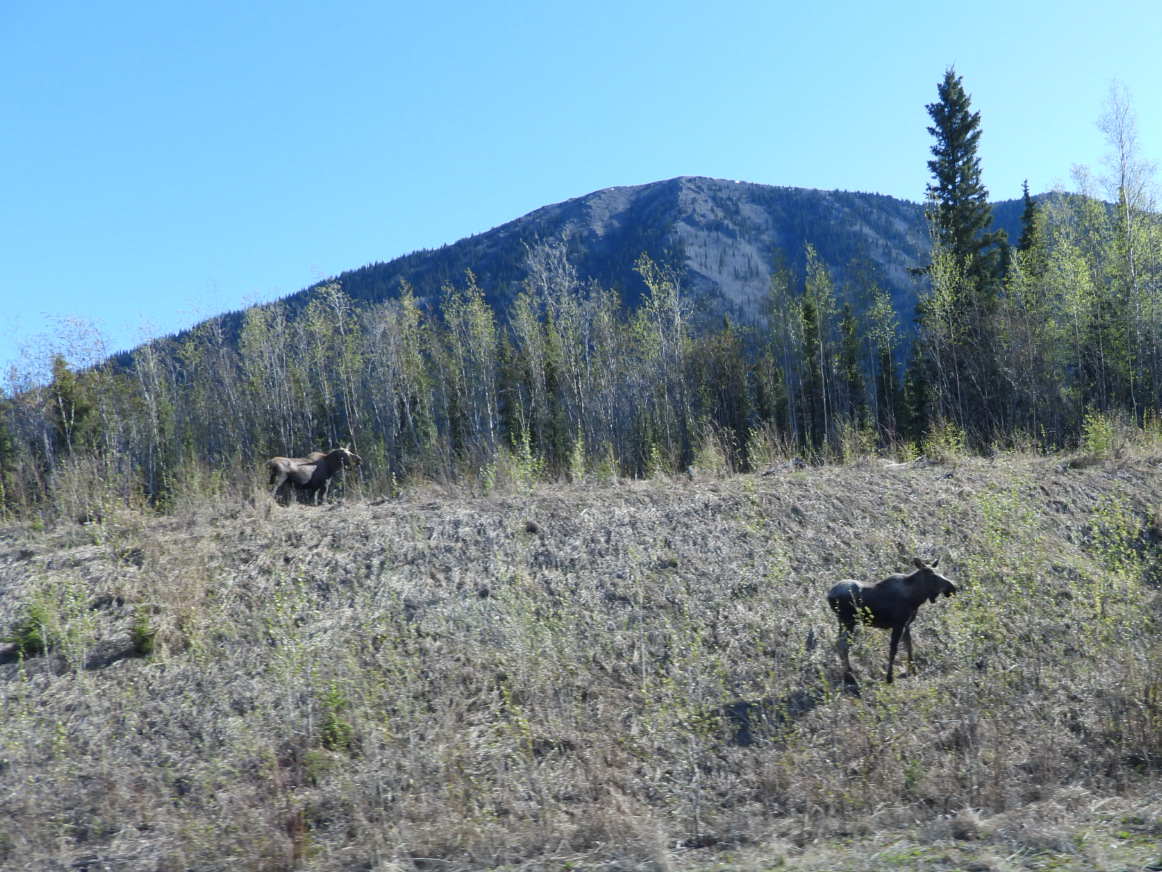
Once we were on the road we had another new wildlife sighting, a porcupine was meadering along the right hand shoulder of the Alaska Highway, but I didn't say anything to Tricia about getting the camera ready because from far off it just looked like a dark rock on the edge of the road. So again, no photo, sorry!


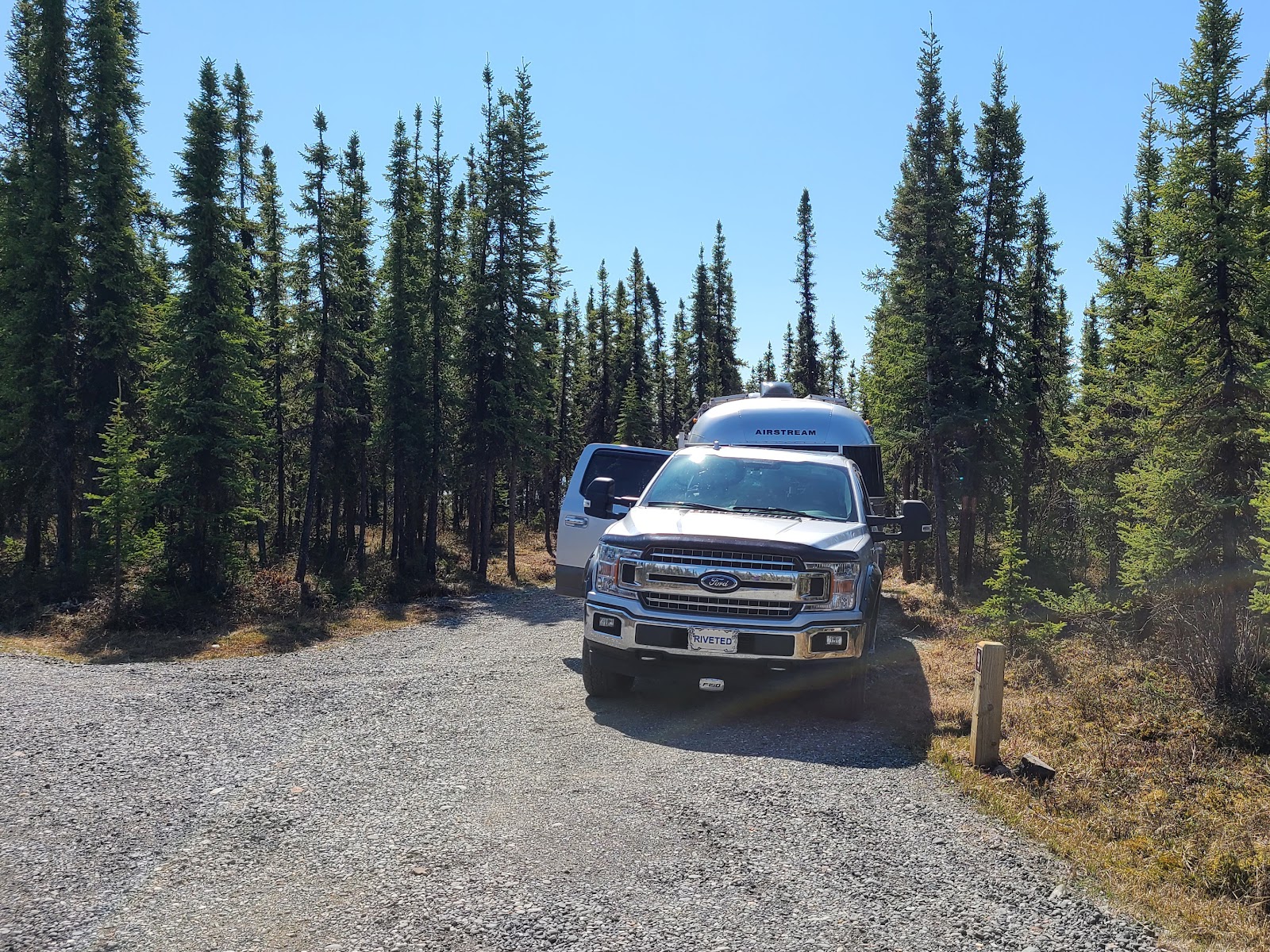
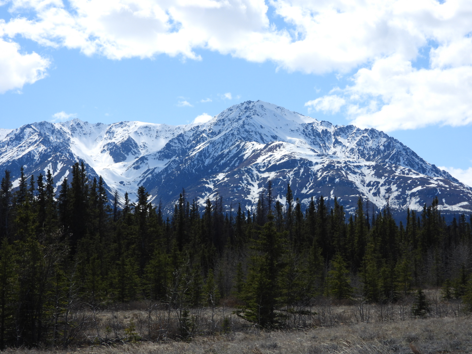
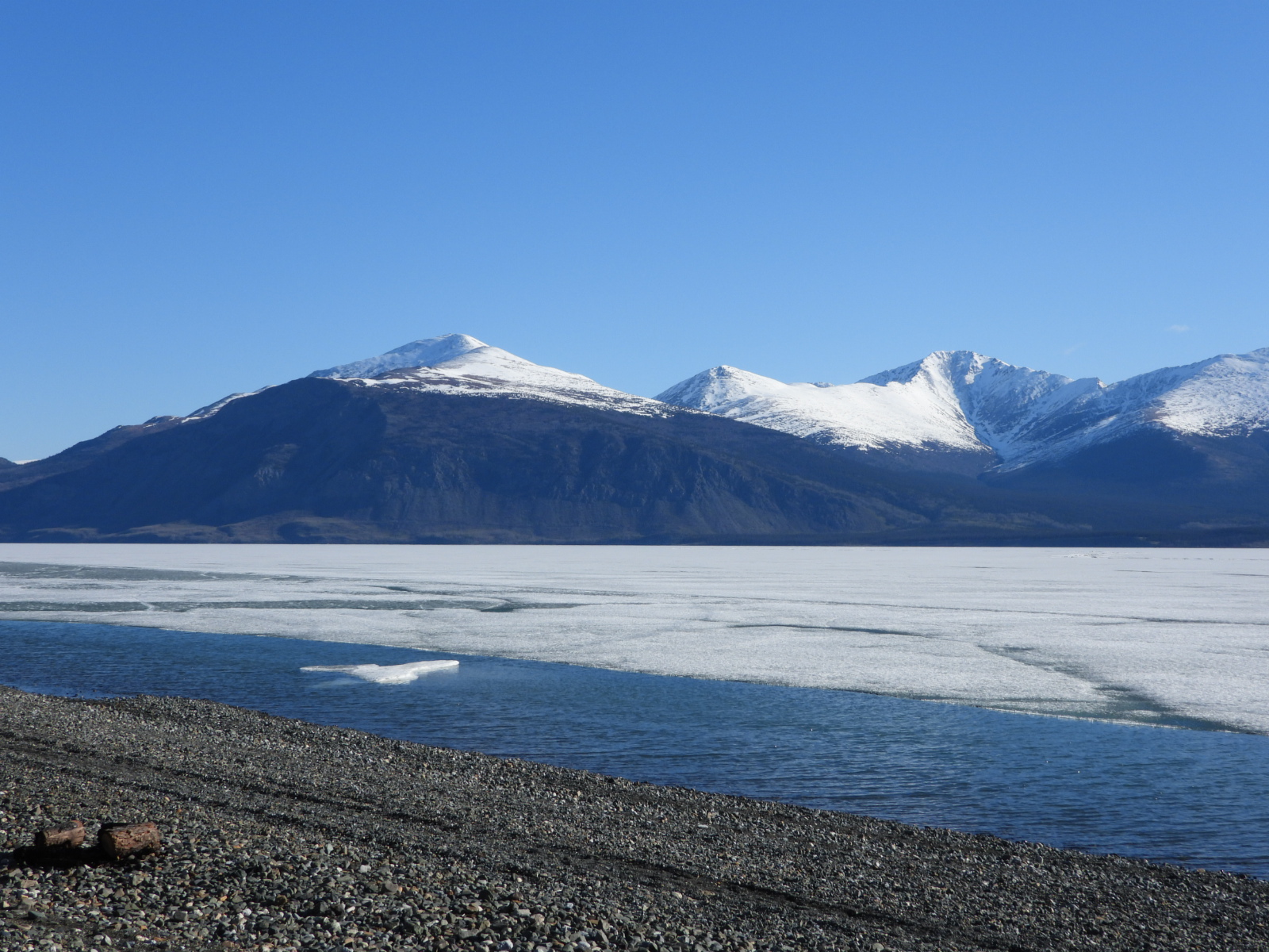
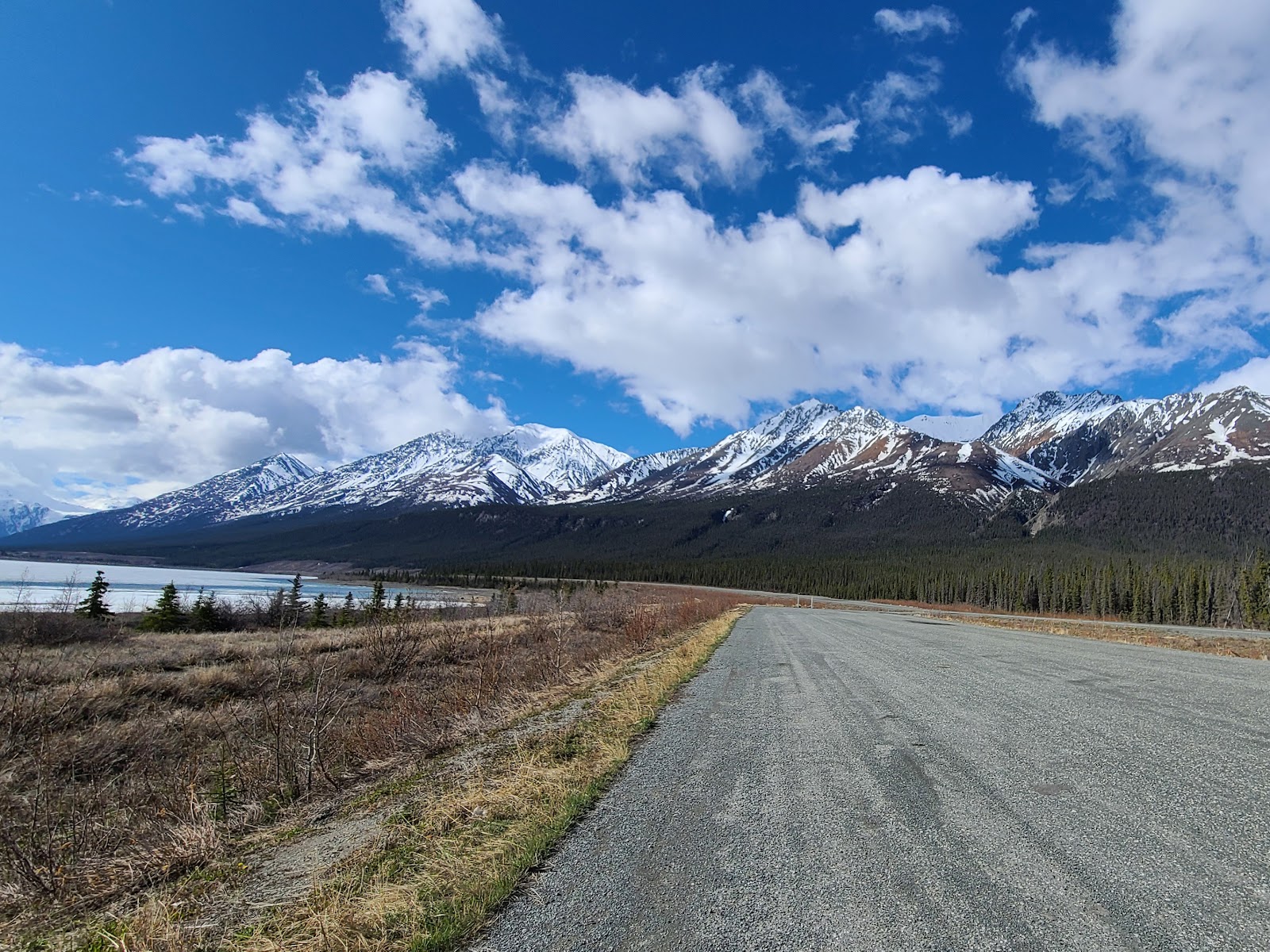
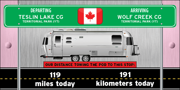
Around 11:00AM we arrived at Wolf Creek Campground which is located about 10 miles south of the capitol city of Whitehorse. A full 75% of the entire population of the Yukon Territory lives in Whitehorse and it's surrounding communities, so it's not unexpected that this campground is one of the hardest to find a vacant campsite in.

We got lucky and found the last neighboring pair of campsites in the entire campground of 46 sites. We paid for our site and Winston's and then drove ROVER and THE POD into town and to take care of a few chores.

First we ate lunch at a Boston Pizza Restaurant like Tricia has been jonesing to do for quite some time now. Let's just say we were both disappointed with our pizzas, we won't be back.

Next we found a service station that offers a "FREE dump station" with "FREE fresh drinking water", as long as you're a paying customer buying their propane or gasoline. We filled one of our 30lb. propane tanks for $34USD (which is very reasonably priced) and then emptied and filled our holding tanks on THE POD for FREE.

Next up groceries! We first tried the Walmart, but they had a very limited selection on just about everything we were looking for today. But one thing they did have was a pretty fancy entrance into their in-store McDonald's Restaurant.

Fortunately for us we didn't have to look far for another grocery store because literally right across the street was a Sav-On-Foods Store with a much better selection for us.

After that is was back to the campground to finally detach from THE POD and set up home for the next three nights. It was after 4:00PM when we returned and soon after VerJean and Winston arrived after checking out a few things of their own around town.


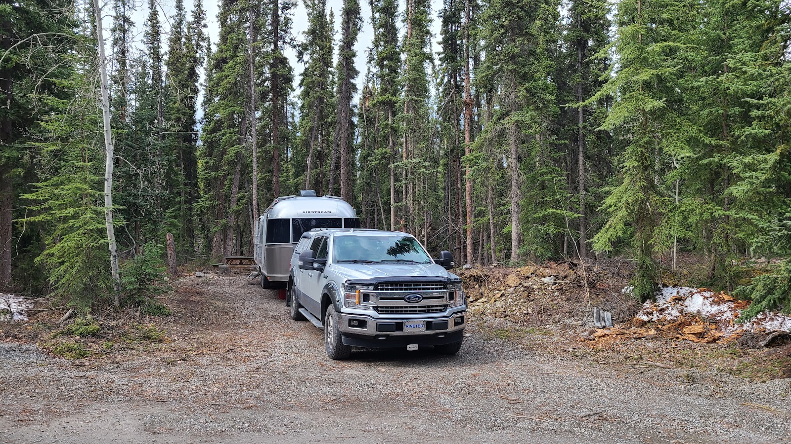
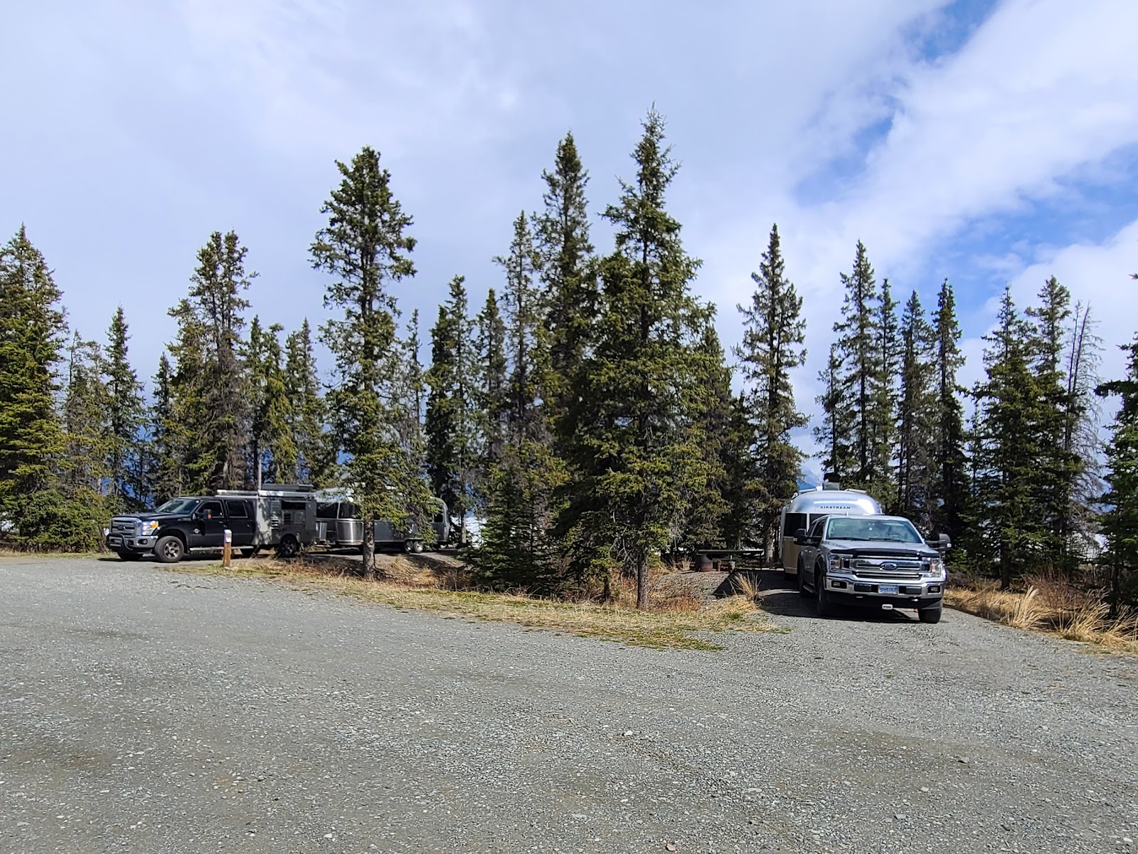
Our Campsite #30 at Wolf Creek Campground outside of Whitehorse, YT


Someone recently spent some time constructing a tipi in the woods behind our campsite.


WEDNESDAY - In addition to having a wonderful lunch at a restaurant called the "Dirty Northern Bastard" with our friends Winston and VerJean we explored the downtown section of Whitehorse today. The restaurant is named after a British football chant (that's soccer to us Americans) to try and anger their opponent, similar to taunting in the NFL, which has been outlawed.


Did you see that? That plane damn near landed on top of ROVER!

Before going downtown we stopped to check out an Atlas Obscura destination that is right along side of the Alaska Highway as it passes through town. It's the World's Largest Windvane and it's the size of a DC-3 airplane, that's because it is a DC-3 airplane. Or course the plane is not pushed around by the wind, it's computer driven motor takes care of that task, but it does match the windsocks located behind the Yukon Transportation Museum at the airport.


Another Atlas Obscura destination we checked out were the Log Cabin Skyscrapers in downtown Whitehorse. In 1947 Martin Berrigan built five of these unique buildings to rent rooms to people relocating to the Yukon. In 1970 three of his buildings were torn down to make room for the parking lot you see, fortunatly two were saved by designating them an Historic Site.


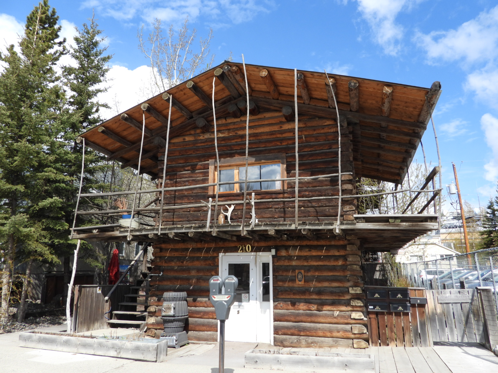
This is the 16x16 foot two-story edition.


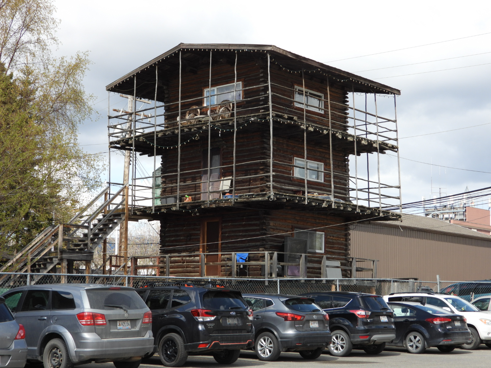
This three-story edition didn't receive electricity until 1964.


THURSDAY - We awoke to our first night of subfreezing temperatures since entering Canada this morning (30°F), but that's not going to keep us checking out our sightseeing plans for today.

First up is to take a scenic drive through Miles Canyon located on the south side of Whitehorse.


A view of the Yukon River from the top of Miles Canyon Scenic Drive.


Next up involves a trip to the Public Utilities Building on the corner of the Alaska Highway and Two Mile Hill Road, the only road that presently leads into downtown Whitehorse. The road on the opposite side of town suffered a landslide this winter and is currently still closed to through traffic.

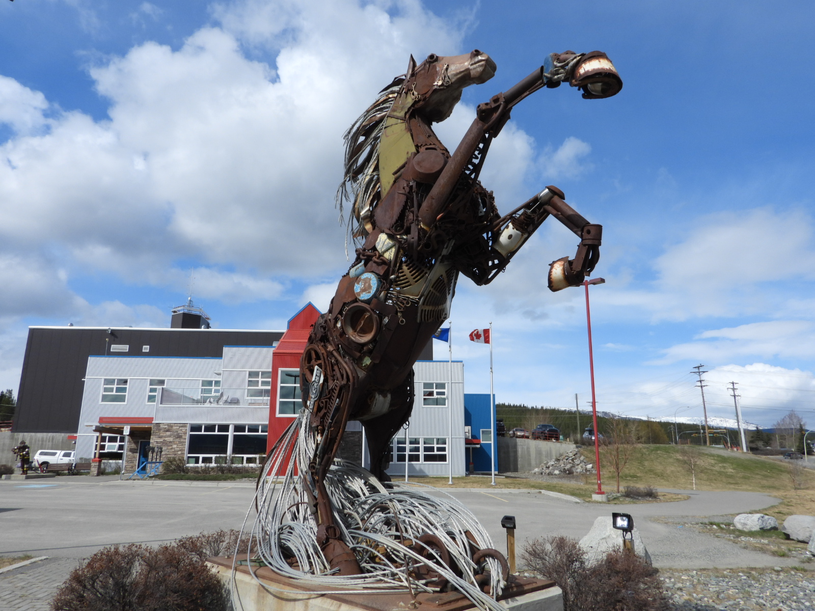
Located behind the building in a beautiful metal art sculpture appropriately titled, Whitehorse. The metal used to create this artwork were all pieces of donated scrap metal from citizens all around the Yukon Territory.


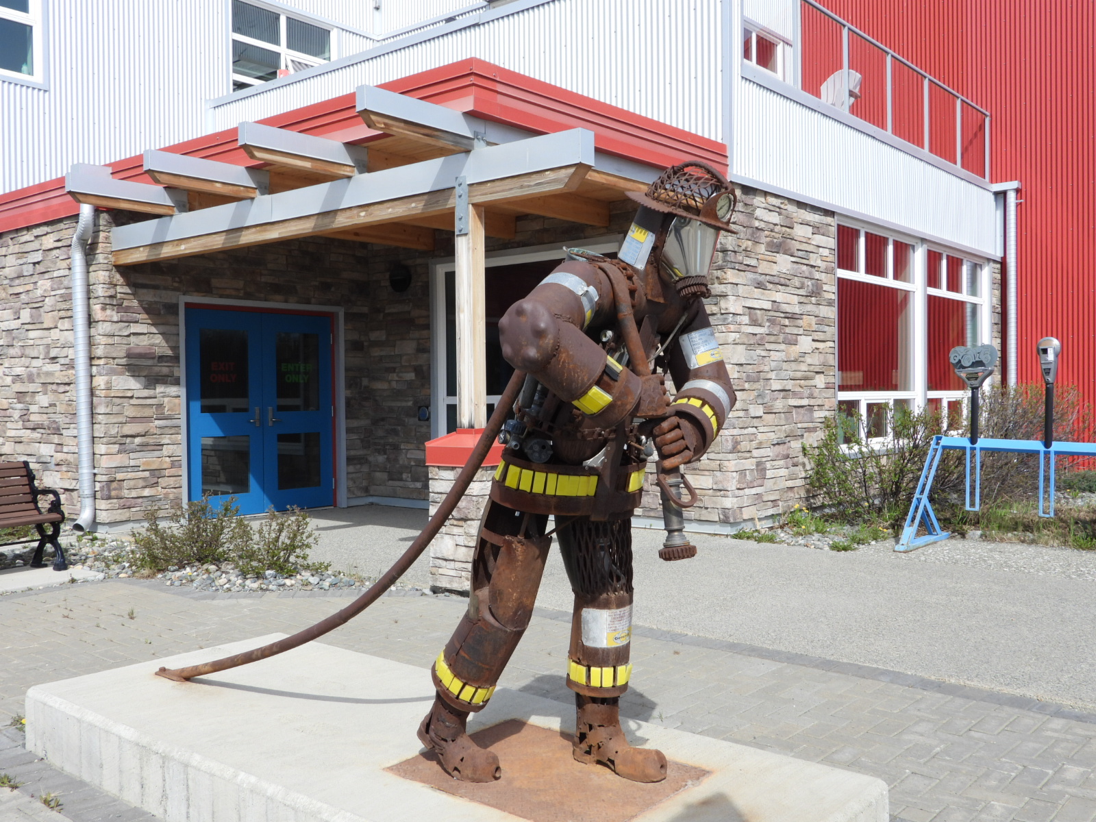
This fire fighter sculpture is also located behind the municipal building.


The SS Klondike II paddlewheeler ship on the edge of town is currently being restored and is a Canadian National Historic Site. It's not quite ready for public tours, but they do offer a short documentary film about the ships history and service.


The SS Klondike II as we saw it today.


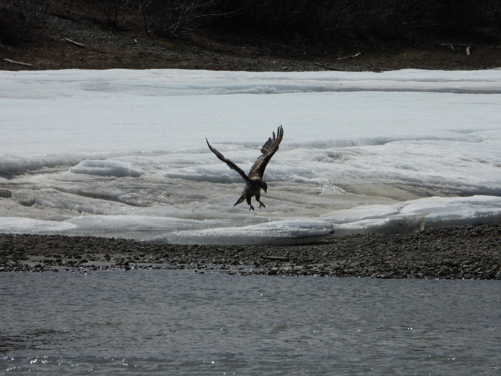
We also watched a juvenile bald eagle fishing for lunch in the Yukon River.


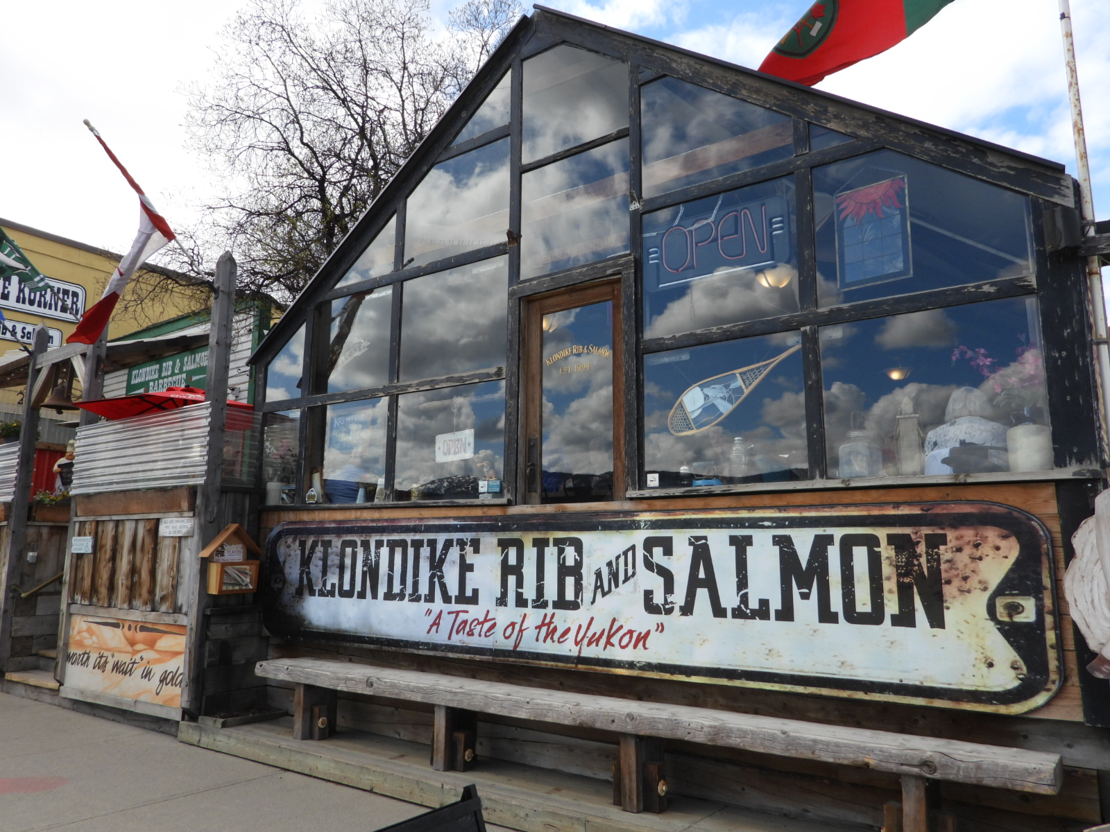
Speaking of lunch, it's time to meet up with Winston and VerJean at a restaurant downtown named the Klondike Rib and Salmon. It's housed in the two oldest buildings still in use in the town of Whitehorse. Since 1900 when the buildings were first erected it's been home to a bakery, a mail and transport business and a carpenters shop, before sometime in the 1930s becoming the restaurant that occupies the space today.


The larger building is the dining room and smaller one is the kitchen.


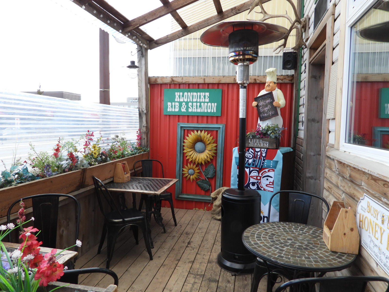
This front porch eating area is dog friendly.


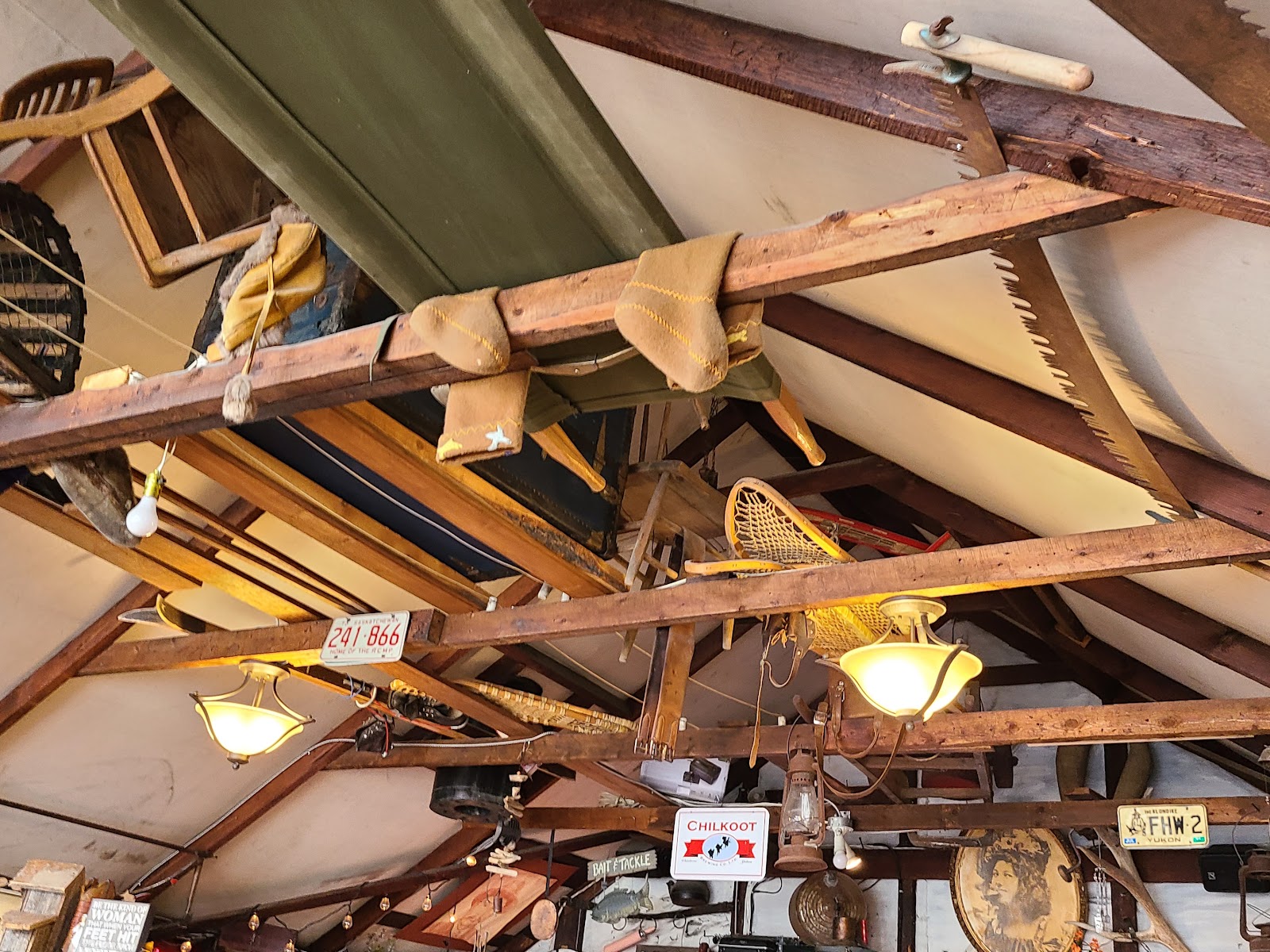
Rafter art in the main dining room.


Everywhere you looked there was something grabbing your attention.

The atmosphere, the service and especially the food were all top notch. I ordered a cup of their Halibut Chowder as an appetizer and liked it so much I substituted my french fries for another serving (for a $3 upcharge) when ordering my Kickass Klondike Burger entree, which is a blend of elk, bison and wild boar meat.

Tricia went with their Famous Halibut Fish and Chips, as did Winston and VerJean. Everyone had a cup of chowder after watching me eat mine.


After lunch it was time to visit the highly touted/don't miss Yukon Beringia Interpretive Centre, which is a museum dedicated to the history of this region since the last ice age. I was a little dissapointed with what we saw, but as usual the best is not always "the best".


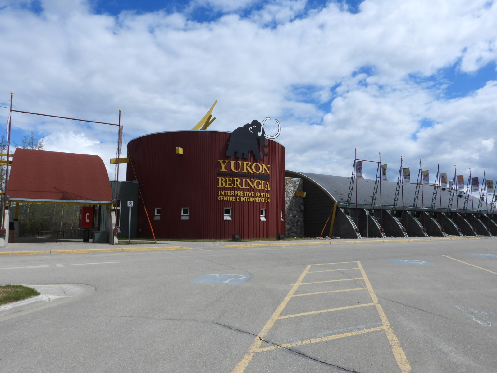
They did have this cool metal art on the outside back porch.


ATTENTION: Tomorrow we'll be moving to a very remote and unpopulated area of the Yukon and then on Sunday crossing the border into Alaska where there will also be no cell service to update this blog. What I'm trying to say is don't worry if you don't hear from us for the next week to ten days. We'll take plenty of photos to share once we reach the town of Valdez.


Would you like to be notified of new blog posts?


We encourage everyone
to leave their comments
in our Facebook Group!


We would really like to hear from you!


Until next time

TWO PEAS