
 SATURDAY |
TRAVEL DAY |
 |

North bound and down, loaded up and truckin'
A-we gonna do what they say can't be done
We've got a long way to go, and a short time to get there
I'm north bound, just watch ol' "ROVER" run!
Lyrics by Jerry Reed (and me kinda)
from the 1977 movie "Smokey and the Bandit"
FYI - the "and down" portion of the lyrics is CB radio signoff jargon for
"I'm going to stop transmitting now, but I'm still listening!"
Day 1 of our big push northward to the Canadian border is in the book, so to speak. Several notable things happened along the route today. First off we accomplished three more of our state border crossings, KS2MO, MO2NE and MO2IA. If you're not sure what I'm talking about just check out this PAGE.
While obtaining the MO2NE crossing meant a short detour from our normal route, we made it entirely worth while by stopping for a Runza Sandwich while in Falls City, NE. Nebraska is about the only place you can find a Runza Sandwich. If you not sure what that is, check out THIS BLOGPOST from our travels last summer.
Also if you're like us, you and always have a hard time deciding between french fries and onion rings. Well at Runza's you can have a little bit of both if you order the "Frings".
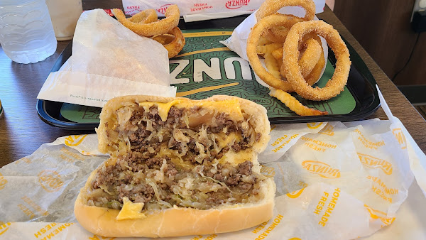
It doesn't look like much, but it sures tastes good!
 SUNDAY |
TRAVEL DAY |
 |
Day 2 and as I suspected nothing much to say, just 322 miles of driving Interstate 29 North.
 MONDAY |
TRAVEL DAY |
 |
Day 3 and we finally have something to report, unfortunately it's not good news. We've been seeing all the weather advisories about the flooding that is occuring in this region of the states. Today we traveled another 100 miles north on Interstate 29 and most of it was spent with water lapping up against the shoulder of the road, both north and south and even in the median strip.
We saw homes from the Interstate where the residents had parked their cars and trucks up to a mile away from their homes, because the roadways leading to their driveways were two or more feet below the surface.
The Red River creates most of the border between North Dakota and Minnesota. North of Grand Forks, ND it's located only a few miles east of Interstate 29, all the way north to the Canadian border. The Red River is considered to be at Flood Stage when it's at 18 feet. It is currently at 24 feet and Moderate Flood Stage is only 1 foot away at 25 feet. Thankfully it's not forecast to get any higher than that anytime soon.
While traveling on the Interstate we saw what was obviously supposed to be corn fields, but they were completely submerged. I suspect that will destroy any seeding that may have been previously done this spring. Don't be surprised if corn gets added to the list of items with dramatically increasing prices.
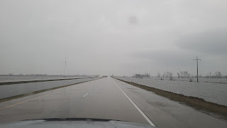
BTW - It was raining hard the entire 4-hours we were on the road today!
We originally planned to spent tonight at a city campground here in Warroad, MN but then found a casino that offers free overnight RV parking, with electric, so guess where we stayed. This is our last night in the United States for several months because tomorrow at 9:00AM we cross the border into Canada, it's only 10 minutes from here.
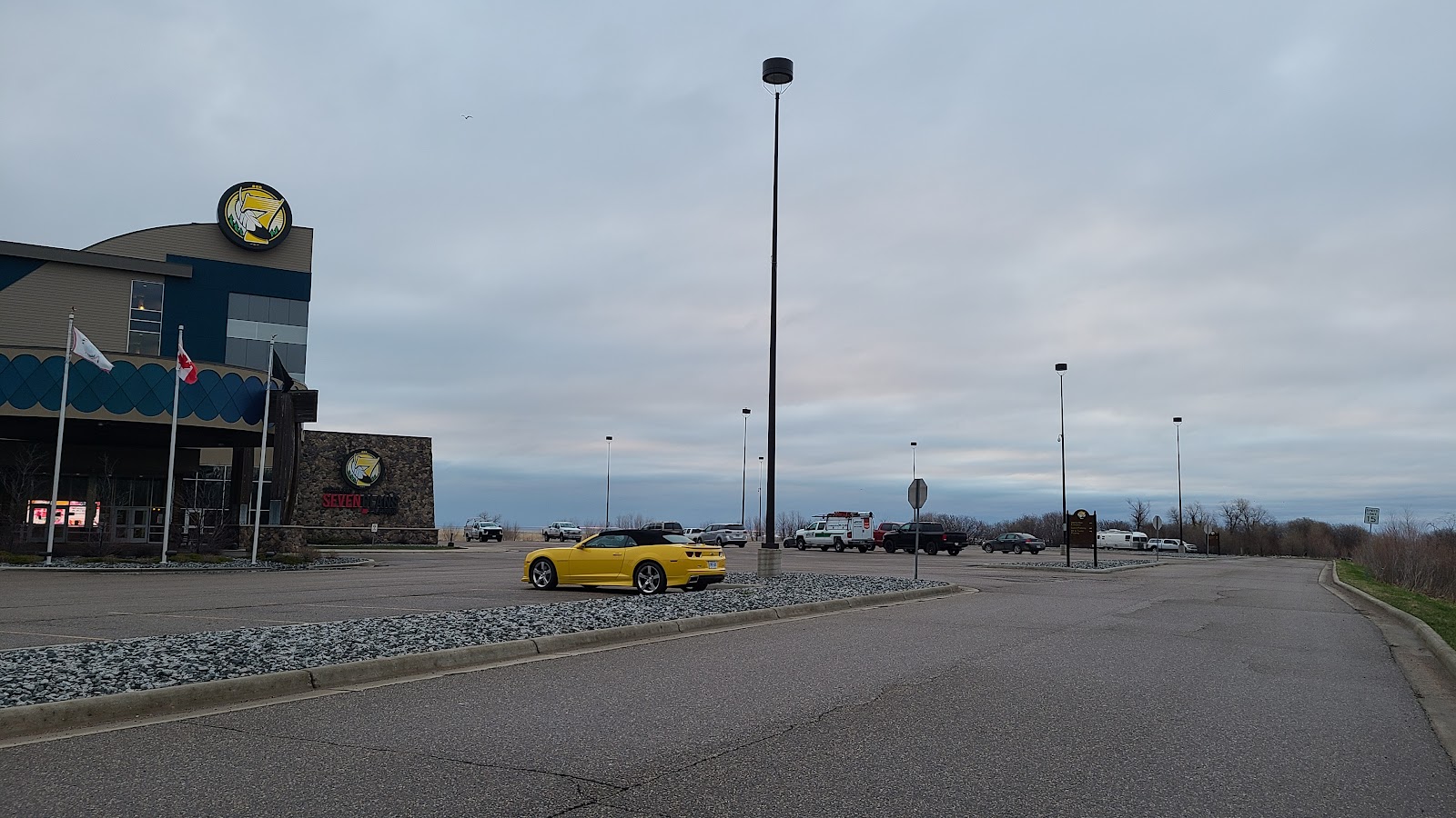
Can you spot ROVER and THE POD hiding
in the Seven Clans Casino parking lot here in Warroad, MN?
Would you like to be notified of new blog posts?

 |
We encourage everyone |
Until next time
