
 |
CANADIAN STOP #1 |
 MANITOBA |
DESTINATION: THE ALASKAN BORDER
| 13% | 87% |
|---|---|
| COMPLETED - 324 miles=(521 kilometers) ⟺ 2262 miles=(3640 kilometers) - STILL TO GO |
|---|

We did take time to make "one" sightseeing detour today. It's one reason we crossed into Canada from Minnesota and not some place more traditional like Washington state.
Being from South Florida we are very aware that the Southernmost Point of the Continental United States is right down there in Key West, FL. Anyone who's been there probably had their picture taken in front of the Southernmost Buoy. It was our very first stop on this fulltime RV journey we've been living since May of 2018.
Then in July of 2019 we traveled up to the Easternmost Point of the Continental United States at the West Quoddy Head lighthouse in Lubec, ME.

Recently the town was in the National News because with the Canadian border being closed for nearly two years to prevent the spread of COVID the residents were effectively stuck at home. When the lake was frozen over this winter the Minnesota DOT maintained an "ice road" so travel could temporarily resume. Of course I believe I read the fee to use the road was around $150 one way.
We have no intentions of visiting the four corners of the world, but with three corners of the United States already under our belts, I believe our U.S. goal might be within reach. We'll know when we visit the Olympic National Park in northwestern Washington sometime in the future.
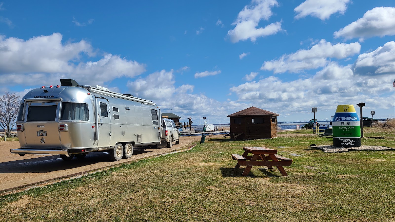
Not nearly as crowded as the Southernmost Buoy.
We saw only one other person while we were here.
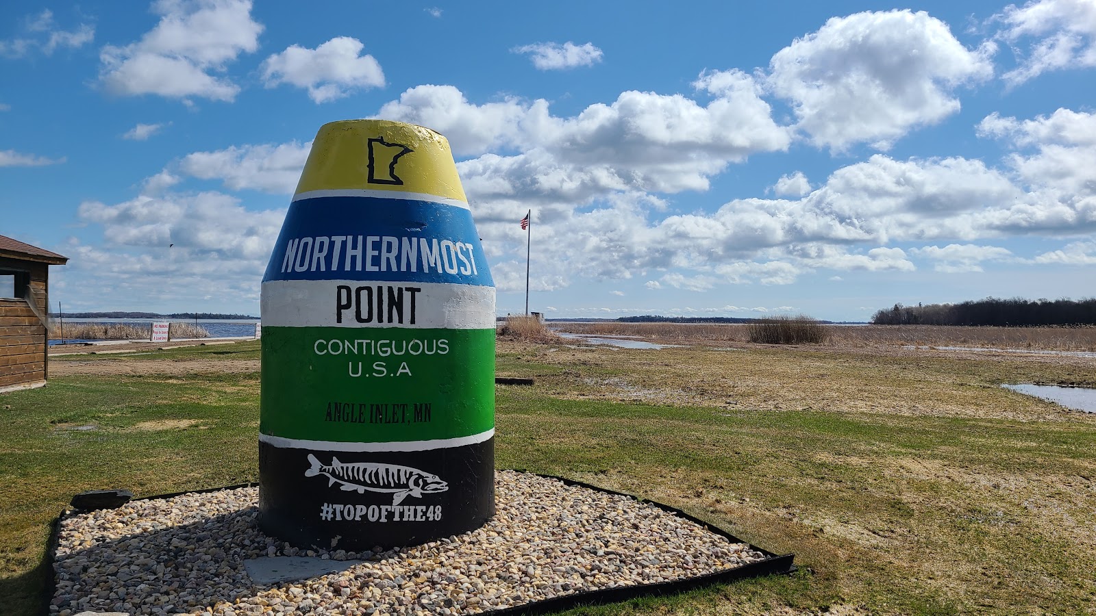
Now that we've been to the Northernmost Point we have three corners down
and only one left to go, the Westernmost Point.

Ironically about halfway through our travels today we passed a sign on the side of the highway informing us we just passed the Longitudinal Centre of Canada.
That's right if you pick the easternmost and westernmost boundary of Canada and split the difference you'll be on the 96 degrees 48 minutes 35 seconds longitude line of the globe, roughly halway across Manitoba province.
We didn't see that one coming!
 |
CANADIAN STOP #2 |
 SASKATCHEWAN |
DESTINATION: THE ALASKAN BORDER
| 27% | 73% |
|---|---|
| COMPLETED - 707 miles=(1138 kilometers) ⟺ 1879 miles=(3023 kilometers) - STILL TO GO |
|---|


Not sure what they were transporting down the highway,
but they were beginning to cause a traffic jam behind them.
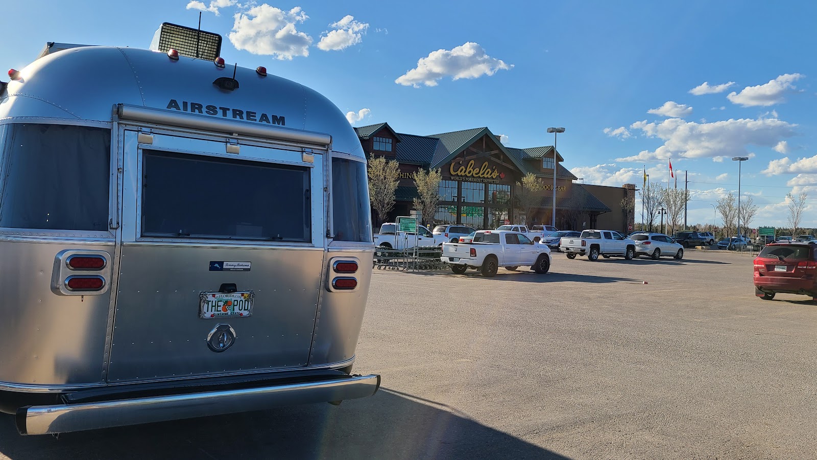
All safely tucked in for the night at the Cabela's in Saskatoon, SK.
 |
CANADIAN STOP #3 |
 ALBERTA |
DESTINATION: THE ALASKAN BORDER
| 40% | 60% |
|---|---|
| COMPLETED - 1041 miles=(1675 kilometers) ⟺ 1545 miles=(2486 kilometers) - STILL TO GO |
|---|

|
no·mad·i·ver·sa·ry
/ˌnō-ˌmadˈəˈvərs(ə)rē/ noun |
That's right, today is our 4th nomadiversary! We've been traveling for 4-years as of today and haven't yet found any reason to stop. |
|---|
 |
CANADIAN STOP #4 |
 BRITISH COLUMBIA BRITISH COLUMBIA |
DESTINATION: THE ALASKAN BORDER
| 54% | 46% |
|---|---|
| COMPLETED - 1402 miles=(2256 kilometers) ⟺ 1184 miles=(1905 kilometers) - STILL TO GO |
|---|

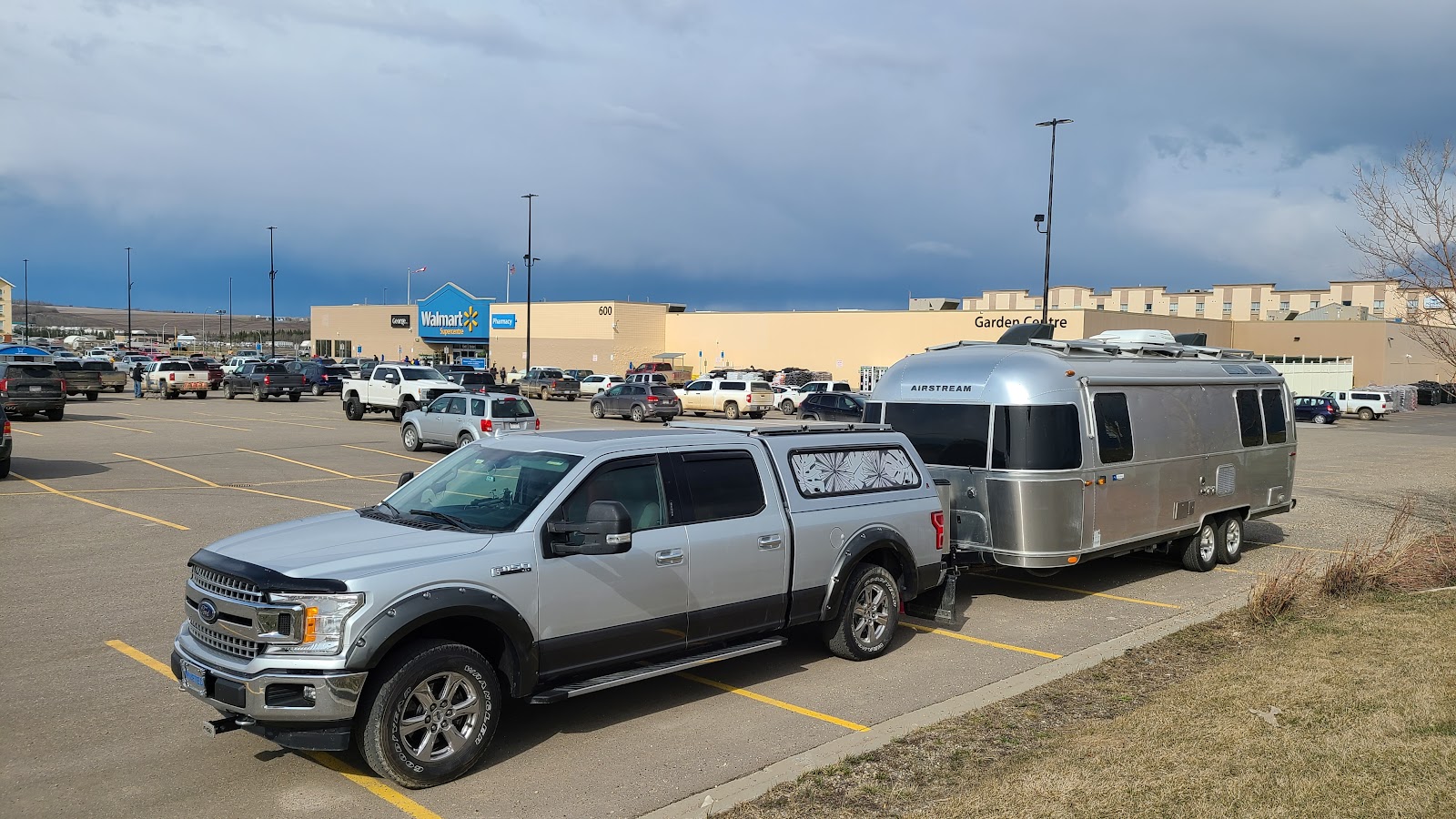
Our home for the night at the Walmart Supercentre in Dawson Creek, British Columbia.
It's hard to believe that last Saturday when we woke up we were in Eastern Kansas outside of Topeka. This Saturday morning (i.e. tomorrow) when we wake up we'll be at the beginning of the 1387 mile long Alaska Highway at Mile 0 in Dawson Creek, British Columbia.
This will also bring an end to our seven consecutive nights of FREE camping, because tomorrow night we'll hopefully be sleeping in a British Columbia Provincial Park campground located right along the highway. It's cost is $20CAD ($15.46USD) for no hookups, but at least it's not a parking lot!
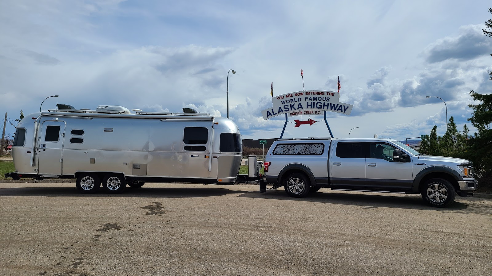
Time to slow down and enjoy the views, this is where the FUN starts!
The Alaska Highway!
Would you like to be notified of new blog posts?

 |
We encourage everyone |
Until next time
