Everyday we learn something new on the road. Today's lesson is one I should have already figured out long ago, the GPS doesn't always pick
"the best" route to send us on.
Even though our GPS is programmed with our weight, length and height to determine where not to send us, it doesn't consider alternate routes that would be safer by factoring out any "white knuckle" situations along the route.
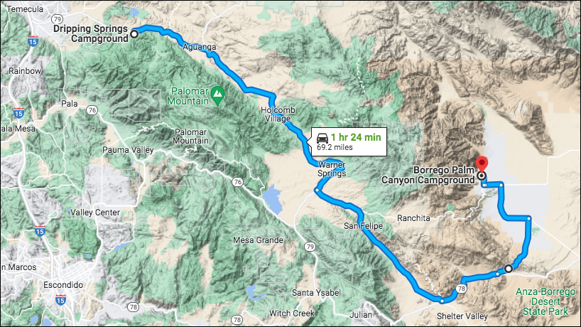
Case in point was today's route selection. There are basically three ways to arrive in Borrego Springs when approaching from the west or south.

Choice Number 1
Notice there are no "tight squiggly" lines along this route.
Choice Number 1 is the longest of the three routes, but only 23-miles longer than the shortest route. If I were planning this the old fashioned way with a paper map and highlighter it's probably the route we would have taken today.
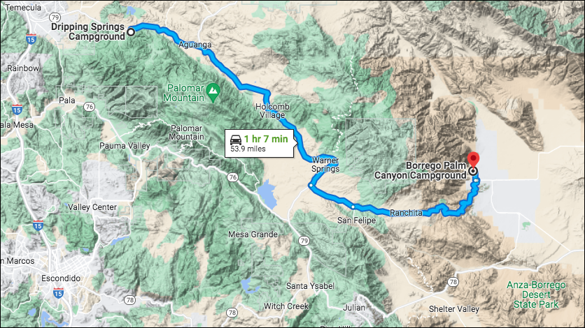
Choice Number 2
This would have been an acceptable alternate route, shaving 8-miles off the route.
Choice Number 2 still has no "tight squiggly" lines and is very similiar to Choice Number 1 in that it too continues south down into a desert valley before heading towards Borrego Springs.
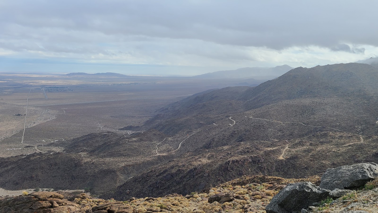
Choice Number 3
I have dubbed this the "White Knuckle Route" and unfortunately the route we traveled today.
Choice Number 3 is exactly the same route as the other two for the first 35-miles. Where this route is drastically different is from this point forward.

The last 11-miles of this route will take you from an elevation of over 4000' and drop you down to less than 800' by the time you reach the city limits of Borrego Springs, which is to say you are basically traveling straight down the side of a mountain.
There are several signs along the way informing you of an 8% grade to the roadway and to shift into low gear, which will allow your transmission to take some of the load off your brakes.
We took that advice and traveled most of the distance in 2nd gear at 25MPH, only using the brakes to slow us down when we reached 35MPH. Still there are very few pullouts along this stretch of road and we could smell our brakes burning from very early on in the decent.
In the end we arrived safely, but with slightly elevated blood pressures. Yes, both of us!
Next time we visit we'll select Choice Number 1, or even 2, for our approach into town.
OH! I almost forgot to mention the fact that it was lightly raining the entire trip today, as if we needed anymore reasons to worry about today's drive.
That is the Choice Number 2 route off in the distance to the east.
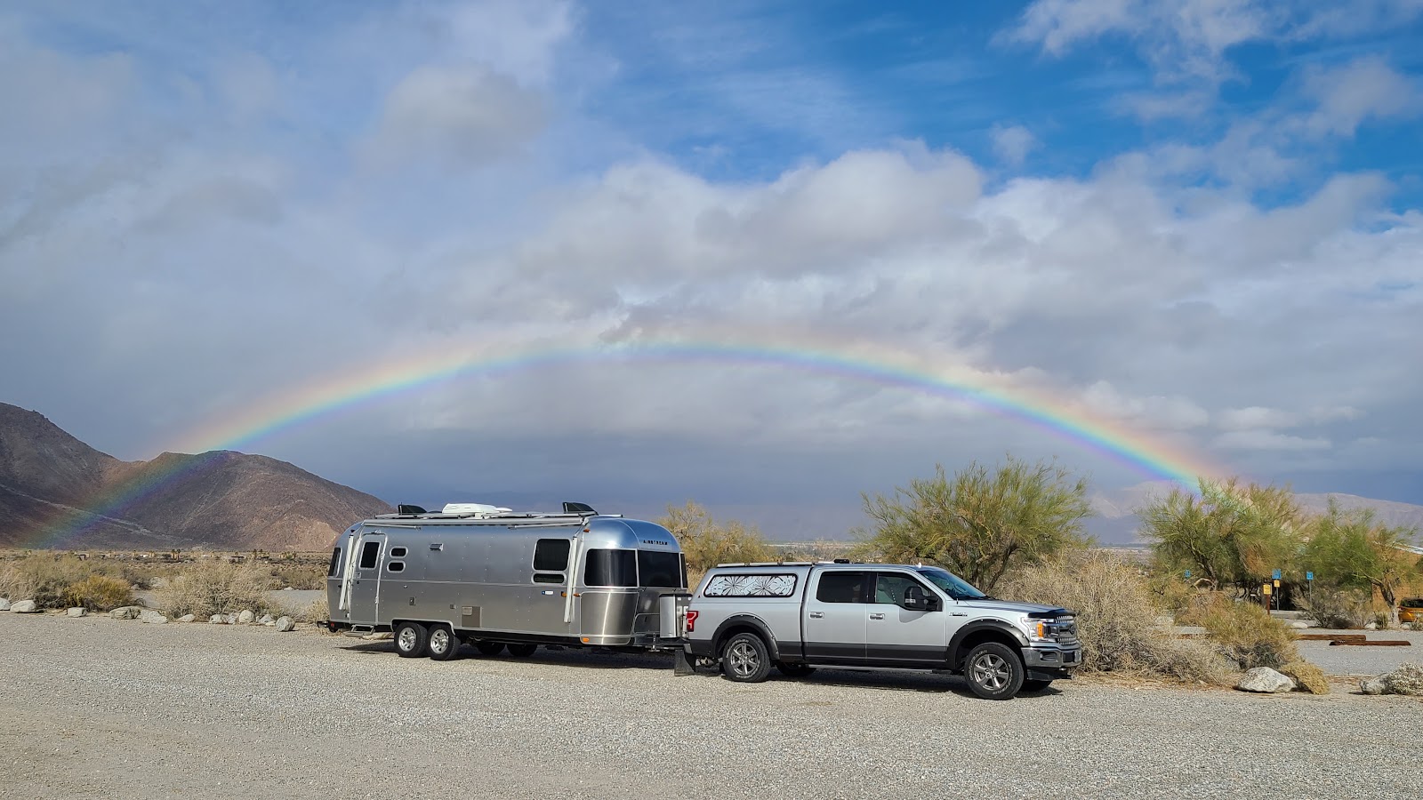
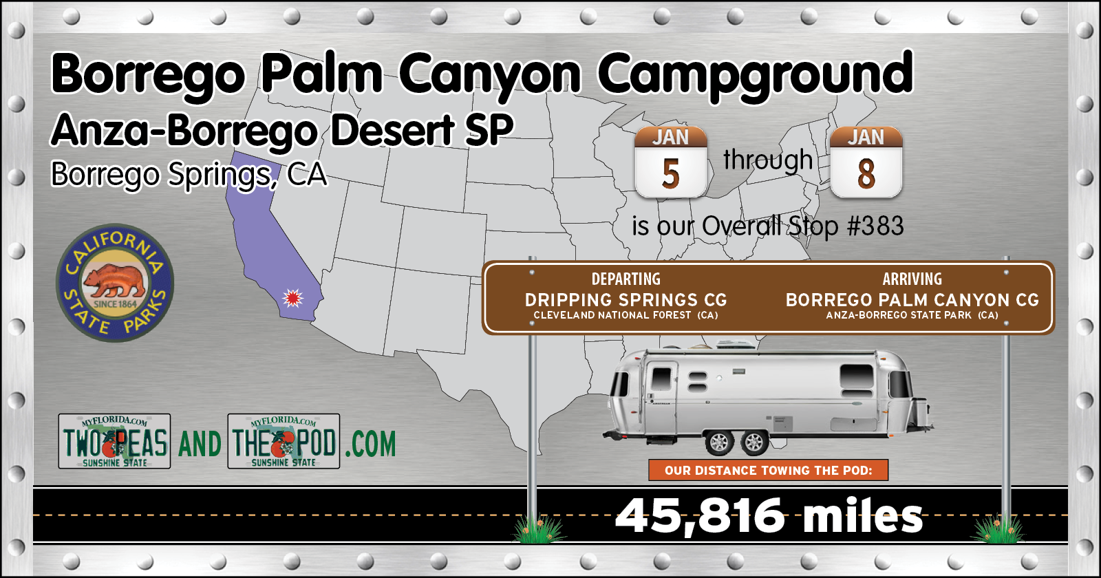
With such a short travel day we ran into a situation we've experienced before. Check-out time at Dripping Springs was 11:00AM and check-in time here at Borrego Palm Canyon isn't until 2:00PM. With only a 54-mile travel day (1½-hours) we arrived at 12:30PM and were politely reminded at the check-in station that we were 1½-hours too early.
They were kind enough to give us a "free parking" pass for the nearby Visitor Center and we were told not to return before 1:45PM to try and check in. There were already several other RVs in the Visitor Center parking lot, so we weren't the only ones that arrived "too early" only to be turned away.
The good news is that it stopped raining when we arrived at the Visitor Center parking lot.
That rainbow briefly turned into a double rainbow before we left the parking lot.
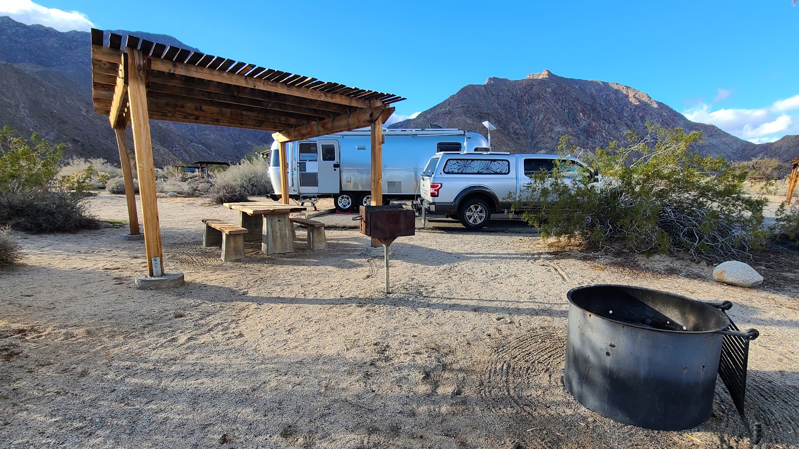
Shortly after 2:00PM we were all setup in Campsite #81 for our 3-day visit.
FRIDAY - We slept in a little late today, 7:00AM, before having breakfast and planning our day of sightseeing.
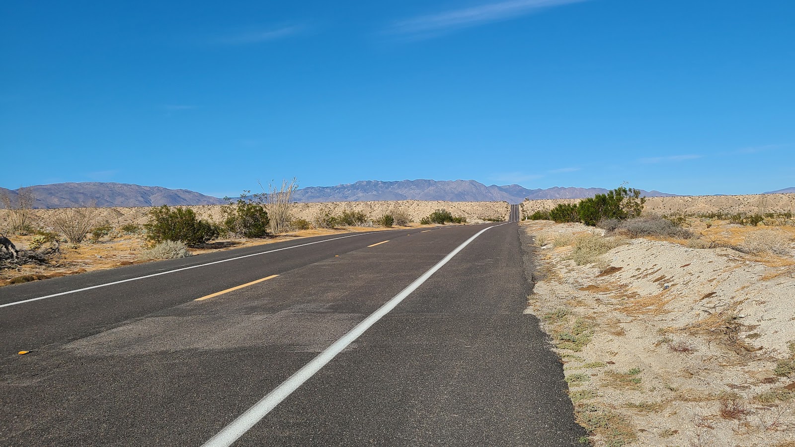
We left THE POD just before 8:00AM and were headed 11-miles east out of town to check out a short hike that was recommended by the Park Ranger yesterday while we explored the Visitor Center.
We didn't even make it two miles down the road before those plans changed! In the center of town is a circle, similiar to what we had back in Hollywood, FL where I used to lived for over 33-years.
Inside this circle is a community park setting where today they were hosting a Farmers Market, complete with music, arts and crafts, jewelery, clothing, fruits and veggies, plus my favorite, baked goods. I picked up a cinnamon swirl the size of my head and Tricia selected a spinach filled croissant, also jumbo sized. We both considered them as breakfast desserts to give us the energy to complete the hike we have planned.
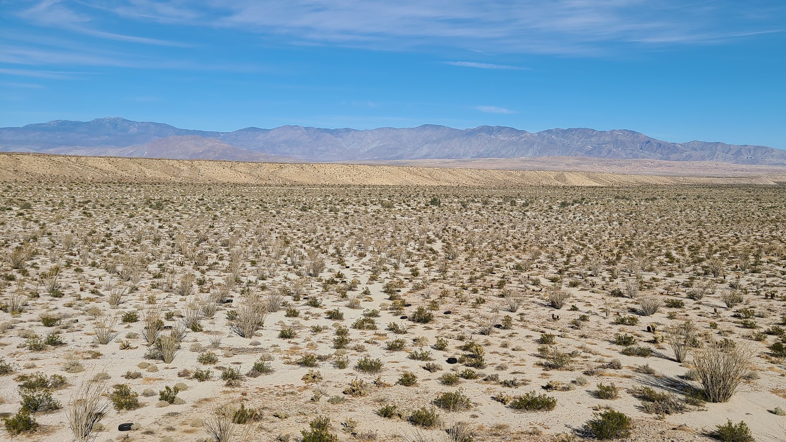
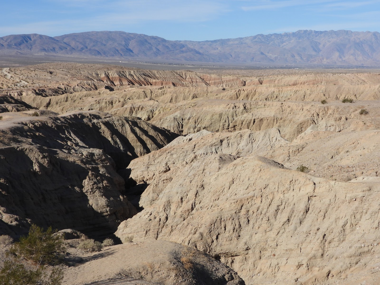
Before we get to the location of the hike we have to drive through a mile wide wash area called The Texas Dip.
This is the place you want to be in the spring when the wildflowers and desert plants are in bloom. Since this area gets a lot of water during the spring the desert colors really come alive in "The Texas Dip".
Looking east from the bottom of the dip...
...and looking west from the exact same location.
Looking north at the floor of the wash.
Once we made it through the wash we still had about 2-miles of paved roadway before we turned off onto a gravel road and traveled another 1¾-miles to the trailhead.
When we arrived at the trailhead I was a little surprised to find six other vehicles already there. A group of three hikers were just getting ready to begin their hike so we waited a few minutes before hitting the trail.
You can make this hike as short or as long as you want. The trail quickly decends to the bottom of the canyon and from there is just keeps going and going and going. We hiked in about ½-mile before turning back and heading for the truck.
At that distance we got a real good feel for what the hike was like, but cut it short because we have more planned for today.
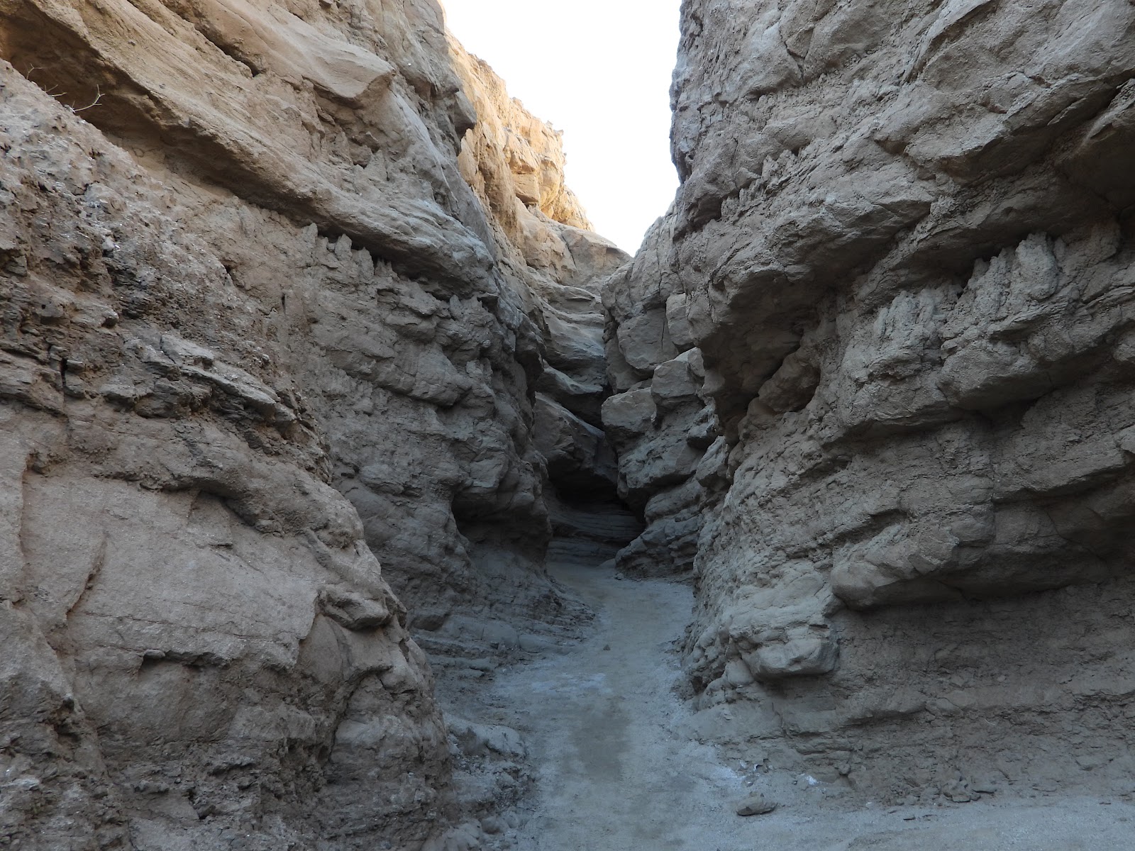
THE SLOT
 Standing at the trailhead you can see just how far of a hike this could be.
 It wasn't long before we thought we had reached the bottom of the slot canyon.
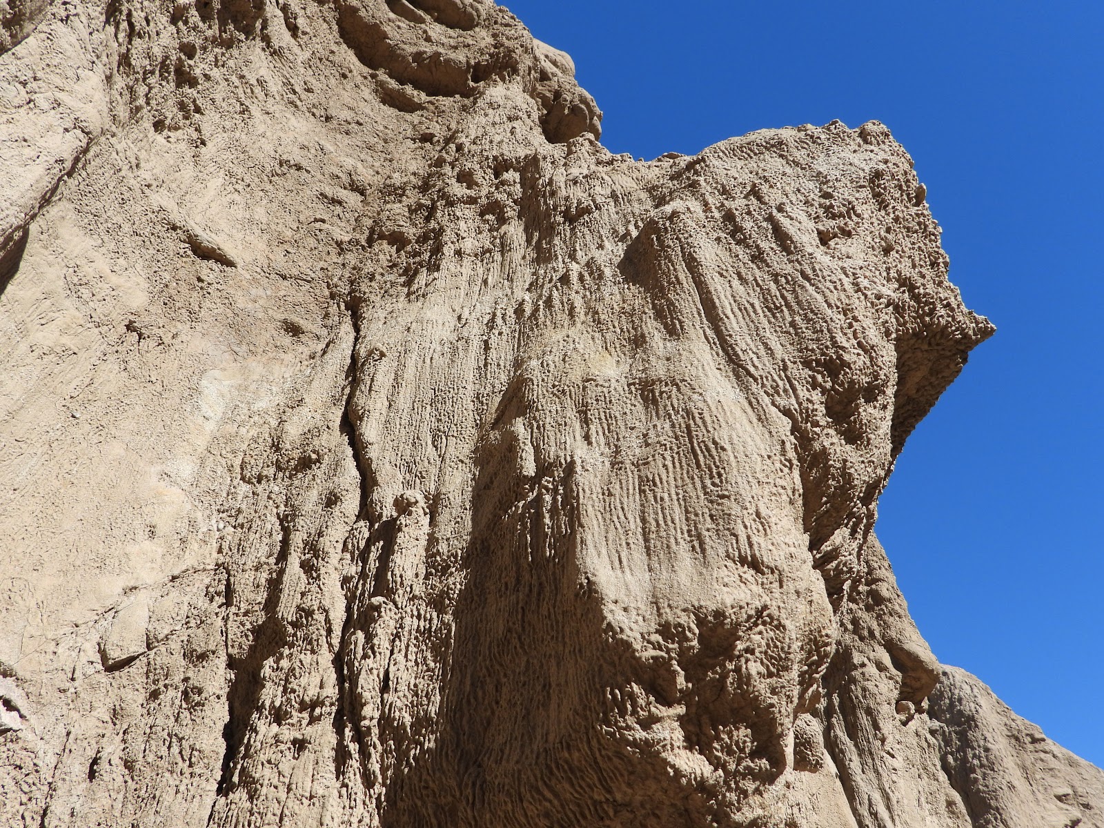
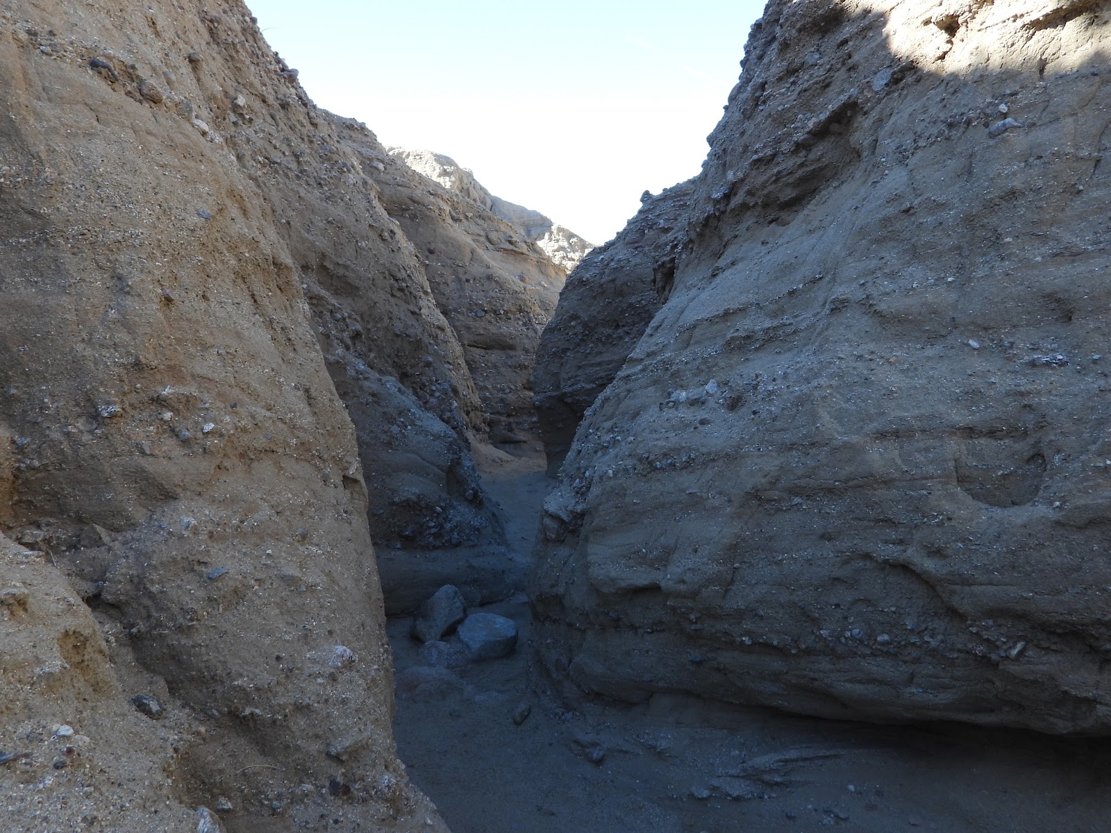 This is pretty typical of the slot canyons we have visited so far.
 With a slight breeze blowing through the canyon it was chilly in the shadows.
 Looking up over our shoulders we could see just how deep the canyon was.
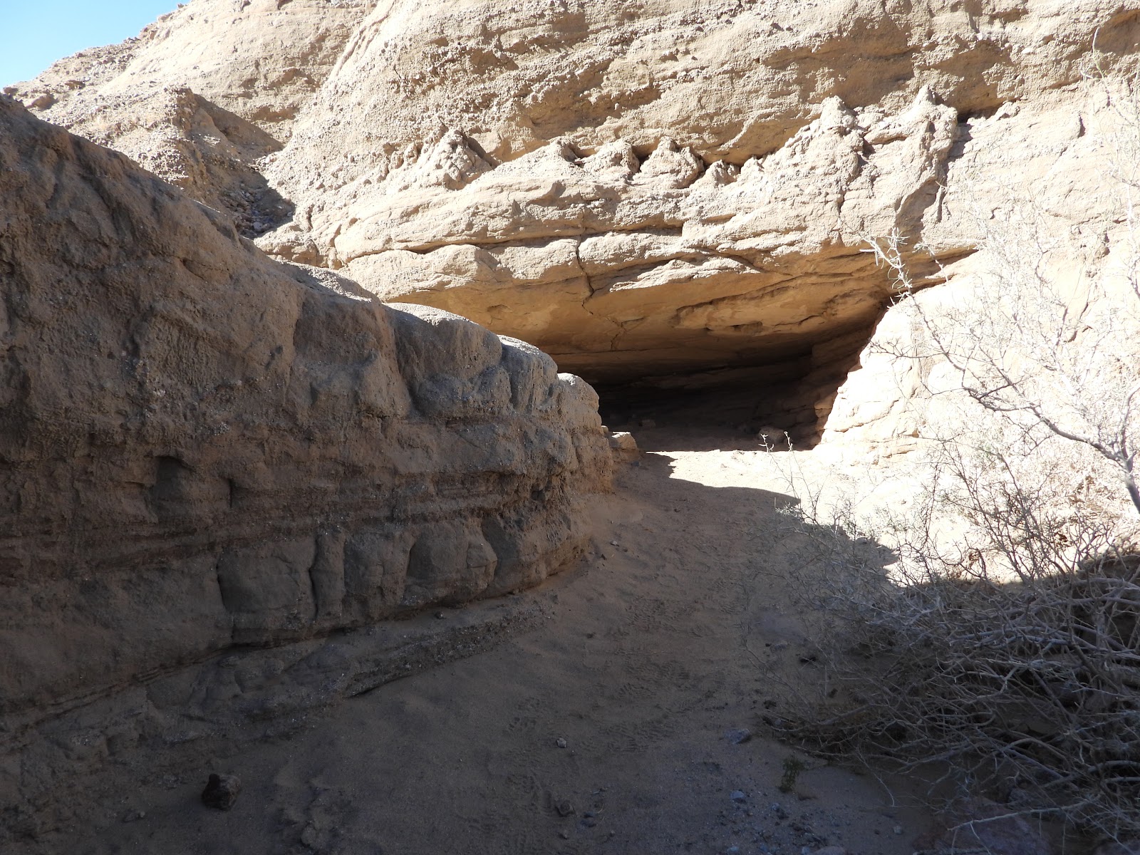
 At this point we headed towards what was almost a cave like setting.
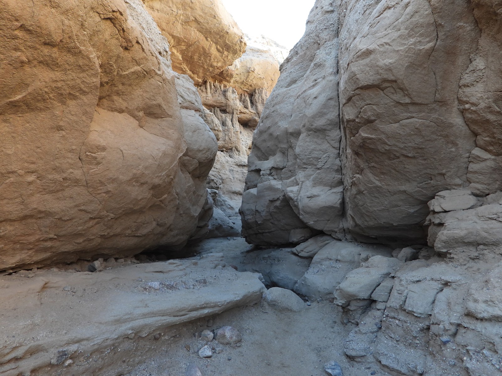
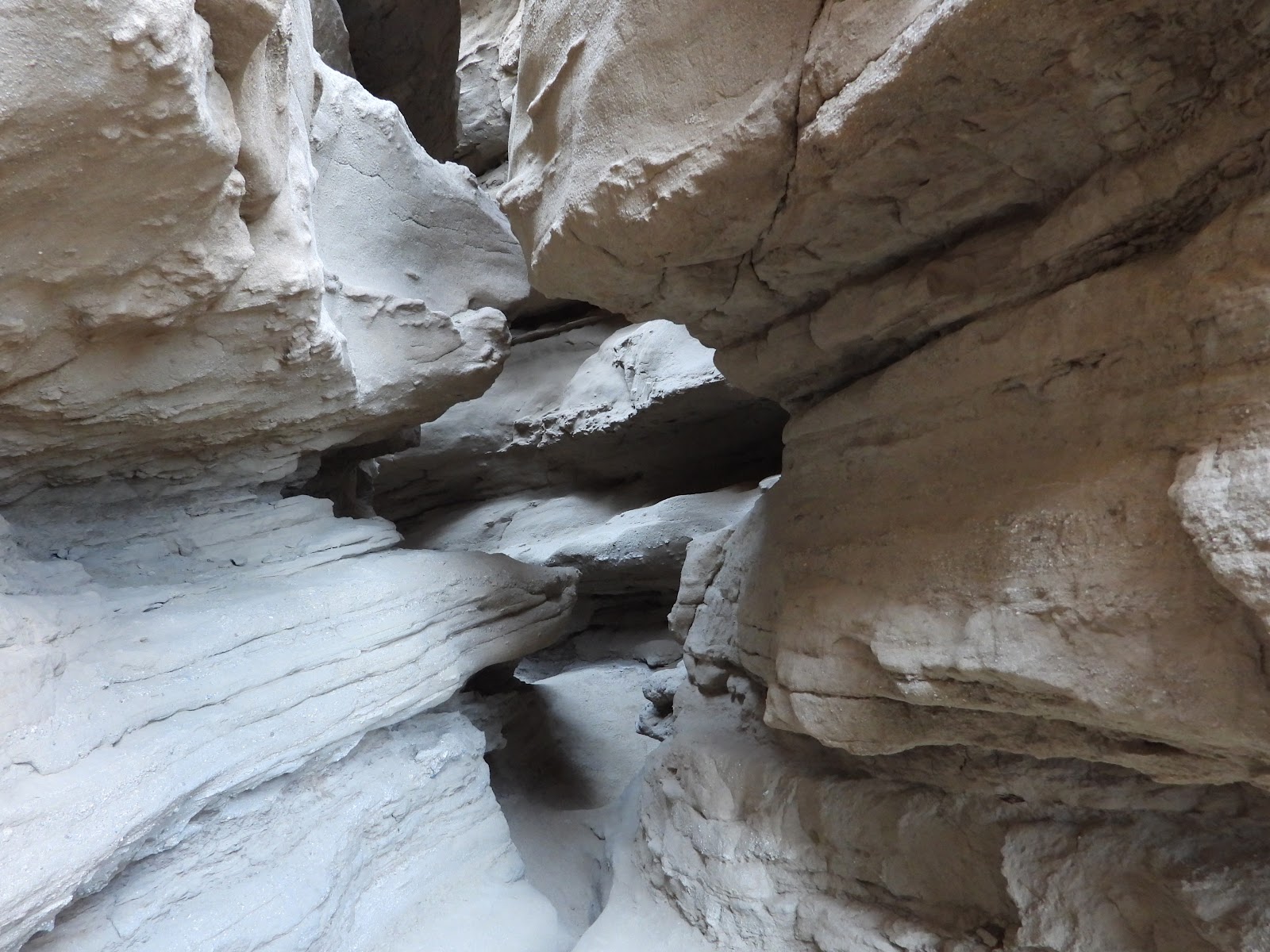 We turned around here where the canyon got very narrow.
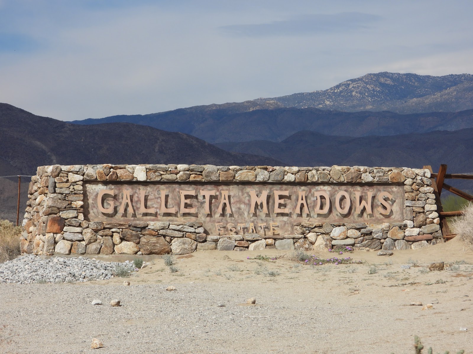
For the rest of the morning we drove all around the desert just south of the town of Borrego Springs, where we saw dozens of metal art installations that are part of the Galleta Meadows "Sky Art Sculptures" collection.
We saw about a third of the entire collection today and will share our photos in tomorrow's slide show after we see the rest of them.
SATURDAY - This morning at 9:00AM we took a 1-hour Ranger led nature walk through the Visitor Center's Garden. Afterwards we headed out to "collect" photos of the rest of the metal art sculptures, this time north of town.
It seems a majority of the "more photographed" and therefore, "more famous" sculptures, are on this side of town.
Overall there are more than 100 of these metal sculptures scattered around the desert outside of Borrego Springs. They can be found in "26 groupings" and they fall into 1 of 3 different categories.
The categories are "Fossil Treasures of the Anza-Borrego Desert", "History and Nature of the Anza-Borrego Desert" and "Whim and Fantasy". I'll let you figure out which ones belong to which category.
Trust me when I say Tricia has a photo of each and every one of these sculptures, but I'm only going to show you about half of them here in the slideshow.
Galleta Meadows
Sky Art Sculptures
 Only the letters are made out of metal on this one!
 Just to give you an idea of how big some of these sculptures are!
This one is described as a Columbian Mammoth. FT-11
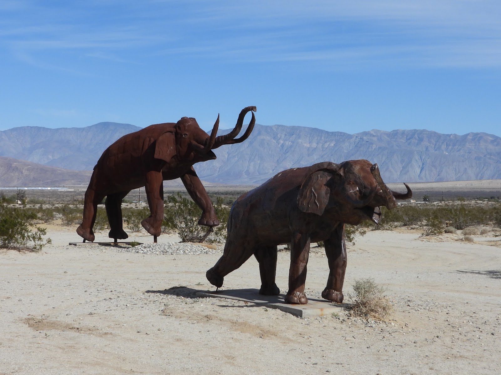 These are also part of the Columbian Mammoth grouping. FT-11
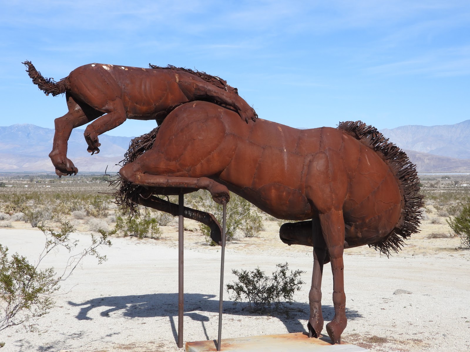
 These are part of the Extinct Horse grouping. FT-10
 More of the Extinct Horse grouping. FT-10
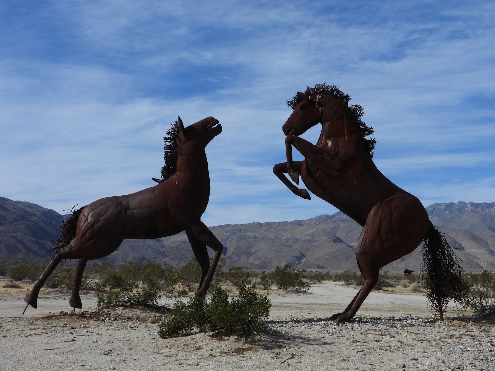 And even more of the Extinct Horse grouping. FT-10
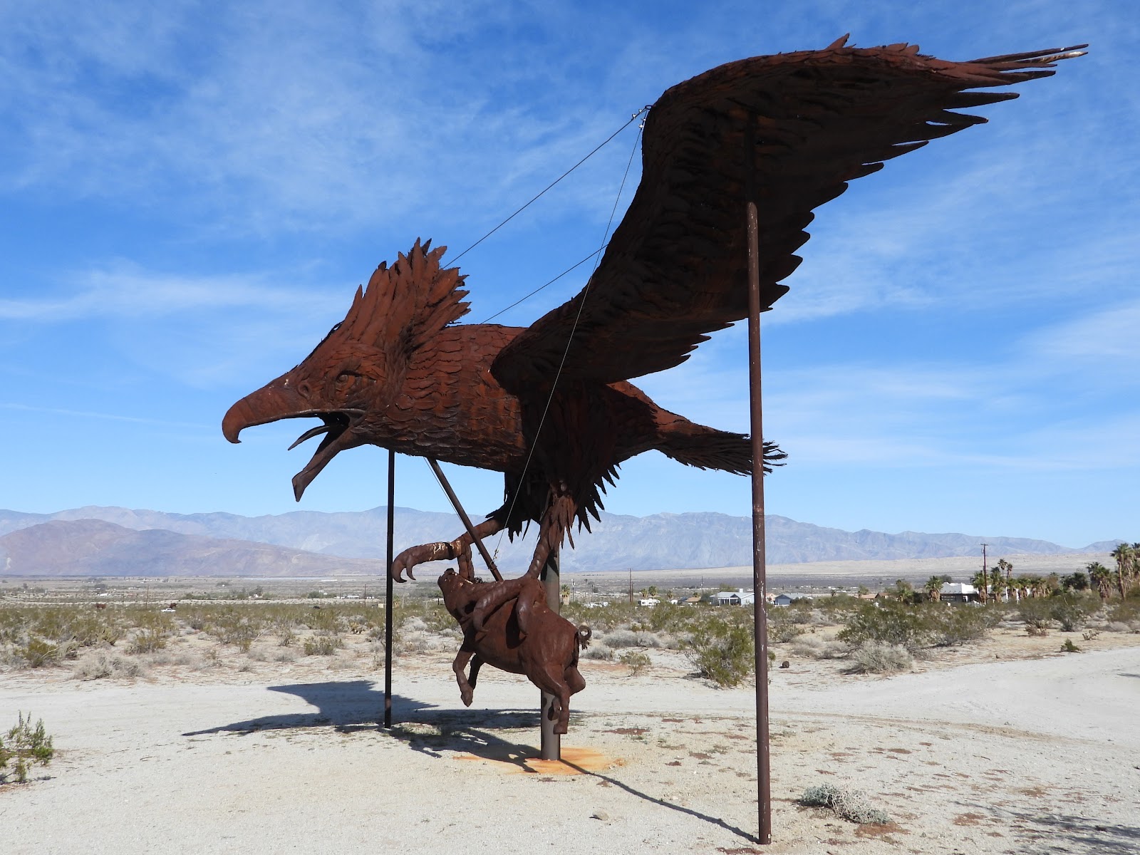
 This is described as "Aiolornis in Nest". FT-9
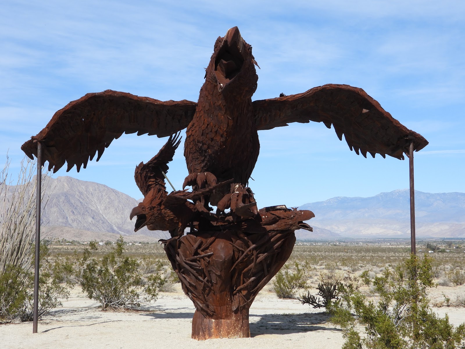 A view from another angle of "Aiolornis in Nest". FT-9
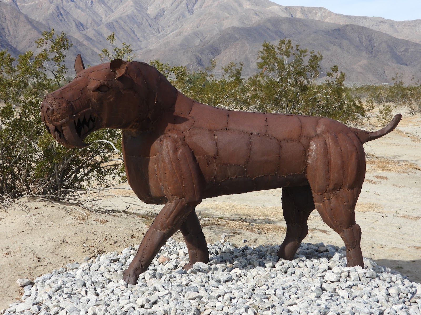
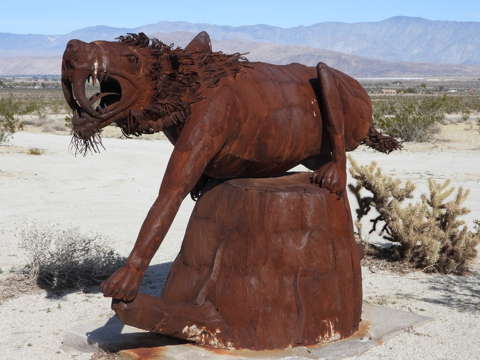 This is part of the "Gracile Sabertooth Cat/Extinct Horse" grouping. FT-8
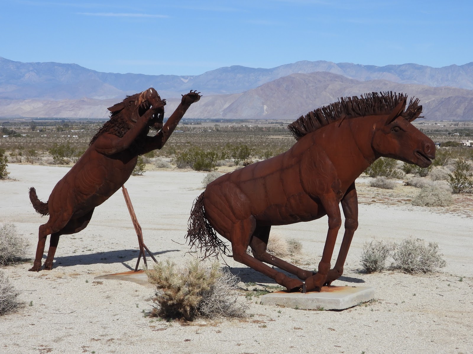 As you can see the "Gracile Sabertooth Cat and Extinct Horse" didn't really get along. FT-8
 More action from the "Gracile Sabertooth Cat and Extinct Horse" grouping. FT-8
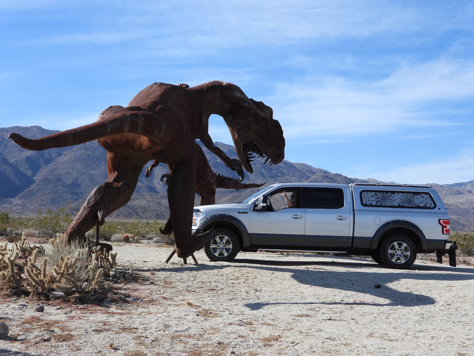
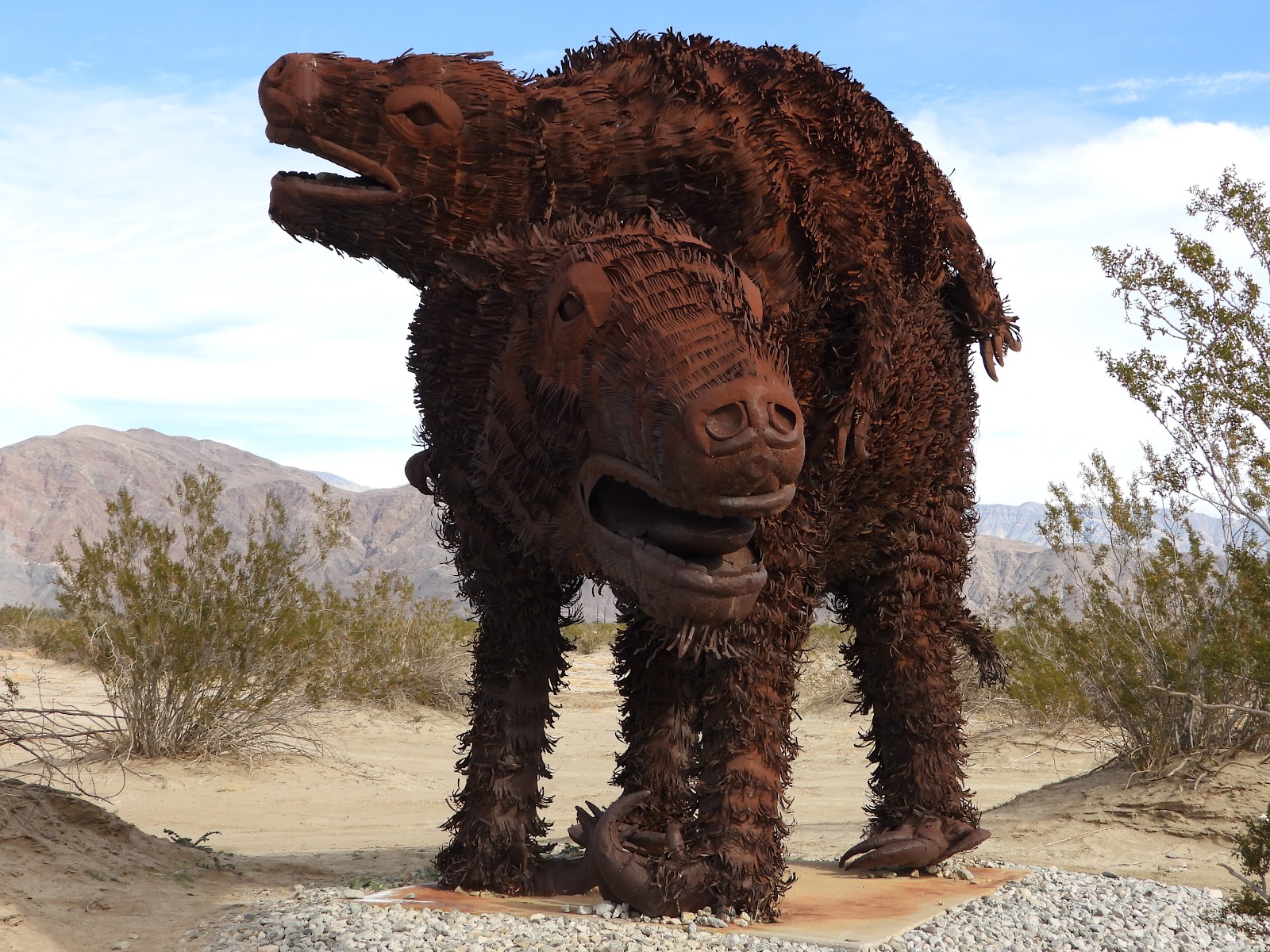
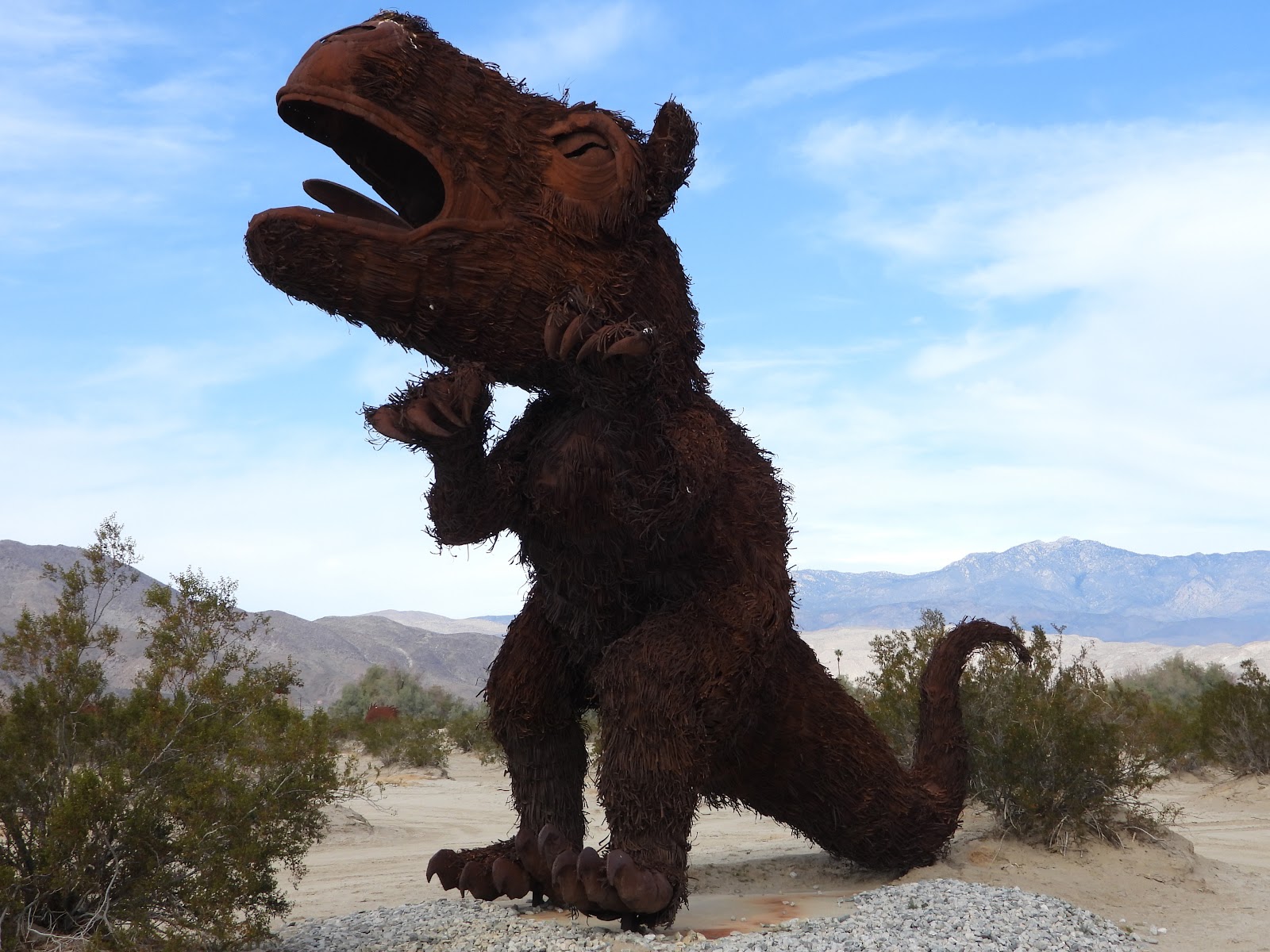
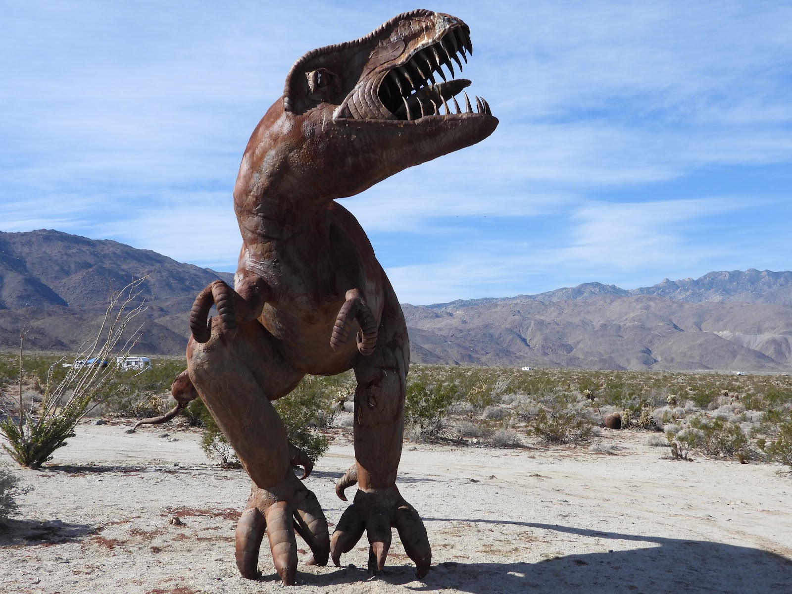 Here is one of everybodies favorites, "Tyrannosaurus Rex". WF-6
 There were a couple of baby "T-Rex"s running around too. WF-6
 They were pretty scary even at a young age. WF-6
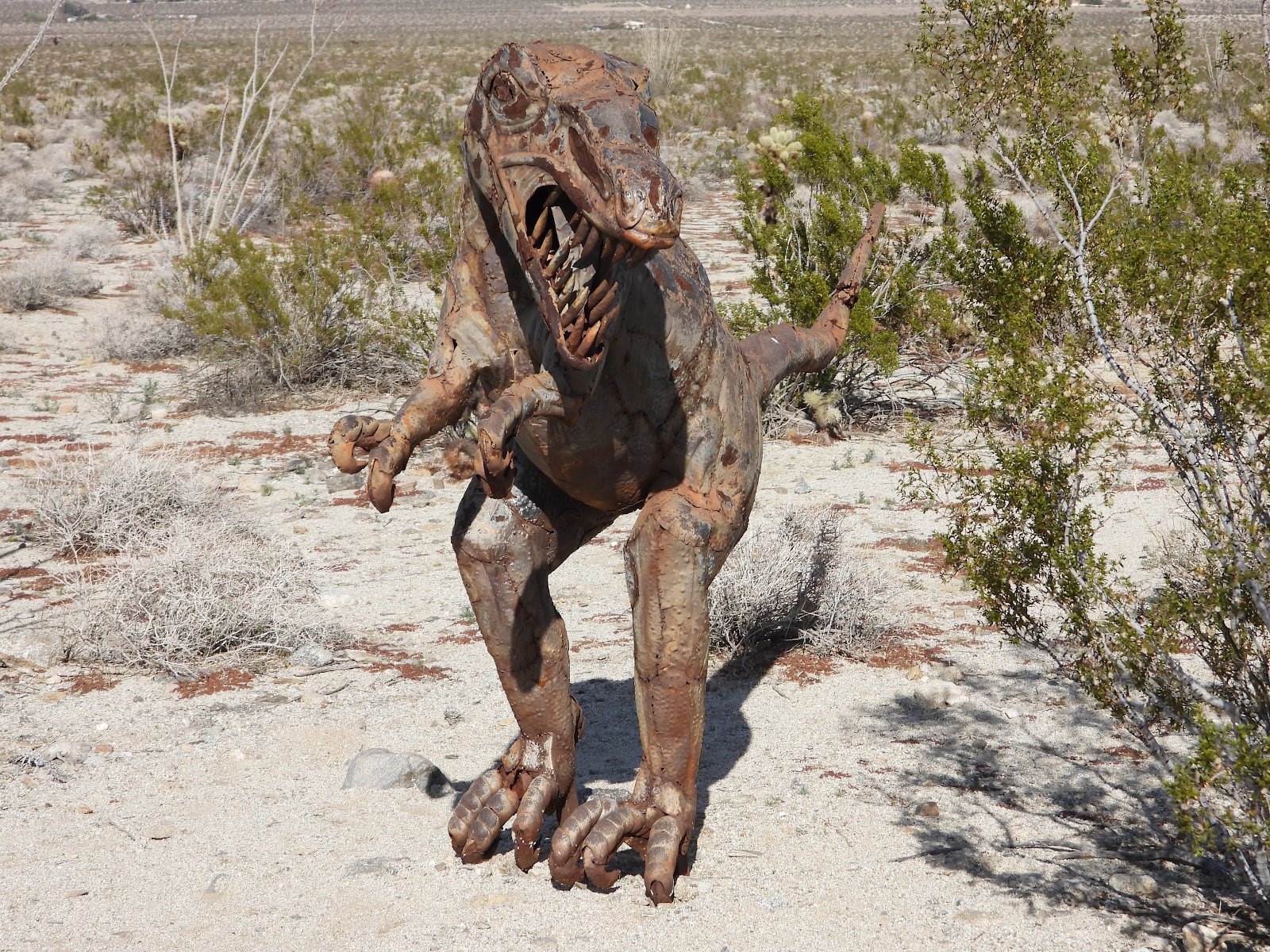
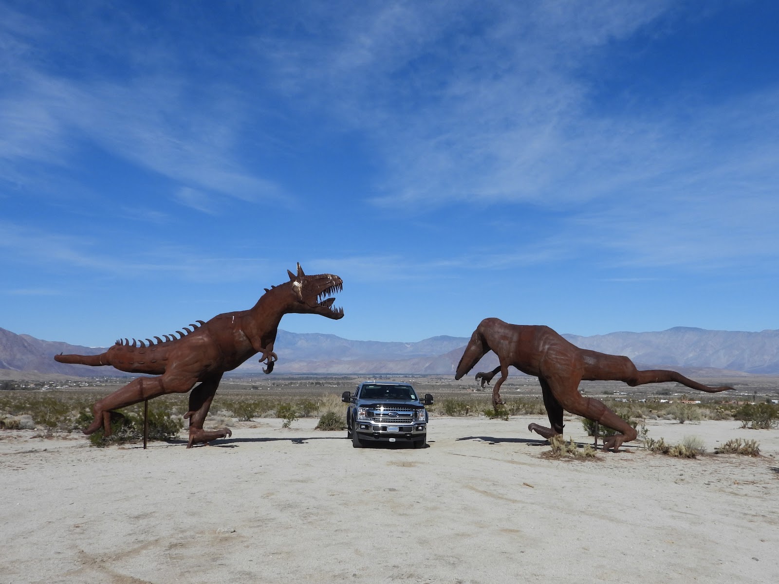 Across the road I got between a couple of "Utahraptors" to try and break up a fight. WF-5
 Even with my harsh scolding of one of them they didn't back down. WF-5
 As a matter of fact I think I just made him even more angry. WF-5
 This one seemed to be laughing at me for trying to break up the fight. WF-5
 This one is described as "Aiolornis with Prey". FT-12
 This one is described as a "Gomphothere". FT-7
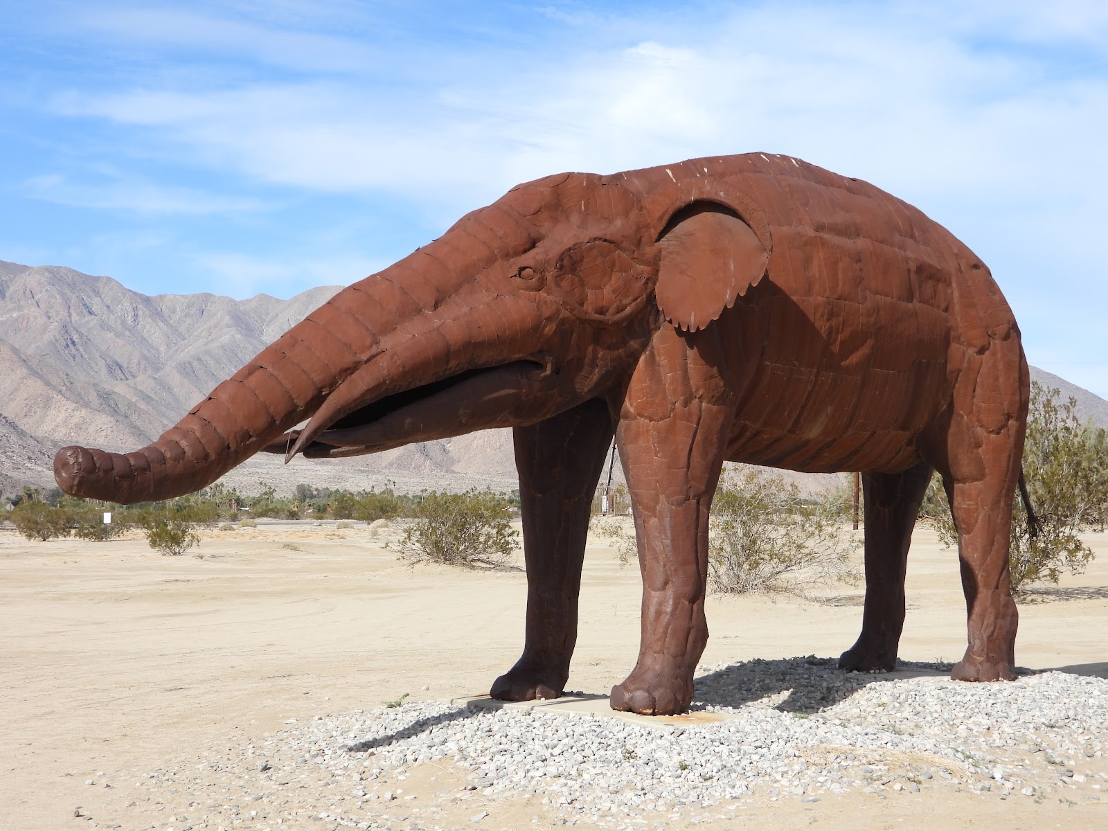 Another "Gomphothere". FT-7
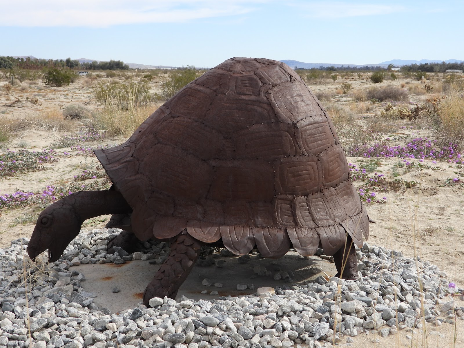
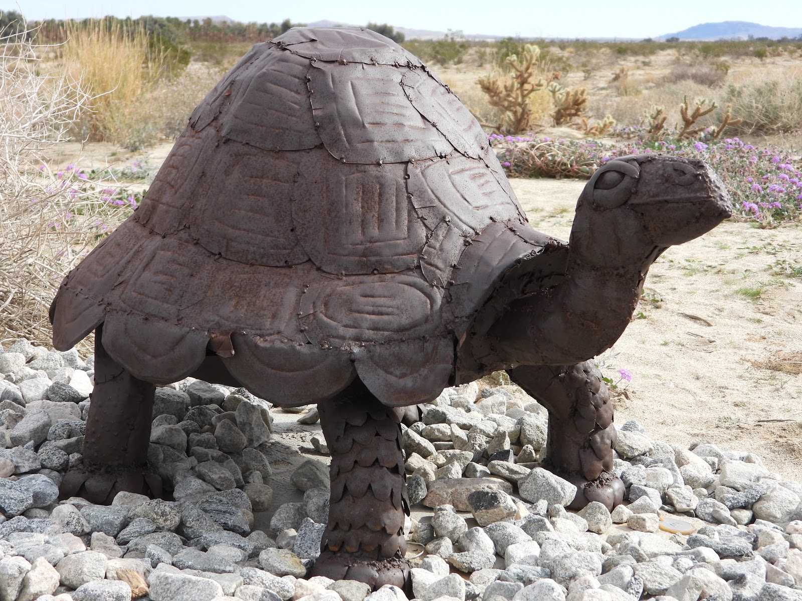
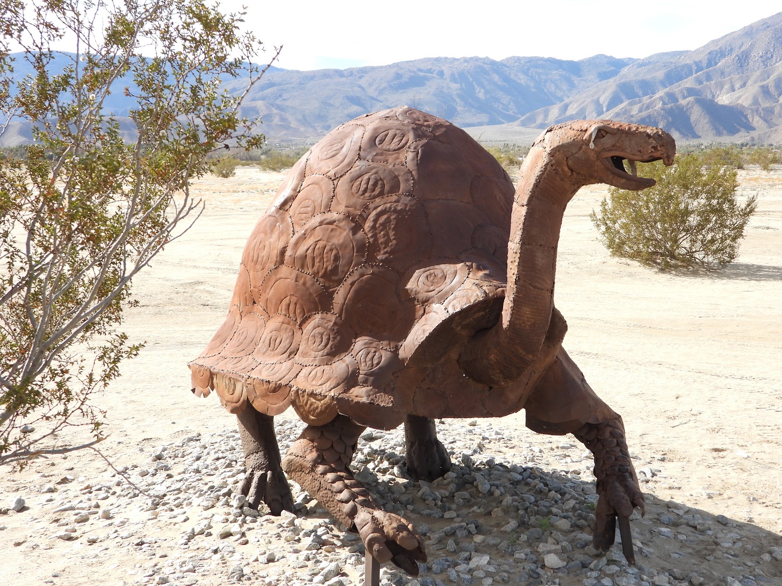 This one is described as a "Giant Tortoise". FT-7
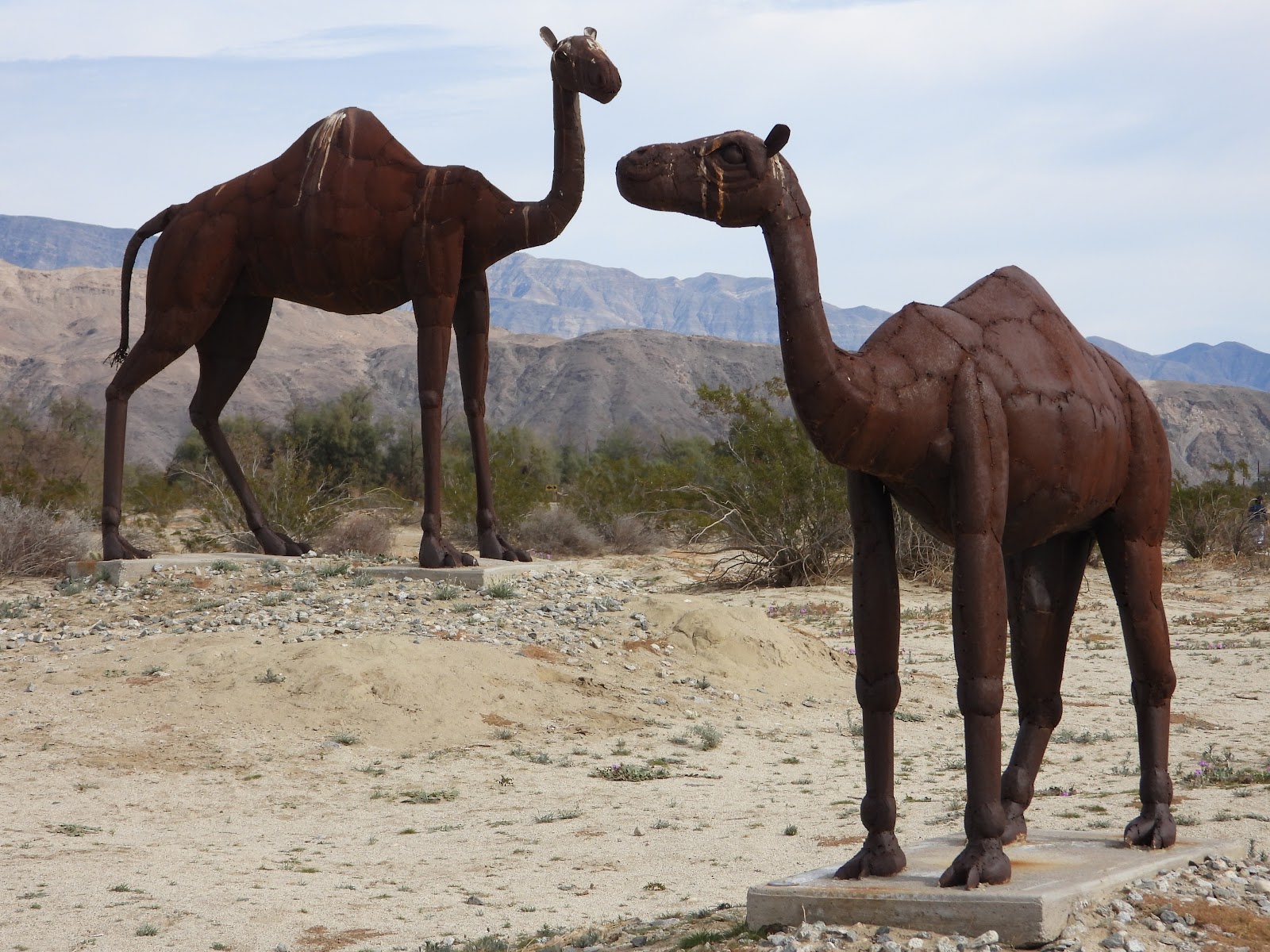
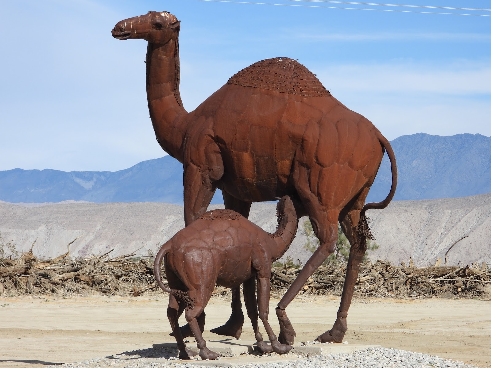 This one is described as a "Camelops". FT-7
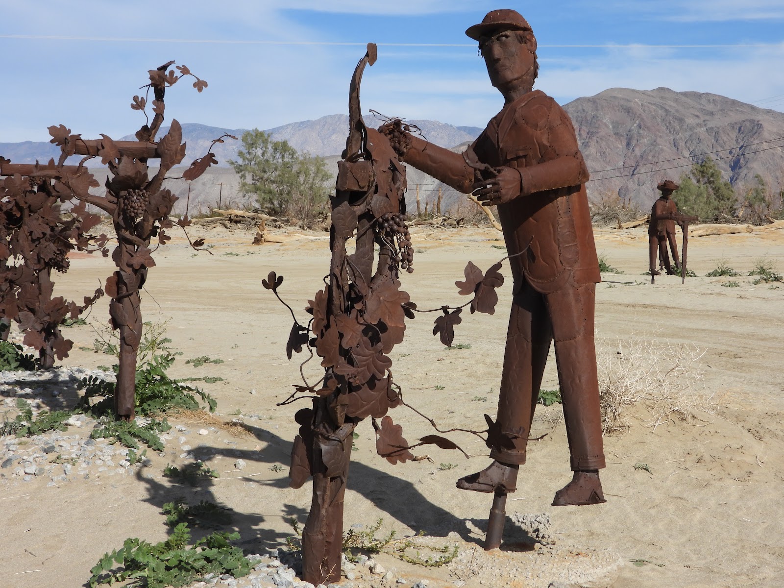 This one is described simply as "Farm Workers". HN-7
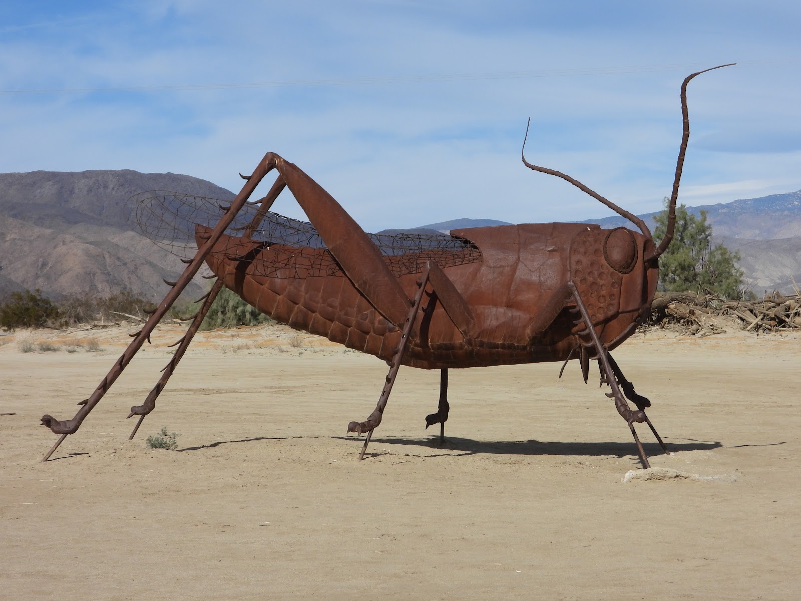 Another one of the favorites is the "Grasshopper". HN-6
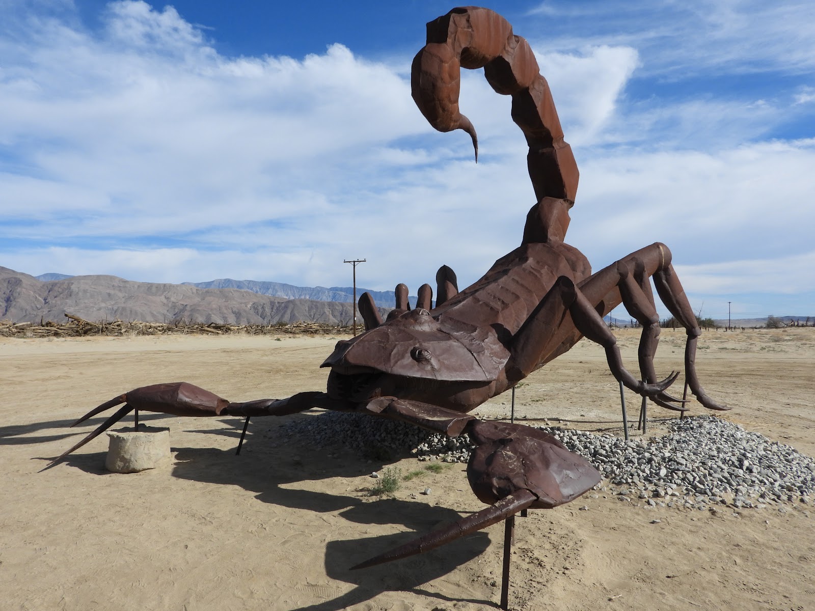 And just a few feet away is the "Scorpion". HN-6
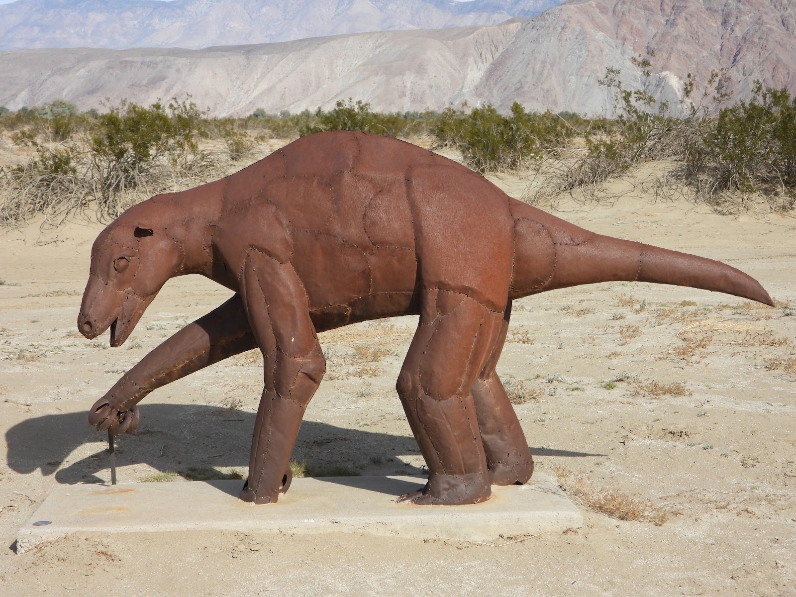 This is part of the "Shasta Ground Sloth" grouping. FT-6
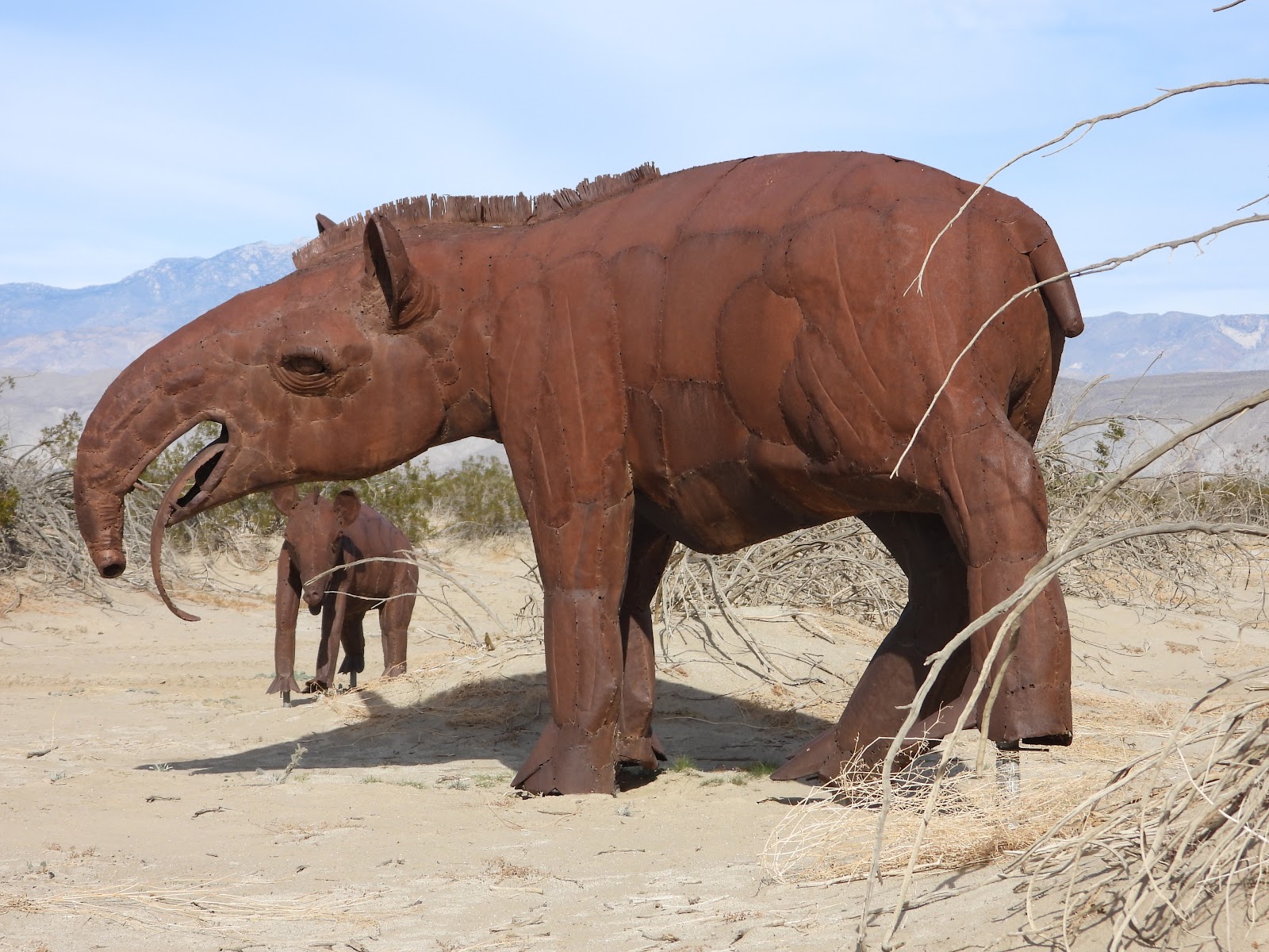 This one is described as "Merriam's Tapir". FT-5
 Another angle of "Merriam's Tapir". FT-5
 This one is described as a "Gracile Sabertooth Cat". FT-5
 This one is described as a "Peccary". FT-5
 A "Camelops". FT-4
 I'm really not sure what this one is...
 ...or this one either!
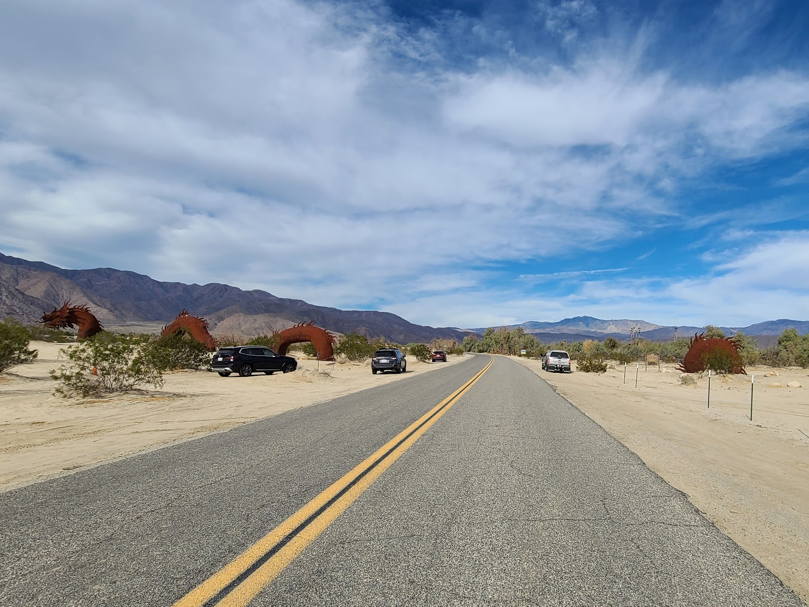 "The Serpent" is so large it straddles both sides of the road. WF-1
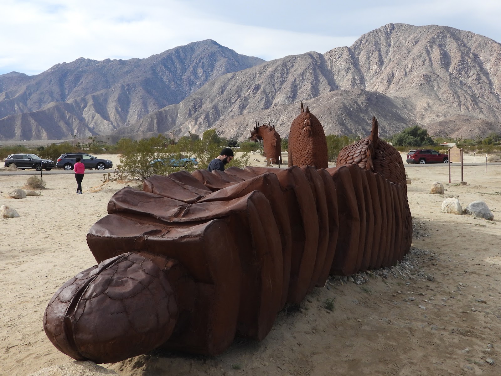 This view is from the tail end of The Seprpent" looking towards the head. WF-1
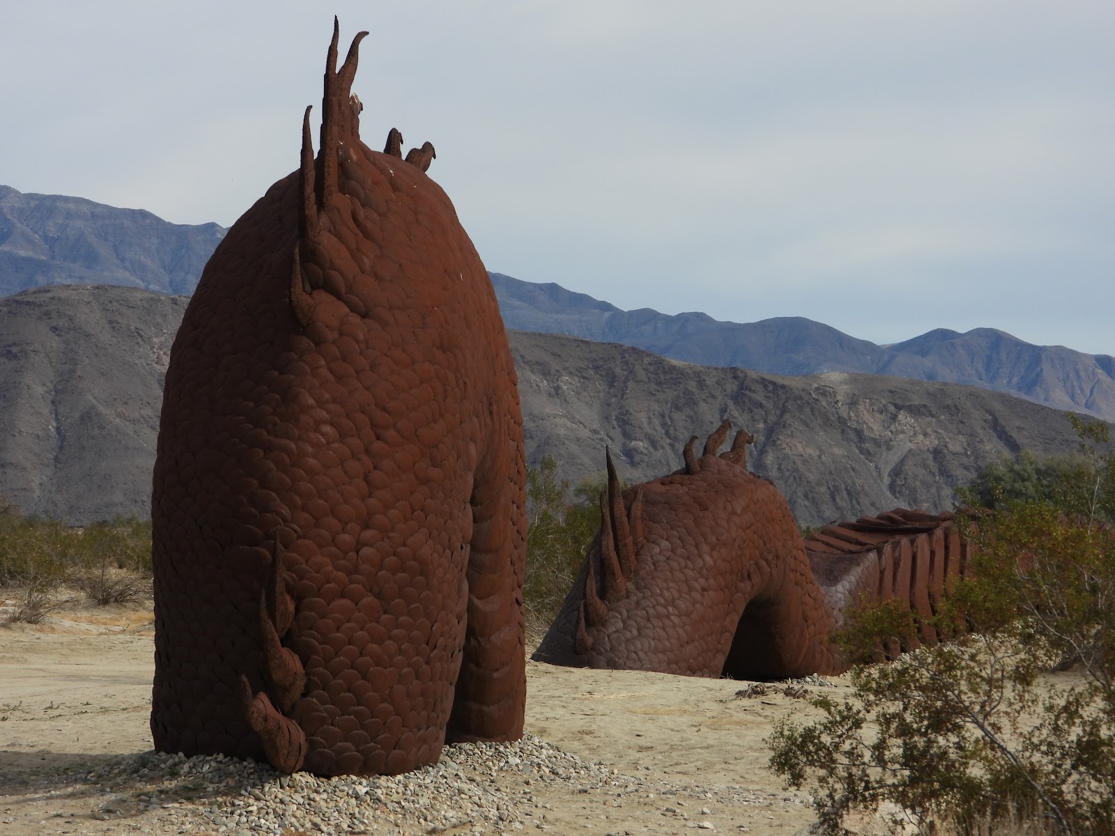 This is the tail section on the east side of the road. WF-1
 And this is the head section on the west side of the road. WF-1
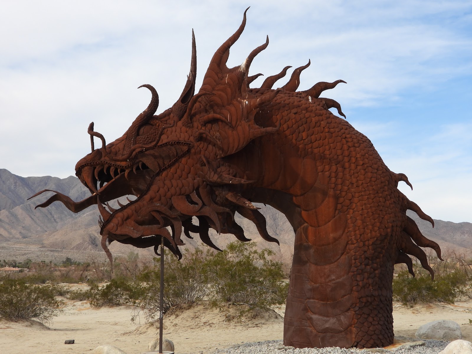 There were a lot of people waiting to have their picture taken in front of the Serpent's head. WF-1
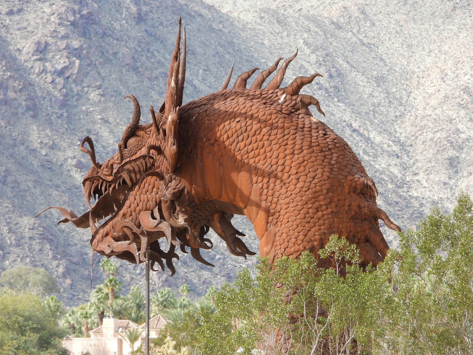 There is quite a lot of detail that went into creating this one. WF-1
 These are more "Camelops"... FT-3
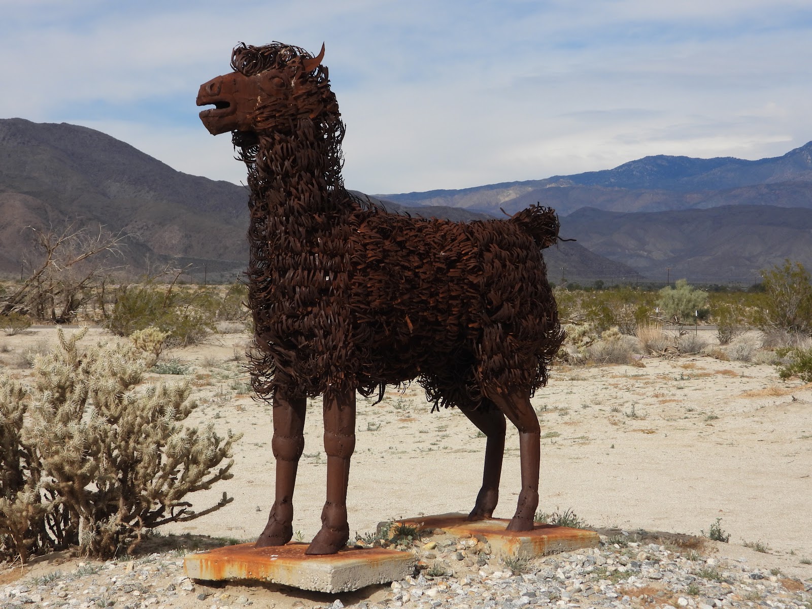 ...and "Llamas". FT-3
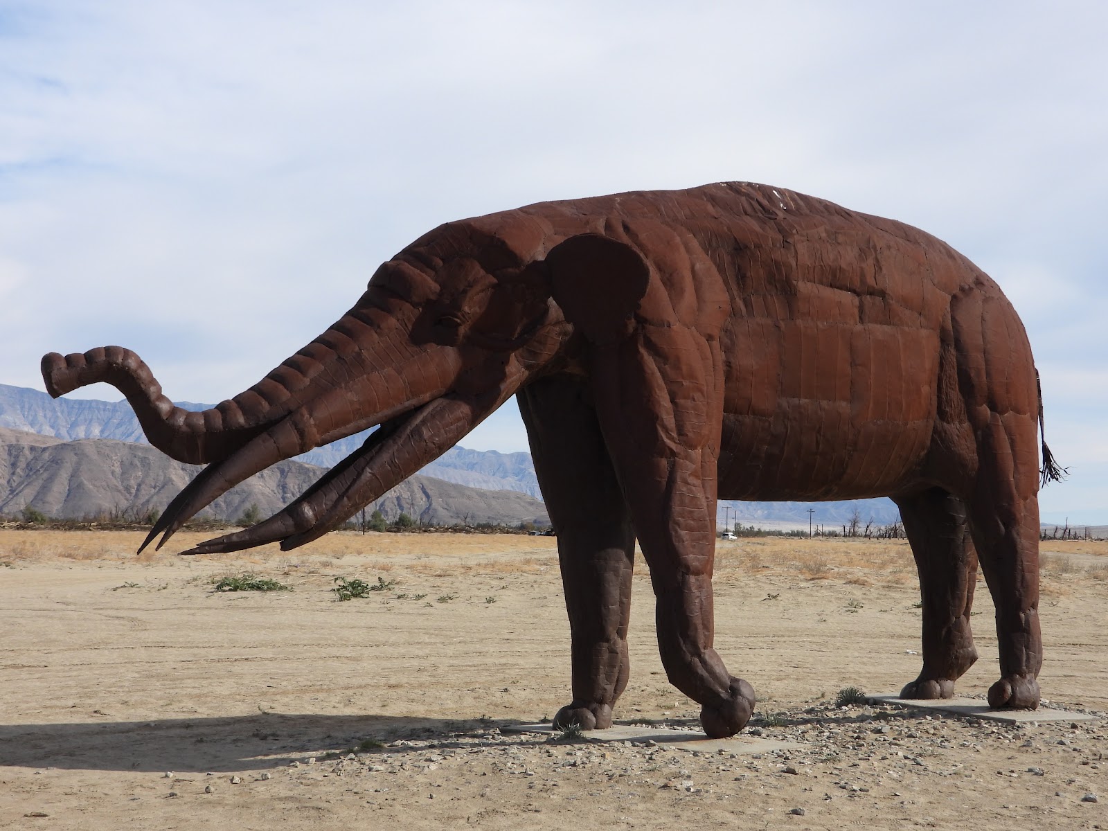
 This one is described as an "African Elephant"... FT-2
 ...and so is this. FT-2
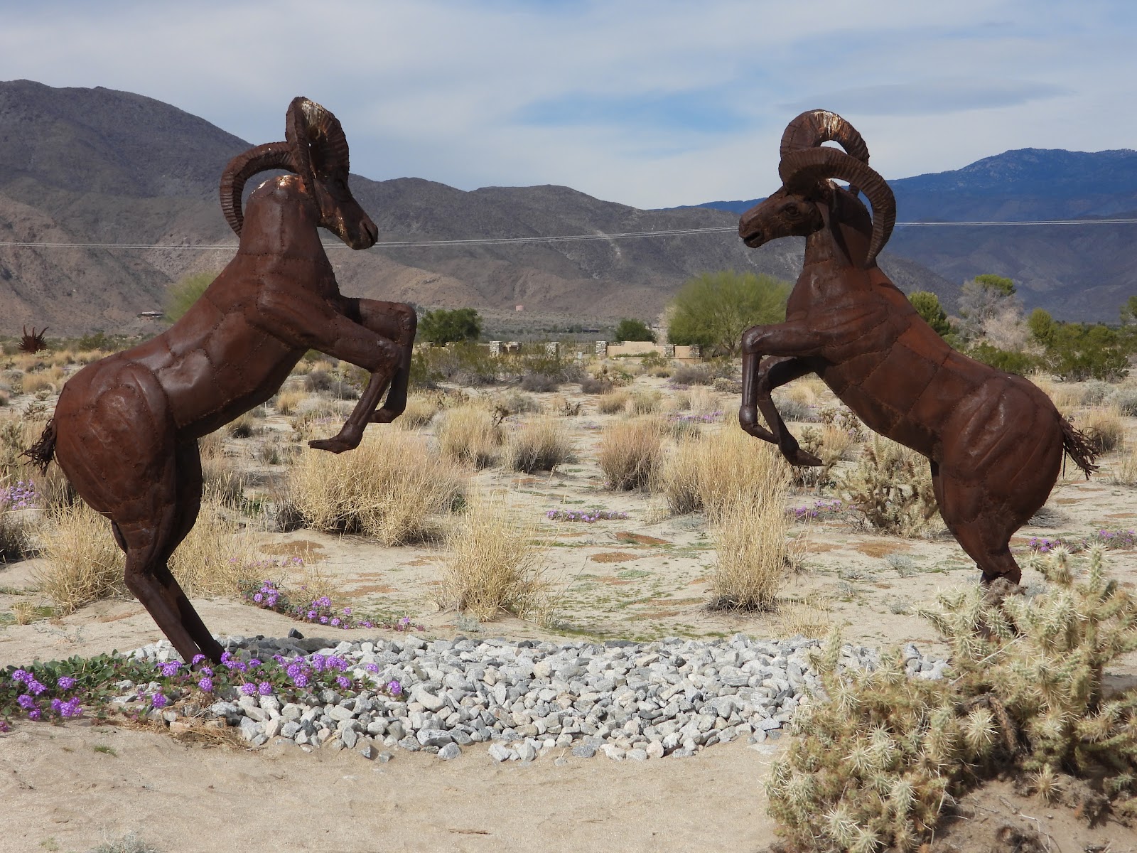 These are part of the "Big Horn Sheep" grouping. HN-5
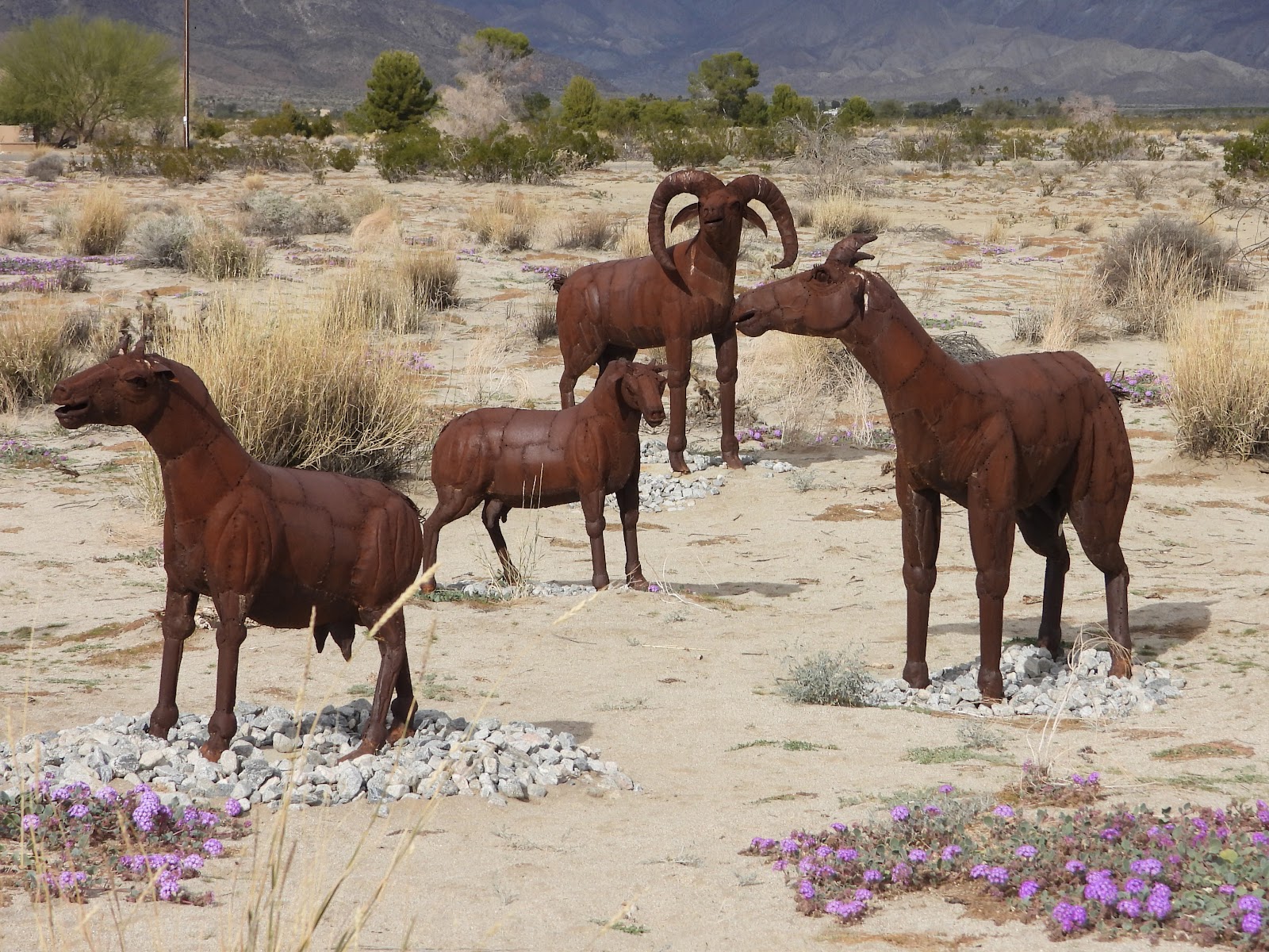 More of the "Big Horn Sheep" grouping. HN-5
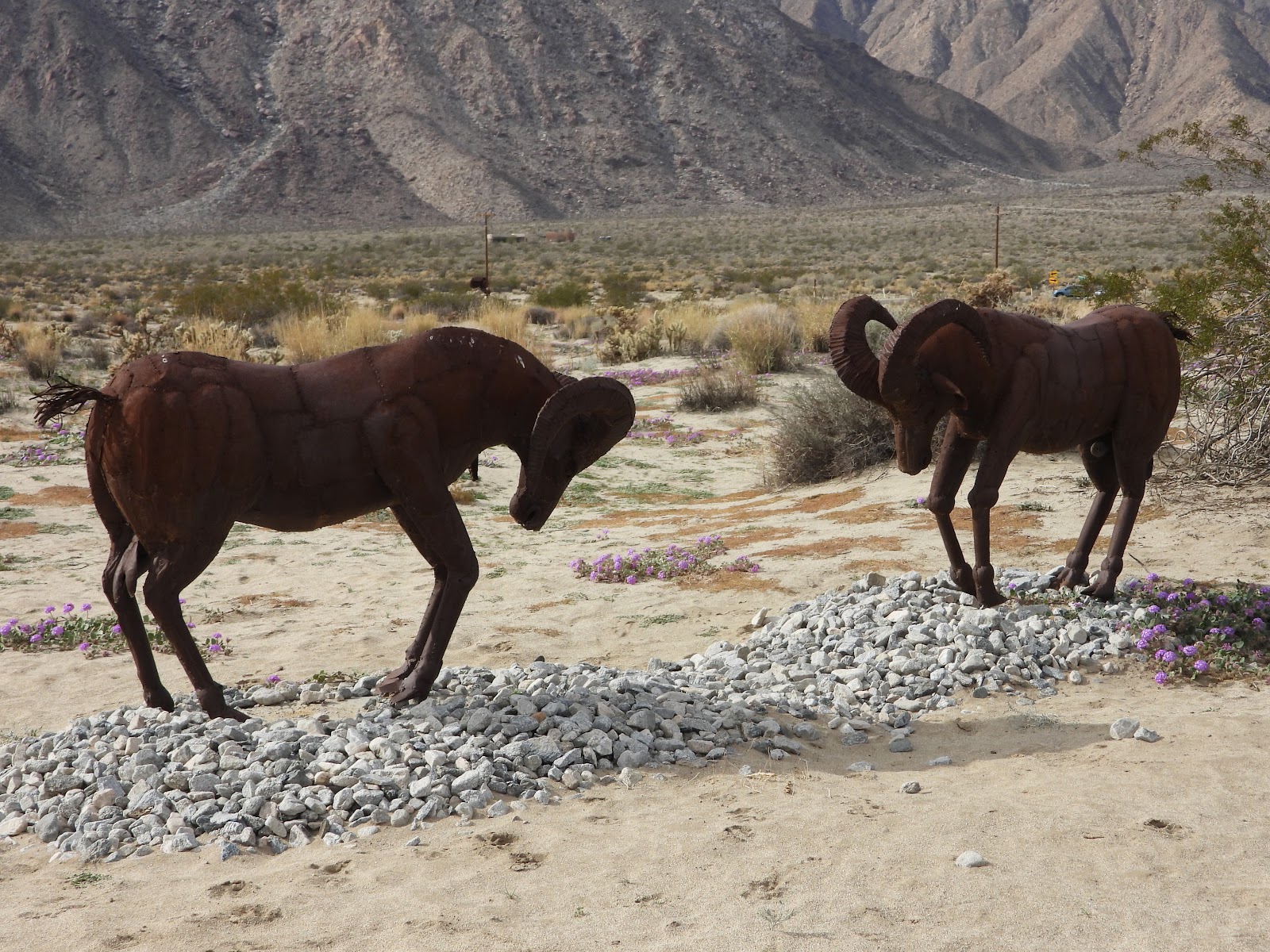 Even more of the "Big Horn Sheep" grouping. HN-5
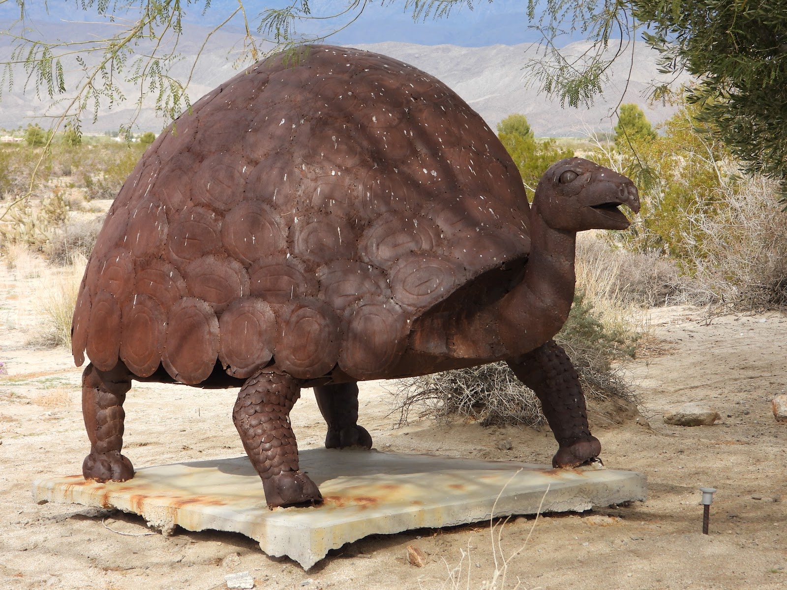 This is part of the "Giant Tortoise" grouping. FT-1
 More of the "Giant Tortoise" grouping. FT-1
 Even more of the "Giant Tortoise" grouping. FT-1
 This guy looks happy to be here! FT-1
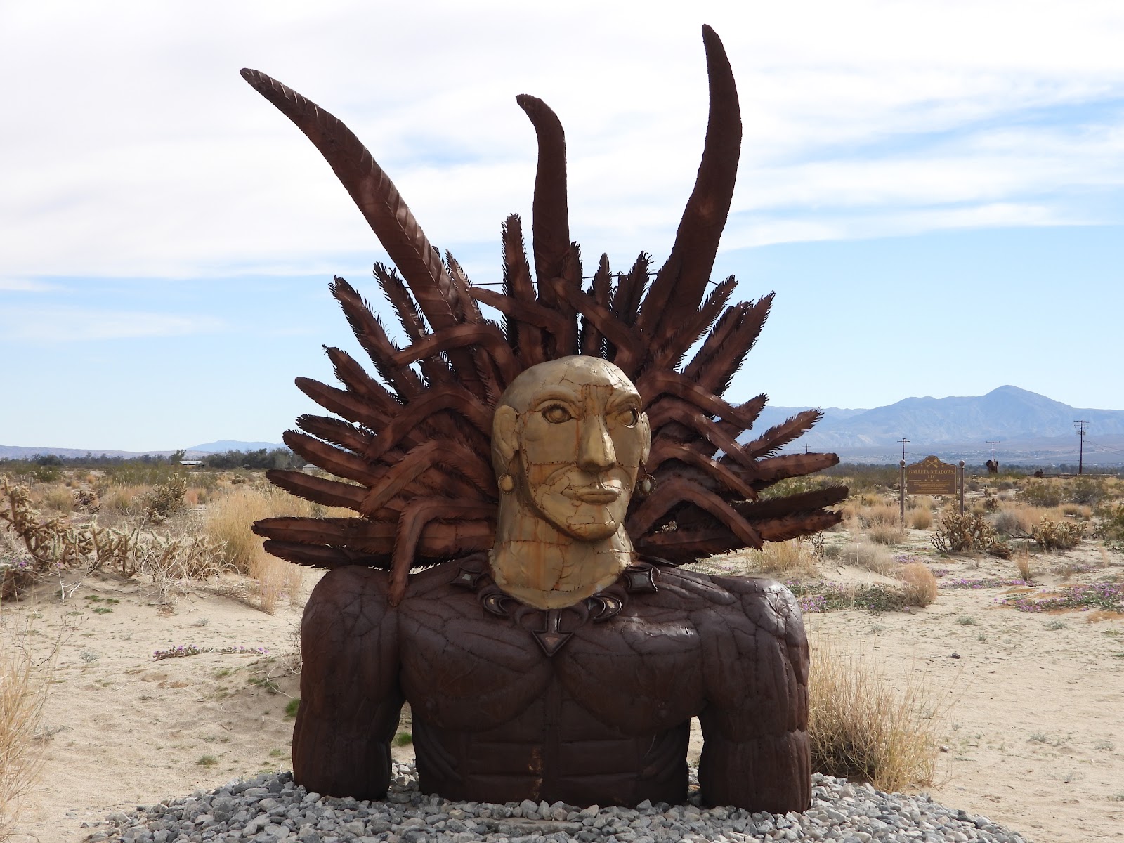 Another one of the favorites is "The Indian Head". HN-4
 This one is called "The Gold Miner". The horse can't seem to shake that bird off his ear! HN-1
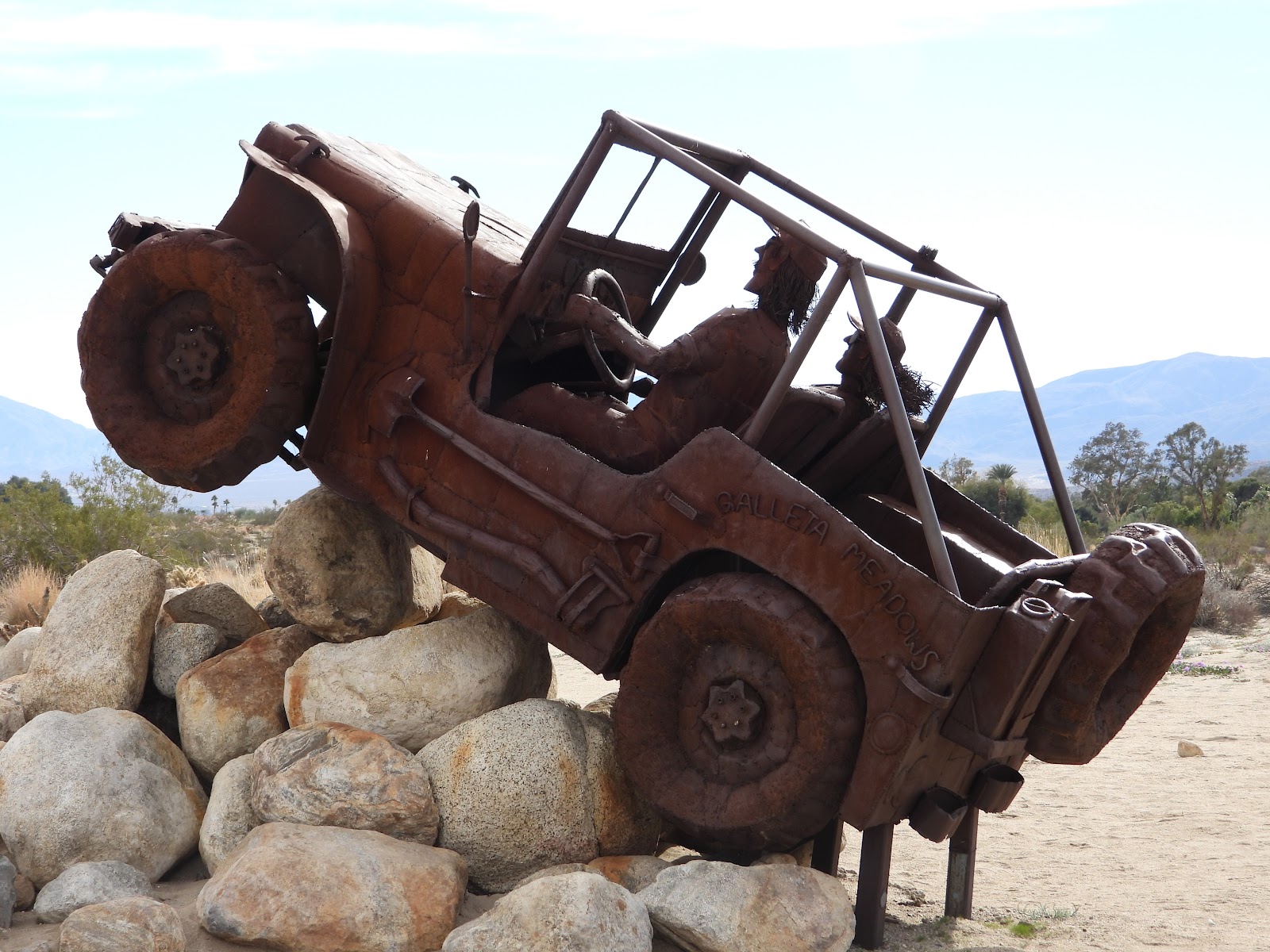 Last but not least is the "1946 Willys Jeep". HN-3
Would you like to be notified of new blog posts?