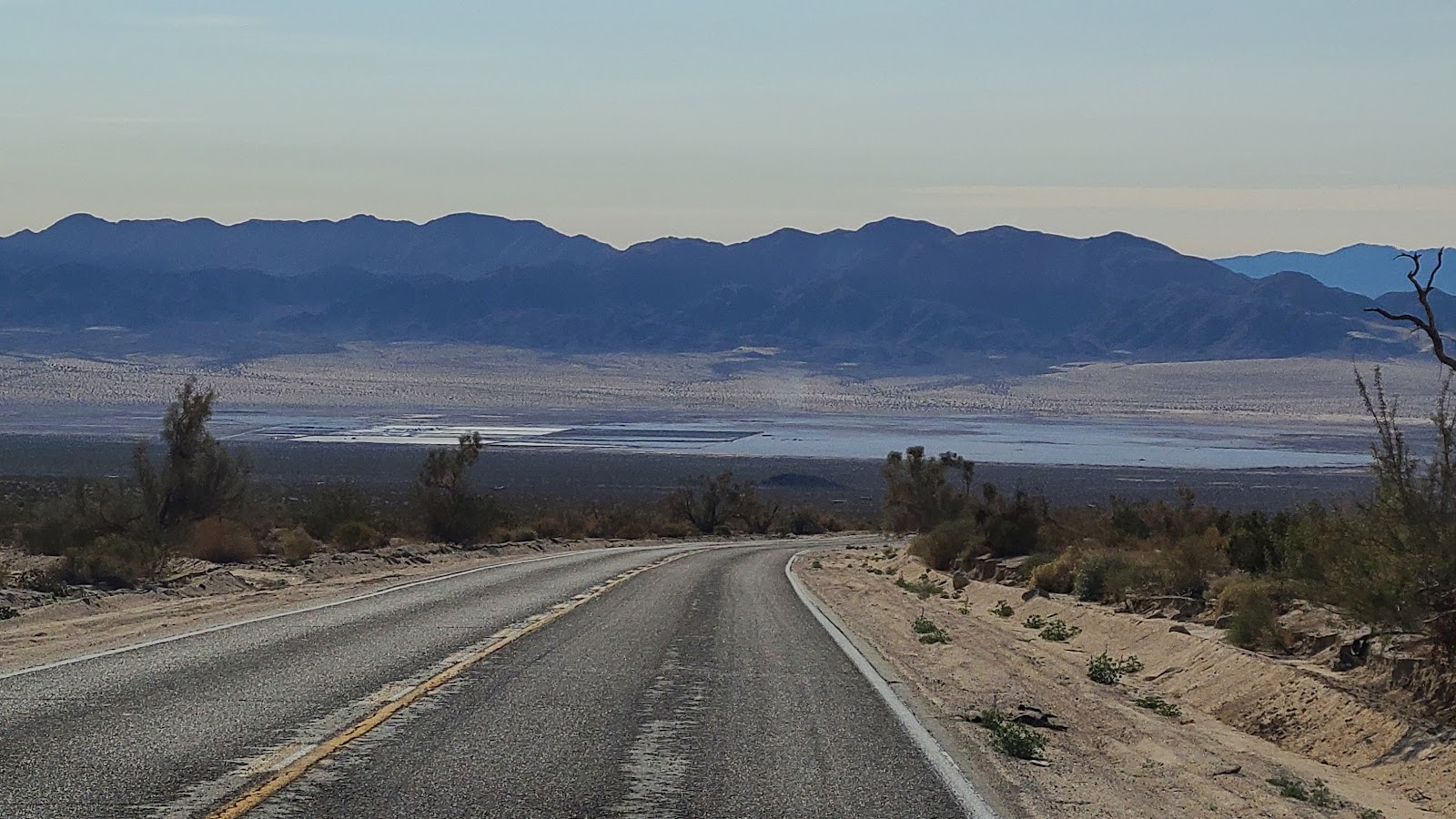

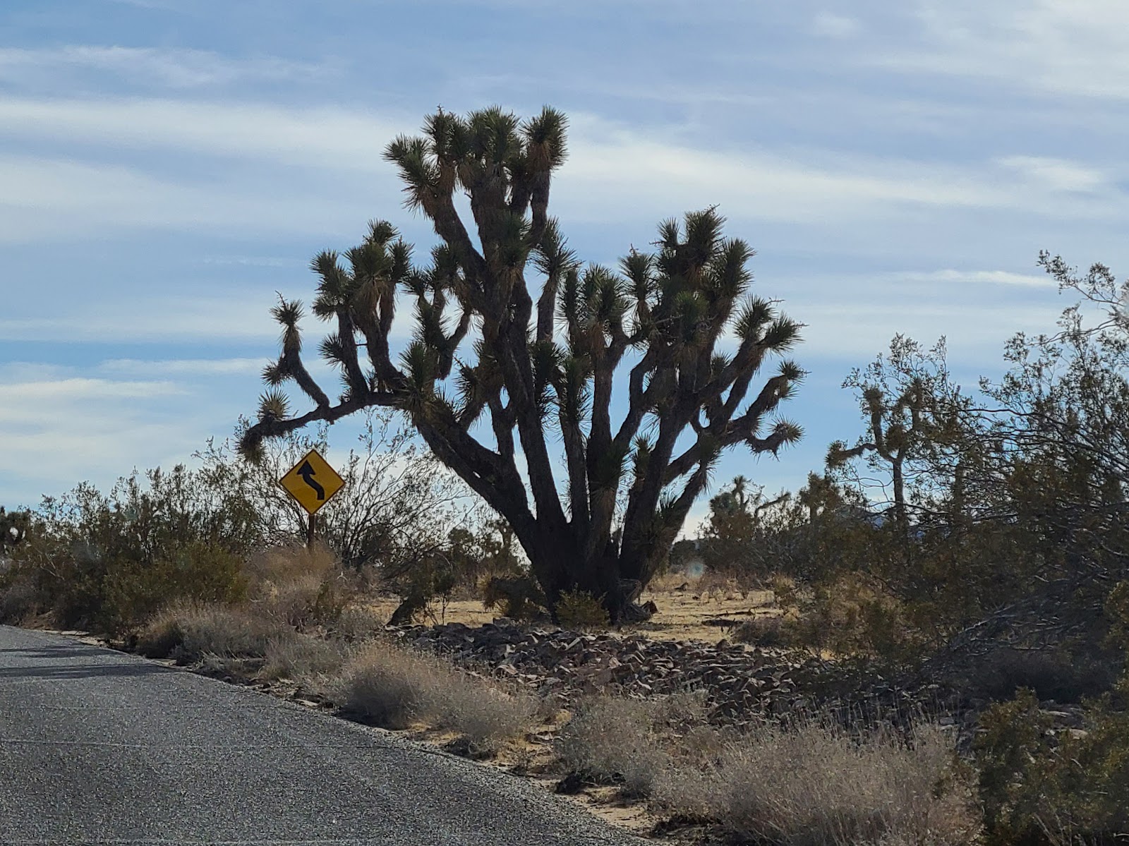
Again we had a short travel day which began with taking the Amboy Road due south out of town. It passes directly between the Cleghorn Lakes Wilderness Area and the Sheephole Valley Wilderness Area in the Mojave Desert. Which means we drove past a whole lotta nothing again.
When we did start to see signs of civilization again it was one of California's many drought stricten lakes. It looked to be only about half the size of what it used to be.
Before heading into the National Park we needed to first eat lunch and then shop for groceries to last us the week. We saw a "new to us" restaurant and decided to give it a try. It's called
Del Taco and is in direct competition with my favorite taco place,
Taco Bell.
I'll admit, Del Taco's food was good, but Taco Bell is still my favorite.
After lunch we went grocery shopping (everyone should know not to go grocery shopping when you're hungry) and spent a little over $160, but we'll get 10% of that back thanks to a deal that American Express is currently offering.
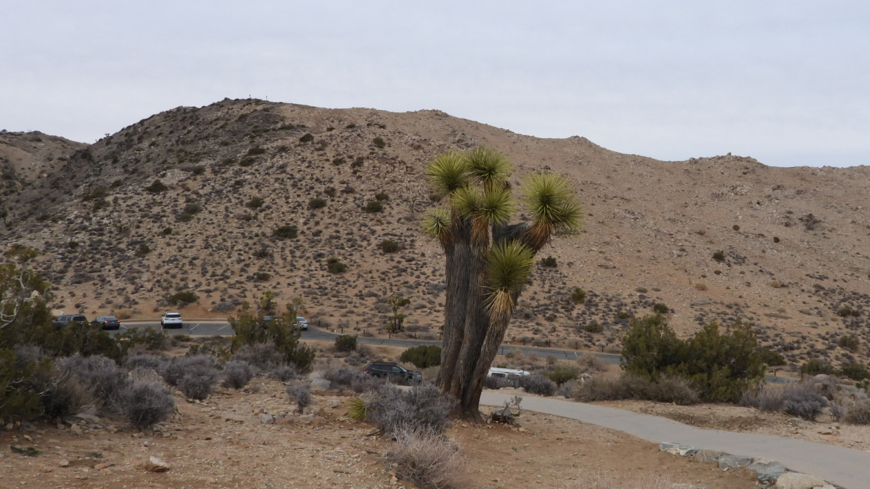
It wasn't too much later we were passing through the gate to visit our 16th National Park.
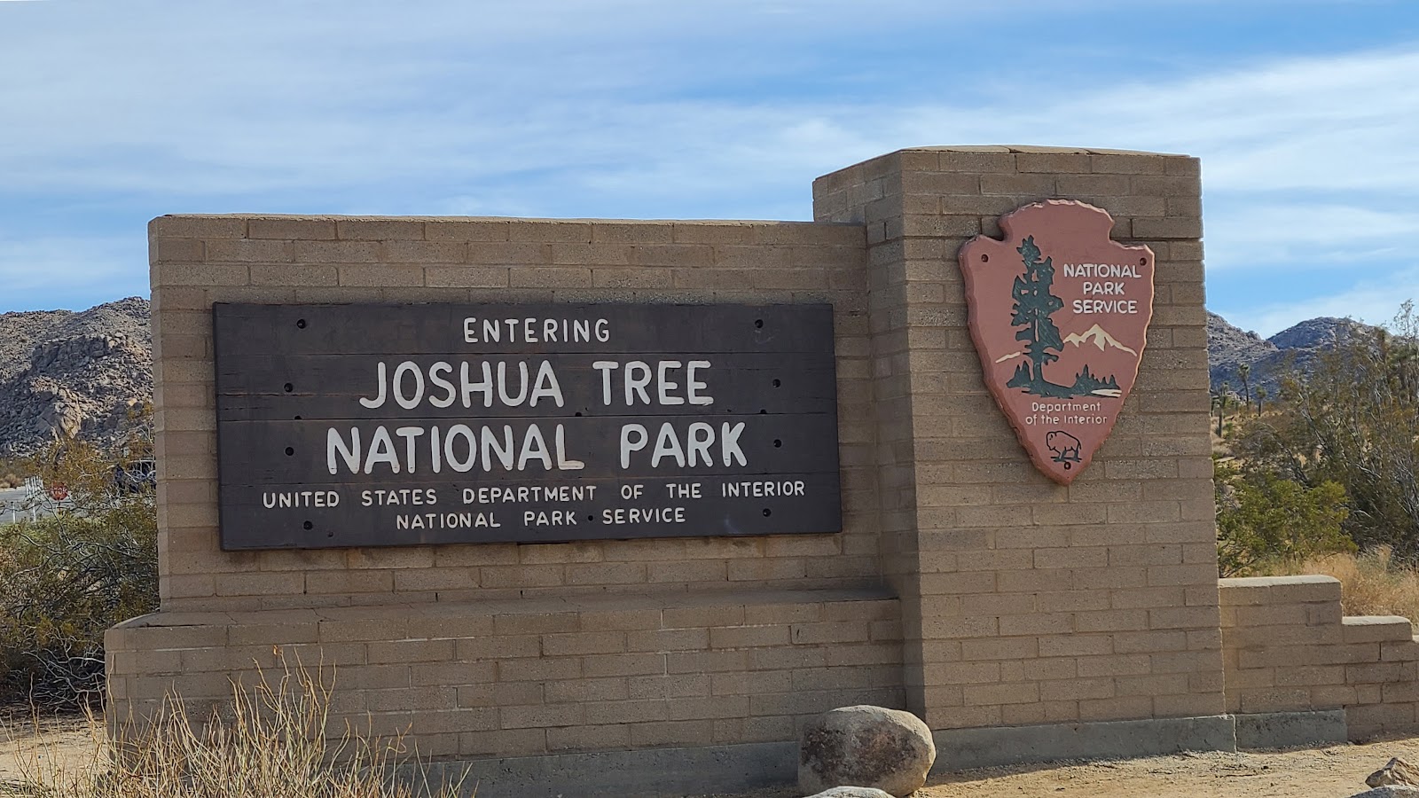 We arrived at the North Entrance to Joshua Tree National Park (Twentynine Palms, CA.)
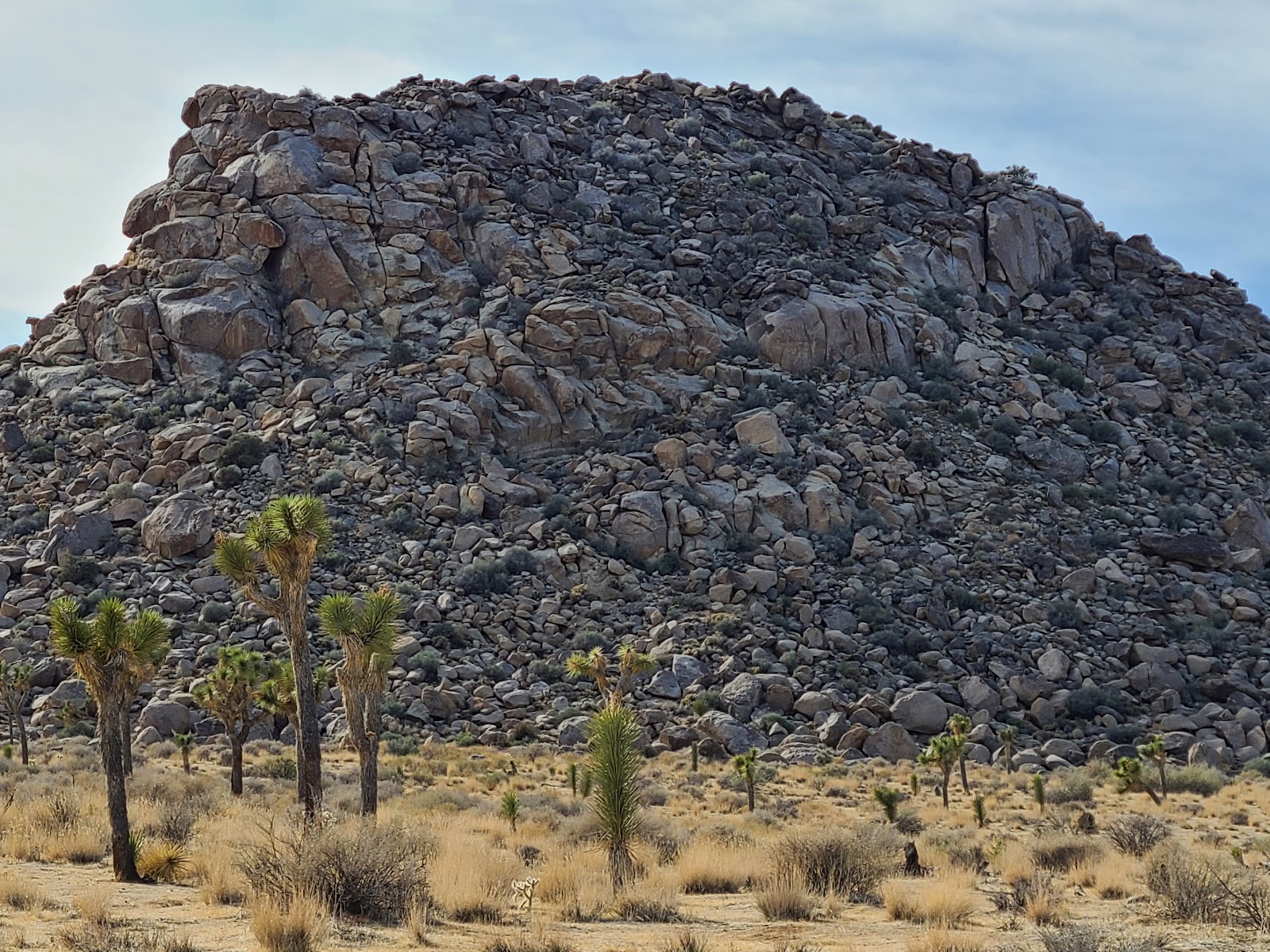
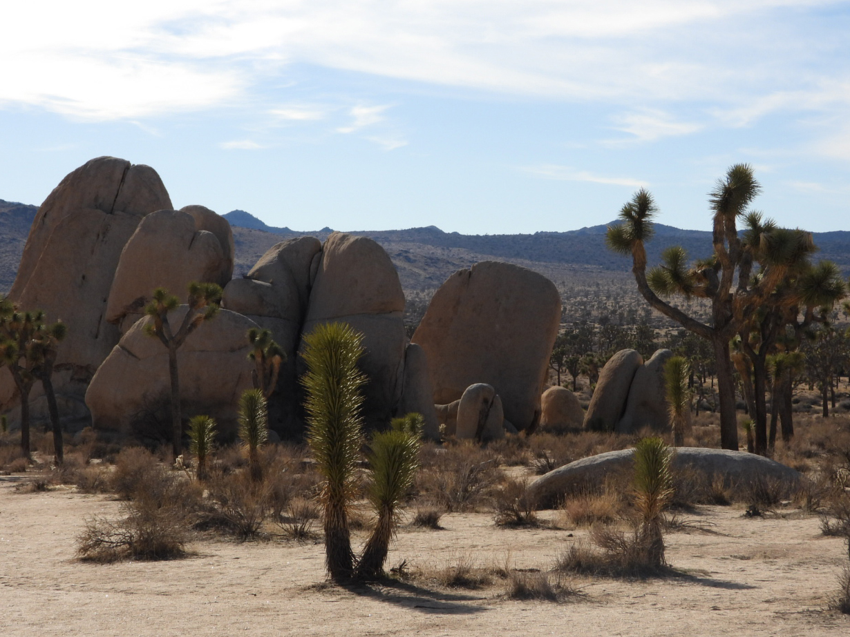
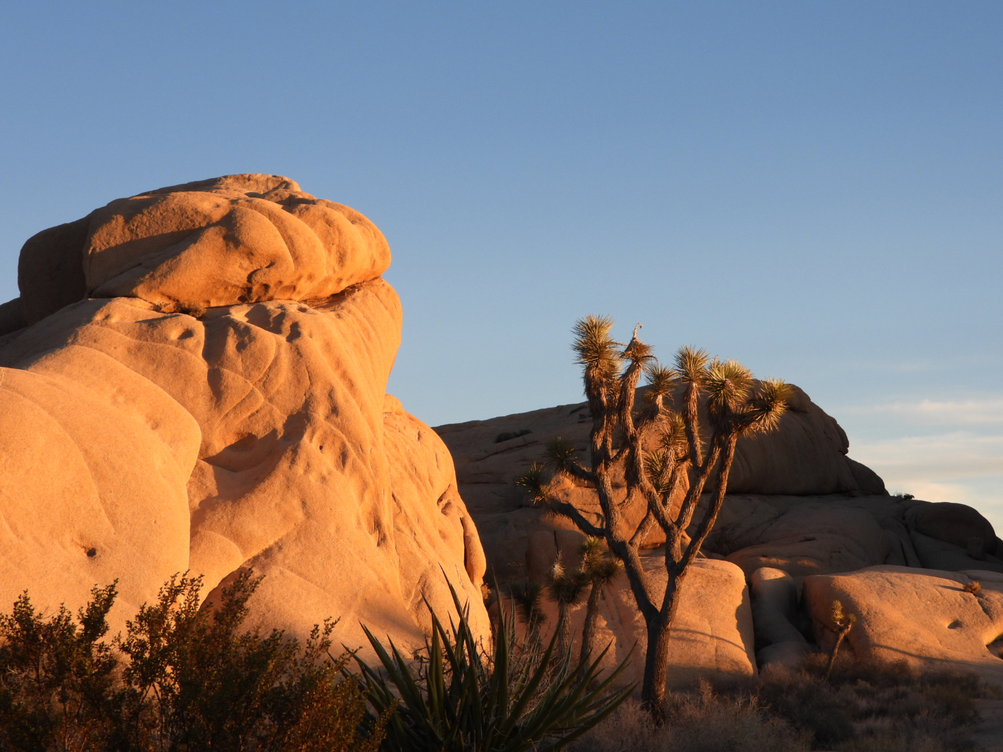
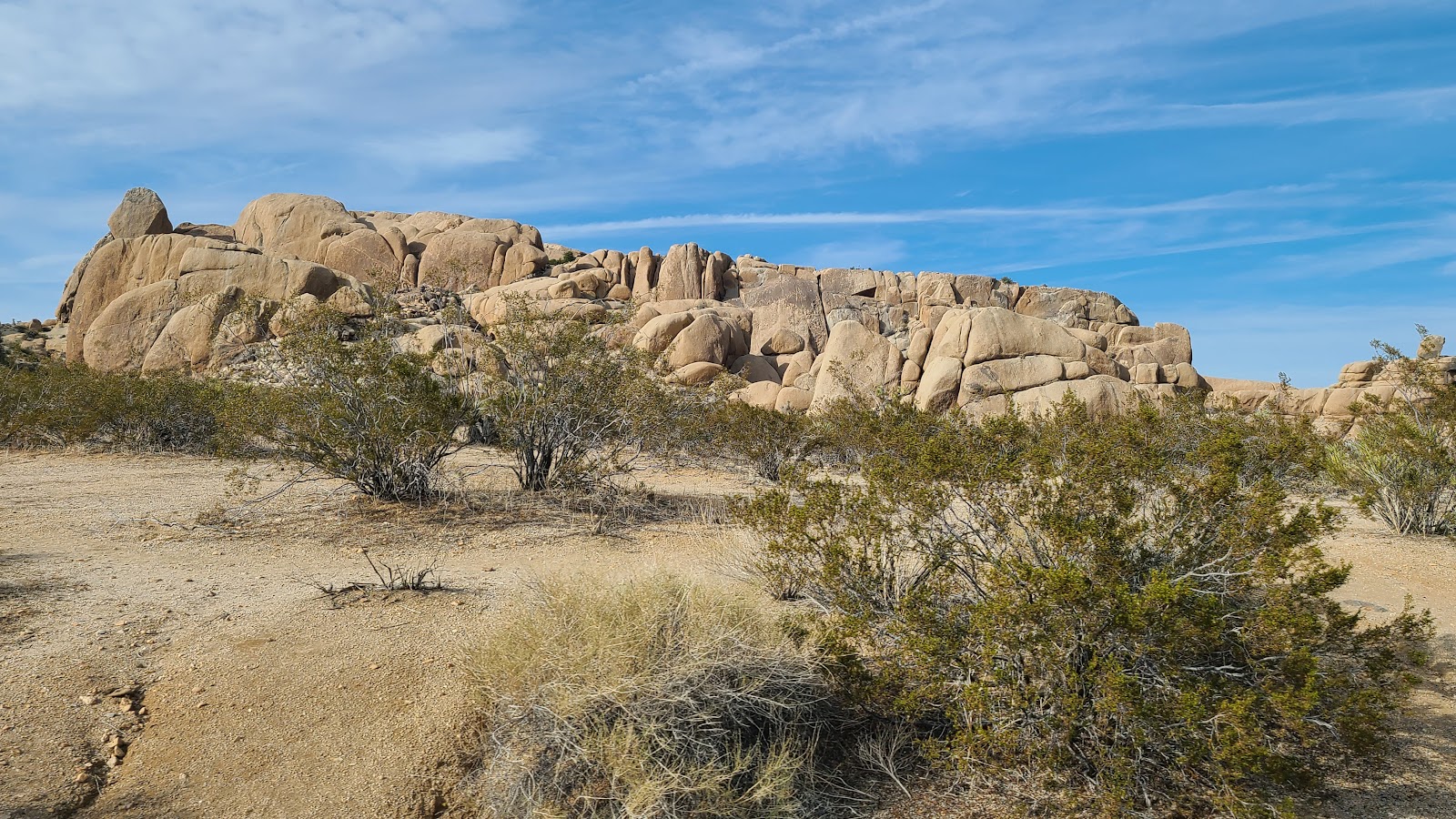 The GPS informs me our campsite is somewhere in those rocks.
 I'll admit the rear view from this site isn't all that spectacular.
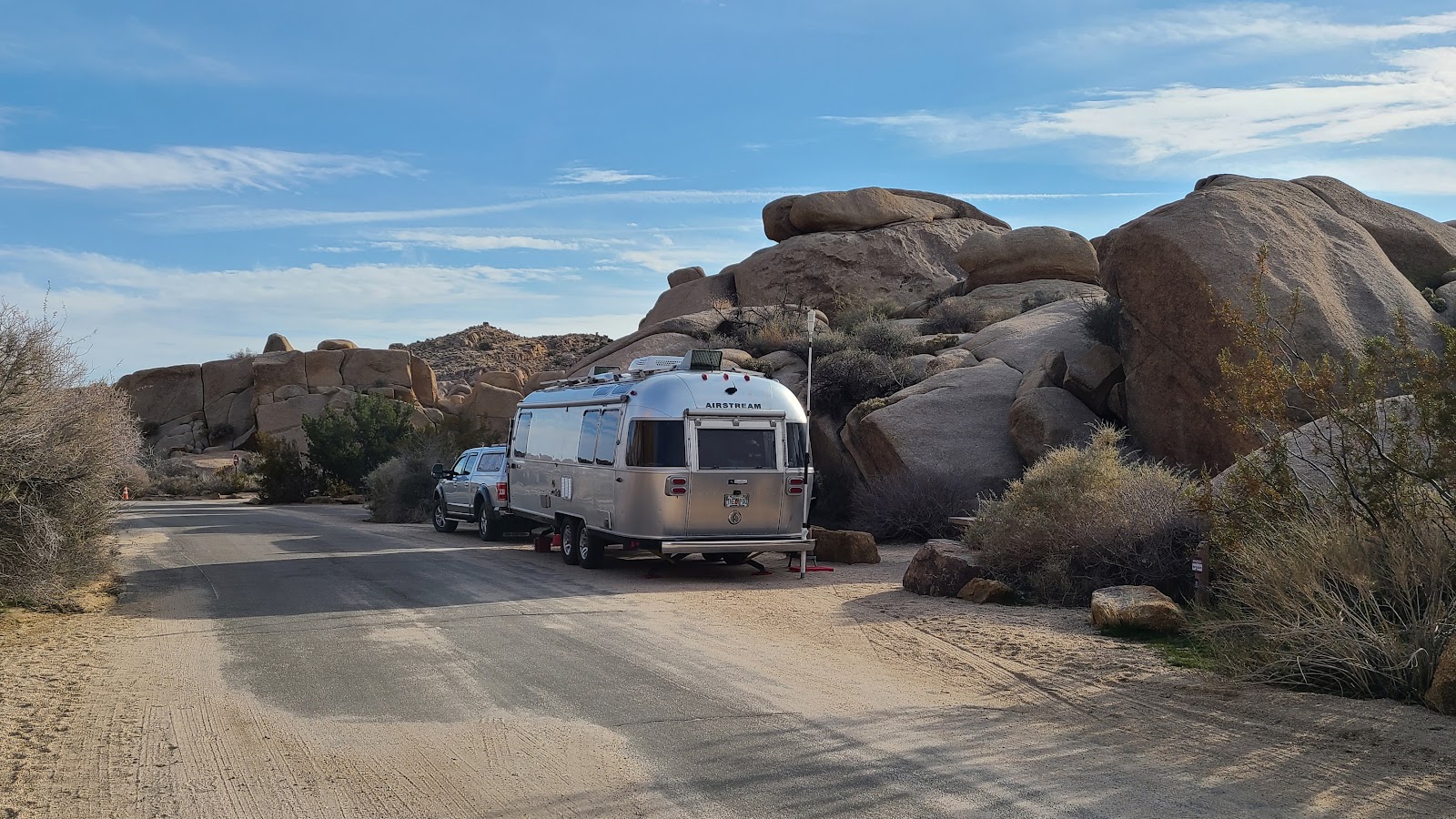 But I'd say the overall view isn't too bad.
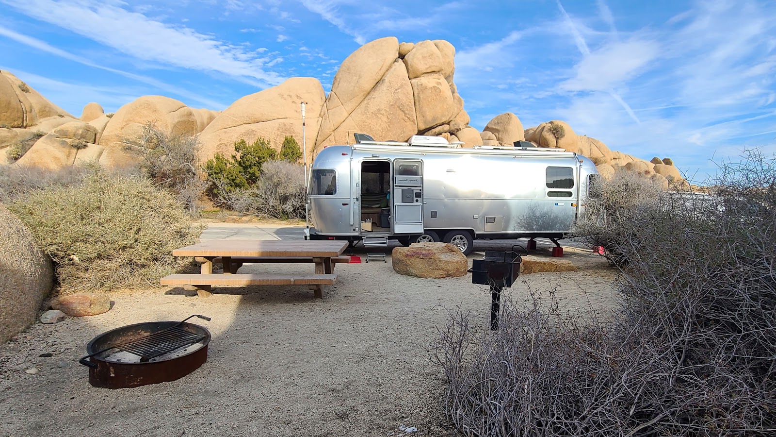 We've got a picnic table, grill and fire pit. What more could you ask for at $10 a night?
 Look! Someone even left us some firewood piled up against the rock to burn later this week.
 They also left us little patches of this wet white stuff all over the campsite?
 We even have a hidden passageway behind the rocks to the next campsite over.
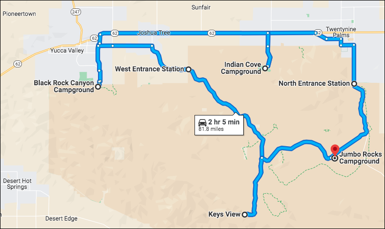
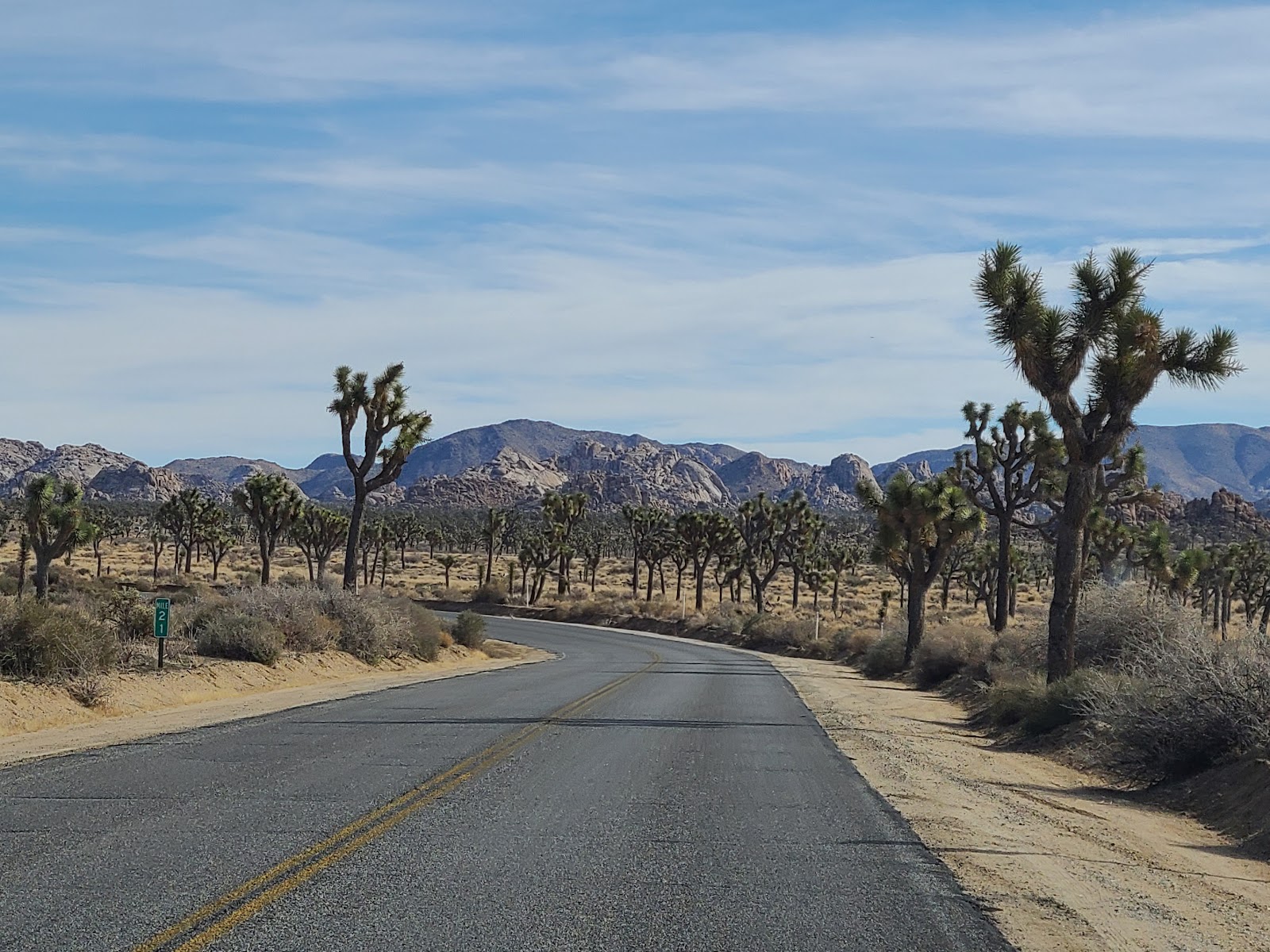
FRIDAY - Per our usual routine when arriving at a new National Park for a week long visit we spend the first full day exploring the park by driving the roadways.
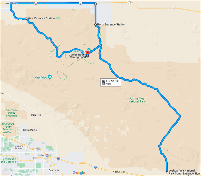
Today, that's exactly what we did. Joshua Tree National Park is rather large so that involved a 128-mile drive around the park.
Our trip starts and ends at our site here in Jumbo Rocks Campground. We first headed out the North Entrance Station (the same one we came in at yesterday) and then traveled west on Route 62 between the towns of Twentynine Palms and Joshua Tree (yes there is a town named Joshua Tree).
Next we re-entered the park through the West Entrance Station, passed right by our campground an headed for the South Entrance where Cottonwood Campground and the dump station is located. We'll be using that dump station when we leave the park next week.
Then it was just a matter of heading back north to return to Jumbo Rocks. It was a long day on the road with several stops to take photos and to walk a few short trails.
Anyway here is a slideshow filled with scenes from our drive today.WARNING:
If you watch the entire slideshow all the way to the end
I will guarantee you'll see a lot of Joshua Trees
and maybe just learn a little bit about them too.
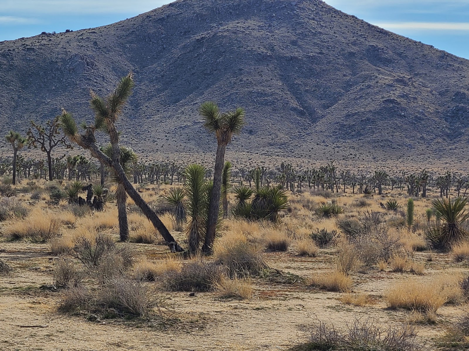
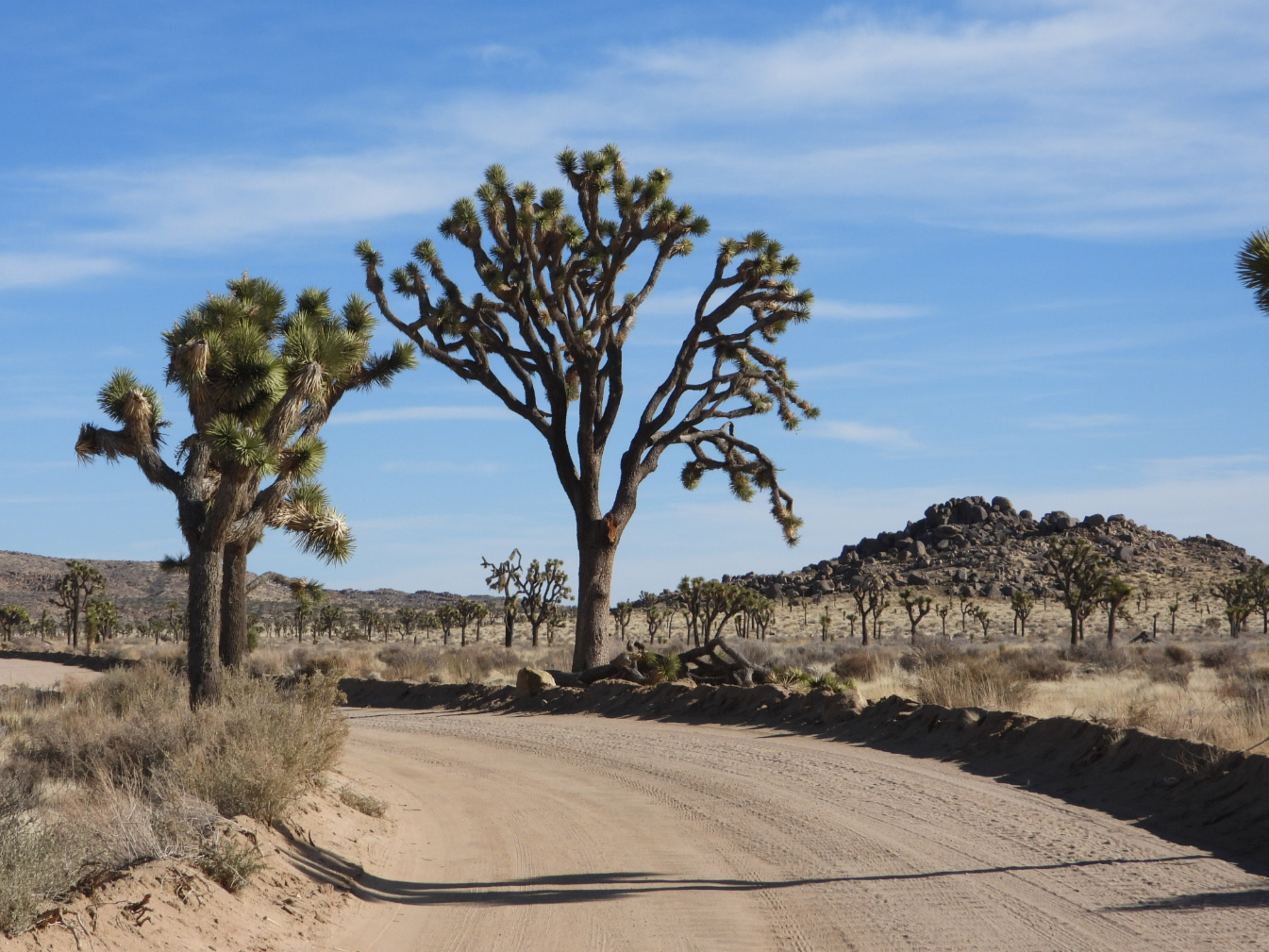
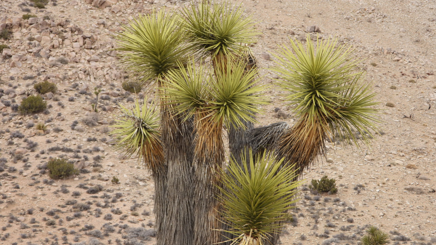
 For those of you who don't know, this is a yucca brevifolia (aka Joshua Tree).
 Joshua Trees only grow about 3" a year for their first 10 years, usually straight upwards.
 Then they slow down to about 1½" a year and begin to branch out after their first bloom.
 Joshua Trees have been known to grow to a height of 49-feet.
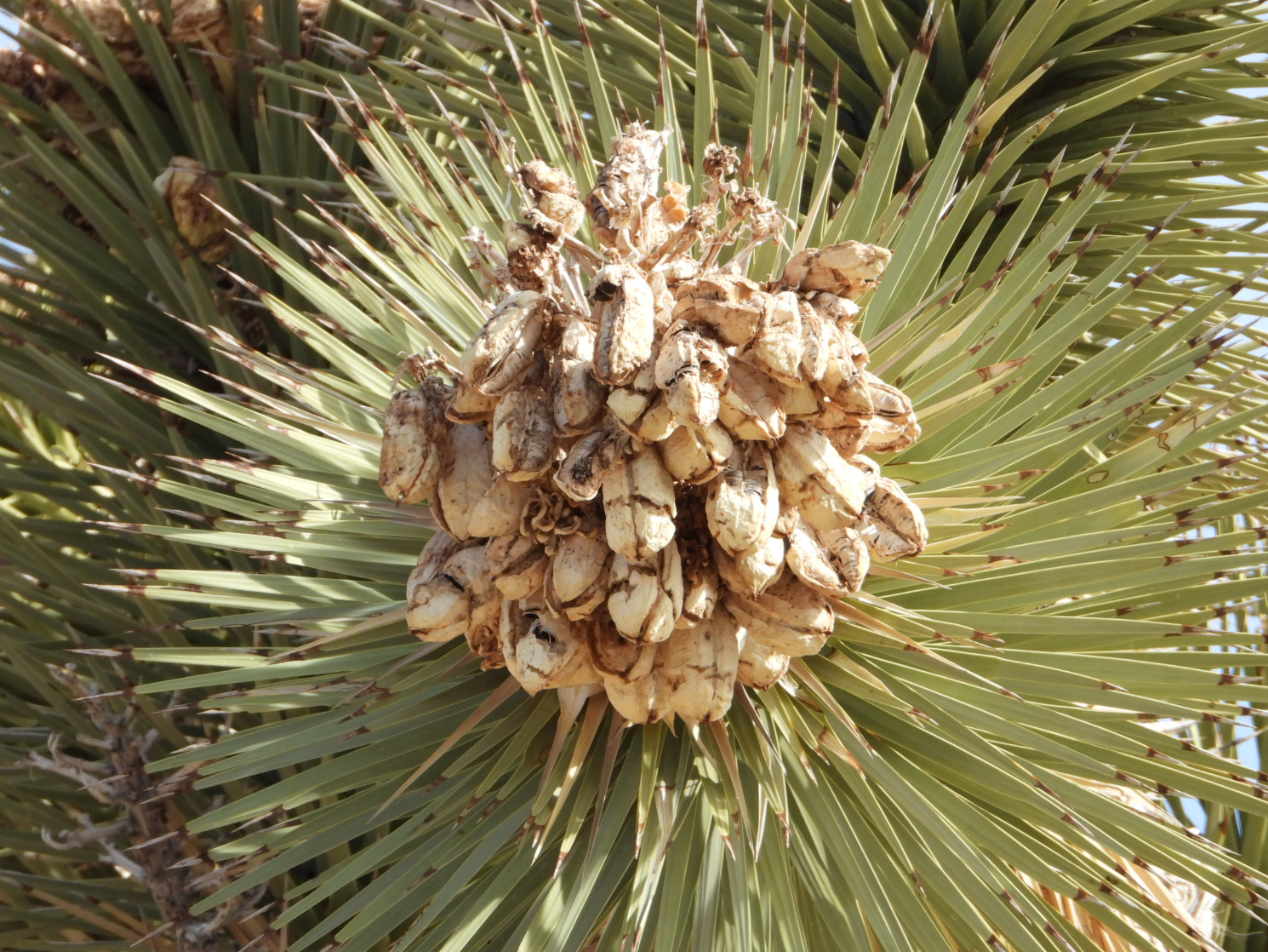 Their blooms produce seeds which most trees grow from...
 ...but occasionally trees grow from the underground roots of a parent tree.
 Joshua trees routinely grow to be hundreds of years old.
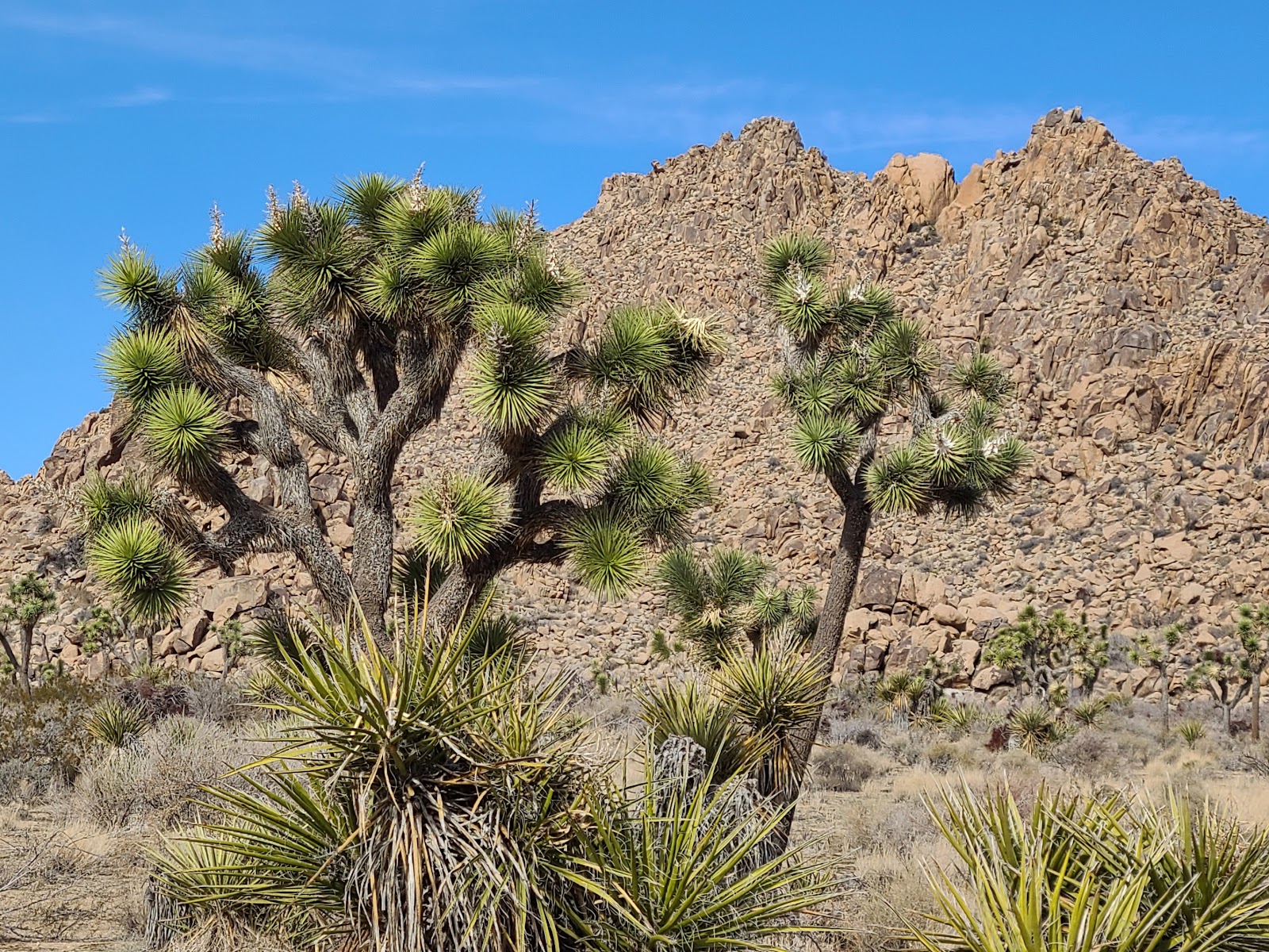 A few even live to be 1000 years old.
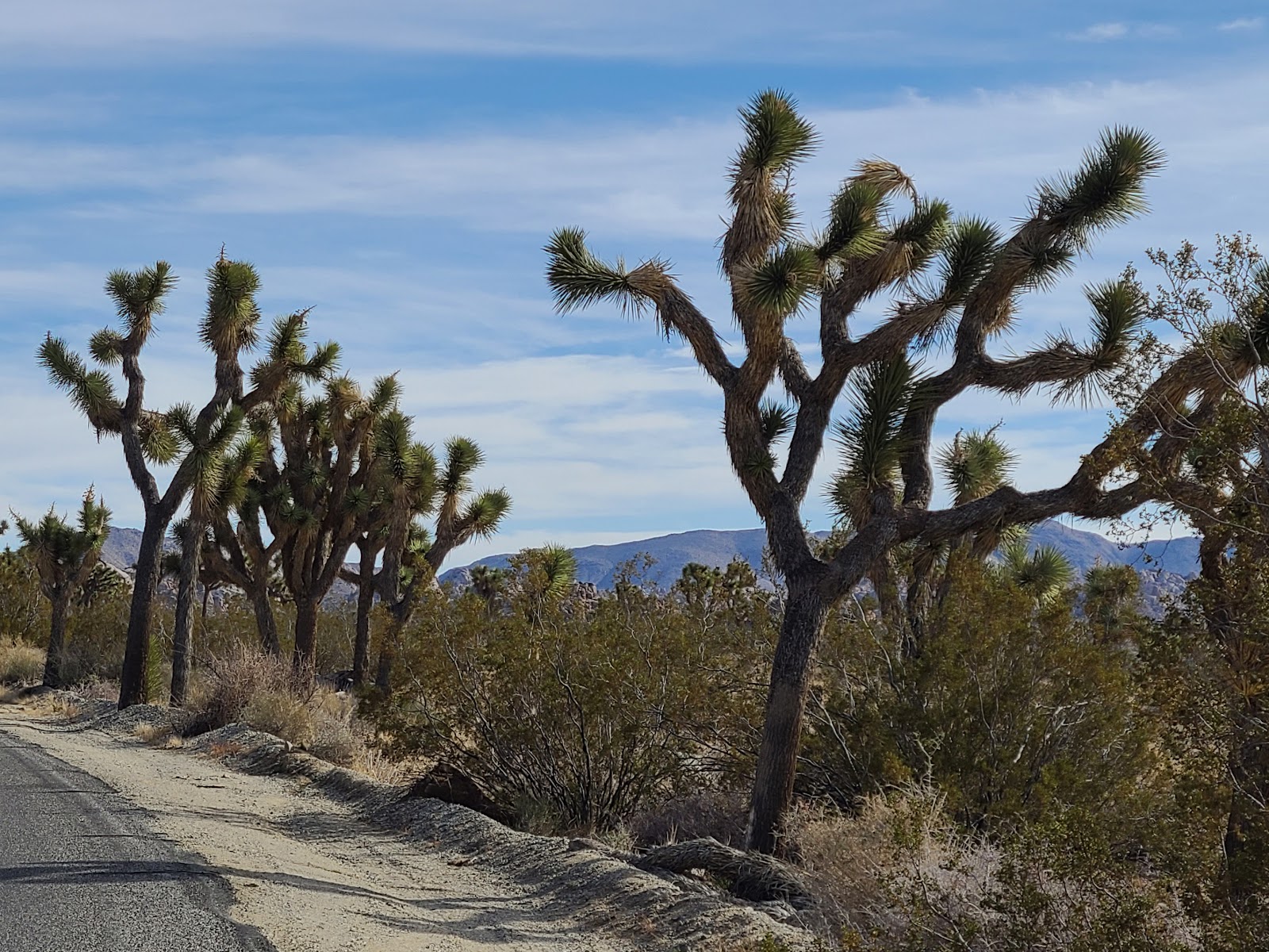
 The northern end of the park is where you'll find the majority of the Joshua Trees...
 ...and where most of the other activities are located.
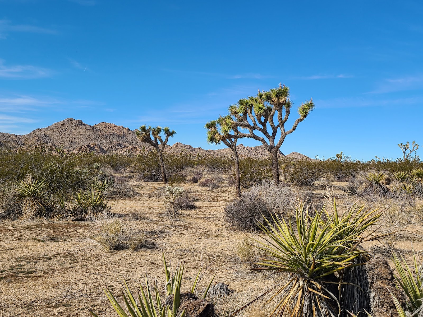
 You can look in any direction and see something new, no two trees are exactly alike.
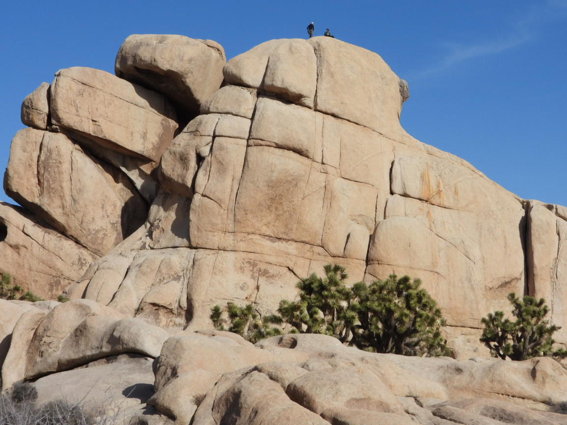
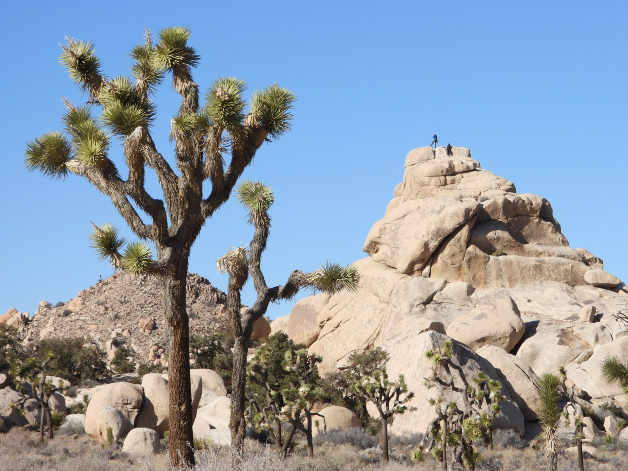
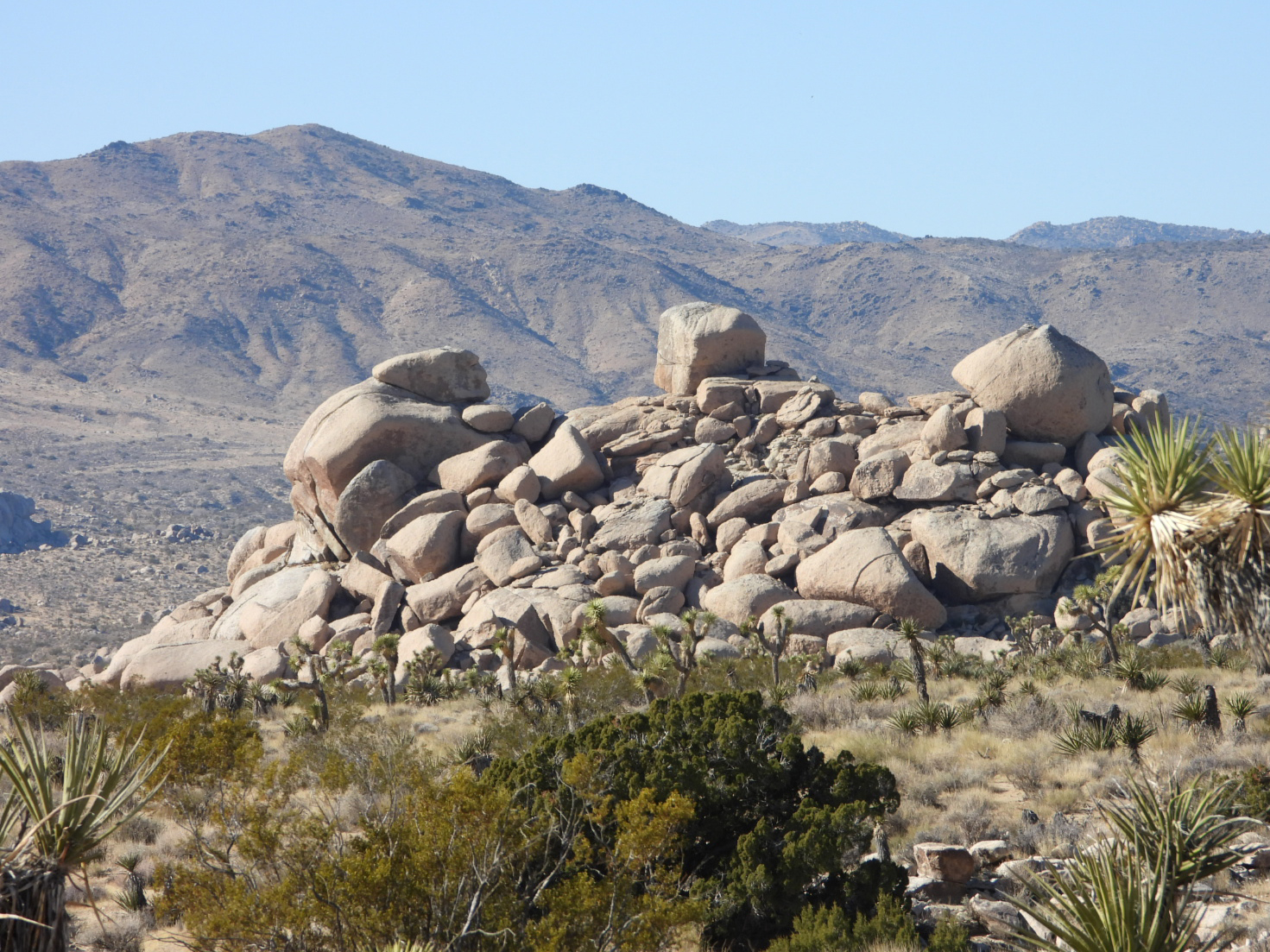
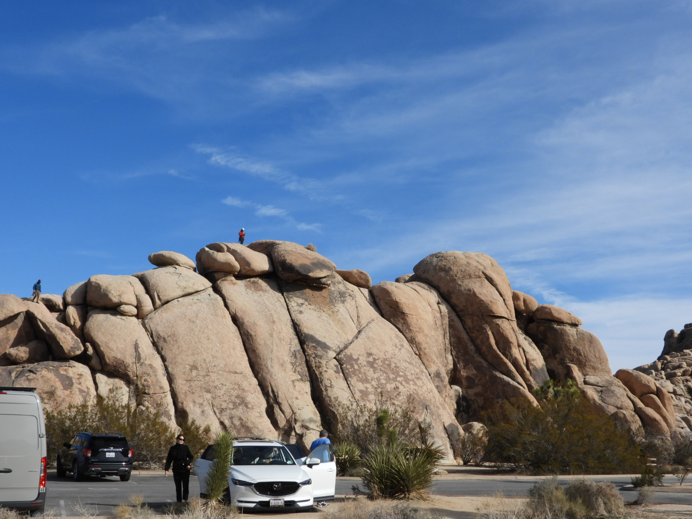 Very popular activities in the park include bouldering and mountain climbing.
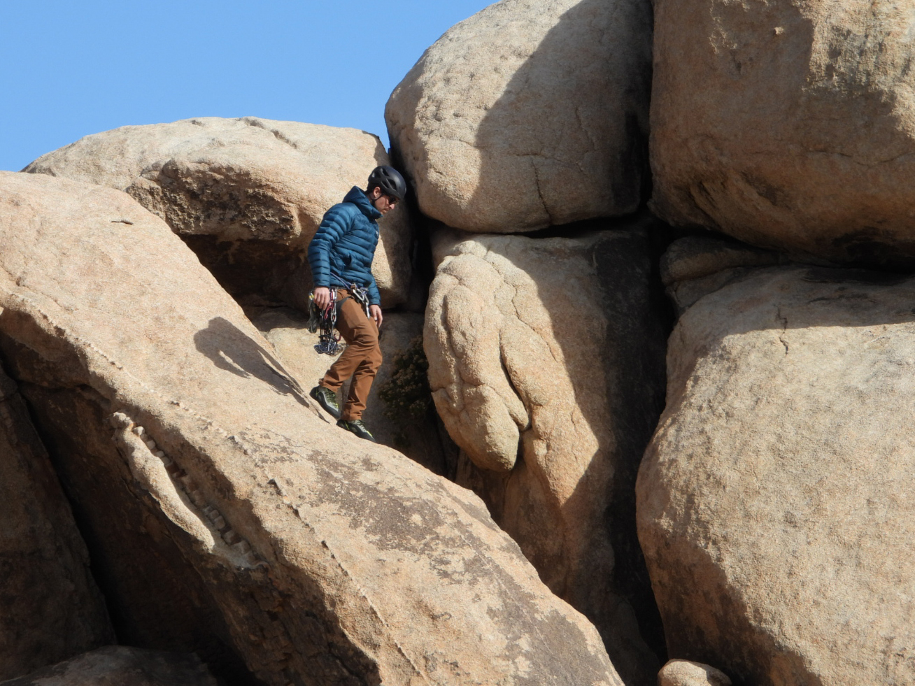 He must have some very sticky shoes to casually decend that rock face like that.
 There doesn't seem to be any limit on how high these climbers will go.
 Just doesn't look like something I would have enjoyed, even as a younger me.
 We found this little guy in the picnic area begging for food.
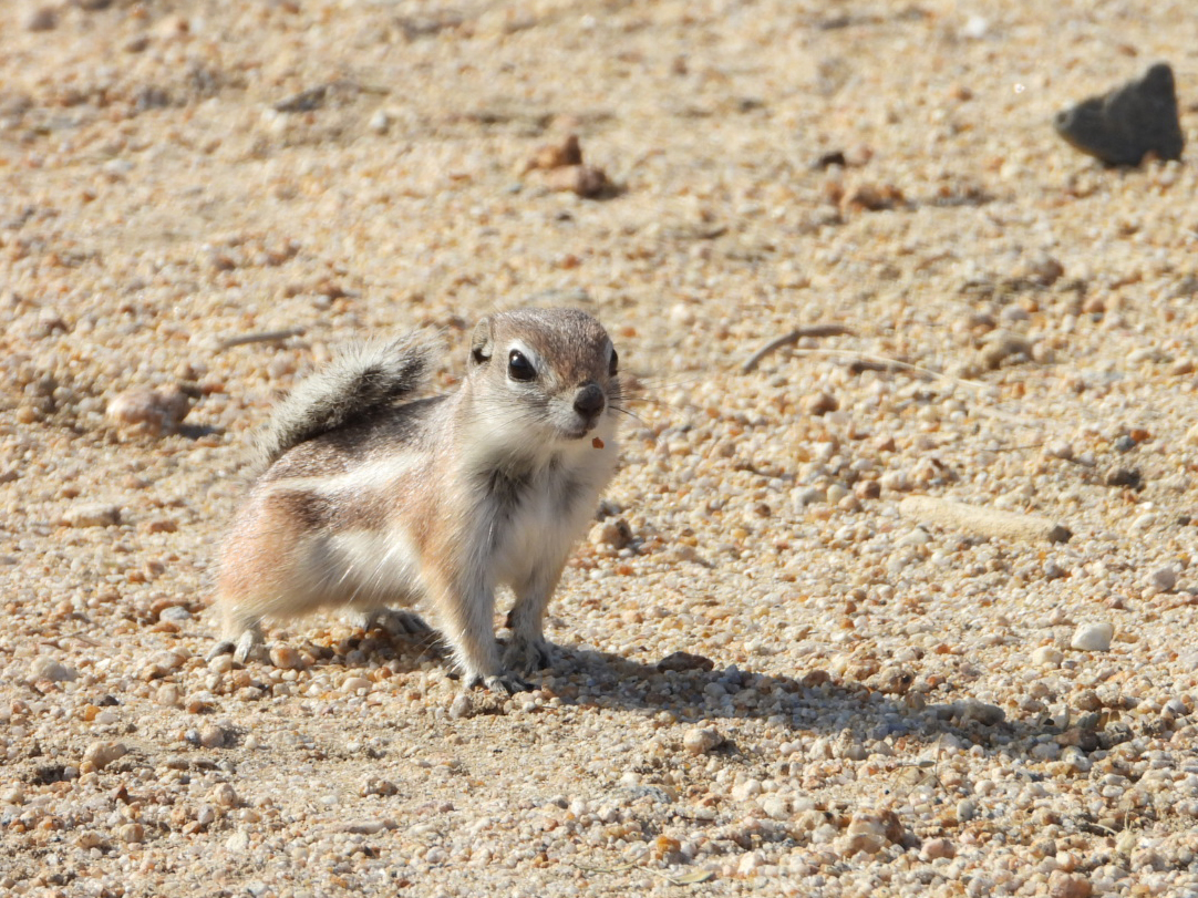 When he realized we weren't going to feed him the show was over.
 Here are several younger Joshua Trees (less than 10-years old) in the foreground.
 This rock had a story board in front of it telling us it's name, but damn if I can remember it.
 There's never a shortage of Joshua Trees or climbers to photograph.
 We did a short detour on one of the unpaved roads in the park...
 ...where we saw perhaps the tallest Joshua Tree we've seen so far.
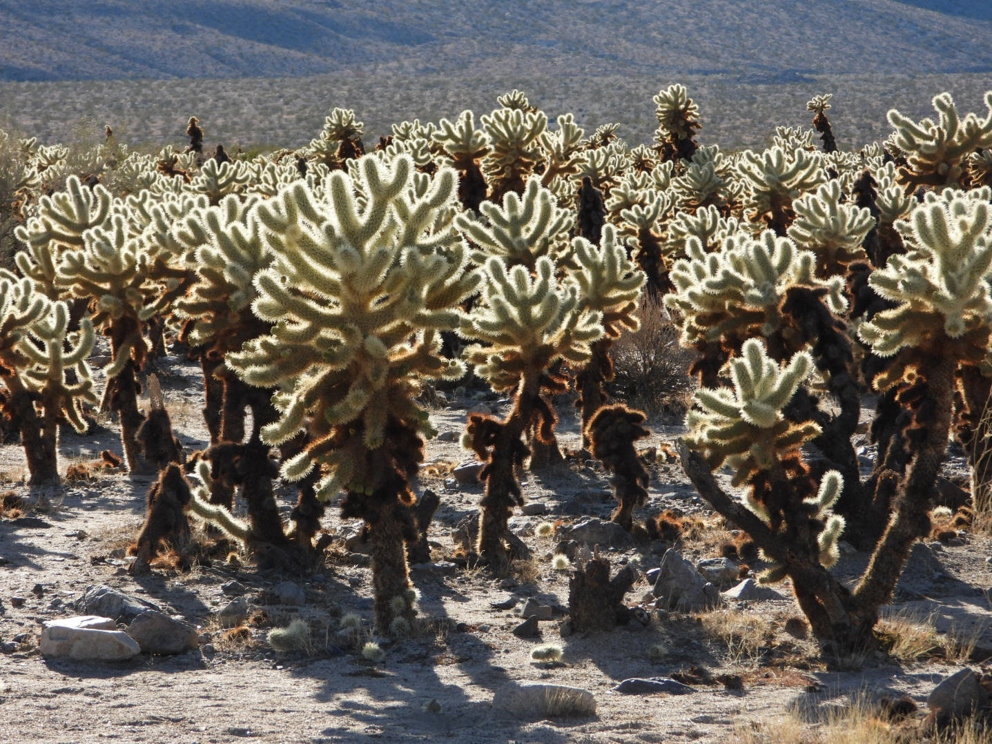
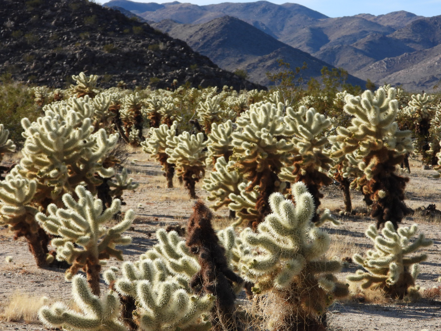
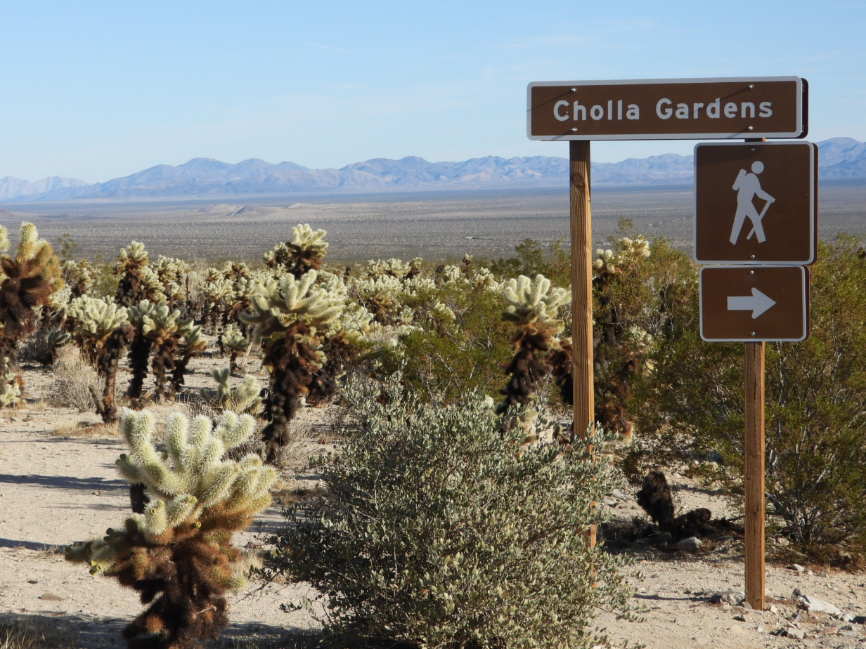 In the southern end of the park you'll find an entirely different enviroment.
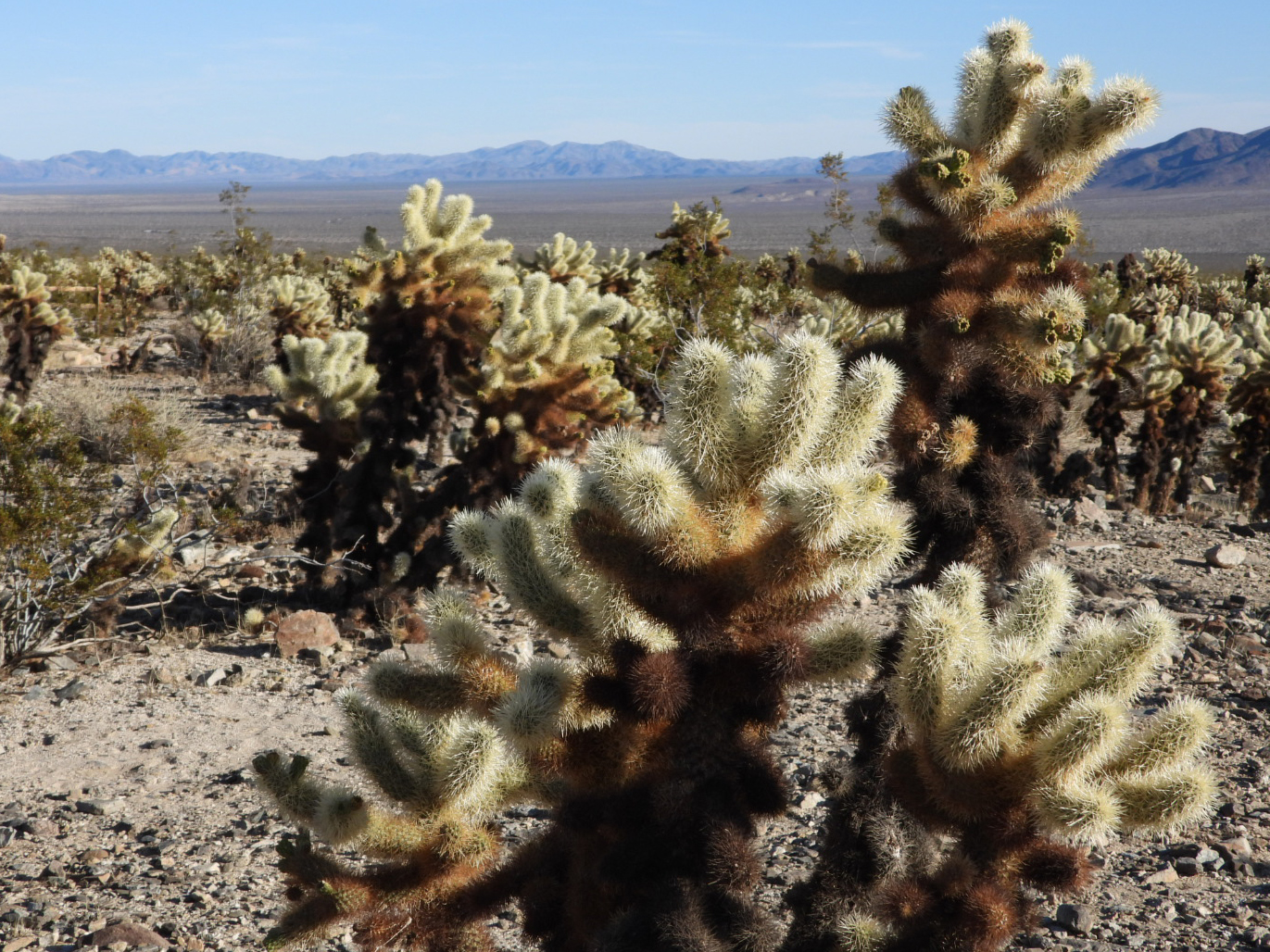
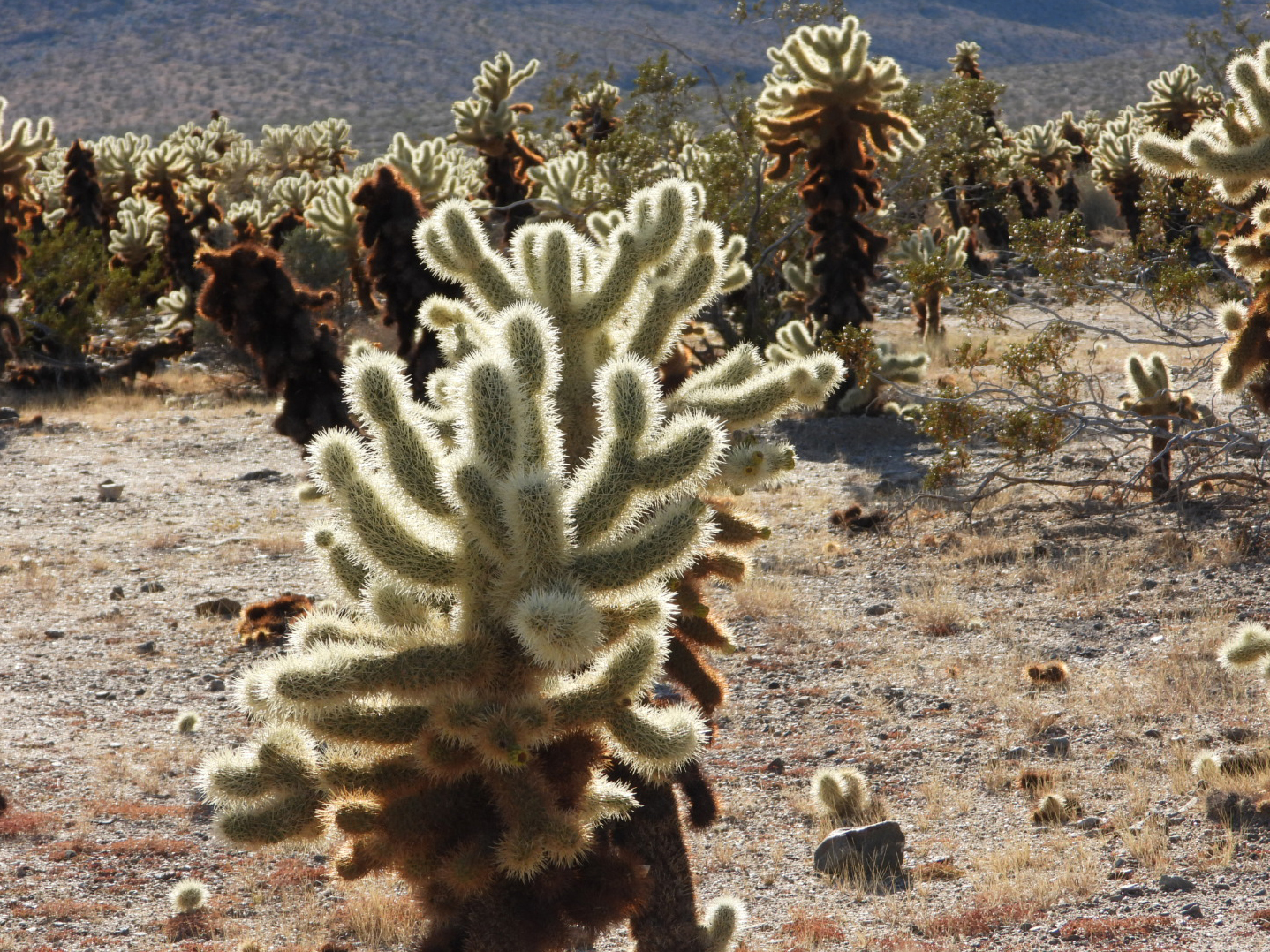
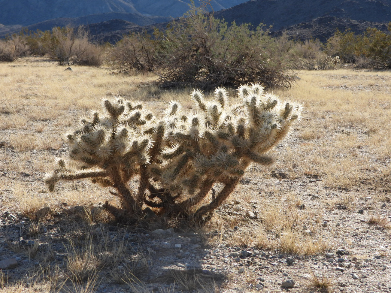 Here the cylindropuntia fulgida (aka Cholla Cactus) is the dominant plant.
 Don't let their beauty fool you. They don't call it the Jumping Cholla for no reason.
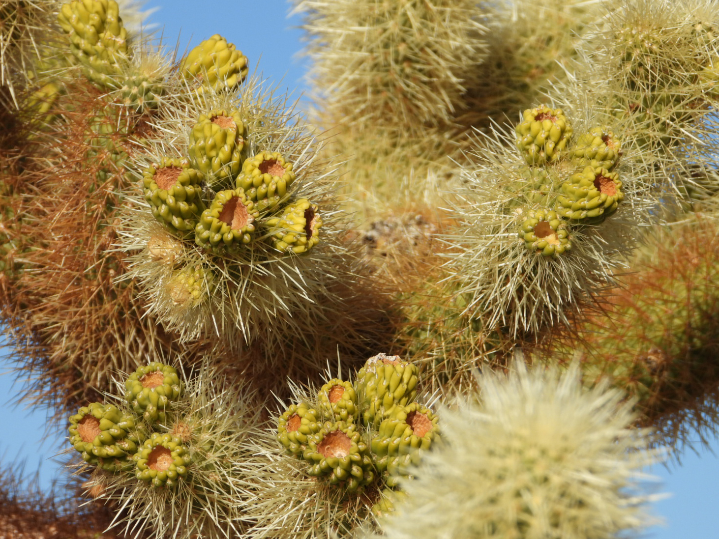
 The cholla also spreads seed pods to create new plants.
 Check out all those thorns just waiting to latch onto you as you walk by.
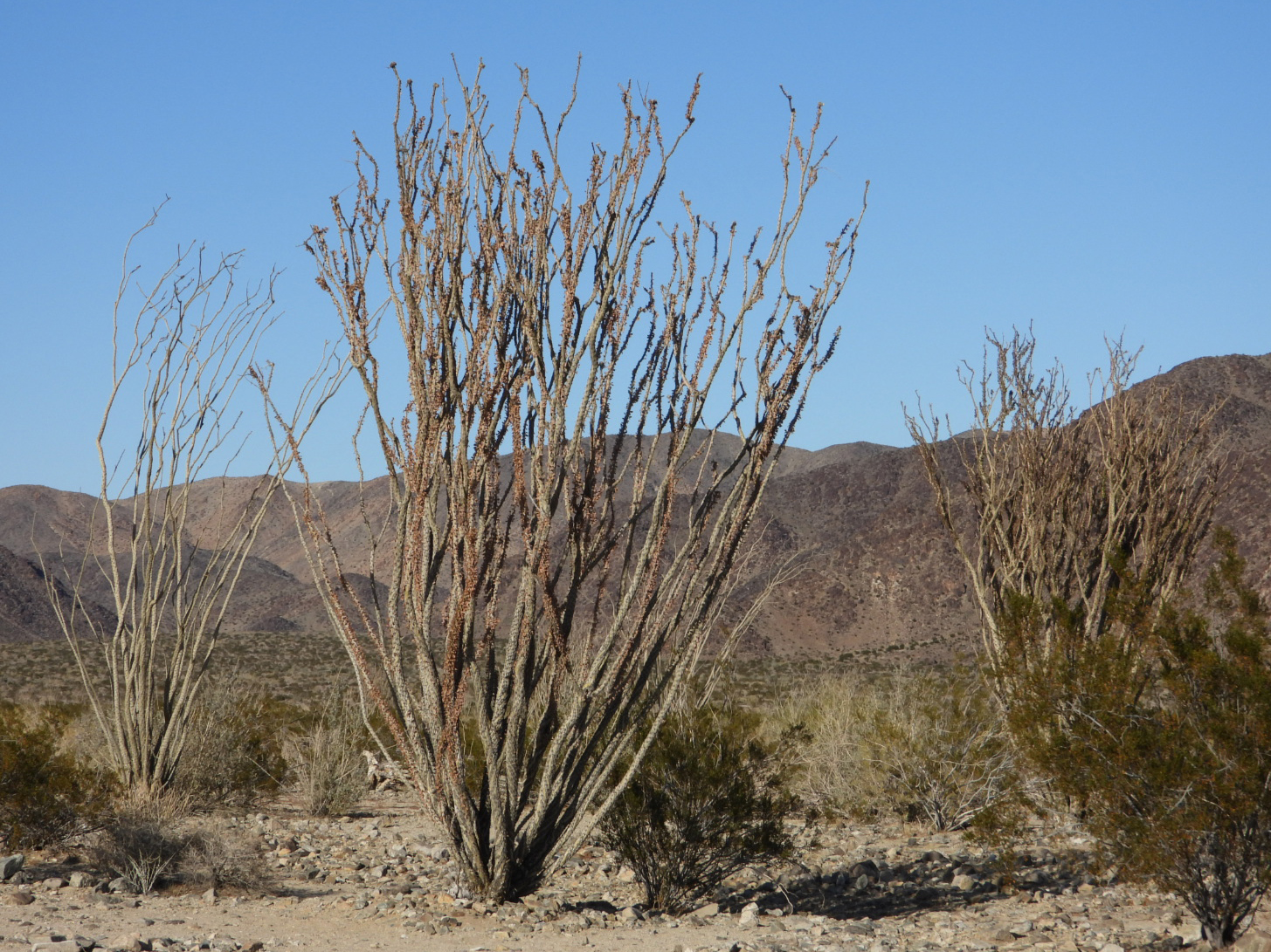 The species fouquieria splendens (aka Ocotillo) can also be found in this end of the park.
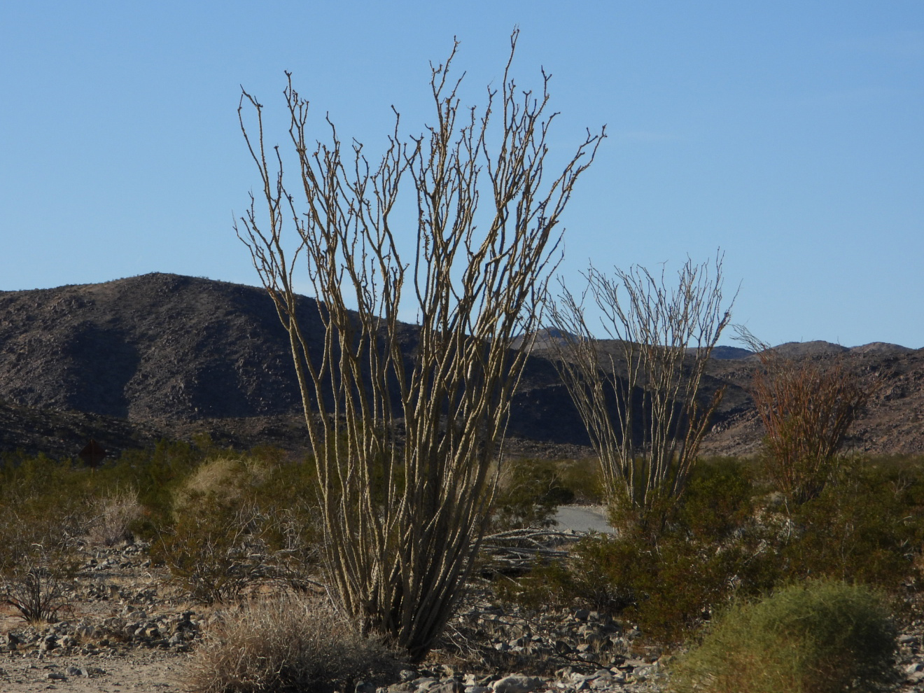 For most of the year the plant looks to be dead.
 But give it just a little bit of rain and it will sprout leaves like this one.
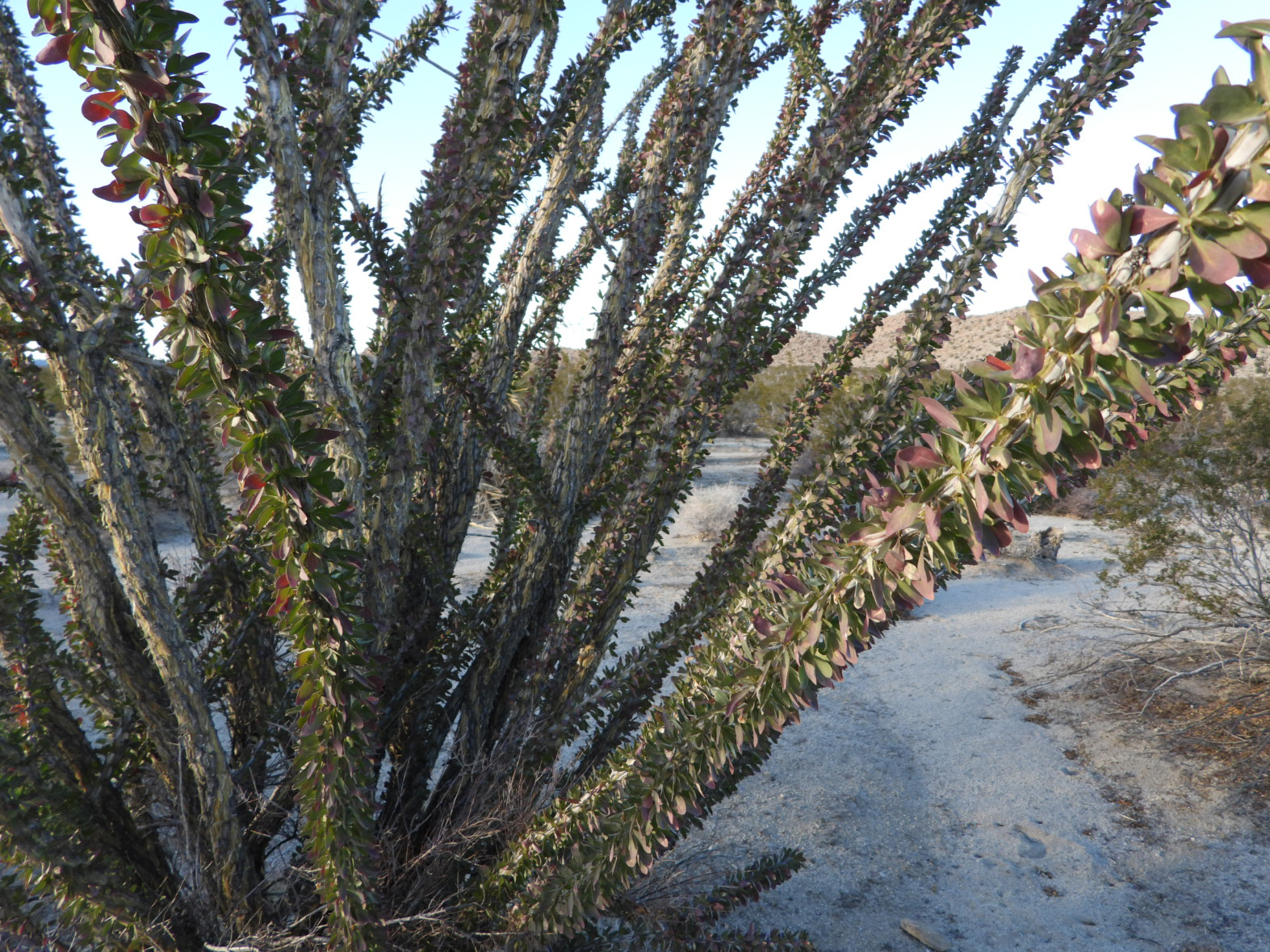 Here's a closer look at the leaves
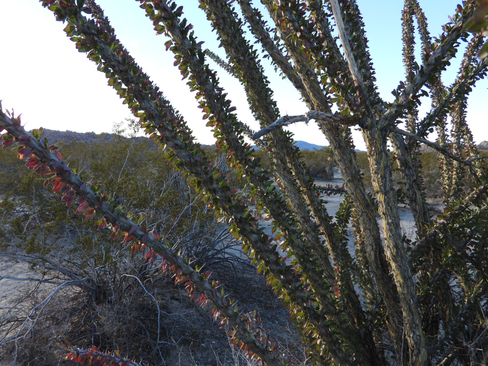 Ocotillo can grow to be 33-feet tall.
 Don't be fooled though and grab hold of one of these thorny branches.
 It's getting late in the day and with the sun setting we headed back to the campground.
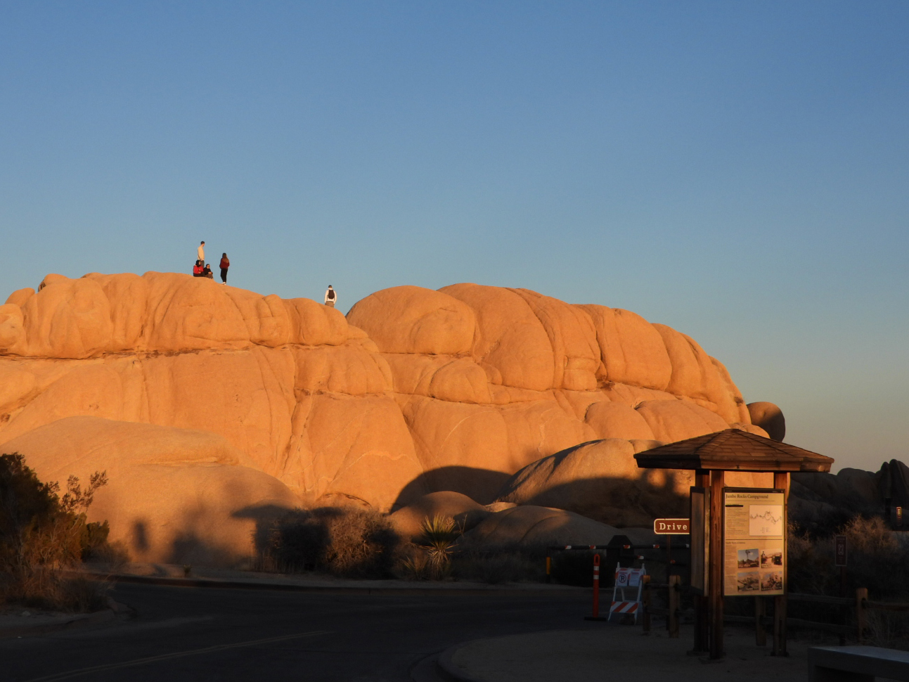 At the campground we found the kids climbing the rocks to get a better view of the sunset.
 And what a wonderful sunset it was on our first full day in Joshua Tree National Park.
SATURDAY - If we learned one thing from yesterday's long drive it's that the southern end of the park doesn't offer as much scenery, activities and camping opportunities as the northern end of the park does.
For that reason we're going to concentrate today's driving tour exculsively in the northern end of the park.
There are two campgrounds which are not accessible from the interior of the park. You'll have to go outside the park and then re-enter through a separate entrance for each campground.
We found that both Indian Cove and Black Rock Canyon Campgrounds were not "big rig friendly", meaning they have tight turns and small campsites. Both campgrounds were heavily used by climbing enthusiasts who tend to camp in tents, vans and micro-sized trailers.
After we checked out both campgrounds we learned another very important lesson, "DO NOT" leave the park on the weekend, unless you are OK with waiting in a long line of cars to re-enter the park.
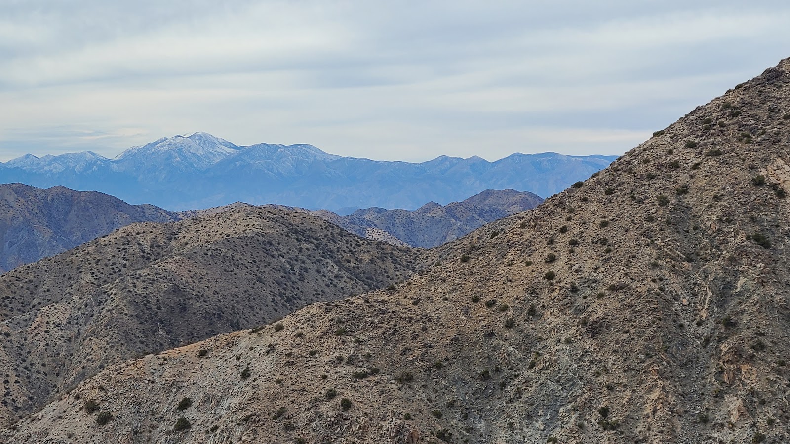
We waited about 30-minutes in line to get back into the park before heading to our sightseeing destination for the day. Keys View Overlook has an amazing view of the Coachella Valley, albeit a very hazy view. The haze is caused by water vapor, dust and of course, air polution, from as far away as the coast.
Todays haze was probably considered moderate. In the summer when you have calm winds, high humidity and high temperatures it's much worse.
 All of these photos are from Keys View Overlook of the Coachella Valley outside of the park.
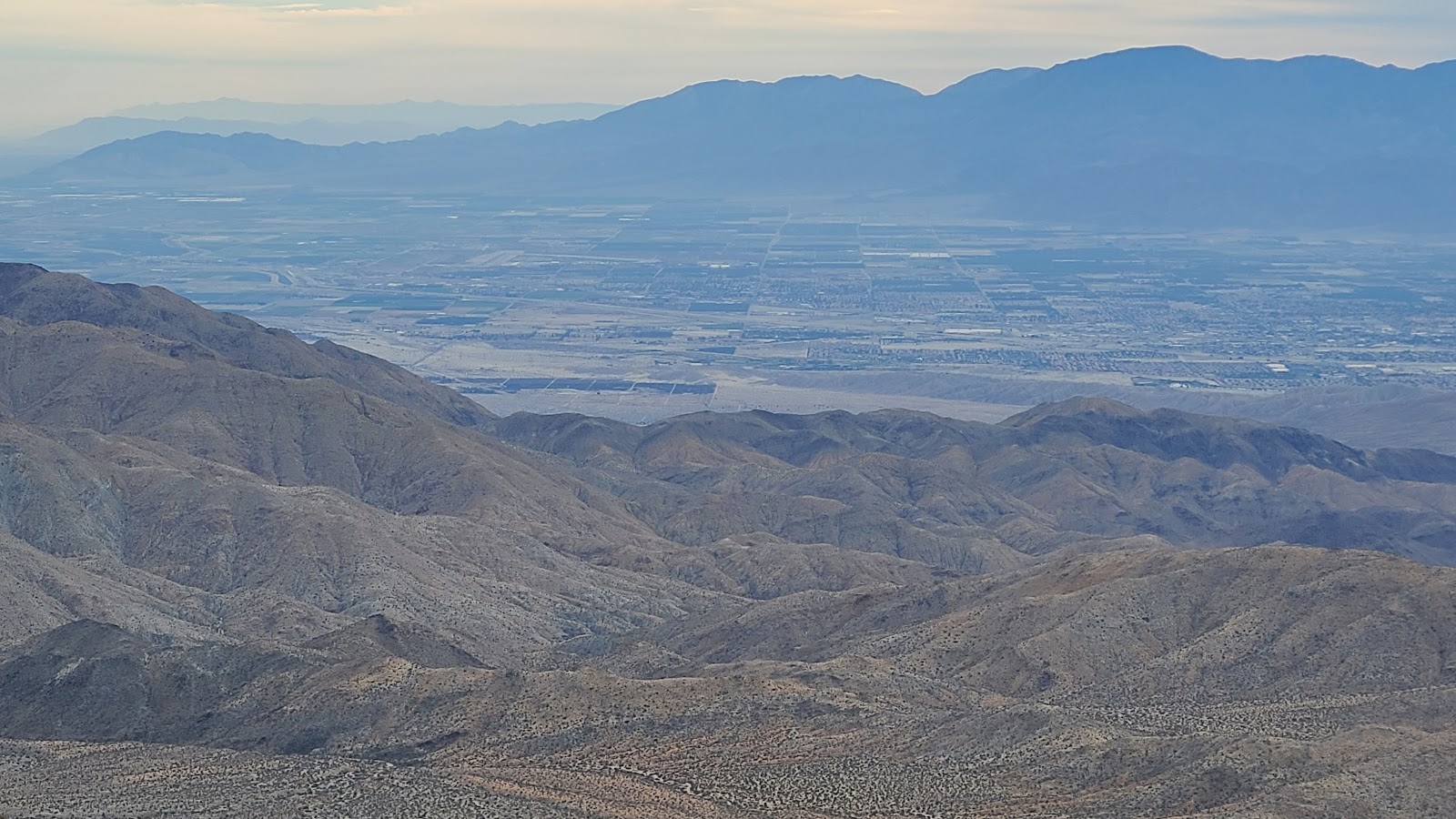 That is the town of Palm Springs, CA in front of Mount San Jacinto.
 Way over there is the San Bernardino National Forest where we'll be spending Christmas.
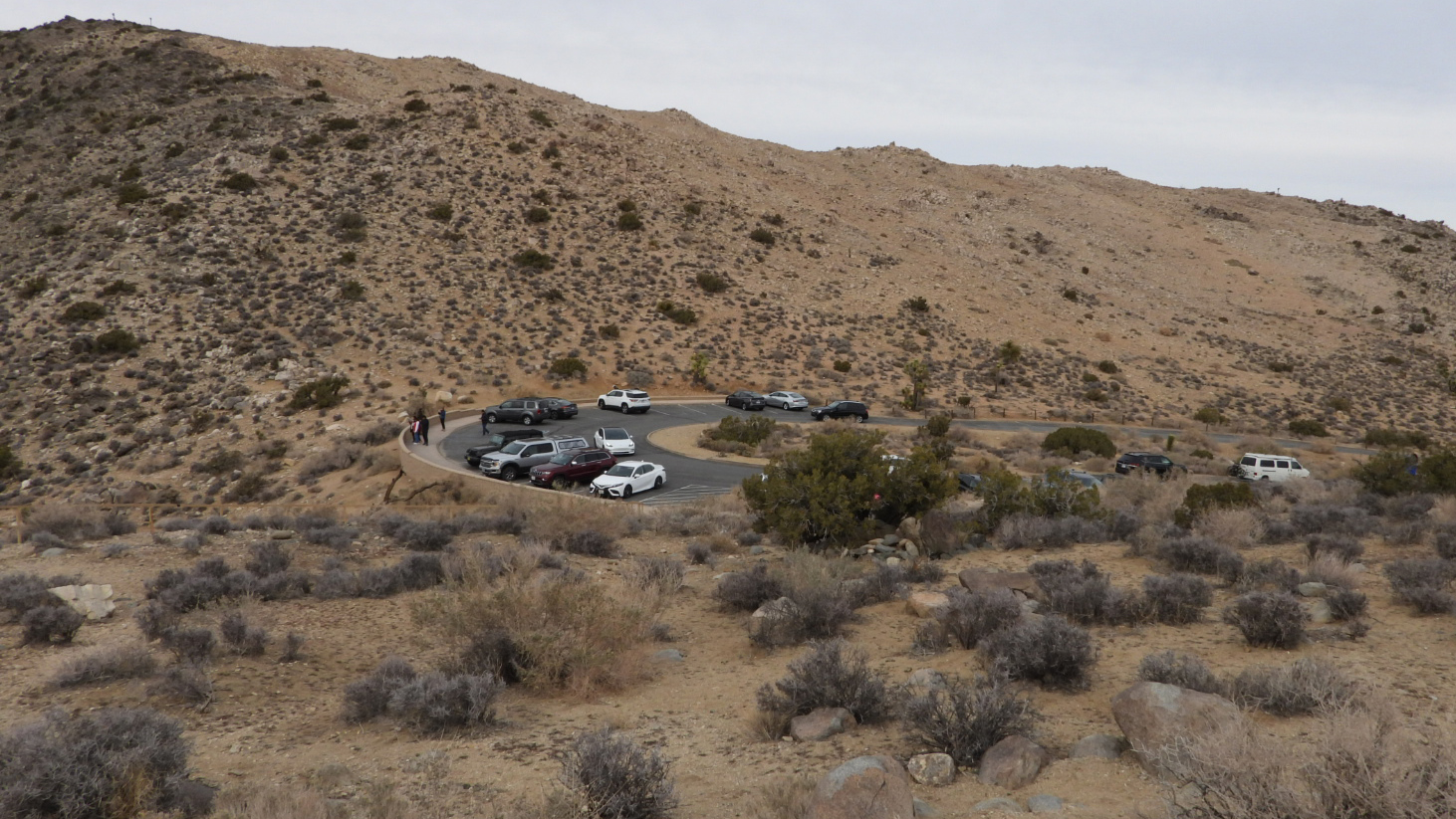 From the top of the overlook we can still see ROVER waiting for us back in the parking lot.
 This little stand of Joshua Trees probably all grew from the same root system.
 See how they all have their own trunk, they're not just branches from one tree.
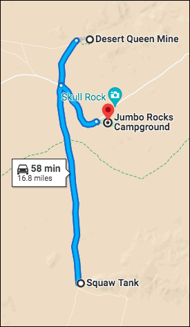
MONDAY - Today's driving tour is quite short compared to the last two we did.
The difference is today's tour is all off road travel, nothing but bumpy washboarded gravel and sand roadways. That's why we're going to keep it short and only do the first 5½-miles (11-miles round trip) of the 18-mile route.
We turned around at Squaw Tank because the road gets rougher if you travel any further and it is the beginning of a 7-mile one-way loop, so once you start the loop you're commited to go all the way around.
A true 4x4 vehicle is recommended for traveling any further and while ROVER is 4x4 equipped, his long wheelbase and being heavily loaded are not favorable conditions for this type of exploring.
The route today is called the Geology Tour Road and is a favorite among the local 4x4 enthusiasts.
It is also available to be explored by hiring local outfitters who rent 4x4 Jeeps and offer self driven guided tours of the route.
Here are a few photos we took while off-roading it today.
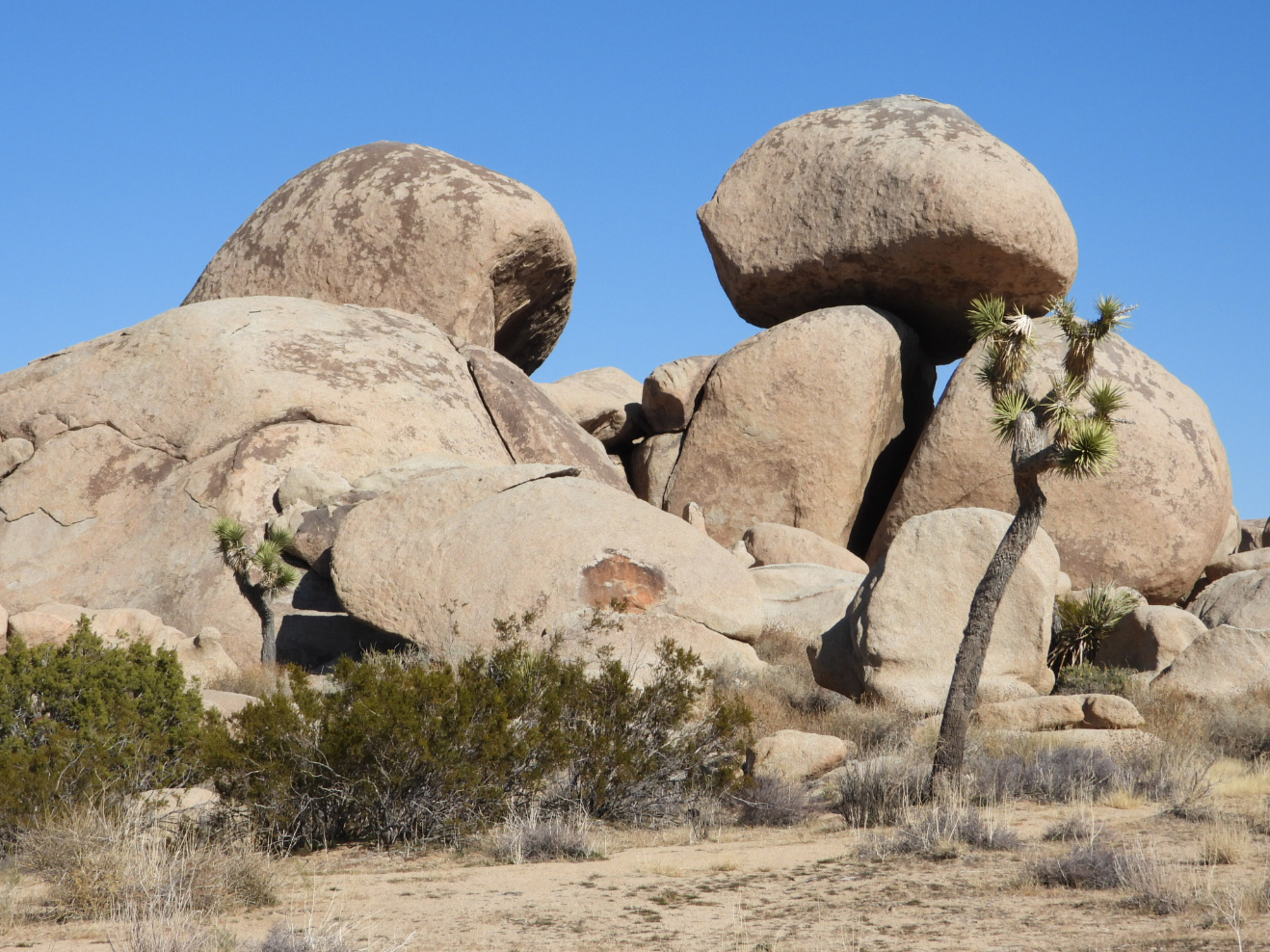
 Yet another pile of jumbo sized rocks.
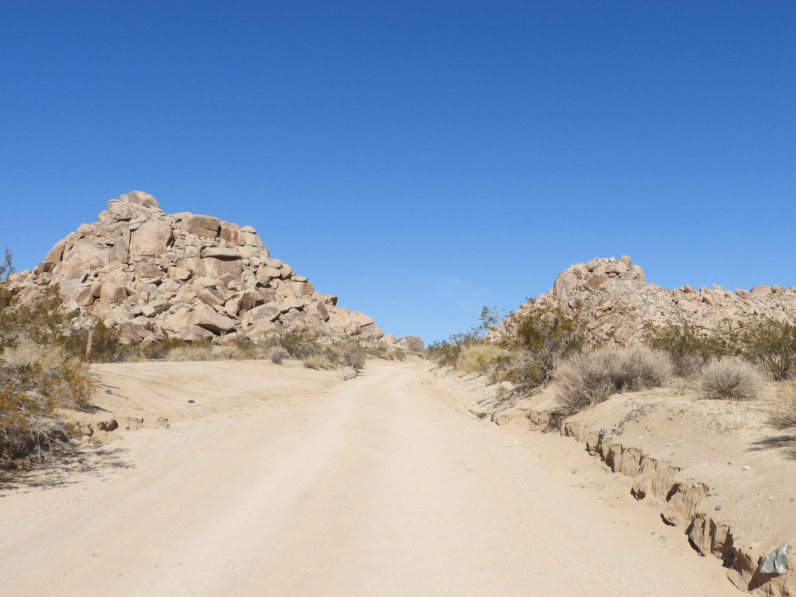 This is a "good section" of the Geology Tour Road.
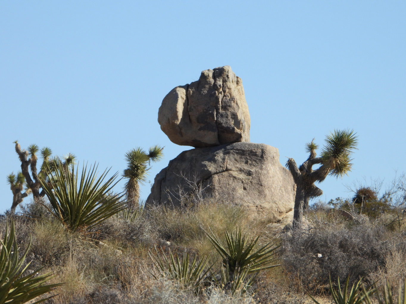 How about that for a balancing act?
 It just doesn't look right for the rocks to be placed like that.
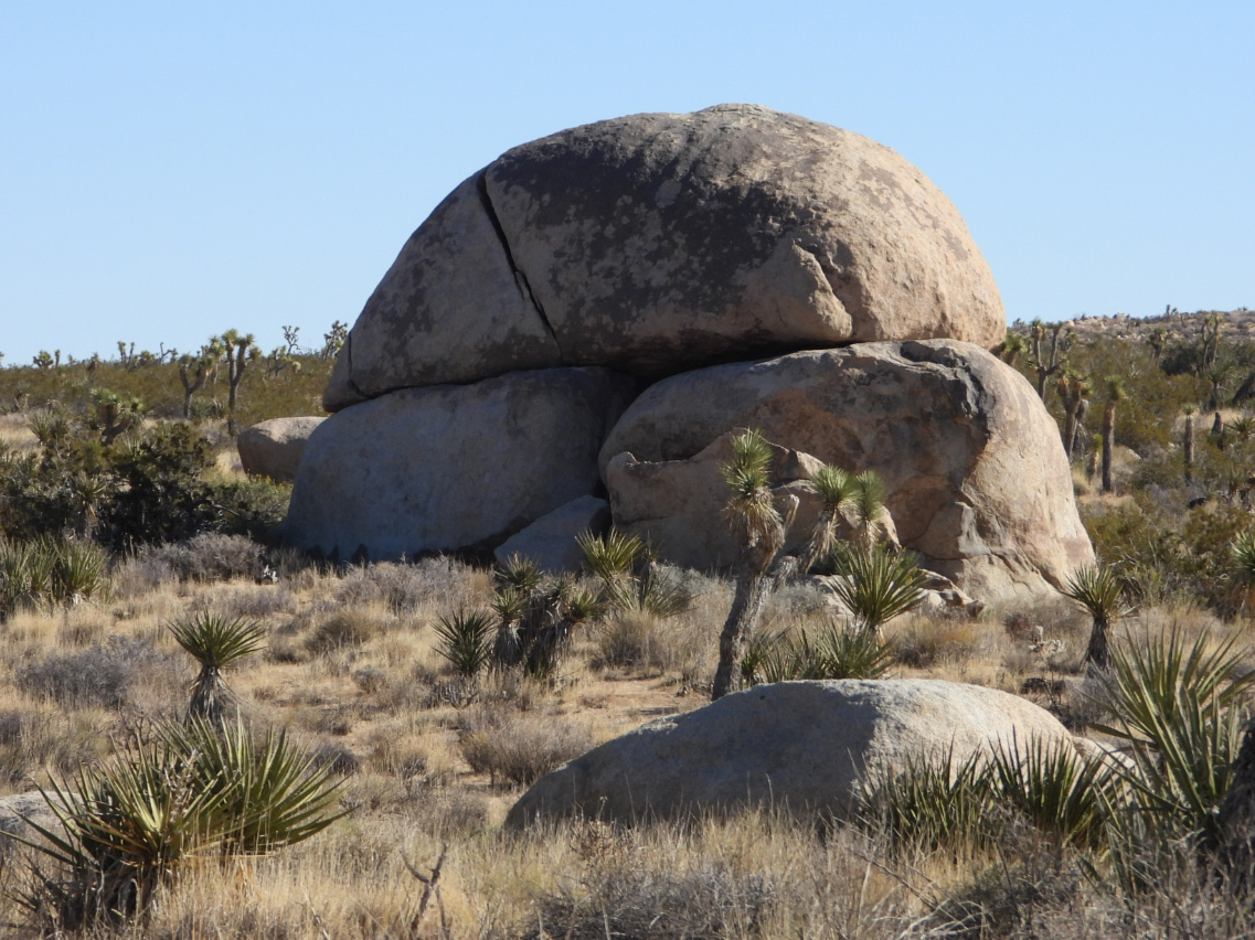 This one Tricia and I named Tortoise Shell Rock. I have no idea if it has a real name!
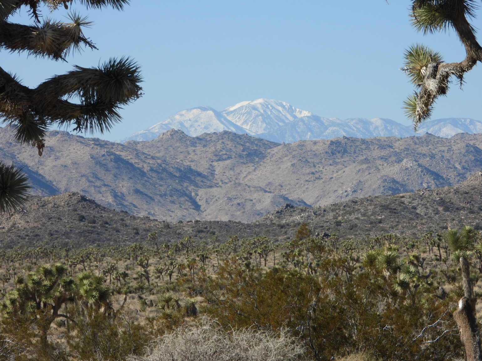 I believe that is the summit of nearby Sugarloaf Mountain (9952 feet in elevation)
After our off roading adventure was over we drove into town, ate lunch, and went to the Tractor Supply Store to refill one of our 30lb. propane tanks.
The temperatures have been in the low 20°F range several of the mornings we've been here and with no electrical hookups we rely solely on propane to heat the trailer. A single tank will last us about 48-hours, if we run it all day and night with the thermostat set at 60°F, even if it's only 20°F outside. No way I want to get caught carrying around an empty tank, even if it is just one of three that we have.
WEDNESDAY - I've been alluding to a special project I've been working on in the last few posts. It's still not quite finished, but it's to a point where I have some photos to share.
Ever since we purchased our Starlink satellite dish so we can recieve internet service, even when we don't have cell phone service, I've been looking for a solution to secure the dish while it's setup outside.
Leaving it laying on the ground while we go off sightseeing just seemed like it was asking to be stolen at some point.
I've always believed you can't stop a determined thief, all you can hope for is to slow them down, or sadly, redirect them to someone elses property where it's easier to acquire what they're looking for.
While my solution is not unique, I've seen others with similiar setups, I understand that what I've come up with is not theft proof, it merely keeps an unprepared opportunist from an easy score.
I also am fully aware that I've now invested another $230 to try and protect my $600 worth of equipment, but the logistics of trying to replace it while continuously traveling from place to place makes it all worth it, if it works!
I always get a chuckle when I see others with their satellite dish extended all the way up
on the end of a 25' tall flagpole as if getting it 10' closer to the satellite will get better reception.
It only needs to be slightly higher than the objects surrounding it to get a clear view of the sky.
This is where my setup differs from the others I've seen.
Notice the hitch receiver locks securing the extension and flagpole holder to the trailer.
I used a bolt-on hitch reciever and an extension to move the flagpole away from the trailer
which leaves enough room that we can still open the front window when necessary.
I then drilled holes through the sections of the pole and placed more hitch locks
to prevent someone from simply lowering the pole to remove the dish.
I also put one in the very bottom of the pole to prevent it from being removed entirely.
By leaving the clips intact I can still use it to fly my flags.
Do I now feel secure enough to leave it outside when we leave the campsite? YES!
Am I still susceptible to theft? ALSO YES!
Is there anything more I'm going to do about it? NO!
If someone wants it bad enough to simply take a sawzall tool and cut the pole down,
THEY CAN HAVE IT.
As I said the project is not finished. I still have to decide on the best solution for getting the wire from the dish to the inside the trailer where it connects to the wifi modem and broadcasts the signal throughout the trailer and nearby surrounding area of our campsite.
Would you like to be notified of new blog posts?