

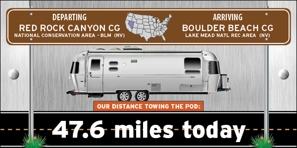
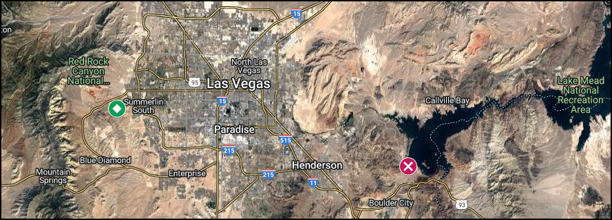
Today we've moved from the western suburbs of Las Vegas over to the southeastern side at the bottom of Lake Mead. Well not literally the bottom, just the bottom if you're looking at it on a map.
We are in a National Park Service campground that is administered by the nearby Lake Mead National Recreation Area office. Lake Mead is essentially a wide spot in the Colorado River that was created when the river was dammed in 1935. The path of the Colorado River determines most of the state border lines between Arizona and Nevada, then further south, Arizona and California.
There is a monumental sized dam just 6-miles from our campsite you may have heard of, it's called the Hoover Dam, and tomorrow we are going on a tour of the inside.


Before you get anywhere near the dam you'll have to pass through a rather rigorous security inspection point (thank you 9/11). They are basically looking for two things, weapons and explosives. They also inquire about drones?
Since our truck has a topper, we were automatically sent to a secondary inspection station to check inside our pickup bed. I had to open several containers for inspection and was waiting for the explosive sniffing dogs to materialize, but they never showed up.
No box trucks or semi trailers are allowed near the dam. In 2001 they closed the road that crosses the dam, it used to be the only road within 100-miles that crossed over the Colorado River, but in 2010 a new bridge was constructed and now the truckers don't have to make a 200-mile detour to just cross the river.
Once through both security checkpoints I thought we were in the clear, until we got to the parking garage. Once again we were asked if we had any weapons, additionally we were asked about flammable liquids. When I replied we had a propane bottle in the back, we were redirected to a different open air parking lot on the other (AZ) side of the dam.
It was the same $10 for parking, but this one is much farther away from the Visitor Center where the tours start. Once across the dam we found there were also several FREE parking lots, but they were even farther away from the Visitor Center.
We were too late arriving at the Visitor Center to make the first tour of the morning, which worked out better because there were only 16 people on the 10:00AM tour with us and maybe 25 people were on the 9:00AM tour we tried to get on.
There are two different tours to select from, a Power Plant tour and a Dam Tour (which includes the power plant). We originally had Power Plant tickets, but upgraded to the Full Dam Tour, which was another factor in missing the 9:00AM tour.
Everyone starts their tour with a 15-minute film before starting the walking portion of the tour. First you'll see the Power Plant area and then pass through some long hallways and short elevator rides that take you through sections of the interior of the dam.
At the end of the tour you'll find yourself exiting an elevator that delivers you to the top center of the roadway that crosses over the dam.
After the tour we walked back to the truck and drove up the Arizona side of the road to where it has been blocked off to through traffic since 2001. There are some very unique views of the dam from up there, that you don't get from the Nevada roadways approaching the dam.
THE HOOVER DAM
1244'L x 45'W @ top & 660'W @ bottom x 726.4'H3.25 million cubic yards of concrete
17 generators capable of producing 1,334,800 kilowatts

|
||||||||
 After being banished from the parking garage
we found a "safe open air" place to park ROVER for the remainder of our visit.
|
||||||||
 This is the view from the Arizona side of Hover Dam.
|
||||||||
 This is the Arizona Spillway for when the water levels get too high,
which has only occured twice since 1935 when the dam was completed,
once in 1941 and again in 1983.
|
||||||||
 The white bathtub ring on the mountain side is the normal high water mark.
|
||||||||
 Just up around that bend to the left is Lake Mead and our campground.
|
||||||||
 The Arizona intake towers that feed water to the turbines which then generate electricity.
|
||||||||

|
||||||||
 The massive amount of power lines leaving the dam,
also the new Interstate-11 bridge high above the Colorado River.
|
||||||||
 The power plant and tailwaters of the Hoover Dam.
|
||||||||

|
||||||||
 The new Visitor Center and the "very nearby" parking garage we weren't allowed in!
|
||||||||

|
||||||||

|
||||||||
 This is the Hoover Dam Memorial Plaza which is under renovation this entire year.
The statues are called, "Winged Figures of the Republic".
|
||||||||
 I think they kind of look like a young Kirk Douglas, don't you agree?
|
||||||||
 I've circled the four vent windows in the dam's face.
Remember the location of the black circle for later. Now let's finally go inside!
|
||||||||
 At the bottom of a long elevator ride we were let out into a long hallway...
|
||||||||
 ...that led to a room with huge water pipes leading to the turbines.
|
||||||||
 After that another long hallway...
|
||||||||
 ...leads to the room which contains the eight turbines on the Nevada side of the dam.
|
||||||||
 Two large overhead cranes are what's used to lift and move the 600-ton turbines
to an offline staging area when it's time for maintenance.
|
||||||||

|
||||||||
 Here are two workers doing maintenance on one of the turbine's magnetic plates.
|
||||||||
 Now that the Power Plant tour is complete it's time to head deep into the dam.
|
||||||||
 All around the terrazzo is decorated with these beautiful Native American inspired inlays.
|
||||||||
 Remember that vent I pointed out? This is us looking out from the inside of the dam.
|
||||||||
 Another long hallway (did you notice they are all curved like the dam)
led us to our final elevator ride back to the top.
|
||||||||
 Back out it the fresh air again!
The vents are what supply the interior areas of the dam with fresh air for the workers inside.
|
||||||||
 The Nevada intake towers.
|
||||||||
 Only one Nevada turbine (see the discharge water churning)
was needed to generate power during our visit today.
|
||||||||
 Looking towards the Arizona side of the dam where ROVER is parked.
|
||||||||
 This is where the spillway water goes down and around the dam.
|
||||||||

|
||||||||

|
||||||||
 All four intake towers.
|
||||||||
 Looking towards Nevada from Arizona.
|
||||||||
 The state line is right in the center of the dam.
|
||||||||
 This small plaque can be found in the center of the dam where Nevada and Arizona meet.
|
||||||||
 This photo is from one of the free parking area located just above the level of the dam.
|
||||||||
 A little farther up and farther away is another place to park for free.
|
||||||||
 A closeup from the same location, which is actually the Arizona Gift Shop parking lot.
|
||||||||
 When leaving the dam area Tricia decided she wanted to walk out
onto the Interstate bridge to take some more photos.
|
||||||||
 A power substation on the Nevada side.
|
||||||||
 The walkway that leads out onto the Interstate bridge...
|
||||||||
 ...where the rest of these amazing photos were taken from.
|
||||||||

|
||||||||

|
||||||||


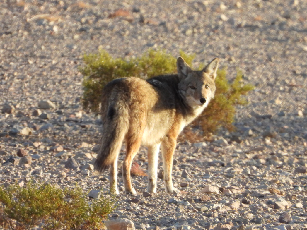
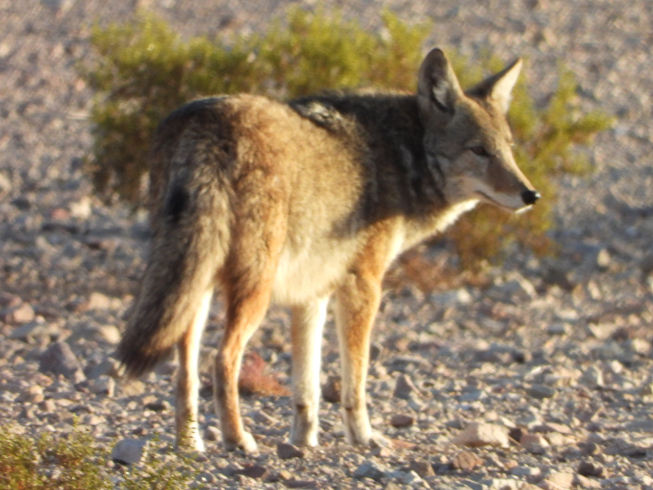
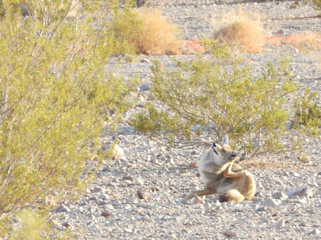
Just on the other side of the road that passes behind our campsite there was a pack of four coyotes yipping and fighting over something they had apparently captured to eat (probably a California Quail).
Once I spotted their location out amoung the low lying shrubs Tricia threw on a sweater over her pajamas and headed out the door. One of our neightbors was already out there looking for the pack and Tricia was able to point her in the right direction.
She was able to capture a few photos before the foursome wandered off and here they are.

That's OK because I have all the dam photos to upload to the blog and that's going to take some time. It's better to do it when no one else in the campground is awake and using up all the bandwidth, at least that's what I'm telling myself.
Later this morning, after it warms up, I have an outdoor project to get started on. Thanks to all the Amazon packages we picked up yesterday in Las Vegas, I now have everything I need to finish the task. At least I hope so anyway!
Tonight at 6:30PM we've been told that there will be some kind of local Holiday Boat Parade out on Lake Mead behind our site. We'll have to wait and see what that's all about!
It's very modest when you compare it to the Fort Lauderdale Boat Parade's I'm used to seeing, but Fort Lauderdale has a population of 182,000 and many surrounding communities with connecting waterways that give it the nicknames of "Venice of America" and "Boating Capital of the World".
Boulder City is in the middle of the dessert and has Lake Mead for it's only boatable waterway. Sure there are residents and corporations of nearby Las Vegas who dock their boats here, but I suspect most of the "big boats" are not to be found here.
All in all it was a pleasurable experience and we got to enjoy it from the comfort of sitting around our campfire and listening to the holiday music of our choice.
Would you like to be notified of new blog posts?


