MONDAY - Today's travels will be a whopping 70-miles, the first 40-miles on MN-1 heading east, followed by 30-miles headed north on MN-61.
Along the route on MN-1 we passed through the town of Finland where we saw a wooden statue on the north side of the road.
We stopped and took a few photos, then learned the 18' tall statue was of St. Urho.
If you've never heard of St. Urho you're not alone. St. Urho is the Patron Saint of Finland, not the town we just drove through, the actual European country that's sandwiched in between Sweden and Russia.
You have probably heard of the Patron Saint of Ireland, St.Patrick. Well these two saints have some similarities and some mighty big differences.
Let's just make it clear, the more widely known St. Patrick was a real person, living sometime in the 5th century. St. Urho wasn't even thought of until 1956 when a Minnesota resident of Finnish ancestory was questioned by an Irish coworker about why there wasn't a famous Patron Saint from Finland. Rather than feel he was bested he made up St. Urho character, complete with an entire backstory.
St. Patrick is credited with driving all the snakes out of Ireland by chasing them into the sea. This is a myth because there have never been any snakes in Ireland. St. Urho on the other hand is credited with ridding the vineyards of Finland from destructive grasshoppers by yelling at them with his mightly voice. I guess that's why the statue has such a "big mouth".
St. Patrick's Day is celebrated on March 17th every year. Want to guess when St. Urho's Day is celebrated? On March 16th of course, just so the inventer could drink his beer a day earlier than his coworker.
A little further down MN-1 we caught a glimpse of Lake Superior, far off in the distance. We'll be camping on the lakeshore for the next few weeks so I'm sure we'll have many more and clearer photos of the lake.
A short while later we were all set up on our Temperance State Park campsite and after a big chef salad for lunch we headed out to see how close we could get to the lake.
LAKE SUPERIOR - FIRST IMPRESSIONS
SLIDE NUMBER
1
OF
7
Right across the campground road from our campsite is this trailhead entrance.
SLIDE NUMBER
2
OF
7
Less than a 100-yards down the trail we saw this opening in the trees.
SLIDE NUMBER
3
OF
7
We made our way over the rocks and down to the lakeshore.
SLIDE NUMBER
4
OF
7
This is where we took our lake water sample of Lake Superior. We intend to collect an ounce of water from each of the five Great Lakes.
SLIDE NUMBER
5
OF
7
I stayed back while Tricia went climbing on the rocky shore.
SLIDE NUMBER
6
OF
7
This was the third little cove we explored today.
SLIDE NUMBER
7
OF
7
Time to head back up to the campsite and plan tomorrow's activities.
TUESDAY - We awoke this morning at 7:00AM to 41°F and rain.
By 2:00PM it had stopped raining and warmed up to a refreshing 44°F, at least the winds had died down. It's forecast to not rise above 50°F all day so around 3:00PM we headed out to do some sightseeing.
Twenty miles north on MN-61 from Temperance River State Park (where we are camped) you'll find Cascade River State Park (FYI it also has a campground). It has a short 1-mile hiking trail that follows up and down both sides of the Cascade River from the trailhead on MN-61.
We elected instead to start our hike from the trailhead right inside the campground, but that makes the hike nearly 1½-miles long, still well within my wheelhouse.
CASCADE RIVER TRAIL
SLIDE NUMBER
1
OF
18
The trailhead sign was easy to spot.
SLIDE NUMBER
2
OF
18
We would be climbing a lot of these stairs carved out of stone.
SLIDE NUMBER
3
OF
18
Where there wasn't enough stone they constructed the stairs out of wood.
SLIDE NUMBER
4
OF
18
Soon we arrived at the Cascade River footbridge.
SLIDE NUMBER
5
OF
18
Looking upriver from the bridge we could see a few of the cascades the river is named for.
SLIDE NUMBER
6
OF
18
Downriver from the bridge there were a few more cascades within sight.
SLIDE NUMBER
7
OF
18
Looking back upriver from down low you can see just how high these cascades really are.
SLIDE NUMBER
8
OF
18
Just beautiful and loud (you'll see in the video that follows).
SLIDE NUMBER
9
OF
18
Here's a long stretch of stairs leading down.
SLIDE NUMBER
10
OF
18
Looking way back upstream at the footbridge we crossed over.
SLIDE NUMBER
11
OF
18
Even more stairs leading down. Remember, what goes down must come back up.
SLIDE NUMBER
12
OF
18
All you wood crafters know exactly how valuable this burl wood tree is!
SLIDE NUMBER
13
OF
18
We're near the bottom of the gorge now and the water is smoothing out.
SLIDE NUMBER
14
OF
18
Here's where the river passes under Highway 61 and enters Lake Superior.
SLIDE NUMBER
15
OF
18
You can just make out the set of stairs that will bring us up to the roadway.
SLIDE NUMBER
16
OF
18
Here's a better view of Cascade Falls from the north side of the river.
SLIDE NUMBER
17
OF
18
It's time to say goodbye to the river...
SLIDE NUMBER
18
OF
18
...and climb the stairs leading back into the campground and trailhead.
Upriver and downriver from the center of the footbridge.
Cascade Falls as seen from the northside of the river.
WEDNESDAY - It's supposed to start raining late this morning and not stop until near midnight, so we were up and out of THE POD by 7:00AM.
Lucky for us there is a bakery just a few miles up the highway and our first sightseeing destination is right across the street.
A couple of $5 breakfast sandwiches and pastries later and we were all set to go.
Cross River Falls as seen from the Highway 61 bridge.
Next up on our list is to visit the falls right here on the Temperance River, just outside of the campground we're staying in. I would like to say we saved the best for last, but it didn't turn out that way!
TEMPERANCE RIVER FALLS
SLIDE NUMBER
1
OF
12
The trail begins at the Highway 61 pullout and immediately heads down a flight of stairs.
SLIDE NUMBER
2
OF
12
At the bottom of the stairs you'll find a circular footbridge over the river.
SLIDE NUMBER
3
OF
12
Looking back towards the highway from the footbridge.
SLIDE NUMBER
4
OF
12
A closer look at the narrow gorge the river has created.
SLIDE NUMBER
5
OF
12
Under the footbridge the river makes a 90° turn into a deep pool...
SLIDE NUMBER
6
OF
12
...just before it joins up with Lake Superior.
SLIDE NUMBER
7
OF
12
The view of the footbridge from the Highway 61 bridge.
SLIDE NUMBER
8
OF
12
See the 90° turn to the left the river takes while passing under the bridge?
SLIDE NUMBER
9
OF
12
Looking upriver from the Highway 61 bridge everything looks pretty calm.
SLIDE NUMBER
10
OF
12
It's amazing how these trees hold on to what little bit of soil there is.
SLIDE NUMBER
11
OF
12
Less than ¼-mile upriver is Hidden Falls.
SLIDE NUMBER
12
OF
12
You can see why it's called "Hidden Falls" (check out the video below).
As seen from the footbridge over the Temperance River.
About as close as you can get to Hidden Falls on the Temperance River.


 Right across the campground road from our campsite is this trailhead entrance.
 Less than a 100-yards down the trail we saw this opening in the trees.
 We made our way over the rocks and down to the lakeshore.
 This is where we took our lake water sample of Lake Superior.
 I stayed back while Tricia went climbing on the rocky shore.
 This was the third little cove we explored today.
 Time to head back up to the campsite and plan tomorrow's activities.

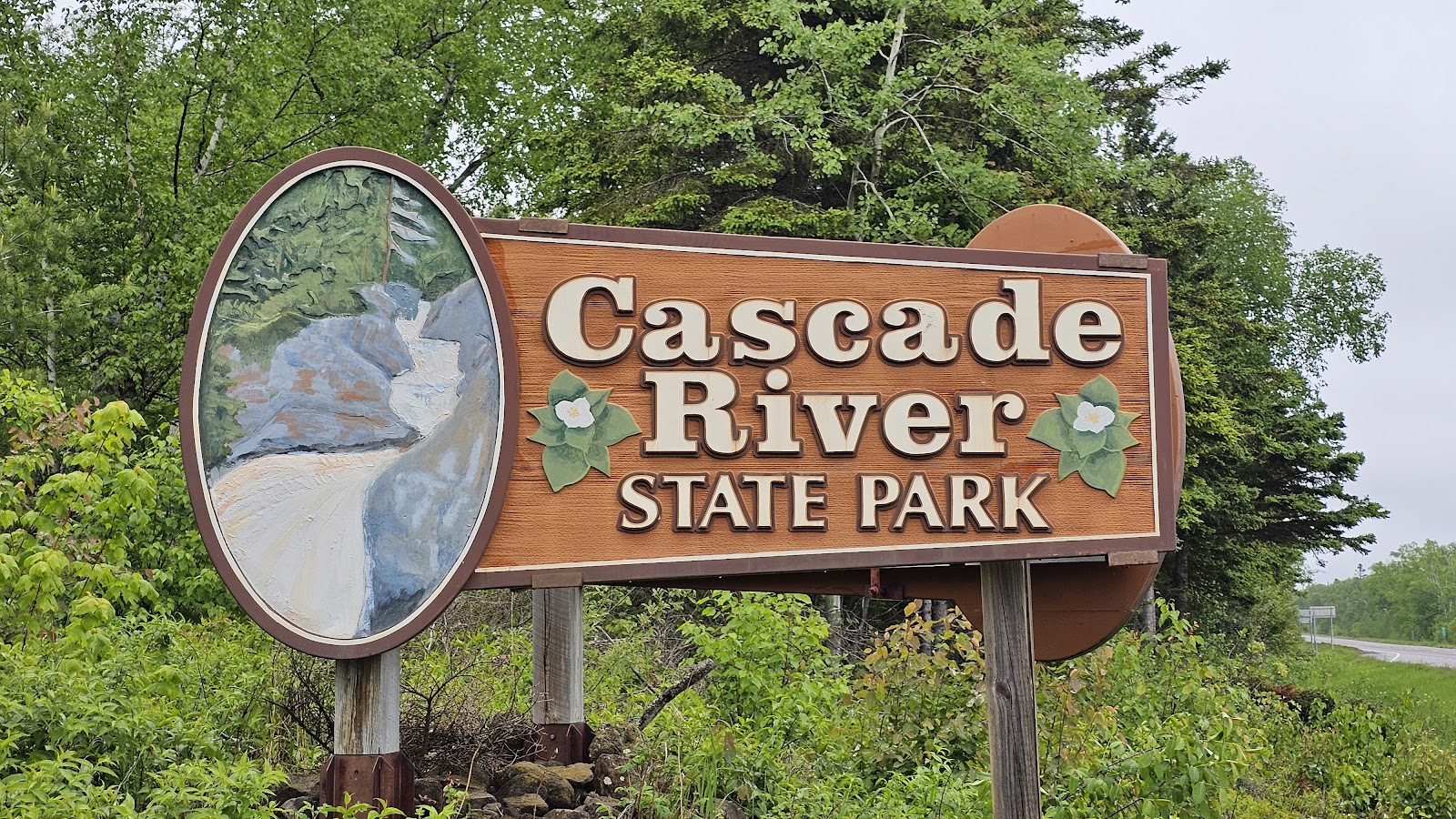
 The trailhead sign was easy to spot.
 We would be climbing a lot of these stairs carved out of stone.
 Where there wasn't enough stone they constructed the stairs out of wood.
 Soon we arrived at the Cascade River footbridge.
 Looking upriver from the bridge we could see a few of the cascades the river is named for.
 Downriver from the bridge there were a few more cascades within sight.
 Looking back upriver from down low you can see just how high these cascades really are.
 Just beautiful and loud (you'll see in the video that follows).
 Here's a long stretch of stairs leading down.
 Looking way back upstream at the footbridge we crossed over.
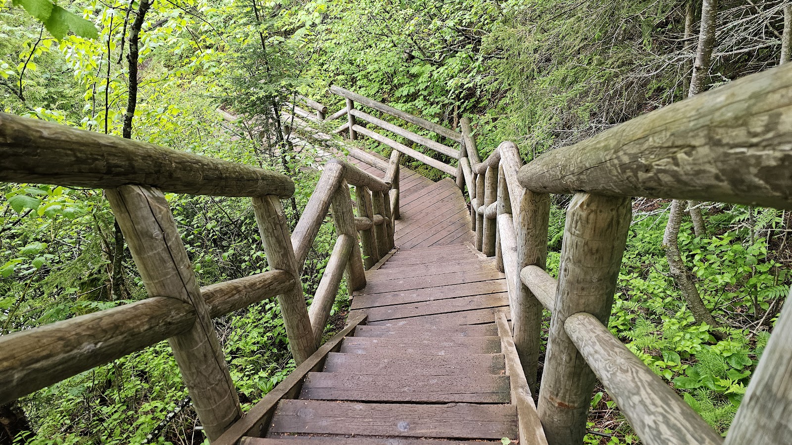 Even more stairs leading down. Remember, what goes down must come back up.
 All you wood crafters know exactly how valuable this burl wood tree is!
 We're near the bottom of the gorge now and the water is smoothing out.
 Here's where the river passes under Highway 61 and enters Lake Superior.
 You can just make out the set of stairs that will bring us up to the roadway.
 Here's a better view of Cascade Falls from the north side of the river.
 It's time to say goodbye to the river...
 ...and climb the stairs leading back into the campground and trailhead.


 The trail begins at the Highway 61 pullout and immediately heads down a flight of stairs.
 At the bottom of the stairs you'll find a circular footbridge over the river.
 Looking back towards the highway from the footbridge.
 A closer look at the narrow gorge the river has created.
 Under the footbridge the river makes a 90° turn into a deep pool...
 ...just before it joins up with Lake Superior.
 The view of the footbridge from the Highway 61 bridge.
 See the 90° turn to the left the river takes while passing under the bridge?
 Looking upriver from the Highway 61 bridge everything looks pretty calm.
 It's amazing how these trees hold on to what little bit of soil there is.
 Less than ¼-mile upriver is Hidden Falls.
 You can see why it's called "Hidden Falls" (check out the video below).