


We then hit the road just before 8:00AM to make our 94-mile move across the northeast corner of Arizona. Before we left town though, we needed to stop at the Maverik's Gas Station just like we did yesterday when we filled up with the least expensive gas in town ($3.13).
Today, we're not stopping for gas again, but this time we are going to make use of their generous offer of a FREE fresh water fill and a FREE dump station. It's not often you can take care of both necessities in one stop for FREE. The best thing is the fresh water is over by the truckers fuel pumps (Lane 22 actually) and then you move across the parking lot to dump your tanks and once again there's FREE water to flush your tanks. I always get a little bit nervous when the drinking water is within reach of the dump station!
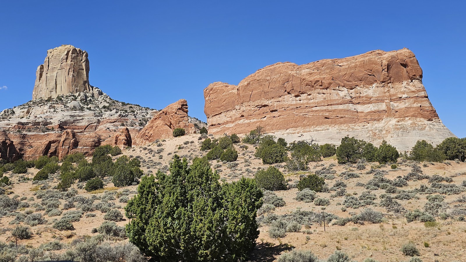
During our travels today we passed by several interesting rock formations. They weren't quite "Monument Valley" calibre, but they still caught our attention enough to grab a few photos.

When we were about 9-miles from our destination we turned off of the wide-shouldered US-160 and onto the non-shouldered AZ-564. If that wasn't bad enough there was a warning sign right at the intersection.
It informed us we were heading towards the Navajo National Monument (that's good), but the warning was the road had very few turnaround opportunities and was not suited for RVs over 28-feet (not good).
Luckily THE POD measures EXACTLY 28-feet from the hitch ball receiver to the rear bumper, WHEW!
The road up to the National Monument was narrow with no shoulders and I only saw one place where I could have executed a U-turn if I needed to.
Navajo National Monument has two campgrounds, one with 31 sites and another with just 14-sites. Both are listed very emphatically as having a 28' MAX RV LIMIT. The smaller campground is even described as a primitive tent campground.
We chose to check out the larger of the two campgrounds first. We could probably have fit THE POD on about 25 of the sites, but there would have been no room for ROVER on the site. Maybe 5 of the sites could fit both, but 2 of them were occupied.
The 31 sites are all in one loop and at the end of our trip around the loop we decided to take Campsite #31. It's just deep enough for THE POD and just wide enough to park ROVER side by side with little room to spare.
Oh heck, just look at the photos!


Sometime before sunset tonight we'll drive the 2-miles further down the road to check out the other campground and see if it would have been a better option for us. I doubt it however!
Before checking out the other campground we drove back out near the entrance gate and checked out a short hike they call the Tsegi Overlook Trail.


We did drive up to the Canyon View campground and the website had it correct, this campground in better suited to tent camping. Some of the sites themselves are large enough to accommodate 28' trailers, but the roads are mostly 1-lane with 2-way traffic.
If a large trailer were trying to leave at the same time as you were arriving with another large trailer, it would create a large traffic jam. We're so glad we went with our first choice of Sunset View Campground.

It leads 150' below the canyon rim to the only place in the park where you can view the Betatakin cliff dwellings. The only other way to experience the dwellings is to hike a much longer and steeper trail on a Ranger led tour that leaves at 7:00AM on Friday and Saturday mornings.
SANDAL TRAIL

|
||||||||
 This exhibit outside of the Visitor Center includes a hogan (left) and a sweathouse (right).
|
||||||||
 The Sandal Trail begins and we learned it's all downhill from the Visitor Center.
|
||||||||
 In some locations the trail was all rock and no shade.
|
||||||||
 There were several "Narrowleaf Yucca" plants in near full bloom.
|
||||||||
 Just around this corner is the first of two rest benches.
I'm going to need both of those on the return trip.
|
||||||||
 This is called "Firecracker Penstemon".
|
||||||||
 There is a series a several steep switchbacks near the end of the trail.
|
||||||||
 We made it to the end of the trail and had the place all to ourselves.
|
||||||||
 This is the view of the canyon to the east...
|
||||||||
 ...and in that alcove over there are the Betatakin Cliff Dwellings.
|
||||||||
 If we zoom in a little bit the buildings become recognizable.
|
||||||||
 That's even better. The dwellings occupy the entire space, left to right.
|
||||||||

|
||||||||

|
||||||||
 This is as far in as Tricia's 10x zoom cameraphone will go.
|
||||||||

|
||||||||

|
||||||||
 I'm sure the Ranger led hikes down into the canyon are awesome.
|
||||||||
 This is a "Plains Pricklypear Cactus" in full bloom.
|
||||||||
 Now that's one piece of knarly wood.
|
||||||||
 These are called "Fragrant Evening Primrose".
|
||||||||
 These little yellow flowers were everywhere.
|
||||||||
 These are called either "Fleabanes or Horseweeds".
|
||||||||
 You can just barely see the Visitor Center up on the top from the second rest bench.
|
||||||||
 More "Plains Pricklypear Cactus" blooms.
|
||||||||
 These "Narrowleaf Yuccas" were in full bloom.
|
||||||||
 I had to create an "unofficial" 3rd rest area and I was so close to making it to the finish.
|
||||||||
 That divot in the rock is a 3-toed dinosaur footprint.

At the end of our hike we returned to the "now open" Visitor Center. We went inside to take care of a few chores.
I went out to ROVER to retrieve my National Parks Passport Book and stamped it upside down. This is the only stamp I've come across in 7-years that you hold it with the flat side at the top instead of the bottom? Go figure! You can bet I won't fall for that trick again.
We watched a 15-minute documentary film that informed us all about the peoples that lived here some 800 years ago. It also spoke about all the decendants who still live in the area and what the National Monument means to them.
Tricia took a stroll around the gift shop and of course didn't come back empty handed. She found two pouches of tea she wanted to try, one of the flavors is supposed to tast like a Cuban Mojito? Her favorite alcoholic drink.

Our next visit to Arizona won't be until later this year in November, but we have plans to stay up to 40-days on that visit.
Tomorrow will also be a driving day that we've been looking forward to for quite some time. I've hinted at where that will be several times over the last few posts.
Take a look at a map and I'm sure you'll figure it out!
How about our State by State Bucket Lists or Visited Campgrounds List?
If so, click on the sign below to be taken to our other website.

Would you like to be notified of new blog posts?

