MONDAY - Today's 89-mile travel day had us traveling through such towns as Bluff, UT (pop. 240), then White Mesa (pop. 277) and since we needed groceries and drinking water we traveled 3-miles off the route to the "bigger" town of Blanding, UT (pop. 3,394).
It was in Blanding where we topped off ROVER's tank with $3.27 fuel and then proceeded directly across the street to the only business in town described as a grocery store, Clark's Market (closed on Sundays). I remember way back when Publix was closed on Sundays to "let there employees have a day with their families". Boy, those days are long gone!
We were pleasantly surprised when we walked into Clark's Market and found a nice variety of the foods we like to eat. They also have an "Arctic Water" dispensing machine (I called ahead to verify) in the back corner of the store where we filled all four of our 3-gallon drinking water bottles. With temperatures well above 90°F most of all last week and no A/C, we've been making a lot of ice cubes, plus drinking a lot of water and fresh-brewed ice tea (Thanks Tricia).
Well enough talk, I know you come here just to see Tricia's photos!
OUR TRAVEL DAY
SLIDE NUMBER
1
OF
13
This photo makes it appear that our day started just like every other day. Only it's 4:15AM and that's not the sunrise, it's the moon setting from the night before.
SLIDE NUMBER
2
OF
13
Now at 5:30AM it's beginning to look like a proper sunrise will occur.
SLIDE NUMBER
3
OF
13
There it is, right on time at 6:03AM!
SLIDE NUMBER
4
OF
13
Approaching the town of Bluff, ROVER just laughed at the roadway challenge in front of him...
SLIDE NUMBER
5
OF
13
...but he sure was happy to see they dug out a path for him over this obstacle.
SLIDE NUMBER
6
OF
13
Somewhere over on that far ridgeline is our campsite for the next three days.
SLIDE NUMBER
7
OF
13
In the parking lot of the Visitor Center were these blooming Palmer's Penstemon.
SLIDE NUMBER
8
OF
13
Those two flat top mesas in the background are called the Bear's Ears. Looks a little wet, I think we'll wait until tomorrow to schedule our visit.
SLIDE NUMBER
9
OF
13
They claim this is a 26' RV site, but we squeezed our 28' Airstream in just fine.
SLIDE NUMBER
10
OF
13
There is plenty of room left over for a tent or a screen room.
SLIDE NUMBER
11
OF
13
With zero cell phone service out here I'm glad we have a clear view of the sky for Starlink.
SLIDE NUMBER
12
OF
13
Even though the campground is full there's not another human in sight.
SLIDE NUMBER
13
OF
13
But this guy came crawling out of the bushes to see if we brought him any food.
TUESDAY - We have got a super busy day planned for today.
In the morning we are going to hike the 2.25-mile round trip "House on Fire" trail. We got an early start for two reasons, we wanted to beat the crowds that go later in the morning and we wanted to beat the afternoon heat.
We succeeded on both counts, only seeing one other person on the way in and four more on the way out. Plus the temperature really didn't factor in and affect our comfort level. That's a big WIN! WIN! in my book.
NOT OUR PHOTO! I REPEAT, NOT OUR PHOTO!
That's what the iconic shot of House on Fire looks like, but that's not what we saw today. We are here about a month too late because the sun bounches off the rocks in front of the "House" in the early afternoon and it would have been in the low 90°Fs if we had shot for that time frame for our hike.
Anyway, the rest of these photos Tricia did take on our hike this morning.
HOUSE ON FIRE TRAIL
SLIDE NUMBER
1
OF
21
The trail begins at this spot on the side of the road.
SLIDE NUMBER
2
OF
21
A little over 1-mile down this canyon is what we came to see.
SLIDE NUMBER
3
OF
21
Any time there was shade on the trail we stopped for a drink of water.
SLIDE NUMBER
4
OF
21
This smaller overhang looks like it too could have once been a homesite.
SLIDE NUMBER
5
OF
21
I don't care! No way I'm stopping under that rock for a drink of water.
SLIDE NUMBER
6
OF
21
This identifies as a Pale Evening Primrose.
SLIDE NUMBER
7
OF
21
This is an Arizona Thistle, over 100-miles inside of Utah?
SLIDE NUMBER
8
OF
21
This Yellow Sweetclover could be found all over the place.
SLIDE NUMBER
9
OF
21
This Western Spiderwort is a brilliant purple color.
SLIDE NUMBER
10
OF
21
Up there under that overhang we could see the edge of House of Fire.
SLIDE NUMBER
11
OF
21
We found this box near the trail, but couldn't figure out how to open it.
SLIDE NUMBER
12
OF
21
We arrived at the House on Fire at 9:45AM, way too early to see the fire.
SLIDE NUMBER
13
OF
21
The sun is still hours away from illuminating the ceiling above the House.
SLIDE NUMBER
14
OF
21
It was still worth the effort to get out here and we were glad to see no graffiti.
SLIDE NUMBER
15
OF
21
We got up close enough to look in the windows, but nothing much to see.
SLIDE NUMBER
16
OF
21
I for one was glad there was still shade in front of the house.
SLIDE NUMBER
17
OF
21
As Scooby would say, "Rut Roh"! I know that look. It's been 30-minutes and it's time to leave.
SLIDE NUMBER
18
OF
21
We were soon back on the trail and headed back towards ROVER.
SLIDE NUMBER
19
OF
21
Ah more shade, but no where to sit except the ground. No thanks!
SLIDE NUMBER
20
OF
21
Tricia spotted this tiny window up in the rocks. I never even saw it!
SLIDE NUMBER
21
OF
21
I see a vehicle up on the rim. It's not ROVER, but he'll be close by.
Just a half a mile from the House of Fire Trailhead was another pullout with an Interpretive Site. We pulled in to check it out, but they also have a bathroom, something the trail did not have.
MULE CANYON INTERPRETIVE SITE
SLIDE NUMBER
1
OF
10
Since we finished the hike before 11:00AM we had to check out this little site.
SLIDE NUMBER
2
OF
10
There was a much appreciated nice flat sidewalk trail throughout the site.
SLIDE NUMBER
3
OF
10
This base is all that's left of a tall observation tower.
SLIDE NUMBER
4
OF
10
Under the large protective shelter was a small kiva.
SLIDE NUMBER
5
OF
10
I say small because we've seen other ones 10 times this size and bigger.
SLIDE NUMBER
6
OF
10
The kiva is used for ceremonies and community meetings.
SLIDE NUMBER
7
OF
10
There is seating all around the outer perimeter of the kiva.
SLIDE NUMBER
8
OF
10
The elevated seats would have been occupied by the tribe elders.
SLIDE NUMBER
9
OF
10
The rest of the site had small rectangular rooms where the families would have lived.
SLIDE NUMBER
10
OF
10
And there's ROVER and I awaiting Tricia's return. I had enough walking today.
Now that the morning activities have been accomplished it's time to head back to THE POD for some lunch and an extended break, because we're not done yet!
BEARS EARS
SLIDE NUMBER
1
OF
14
SLIDE NUMBER
2
OF
14
The 6-mile section of Elk Mountain Road that we will be traveling on today starts at the UT-275 Highway at an elevation of about 6900' and ends in the saddle between the two Bears Ears peaks at an elevation of just over 8500'.
SLIDE NUMBER
3
OF
14
Tricia thought that slanted rock on the right looks like a snake with it's mouth open, ready to bite the next car that passes by!
SLIDE NUMBER
4
OF
14
There's the Jeep headed down the mountain that we just passed on the road a minute ago.
SLIDE NUMBER
5
OF
14
The road wasn't all uphill, but it sure felt like it.
SLIDE NUMBER
6
OF
14
We haven't reached the Bears Ears yet and I'm beginning to believe it's not in the National Monument at all, instead it's in the National Forest?
SLIDE NUMBER
7
OF
14
Those are the two Bears Ears peaks that we're headed up to get a closer look at.
SLIDE NUMBER
8
OF
14
Almost there!
SLIDE NUMBER
9
OF
14
It apears the peak on the right is a little over 100' higher.
SLIDE NUMBER
10
OF
14
This is the left peak (the shorter one).
SLIDE NUMBER
11
OF
14
That's the right peak that's just a tad bit higher.
SLIDE NUMBER
12
OF
14
Well, time to head 1600' back down this mountain.
SLIDE NUMBER
13
OF
14
SLIDE NUMBER
14
OF
14
On our way out we passed this 25'+ RV, what you can't see is the 15' trailer on the back with a full sized 4-wheeler.
WEDNESDAY - I know what you're thinking! We've been here at Natural Bridges National Monument going on three days now and we haven't shared a single photo of a natural bridge yet.
You're absolutely right of course, but that's because we haven't seen one either. That all changes today on our last full day here.
The three named natrual bridges found here in the park can all be seen from overlooks along the 9-mile Scenic Drive in the rear of the park.
Each natural bridge can be hiked down into the canyon where you can get stunning photos looking up through the bridge with the blue sky in the background, you know, the same photos you see in all the brochures and advertising information.
Well you won't be seeing any of those from us, we observed each location from an overlook that was never more than a few hundred feet from the parking lot.
First off a little bit of education. Does anyone know the difference between a natural bridge and an arch? They look the same but are formed entirely different.
Natural bridges are formed by the erosive action of moving water. Arches are formed by other erosional forces, mainly frost action and seeping moisture, that also enlarge a natural bridge once stream erosion forms them.
That definition was taken straight out of the brochure they handed us in the Visitor Center and I assume they know what they're talking about.
Sipapu Bridge is the second largest natural bridge in the United States, only Rainbow Bridge is larger. In Hopi mythology a "sipapu" is a gateway through which souls may pass to the spirit world.
If you would like to try and see if the myth is true, you'll have to hike down 400' along a 1.5-mile trail to find out. As I said before, we didn't take the hike and opted to observe from the convenient overlook instead.
This one is not a bridge, but we did hike .6-miles to get this view.
This is called Horsecollar House, thanks mostly to the shape of the windows.
The dwelling to the left of it still has a partial intact roof, even after 750+ years.
Owachomo means "rock mound" in Hopi, named after the rock formation on top of the southeast end of the bridge (not in the picture).
I suspect in the coming centuries that this will be the first of the three bridges to collapse, it does happen. This is the thinnest of the three at only 9' thick and large cracks are already visible near the center of the bridge.
Tricia did spot a fourth bridge and as far as we know, yet unnamed. There is already a large chunk of the ceiling laying directly underneath the arch. Maybe someday we'll come back and find out that it too now has a name.
Looking for our Visited States Map and Data? How about our State by State Bucket Lists or Visited Campgrounds List? If so, click on the sign below to be taken to our other website.


 This photo makes it appear that our day started just like every other day.
 Now at 5:30AM it's beginning to look like a proper sunrise will occur.
 There it is, right on time at 6:03AM!
 Approaching the town of Bluff, ROVER just laughed at the roadway challenge in front of him...
 ...but he sure was happy to see they dug out a path for him over this obstacle.
 Somewhere over on that far ridgeline is our campsite for the next three days.
 In the parking lot of the Visitor Center were these blooming Palmer's Penstemon.
 Those two flat top mesas in the background are called the Bear's Ears.
 They claim this is a 26' RV site, but we squeezed our 28' Airstream in just fine.
 There is plenty of room left over for a tent or a screen room.
 With zero cell phone service out here I'm glad we have a clear view of the sky for Starlink.
 Even though the campground is full there's not another human in sight.
 But this guy came crawling out of the bushes to see if we brought him any food.


 The trail begins at this spot on the side of the road.
 A little over 1-mile down this canyon is what we came to see.
 Any time there was shade on the trail we stopped for a drink of water.
 This smaller overhang looks like it too could have once been a homesite.
 I don't care! No way I'm stopping under that rock for a drink of water.
 This identifies as a Pale Evening Primrose.
 This is an Arizona Thistle, over 100-miles inside of Utah?
 This Yellow Sweetclover could be found all over the place.
 This Western Spiderwort is a brilliant purple color.
 Up there under that overhang we could see the edge of House of Fire.
 We found this box near the trail, but couldn't figure out how to open it.
 We arrived at the House on Fire at 9:45AM, way too early to see the fire.
 The sun is still hours away from illuminating the ceiling above the House.
 It was still worth the effort to get out here and we were glad to see no graffiti.
 We got up close enough to look in the windows, but nothing much to see.
 I for one was glad there was still shade in front of the house.
 As Scooby would say, "Rut Roh"! I know that look. It's been 30-minutes and it's time to leave.
 We were soon back on the trail and headed back towards ROVER.
 Ah more shade, but no where to sit except the ground. No thanks!
 Tricia spotted this tiny window up in the rocks. I never even saw it!
 I see a vehicle up on the rim. It's not ROVER, but he'll be close by.
 Since we finished the hike before 11:00AM we had to check out this little site.
 There was a much appreciated nice flat sidewalk trail throughout the site.
 This base is all that's left of a tall observation tower.
 Under the large protective shelter was a small kiva.
 I say small because we've seen other ones 10 times this size and bigger.
 The kiva is used for ceremonies and community meetings.
 There is seating all around the outer perimeter of the kiva.
 The elevated seats would have been occupied by the tribe elders.
 The rest of the site had small rectangular rooms where the families would have lived.
 And there's ROVER and I awaiting Tricia's return. I had enough walking today.
 The 6-mile section of Elk Mountain Road that we will be traveling on today starts
 Tricia thought that slanted rock on the right looks like a snake
 There's the Jeep headed down the mountain that we just passed on the road a minute ago.
 The road wasn't all uphill, but it sure felt like it.
 We haven't reached the Bears Ears yet and I'm beginning to believe it's not in
 Those are the two Bears Ears peaks that we're headed up to get a closer look at.
 Almost there!
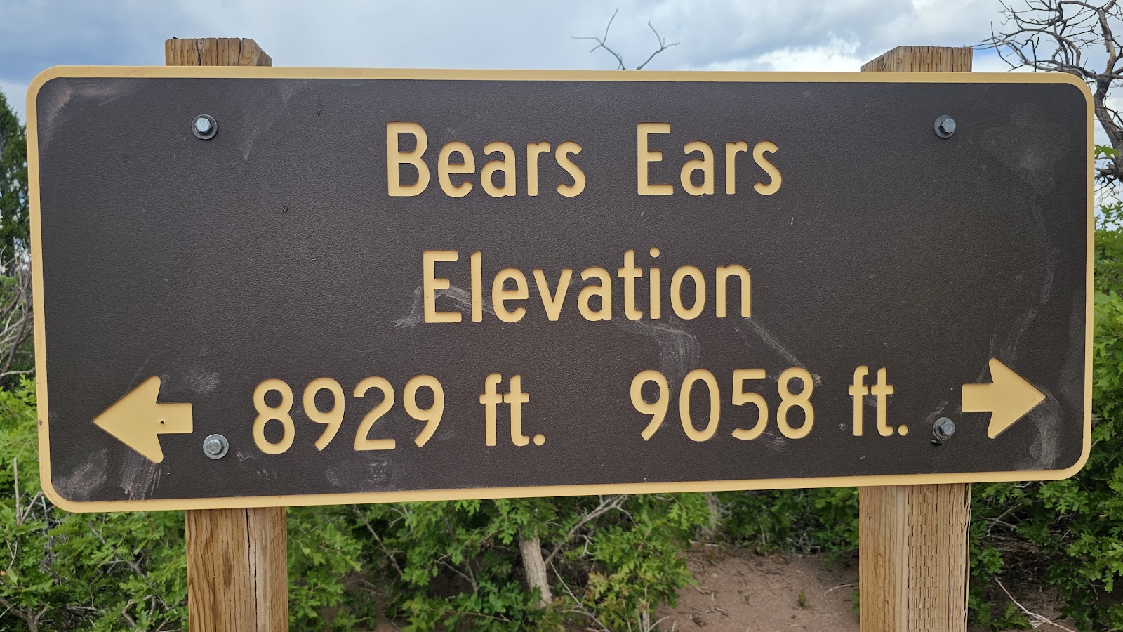 It apears the peak on the right is a little over 100' higher.
 This is the left peak (the shorter one).
 That's the right peak that's just a tad bit higher.
 Well, time to head 1600' back down this mountain.
 On our way out we passed this 25'+ RV,


