We're not quite sure where we will be spending the night, but I have a general idea to be somewhere along the Colorado River outside of Moab, UT.
There are 4 campgrounds that fit those requirements with a total of 74 campsites. Mind you, not all of those 74 campsites will fit ROVER and THE POD, and it is a Saturday, so all of the locals have probably been on most of those campsites since last night.
They are all First-Come-First-Serve so there are no advanced reservations like I usually try to secure before our arrival. All we can do is drive through the first of the four campgrounds and see if there are any vacancies.
The first campground is about 80-miles from where we're starting today and is likely to be full. It's only 2.5-miles from downtown Moab and 3.5-miles from the entrance to Arches National Park. Plus, it's one of the few campgrounds that has campsites with direct access to the Colorado River.
Wish us luck! I hope we have enough "Good Karma" credits built up to make another big withdrawal from our account.


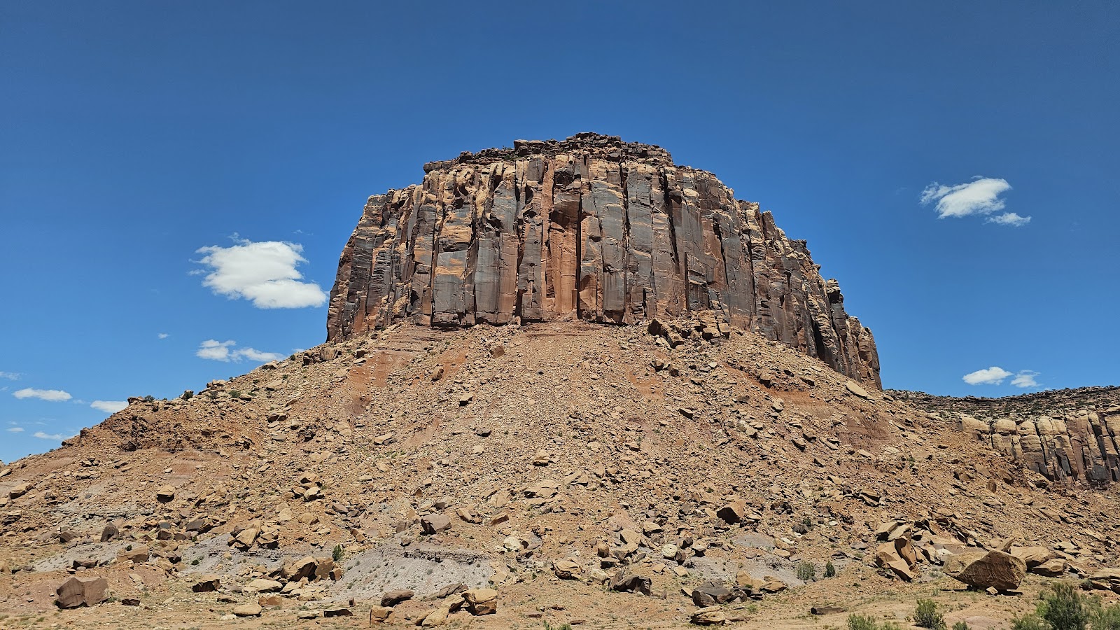
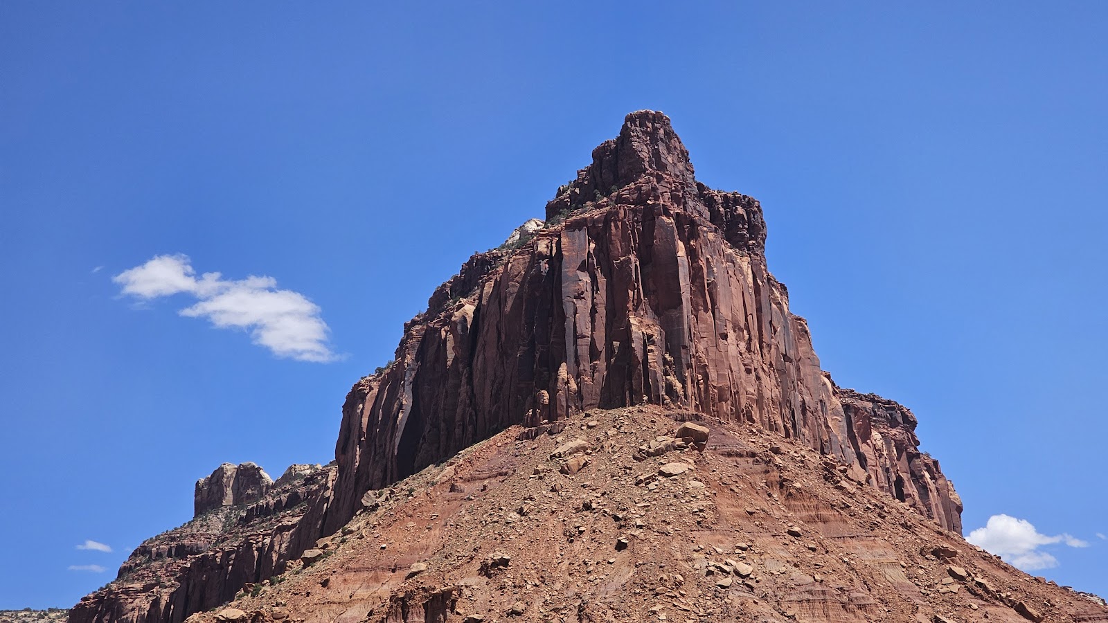
It wasn't very long before we found ourselves exiting Canyonlands National Park and immediately found ourselves entering the Bears Ears National Monument property.
A feature location we saw on the way in yesterday is the Newspaper Rock Petroglyphs. We caught a brief glimpse as we drove by yesterday but didn't stop, knowing we would have a chance to give it a proper visit this morning on the way out. The parking lot was just big enough for ROVER and THE POD, plus about 10 others cars.
NEWSPAPER ROCK PETROGLYPHS

|
||||||||

|
||||||||
 This rock truly is like a newspaper, if you know how to read it.
|
||||||||
 I can't make much sense of all the symbols, can you?
|
||||||||
 Unfortunately since the rock is not guarded there has been some graffiti.
|
||||||||

|
||||||||

|
||||||||
 Since you can't remove the "scratched in" graffiti it's been "obliterated" instead.
|
||||||||

|
||||||||

|
||||||||

|
||||||||

|
||||||||

|
||||||||

|
||||||||

|
||||||||
 The images have been added to over the centuries, but the earliest ones are 1500 years old.

We finally made it back out onto U.S. Highway 191 after driving 38-miles and turned north towards Moab, UT. It seemed the closer we get to Moab, the nicer the scenery gets.


passed the Hole N" the Rock, a 5000 sq. ft., 14-room home scratched deep into the mountain.

WE SCORED AN AWESOME CAMPSITE for just $10 a night!
I wonder just how many Good Karma credits we burned up on this bit of luck?


I think I know where the Good Karma credits came from. When we were in Silverton two days ago, at the turnaround point of our scenic train ride, Tricia went off taking photos of the town while I took a seat on a bench within view of our train so I wouldn't miss it taking off.
Two pre-teen aged boys had a table set up on the sidewalk and they were selling "pretty rocks" to the tourists for anywhere from $1 to $3 each. A few people who walked by "looked" at the rocks, but very few "bought" anything.
I was sitting close enough that I could hear their "sales pitch" that they were raising money for a church field trip they wanted to go on. Sitting next to me, on another bench, was an older couple from Tampa who had ridden the same train up with us from Durango, but elected to take the much faster and more comfortable tour bus back down the mountain.
After 15-minutes of watching them having very little success selling their rocks, the man from Tampa stood up and approached the boys. They got all excited with the new prospect of selling some of their rocks, and the man did indeed buy a few dollars worth from them.
When he was finished and returned to his seat I knew what I had to do. It was my turn to approach the boys. I had a $20 bill in my hand and explained that I didn't want to buy any of their carefully selected inventory, but I did want them to enjoy the field trip they were working hard to attend.
I sat back down on my bench and the woman from Tampa looked over at me and said what a nice thing that was I did for the boys. I explained that they could very well be just be a couple of young locals, scamming the tourists, but that would be on them, and I would still recieve my Good Karma credits. I guess I did!
Between 10:30AM and 11:00AM we had a few groups of "red rafts" come floating by our campsite. They were all obviously all from the same outfitter giving rides down the river. There were a few others who floated by on their own rafts and even a small motor boat went by.


She was in the water for almost an hour and when she returned to THE POD I asked if the water was "cold", she smiled and said it was "refreshing", in other words, I wouldn't like it!


Typically I like to drive no more than 100-125 miles between campsites, so we need someplace to camp tonight between here and there.
The town of Grand Junction, CO is 100-miles from here and there are two Walmarts in town, just off Interstate-70 which we will be traveling on. Sounds like a perfect place to overnight for just one night and it splits the 178-mile drive very nicely.
There's only one problem with that plan, the town of Grand Junction has a city wide ordinance that prohibits overnight parking. I called both Walmarts and got the same answer, sorry but we can't allow overnight parking!
I understand the city ordinance, which is probably designed to deal with "undesirable" people trying to "camp" multiple nights in locations like Walmart, and we will obviously abide by it. What I don't understand is why eliminate Walmart's storewide "good neighbor" policy of allowing RVers to overnight "for one night" before moving on the next day.
There is one other town along our route that has a Walmart, but it's 150-miles from here. That doesn't really help split up the long drive does it?
What to do? Here's our simple solution.
One good thing about First-Come-First-Serve camping is that "once you have secured a campsite" it's yours for as long as you want it (up to the 14-day maximum at this location). That means that as long as I go pay for another day before the check-out time of 11:00AM we can just stay put right here on our awesome riverside campsite.
It also means we'll have to leave early tomorrow morning and will be facing a 188-mile driving day. We'll still make an extended stop "in the daytime" at the Walmart 100-miles down the road in Grand Junction. We'll eat lunch there and shop for groceries for the next week, before getting back on the road to finish the 88-miles to our final destination.
By 10:00AM I was beginning to wonder why I hadn't seen any rafters, kayakers or stand up paddle boarders floating by on the river?
About 30-minutes later I think I figured it out.


Good news is my weather station says it "Feels Like" 102°F, thanks to the low 10% humidity!
Around 1:30PM this afternoon we "may" have broken our All Time Record Hot Temperature while traveling. Our "Official" record is currently 105°F, that temperature we posted way back in June of 2021 while visiting South Dakota.
We'll have to wait and see what the Weather Channel says the official temperature was in Moab today, before we call it a new record. I can't imagine my inexpensive equipment is more accurate than their million dollar weather stations. Their forecast for today was to be only 101°F.
Coincidentally, just like today, when we set that record back in June of 2021 we had no electricity and therefore no A/C. At least back then we were overnighting in a Walmart parking lot and Tricia could go inside the store and "literally" stick her upper torso into the freezer cases. No such luck with anything like that around here!
How about our State by State Bucket Lists or Visited Campgrounds List?
If so, click on the sign below to be taken to our other website.

Would you like to be notified of new blog posts?