THURSDAY - We were up before dawn this morning, breaking down camp and heading for the exit.
To quote the late Jerry Reed (1937-2008) from Smokey and the Bandit fame, "We've got a long way to go, and a short time to get there".
By 7:00AM we were leaving the dump station and exiting Goblin Valley State Park.
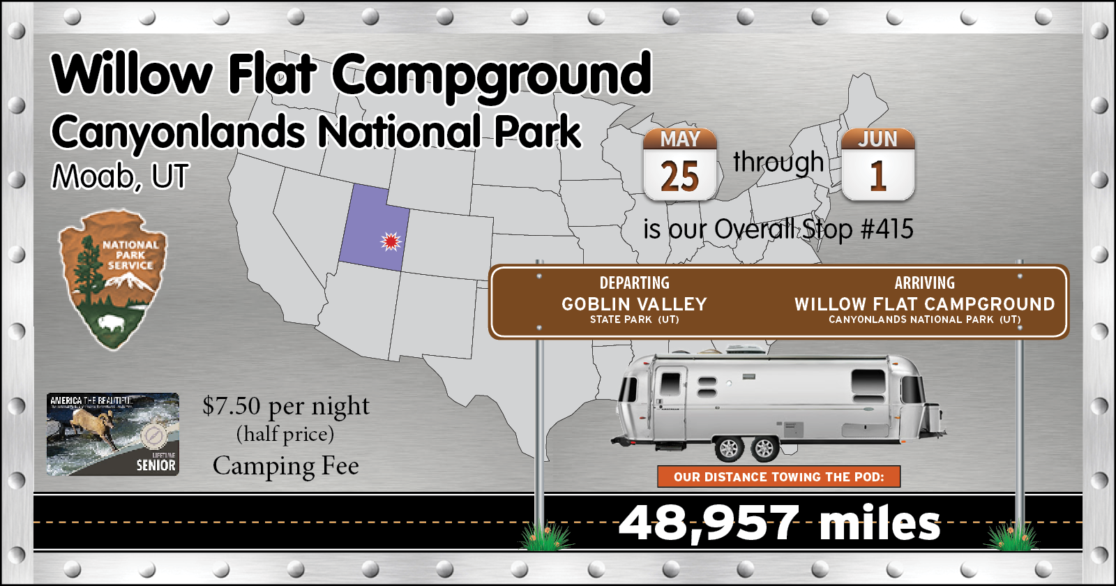
Today we're headed 120-miles over to the First-Come-First-Serve (i.e. no reservations) Canyonlands National Park's Willow Flat Campground. Check out time there is 10:00AM and with only 12 sites, of which only about half are long enough to fit
THE POD, we need to be there when people start vacating their campsites.
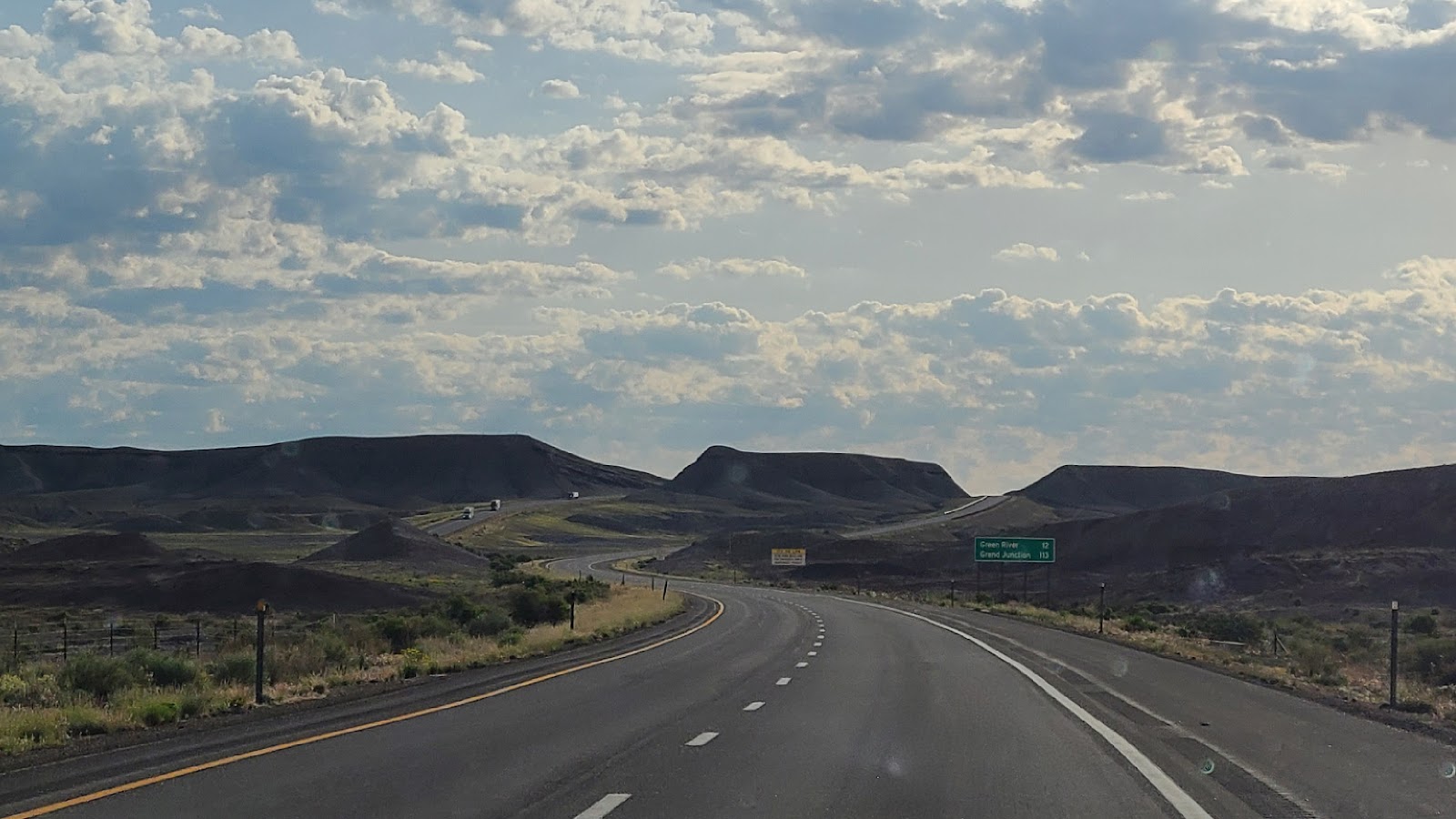
A short stretch of the route had us traveling east on Interstate 70.
Even though the speed limit on the Interstate was
80MPH we don't often tow
THE POD any faster than
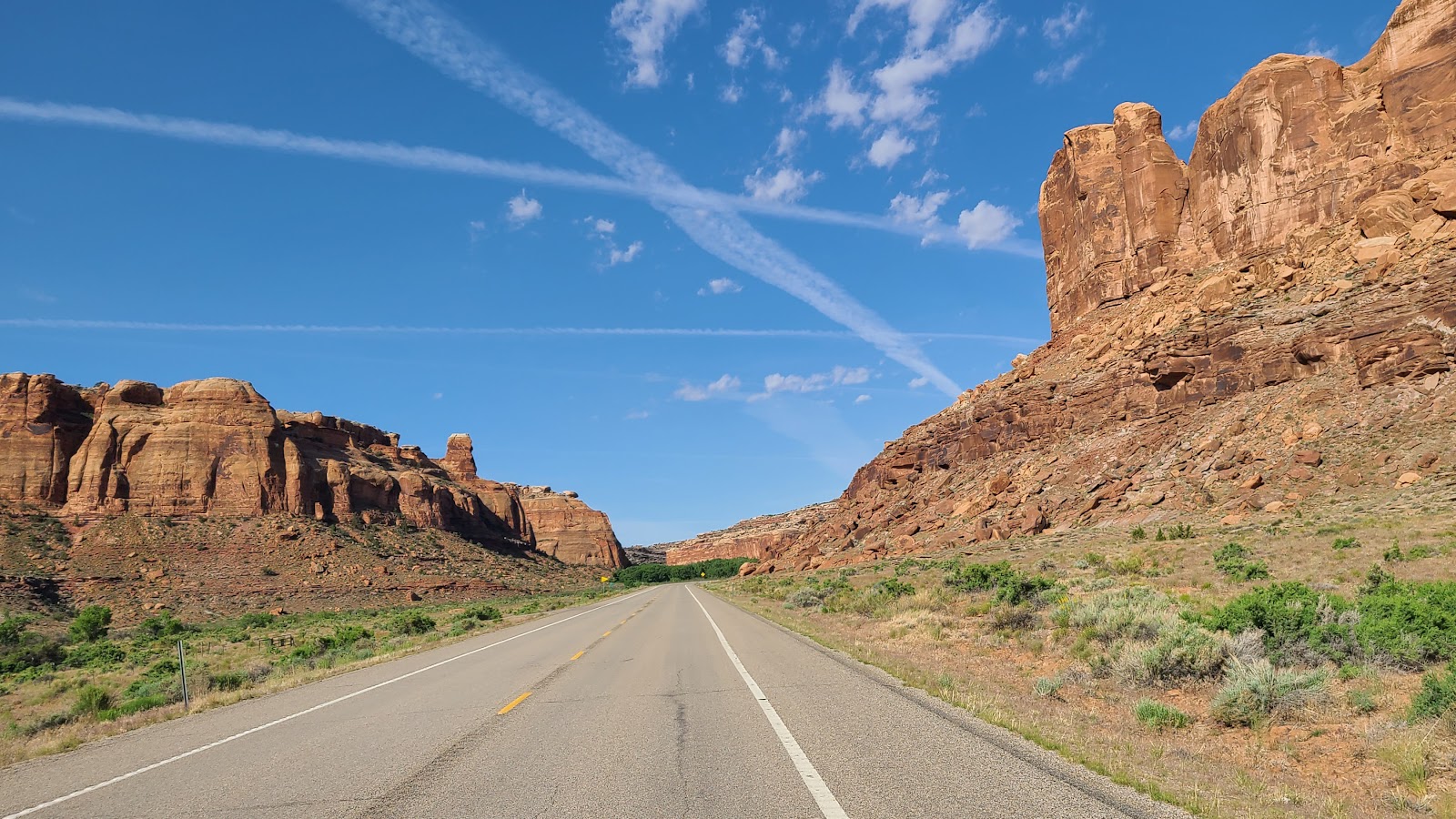
60MPH. At the small town of Crescent Junction we left the Interstate and began heading south on US-191, until just before Moab, UT where we turned onto UT-313 that would take us to Grand View Point Road, the main road in the park.
This is UT-313 just after leaving US-191 which continues on, passing through Moab, UT.
Shortly there after we pulled directly up to the National Park Entrance Gate (no waiting) where we saved another $30 entrance fee by producing my Drivers License and Lifetime Senior Pass, good for me and anyone else riding in the same vehicle, in this case that would be Tricia.
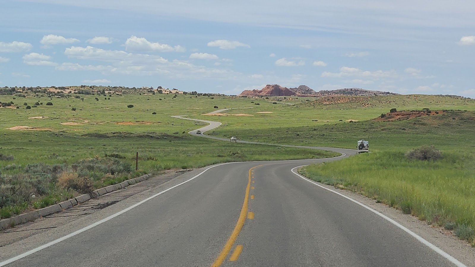
It's a meandering drive once you've passed the Entrance Gate and Visitor Center.
Grand View Point Road travels the full length of the Island in the Sky District of Canyonlands National Park. There are only two short roads that branch off of it that takes you to the campground and several hiking trails.
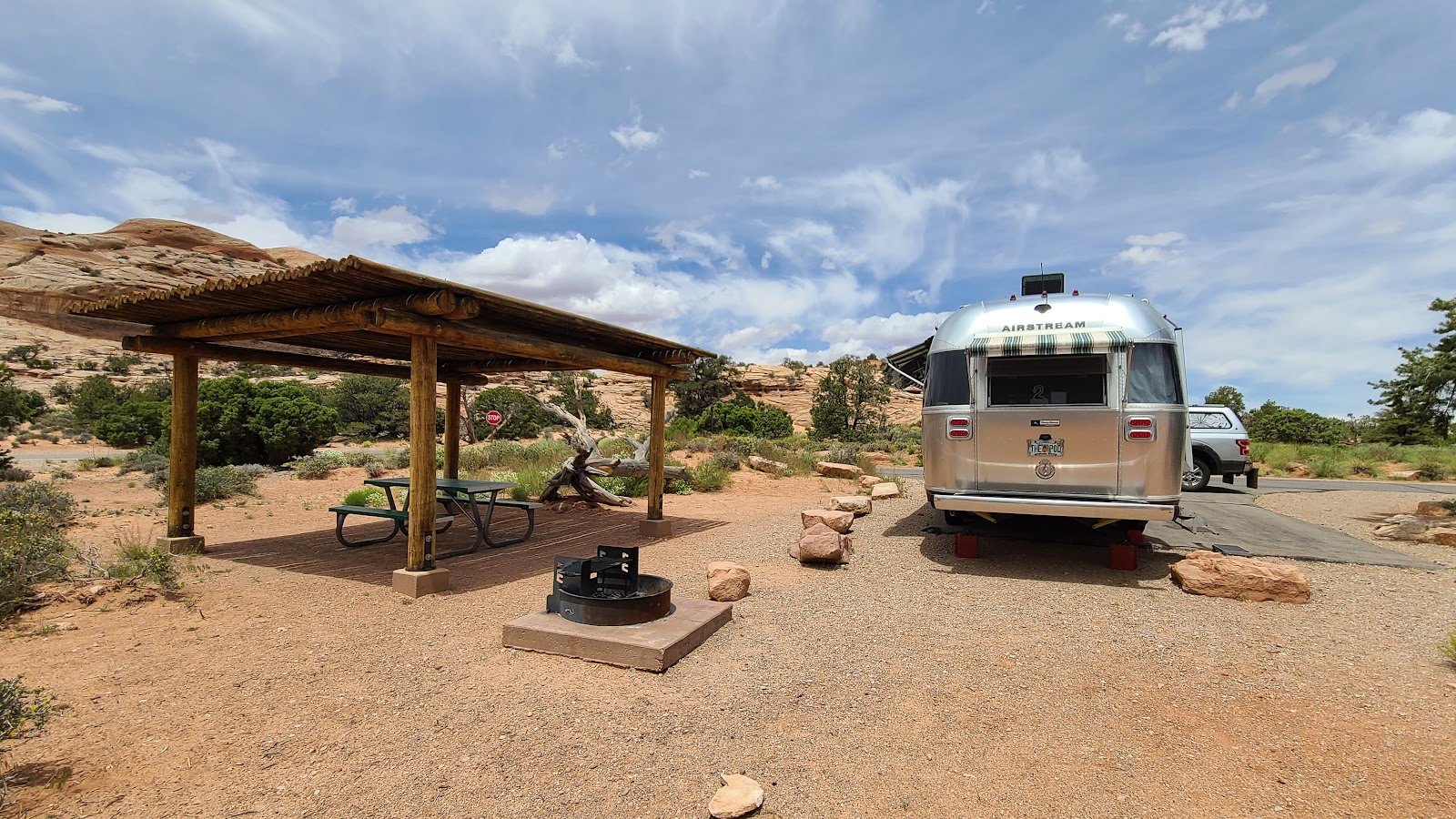
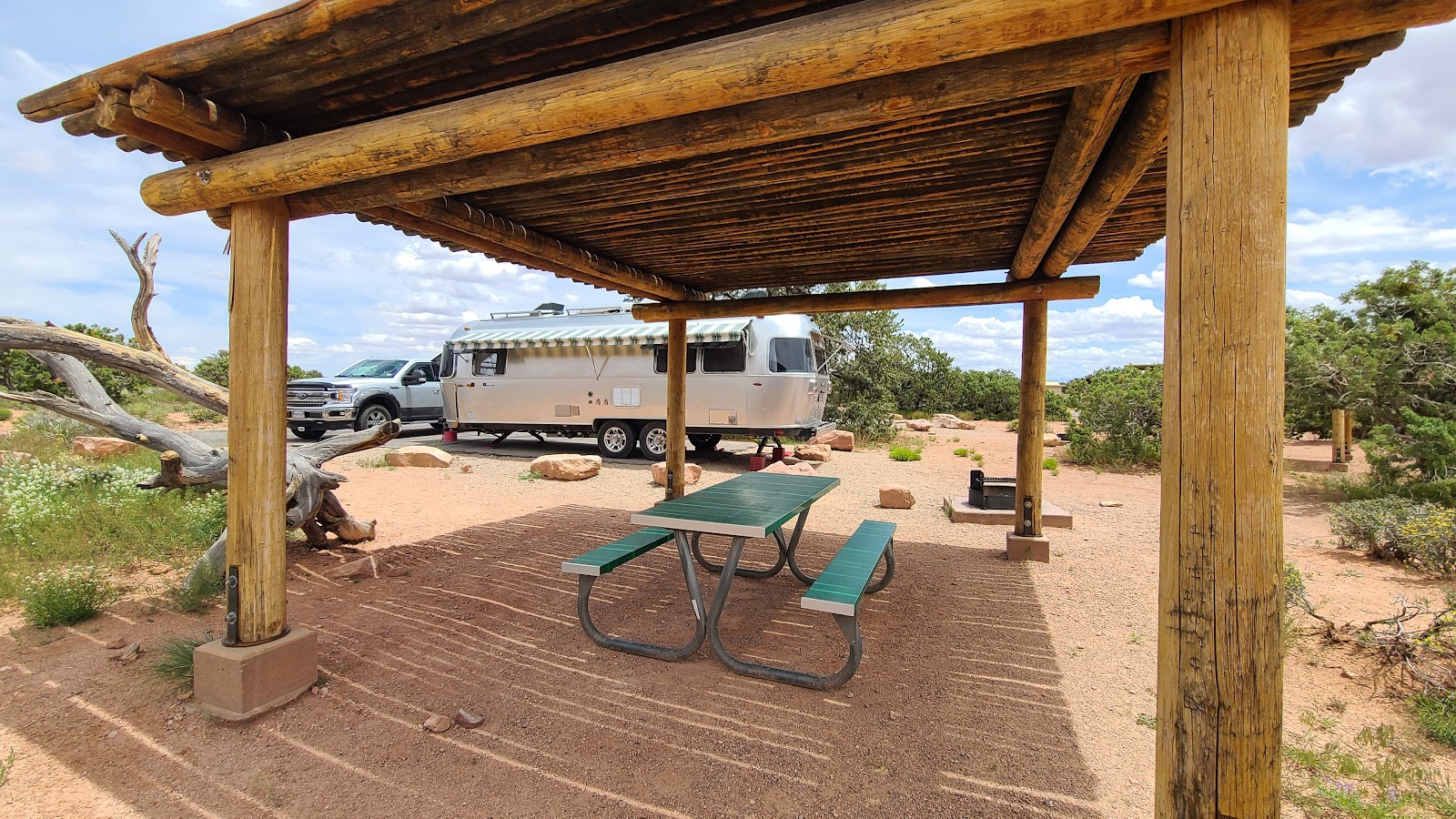
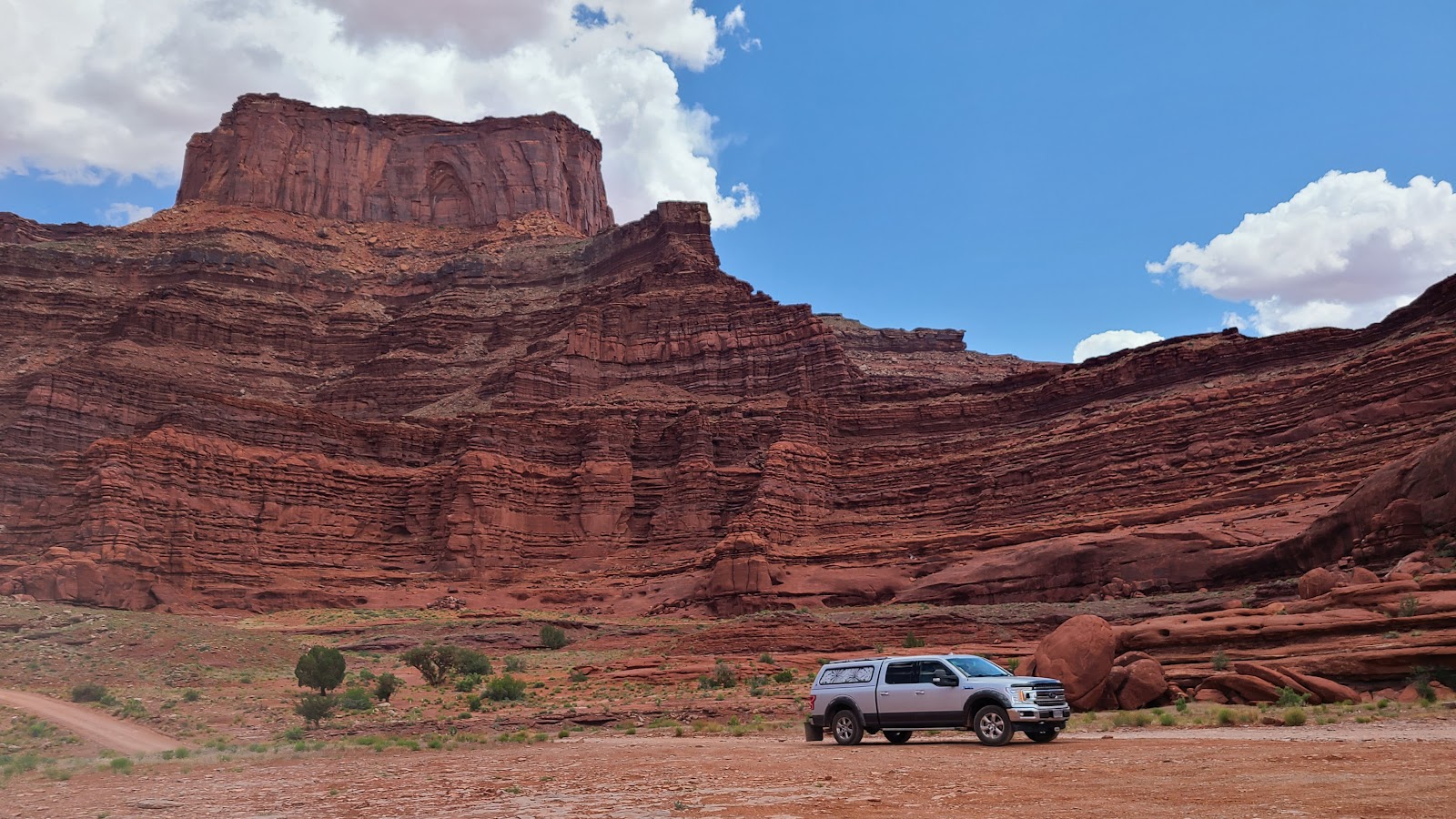
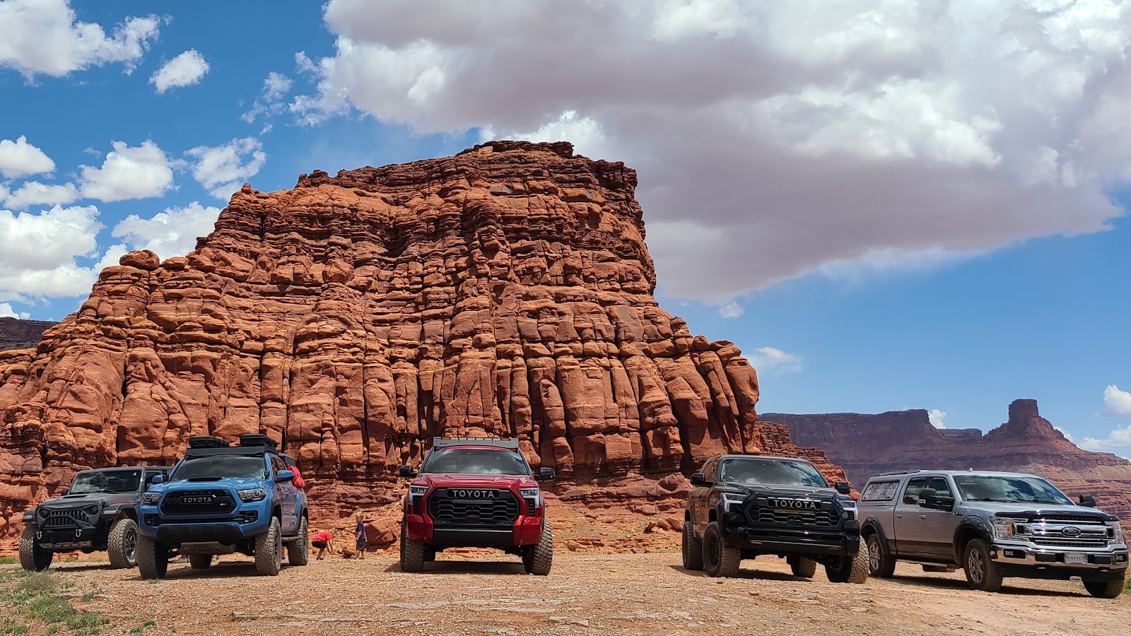
We timed our arrival at the campground just right. There were four vacant sites and two of them were long enough to fit THE POD and ROVER. There is a max RV limit of 28' in this campground and as you can see in the two photos we used every inch of that, even letting our rear end hang past the end of the pavement.
After enjoying a quick lunch we began our usual National Park arrival ritual of heading to the Visitor Center, getting my Passport Book stamped, picking up a couple of Junior Ranger books and badges to mail back home to Tricia's young 2nd cousins and watch the 20-minute informational movie all about the park.
Once back at THE POD we start to plan our activites for each day of our 7-day visit because...
Tomorrow the fun starts!
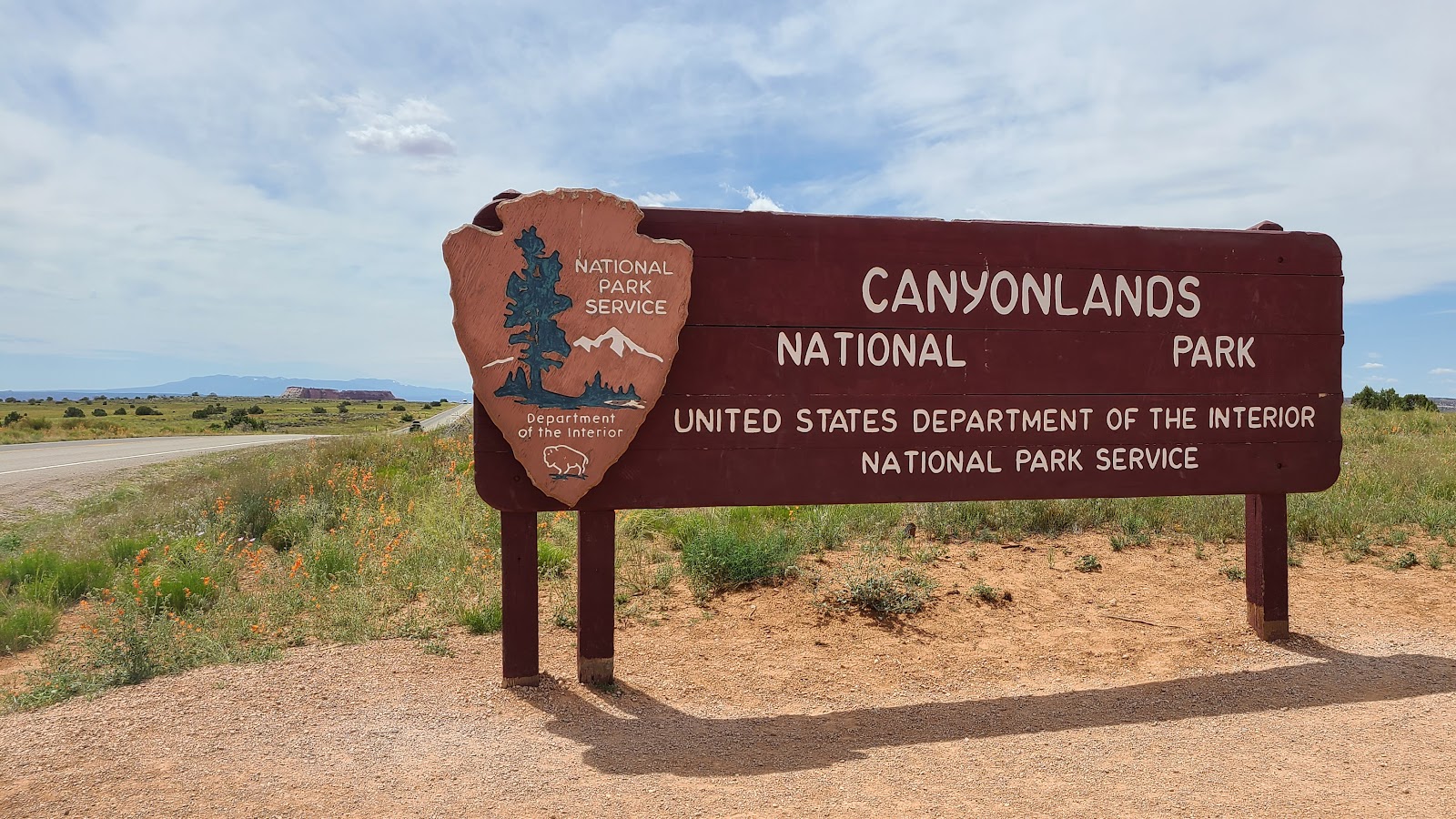
But first a little background information on Canyonlands National Park.
Canyonlands National Park is divided into three distinct districts:
1.) The Maze District is a beautiful wilderness of backcountry trails with no roads.
2.) The Needles District is located south and east of the Colorado River.
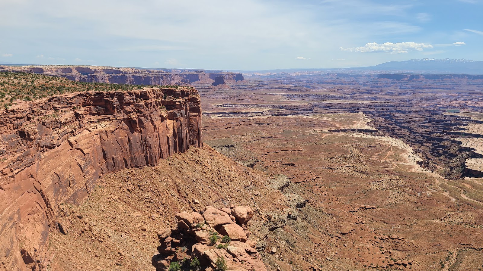
3.) The Island in the Sky District is where we are visiting this week.
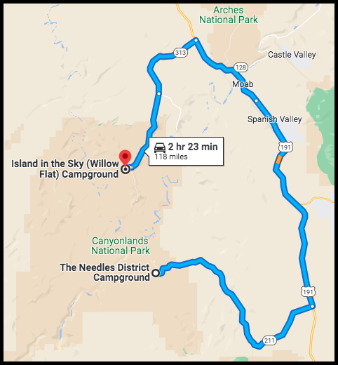
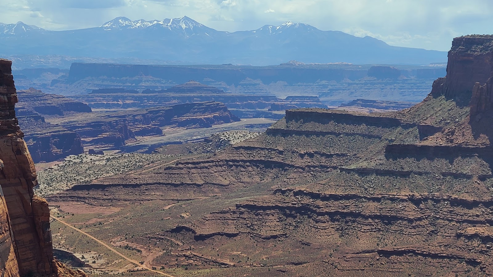
As you can see in the map above Island in the Sky District is located in between two major rivers. It truly is an "island in the sky" when you consider the 1000'+ canyons that surround this high plateau between the rivers.
The Green River forms the western boundary, the Colorado River forms the eastern boundary and where the two rivers converge (just outside the bottom of the map above) it locks in the southern boundary.
That means the only way in and out of this district is on the northern border. There's only about 20-miles (as the crow flies) between the campground we're currently in and the campground in the Needles District, but it's a 118-mile drive to get there, since you can't just "hop over" the Colorado River with a truck.
There is a interesting 100-mile long, rough gravel road, called the White Rim Road, that travels around the bottom of the Island in the Sky District, down by the river banks, but we won't be doing that with ROVER.
We do however hope to do a "short section" of that road before we leave.
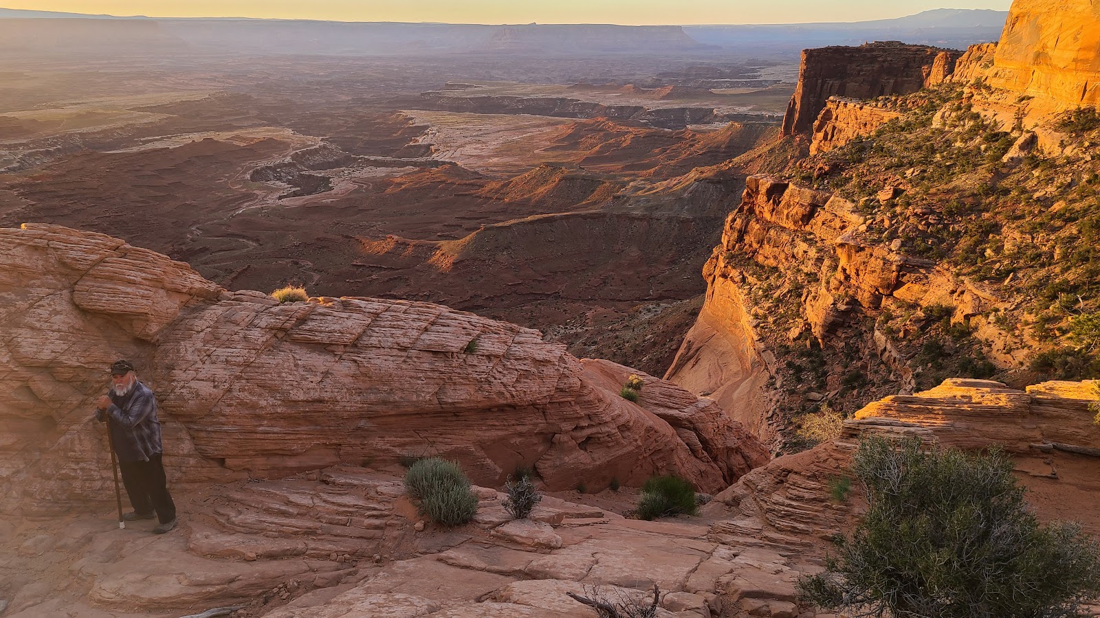
FRIDAY - The park's Visitor Guide tells everyone that if you only have 2-hours to visit the park, then you must hike to Mesa Arch.
If you read the fine print, it says the best time to see it is at sunrise. So yesterday we were up and on the road by 7:00AM, well this morning, we were on the way to Mesa Arch by 5:15AM!
The name of this park is Canyonlands National Park, and Arches National Park is less than 50-miles from here, but if the Visitor Guide wants us to visit their arch, then by golly that's what we're going to do.
The hiking trail to see Mesa Arch is a .6-mile loop trail, so I guess that won't be too hard to do at 5:30 in the morning. The arch is located just about in the middle of the loop, so only .3-miles down the trail you get your reward.
MESA ARCH AT SUNRISE
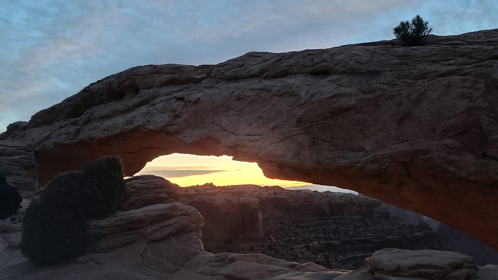 Mesa Arch at 5:45AM, "first light" was 15-minutes ago.
 Off to our right was this scene, also at 5:45AM.
 Mesa Arch is only attached to the rockface on the ends, no where in the middle.
 Roughly 10-minutes later the skies were brightening.
 Ten more minutes and then everything got quiet.
 When I say quiet, I meant all the other fools (i.e. photographers) awake at 5:30AM.
 It won't be long now, the clouds are taking on a pinkish color.
 A few minutes later and the pink clouds turn a light shade of yellow.
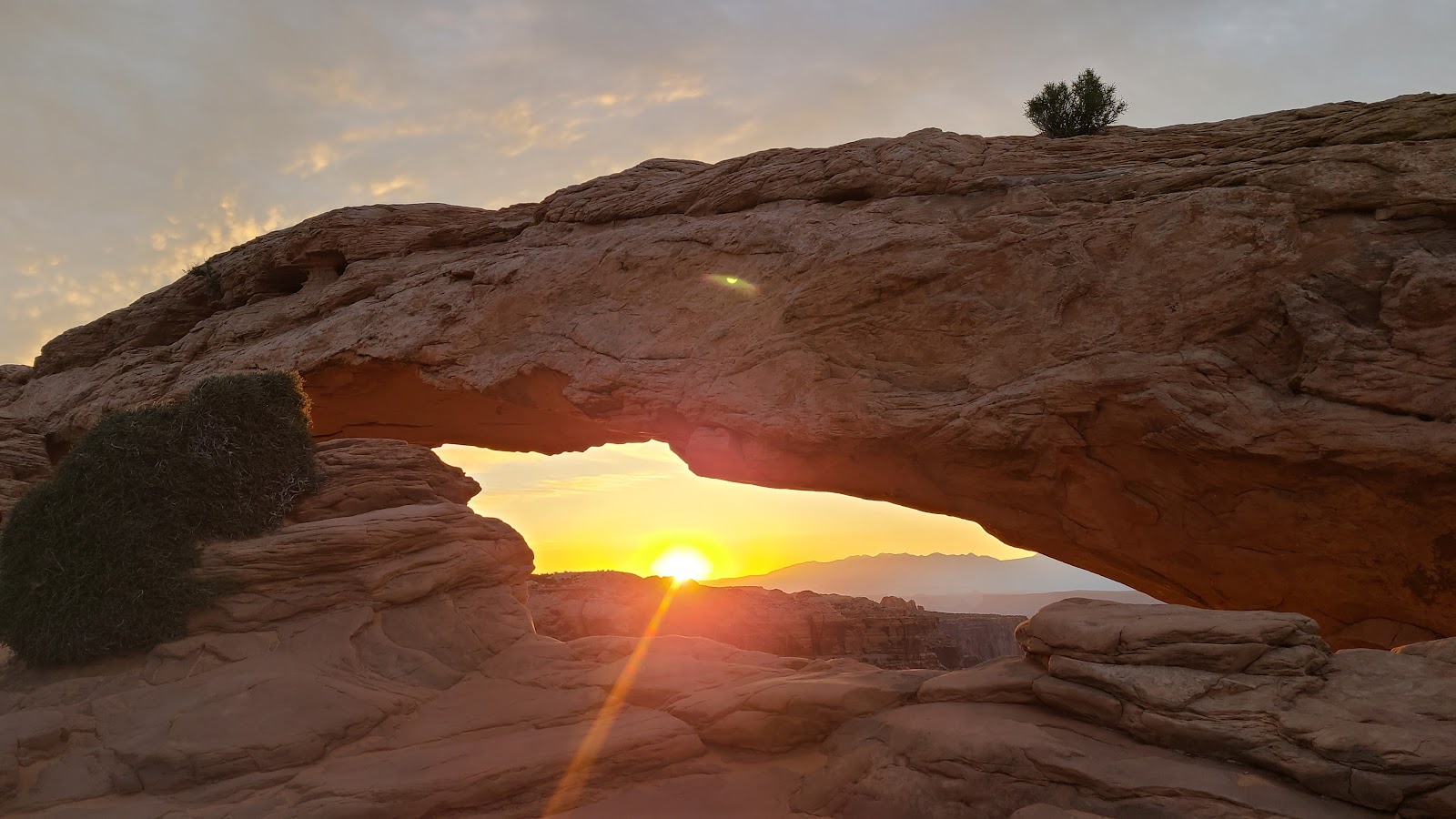 And then it happened, the sun peaked over the horizon.
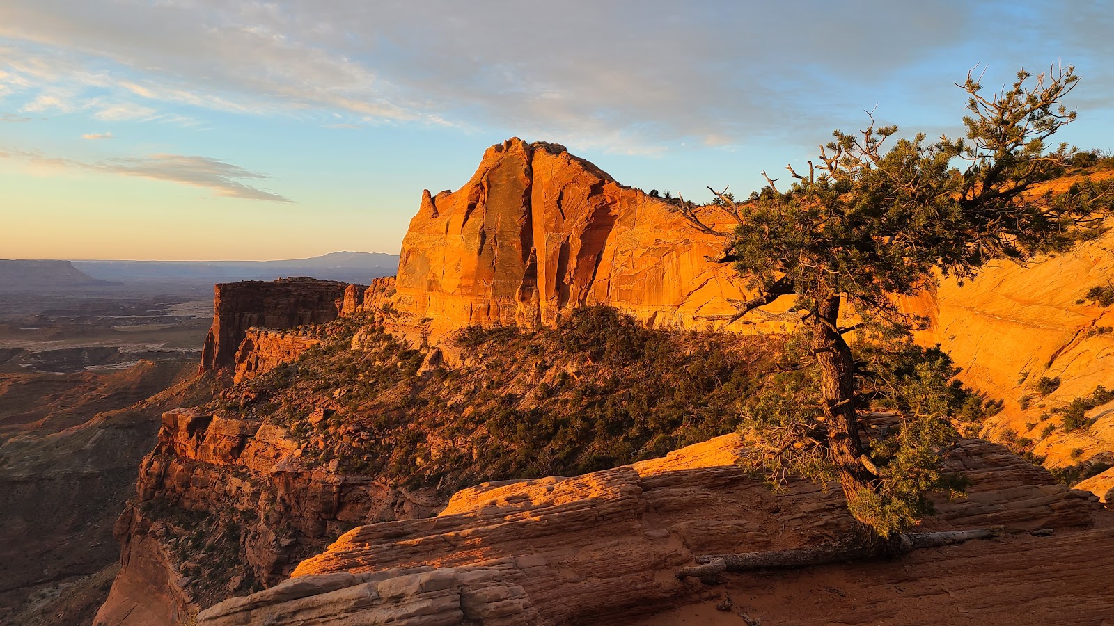 Now check out how that mountain off to our right is lit up!
 There's a bit of an early morning haze over the canyon, but that should burn off soon.
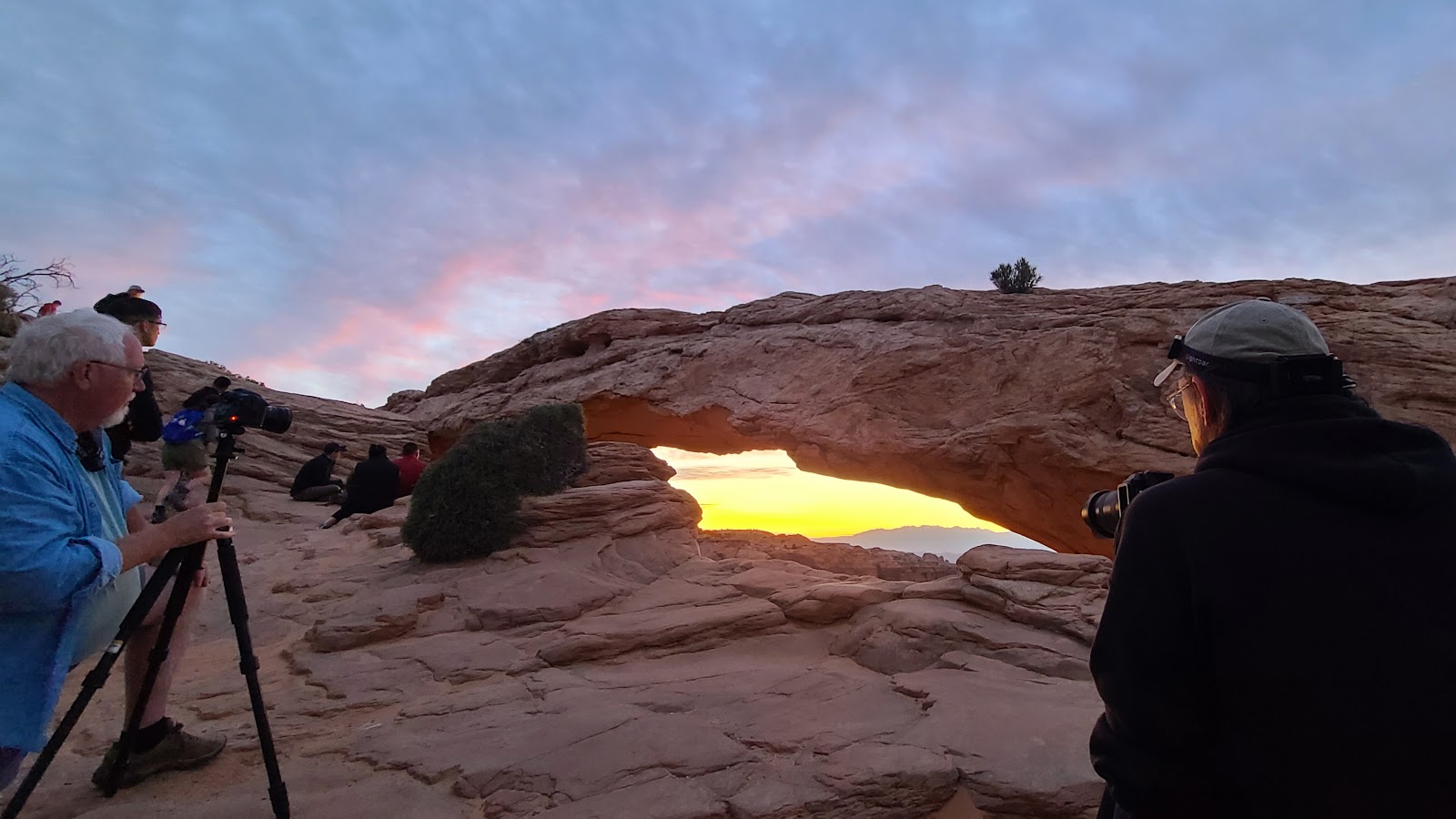
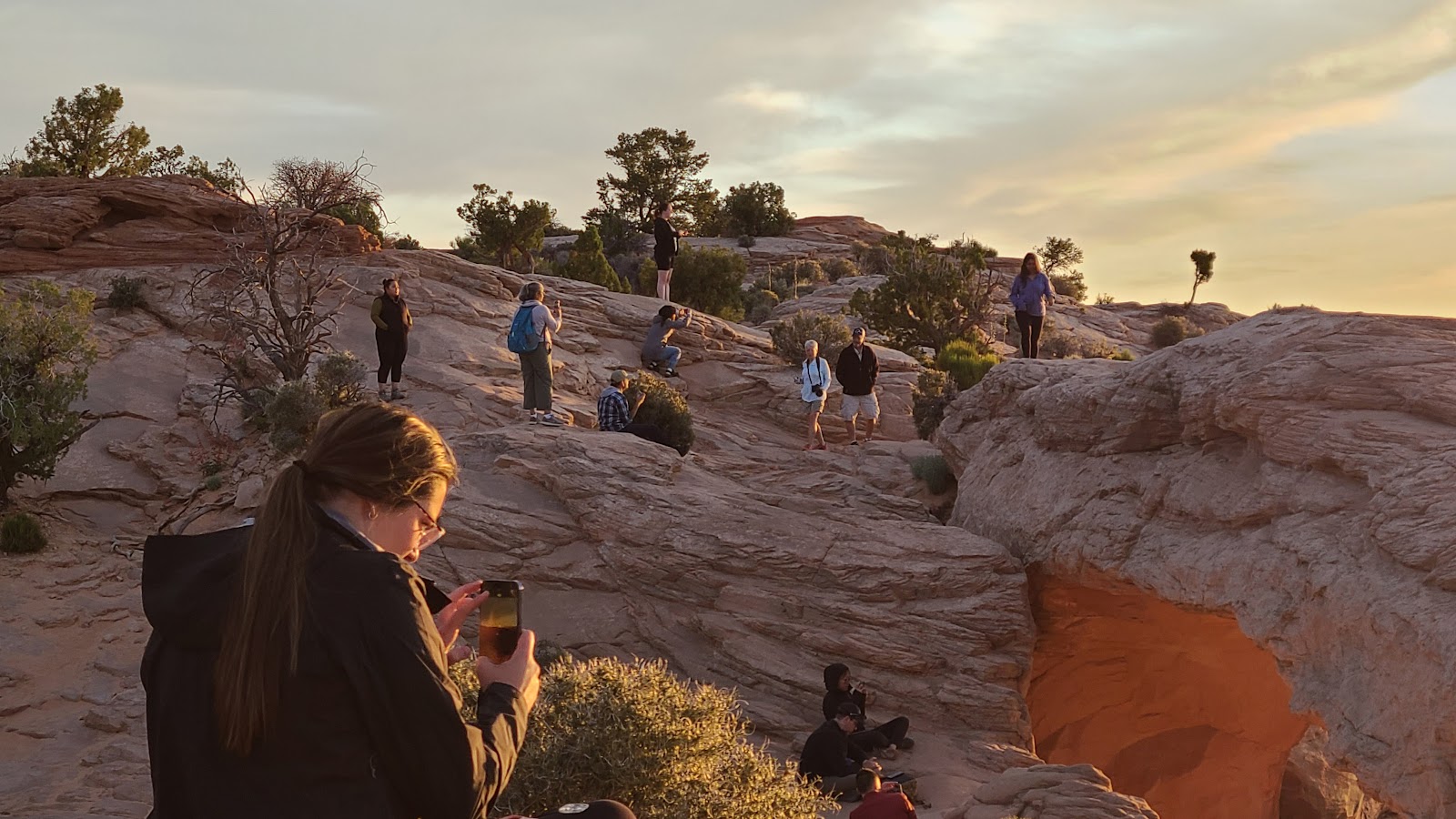 Now that the show is over most people turned away to leave.
 I tried to get out of Tricia's shot, but I think she did this on purpose.
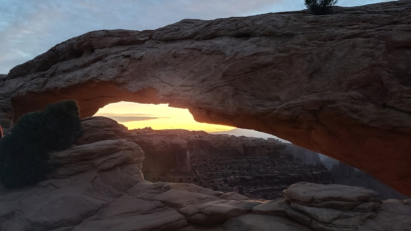
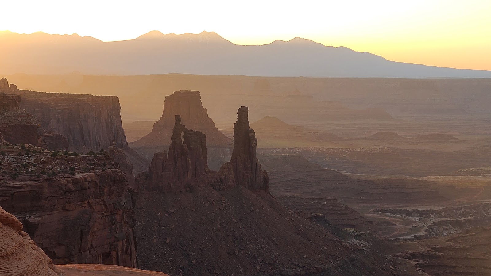
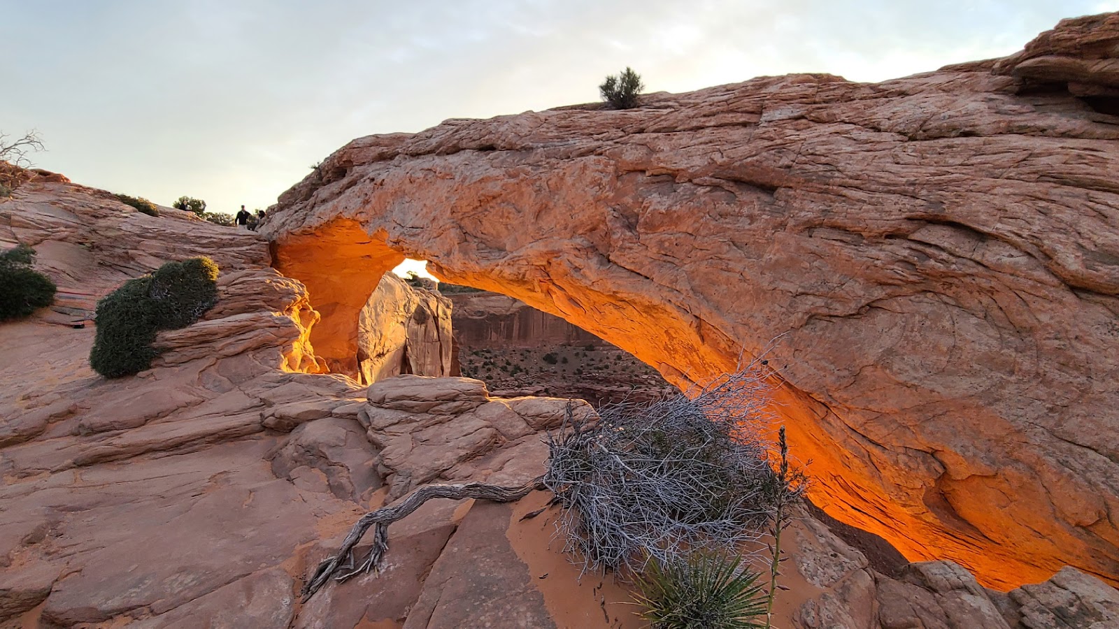 Now that the sun has been up for a while, check out the glowing arch.
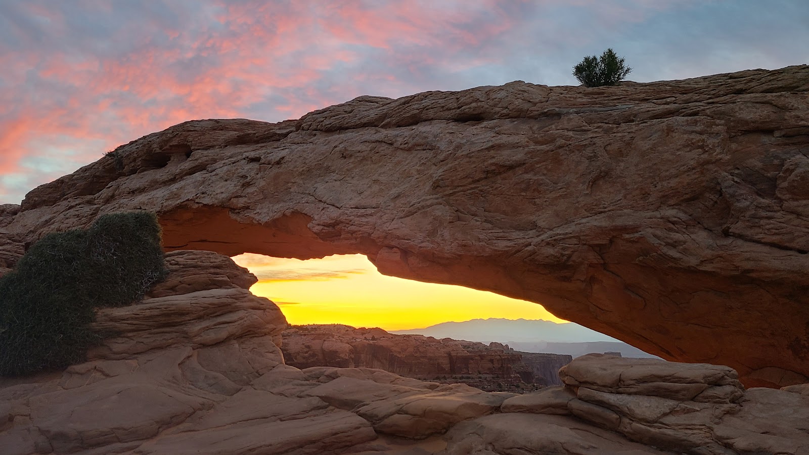
 This is just a teaser for tomorrow's activity,
driving the Shafer Trail down into the bottom of the canyon.
After completing the loop hike at Mesa Arch we drove 38.5-miles into the town of Moab for breakfast, gasoline, scouting out a laundromat for later this week and a Verizon Store to see if we can replace Tricia's cell phone.
The highest rated breakfast location in Moab is the Moab Garage Co., obviously some time ago it must have been the town's garage. They don't open until 8:00AM, so I guess the laid back residents of Moab aren't early risers.
So we purchased gasoline first. Needing 27 gallons at $4.03 per to fill ROVER's 36-gallon tank, it's the first time we've spent over $100 at a gas station in quite awhile (think back to Alaska and Canada).
We drove around town for 30-minutes before returning to the restaurant and found five other people waiting for it to open. Fifteen minutes after they opened there must have been twenty people waiting for food and coffee. I guess we were in the right place!
After breakfast we located the Verizon Store, but they don't open until 10:00AM. So we drove around town for another 45-minutes before returning to the store. At 10:15AM I got tired of waiting for someone to show up to open the store, so we and several other people drove away without being helped.
We'll just have to revisit the Verizon Store when we go to town to do laundry.
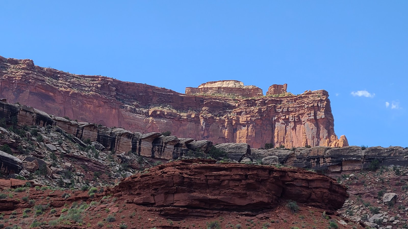
On the way back to the campsite from Moab we stopped to take photos that we couldn't do while towing THE POD into the park yesterday.
RETURNING FROM MOAB
 A view along US-191 just outside of Arches National Park north of Moab, UT.
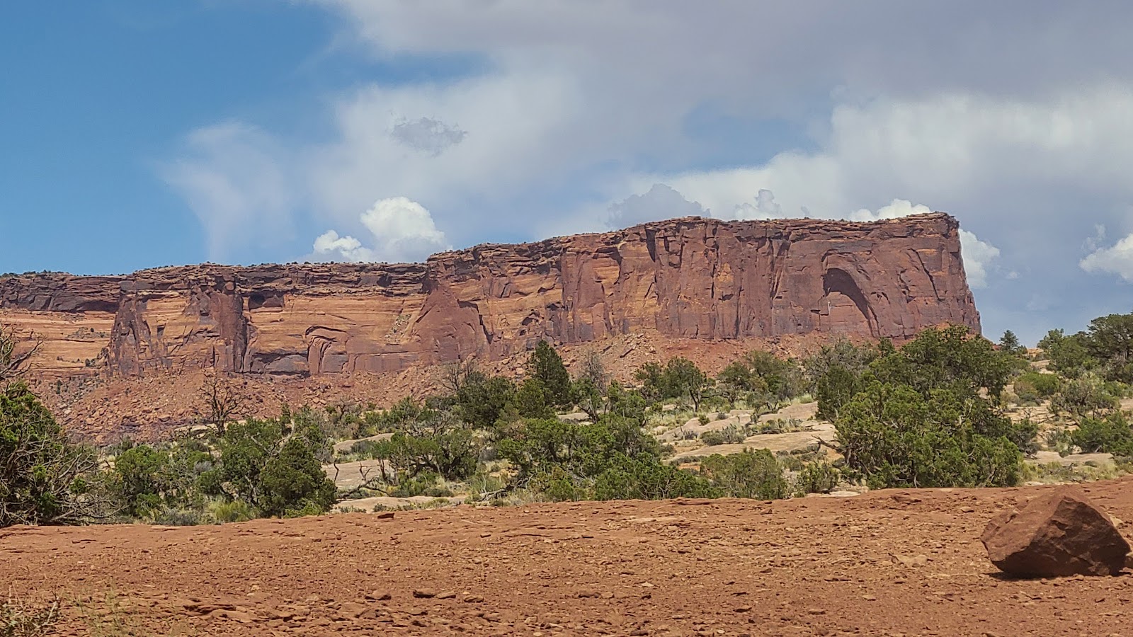
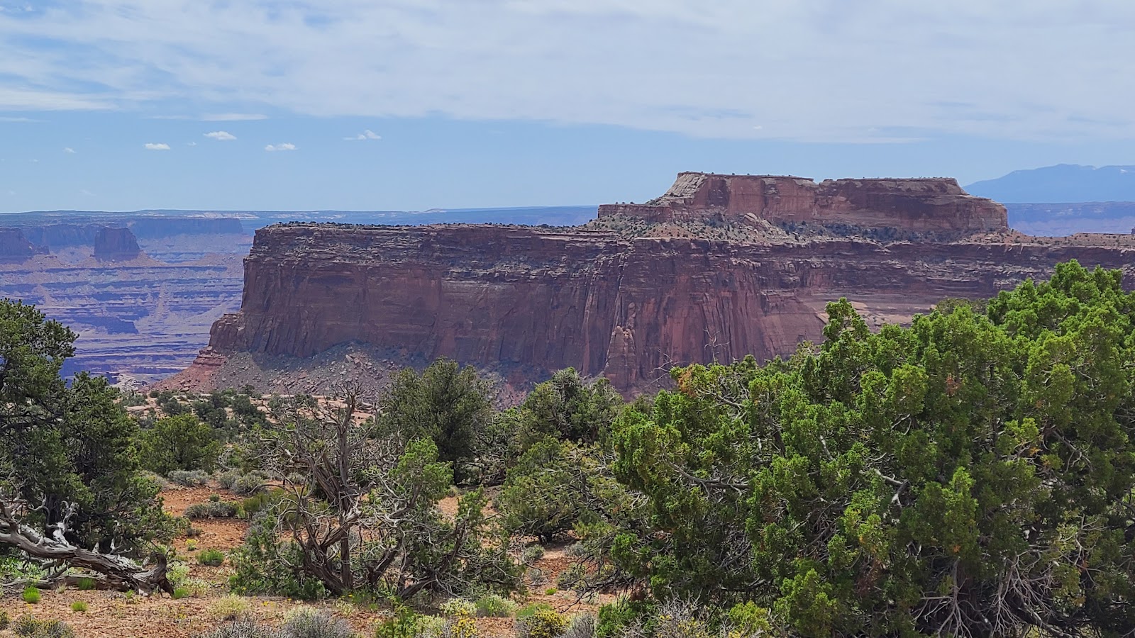
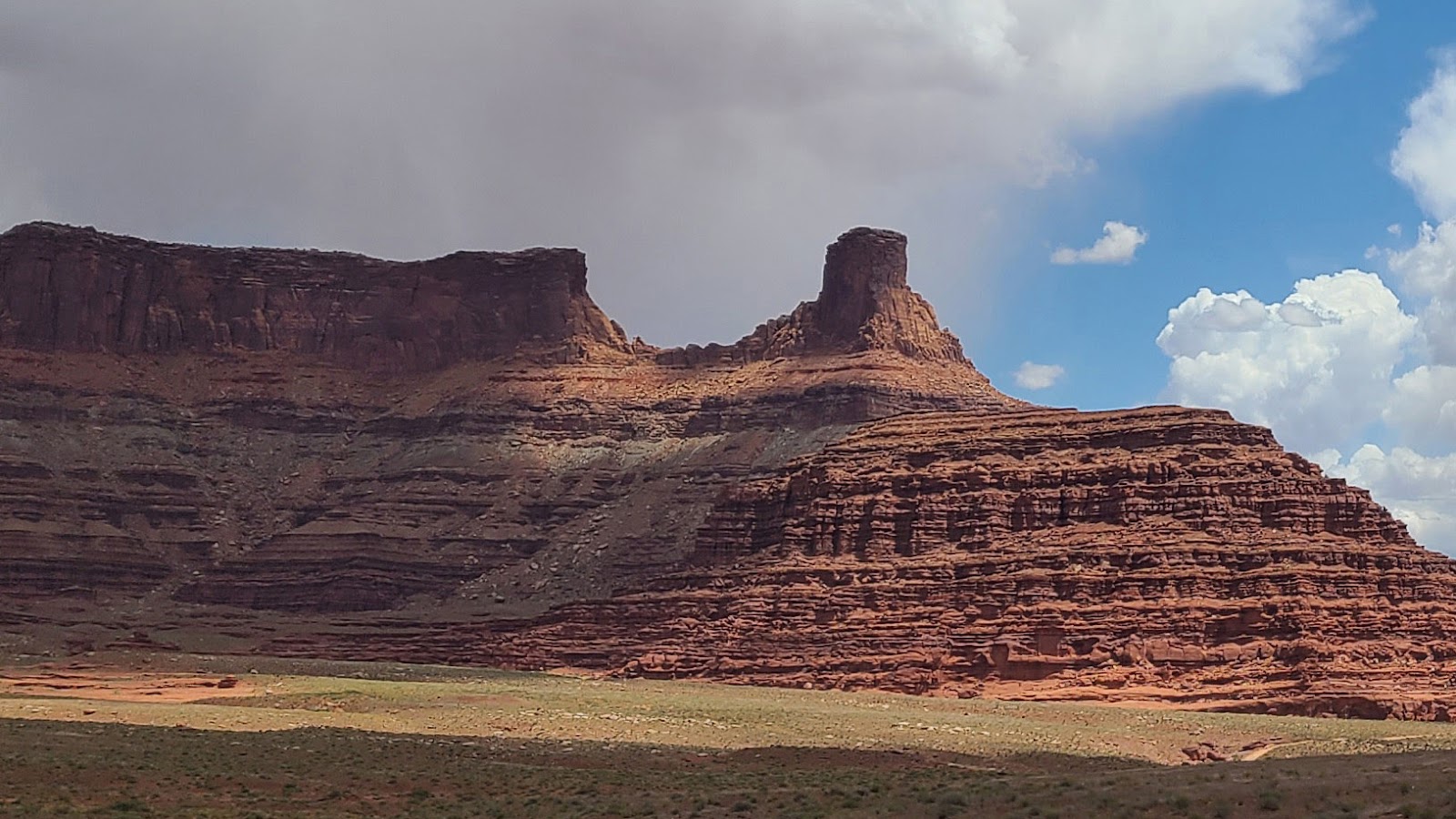
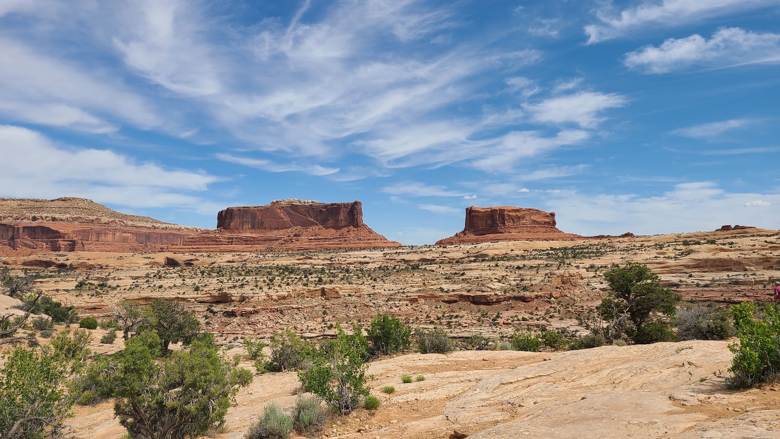 Merrimac Butte on the left and Monitor Butte on the right, just off UT-313.
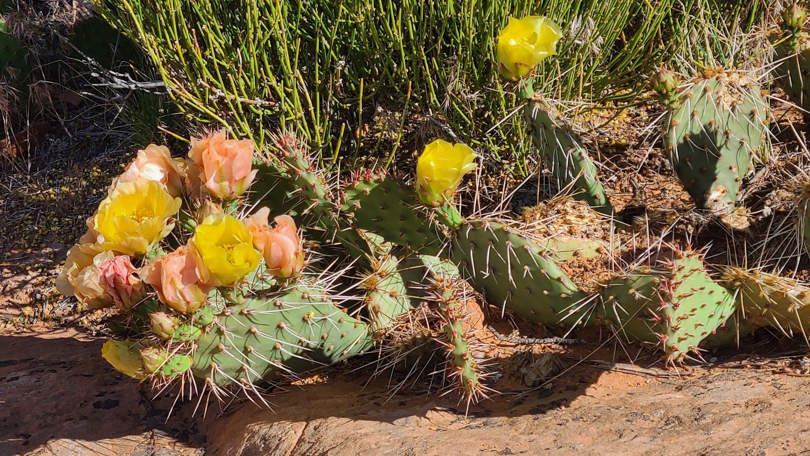
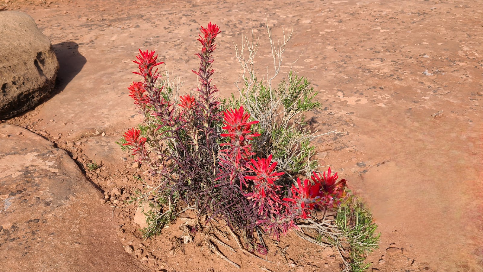
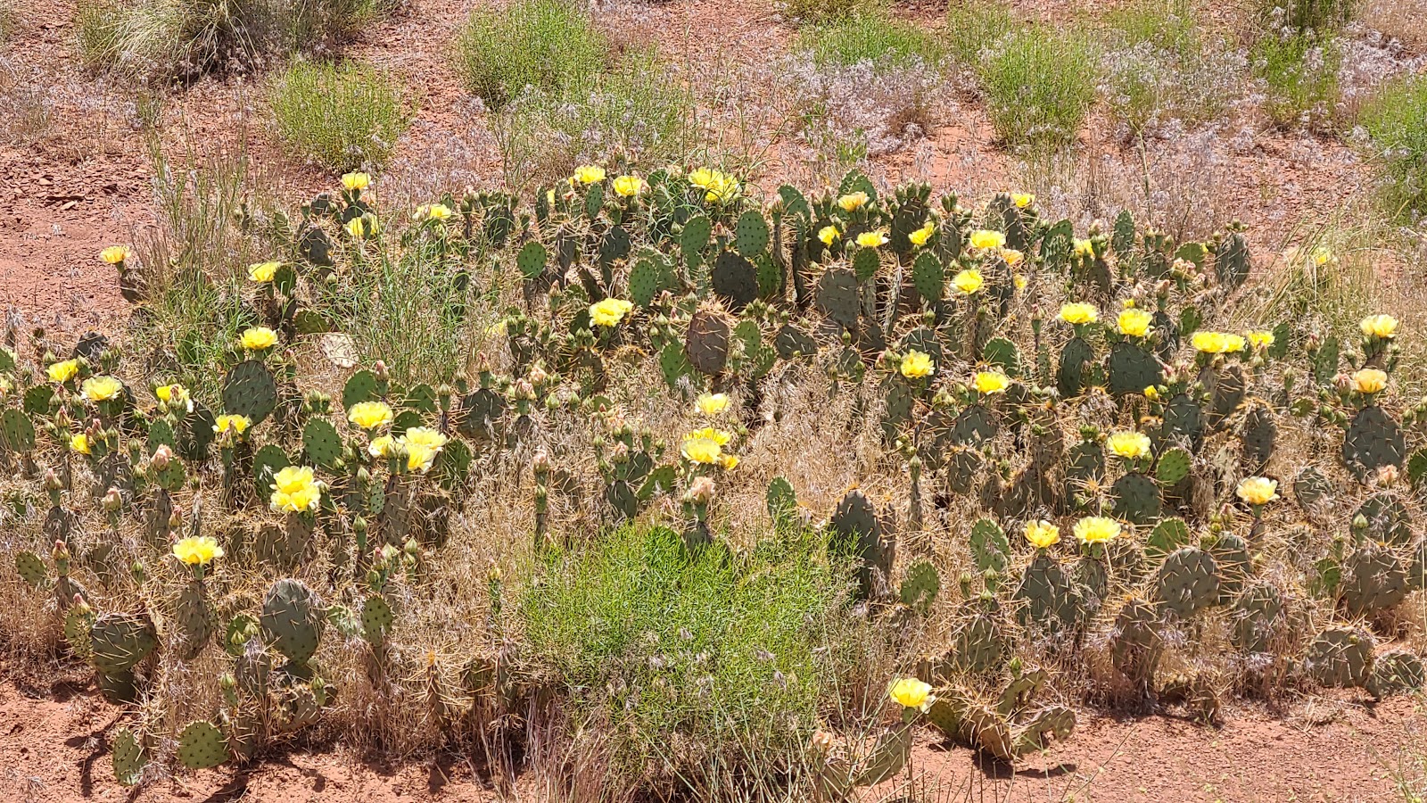
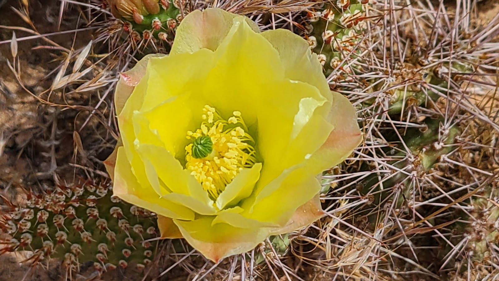 I still can't believe such a beautiful and delicate flower comes out of such a prickly cactus.
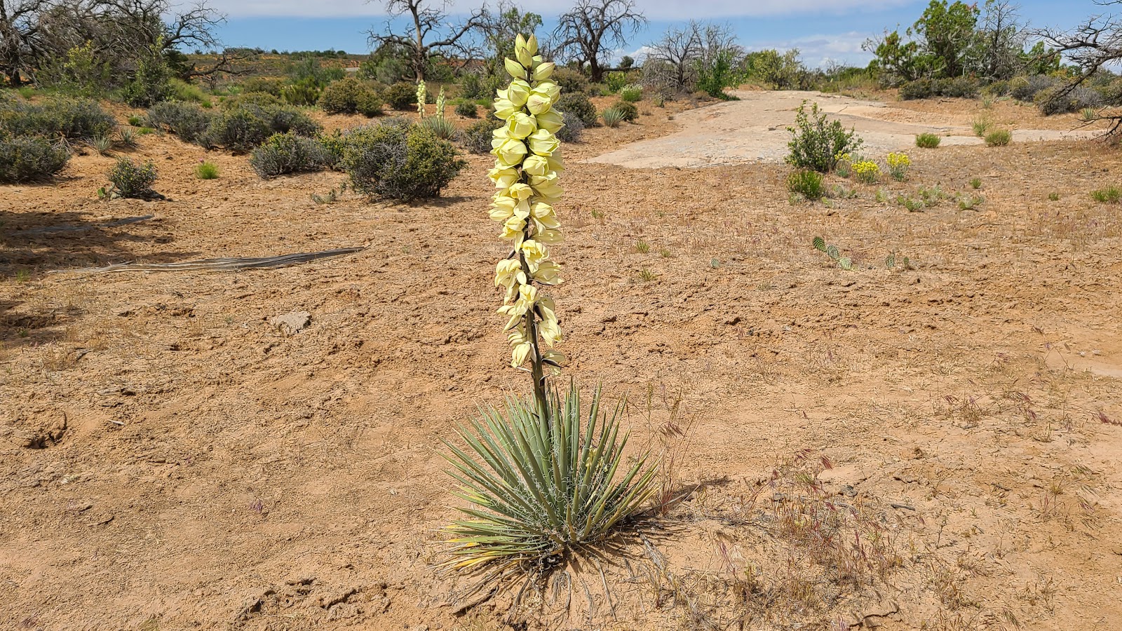 This Dwarf Yucca has a flowering stalk which grows to be 4-5 times it's height.
 Previous photos were all located outside of the park, the rest are inside the park.
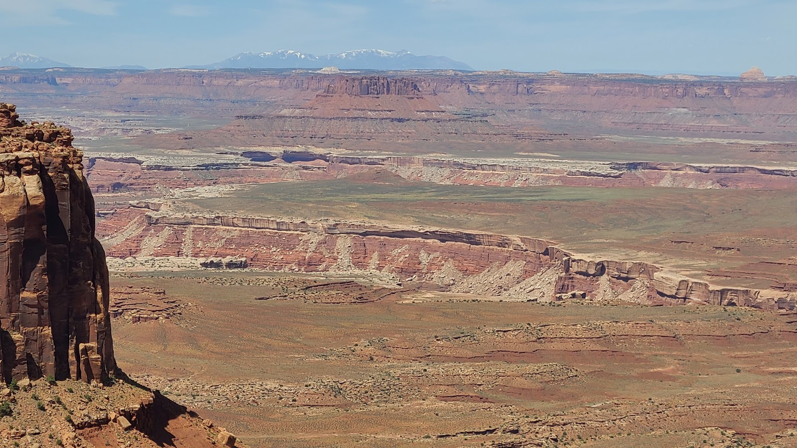
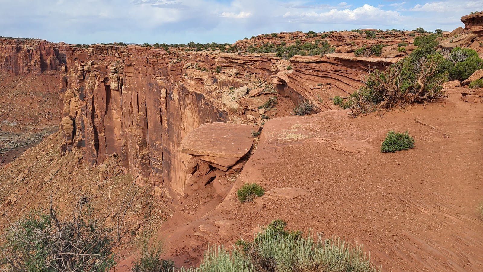
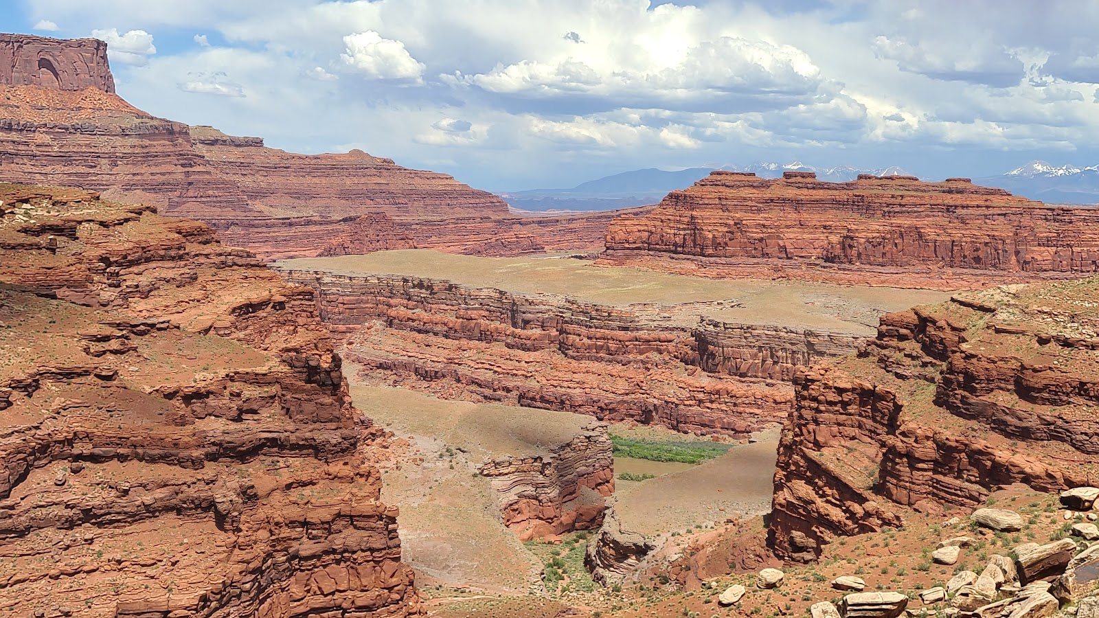
 This is why they call it "Canyonlands" National Park.
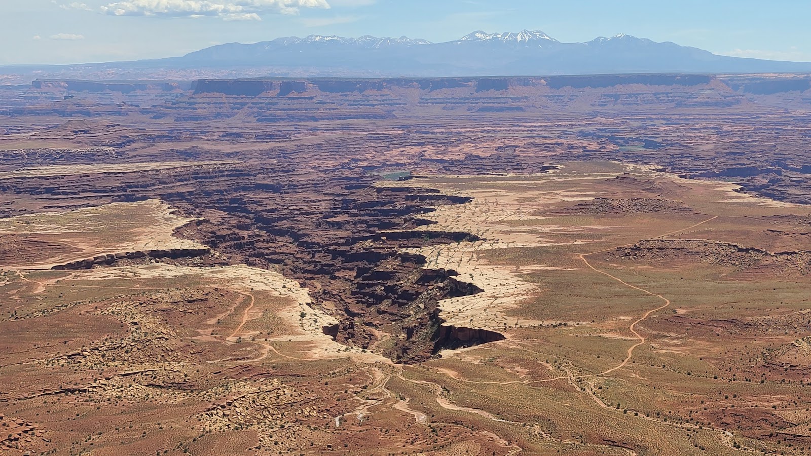
 Another fine example from inside of Canyonlands National Park.
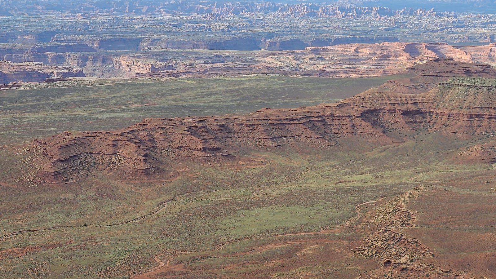
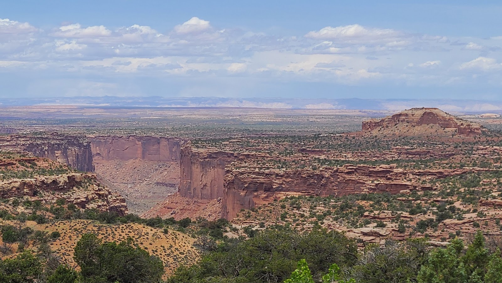
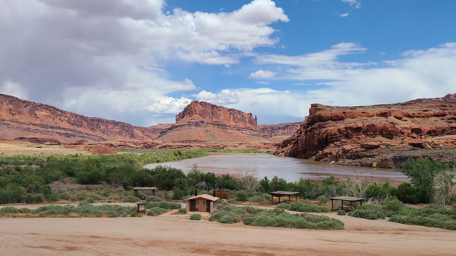
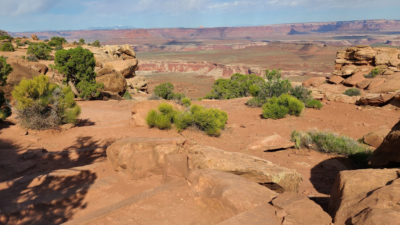
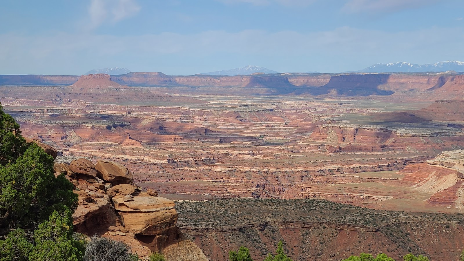
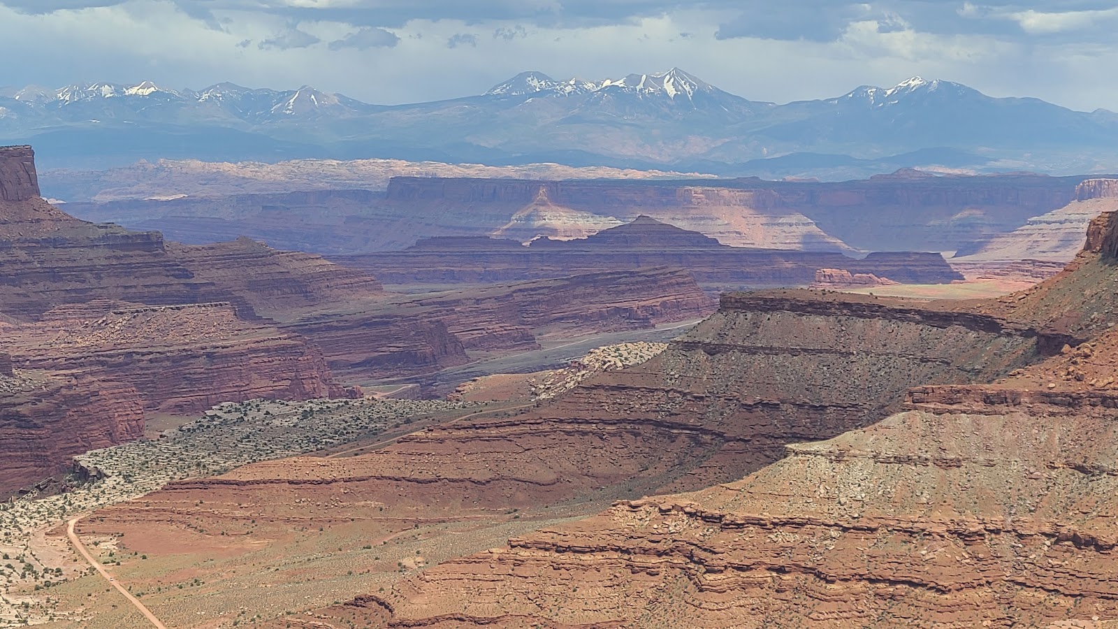
 This view is from the Green River Overlook located just 1/10 of a mile from our campsite.
 The Green River today is just a fraction of what it has been throughout ancient history.
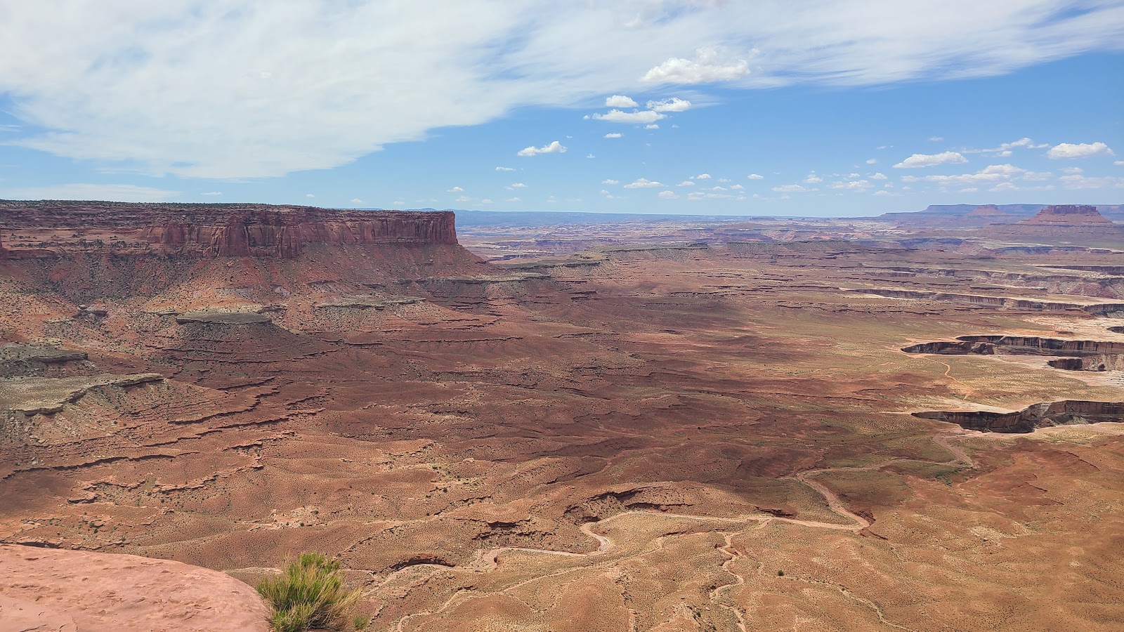
 This photo shows the 100-mile White Rim Road leading away from the edge of the canyon.
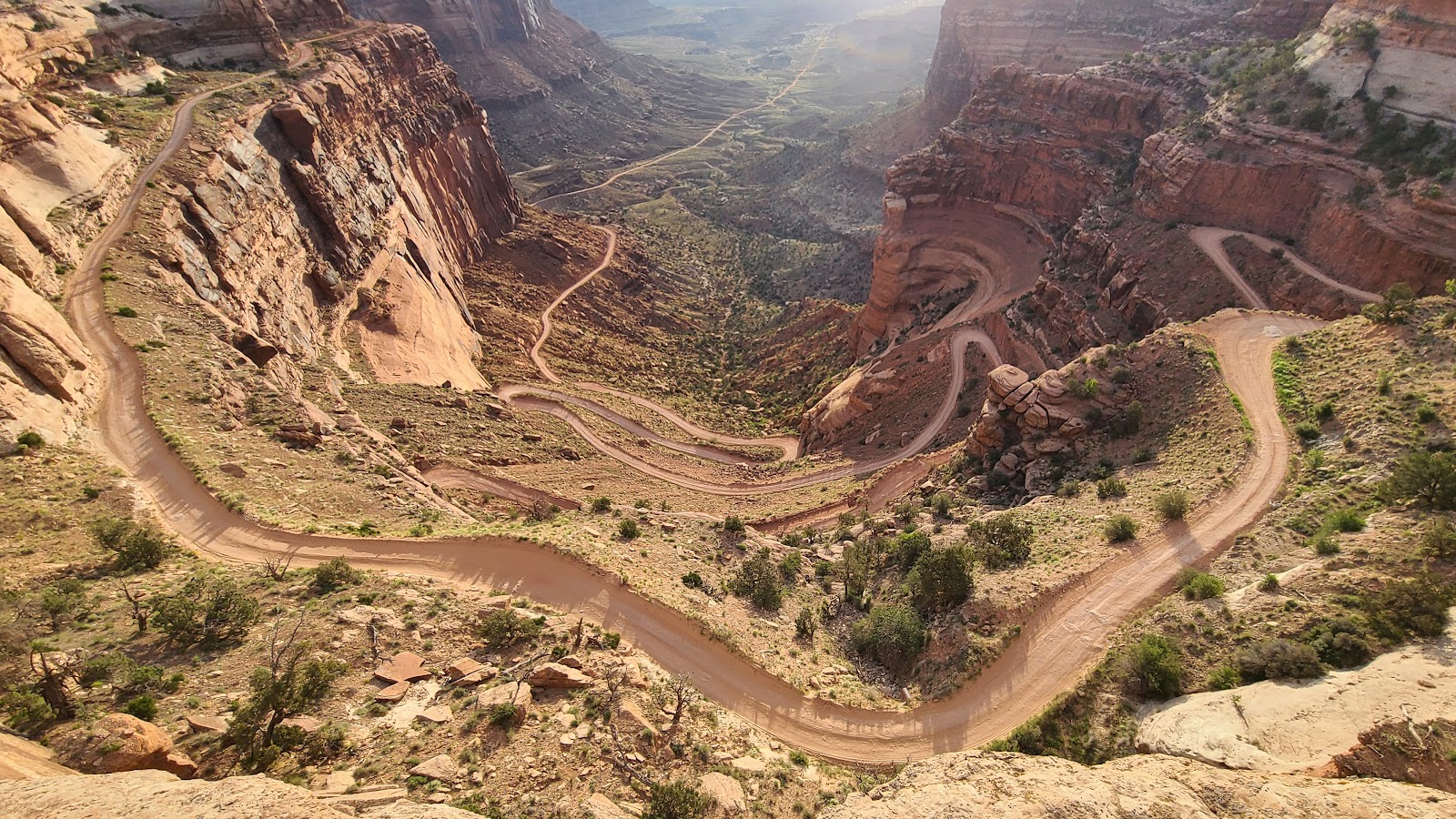
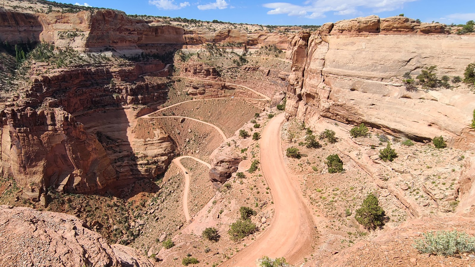
SATURDAY - Yesterday I showed you a teaser photo of this morning's activity.
Today we took one more look at the challenge ahead of us before commiting to doing it. There's no turning a 20' long truck around once you start down the switchbacks.
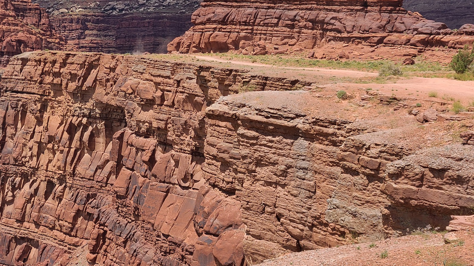
SHAFER CANYON ROAD AND POTASH ROAD
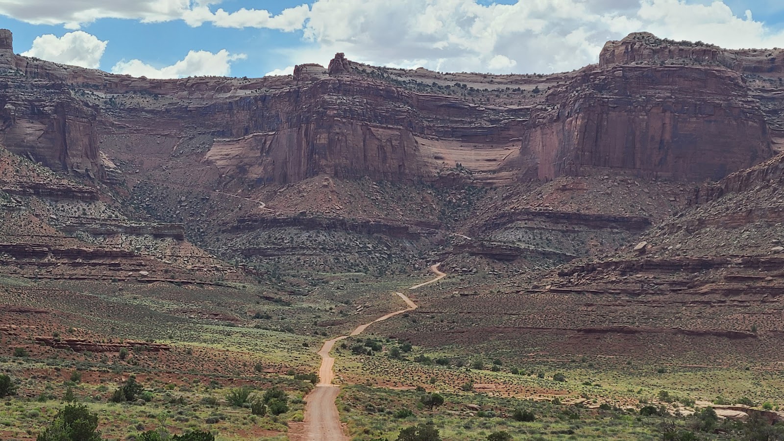
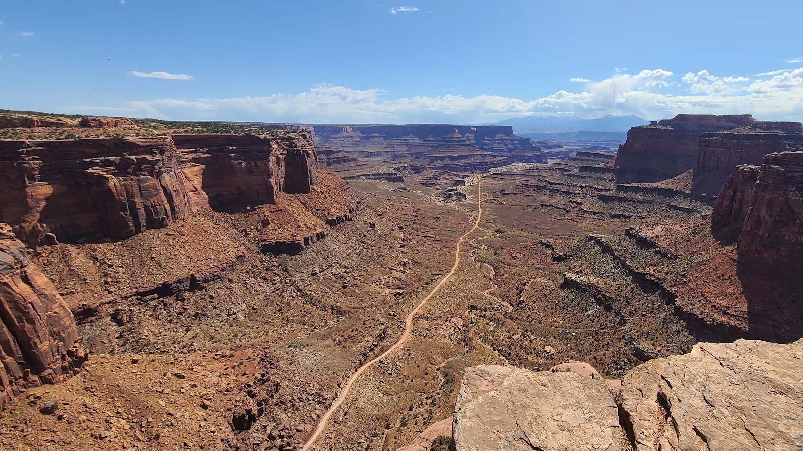 That's where we're going...
 ...and this is the road we're taking to get there.
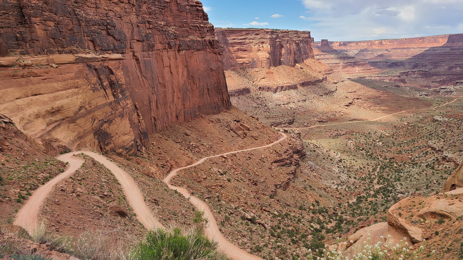
 We've made it passed the first bend, but little descent so far.
 The second bend had us nearing the beginning of the swithbacks.
 Now we've begun to get below the rim of the plateau.
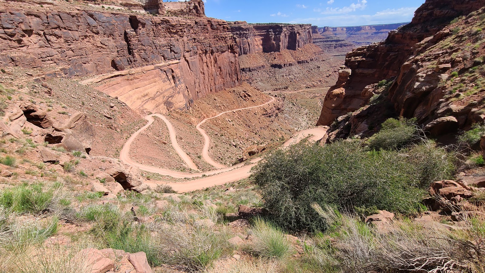 It's 1400' to the canyon floor, nearly twice what the Burr Trail switchbacks were 2 weeks ago.
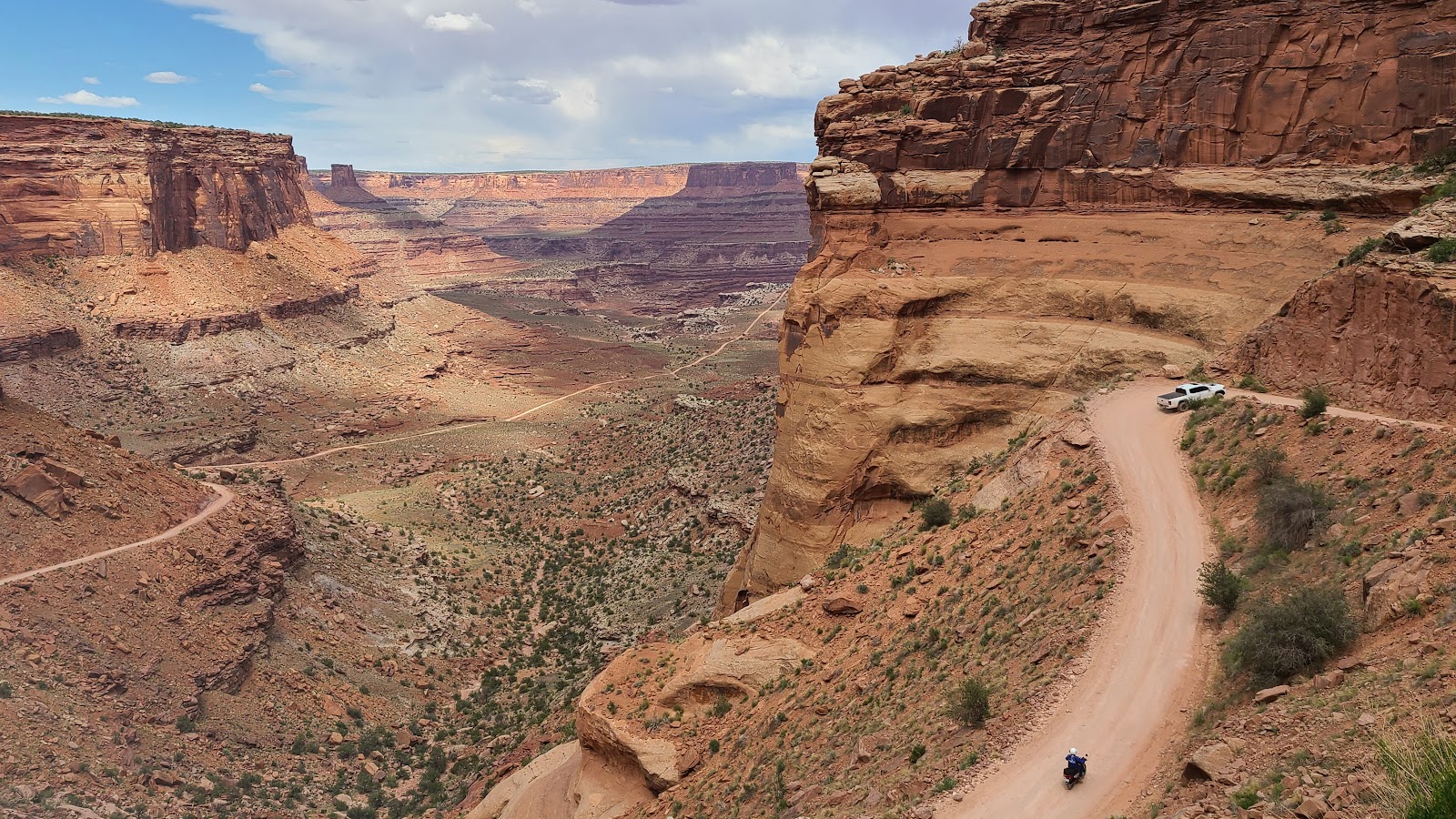
 Here we go, no turning back now!
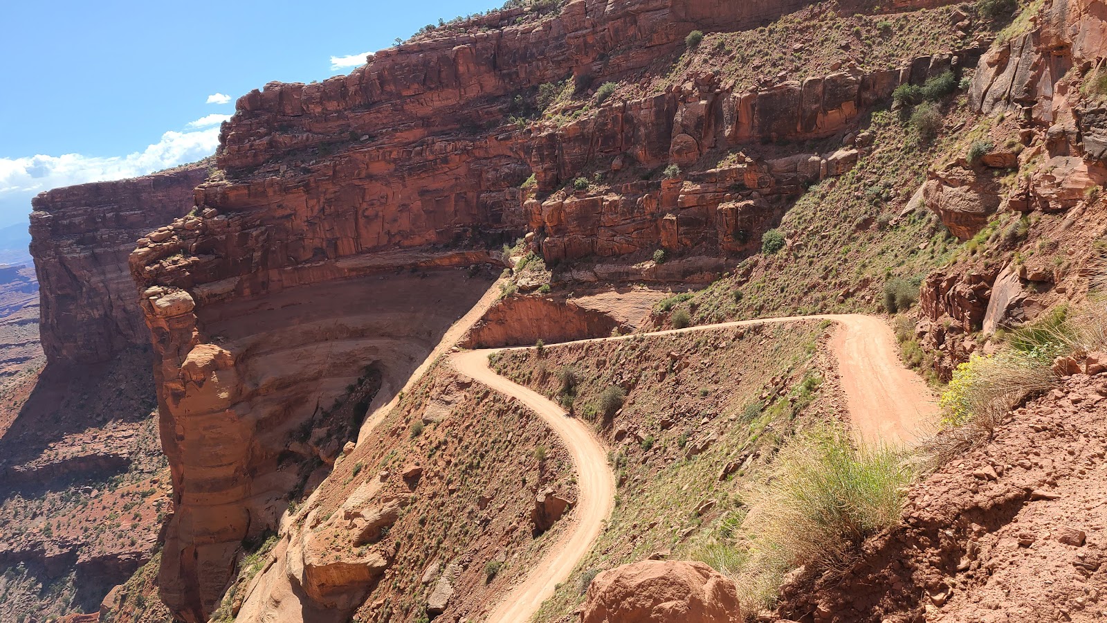 Notice there are no guard rails on this gravel road.
 About half way down now, so we stop to let ROVER's brakes take a breather and me too.
 The last switchback before the road straightens out.
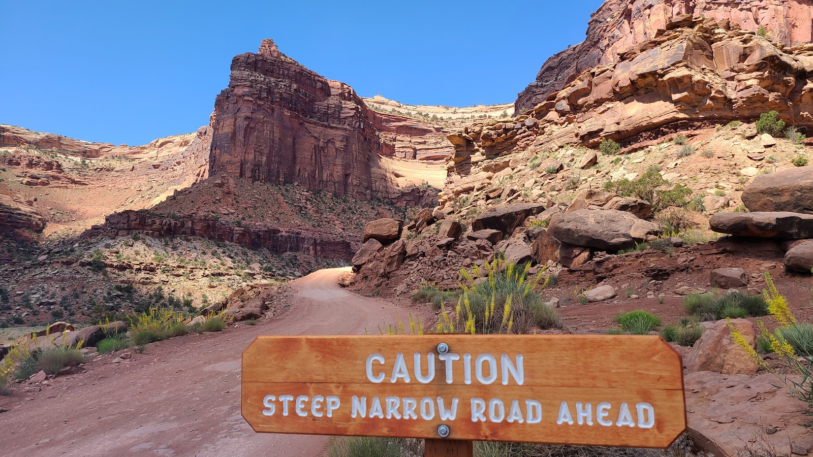 There was a sign just like this one at the top of the switchbacks.
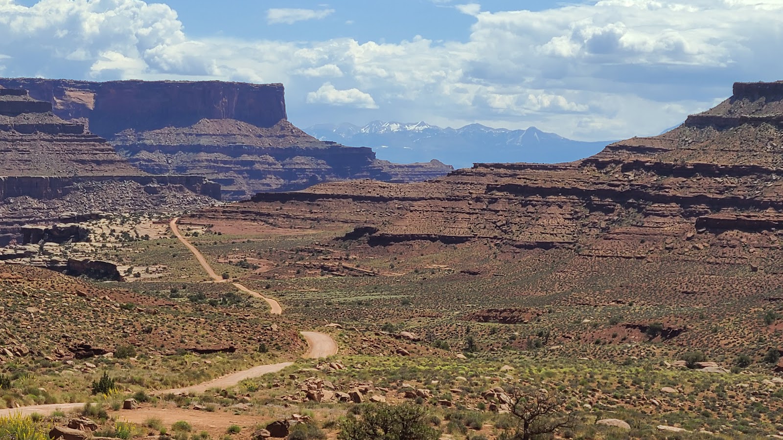
 Now we've put some distance between us and those switchbacks.
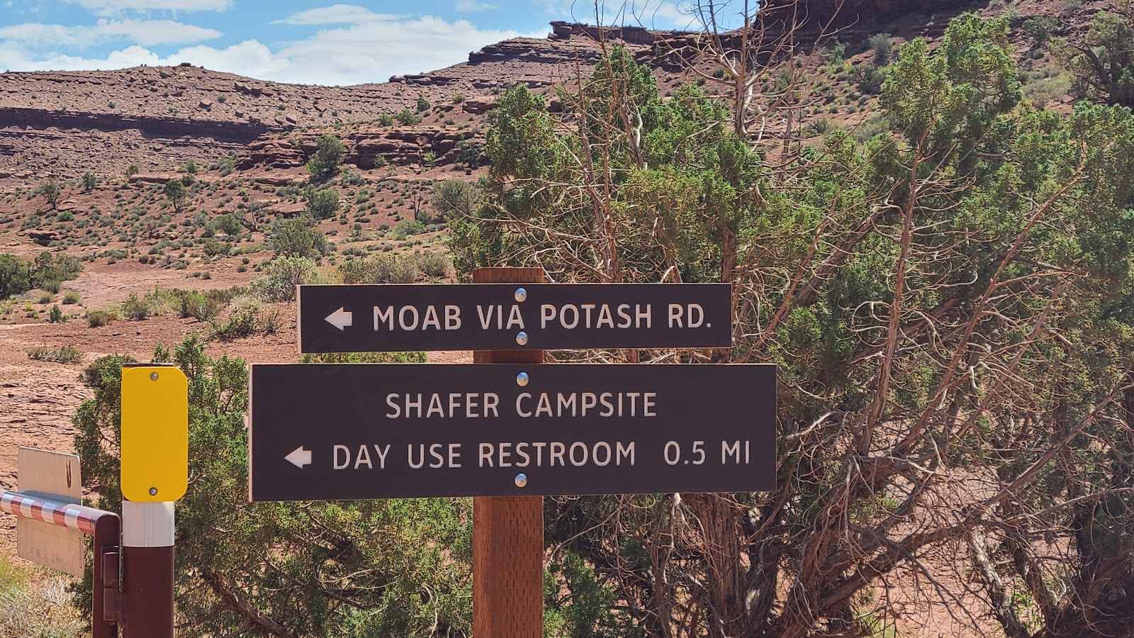 There's a welcoming sign, we're on the right road and there's a bathroom.
 Only 32-miles to go, I hope it's not all gravel.
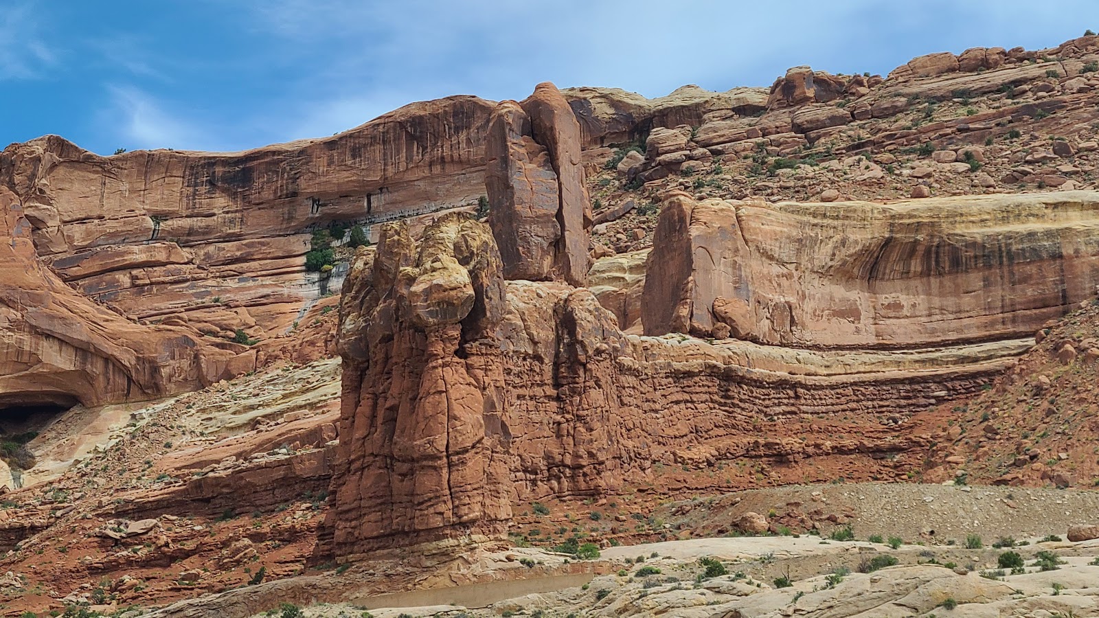
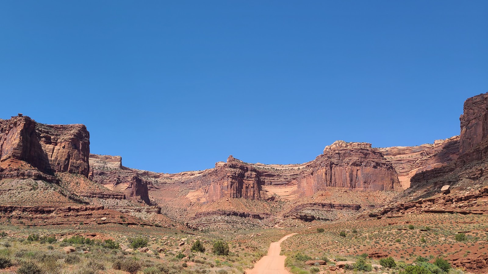
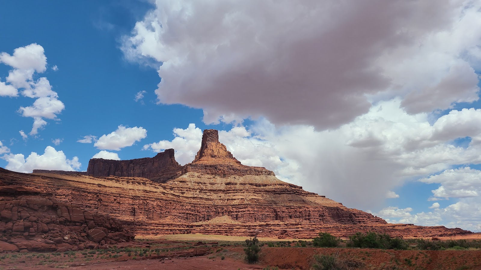
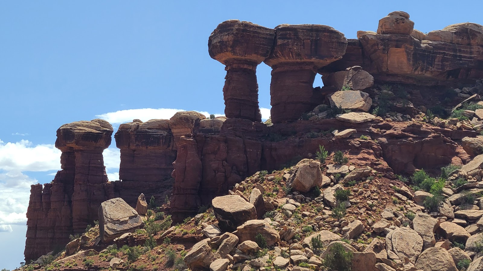 These formations were interesting, kind of reminds me of Goblin Valley.
 This photo was taken in the bathroom parking lot.
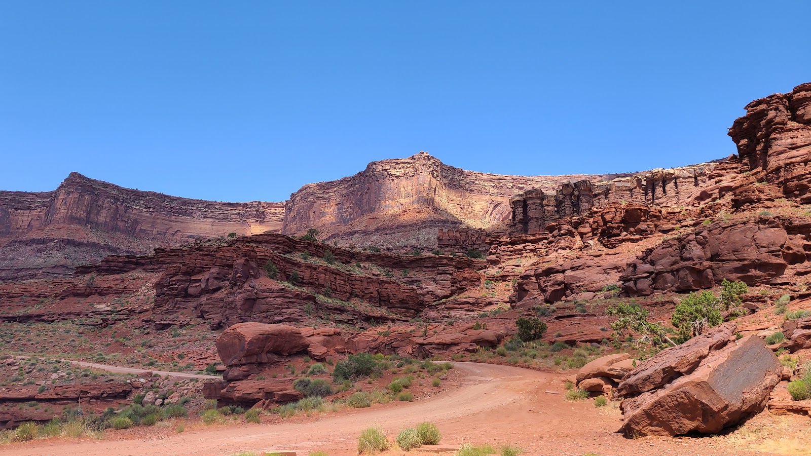
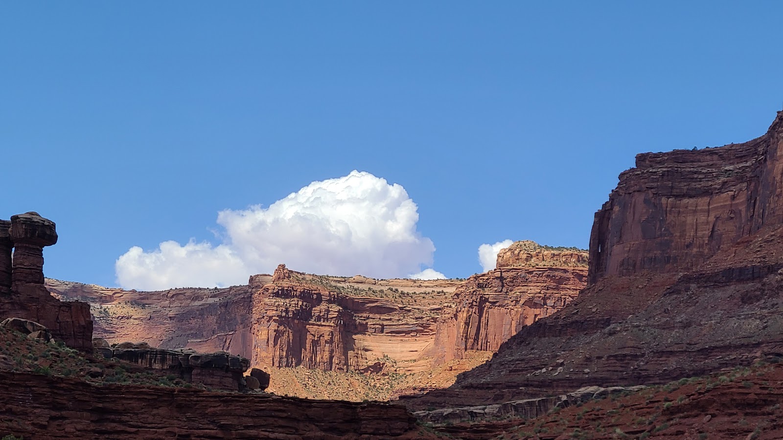 The scenery just keeps getting better.
 Oh no, more down hill, I thought we were done with that.
 This sign is posted for people heading in the opposite direction from us.
 Again, we're exiting the national park, not entering it.
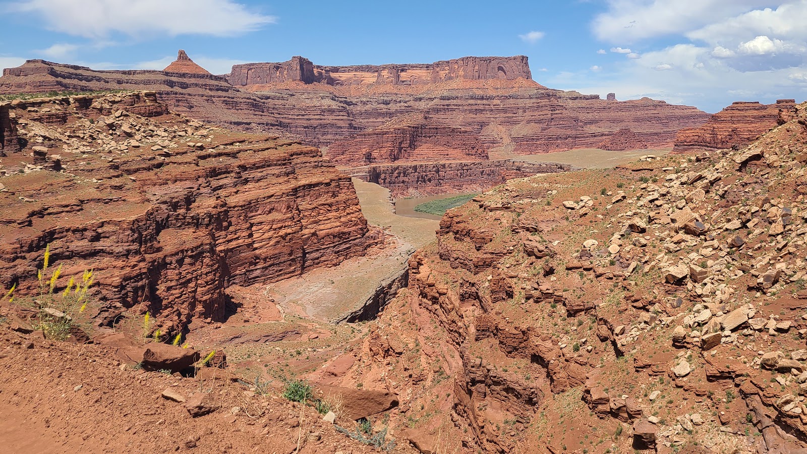
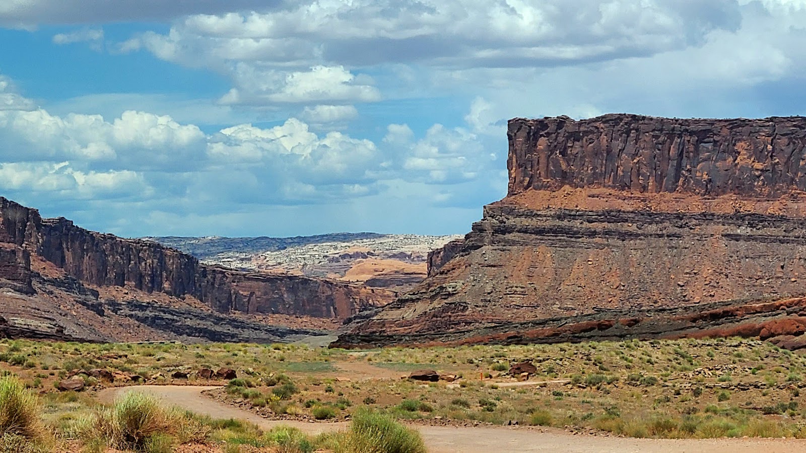
 Our first peek at the Colorado River we've been paralleling.
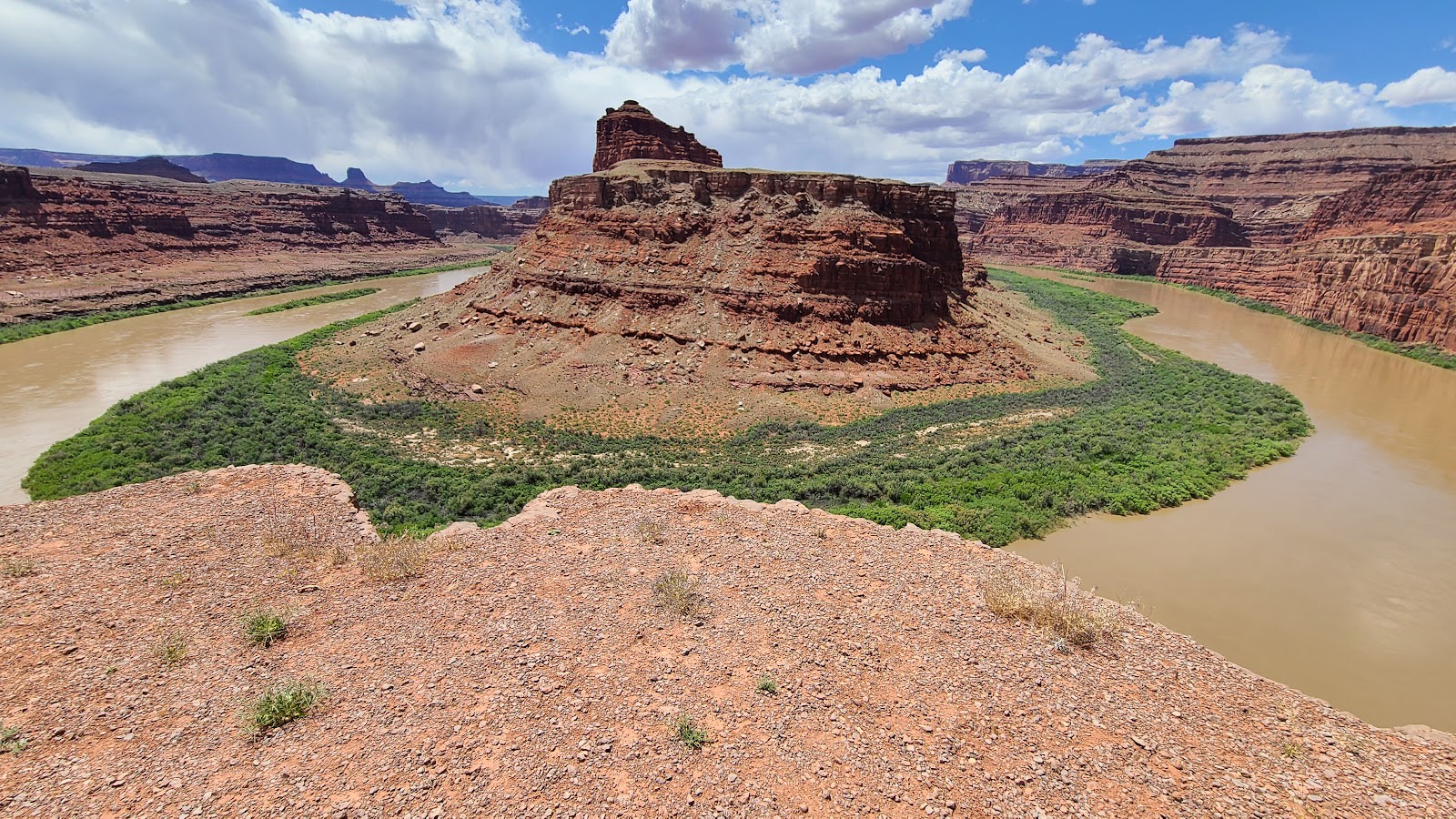 This view is from Gooseneck Overlook, one of our planned stops for today.
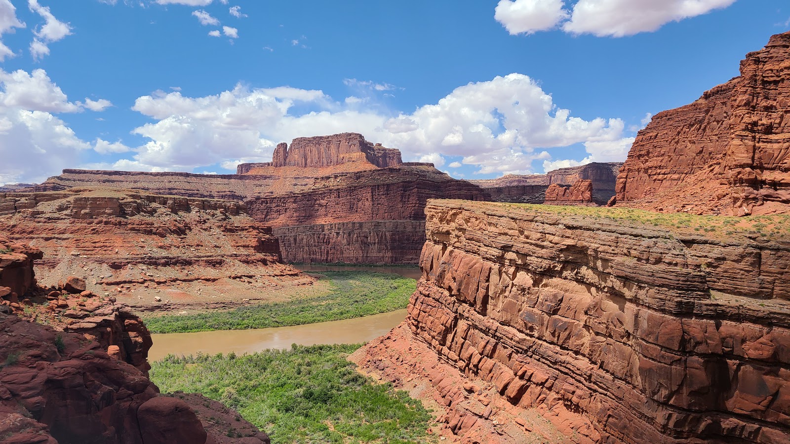 Around the next corner we got another glimpse of the Colorado River.
 That rock face under the roadway doesn't look to stable to me.
 I think I'll park a little further back from the edge from now on.
 Another one of our planned stops today, only we didn't expect to see this many people here.
This was the location for a very famous scene in a 1991 blockbuster movie, any guesses?
 Does this formation look familiar? Maybe the next photo will help.
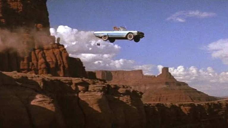 That's right, it's from the suicide scene at the end of the Thelma and Louise movie.
 Most of the cactus blooms have been yellow, but we found these pink ones today.
 Another angle of the Thelma and Louise formation, that's what I'm calling it anyway.
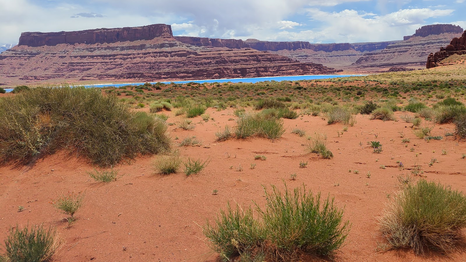 What is that? Did someone lay a giant sized blue tarp on the desert floor?
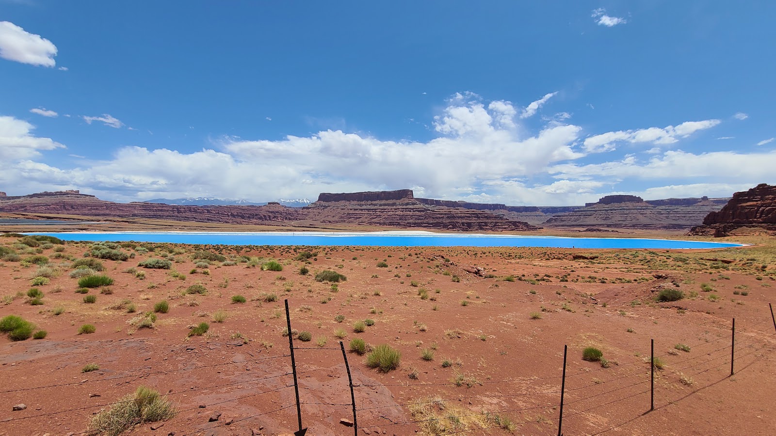 That's called an evaporation pond, which is used to extract potassium chloride from the water.
 What gives it the bright blue color? I don't know.
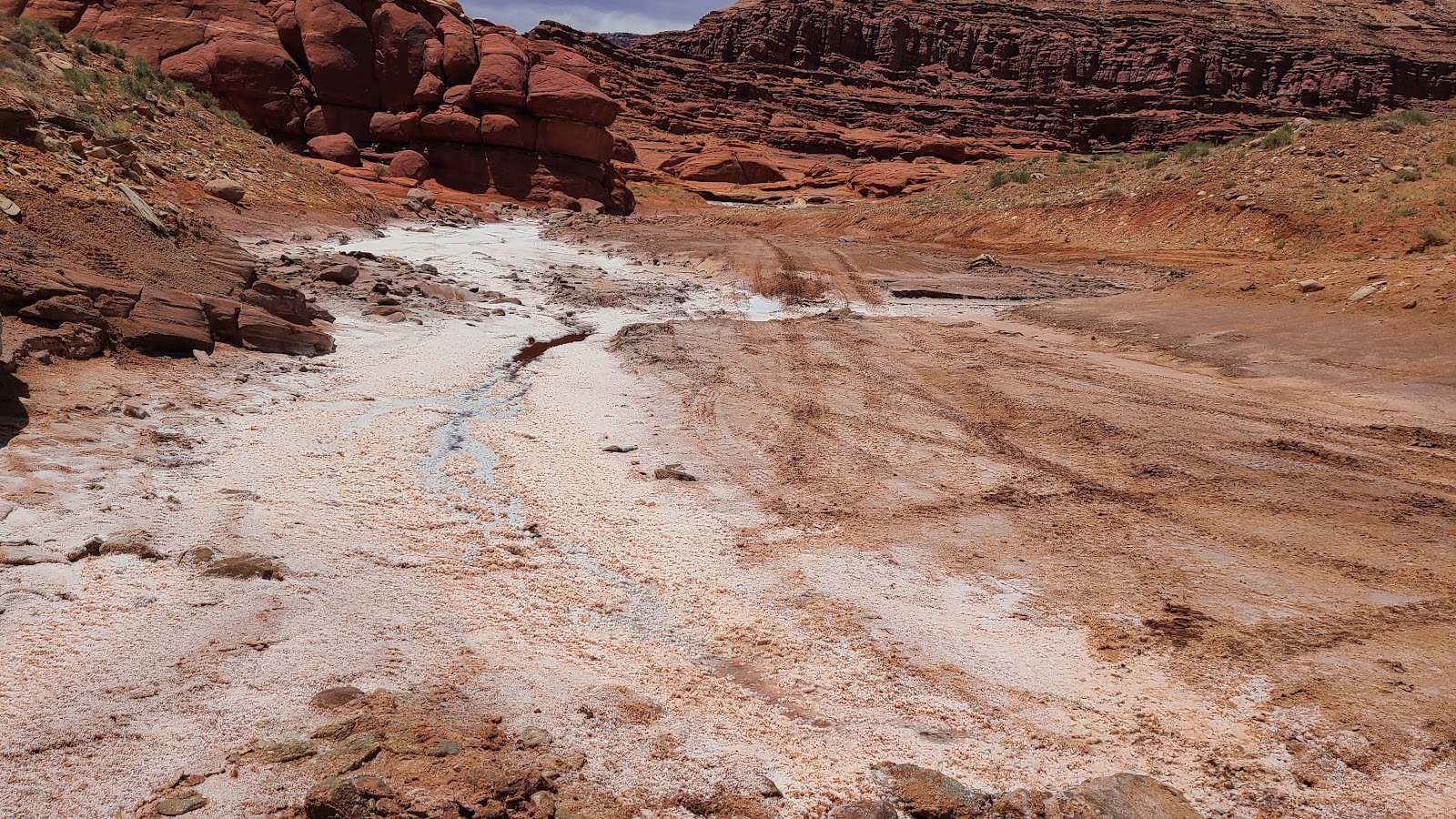 Even the runoff leaves behind salt and potassium chloride (aka potash).
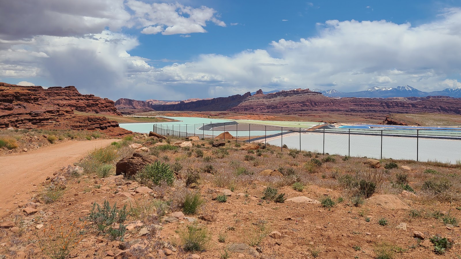 Bright blue isn't the only color of the water out in the ponds.
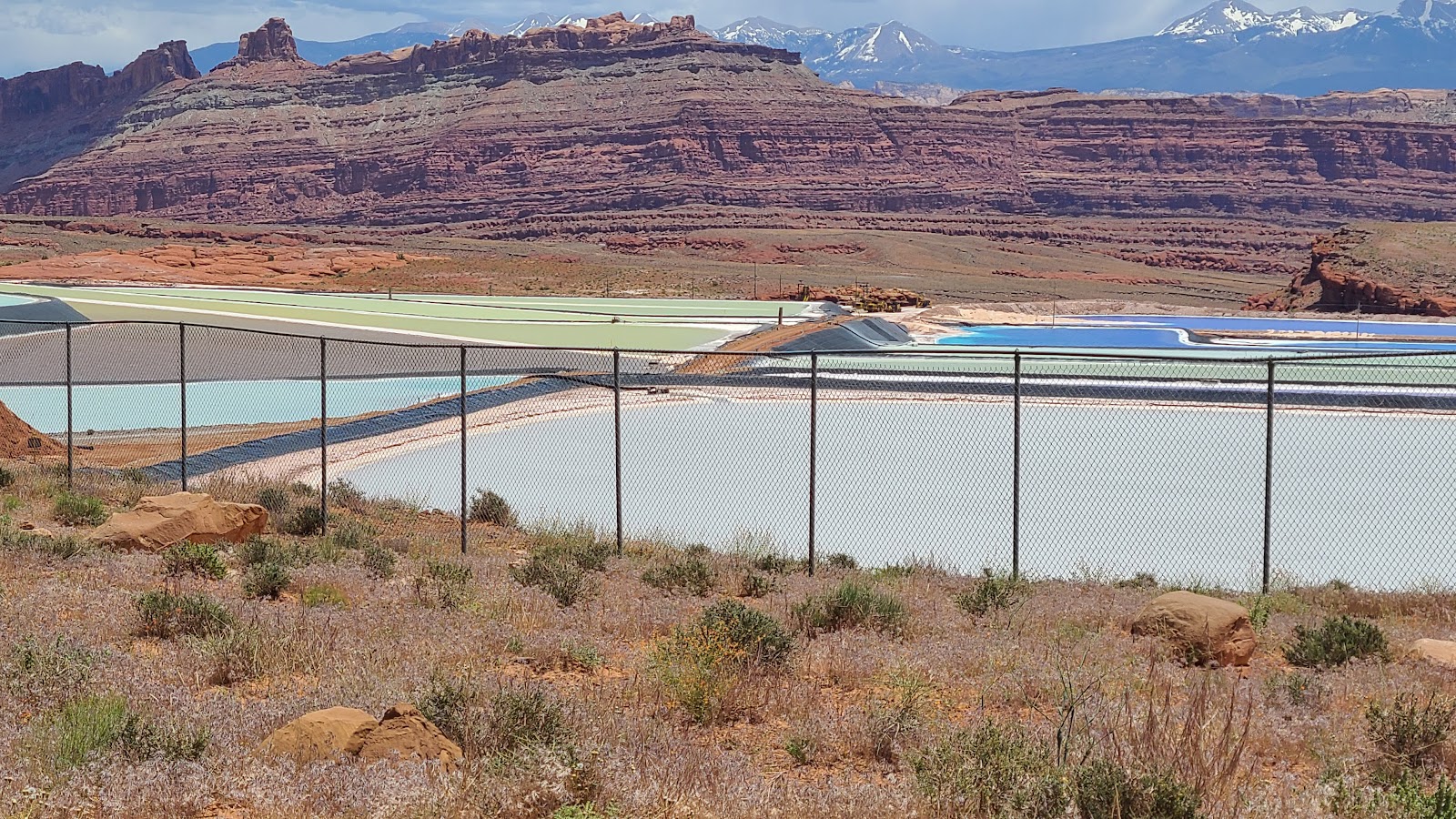 There are pastels of green, lavender and blue.
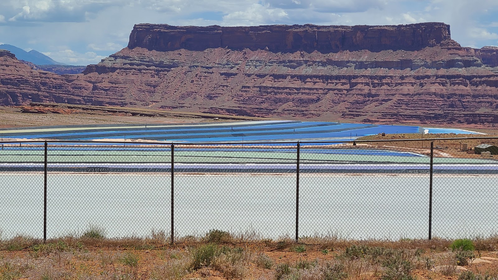 I knew about this due to my research, but Trica was caught totally by surprise.
 The ponds went on for about 3-miles following the roadway.
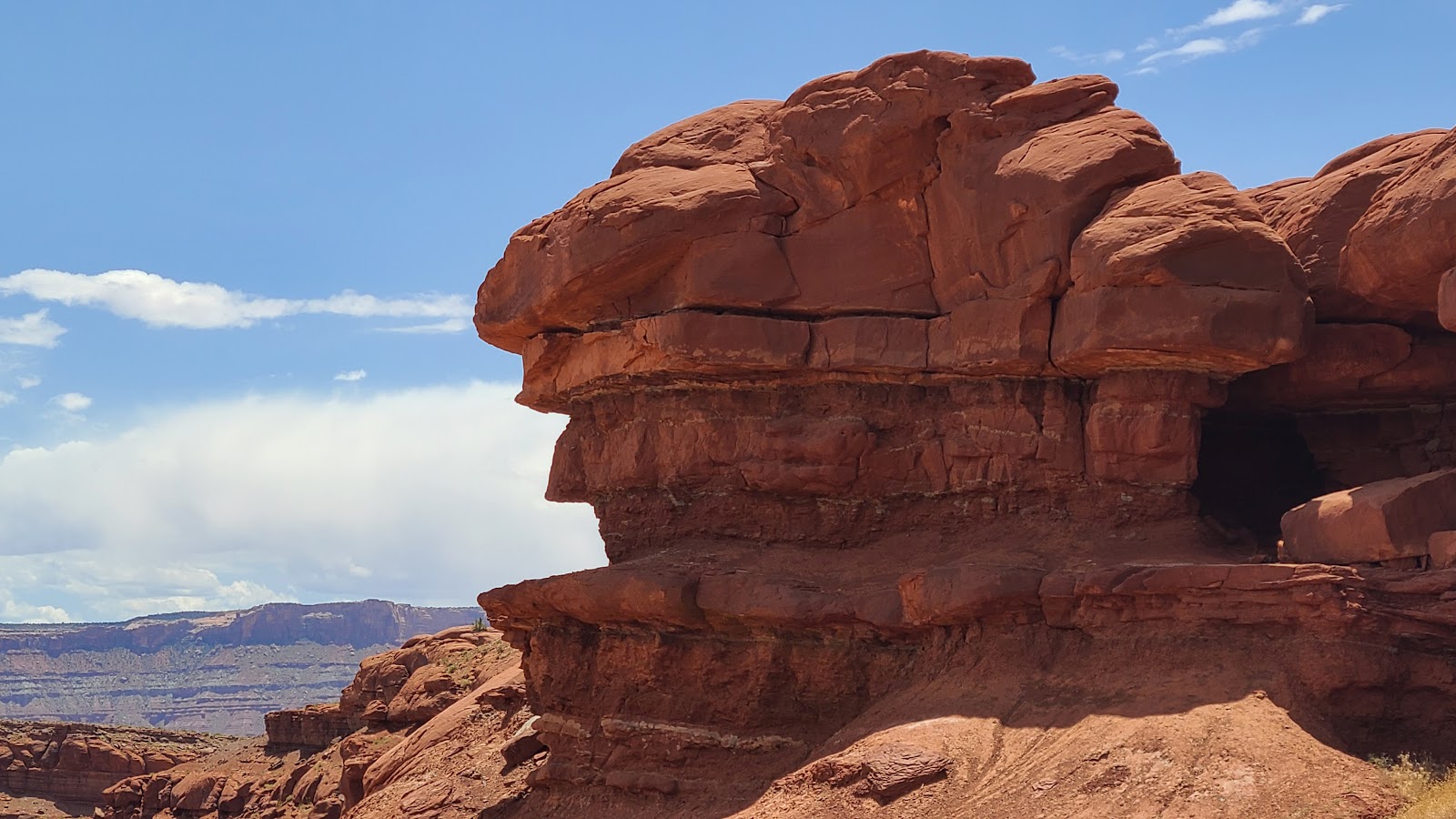 Does this look like Elvis Rock to anyone? That's what it says on Google Maps anyway.
 We're nearing the end of our travels today and hopefully this gravel road.
 Do you see what I see? Another much needed bathroom break.
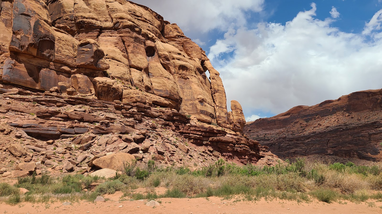 This formation is called Jug Handle Arch.
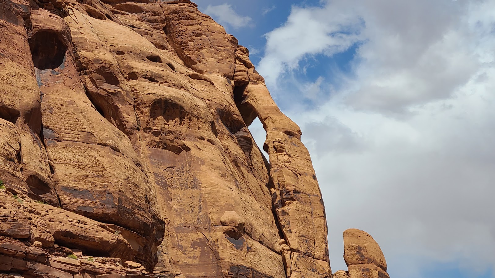 Here's a closer look.
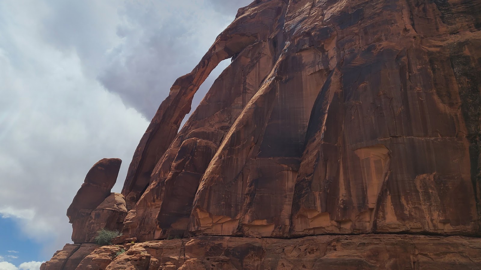 Here's what it looks like from the other side.
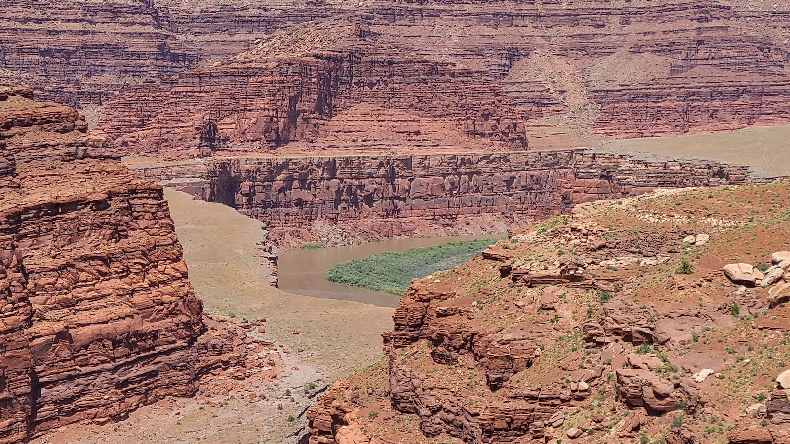
 Today the Colorado River is only a couple of feet below the road level.
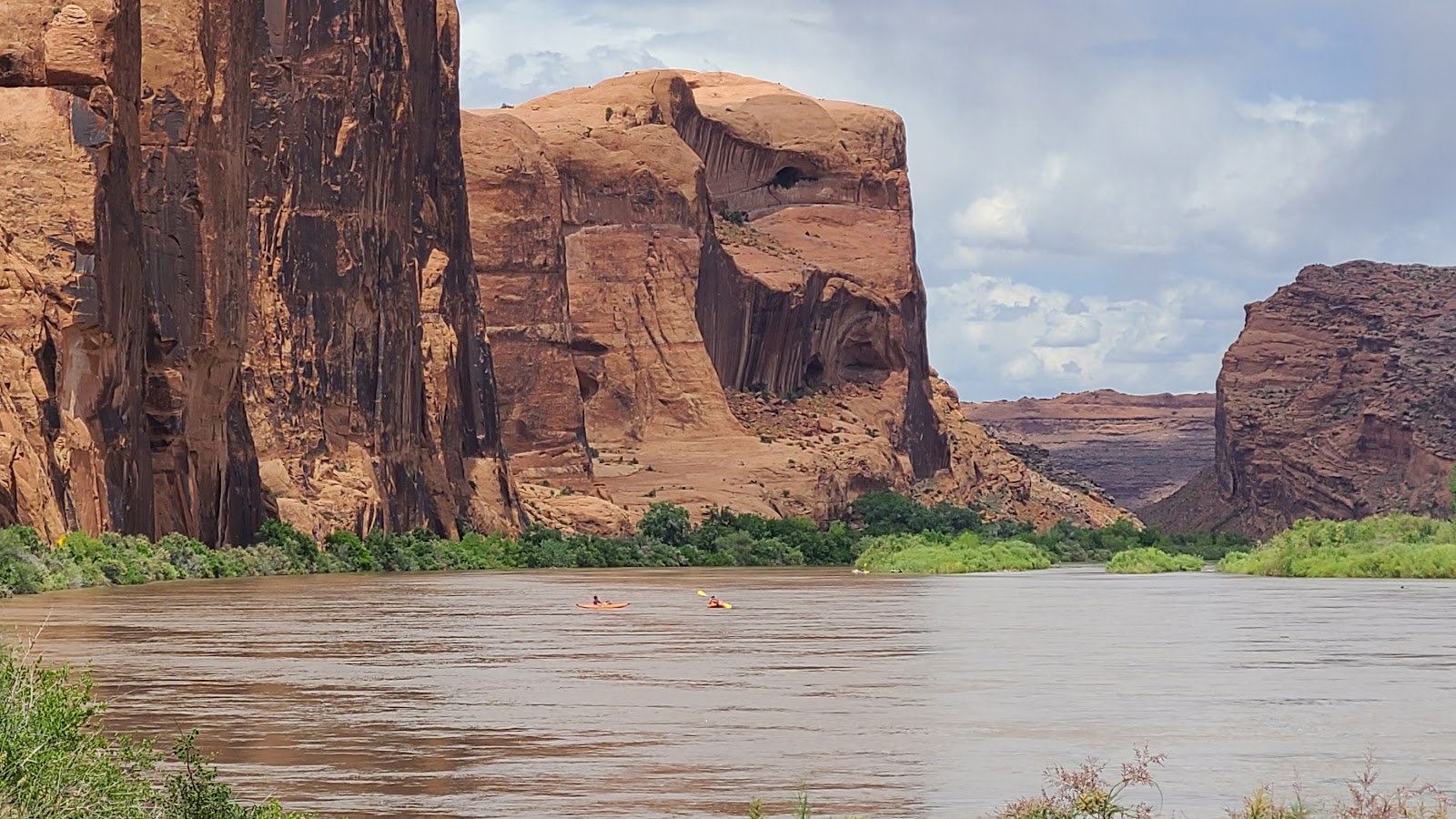 Making it a perfect day to get out and kayak on the river I guess.
TUESDAY - With two days of rest and the park returning to normal after the Memorial Day Weekend crowds have left, we're ready to get back out on the hiking trails.
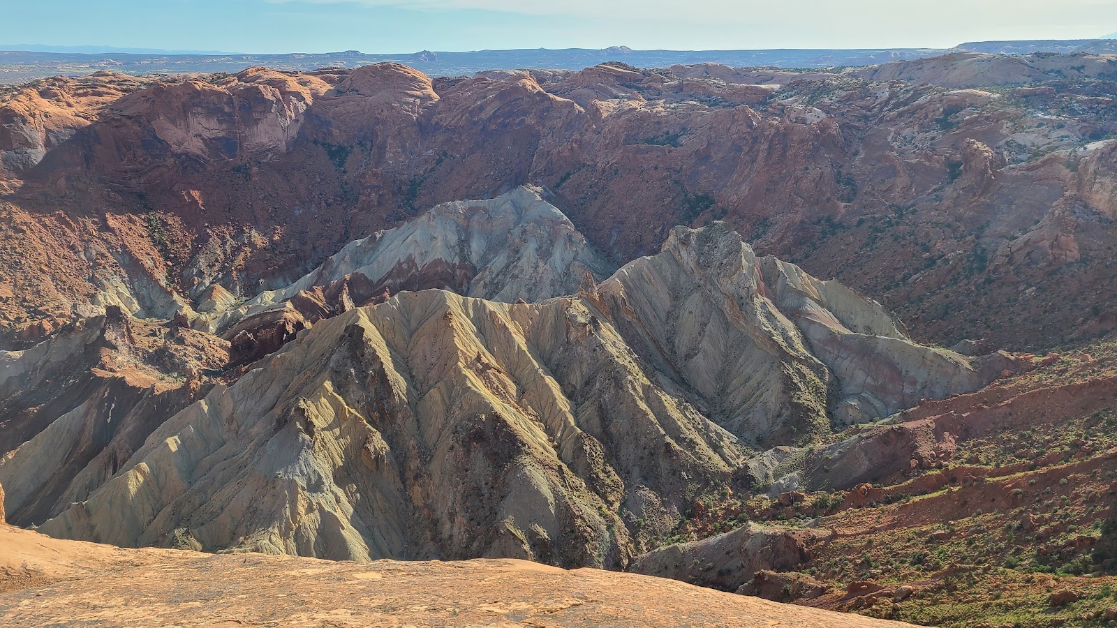
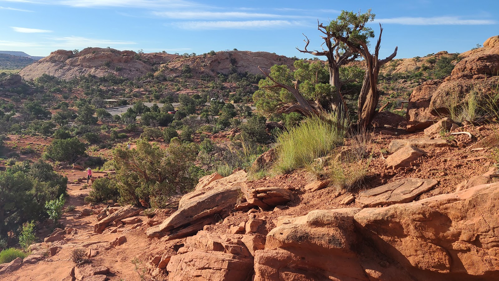
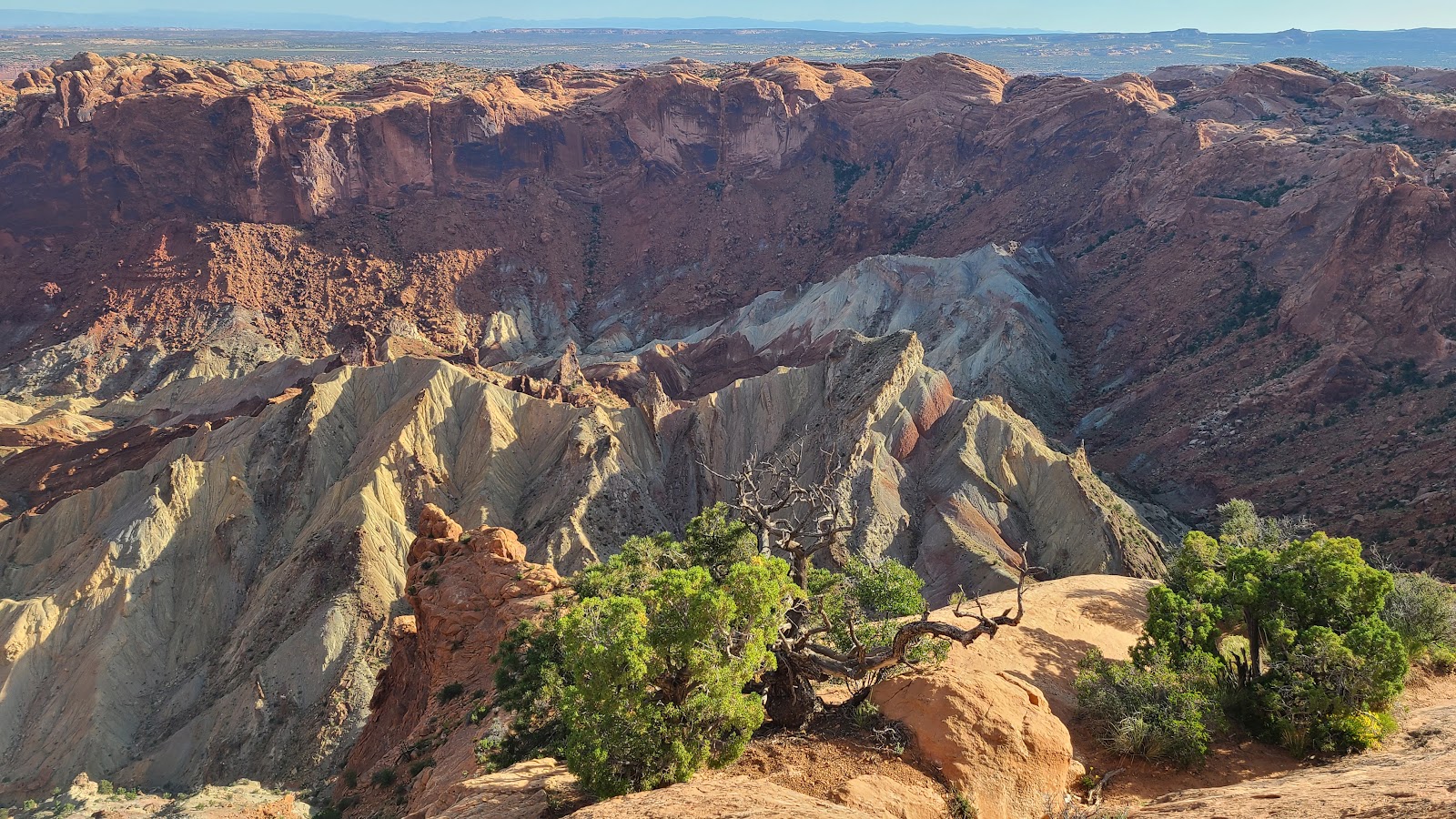
First thing this morning we drove out to the western edge of the park's roadway system where we found the Upheaval Dome Trail. The trail is 1.2-mile long and 229' of elevation gain. Along the trail you'll find two overlooks with a view of a 3-mile wide crater. It is believed to have been caused by a meteorite impacting the earth some 60-million years ago.
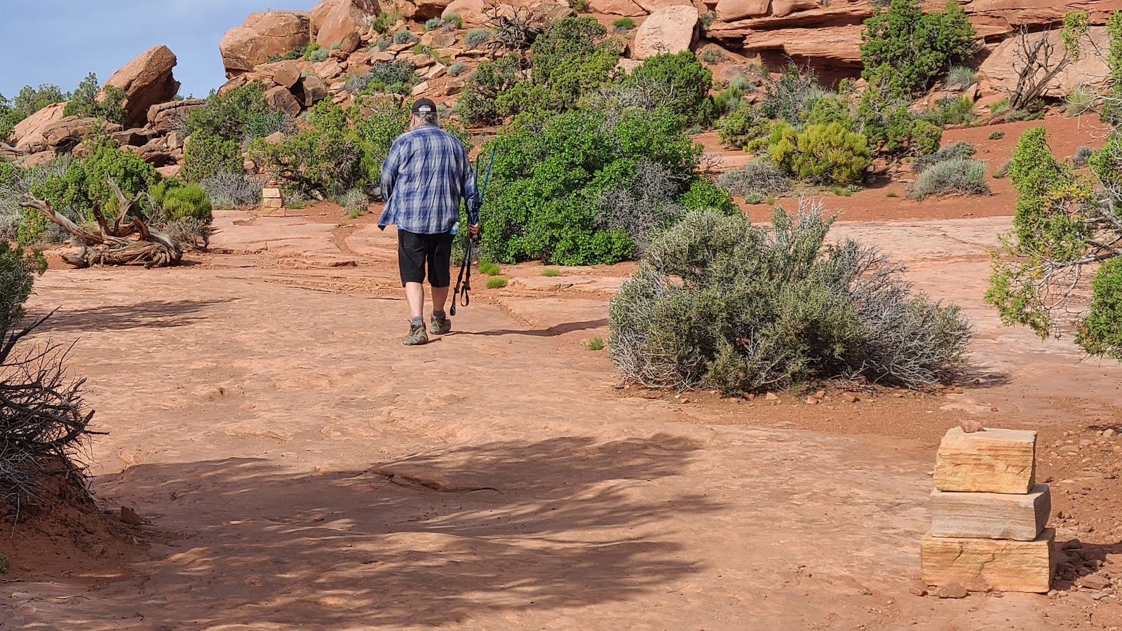
The second hike for this morning is right next door and is named Whale Rock Trail. This is a 1-mile long hike up a 141' tall rock that resembles a whale I guess, not from any ground level perspective we had at least. Maybe from directly above?
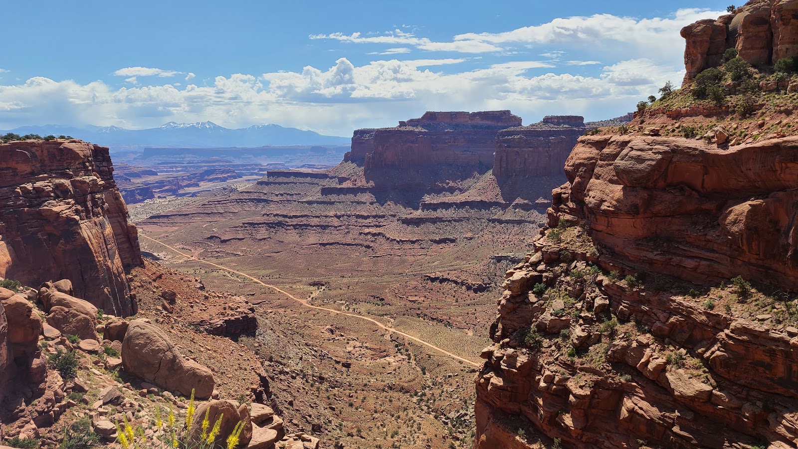
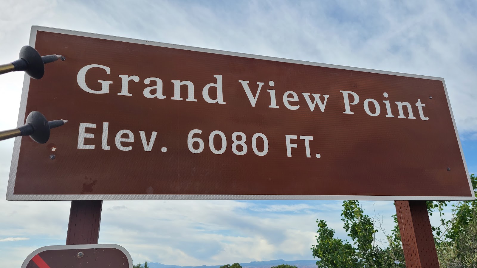
Afterwards we'll take a drive down to the southern edge of the park to check out the Grand View Point Overlook. (•FYI-We did, but the parking lot was already full by 10:30AM so we'll go again tomorrow, but earlier.)
UPHEAVAL DOME TRAIL
 Looking back at the parking lot I was surprised how quickly we gained elevation.
 Here I am getting ready to crest the hill to the 1st overlook.
 I'm studying the storyboard in case there's a test later.
 Tricia left me here with this view of the Upheaval Dome...
 ...while she pressed on to the 2nd overlook somewhere over there.
 This is part of the trail heading over to the 2nd overlook...
 ...and so is this.
 As long as you stay between the rock cairns (rock piles) you're on the trail.
 The end of the trail.
 I'll admit I missed some pretty excellent views by not going with her...
 ...and viewing the crater from the other side.
WHALE ROCK TRAIL
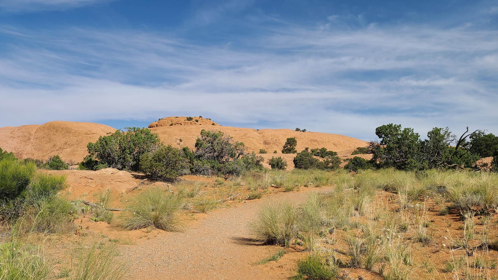 The trail starts out nice and easy. FYI-That's Whale Rock in the background.
 Along the trail we saw many blooming cactus plants.
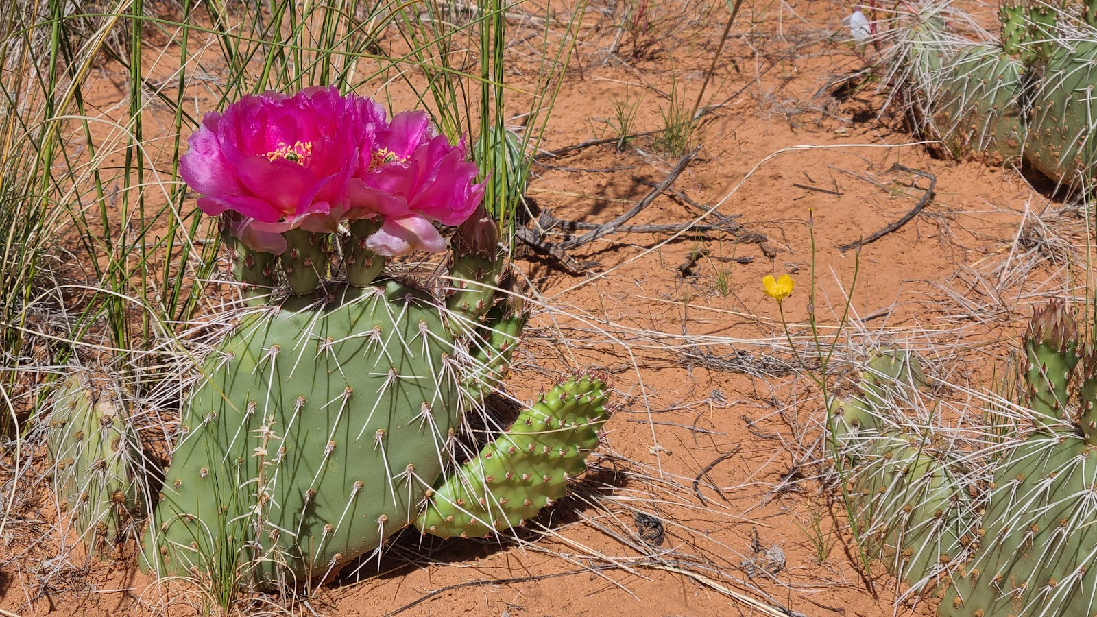 There were a few of these red colored ones...
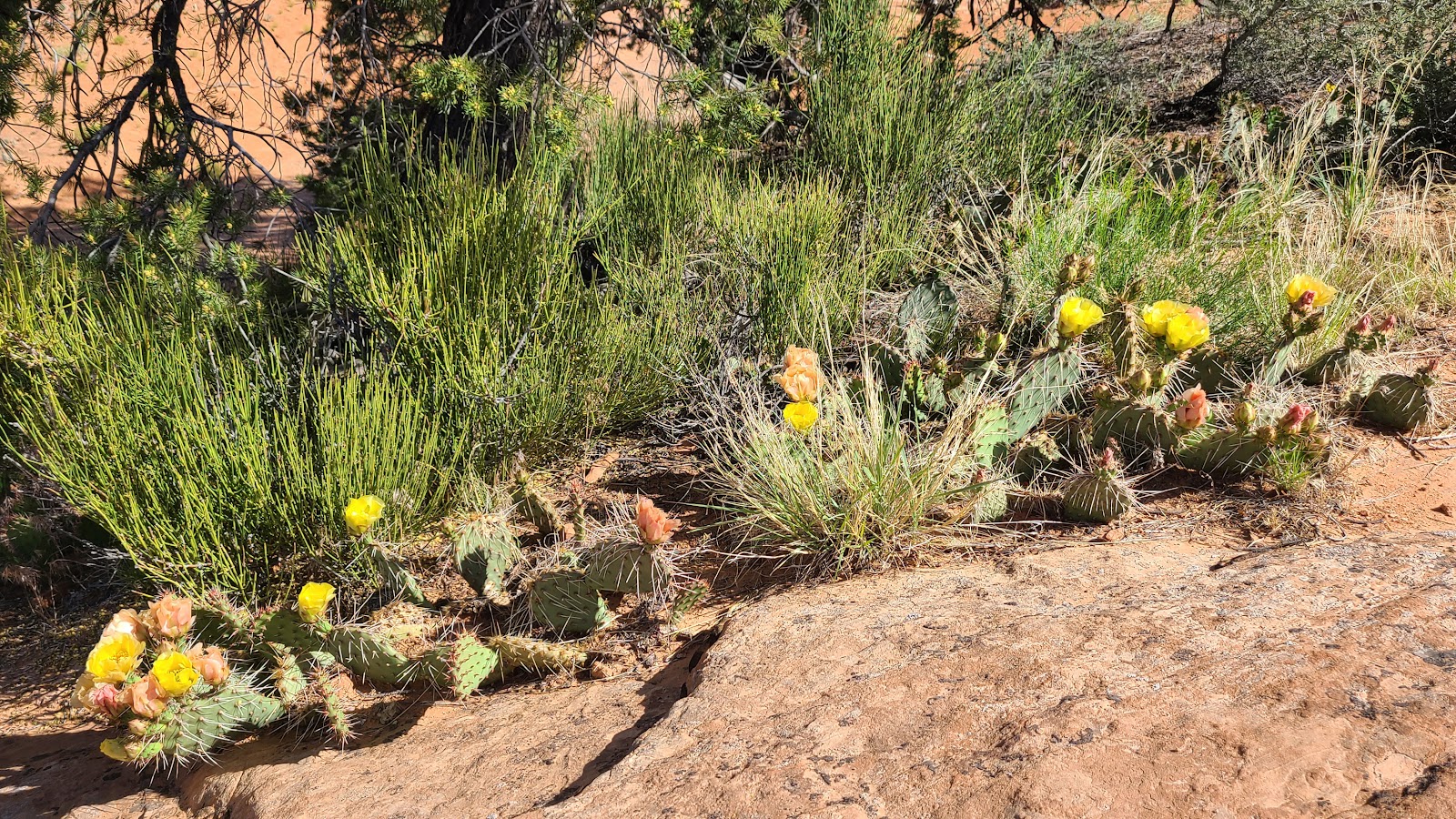 ...but most seemed to be of the yellow variety.
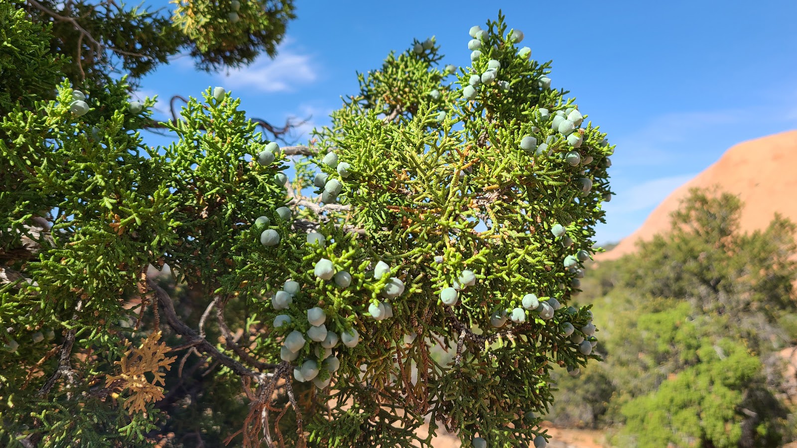 Even the juniper trees were sporting some berries.
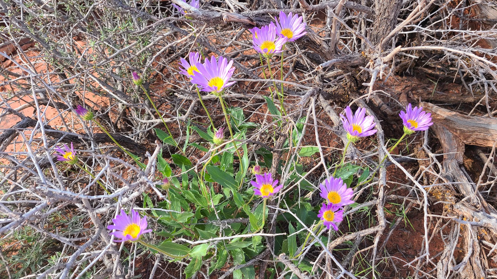
 I'm not sure what these red and yellow plants were, but they sure are pretty.
 Tricia once again left we sitting under a tree while she forged ahead.
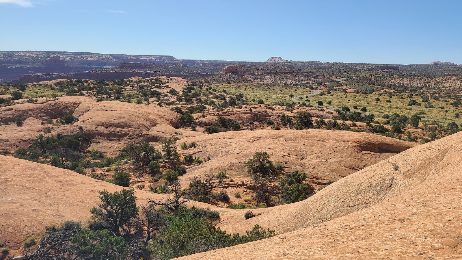
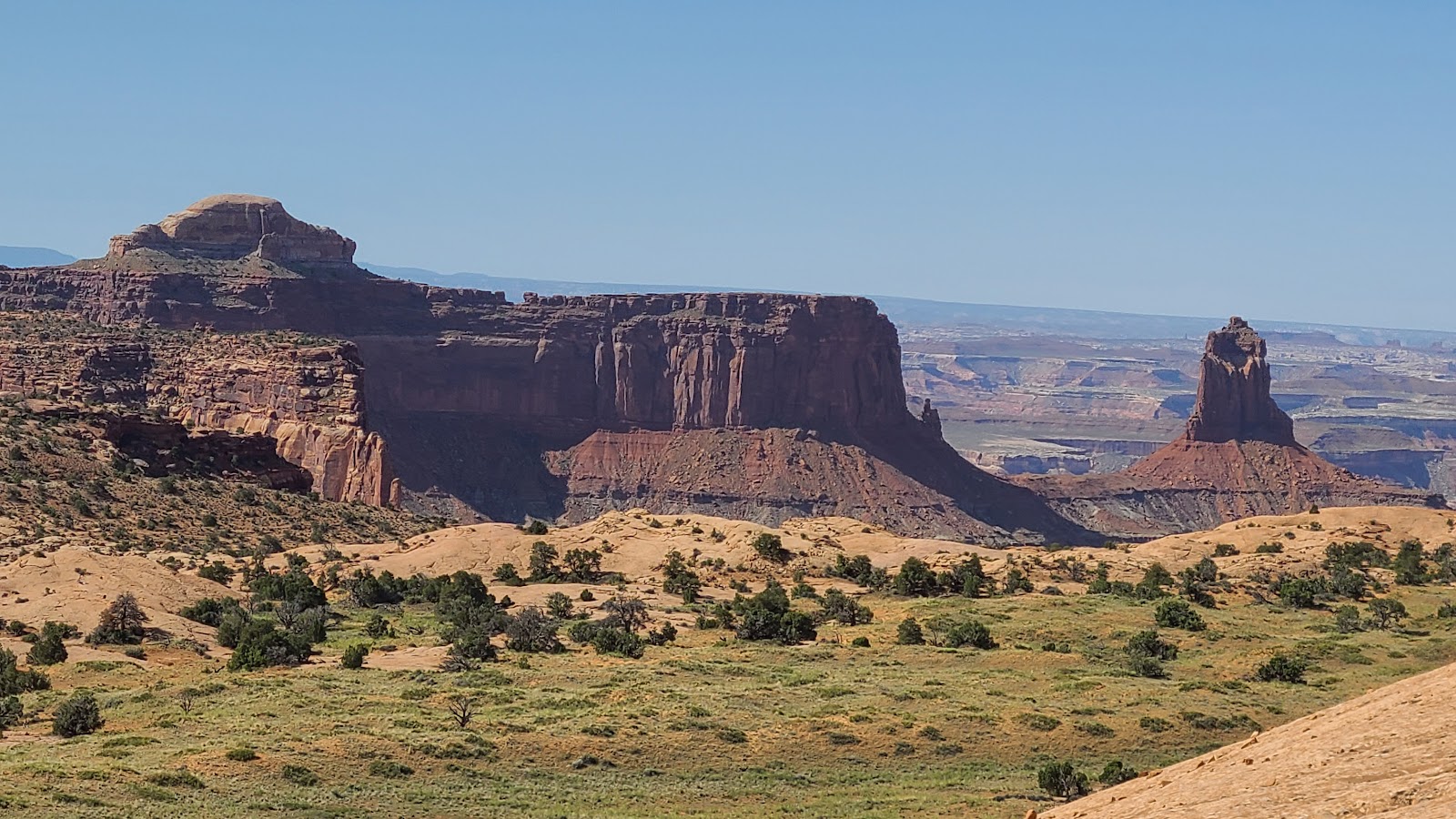 Getting close to the top affords some long views of the surrounding canyons.
 That's the top! Almost there now.
 From the top you can see the Upheaval Dome parking lot where we were earlier.
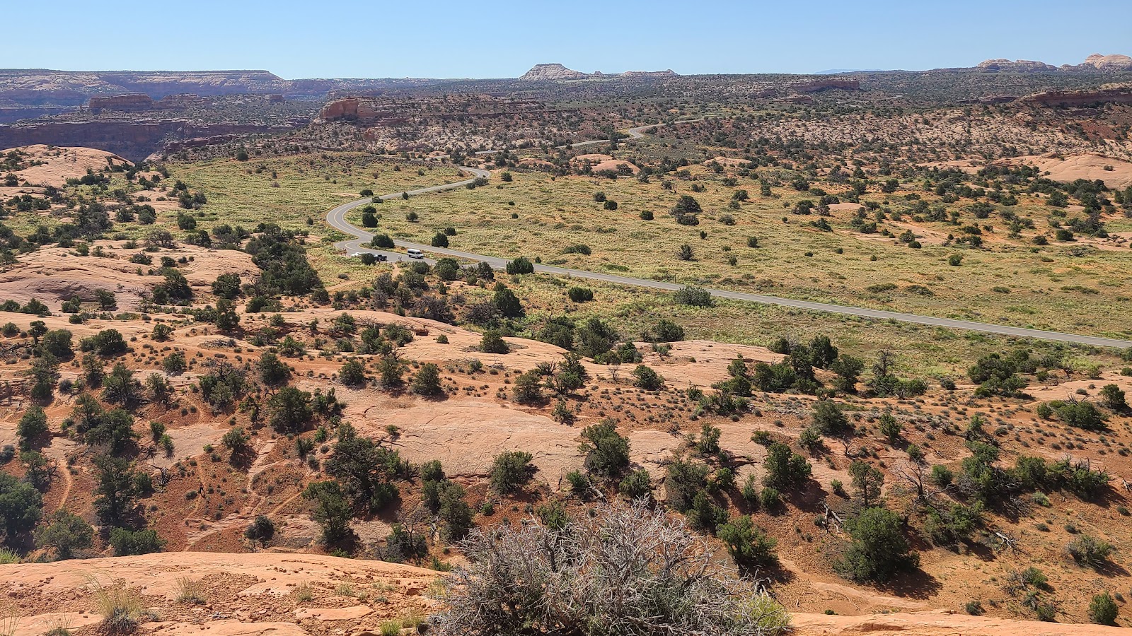 You can also see the parking lot for this trail.
 ROVER is hiding behind that clump of trees.
 The views were well worth the effort to climb to the top.
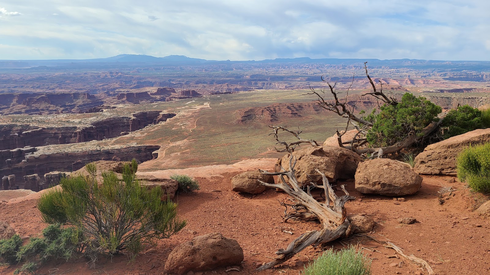
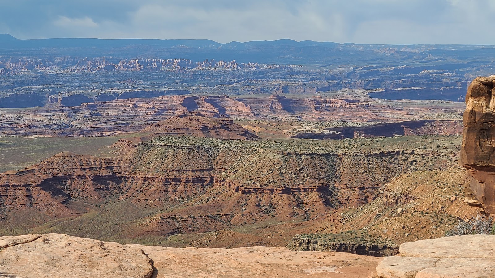
We didn't get out of the truck at Grand View Point Overlook due to the full parking lot, but we did visit the nearby Buck Canyon Overlook to take these several photos for you.
In the last photo you can see the White Rim Road down below. I still want to drive a section of that road, but it means another trip down the 1400' Shafer Switchbacks and then this time, drive back up them again.
WEDNESDAY - After a good night's sleep we awoke full of energy.
I know what we can do, let's go do a hike!
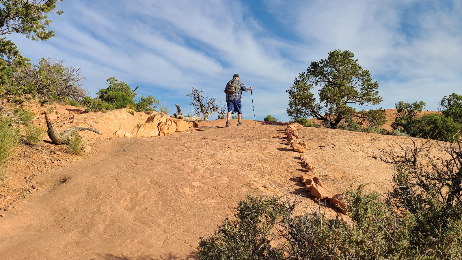
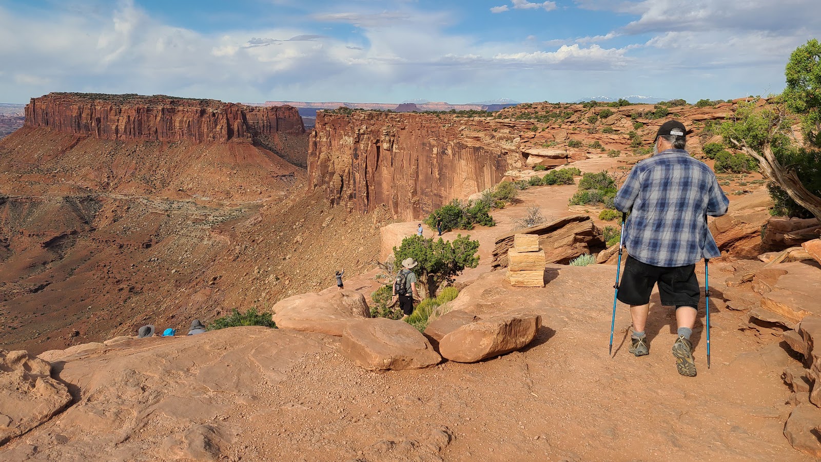
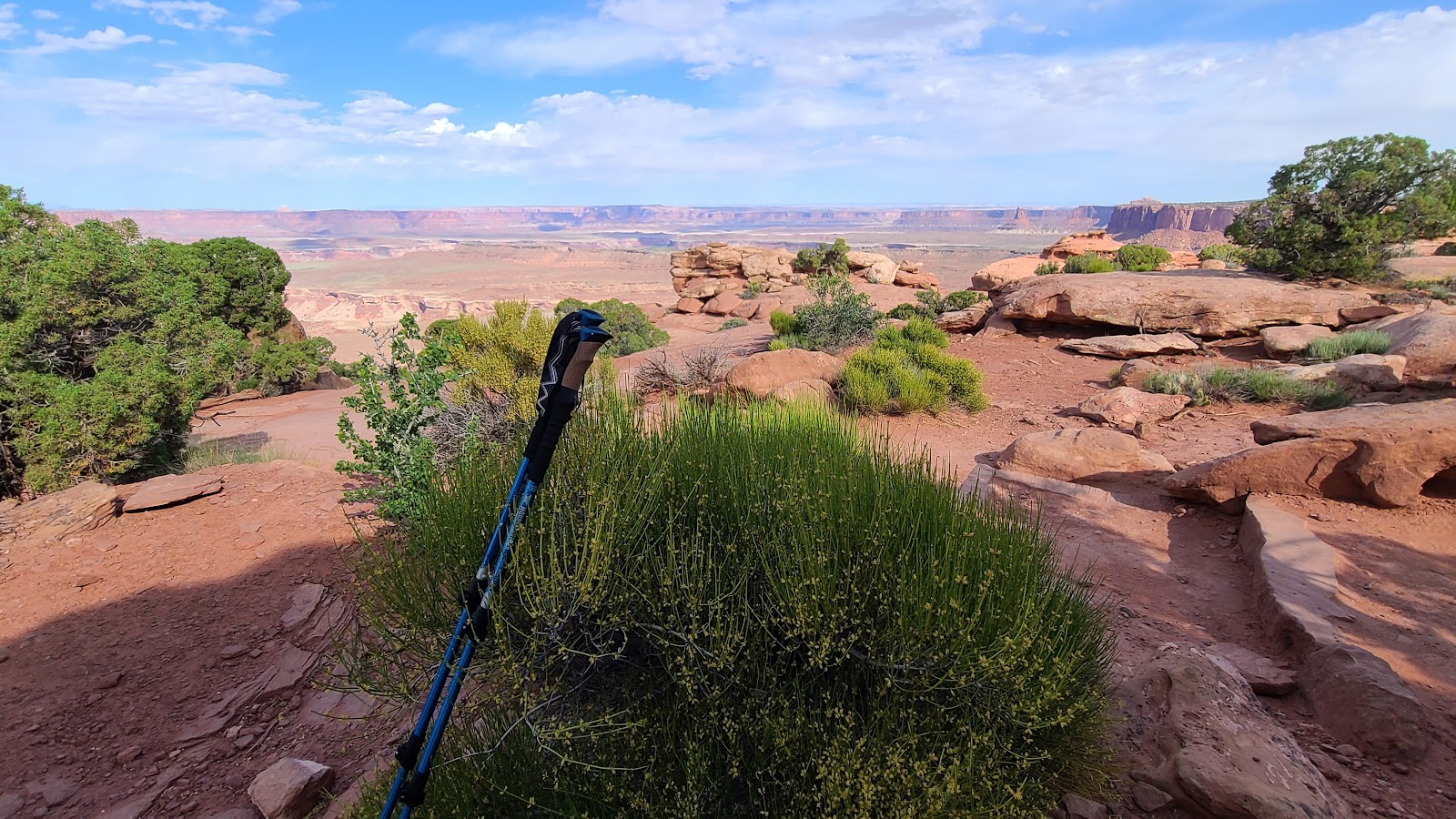
The trailhead parking lot for Grand View Point Trail is always packed full of vehicles, but not at 8:00AM when we got there. We weren't the first ones to arrive, but we were in the first half dozen or so.
The trail is listed as 1.8-miles round trip with only 73' of elevation change. That figure might be correct if you're talking about the difference between the starting point and ending point of the trail, but trust me you'll gain and lose that 73' several times on your roller coaster ride of a hike.
GRAND VIEW POINT OVERLOOK TRAIL
 This is where it all starts, in the parking lot.
 The trail starts out heading downhill.
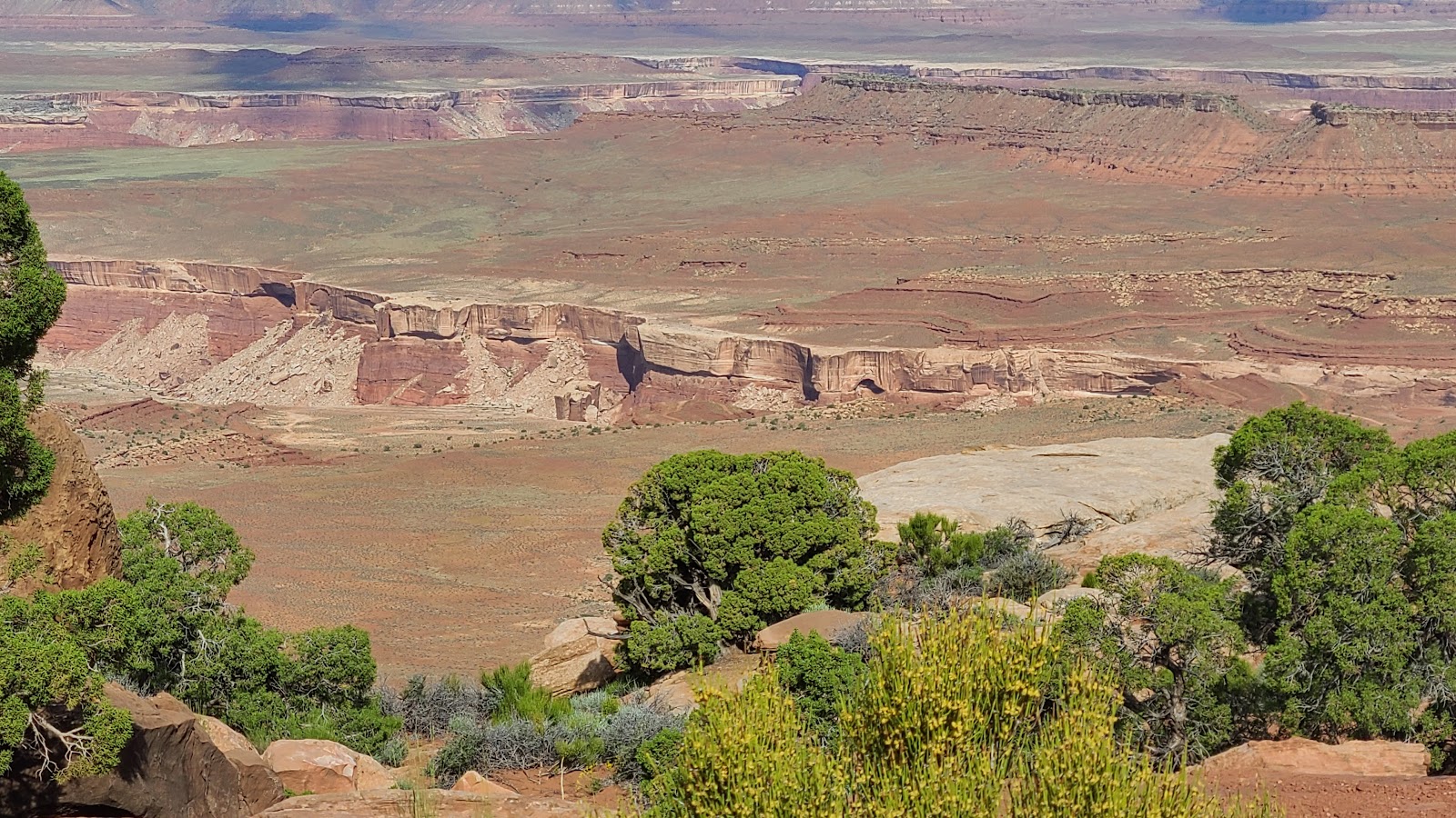
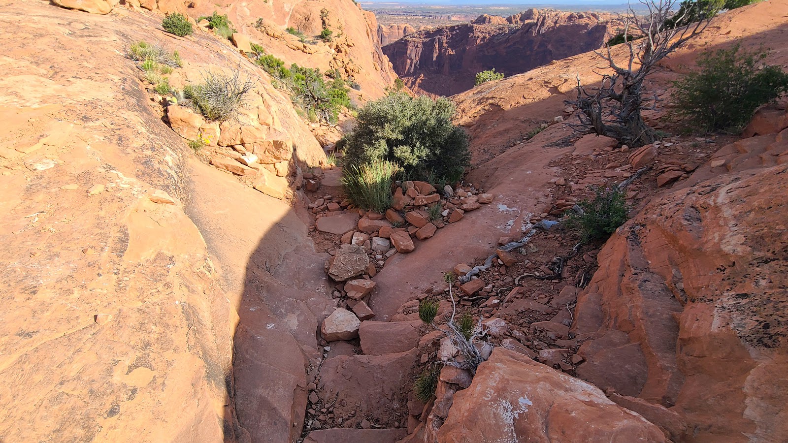
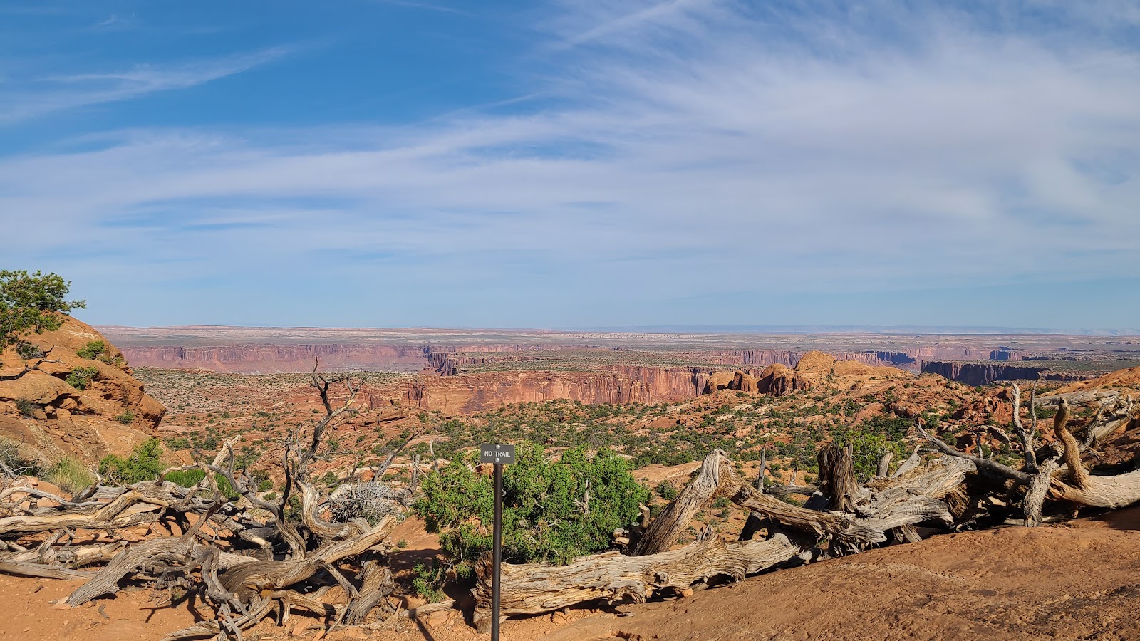
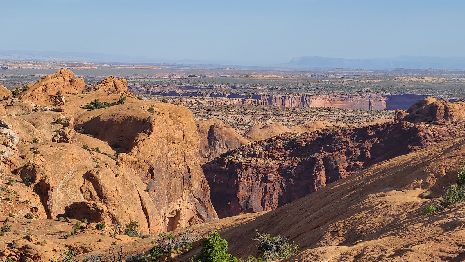
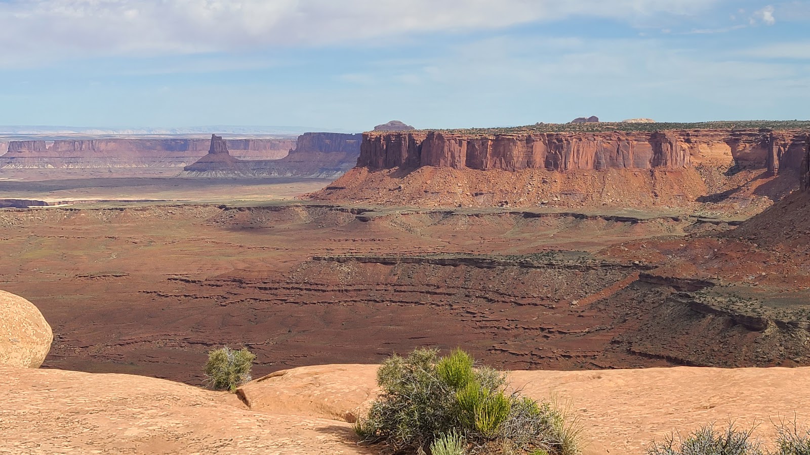
 Most of the trail has deep canyon views just a few feet from the edge.
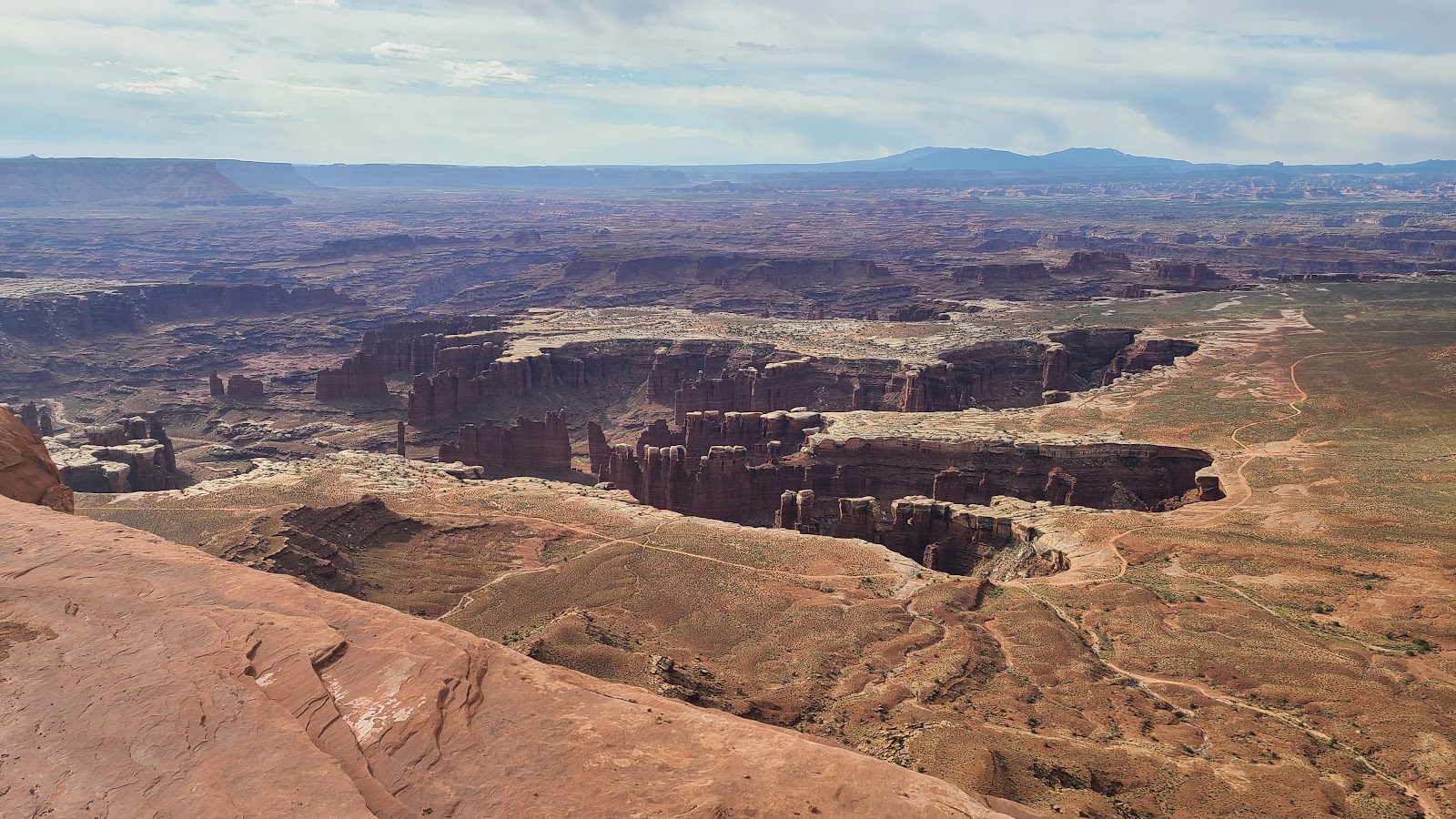 More canyon views with the White Rim Road visible.
 Now the trail is going back up? Why the roller coaster effect?
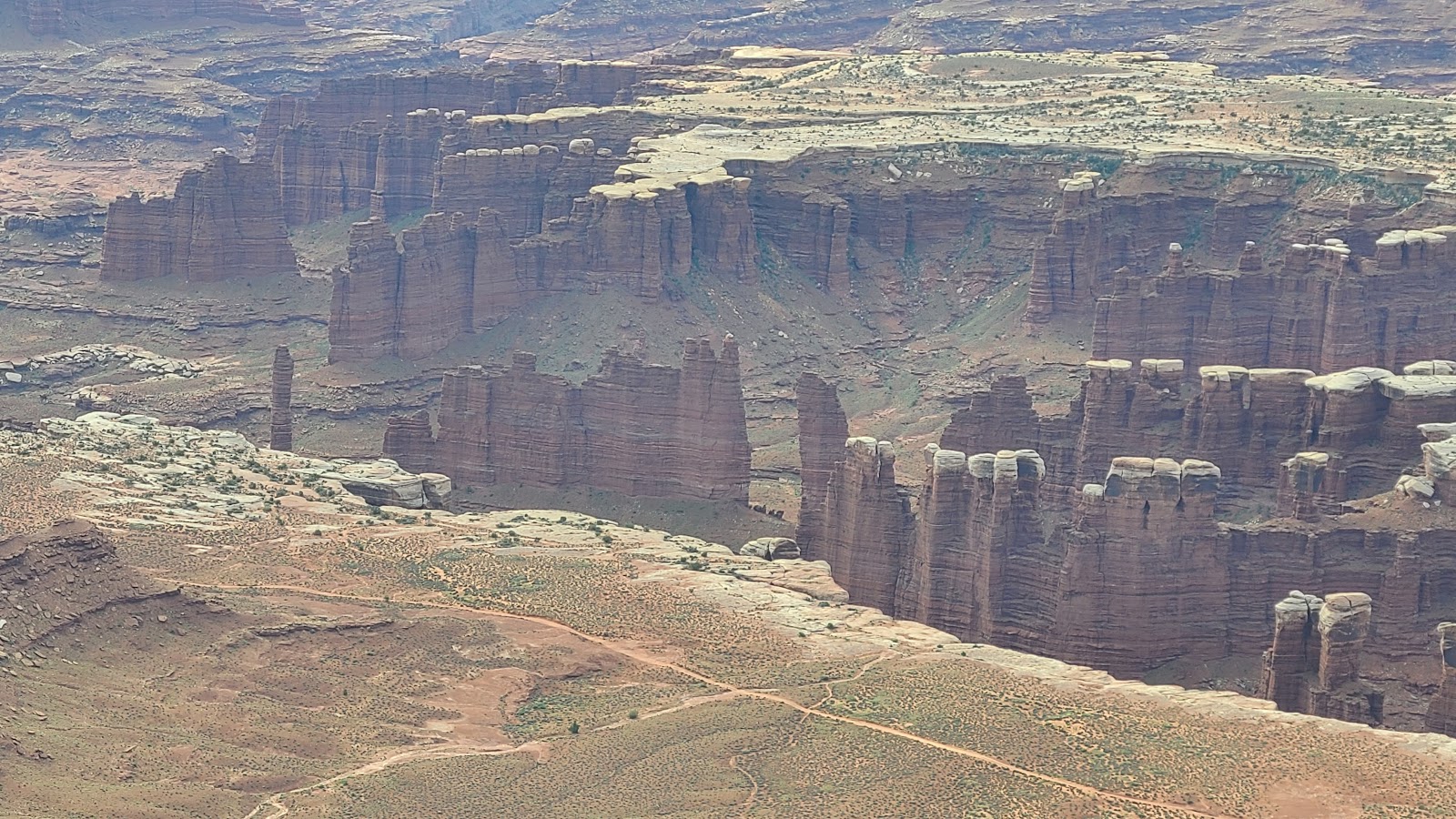 More canyon views with the White Rim Road taunting me.
 That's a mighty steep dropoff.
 Just follow the stacked rocks Phil, you'll be fine.
 Looks like we're approaching the end of the trail here.
 Yep, end of the trail and I found a perfect place to sit down in the shade to rest.
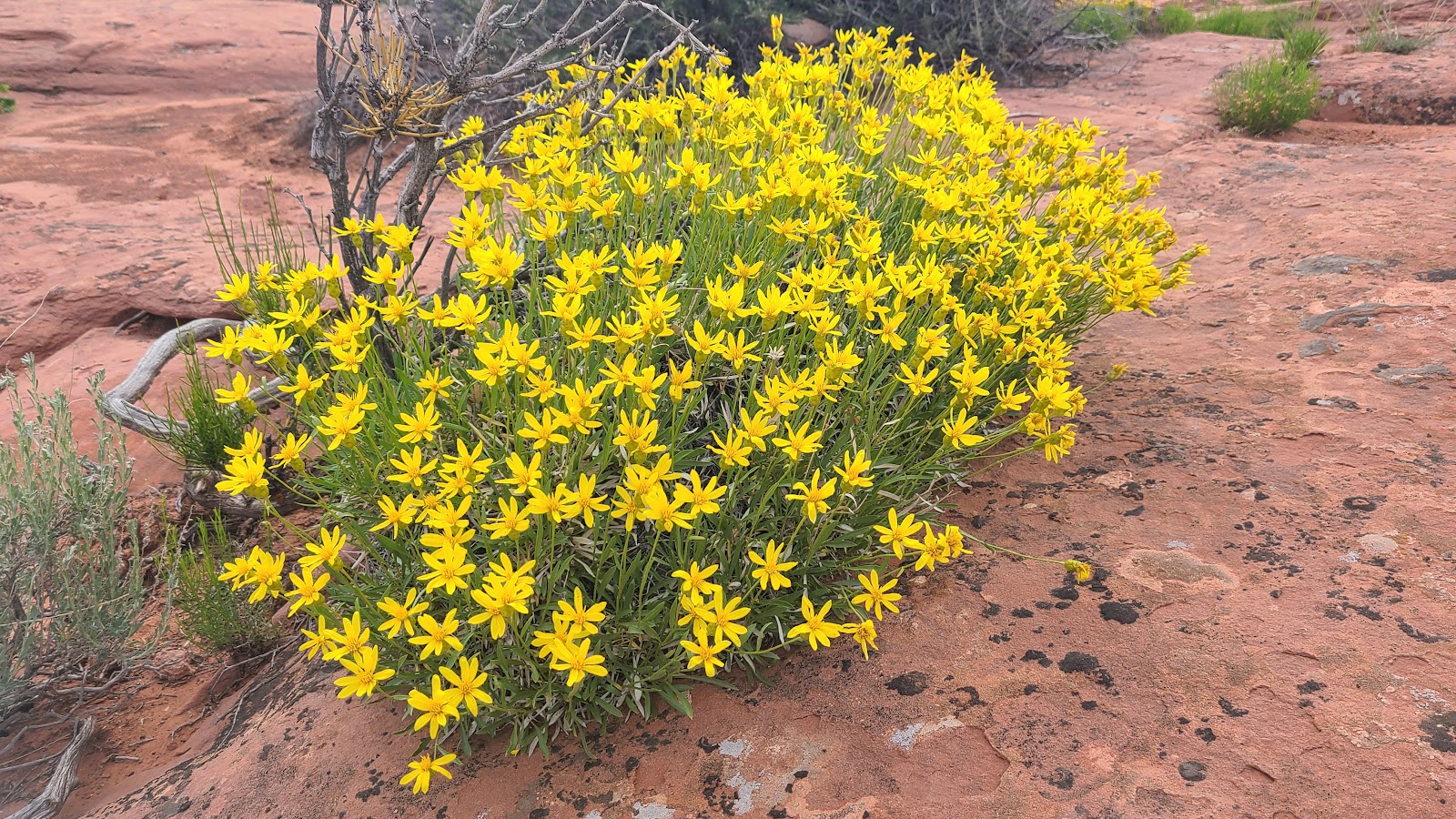
 Aren't these blooms pretty?
 Still checking out the views from the trail's end.
 More blooms, we haven't seen these befoe.
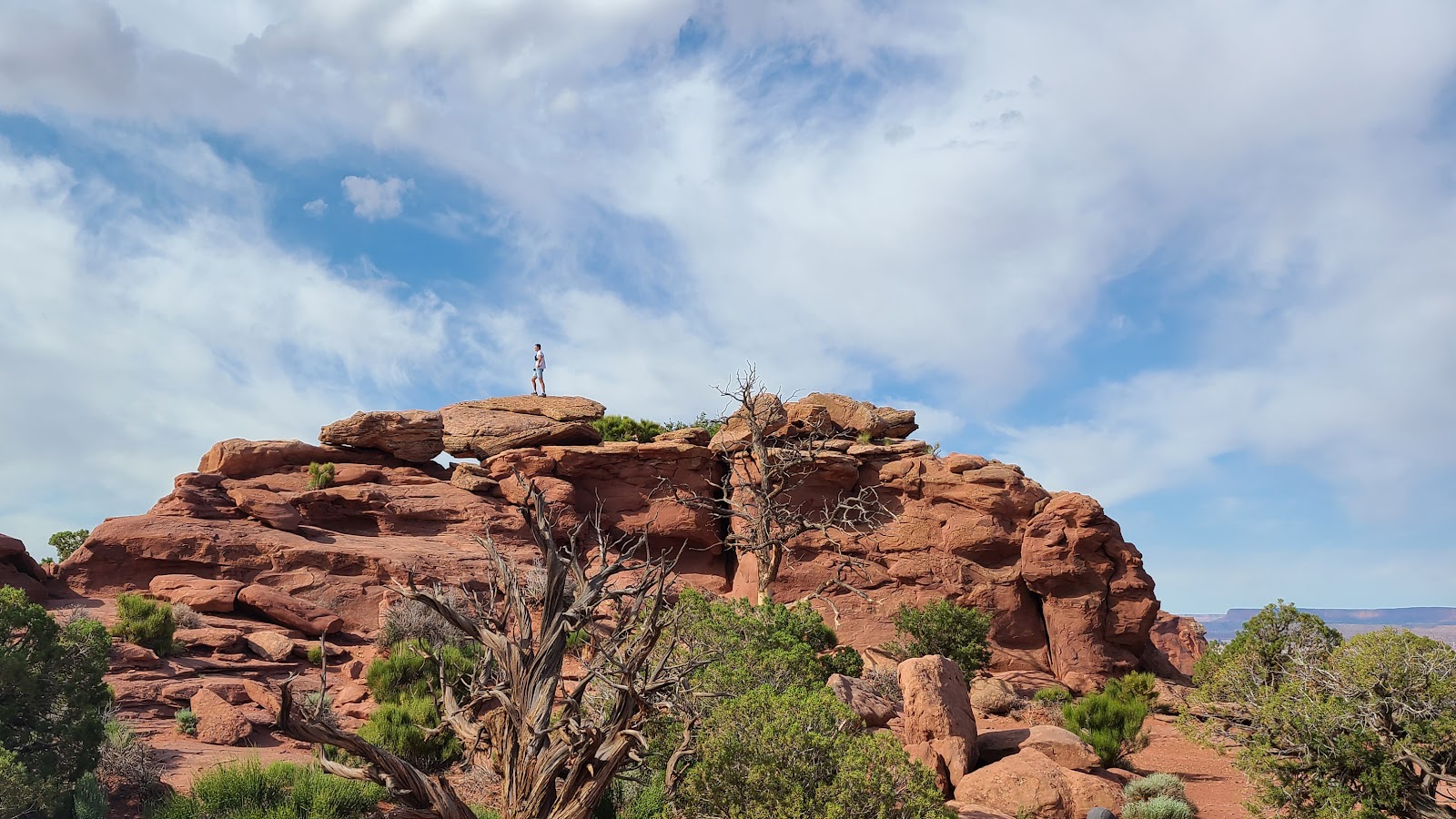 I doubt that guy is still on the "official" trail route up there.
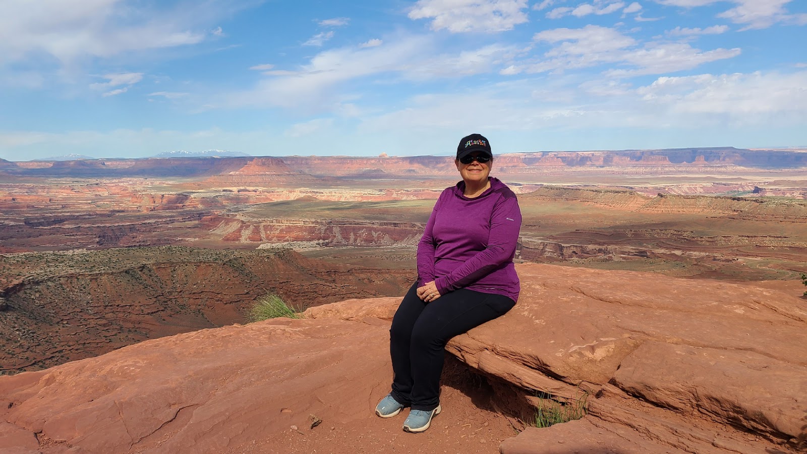 That Alaska hat Tricia's wearing was a real conversation starter,
with "every single" person who passed us on the trail.
 One last look from the end of the trail.
 How did we miss all those on the way out here?
After the hike we sat in on a well presented 30-minute Ranger Program that taught us all about the history and geology surrounding us here at Canyonlands National Park.
The talk was conveniently held right at the trailhead near the parking lot. Afterwards we went back to THE POD and ate lunch.
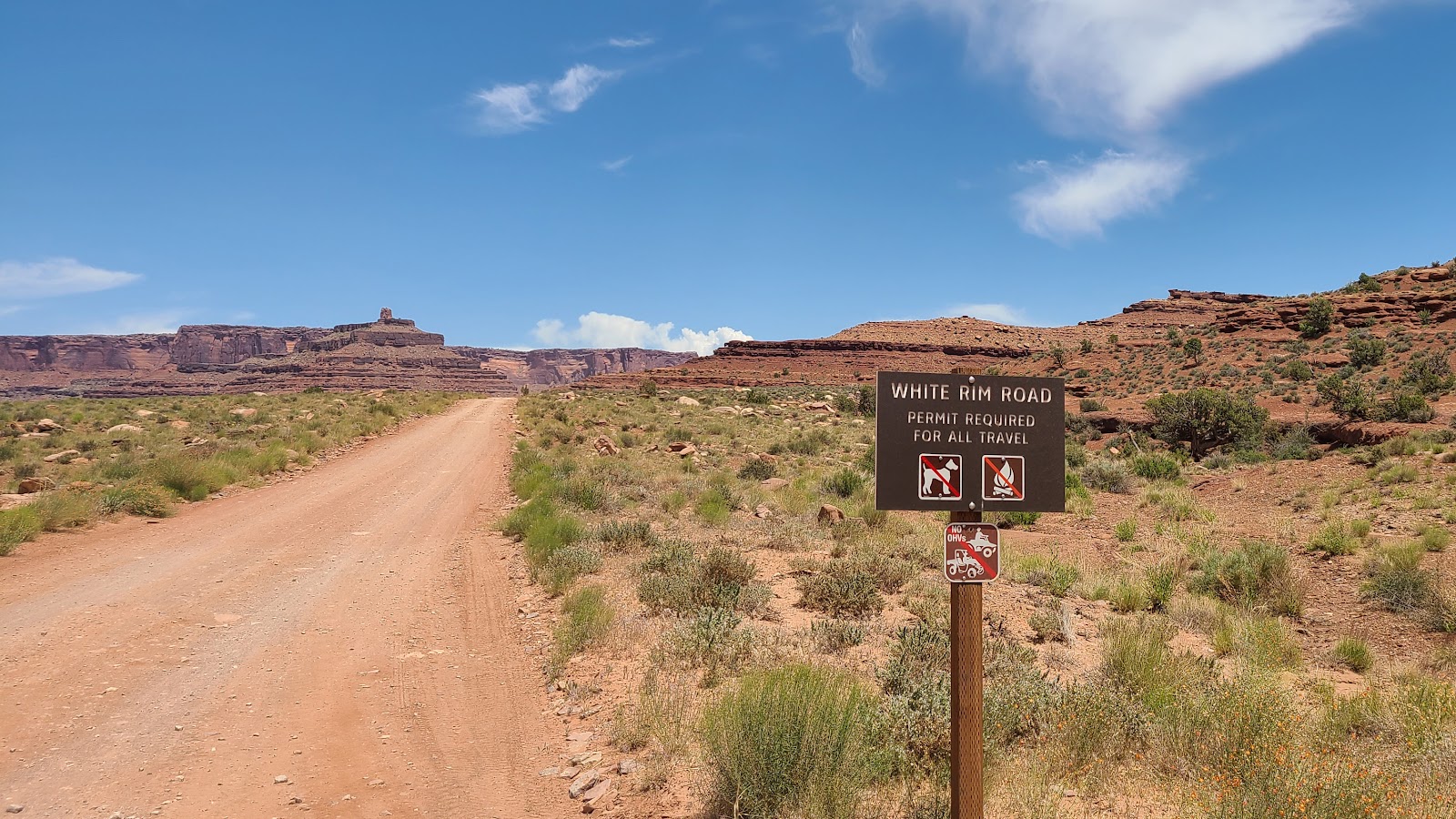
We threw around of couple of ideas on how to pass away the afternoon and I suggested we finally go and drive some of the White Rim Road we keep seeing at the bottom of all our canyon photos.
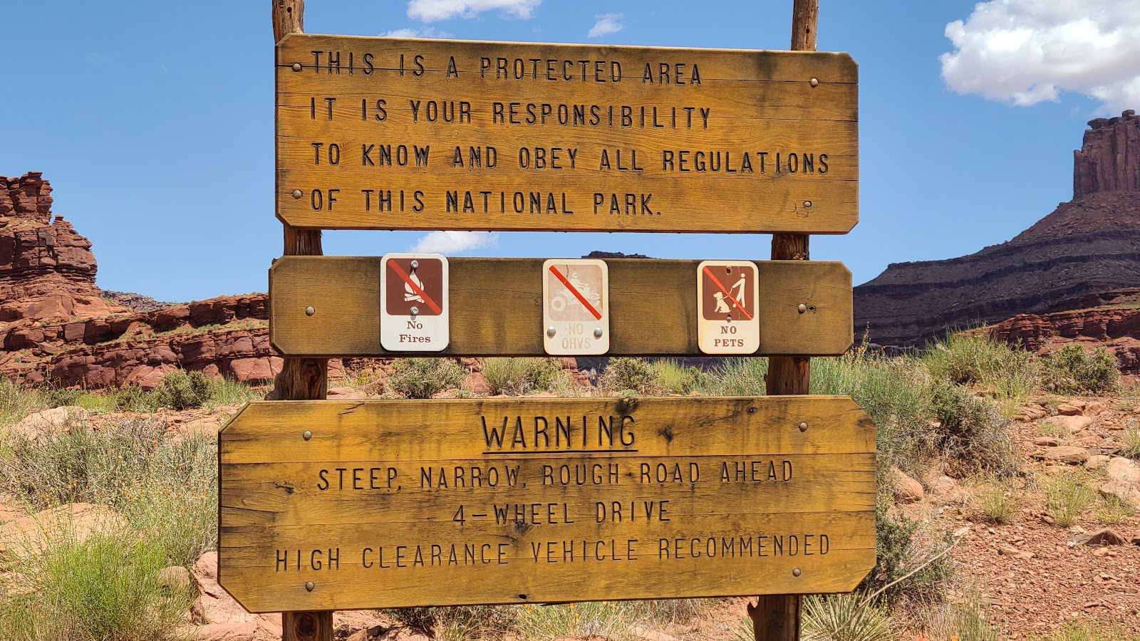
Curiously, you need to secure a permit before driving on White Rim Road, but not on the Shafer Canyon Switchbacks, which you need to do first if you want to reach the White Rim Road.
The permit was FREE and easy to obtain at the Visitor Center, even applying just before we started on the drive.
I had planned a route that would have taken us 12-miles down the road, but after just 3.5-miles we turned around and headed back.
White Rim Road is a wonderful drive, but you really should consider only attempting it with a "proper" 4x4 short-wheel-base vehicle like a Jeep Wrangler. ROVER is a long-wheel-base FORD F-150 and has a much wider turning radius than the Jeep Wrangler. Not to mention the fact that ROVER is always loaded down with all kinds of gear that wouldn't be necessary to bring along on a drive like this. I was sure there were several locations where we were going to "bottom out", but thankfully we didn't.
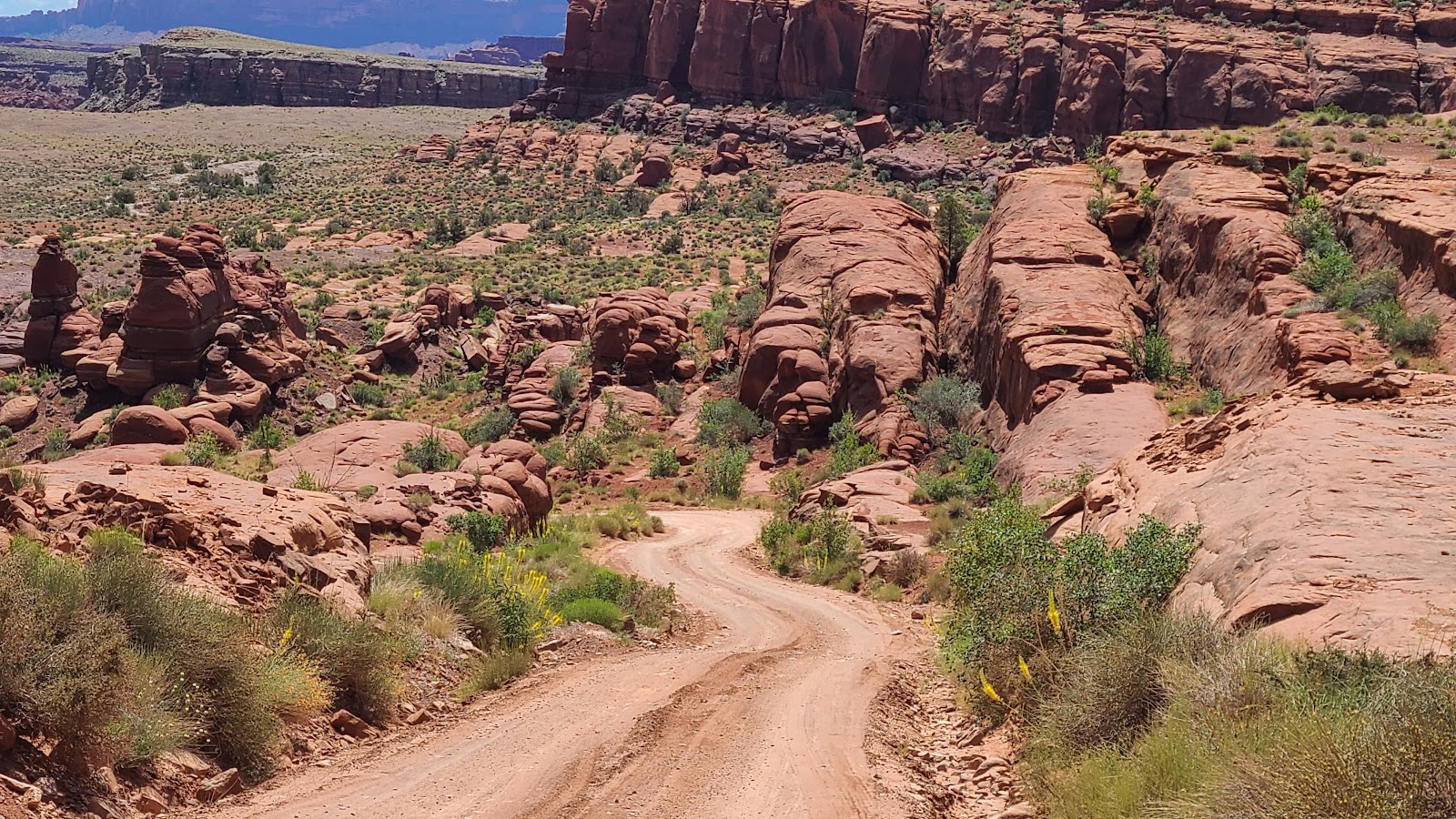
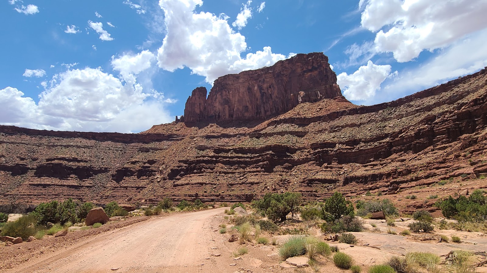
TRAVERSING WHITE RIM ROAD
 Glad we didn't make it all the way down those switchbacks,
just to find out you need a permit to drive on White Rim Road.
 For once we're somewhere at the perfect time, everything here is in bloom.
 Does that rock formation look like it's leaning towards us?
 More plants showcasing their beautiful blooms.
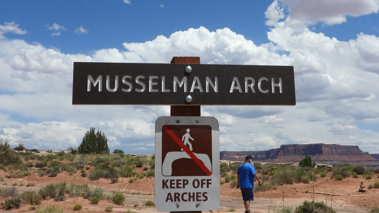 We made it to our destination. What do they mean, stay off the arches?
 It's hard to see is this photo, but Musselman Arch is right in front of you.
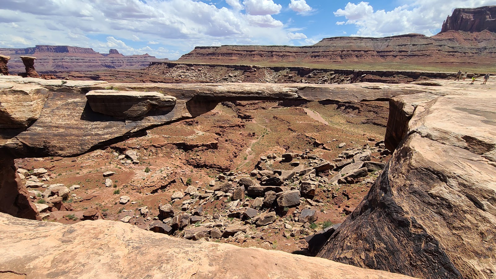
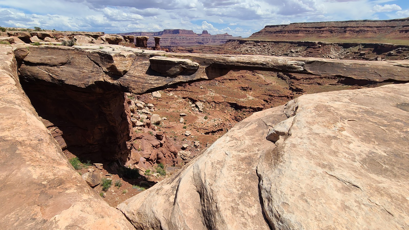 Maybe this angle will help in come into view.
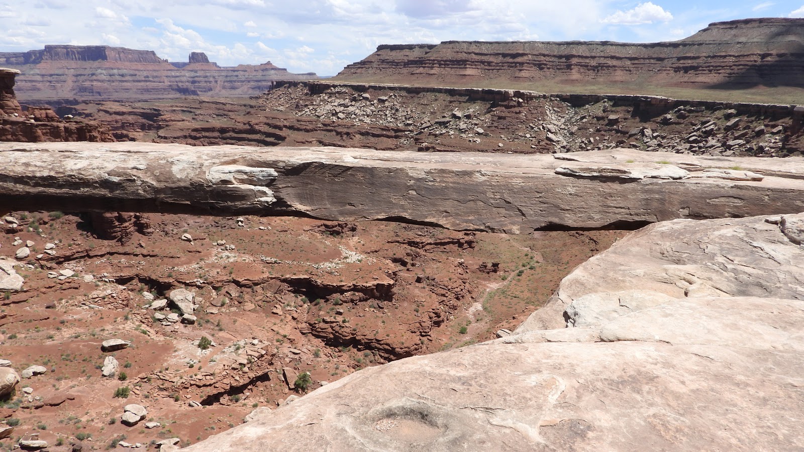 For most of it's length it's only about four feet thick.
 A view looking across the top of the arch. Now I see how you could accidentally walk across it.
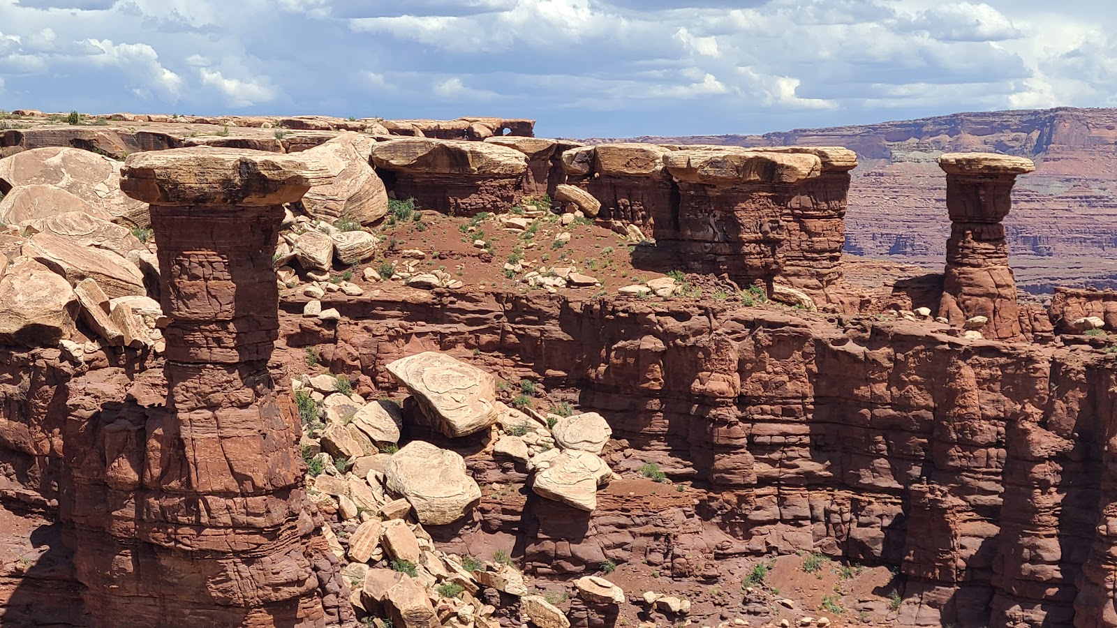 Here are a bunch of hoodoos wearing white hats.
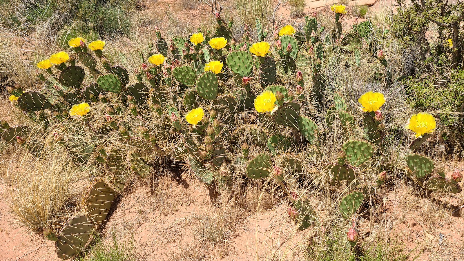 More blooming cactus.
 Time to start heading back.
 You can see just a slice of the Colorado River down below.
 We got another "bonus" peek at the river.
 Now we'll need to climb back up to the top of that plateau where THE POD is waiting.
 About half way up at this point.
 Look! There's people following us!
 We made it to the top once again.
This brings us to the conclusion of our visit to the Island in the Sky District visit of Canyonlands National Park.
Tomorrow we need to be off this campsite by the 10:00AM check-out time. To MISquote the same Jerry Reed lyric that I started this blogpost with, this time "We've got a short way to go, and a long time to get there".
Would you like to be notified of new blog posts?