Today was an extremely short travel day at just under 26-miles, but we also lost just over 2000' feet in elevation, which should make our overnight temperatures a whole lot more comfortable without burning through so much propane.
We stayed on our campsite at Bryce Canyon right up until check-out time at 11:30AM. Check-in time here at Kodachrome Basin State Park is officially 3:00PM, but check-out time is noon. We were hoping they weren't real strict about those times.
We arrived just after noon and had no issues getting onto our site early.
Quite an impressive Welcome Sign.
It's easy to see why it's called Kodachrome, after the vividly colorful Kodak film from 1936-2010.
We've got a pretty sensational view out the front of our campsite.
While sitting in THE POD our dinette view out the back is even better IMHO.
If this is the worst view we have, we'll live with it for three days.
By 1:00PM we were all set up on our new campsite, finished eating lunch and were itching to get out and see the rest of the park. But first we have a few chores to take care of, that must be sounding familiar by now!
It's 9½-miles back to Utah's Highway-12 and then 14-miles west back to the town of Tropic, where we were able to purchase propane, gasoline and a loaf of bread that we forgot to pick up last time we went shopping.
All of the following photos were taken while heading back into town and then exploring inside the park once we returned.
KODACHROME BASIN STATE PARK
AND
THE SURROUNDING AREA
 This can be seen on the 9½-miles of road leading back to the highway.
 There is conveniently a pullout so we could stop and take photos.
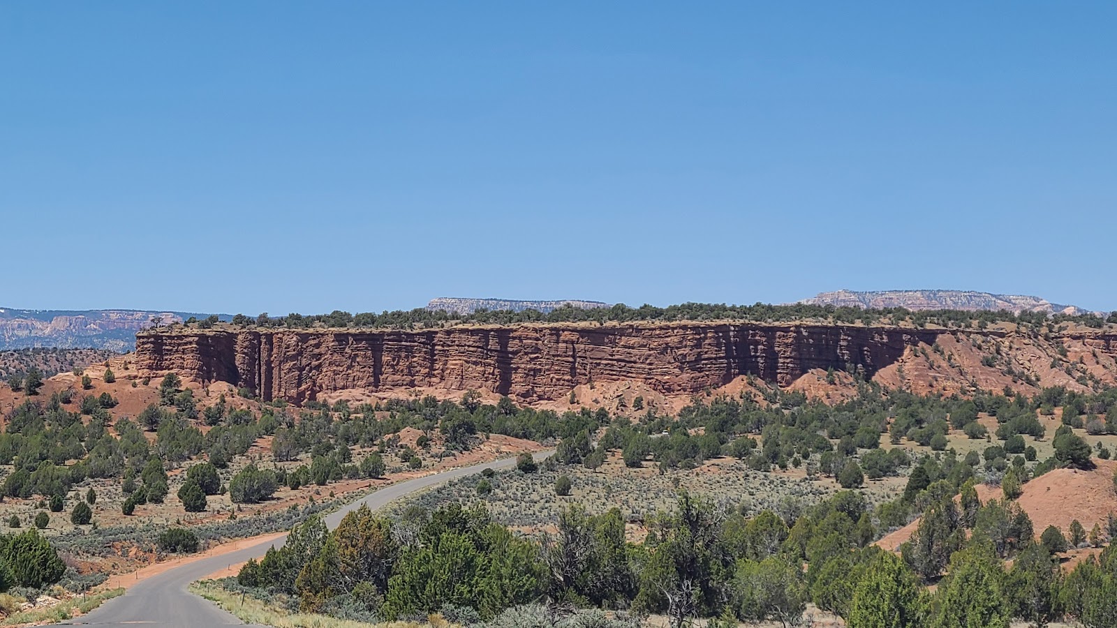
 Just stunning isn't it?
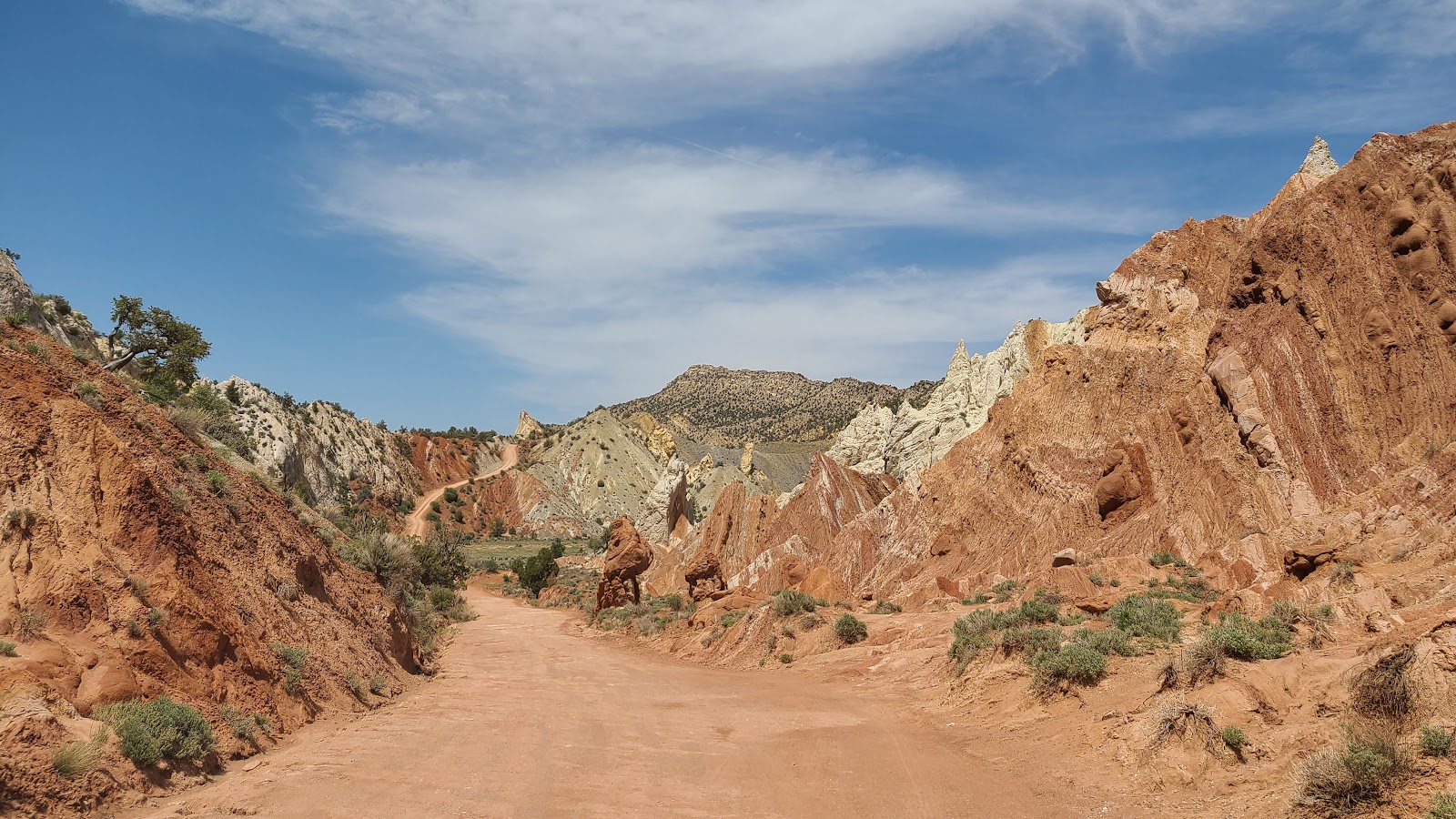
 We are back from town now and checking out what's down this dirt road.
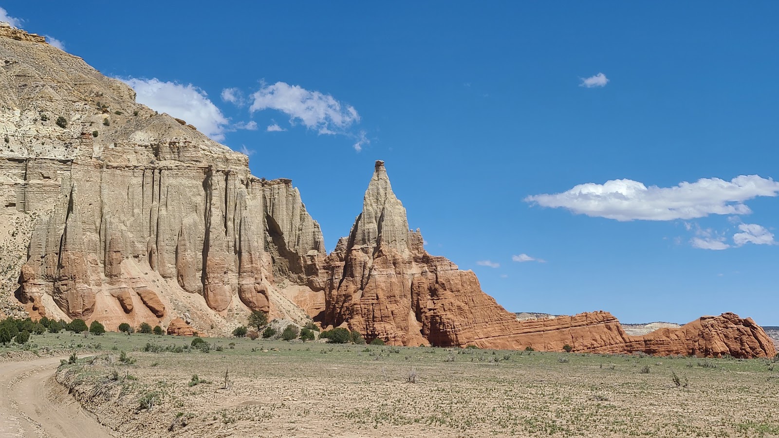 These pointed rock formations are called "spires".
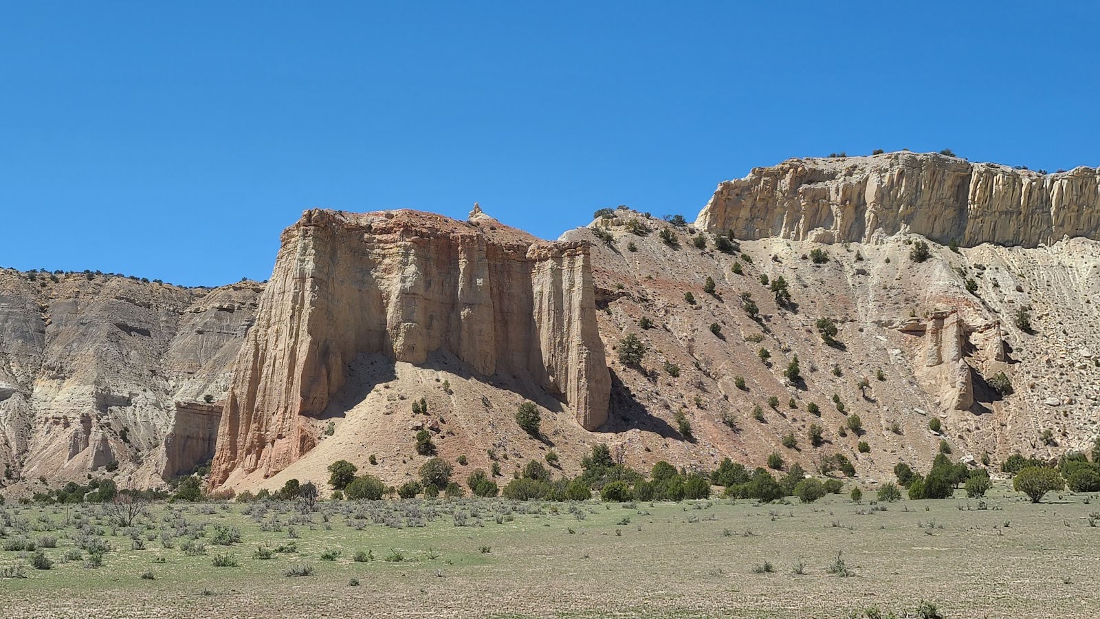 These smooth rock walls are spires in the making.
 This impressive rock formation is called "Chimney Rock".
 There is a storyboard at the base with a 1949 photo that looks identical to what we see today.
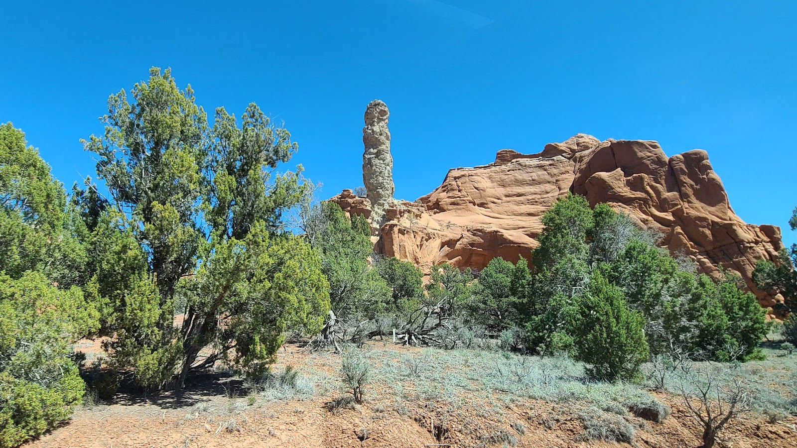
 Here is another prominent spire found in the park.
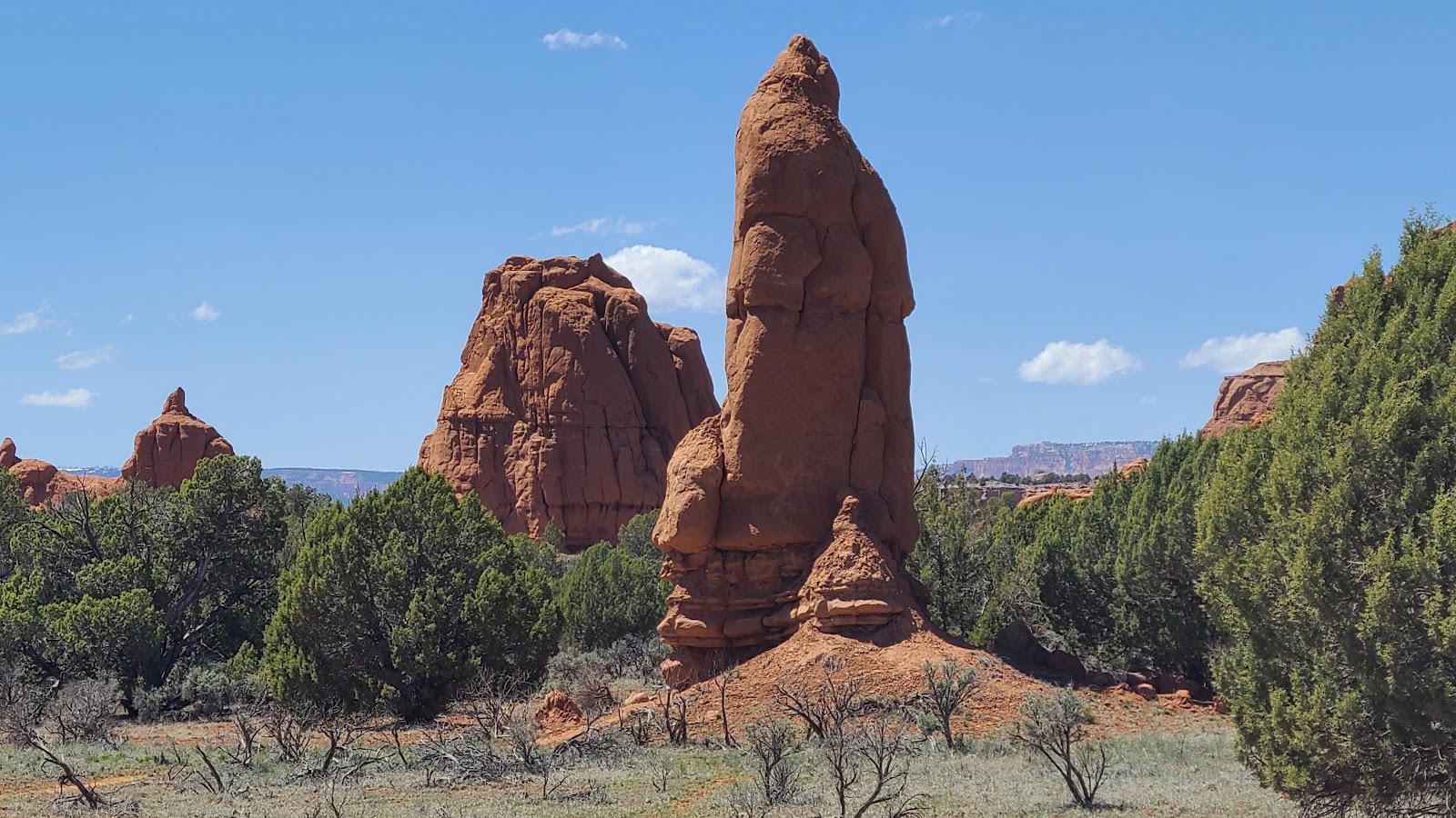 They seem to be everywhere.
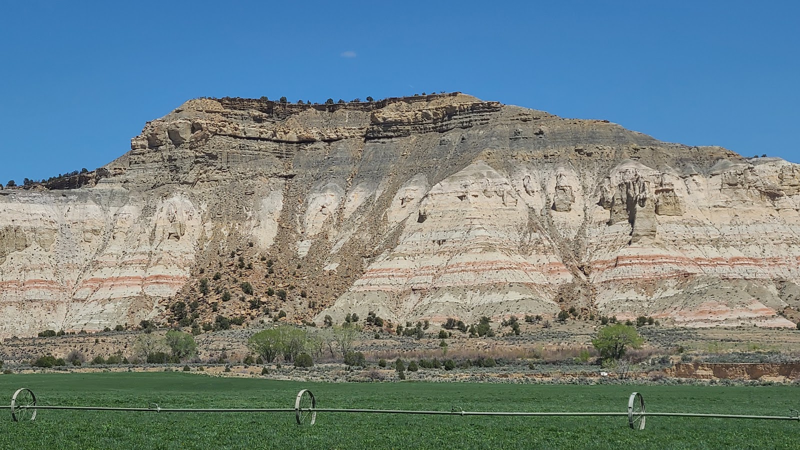
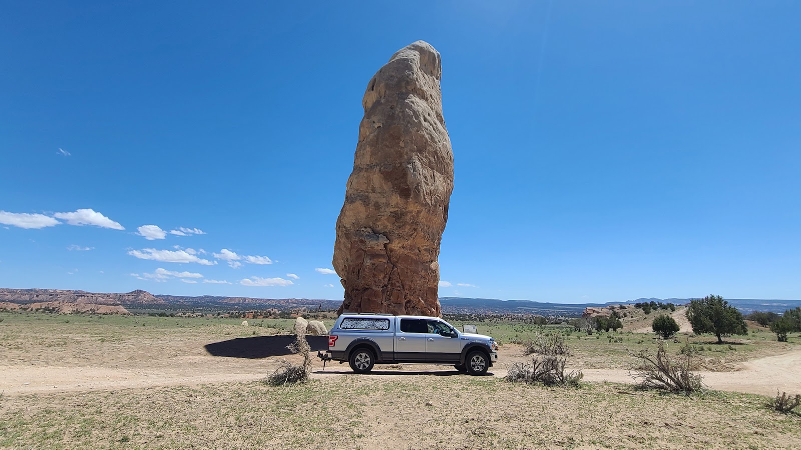
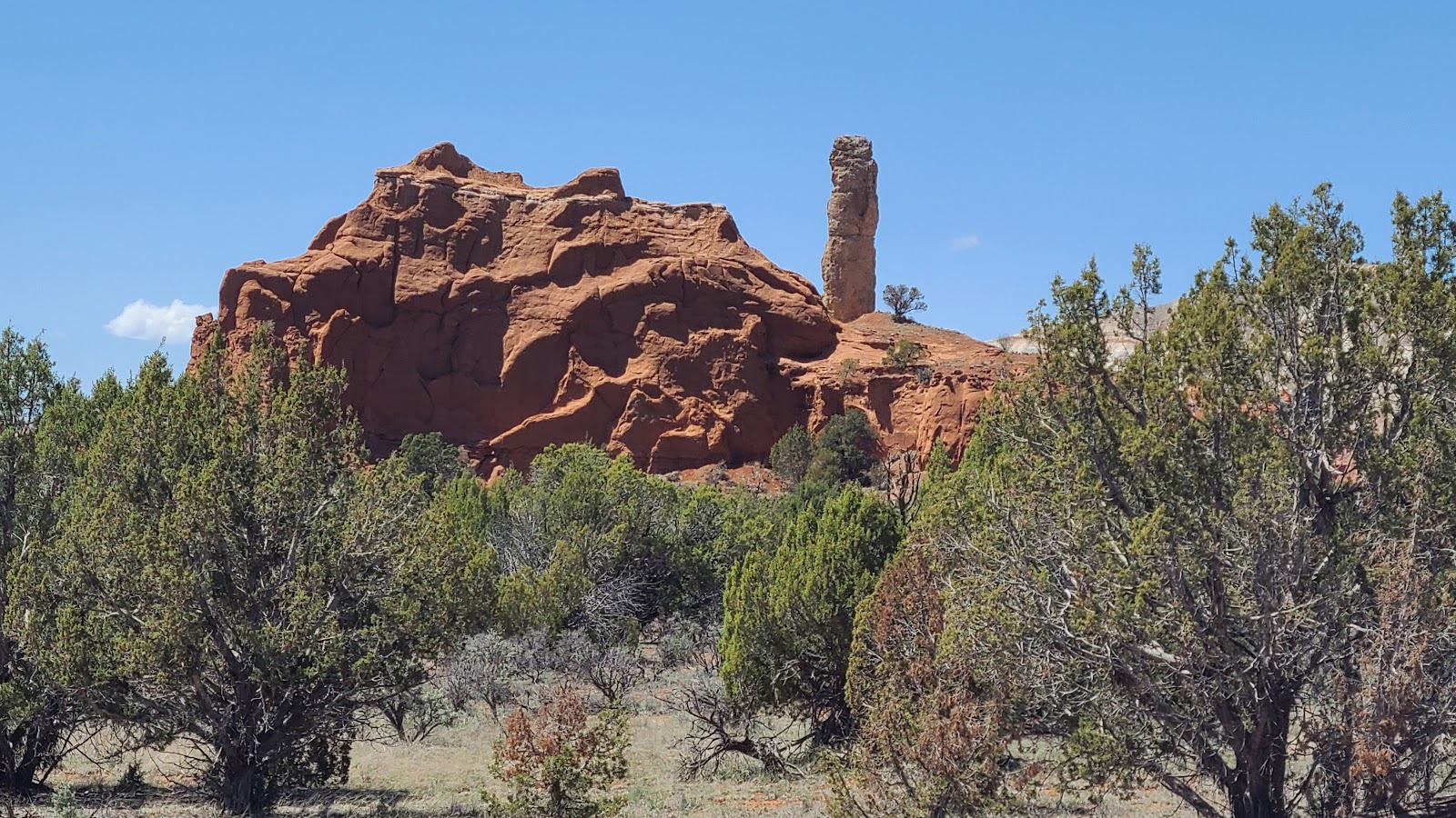
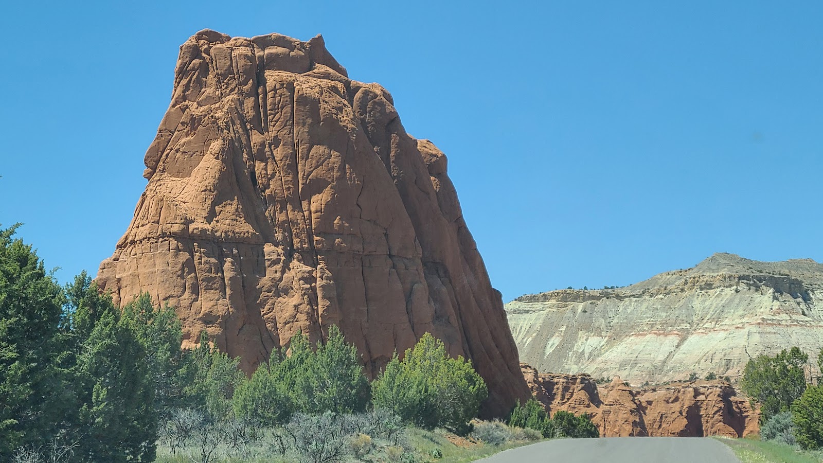 This monster sized rock formation is just outside of the campground.
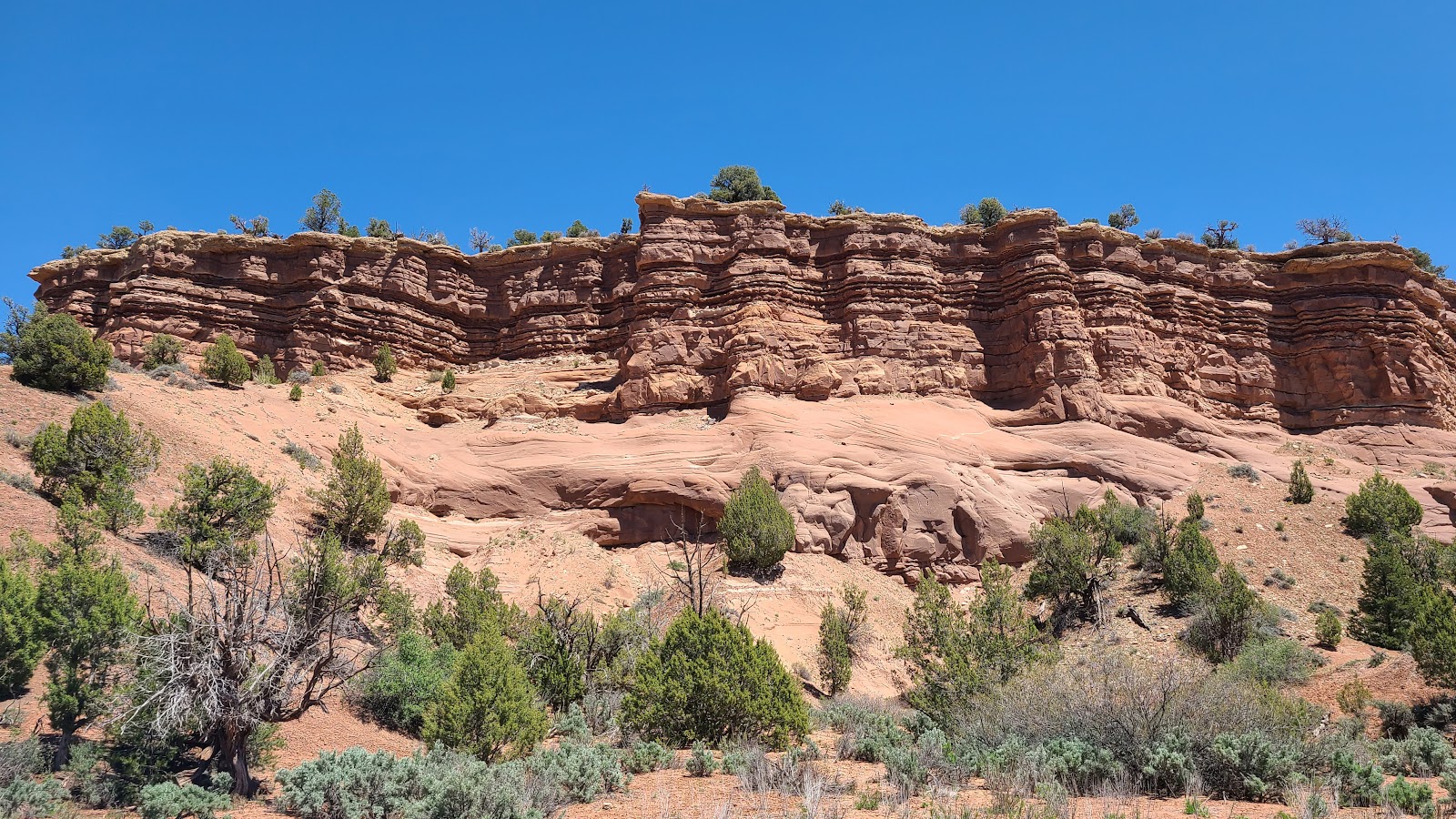
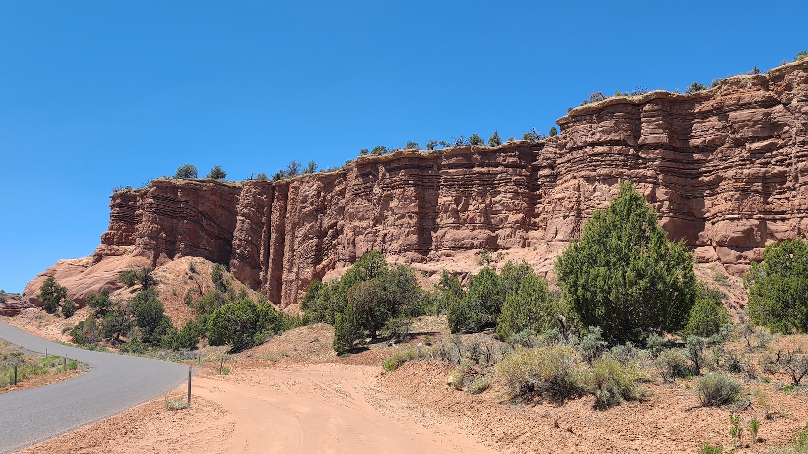
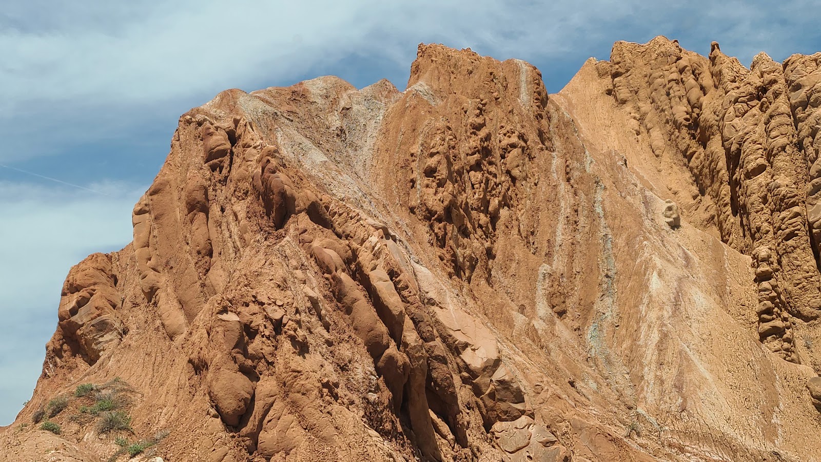
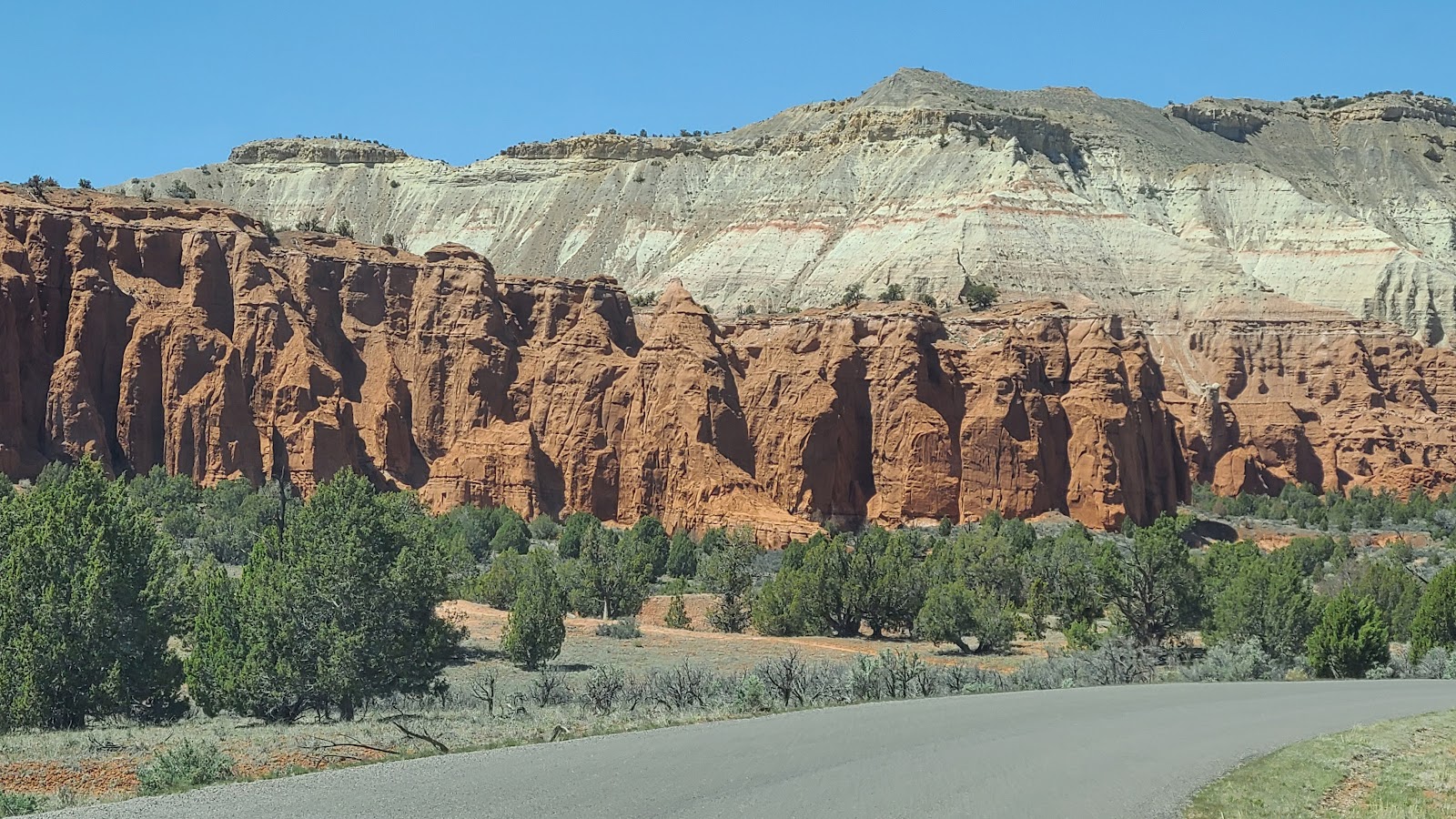 This is part of the basin walls that surround the campground.
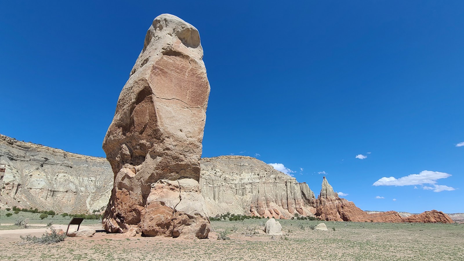
 This spire appears to be a little more delicate than the rest we've seen.
 Any ideas what they could possibly name this rock hard formation?
TUESDAY - Today we are going to be exploring the northernmost 13-miles of the 40-mile long
Scenic Backway Cottonwood Road.
The road signs all along the route are numbered as Road #400, but that's just a number assigned by the Grand Staircase-Escalante National Monument that the road travels through.
If you're searching for it on Google Maps it's listed as Route 7000 or K7000?
We have two sightseeing destinations scheduled today in addition to all the beautiful scenery we'll be driving through.
The first is Grosvenor Arch, whose turnoff is located 9.5 miles from the beginning of the road. You'll have to take a spur road for an additional mile before reaching the parking lot, where you''ll find vault toilets and a concrete pathway that leads right up to the base of the arch.
The second destination is the Cottonwood Narrows North Trailhead, where there is a short slot canyon hike we'd like to do.
Enough talk, here are the photos you're probably here to see!
GRAND STAIRCASE-ESCALANTE NATIONAL MONUMENT
Scenic Backway Cottonwood Road
Grosvenor Arch - Cottonwood Narrows Hike
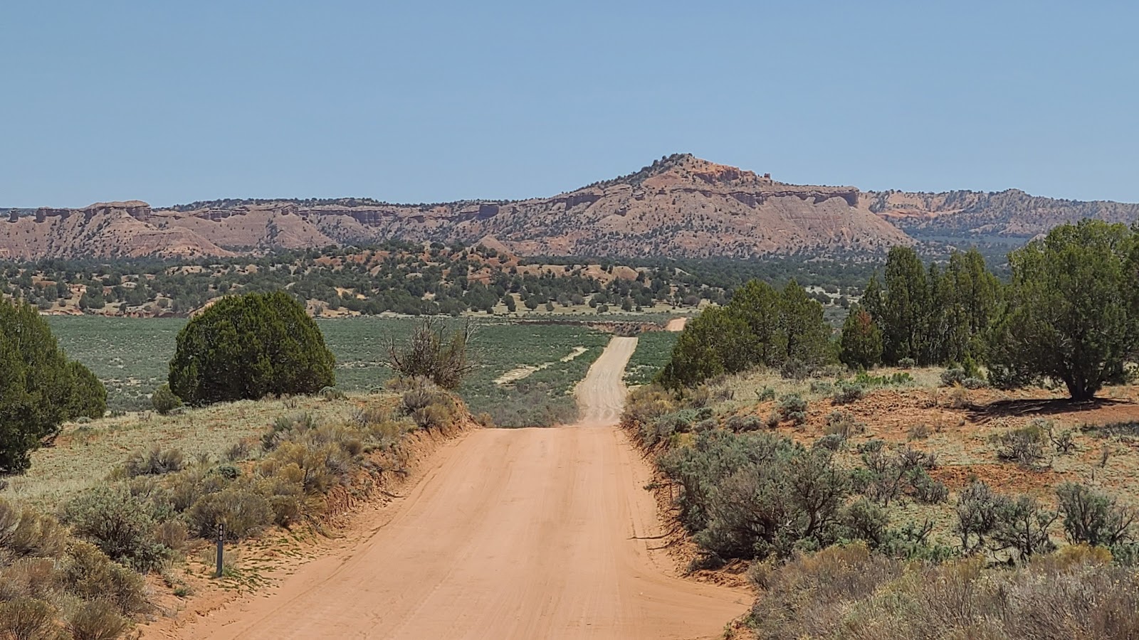 Our journey into the National Monument begins just outside the front gate of the State Park.
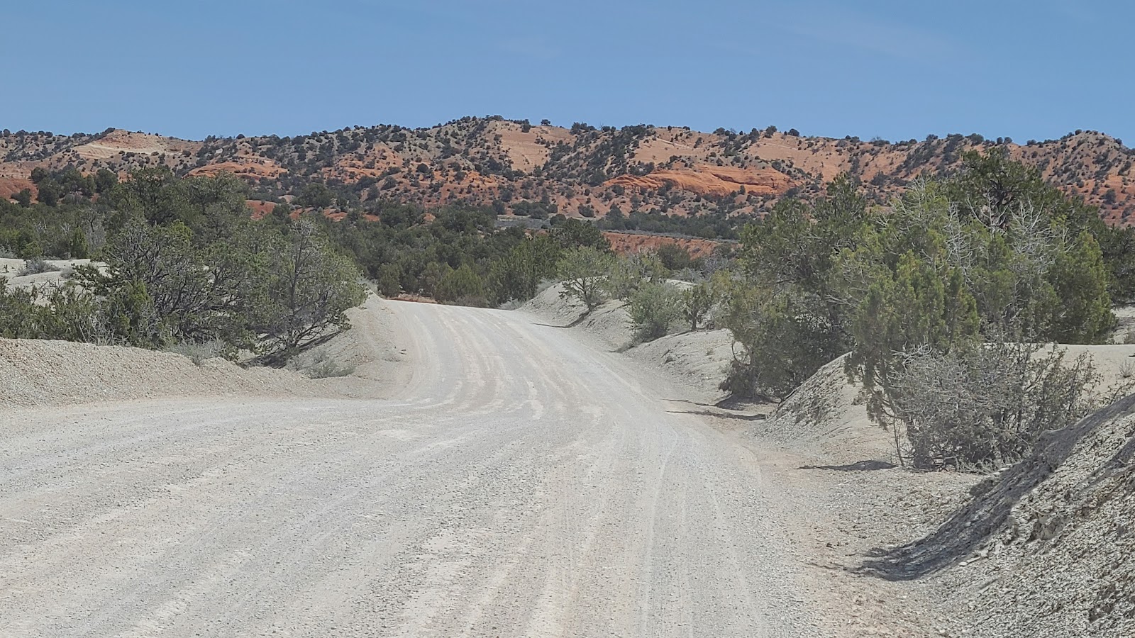 Even the roadway changes color during our route today.
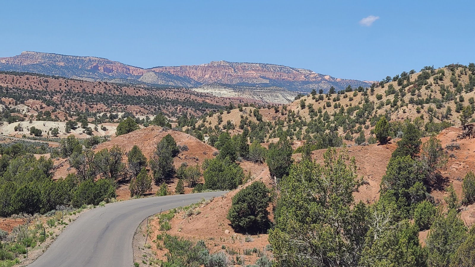
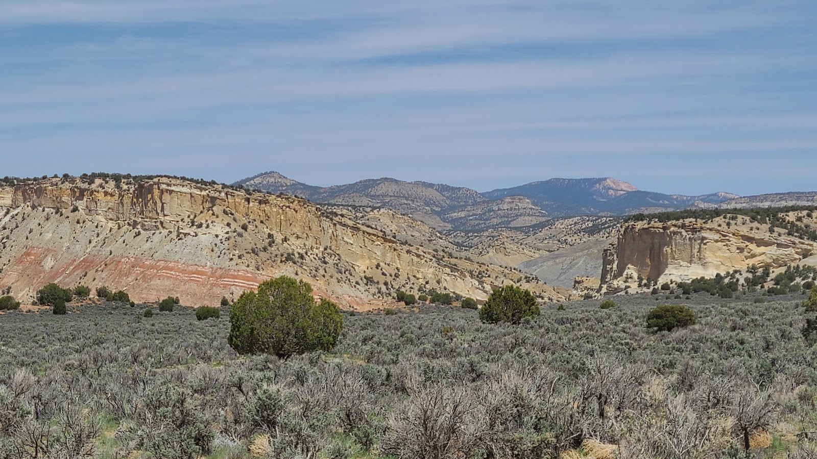 We love these "long views" of the different mountain layers.
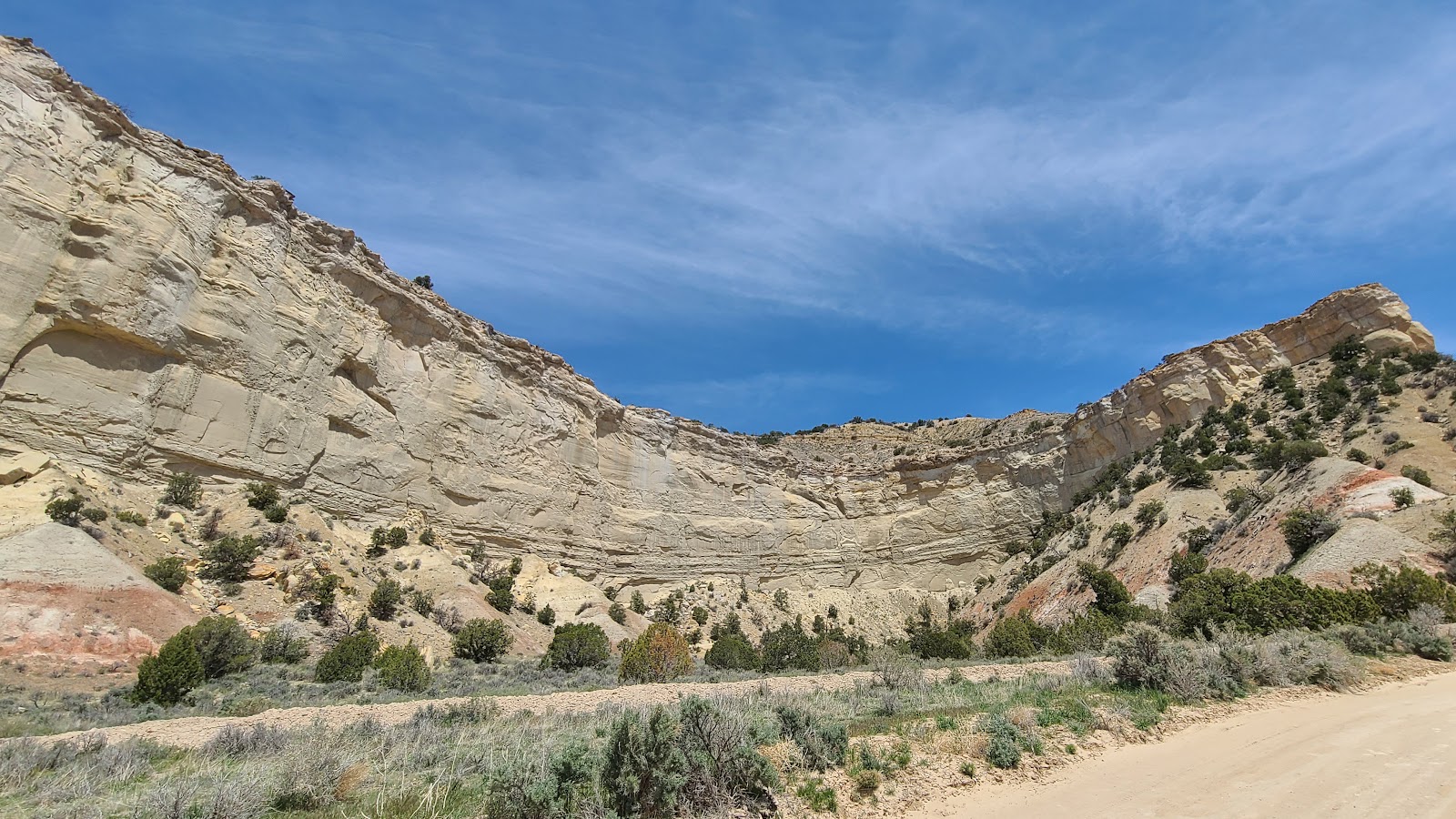 Here's a circular basin carved out of the mountain side.
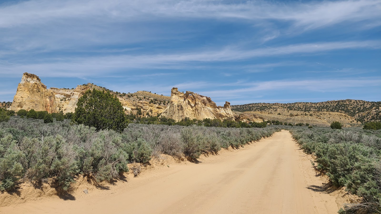 Can you spot the Grosvenor Arch in this photo? HINT: It's still a half mile away!
 The view from the parking lot should make it a little bit easier.
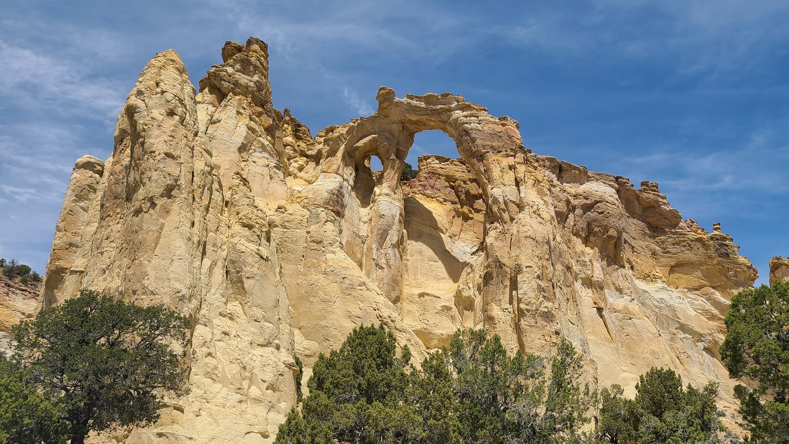 This is the view from the end of the concrete walkway.
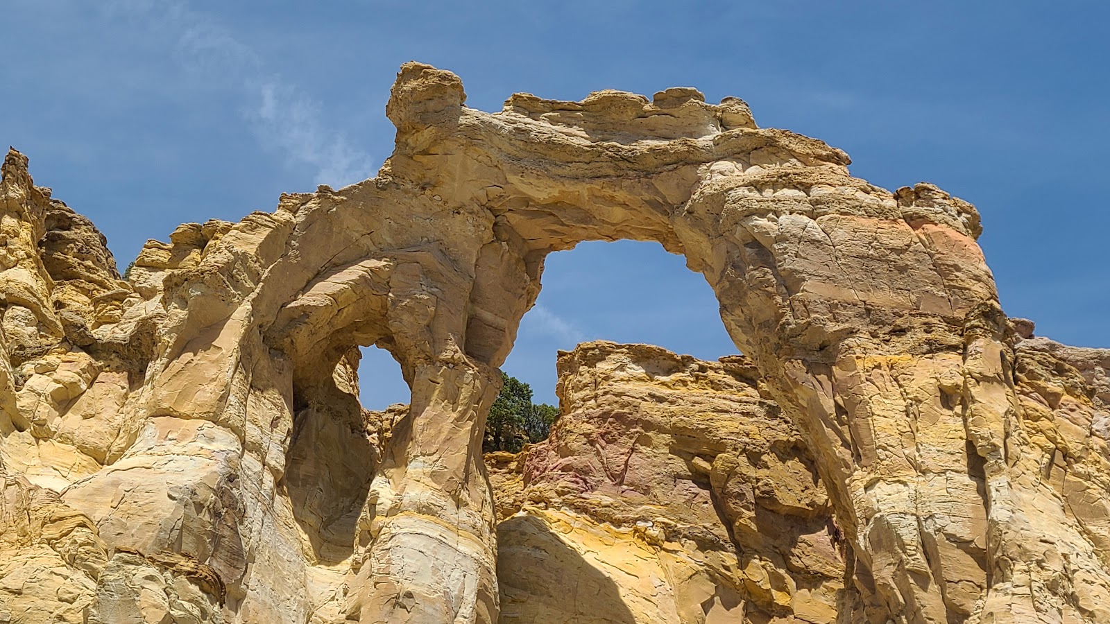 From up close you can see just how large the two arches really are.
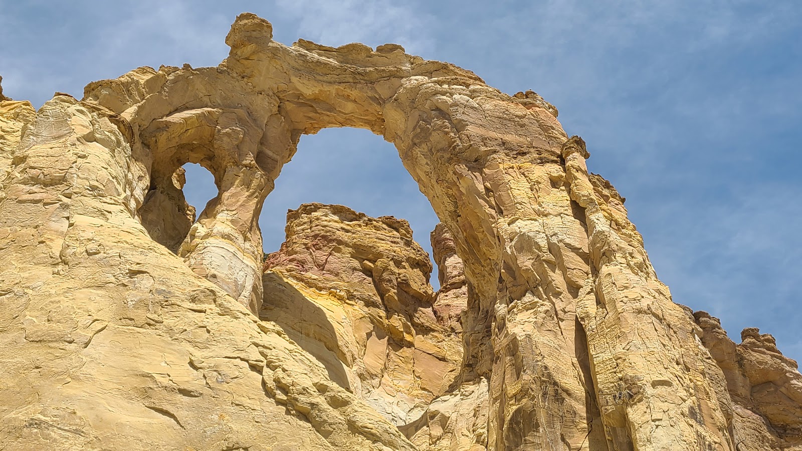 The larger arch is 150' off the ground and nearly 100' in diameter.
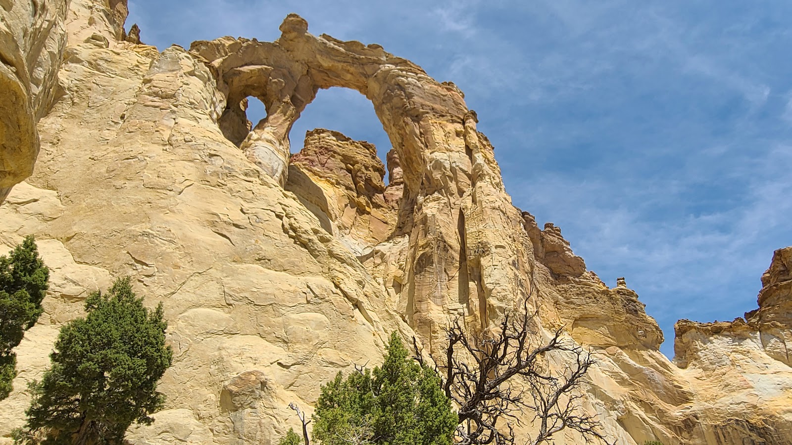 I hope you like arches as much as we do!
You're going to be seeing a lot more of them in the coming weeks.
 This is certainly different than the other formations we've seen in the past.
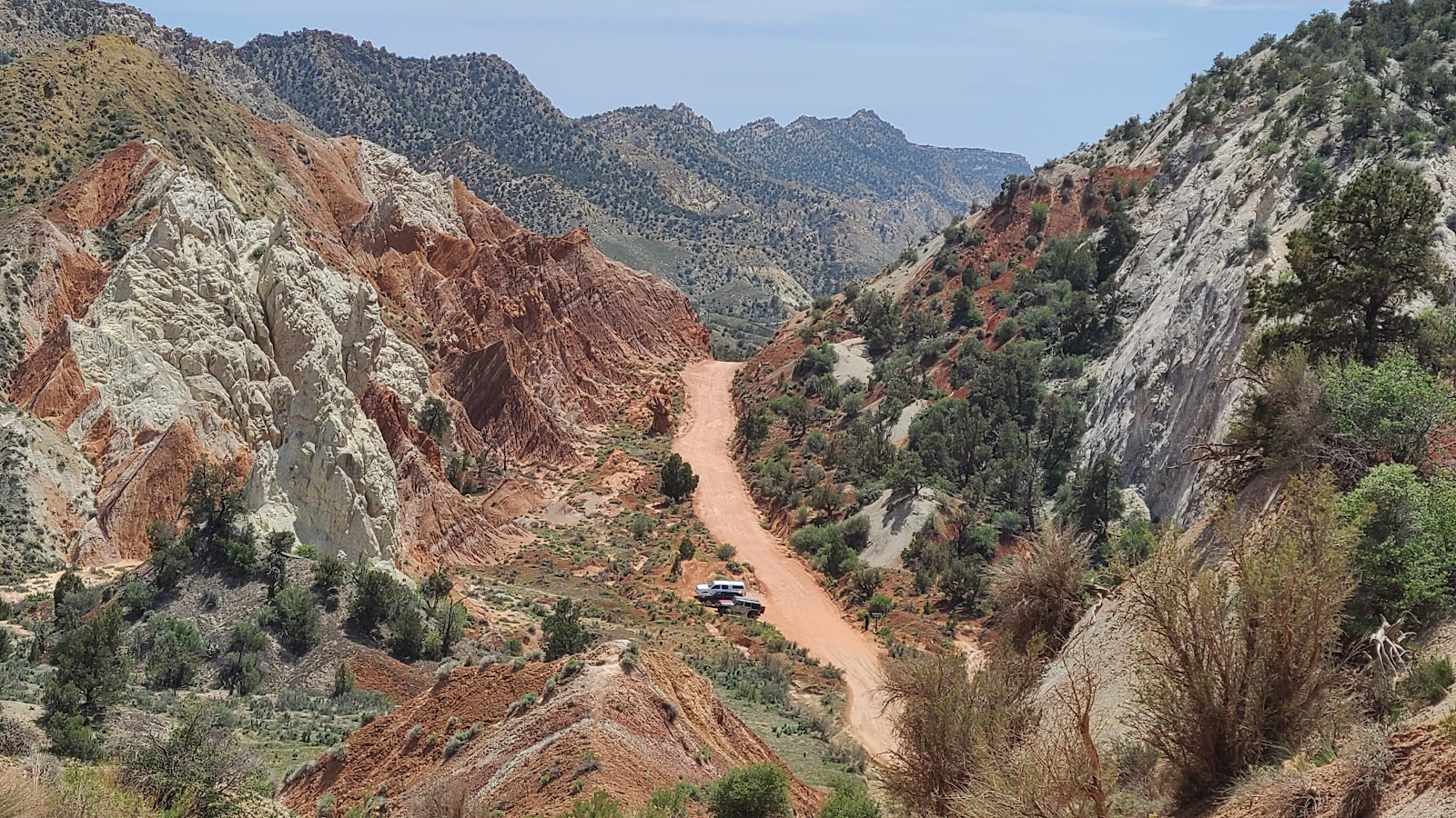 That's the parking lot for our second destination down there.
 The parking lot was full so we traveled another mile down the road to the south parking lot.
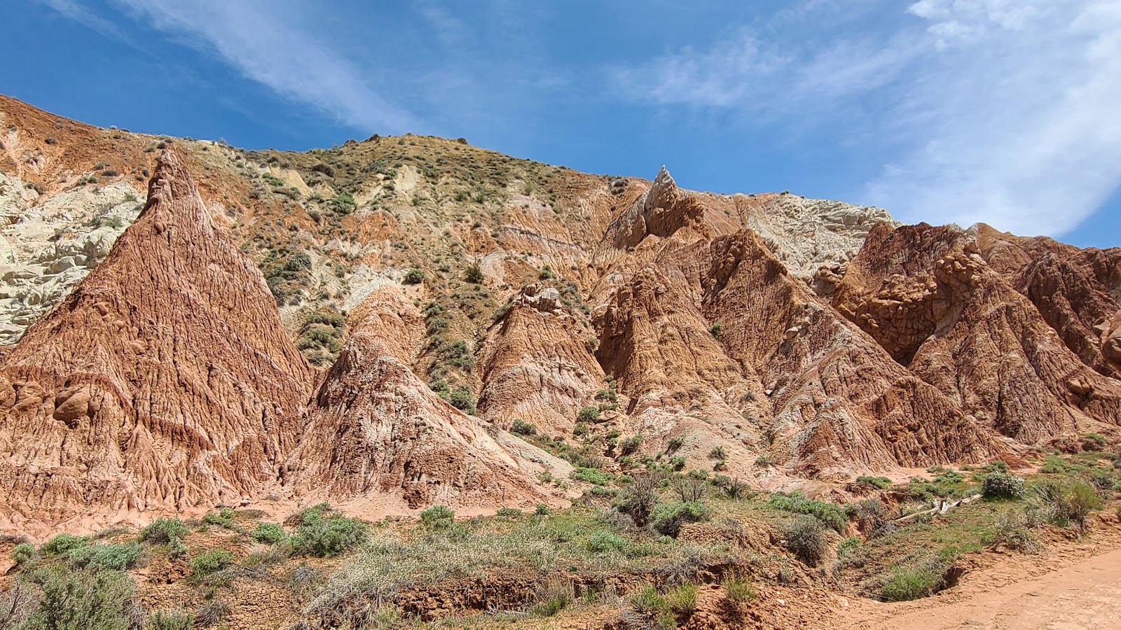 I'm glad we drove the extra mile to see these pointy formations.
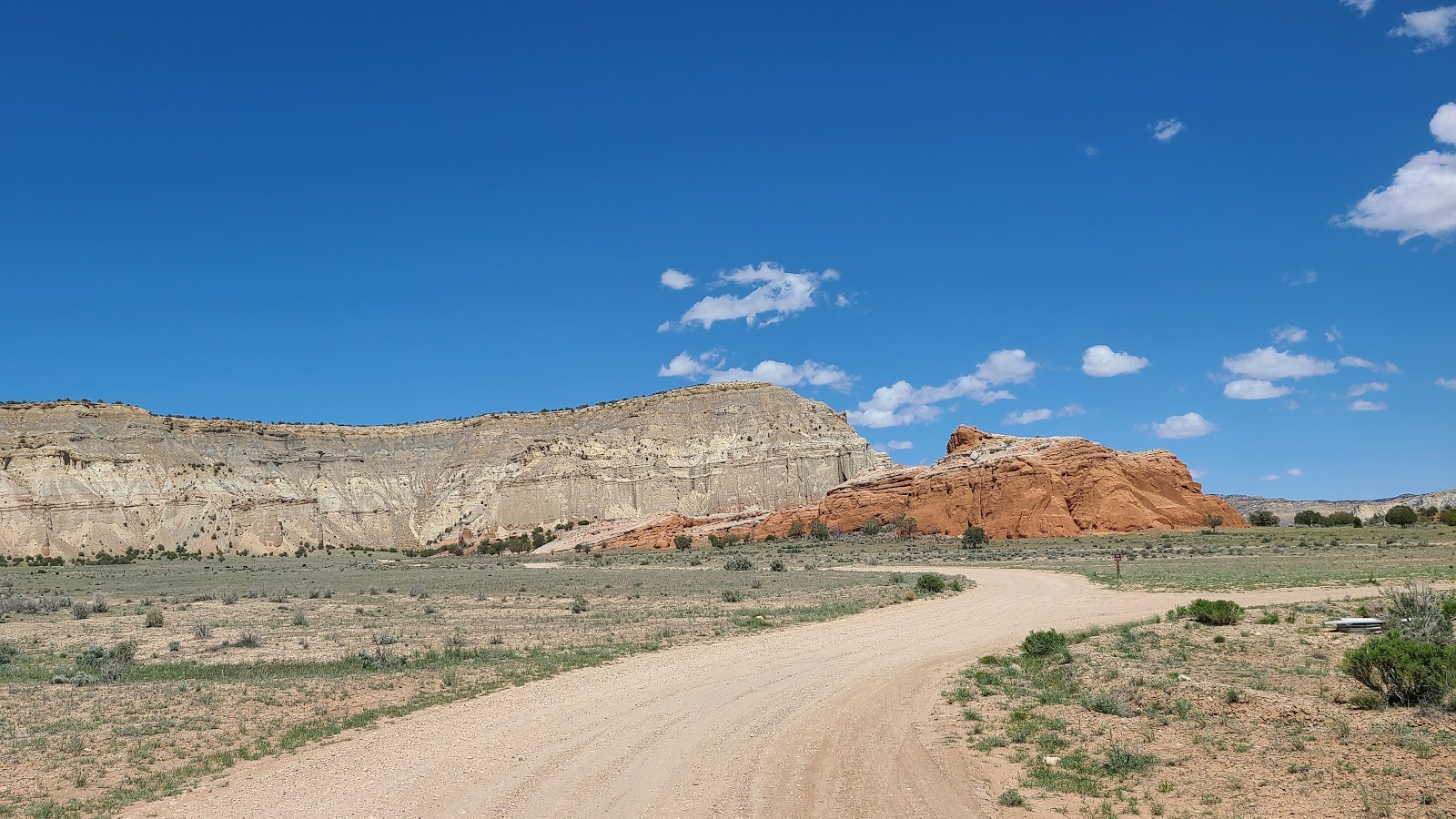
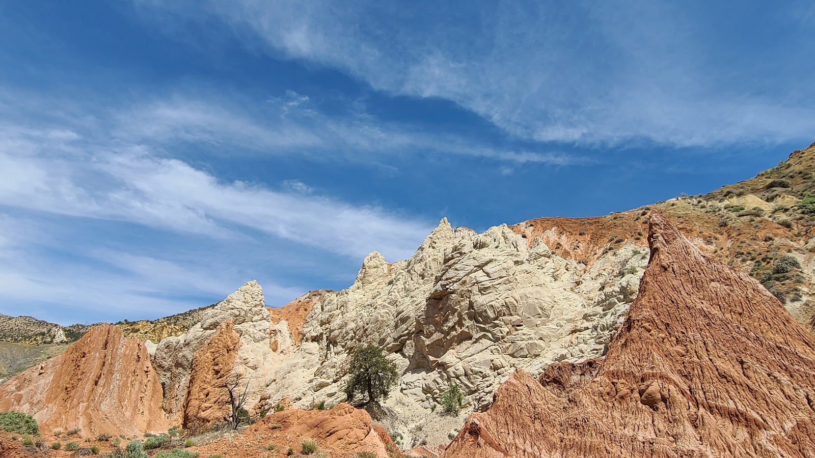 That's more "white color" than we've seen anywhere else around here.
 This ridge looks like it's been uplifted nearly straight up.
 We've turned around and are now nearing the parking lot again for the north trailhead.
 There was only one spot open now and it looks like we got here just in time.
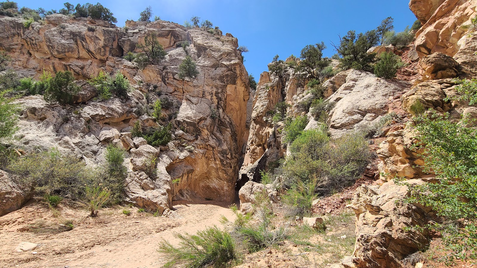
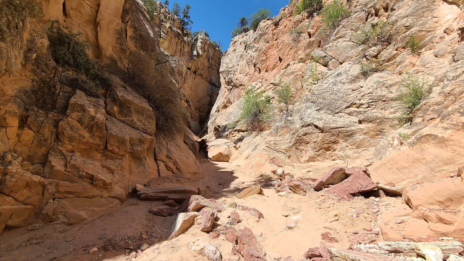
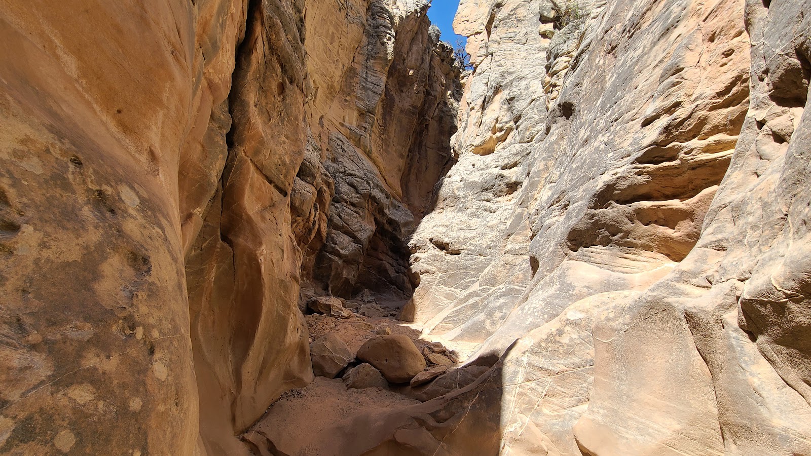
 Time to start our hike down into the Cottonwood Narrows slot canyon.
 At the bottom we had a choice to make, left or right?
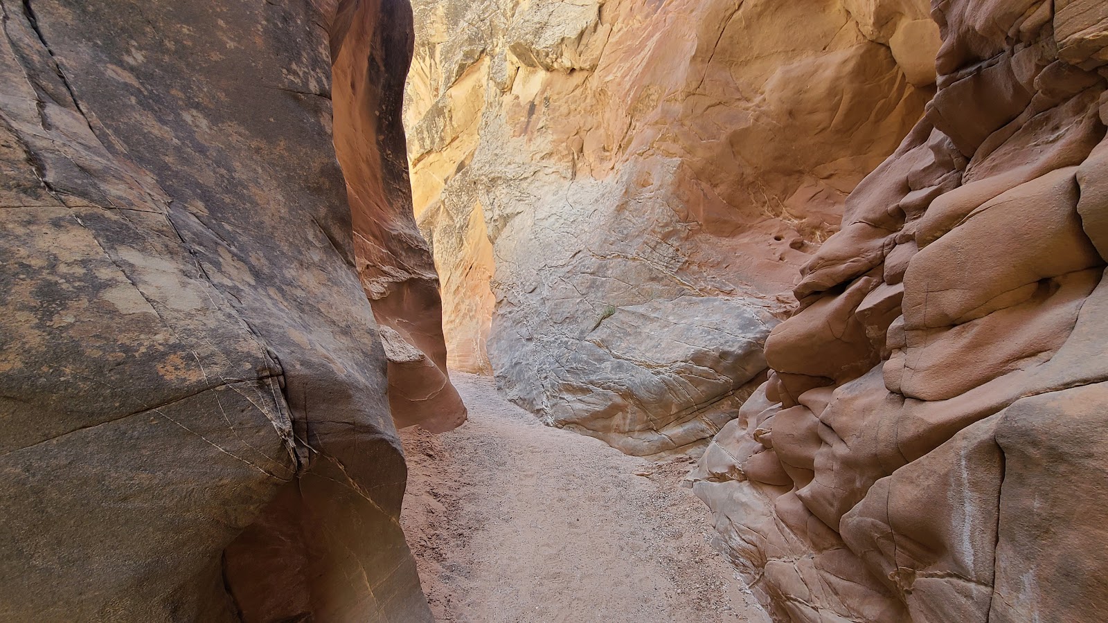
 I'm glad we chose right. The slot canyon was just around the corner.
 We weren't the only living creatures in the slot canyon.
 It amazing how the water erodes one side of the canyon differently than the other.
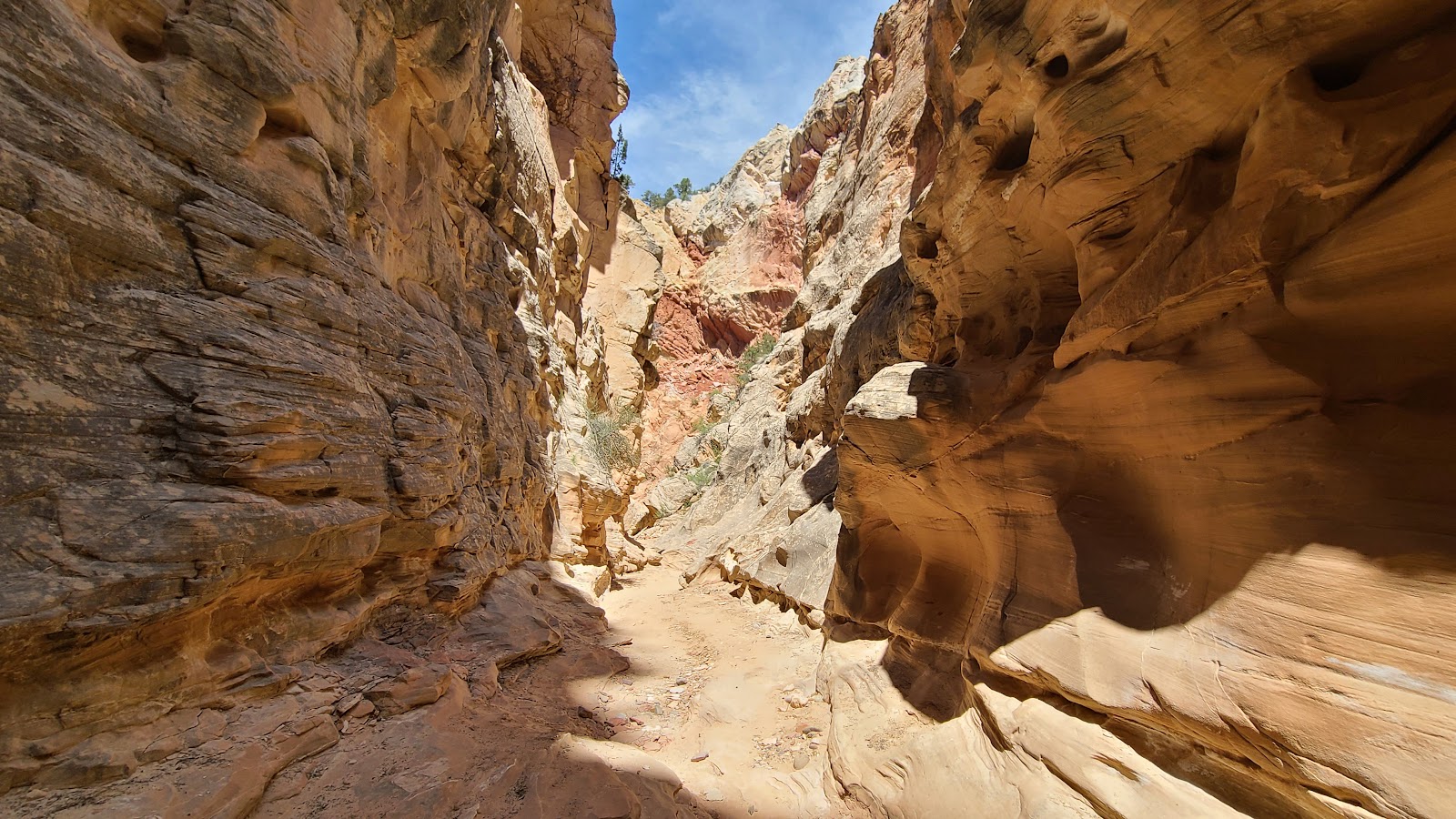
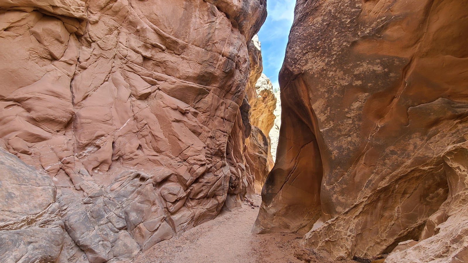
 Sometimes the canyon was wide and sunny...
 ...and other times it's narrow and shady.
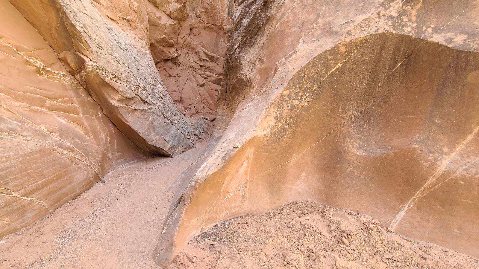 Notice how smooth the water carved out this wall of the canyon.
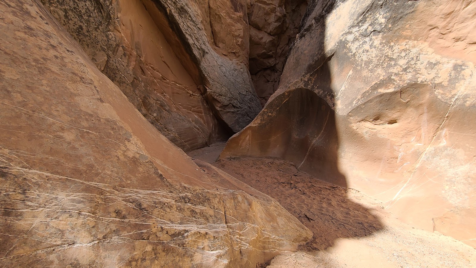
 I'm seeing another opening in the canyon up ahead.
 This looks like it could be the end of the canyon for us.
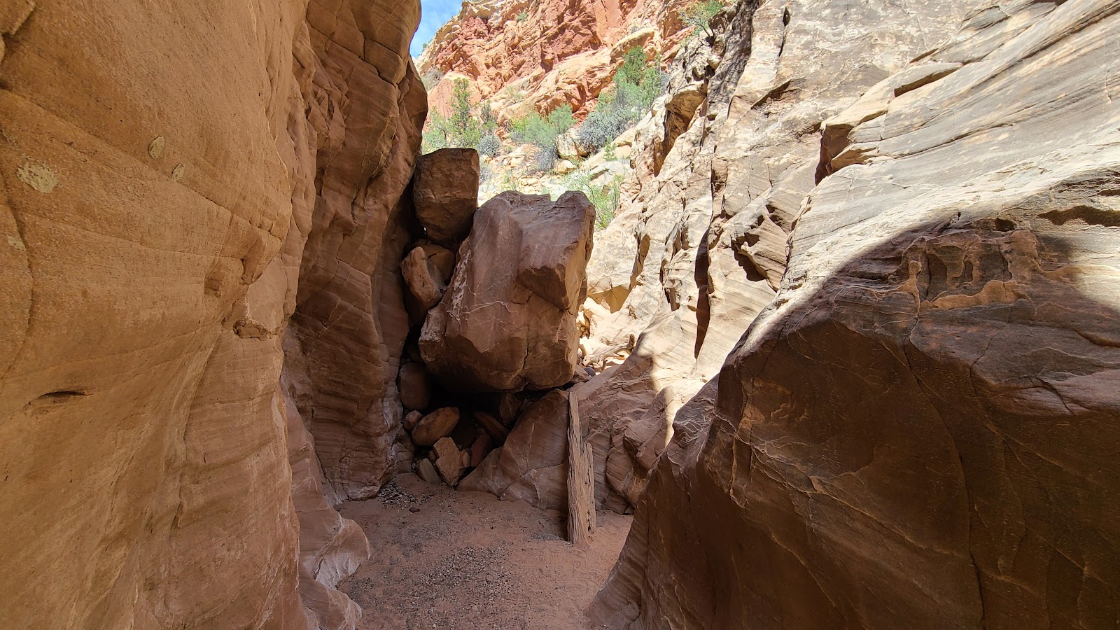 Nope! This is the end of the canyon for us, due to our meager bouldering abilities.
 Behind that 3' boulder in our way were more, larger boulders to negotiate.
 3/8's of a mile in is where we turned around and started to make our way out.
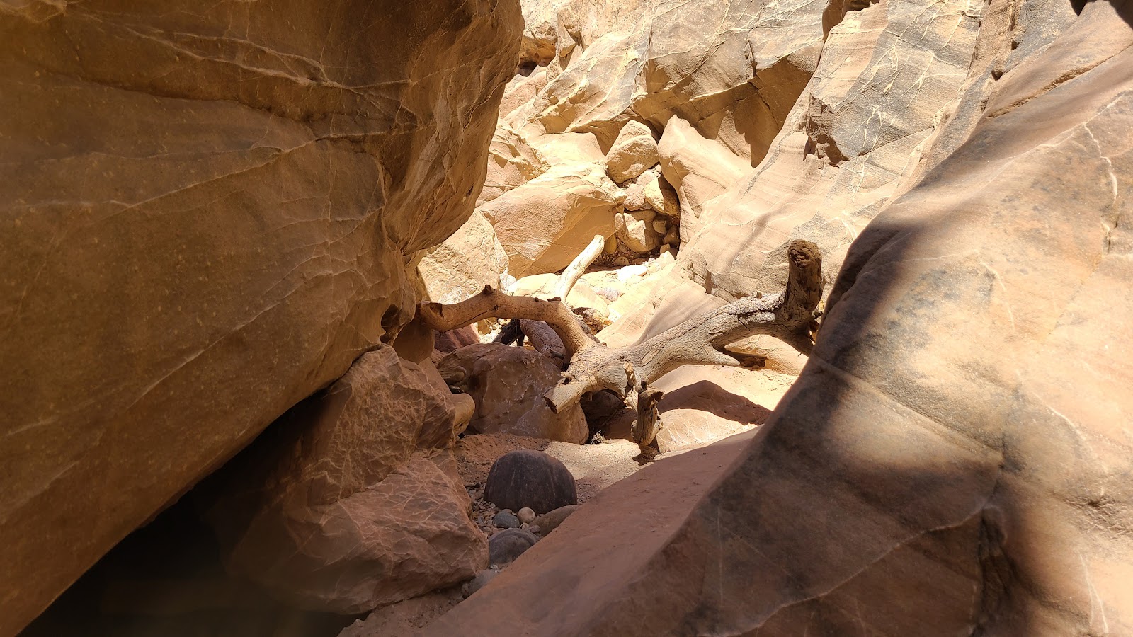
 It's funny how you notice things you didn't see on the way in.
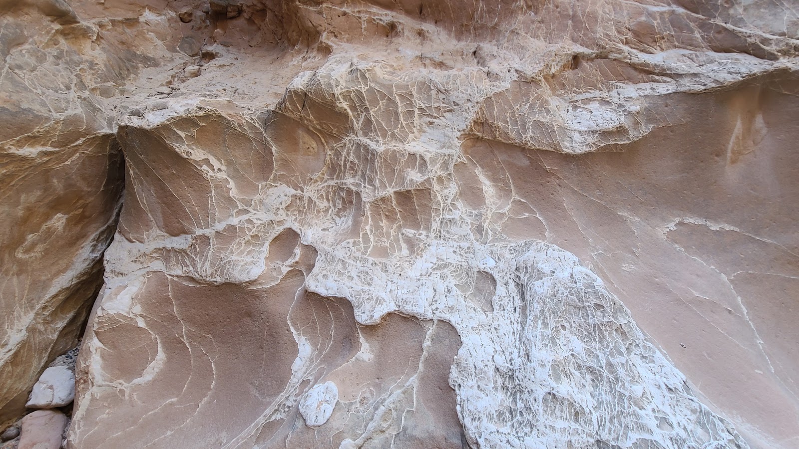
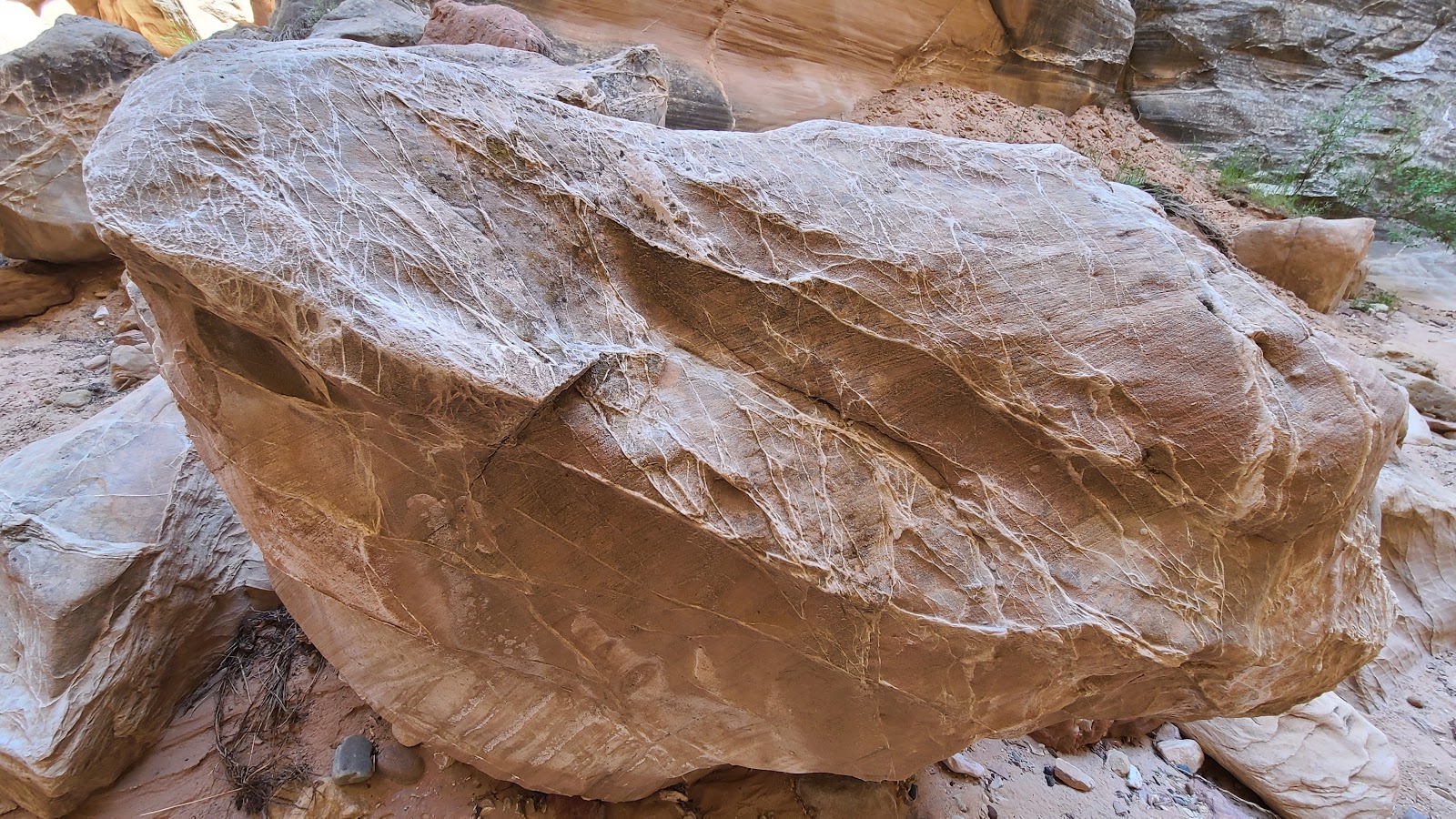 Like this "veiny" rock right in the middle of the trail...
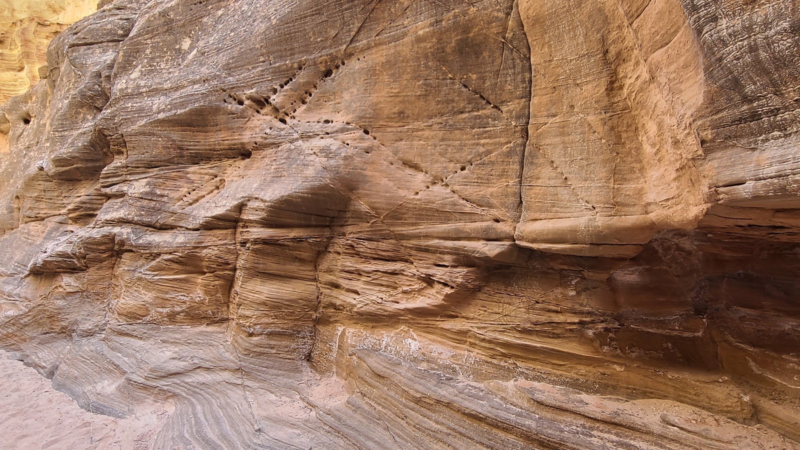 ...and these "X" marks on the canyon wall.
 We're making our way back out of the canyon now. I hope ROVER is still there waiting for us.
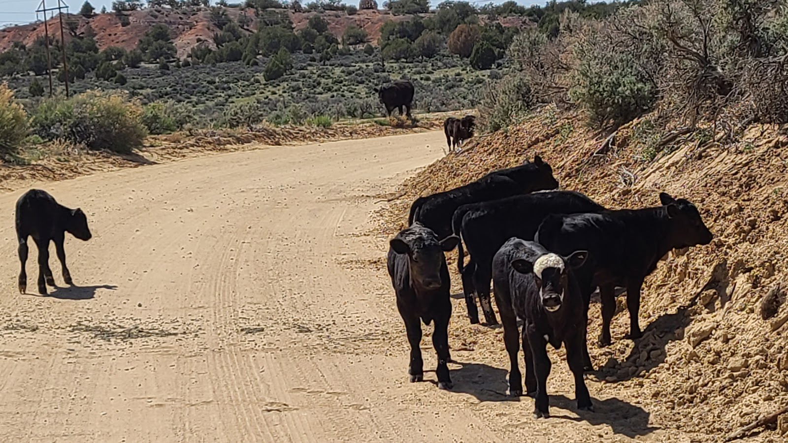 We encounter these guys on the way out. Two of them seem to be challenging us to a duel.
 I moved ROVER a foot closer and they literally "turned tail" and "ran for the hills".
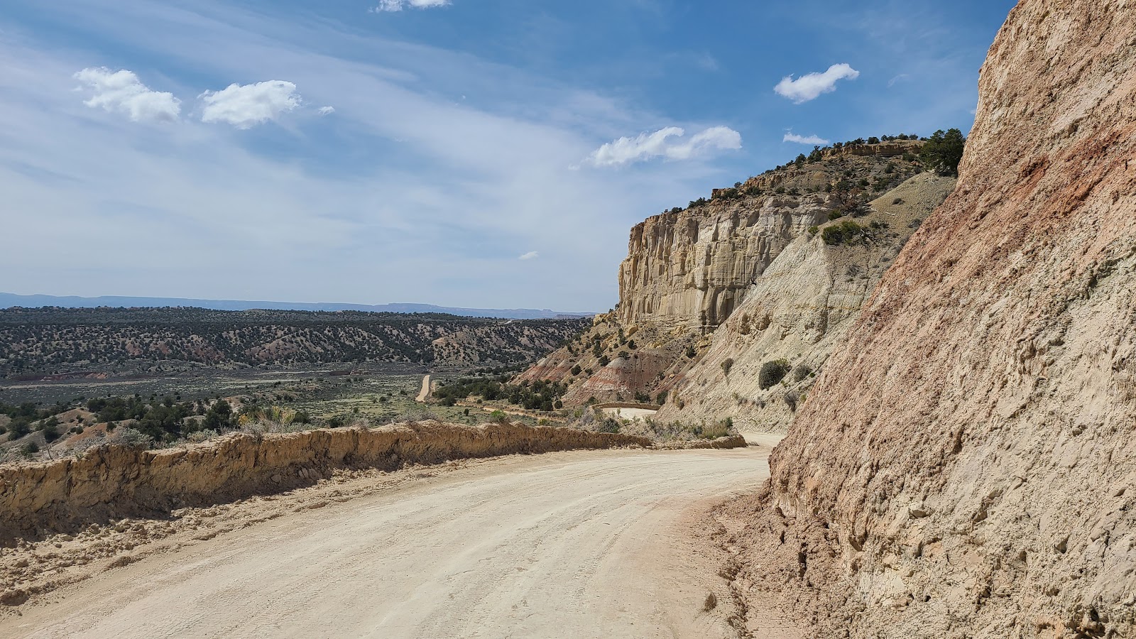 I hope the rest of the road is clear all the way home.
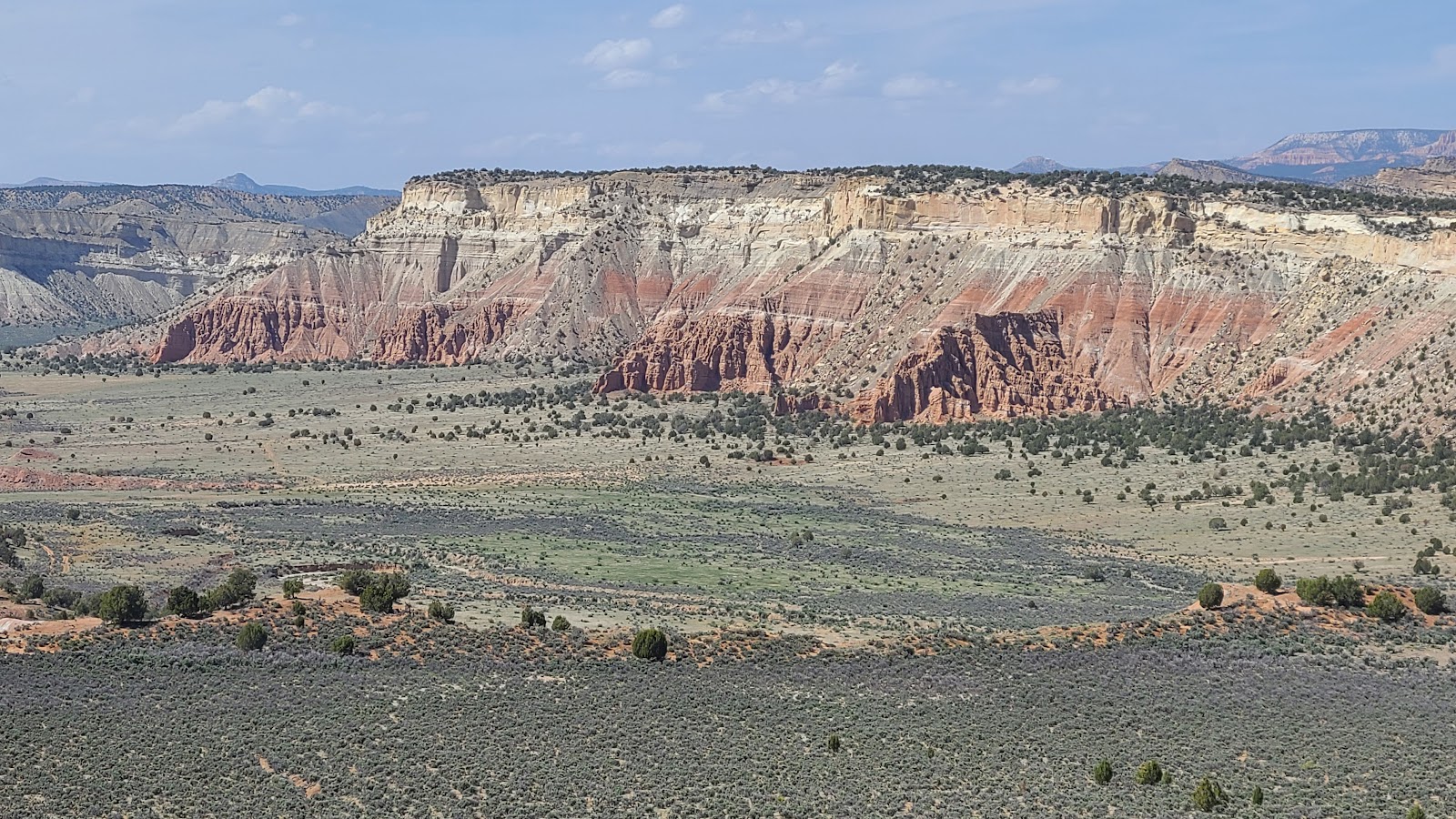 Just amazing!
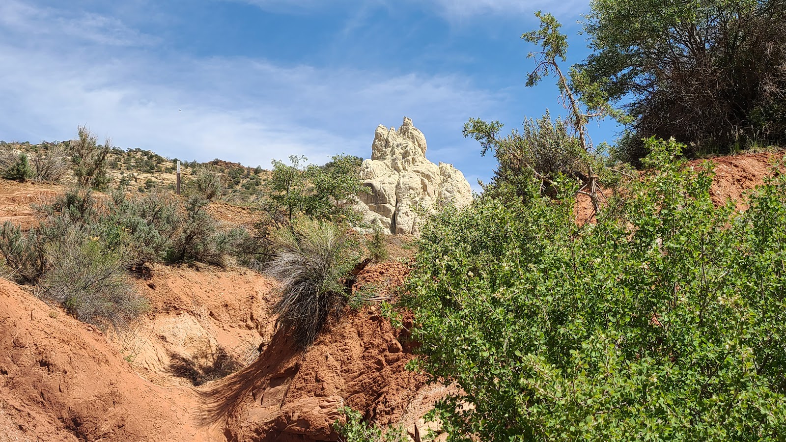
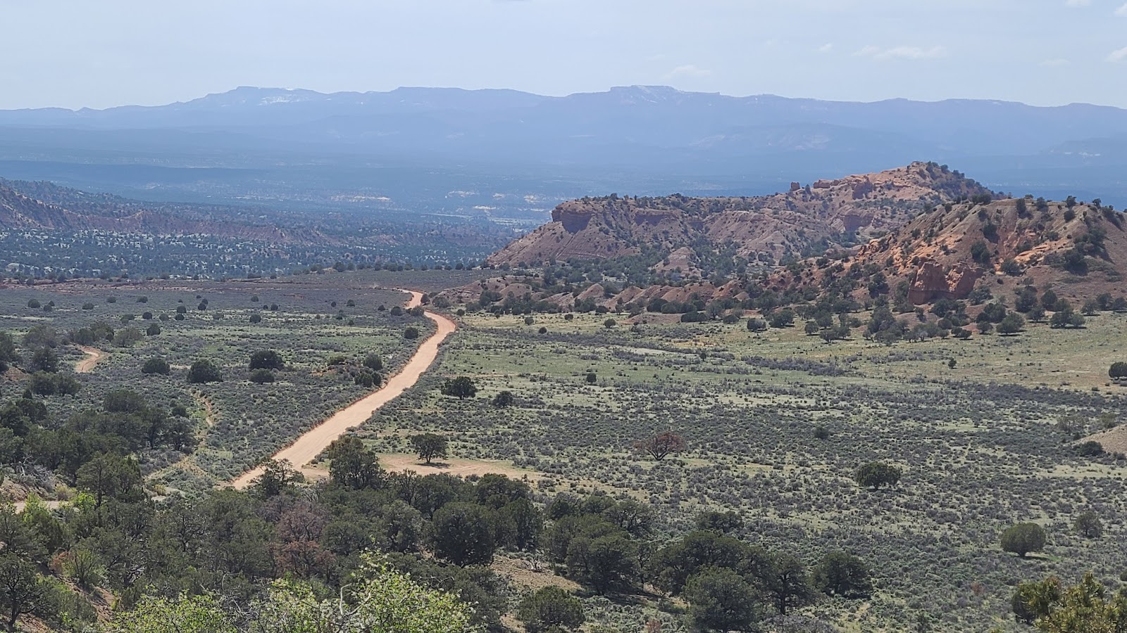 Somewhere just beyond that next rise is the campground.
THIS IS FOR WINSTON AND VERJEAN
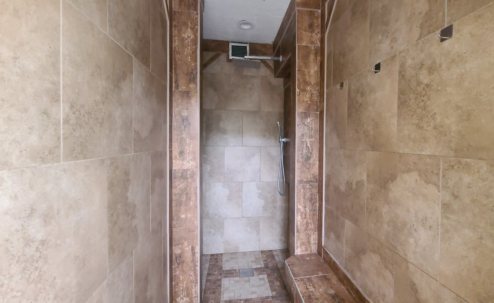
After partaking of the showers here at Kodachrome Basin State Park, I have to humbly disagree with your previous 🌟🌟🌟🌟🌟 (5 star) rating of the showers offered here.
First let's talk about what they do offer: Nice clean private rooms with locking doors, newly tiled floors, walls and a long bench to put your bathroom necessities on. Additionally there were three nice coat hooks on the wall in the dressing area, far away from the shower area, so everything you hung there stayed dry.
There was an Overhead Rain Shower with a diverter to a separate Shower Wand, so you can access all those hard to reach areas. There was also unlimited steaming hot water, something that's a rare find in most State Park bathhouses.
Now that we've discussed all the things they DID have,
let's talk about all the things they DID NOT.
Right off the bat I noticed there was no FREE ground transportation from our campsite to the bathhouse that was at least 50-yards away.
There was also no hot tub or sauna anywhere around to enjoy before my shower. I know this because I walked all the way around the building looking for the appropriate door to enter, unless it was in the womens restroom, I couldn't find it.
There were no little bottles of body wash, shampoo or conditioner anywhere to be found inside the shower room itself.
Additionally, there was no complimentary terrycloth bathrobe waiting for me after my shower, thankfully I had the foresight to bring my own shampoo and a towel to dry off with.
And lastly, I would have enjoyed a nice massage after my shower, but alas, that was nowhere to be found either.
Even with everything the showers here didn't offer I still scored them a solid 4.9 stars, after all, everything wasn't perfect, was it?
Maybe I missed my calling and should have been a gymnastics judge for the Olympics.
This concludes our visit to Kodachrome Basin State Park in Utah, but we're not done with the Grand Staircase-Escalante National Monument yet.
No, no, no! We've only scratched the surface of the sites to seen in the National Monument. So stay tuned as we visit a different region of the 1,870,000 acres that make up this wonderful National Monument we're currently visiting.
Would you like to be notified of new blog posts?