With a relatively short 89-mile moving day you'd think we wouldn't have very many photos to share. That would normally be true, if we weren't leaving Zion National Park through the eastern gate.
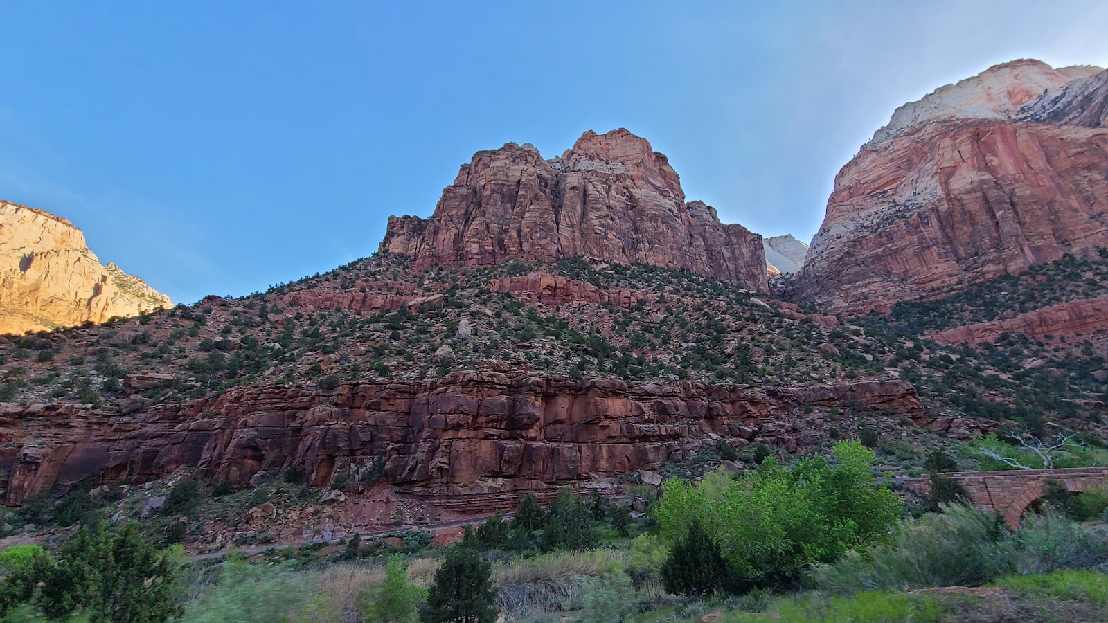
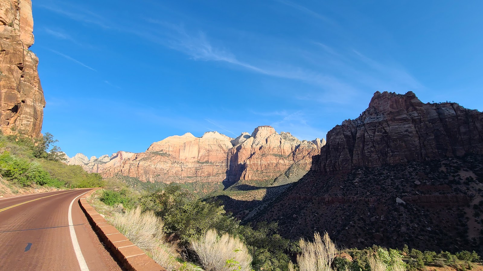
The eastern side of Zion National Park is entirely different than the main section of Zion Canyon with it's 2000' straight up mountainsides.
Here are a handful of photos from our exiting Zion National Park this morning at 8:00AM.
FAREWELL TO ZION NATIONAL PARK
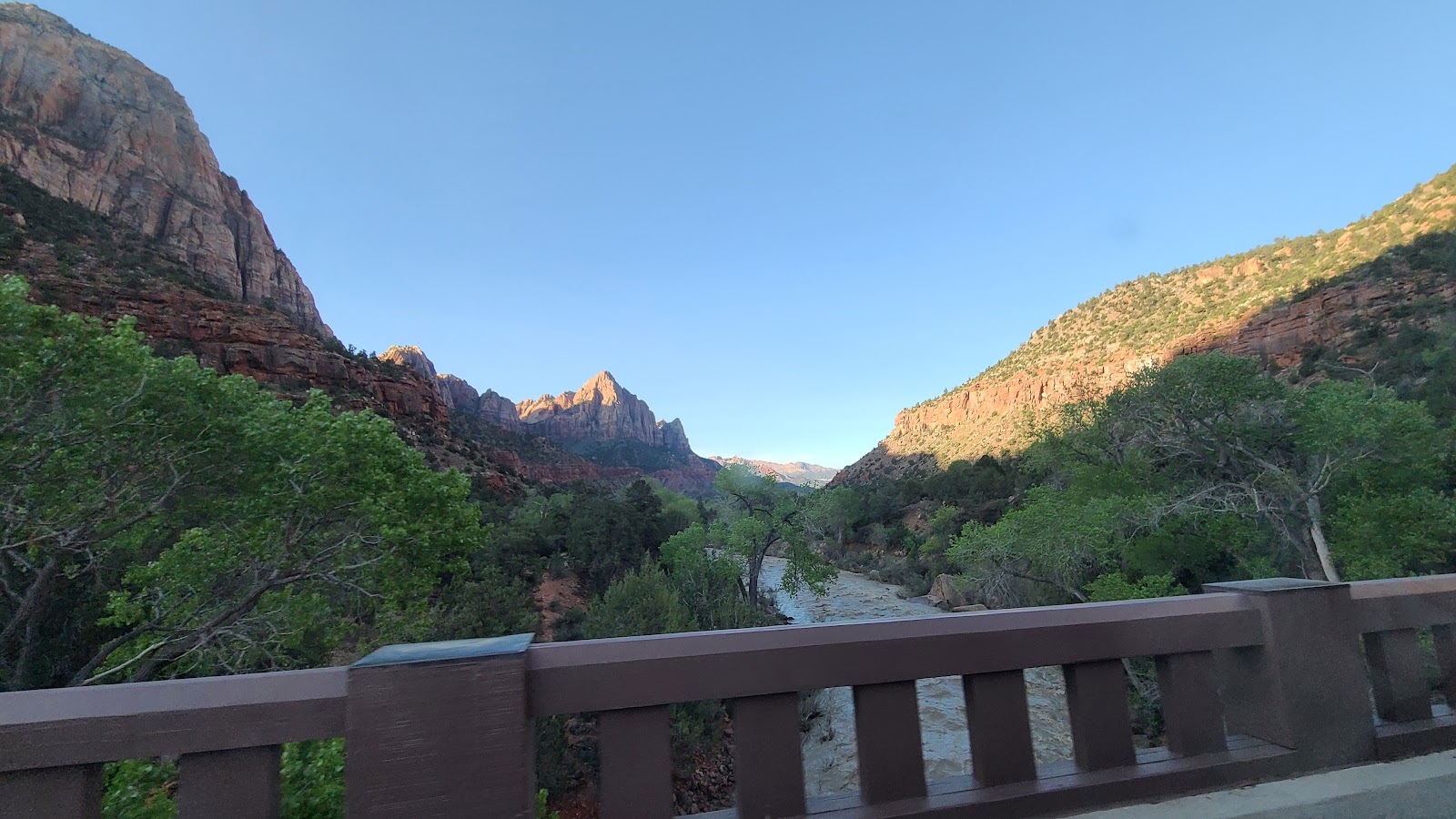 A final look at The Watchman from the Canyon Junction Bridge.
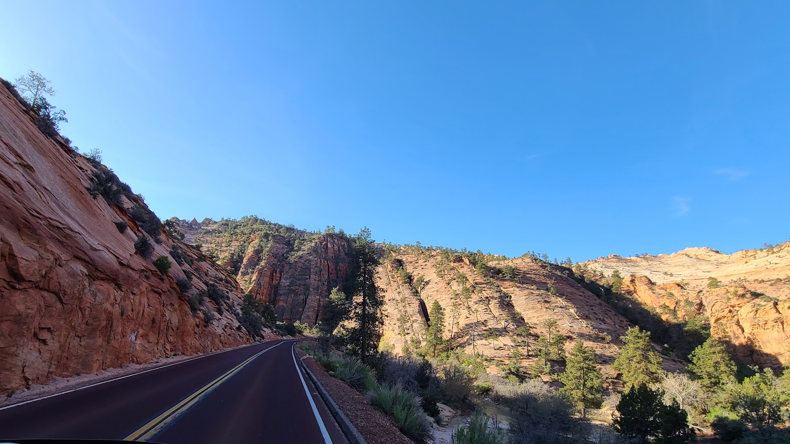
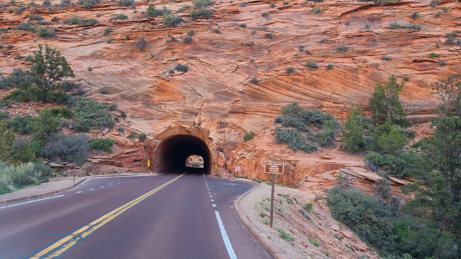
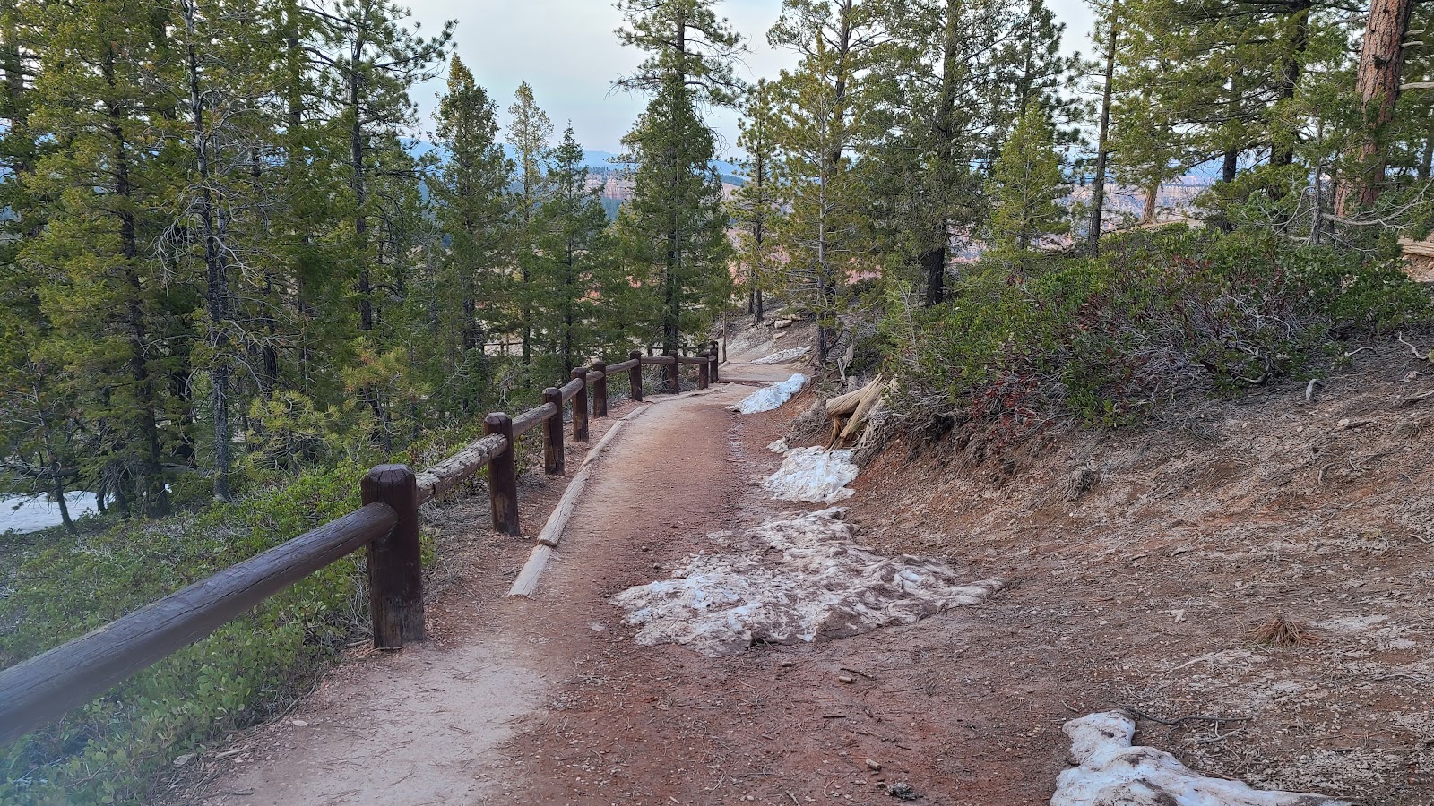
 The beginning of the switchbacks that will take us up to the Zion-Mt. Carmel Tunnel entrance.
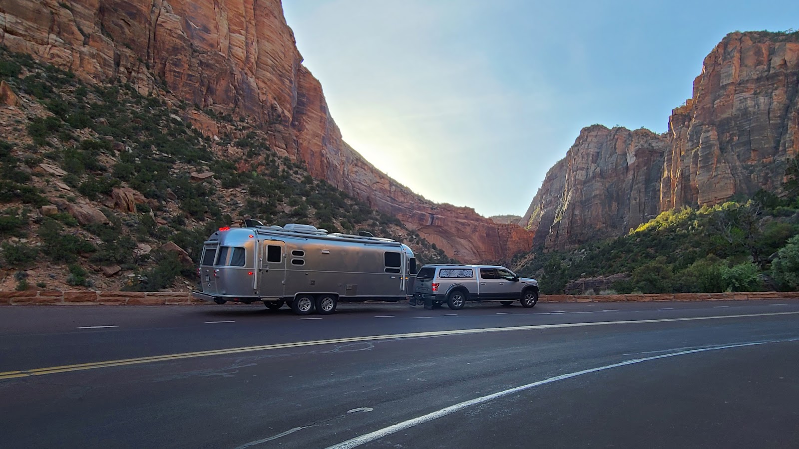 We were ahead of schedule so halfway up to the tunnel we pulled over to spend a few minutes.
Tricia took the opportunity to clean ROVER's windshield for her upcoming photos.
 Up, up, up we go!
 The last of six switchbacks leading up to the tunnel.
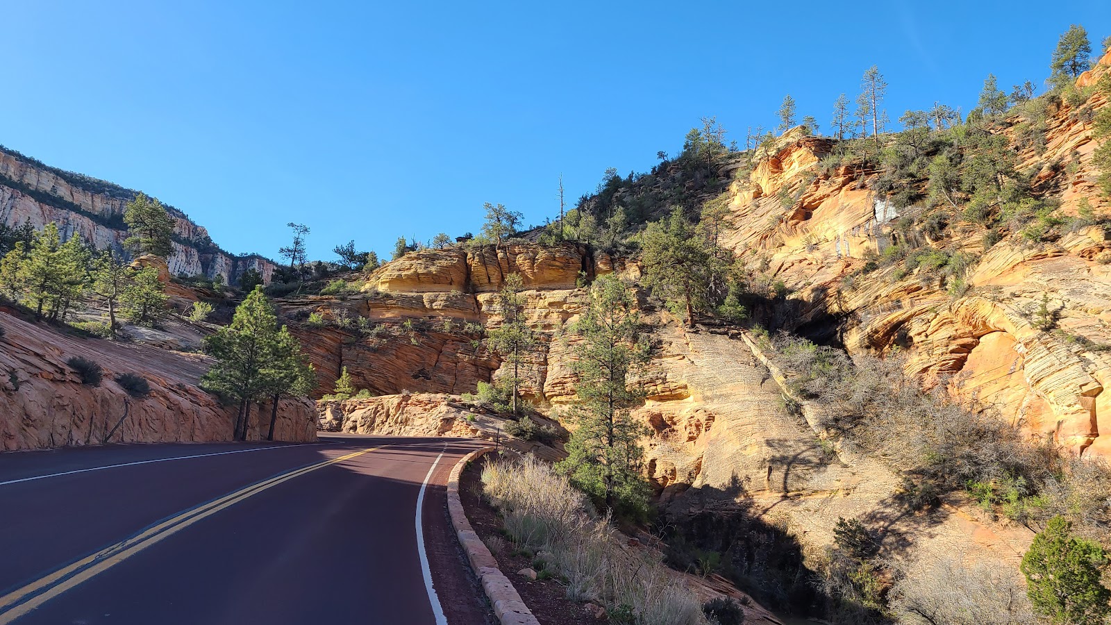
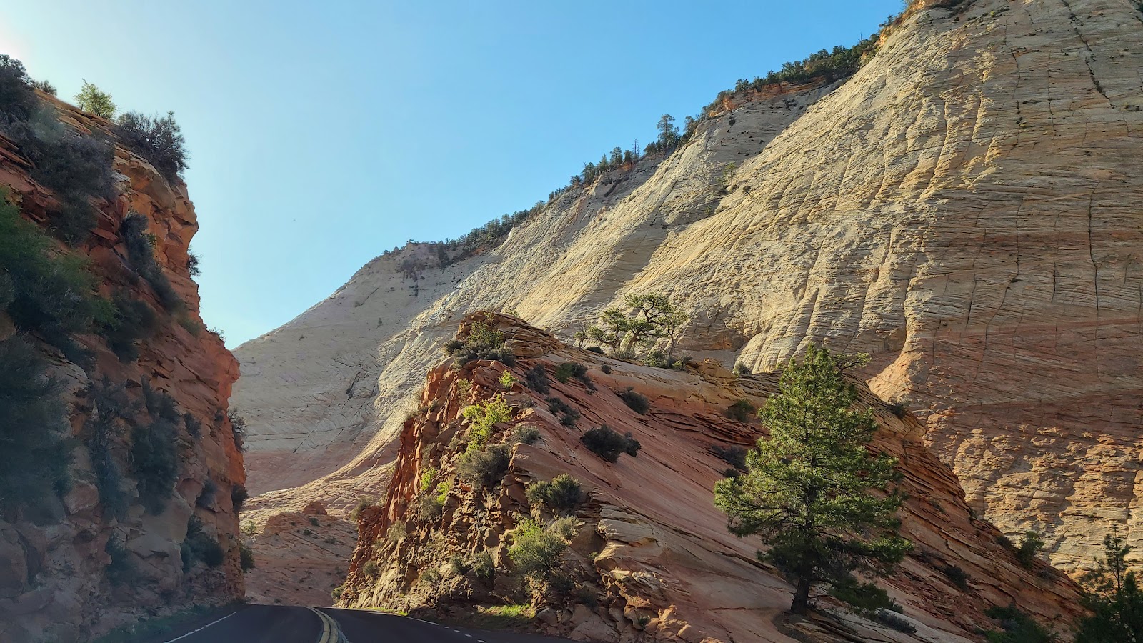
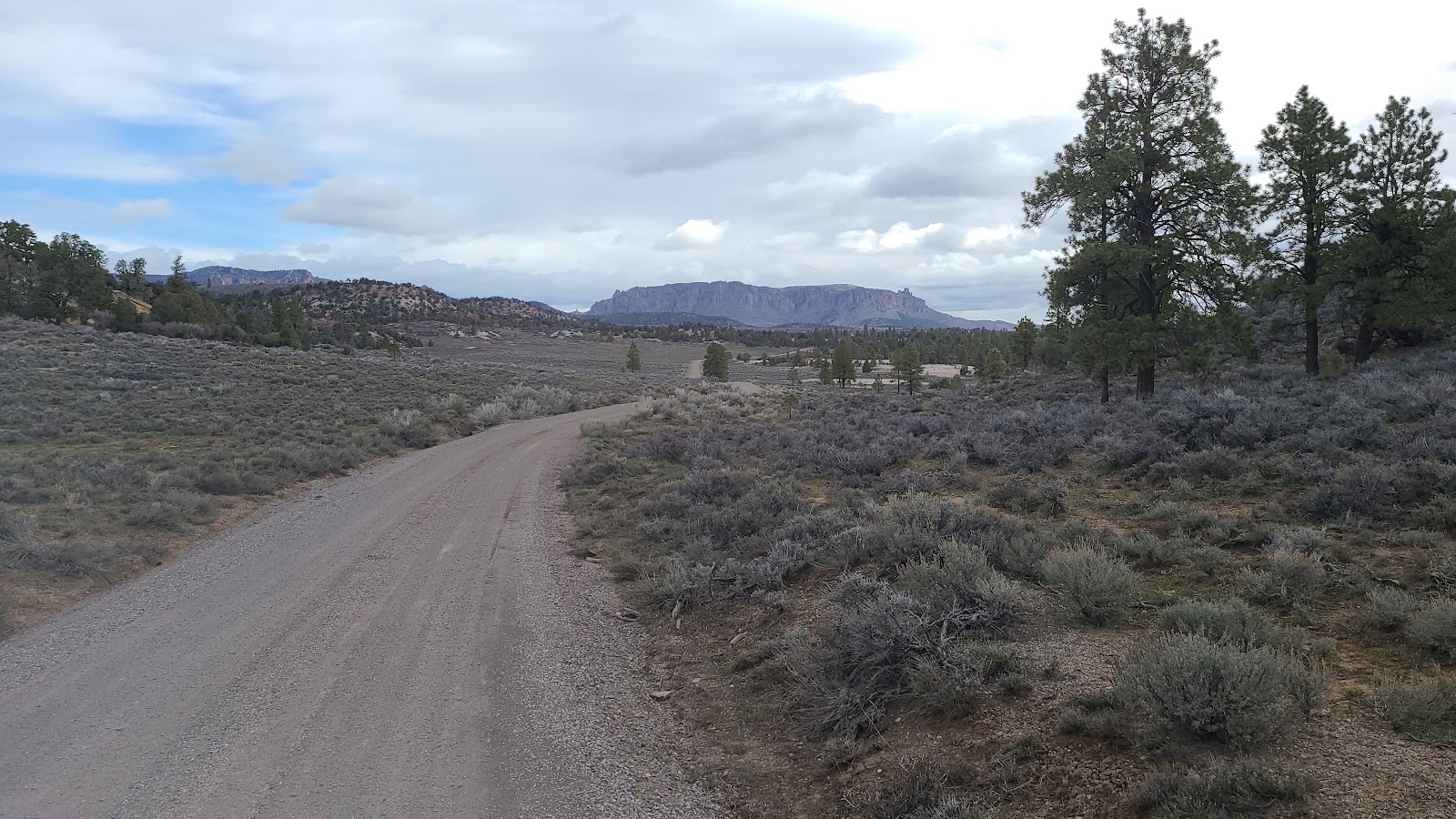
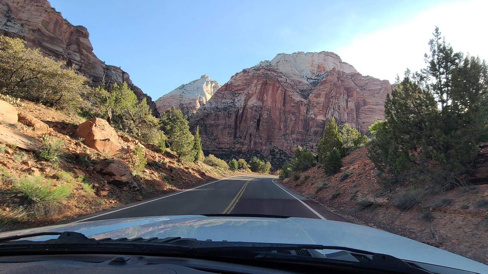
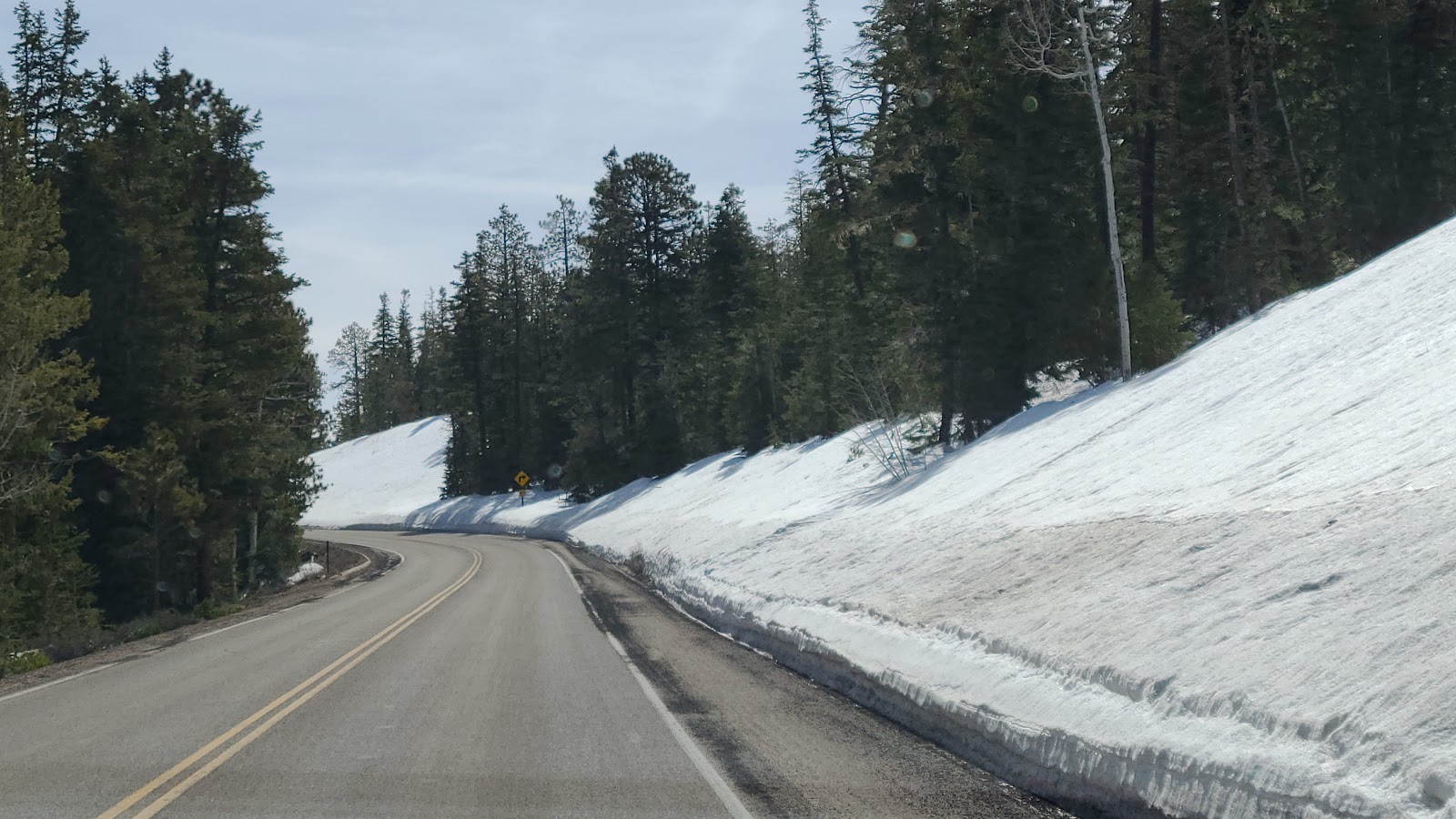
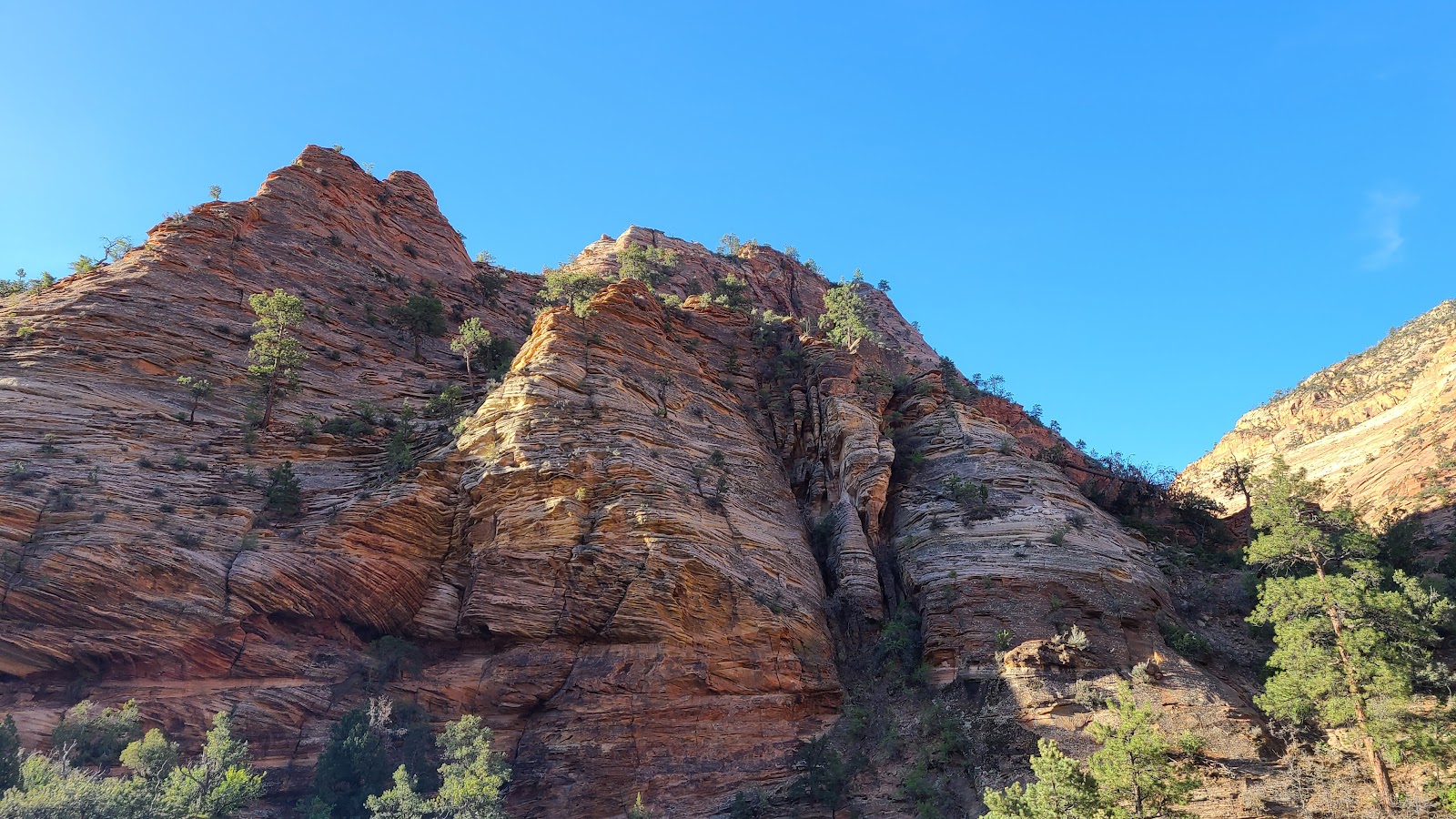 Once on the other side of the tunnel the scenery changes.
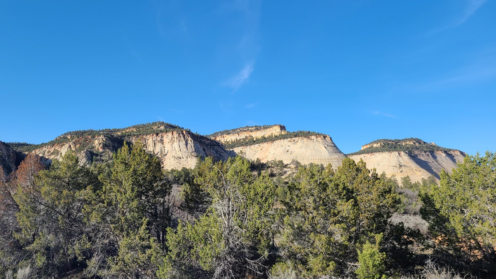
 Gone are the tight canyon walls, replaced with a carved out roadway.
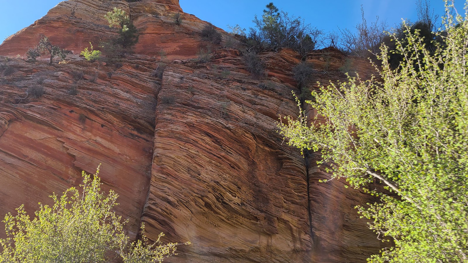
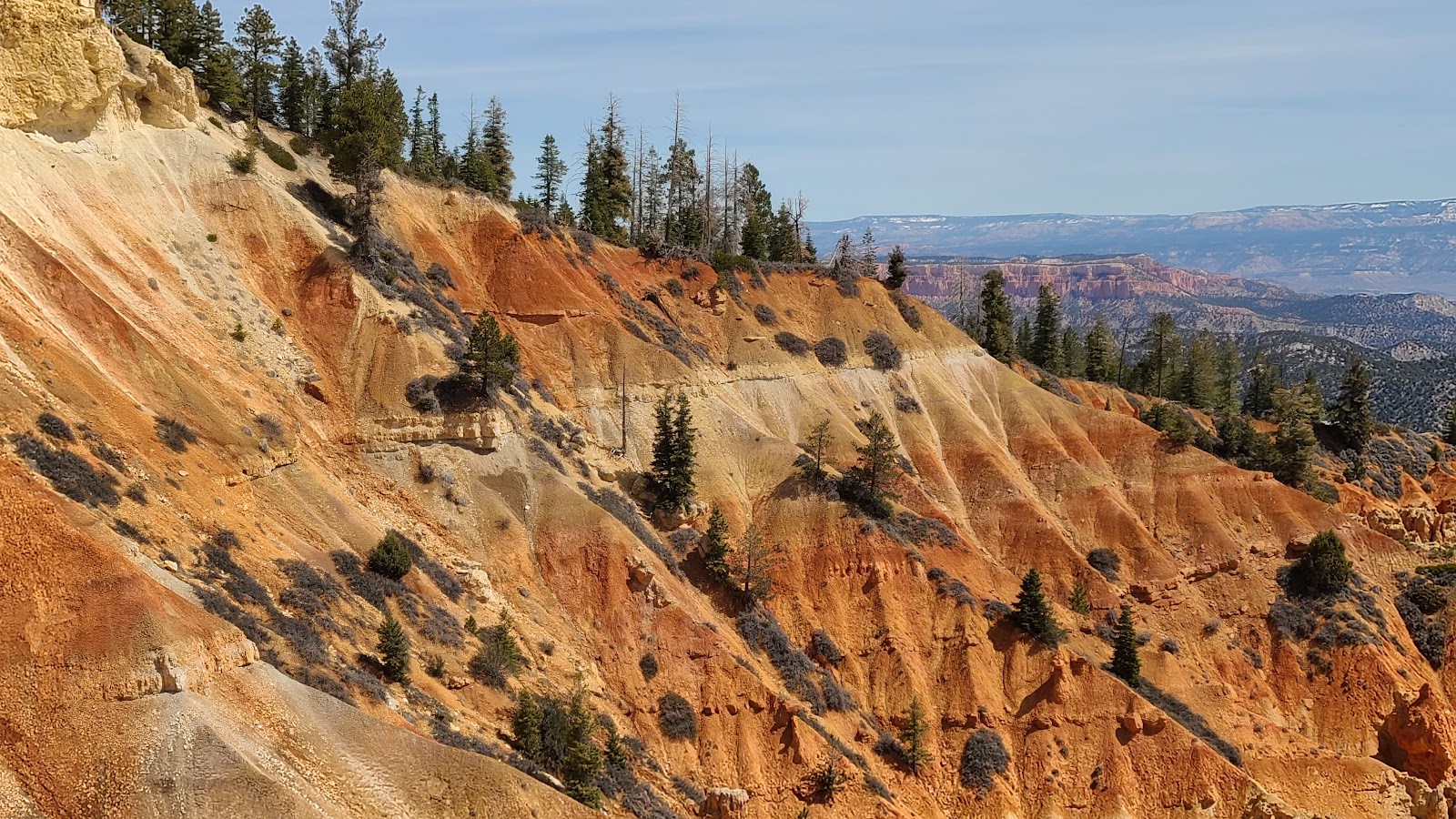
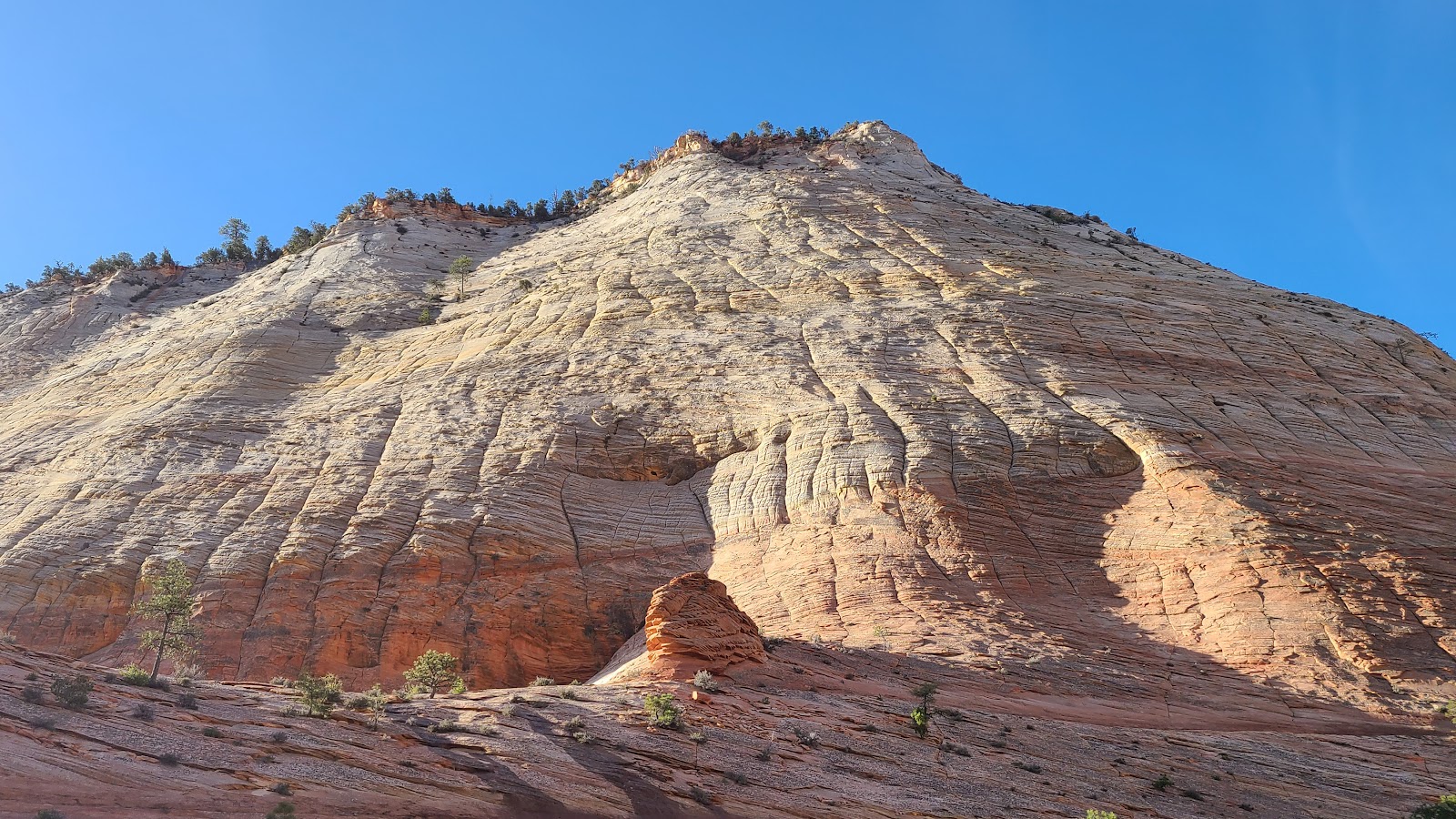
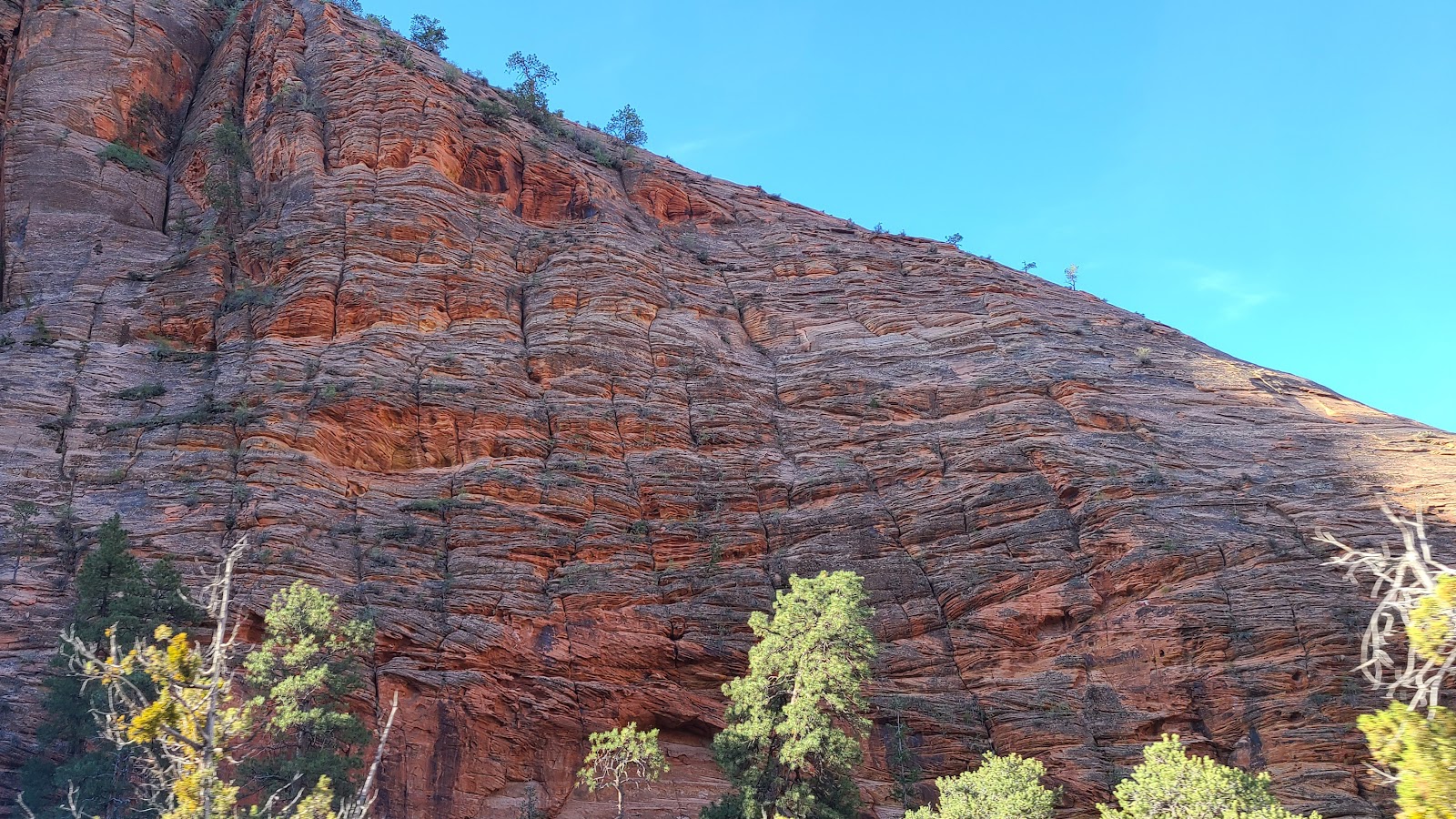 This rockface is composed entirely of Navajo Sandstone.
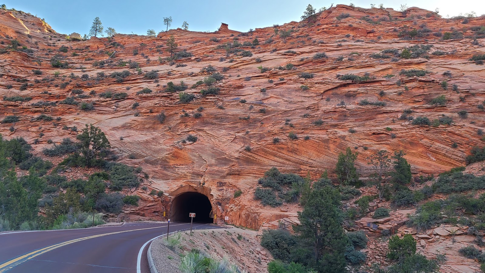 As if one tunnel wasn't enough, here's another shorter one.
 This one is a lot shorter than the 1.1-mile long Zion-Mt. Carmel Tunnel.
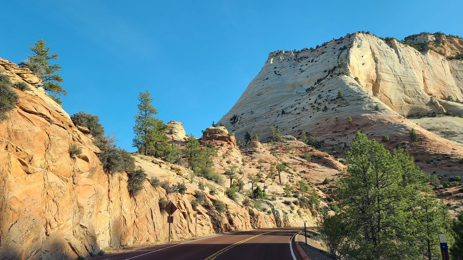
 A final look at the Checkerboard Mesa.
 Until we meet again Zion National Park.
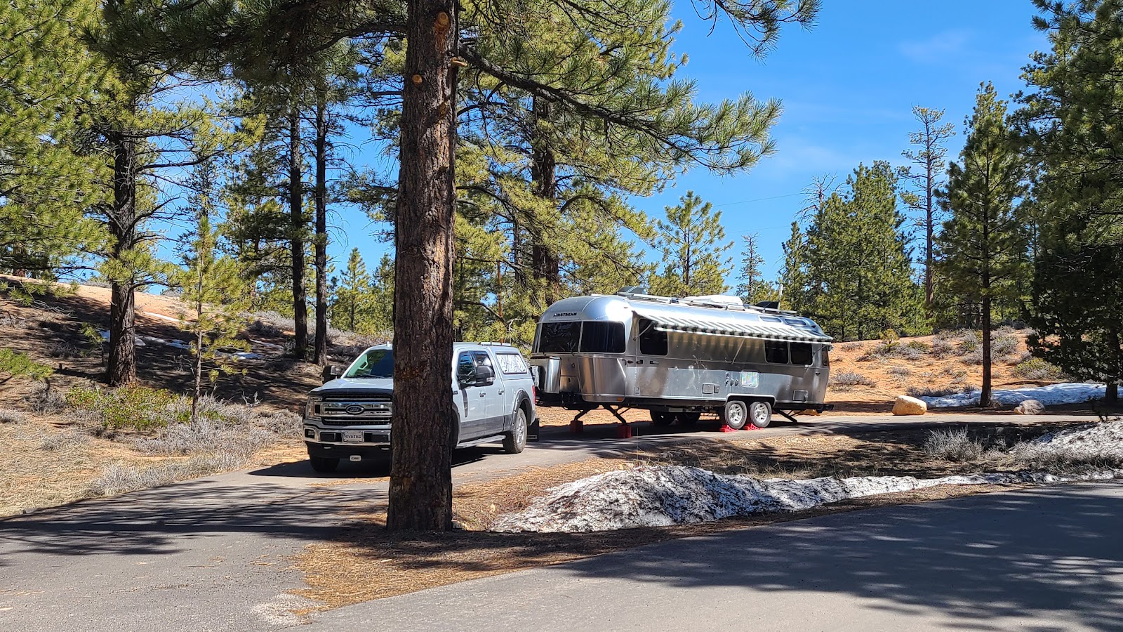
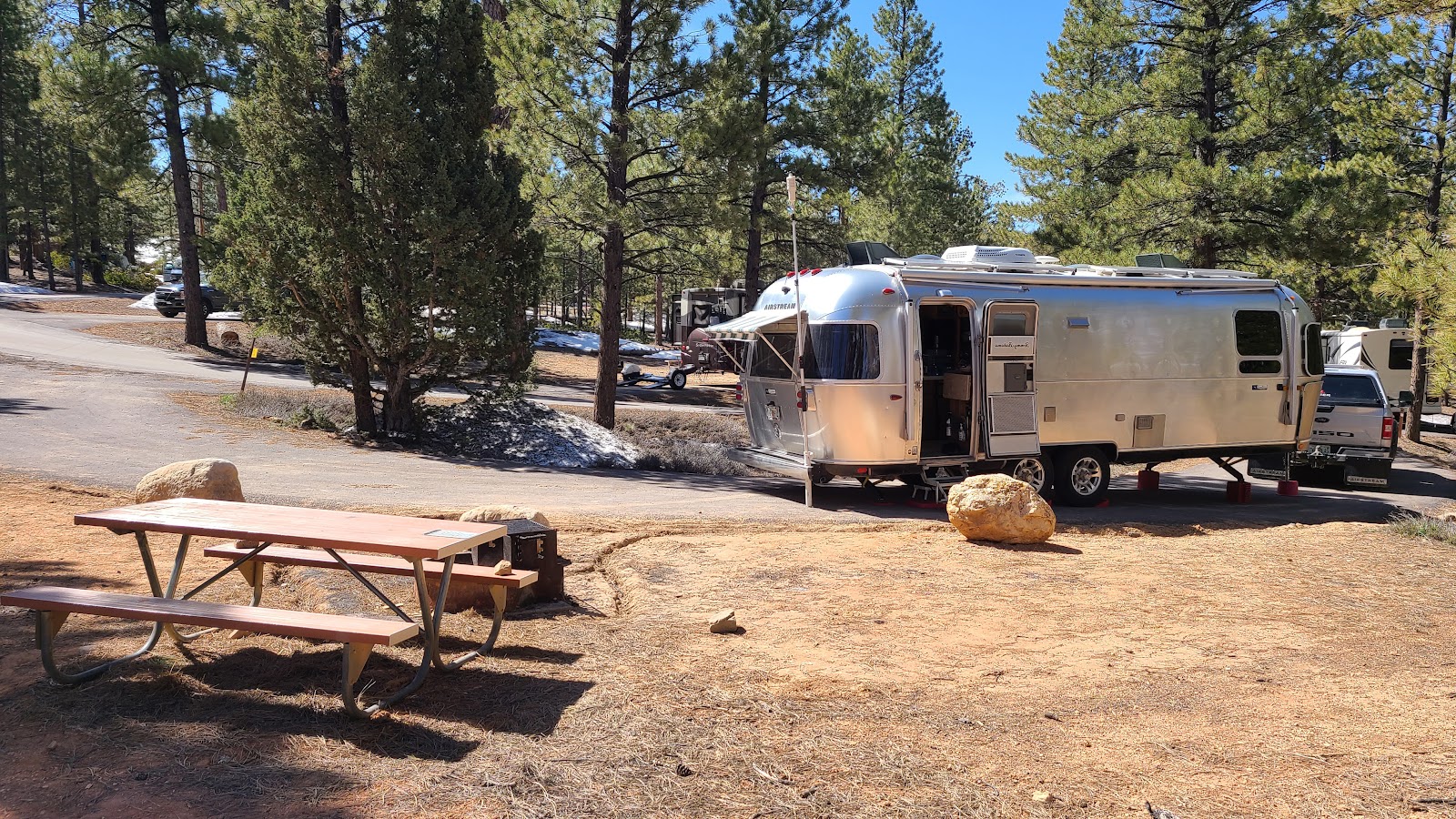
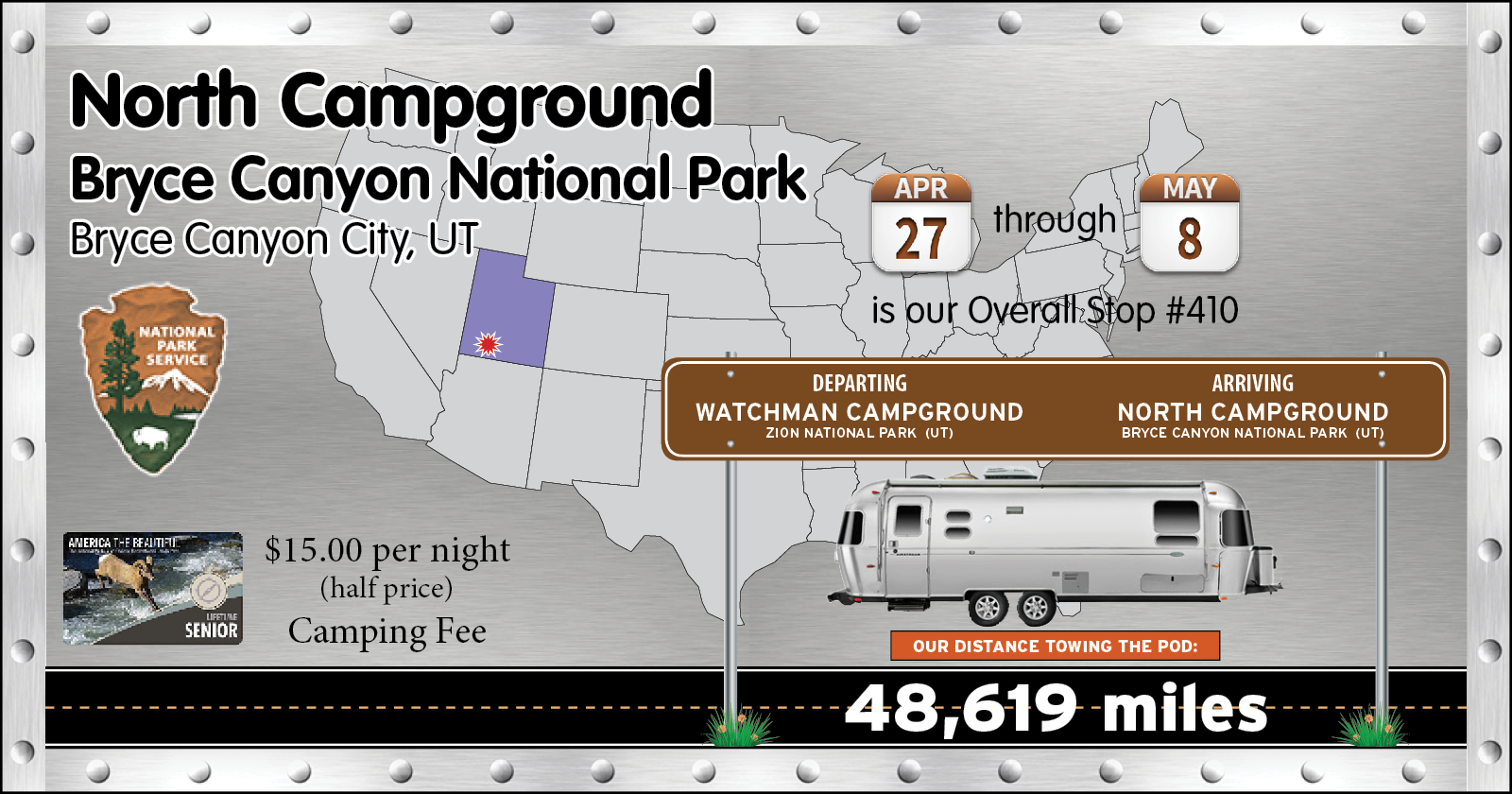
By 11:00AM we were all set up in our new campsite for the next 11-days at Bryce Canyon National Park. The site is plenty big enough and we even have a clear view of the northern sky so our Starlink satellite dish will be happy here. Now if only we could have been lucky enough to grab a site that was just a little more level, but we were able to make it work for us.
Our campsite here in Bryce Canyon did set a new
TWO PEAS AND THE POD record for being our highest campsite to date at an elevation of 7930' (measured at our dinette table).
As we typically do after arriving at a new National Park we finished setting up in our campsite, displayed our receipt on the campsite post and deposited our check in the Iron Ranger for the first five nights of camping.
After all that was taken care of we drove up to the Bryce Canyon Lodge to eat lunch in their 180-seat dining room.
I sampled their offering of a $9 cup of Elk Chili, it was good, but it tasted just like Beef Chili to me. Turns out the description was a white bean chili with ground elk, beef and shredded jack cheese. I wonder what the elk to beef ratio is in the chili?
Anyway, Tricia's $14 "Grown Up" Grilled Cheese Sandwich and my $17.75 ½-lb. Angus Beef Burger and Fries were both acceptably tasty, but quite pricey if you ask me.
After lunch we headed for the Visitor Center to get my Passport Book stamped, then checked out the little history museum and watched the movie about Bryce Canyon National Park.
So now at the end of our first day in Bryce Canyon National Park we've seen exactly zero hoodoos, zero magnificent sunrises or sunsets and virtually zero wildlife sightings, except for the birds flying around our campsite.
We figure, what's the hurry? We've got 10-more days here to do all that!
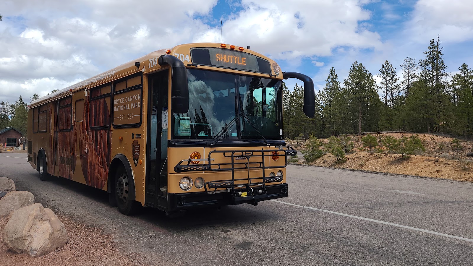
FRIDAY - The Shuttle Bus route here at Bryce Canyon National Park, much like we found in Zion National Park last week, has several stops just outside of the park in the nearby town. There are also stops inside of the park, but they don't even begin to cover the entire park.
The Shuttle Bus here only covers what's known as the Bryce Amphitheater section, which is where everyone seems to concentrate their exploration of the park. If we were only here for 1-2 days, I guess we would be doing the same thing.
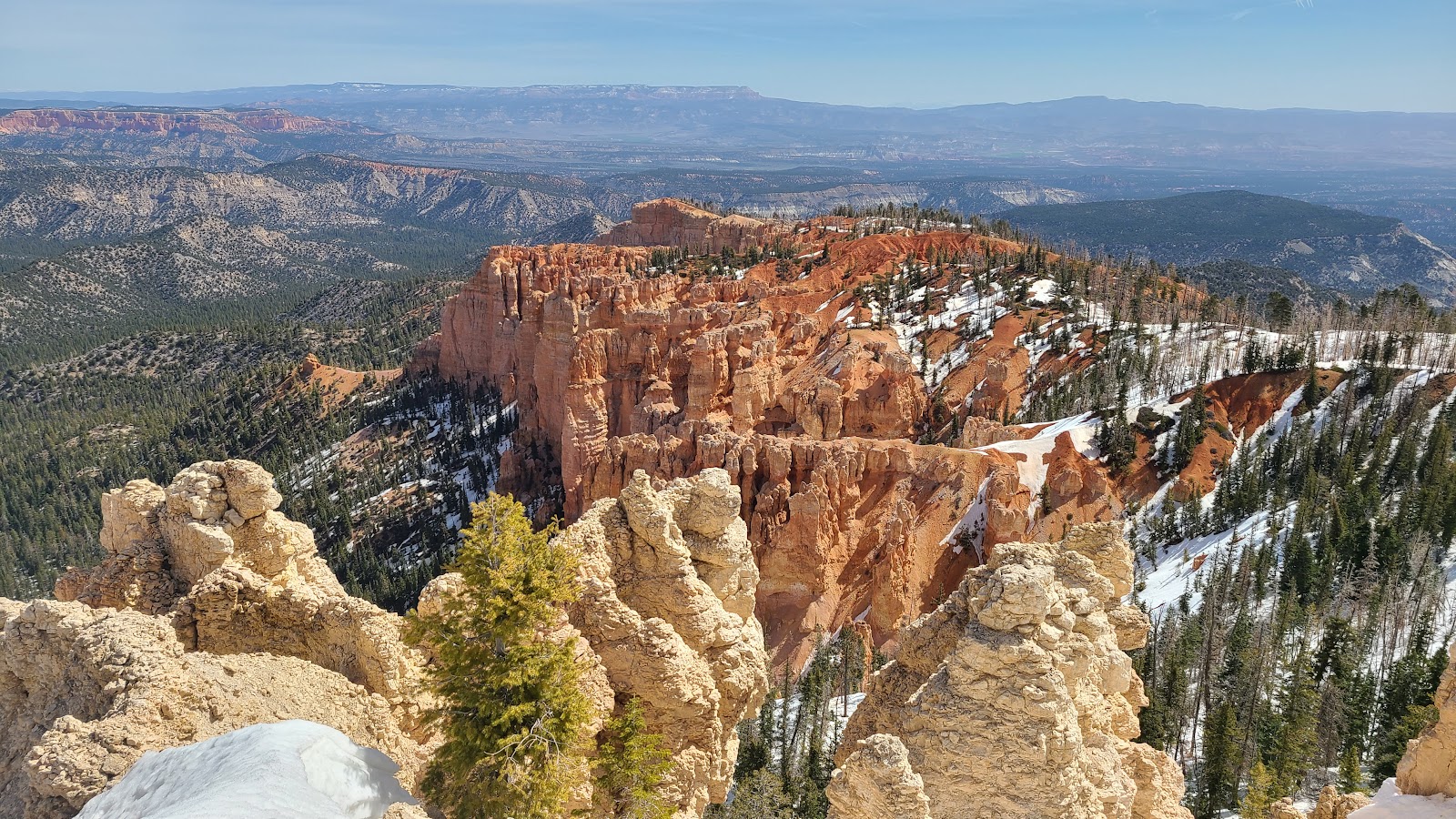
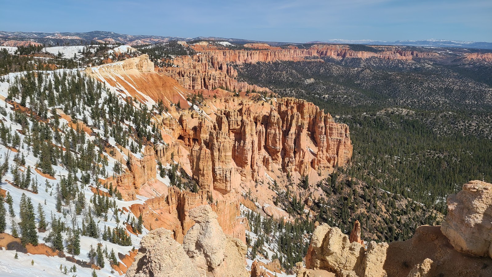
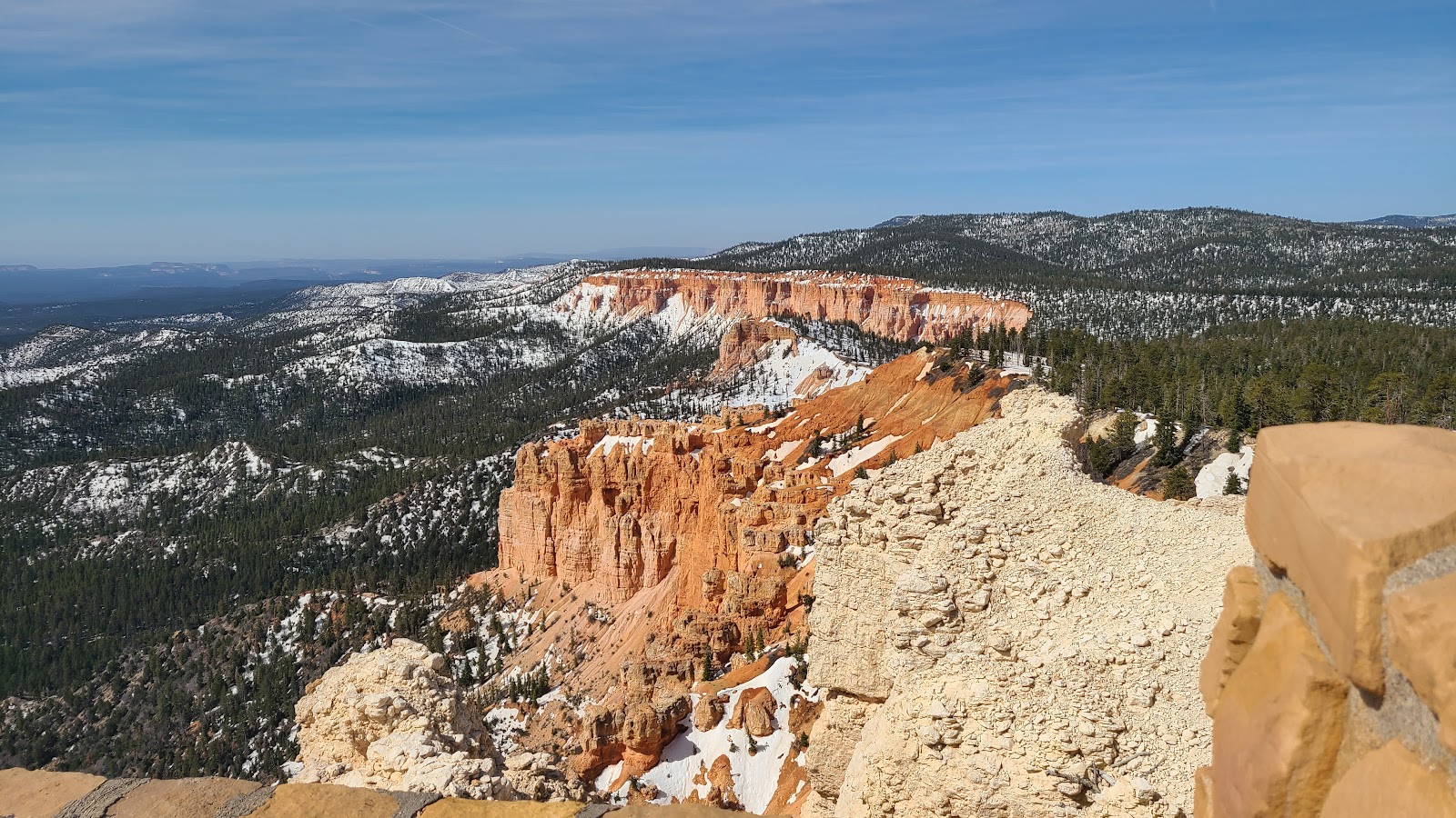
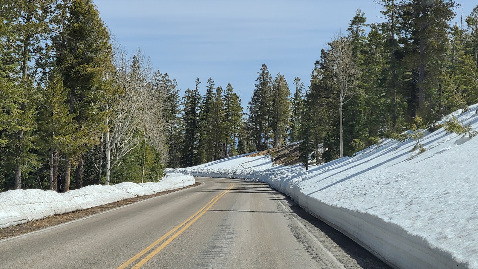
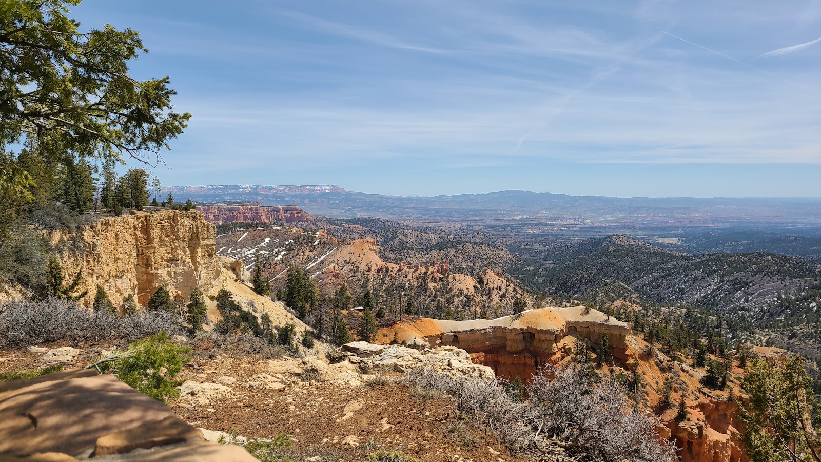
But we have 11-days here, so today we are going to explore the recently opened 15-miles of roadway that the Shuttle Bus doesn't cover, all the way UP to the end of the road at Rainbow Point (elev. 9115').
BRYCE CANYON SCENIC OVERLOOKS
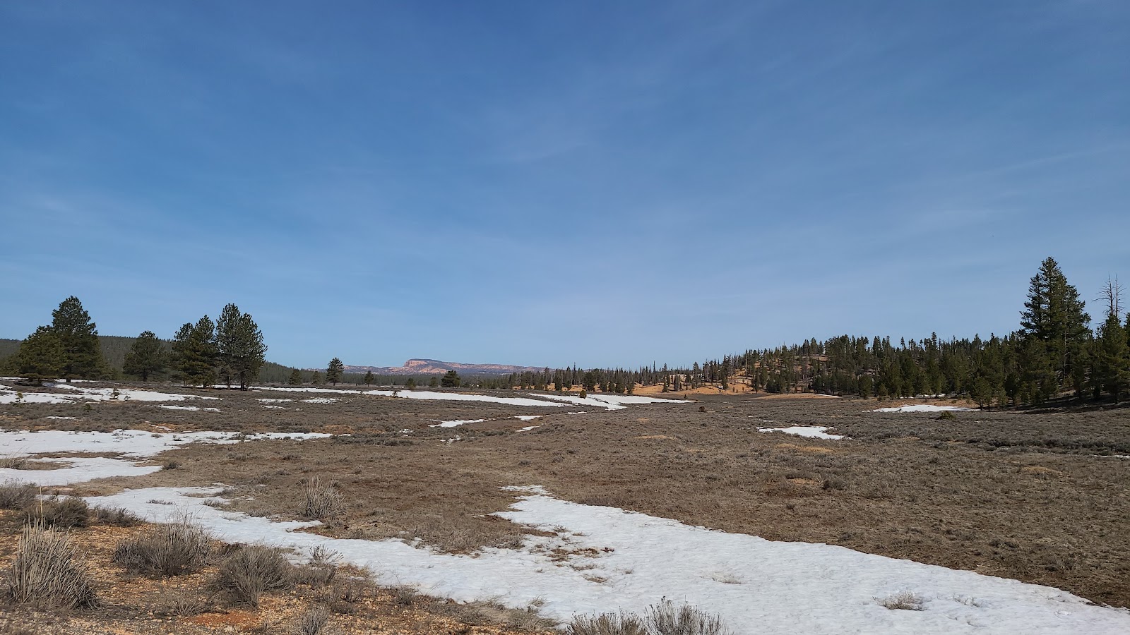 Rumor has it that a large colony of Utah Prairie Dogs live in this field.
 The final 3-miles of the scenic drive just opened earlier this week.
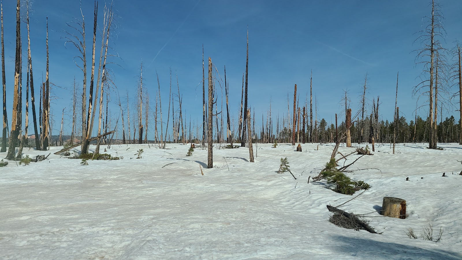 Evidence of a recent forest fire can be seen in this photo.
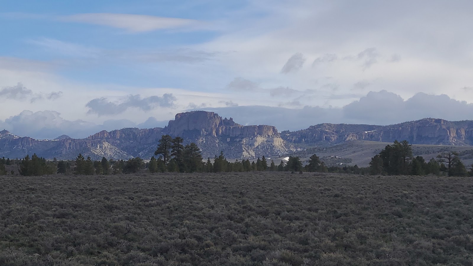
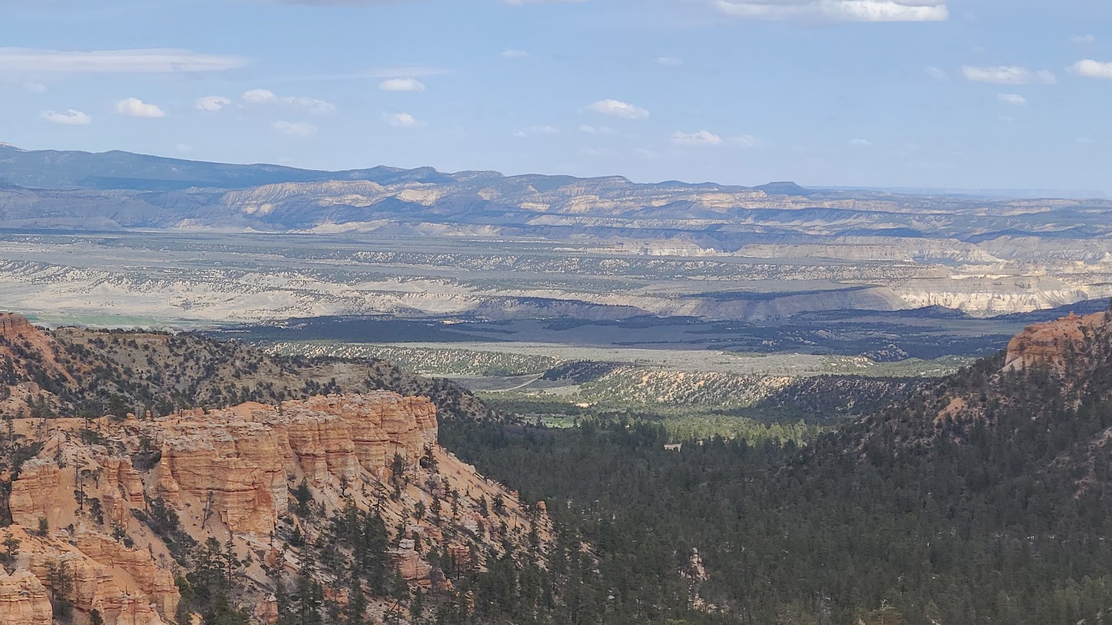
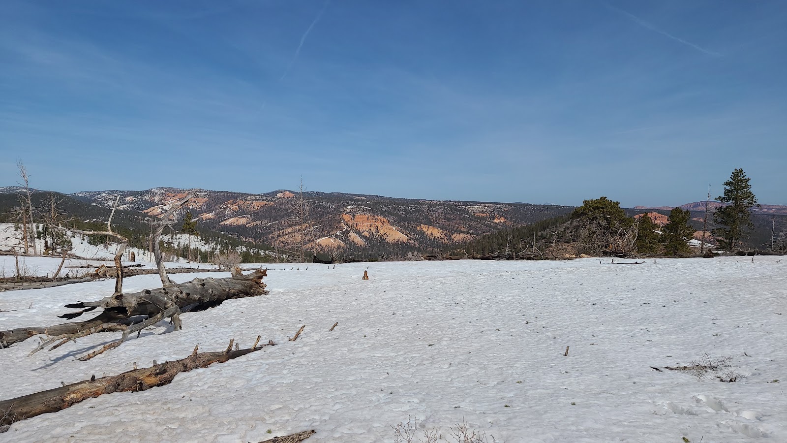 Looking east towards the Dixie National Forest.
 We are nearing the end of the road now.
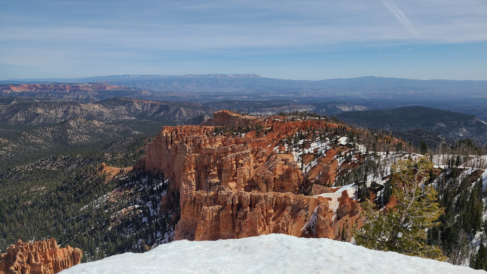
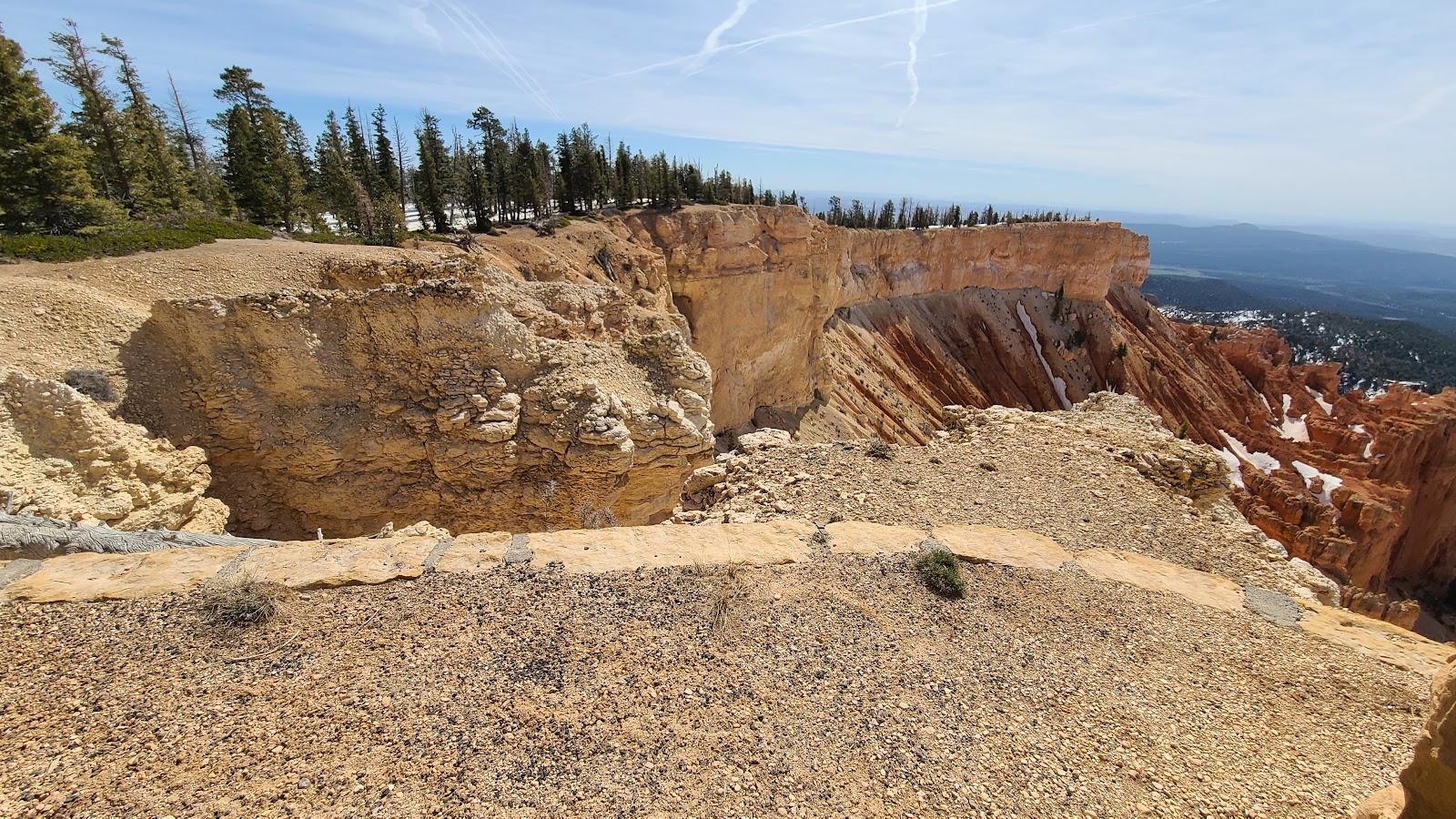
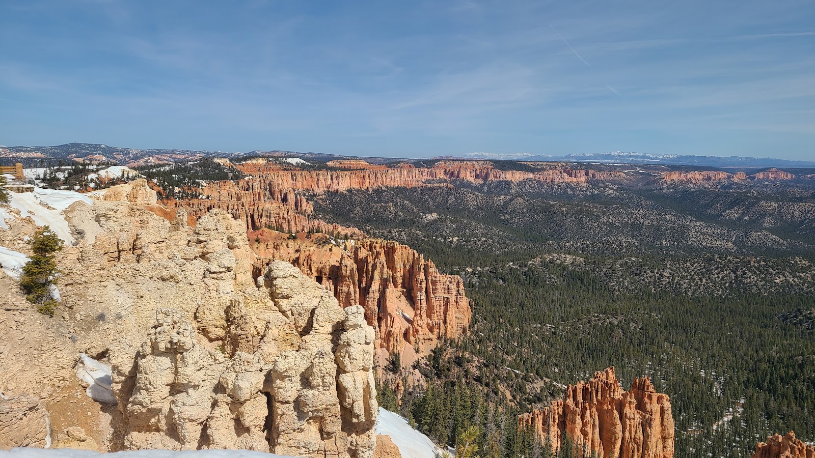 Views from Rainbow Point (elevation 9115').
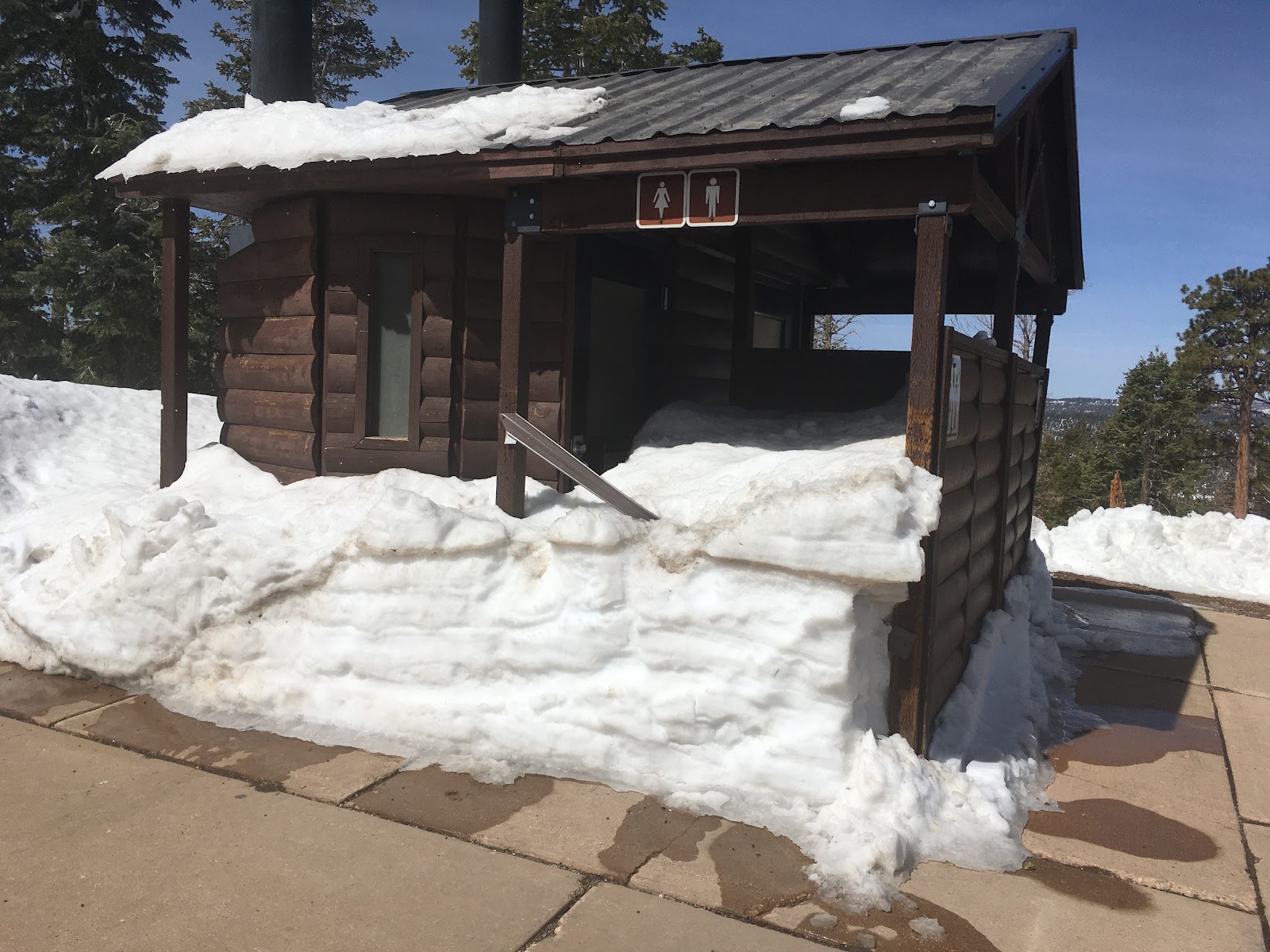 These bathrooms don't appear to be open for the season yet!
 Also at the end of the road you'll find Yovimpa Point (elevation 9106').
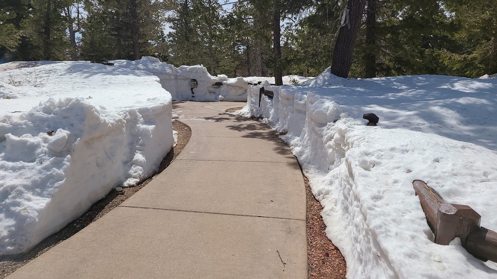
 It's easy to see why this section of the park just recently opened.
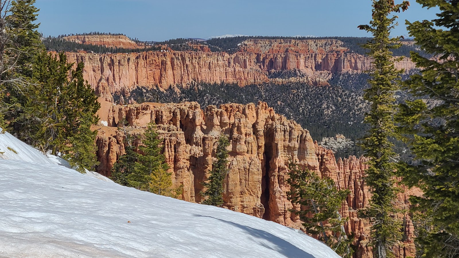
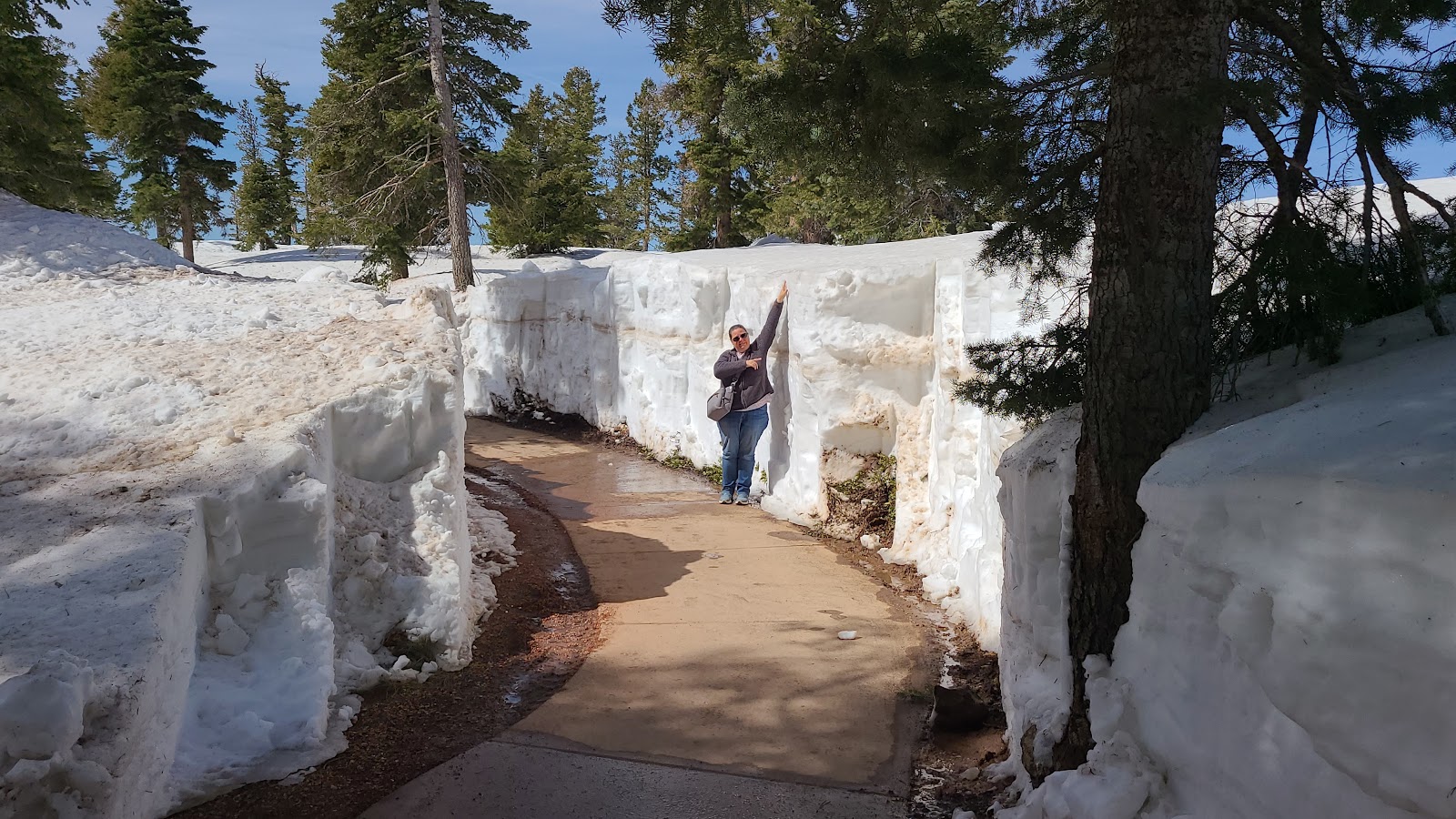 This snow bank is easily 6½ feet thick.
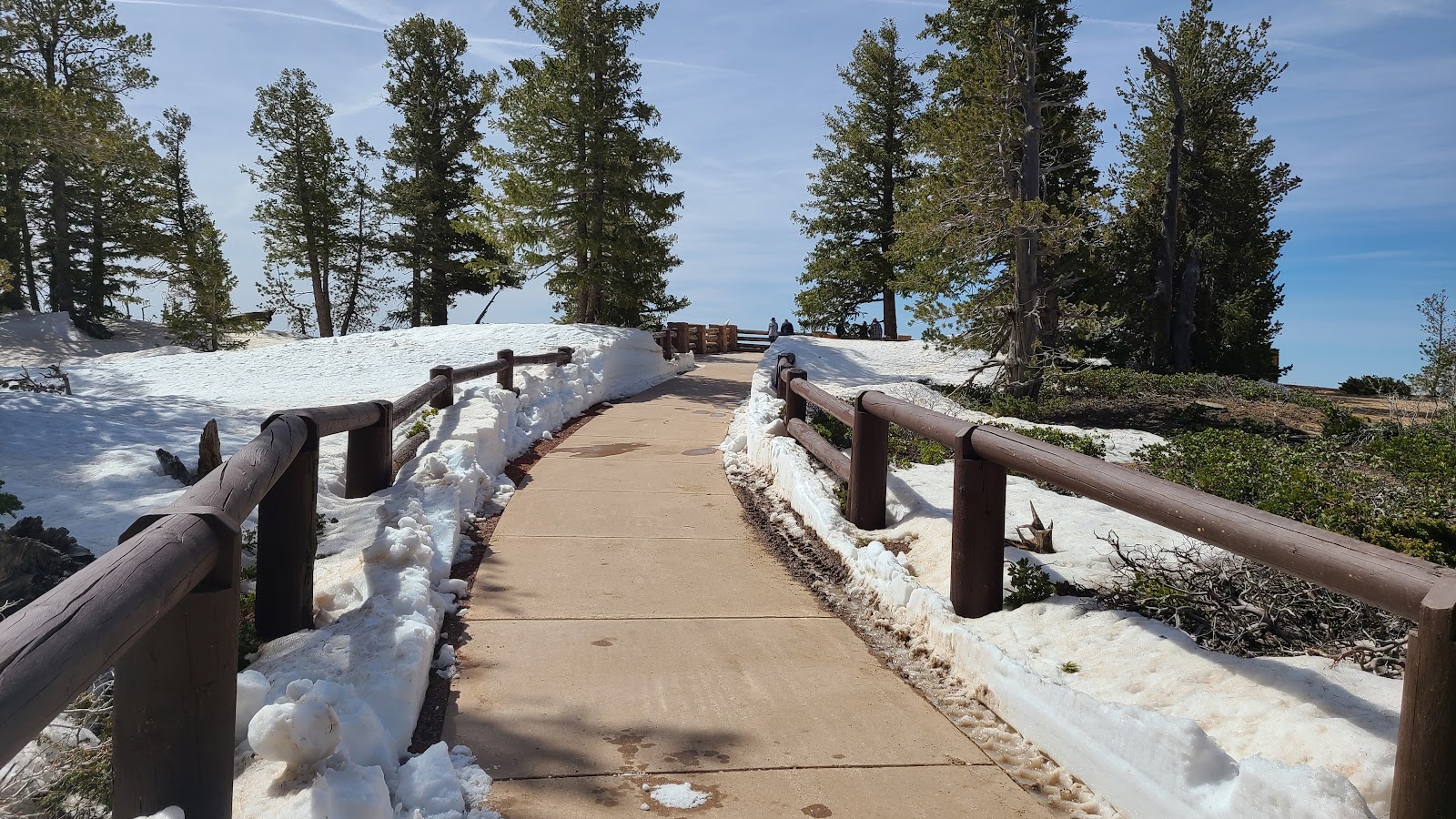 We are nearing the end of the walkway now.
 Views from Yovimpa Point.
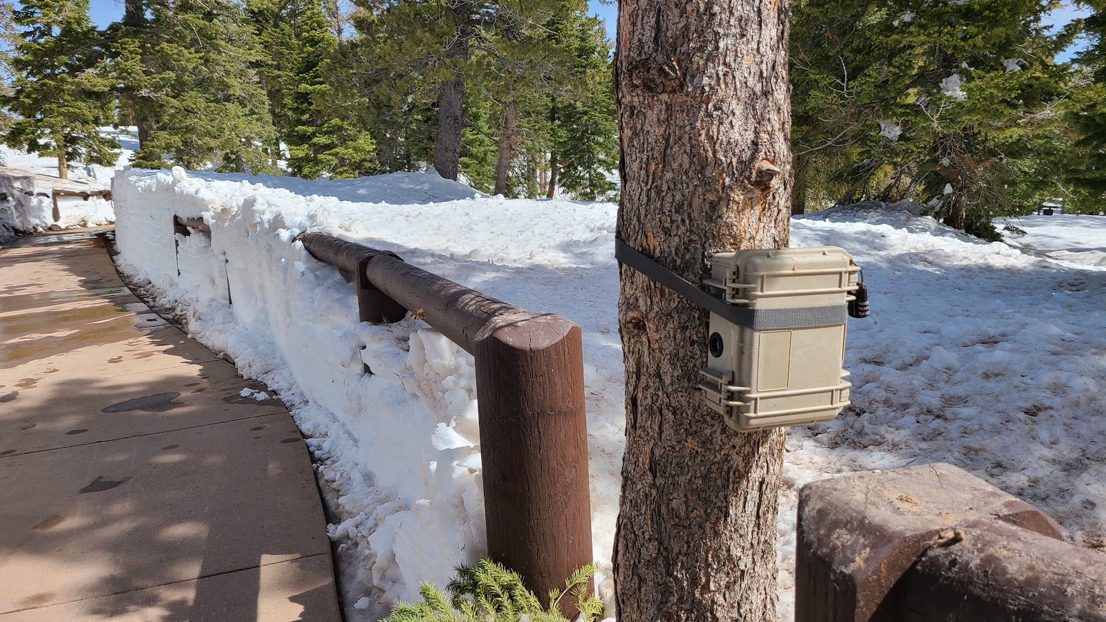 When returning to the parking lot we noticed this camera which counts visitors to this area.
 Time to head back down the road to more reasonable elevations.
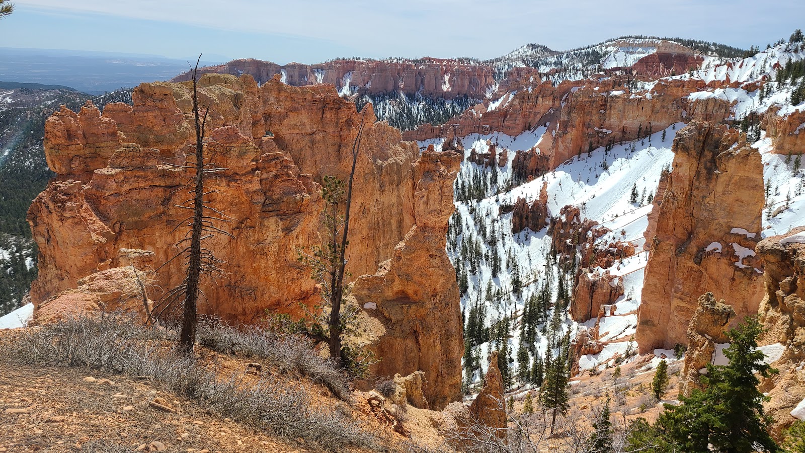
 Views from Black Birch Canyon (elevation 8750').
 One of several trails still closed near Ponderosa Point (elevation 8904').
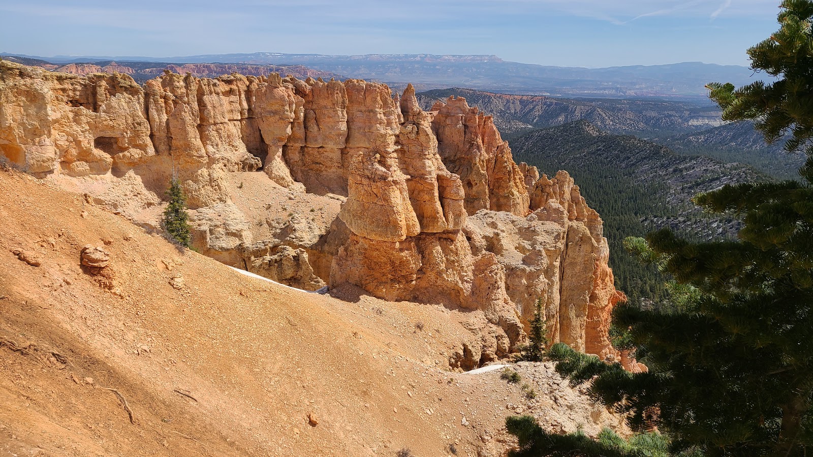
 The view from Agua Point (elevation 8800').
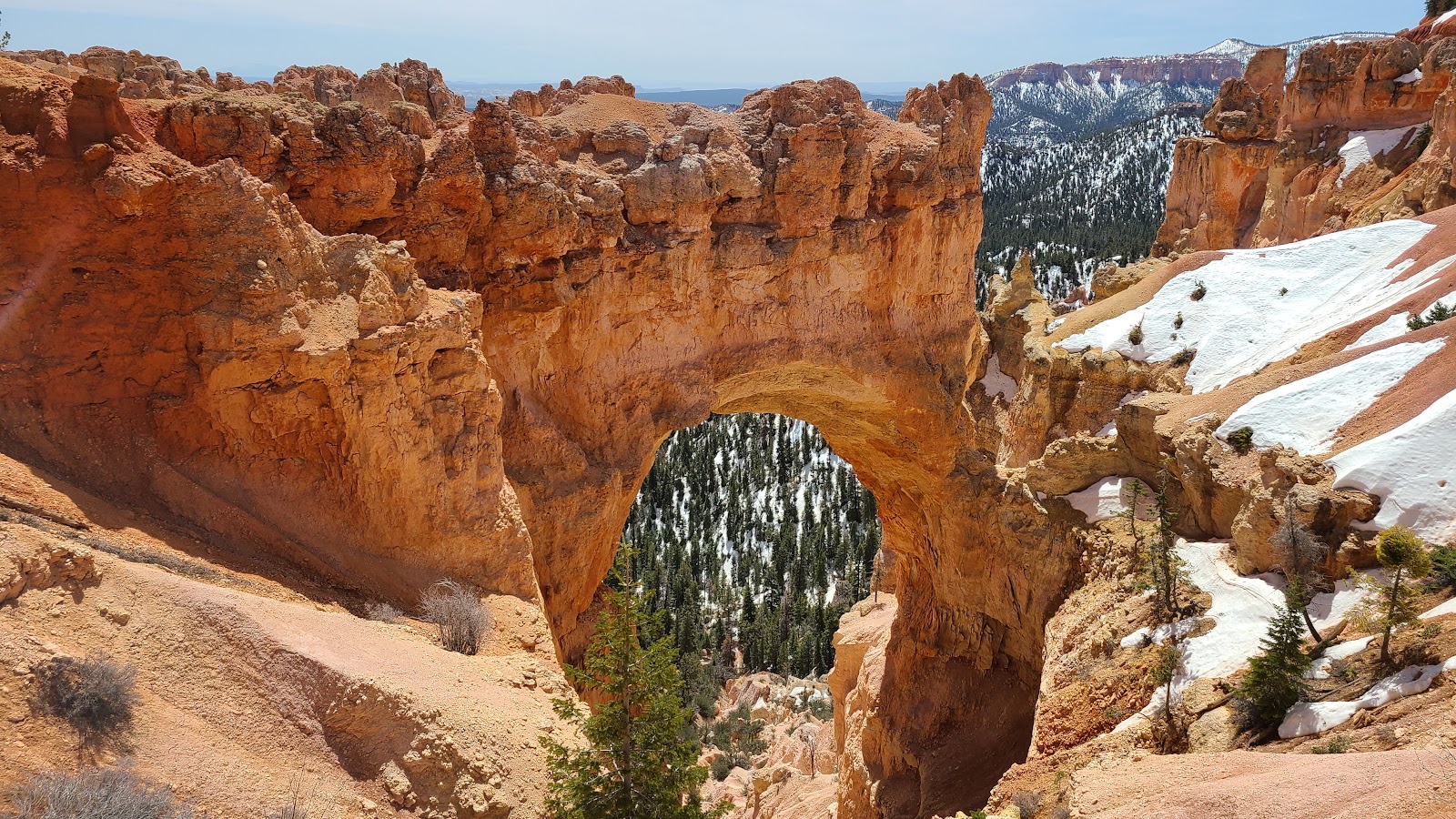
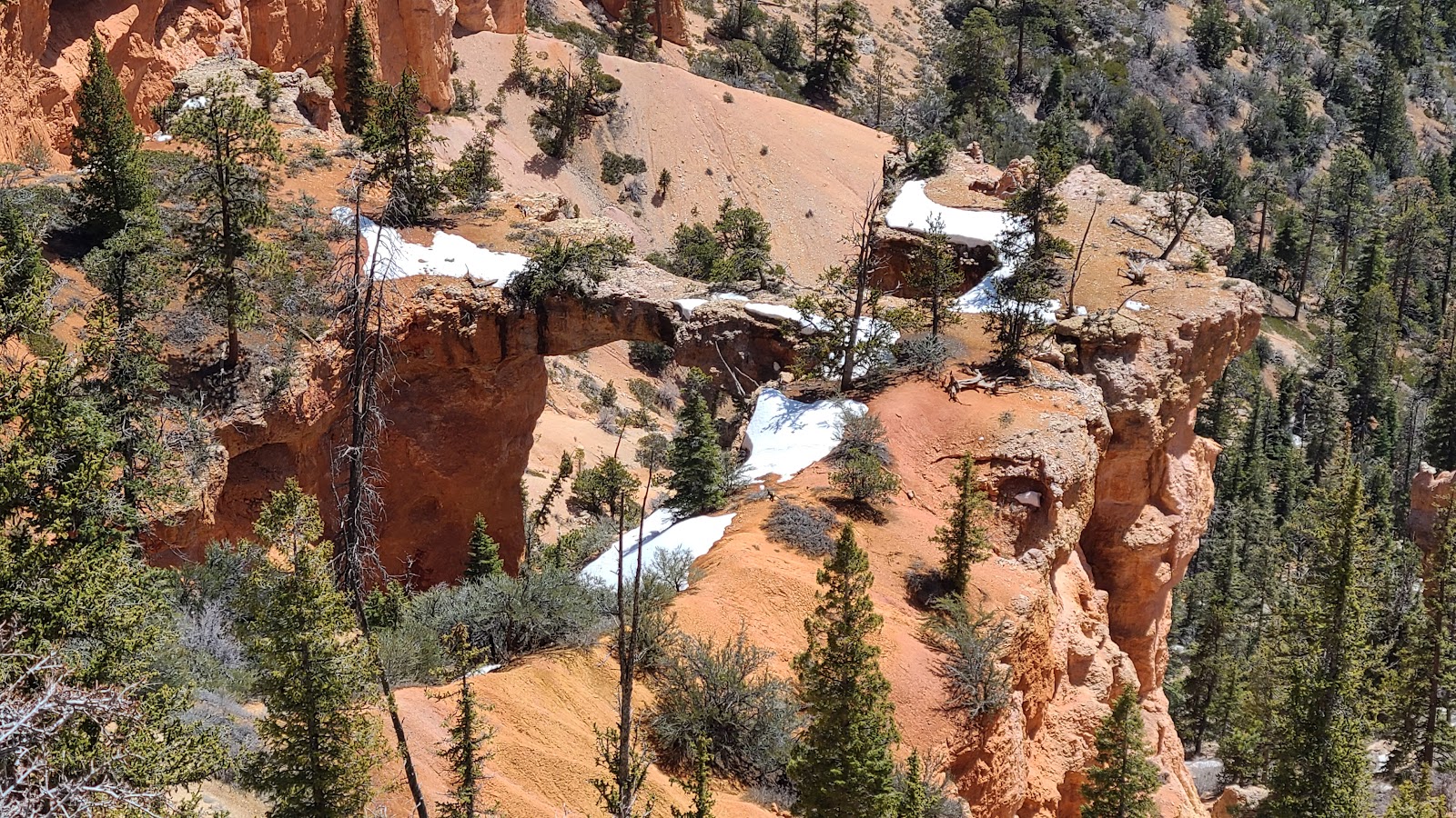
 Views of Natural Bridge (elevation 8627').
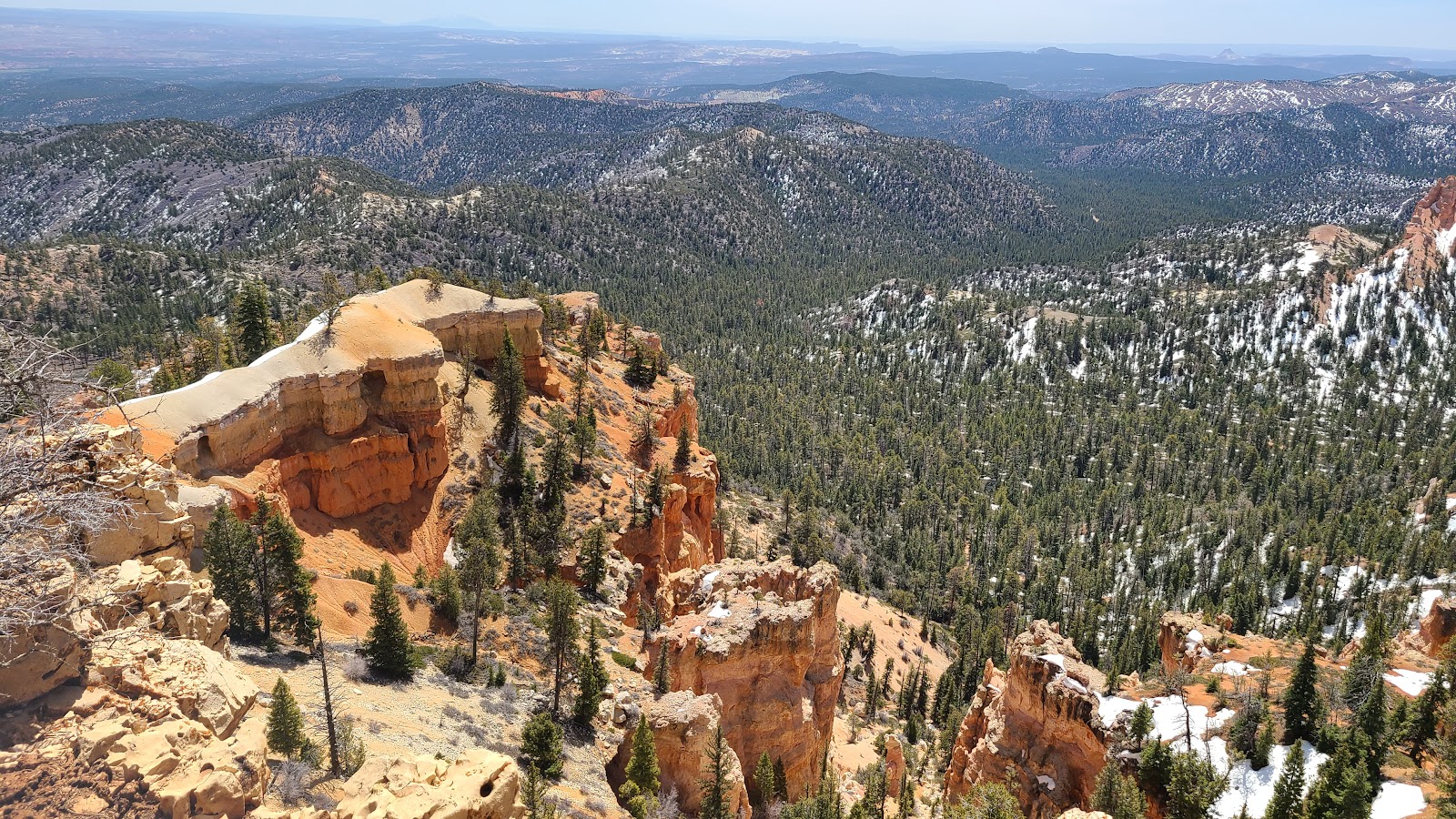
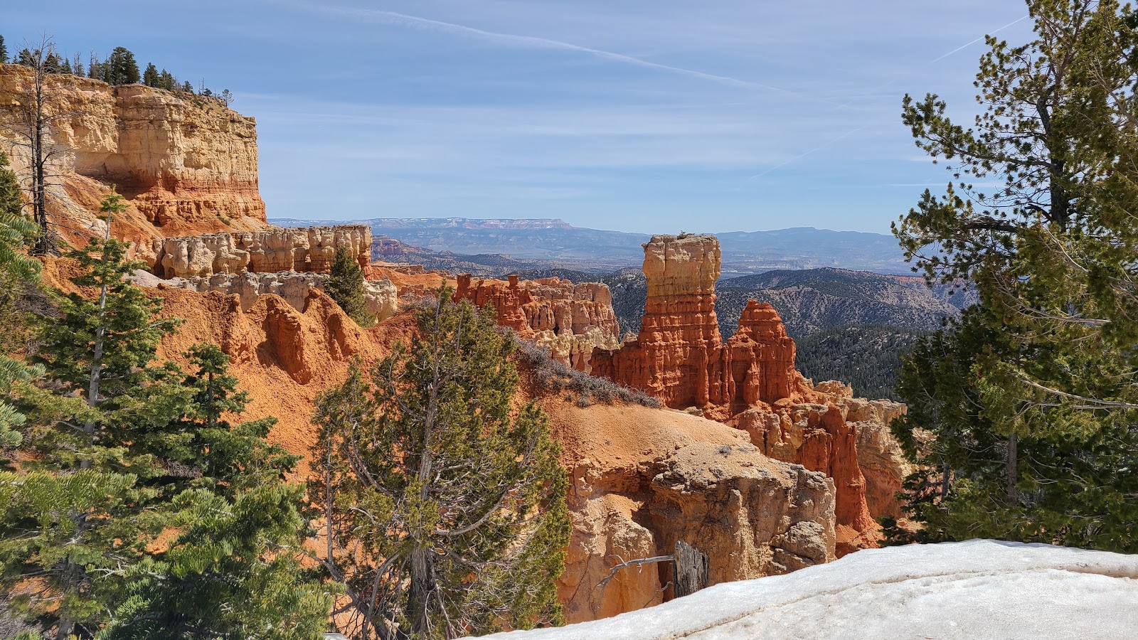
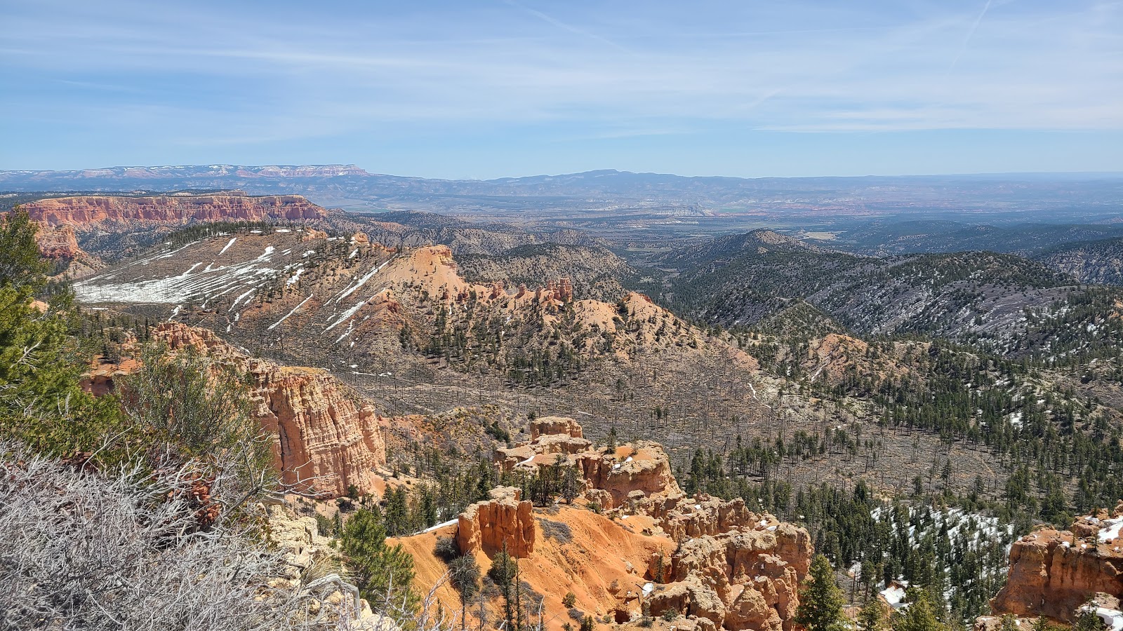
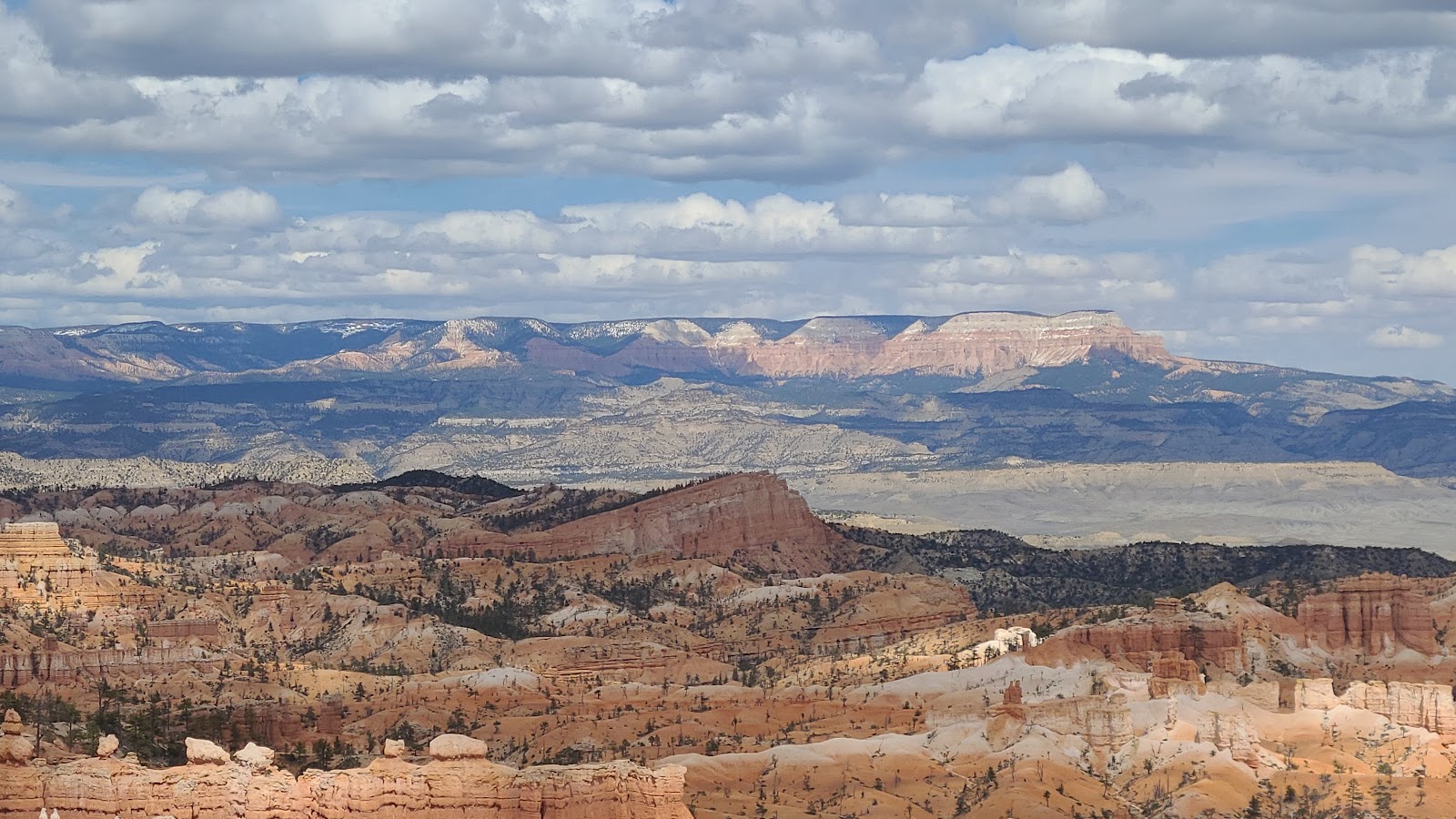
 Views from Farview Point (elevation 8819').
 Another smaller natural bridge can be seen in this photo.
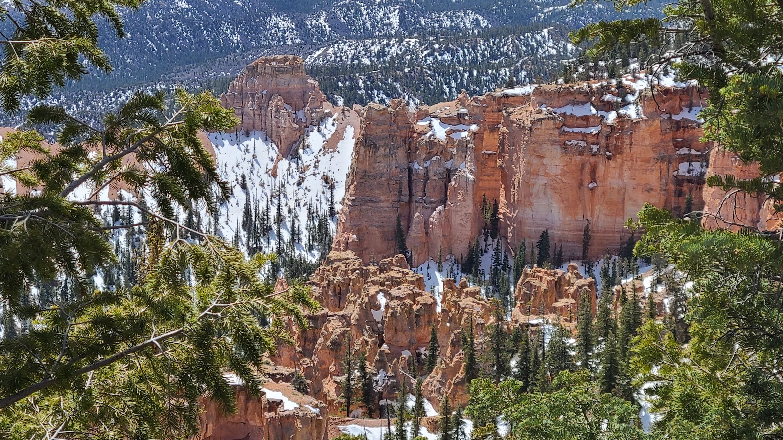
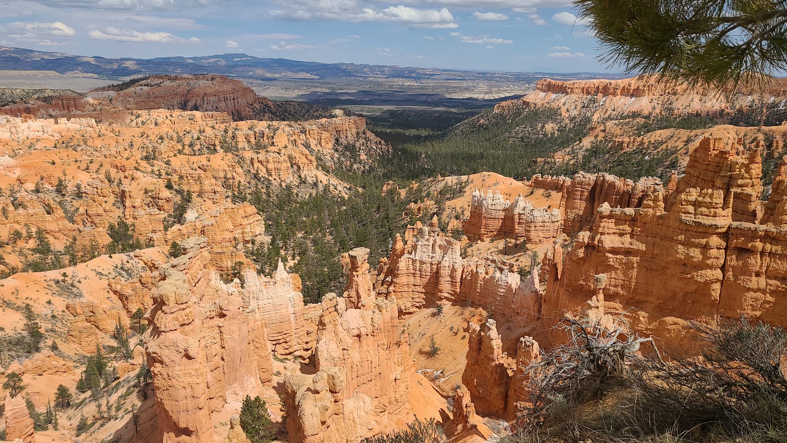
 Views from Piracy Point just a few yards from Farview Point.
TUESDAY - For once we took our own advice and didn't try to compete with the weekend crowds visiting the park.
So for the last three days we been enjoying our campsite and each morning we get up early (7:30AM) and try to get some chores done, mostly laundry, before everyone else is awake.
Today the crowds have returned to normal, in other words, not crazy busy, just plain busy. The National Parks in Utah are always popular with foreign visitors and we've spoken to several campground neighbors these past few weeks visiting from places like Belgium, Germany and Ireland.
Their story is always the same. They fly into Los Angeles, rent an RV, spend 3-4 weeks in the American West, before heading back to Los Angeles, return the RV and board a plane to head back home.
Shortly after an early dinner we hopped into ROVER and drove to three of the five more frequently visited viewpoints along the Bryce Canyon Amphitheater rim.
As usual we drove to the farthest viewpoint first and worked our way back to the campground. Today's viewpoints aren't quite as high in elevation as the ones we did on Friday (9100' - 8600'), but they are still all between 8300' - 8100'.
PART 1
OF THE
BRYCE CANYON AMPHITHEATER VIEWPOINTS
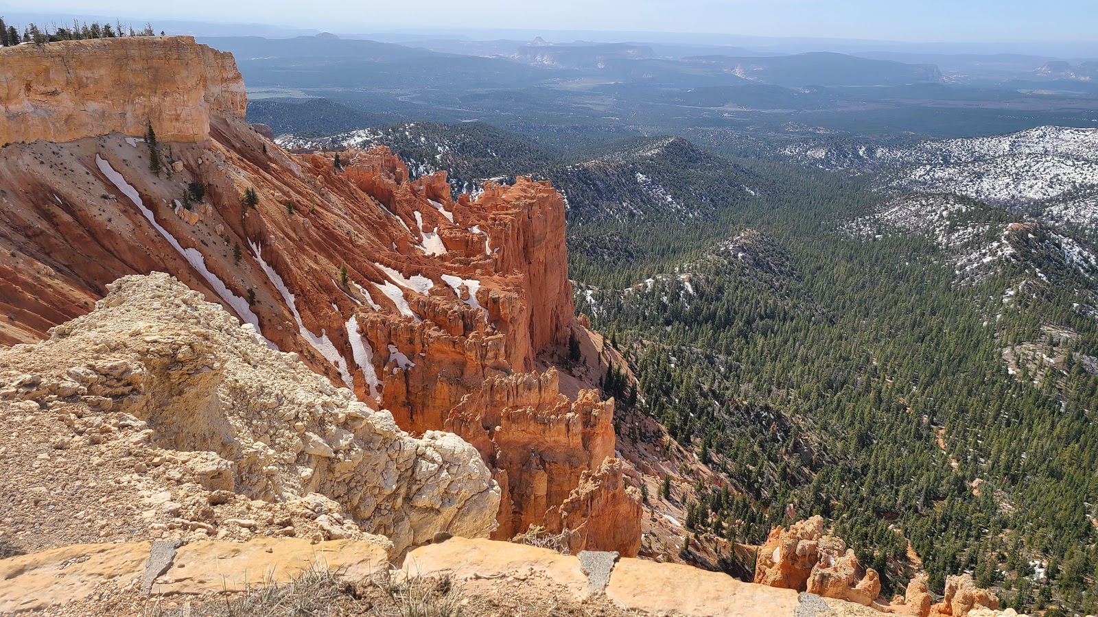
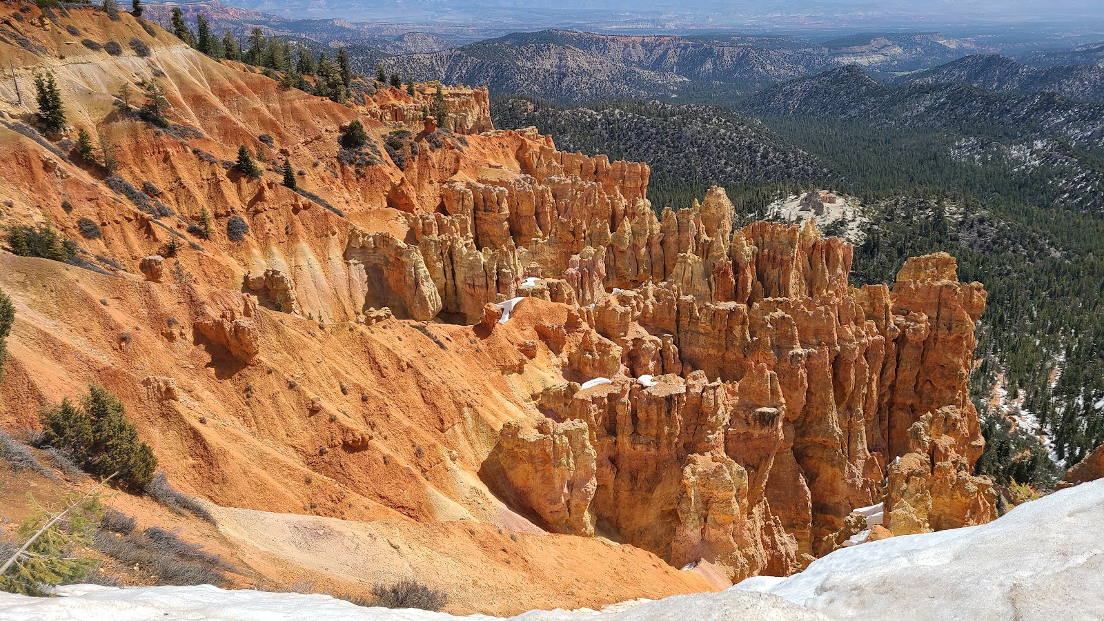
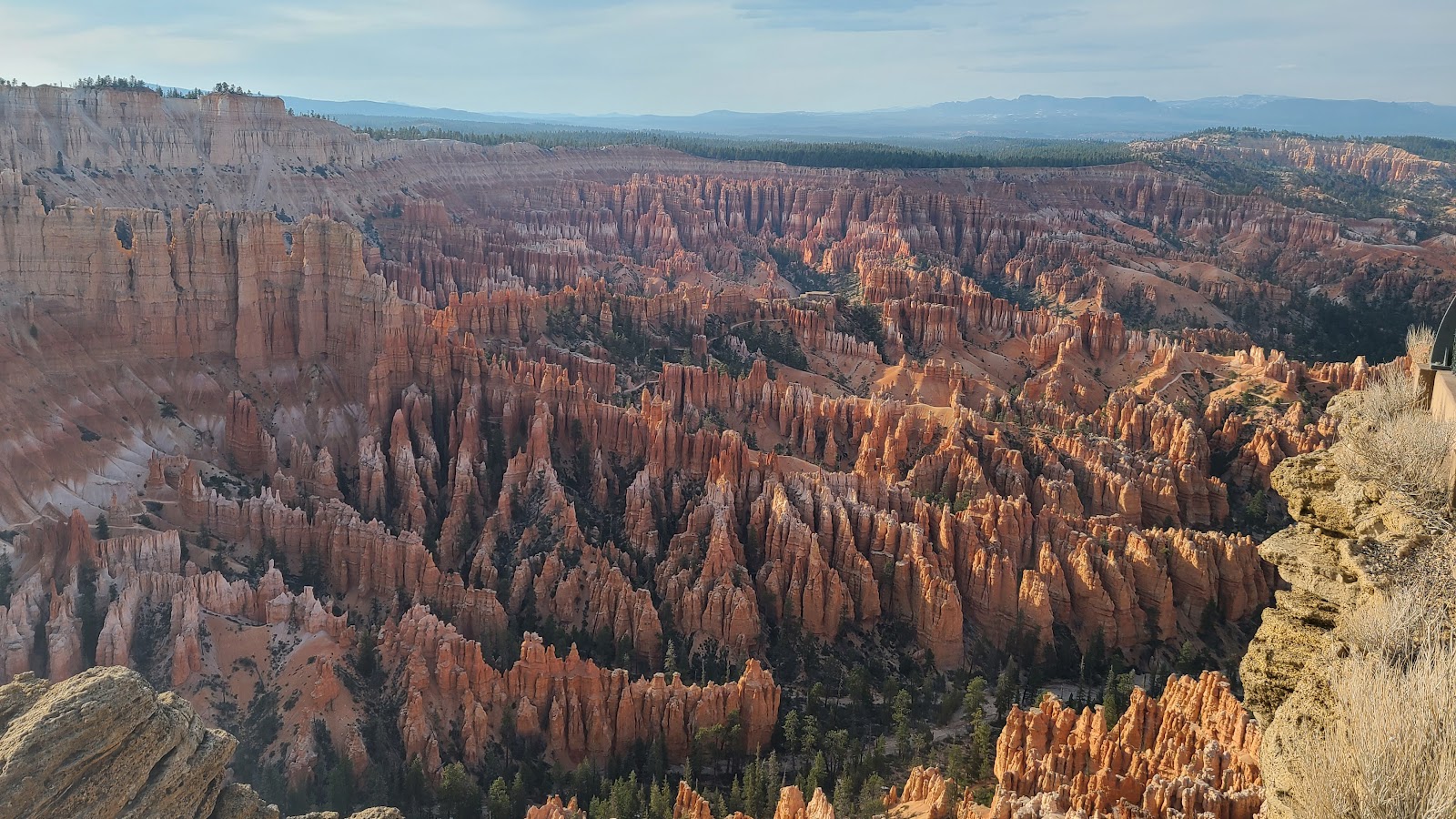
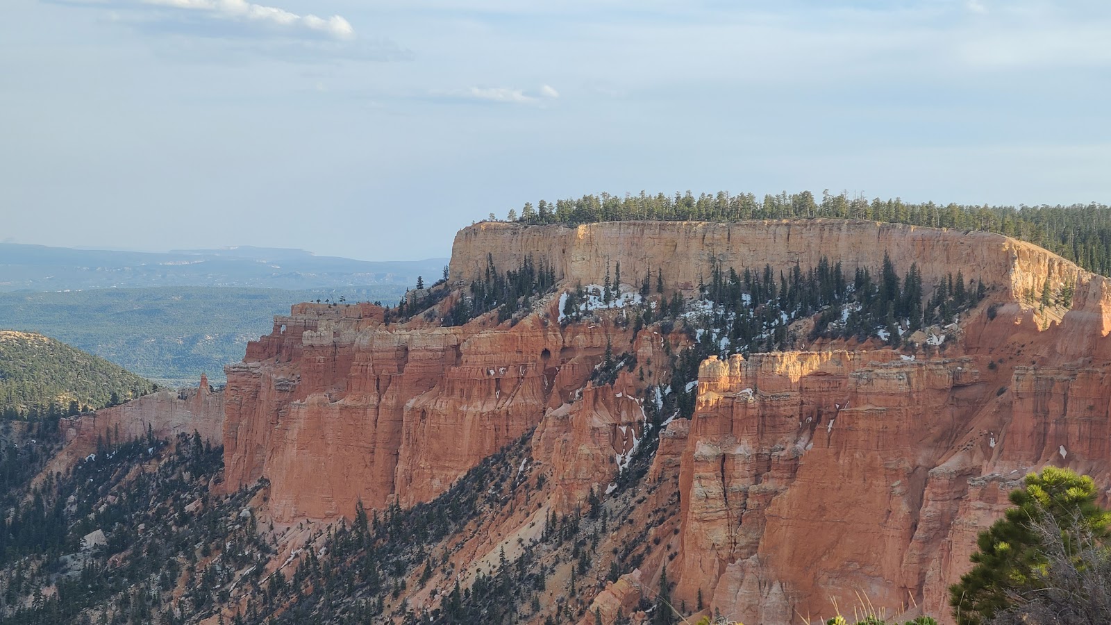
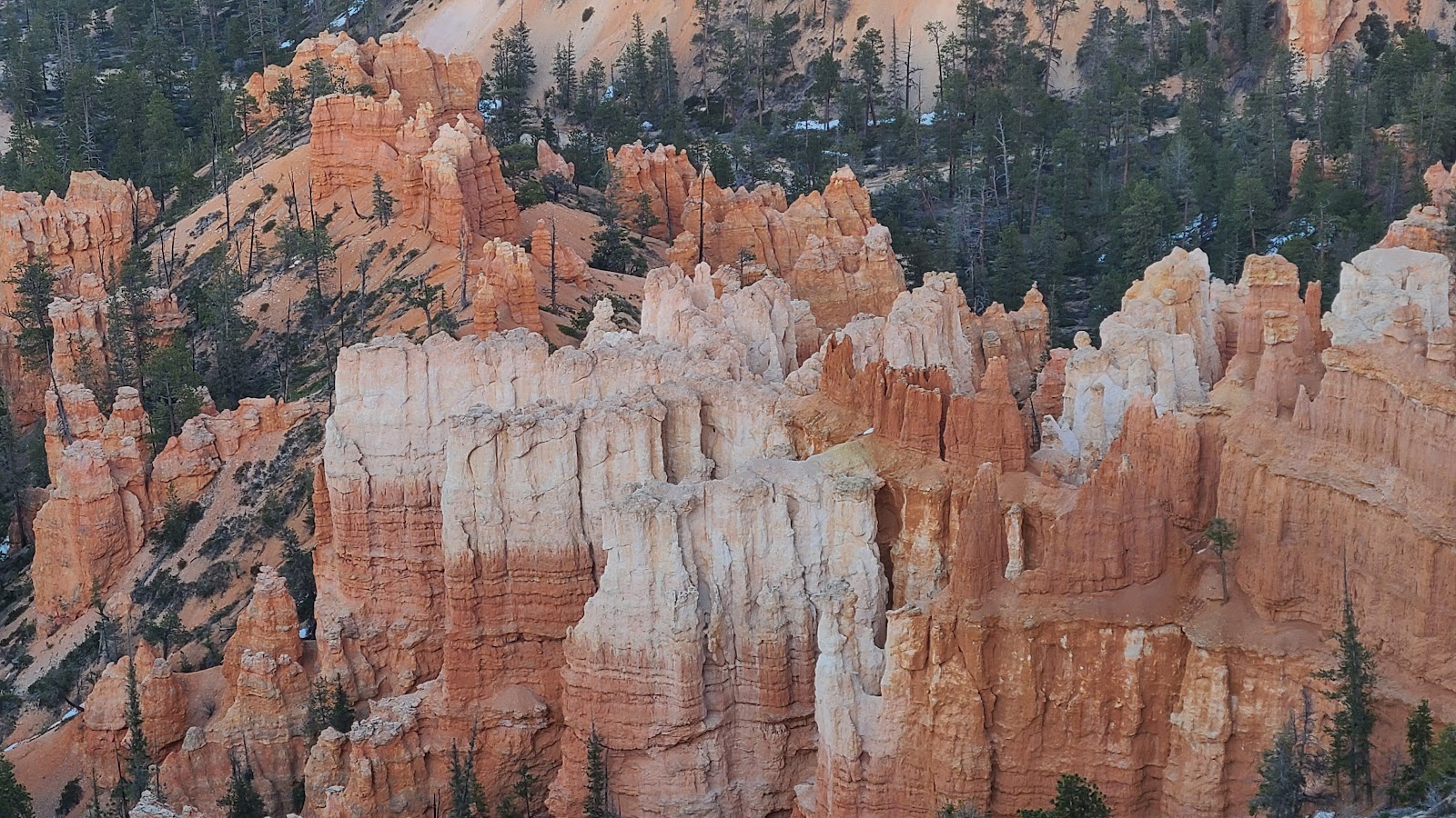
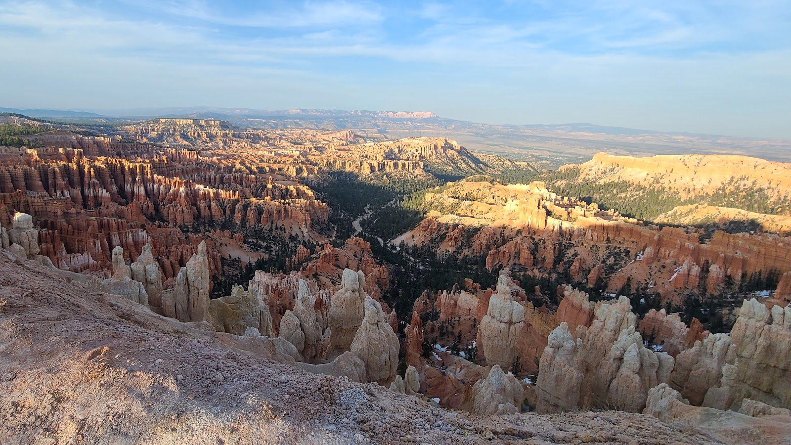
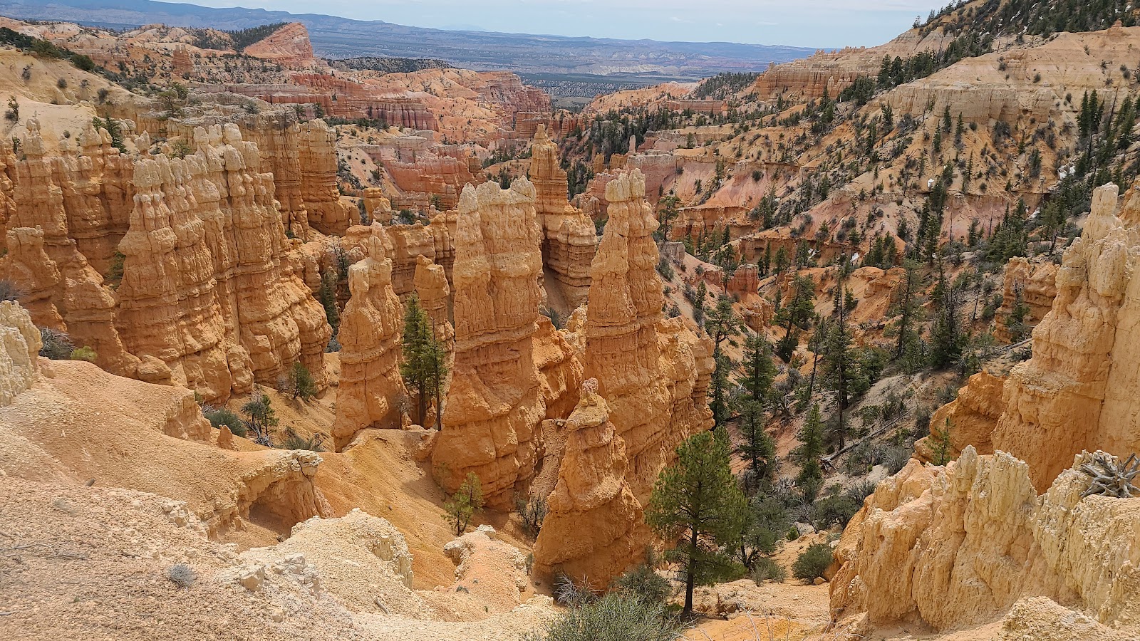
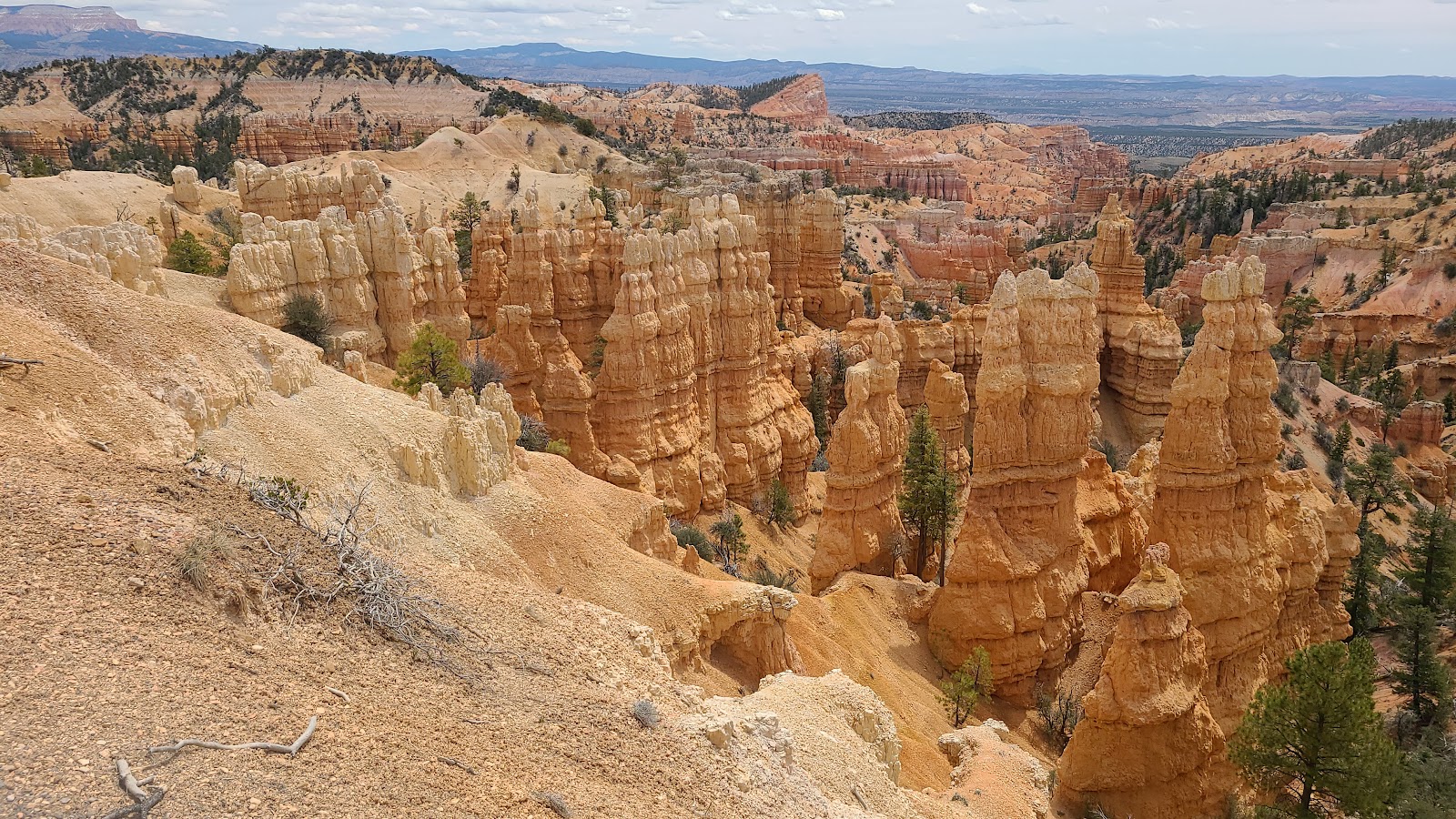
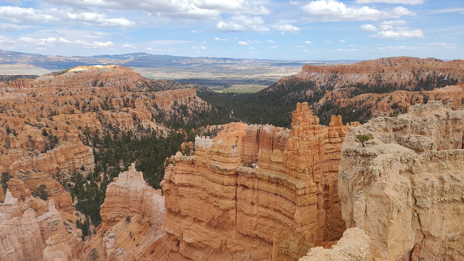
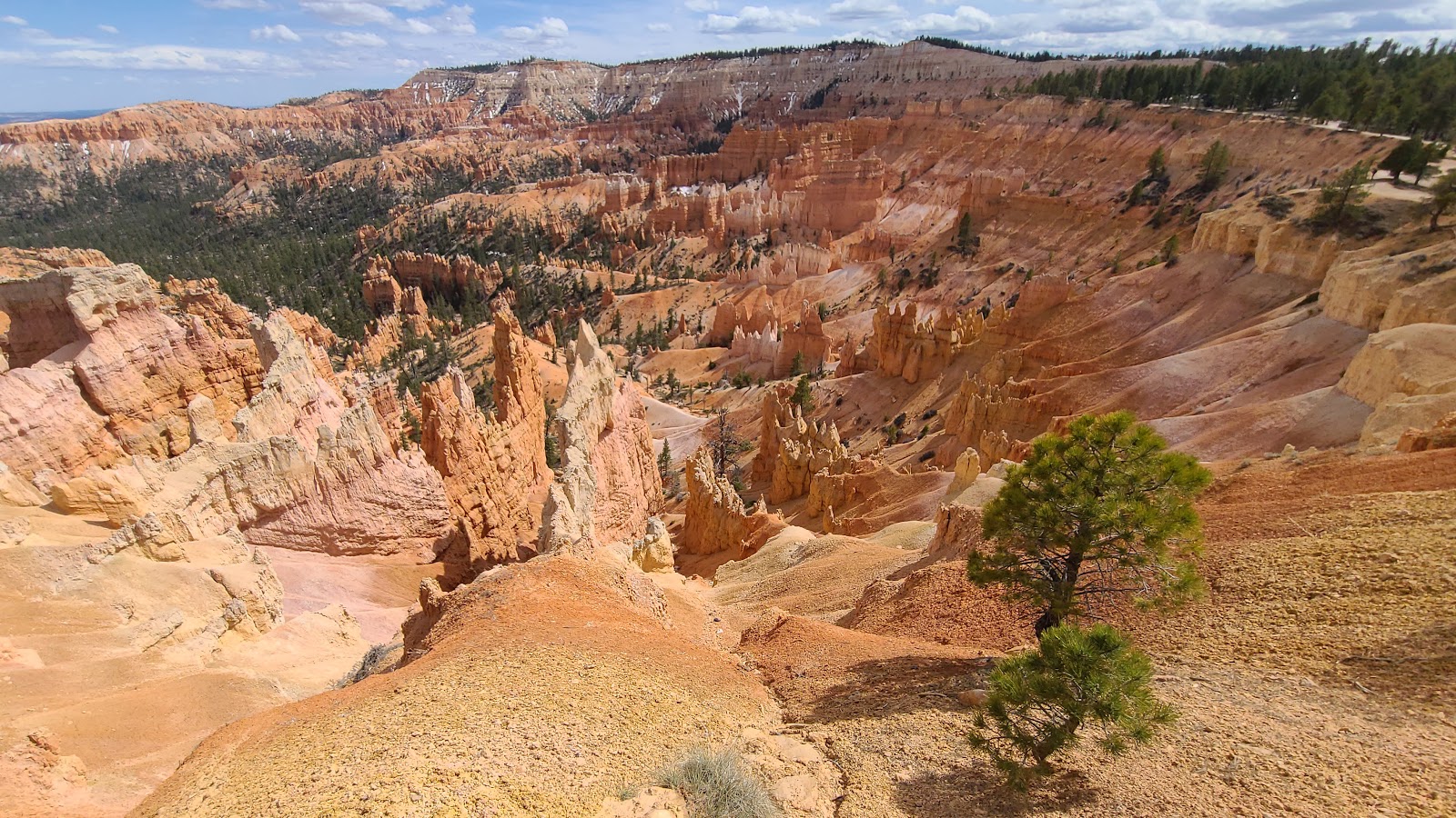
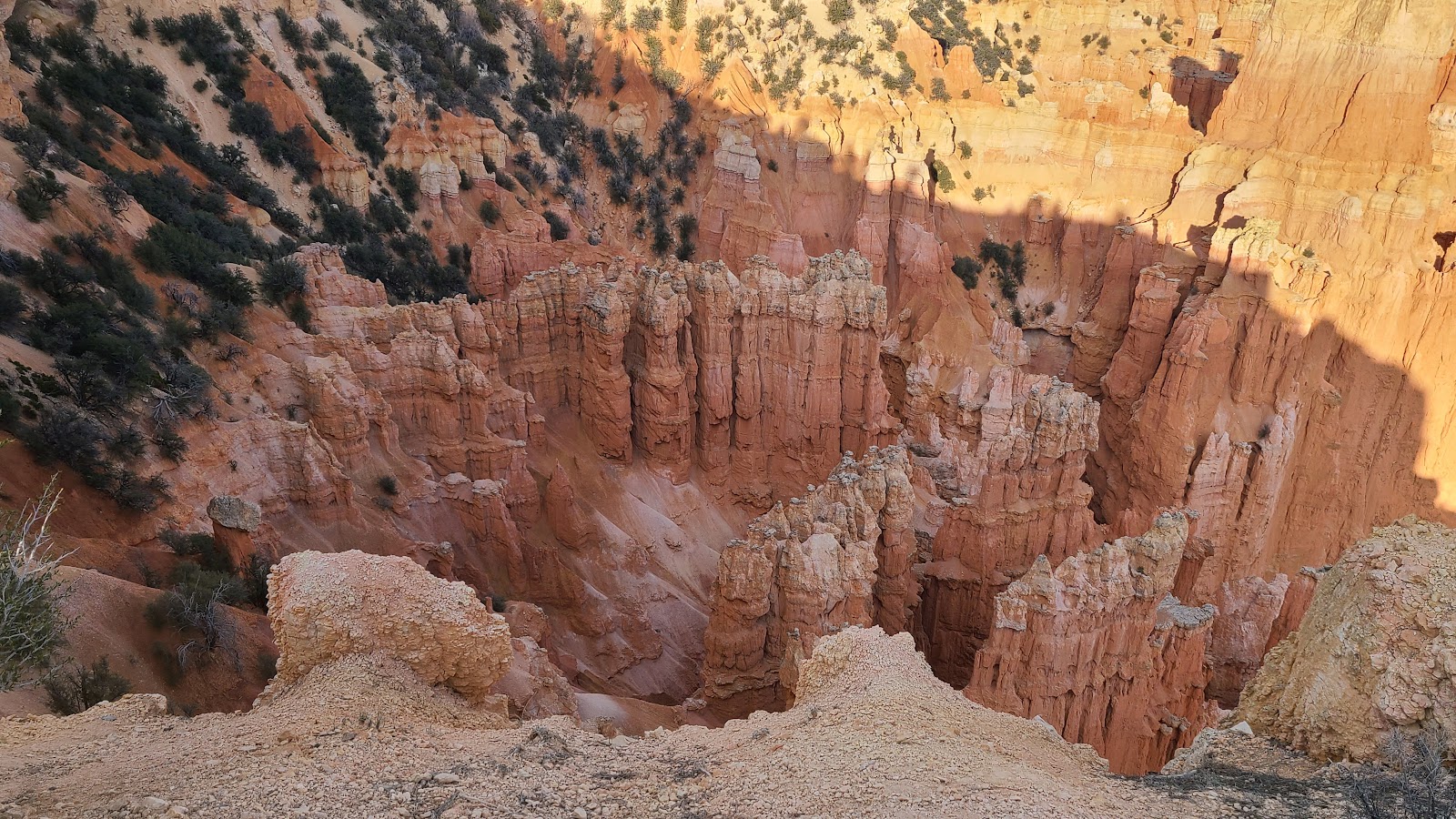
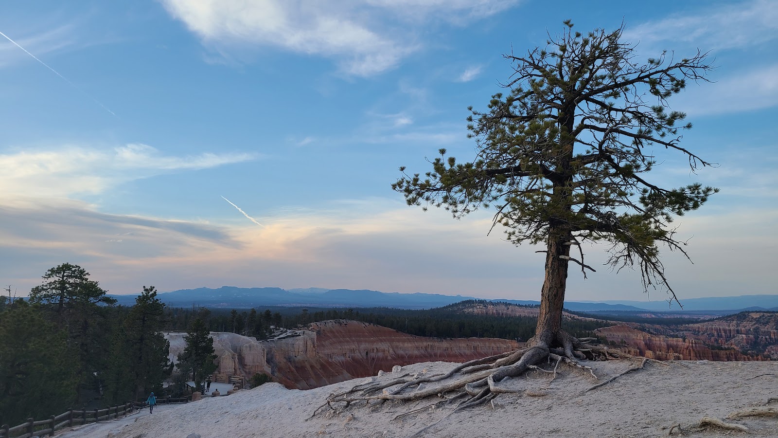
 First up is Bryce Point at an elevation of 8296'.
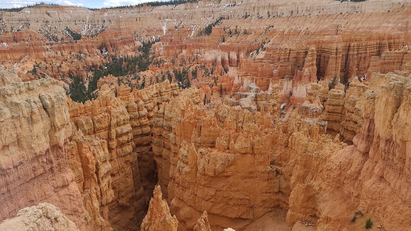
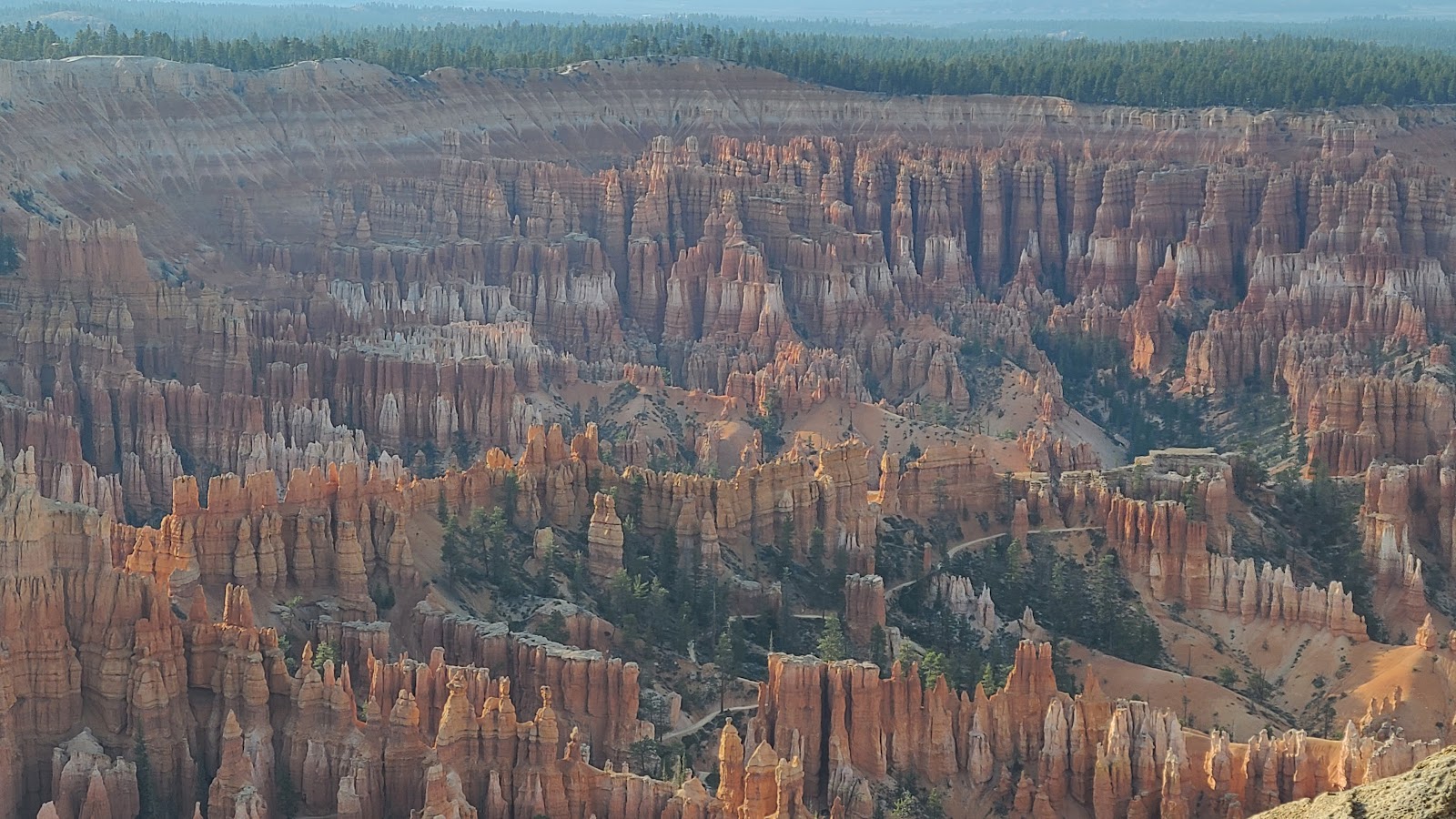
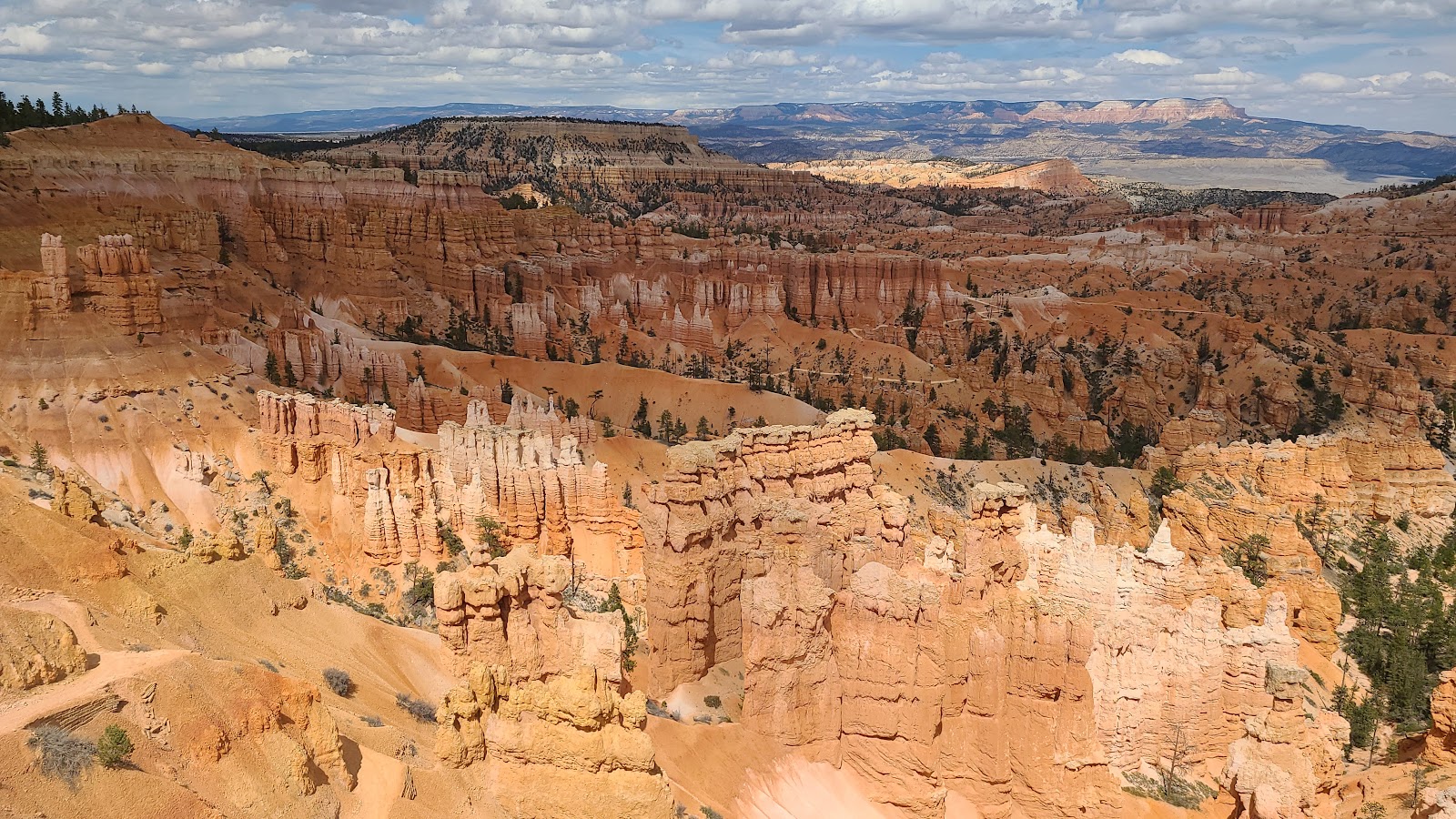
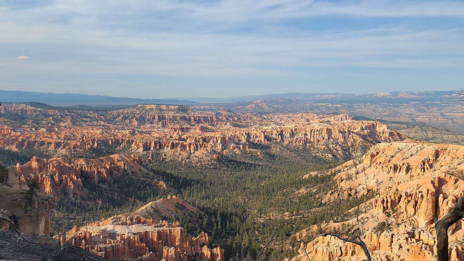 From up here you can see the entire Bryce Canyon Amphitheater.
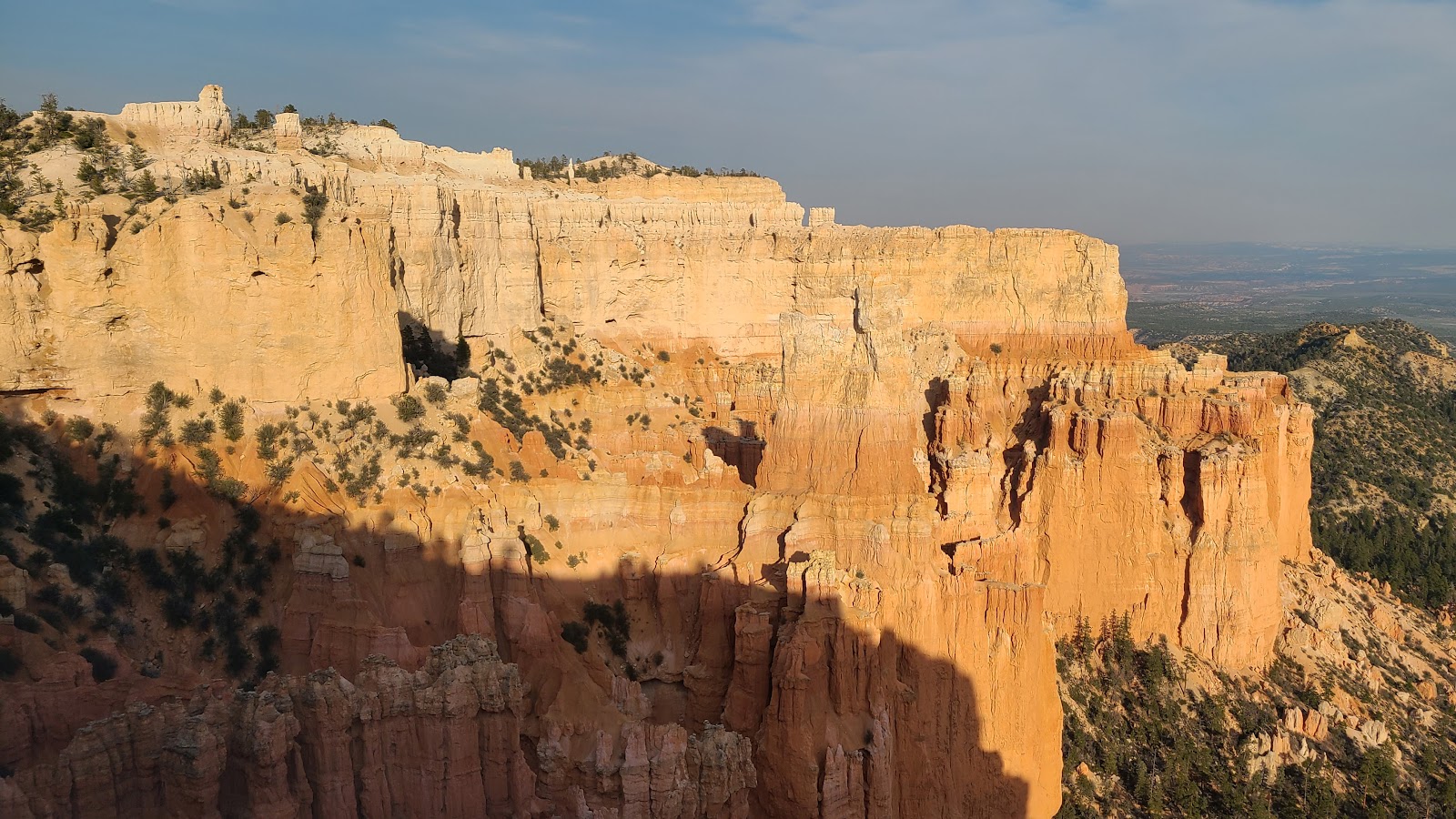
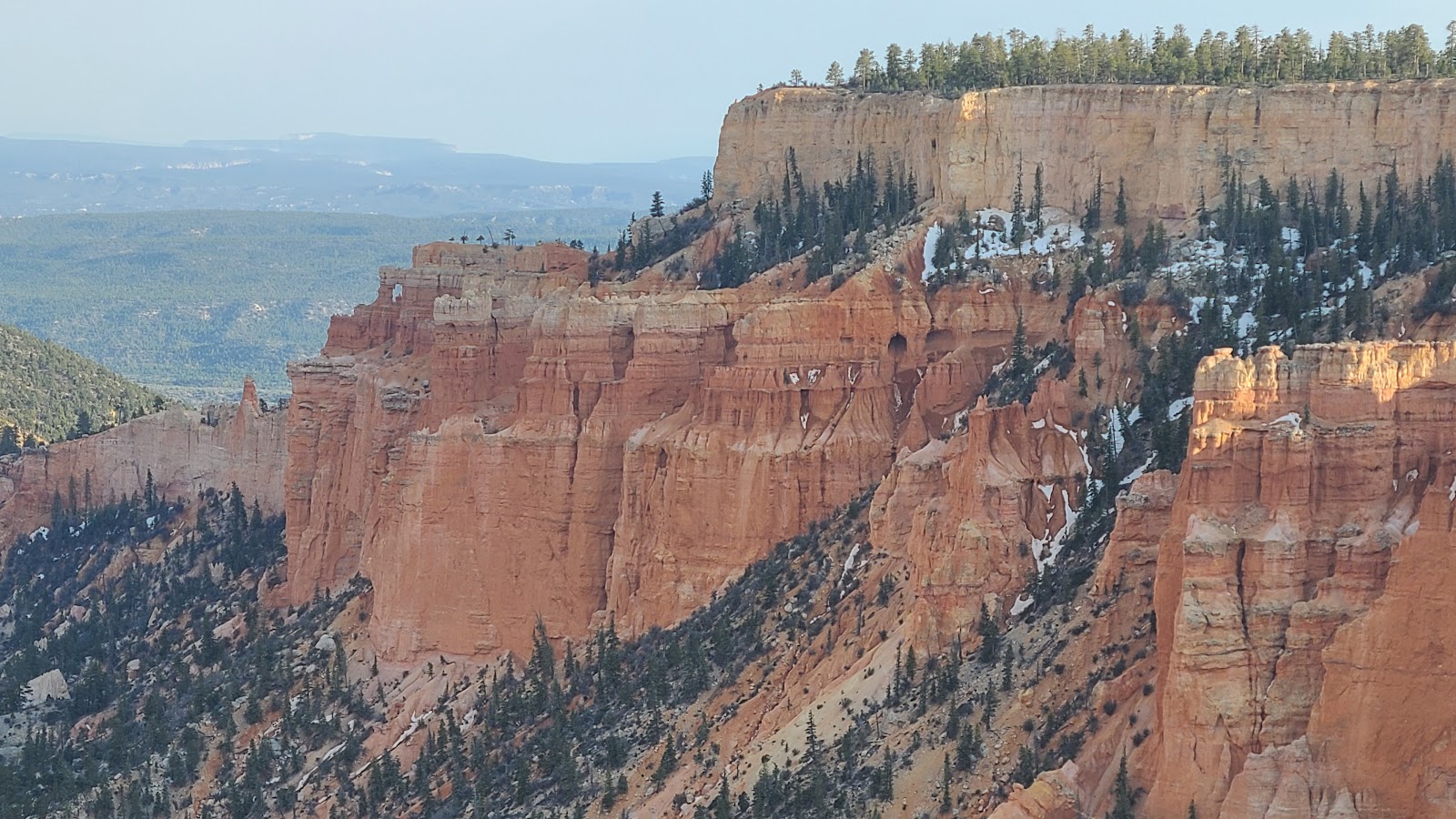
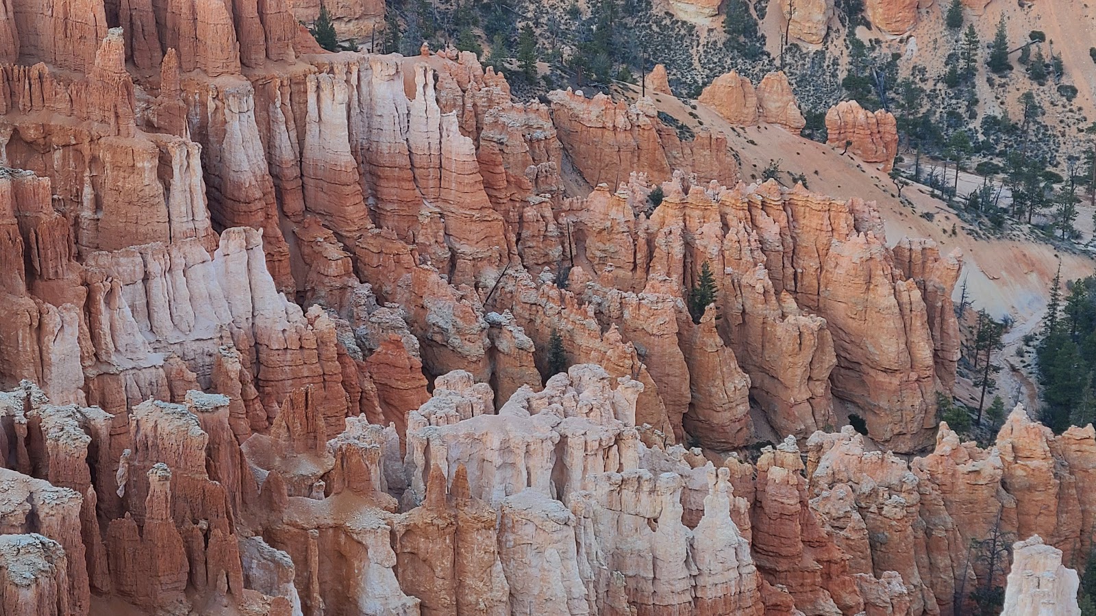
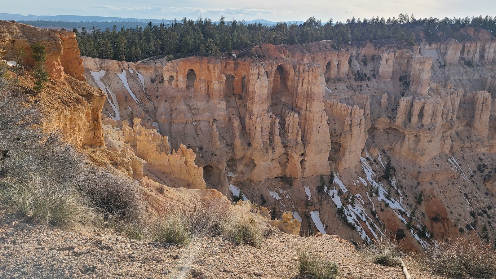 This wall is different than the rest, it contains large arch shaped areas of erosion.
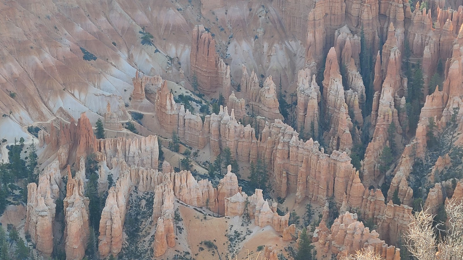
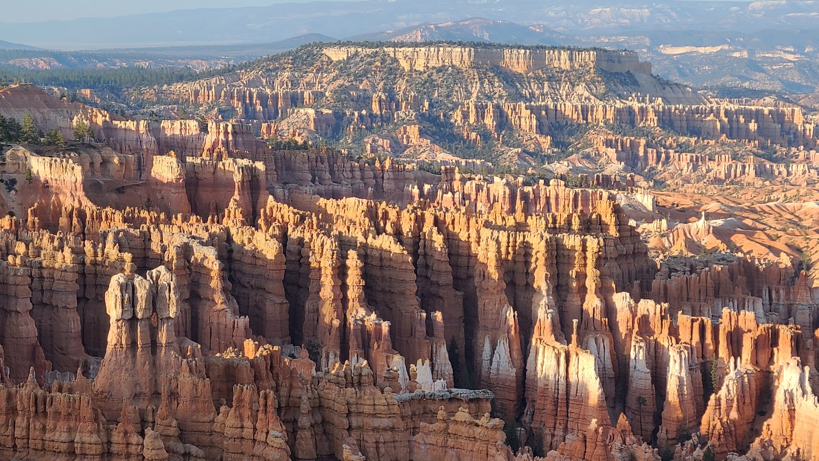
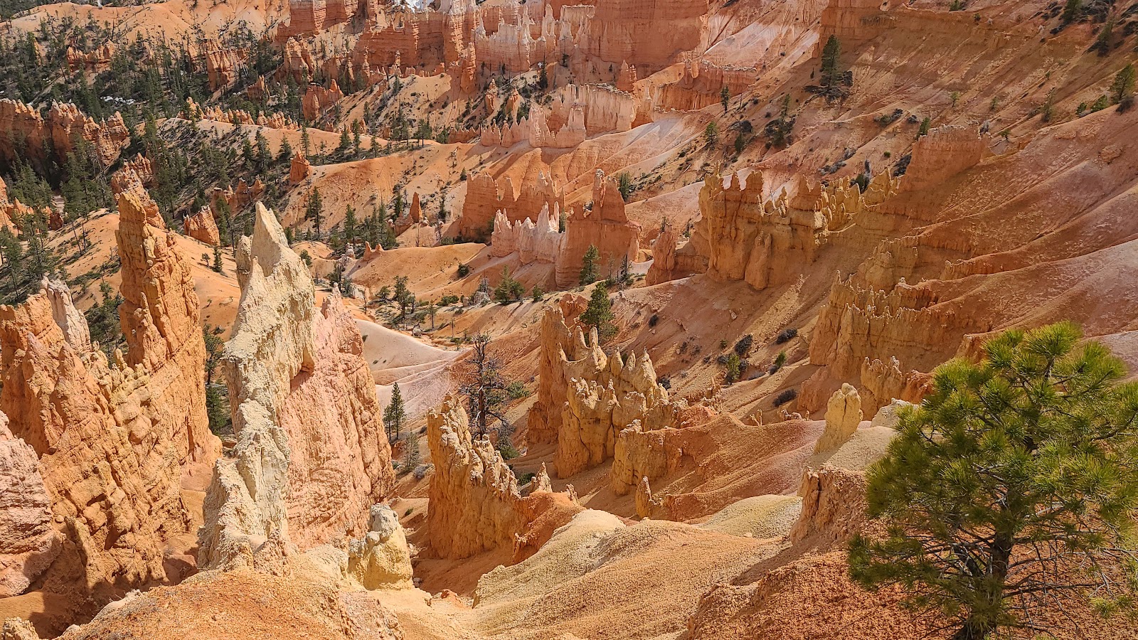
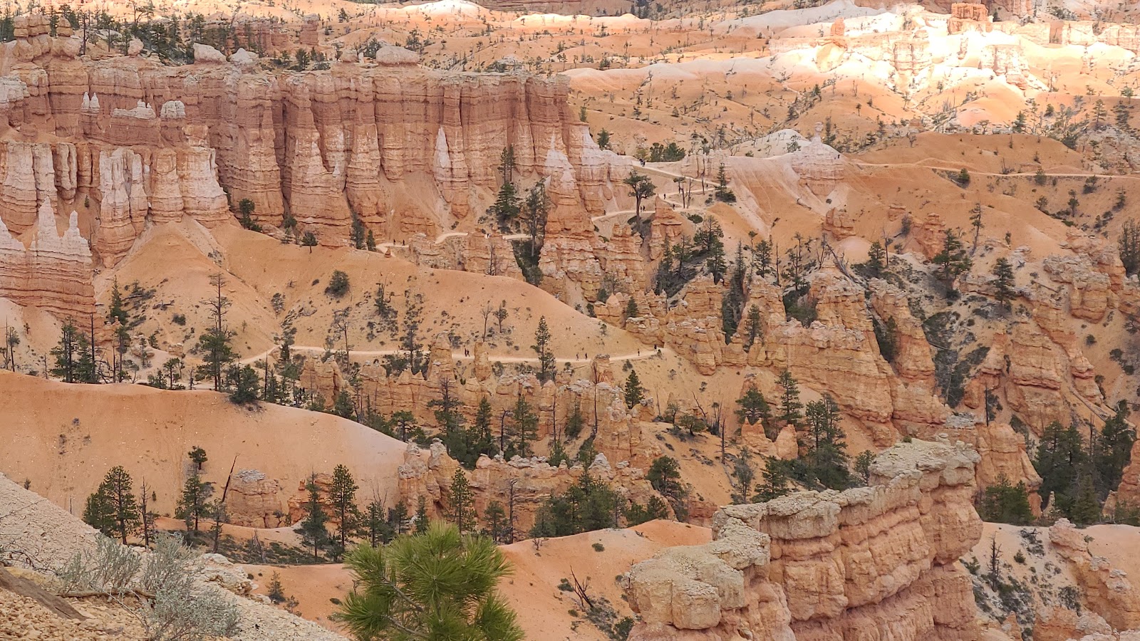
 Far below are the "hoodoos" the park is famous for.
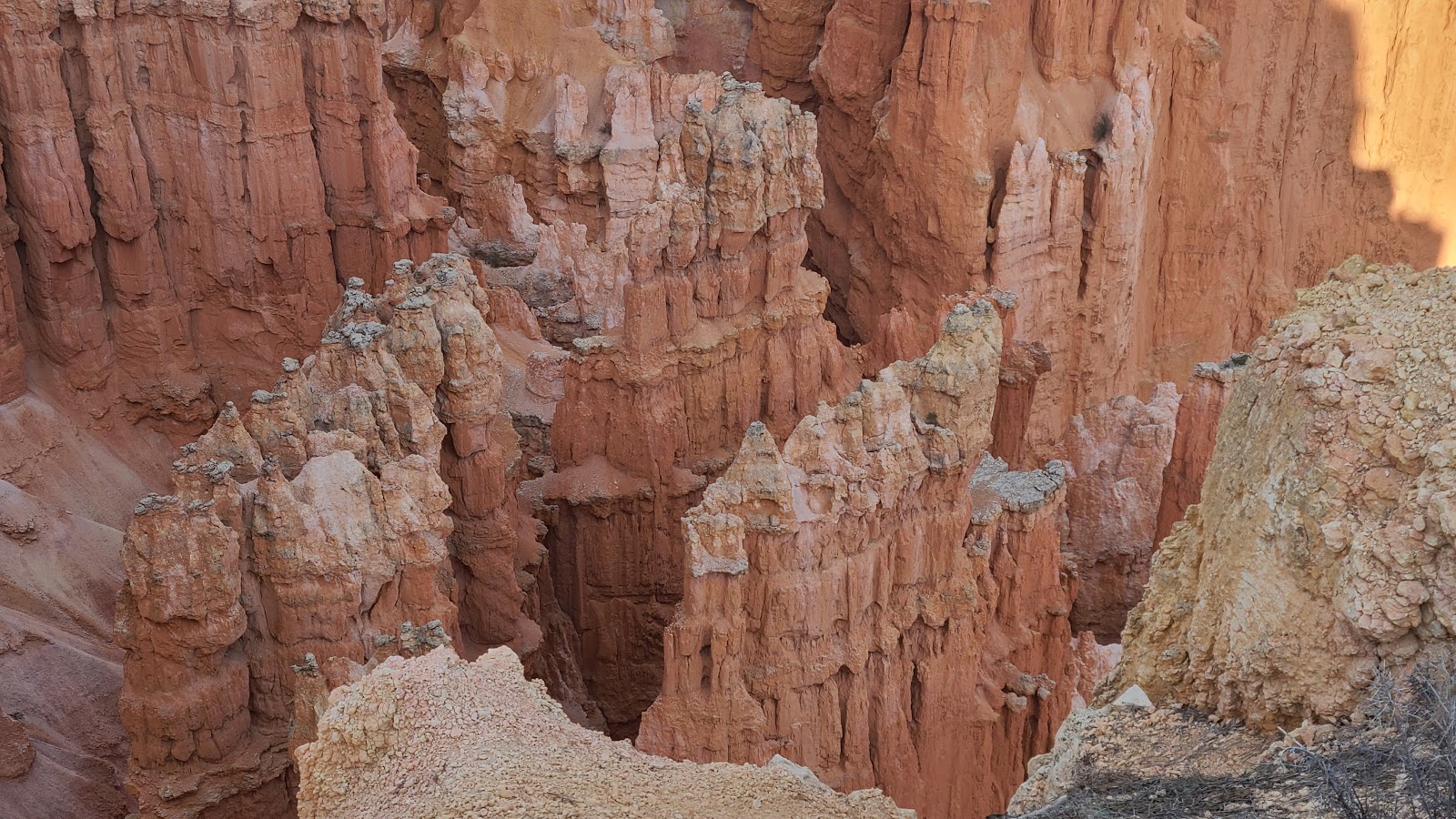
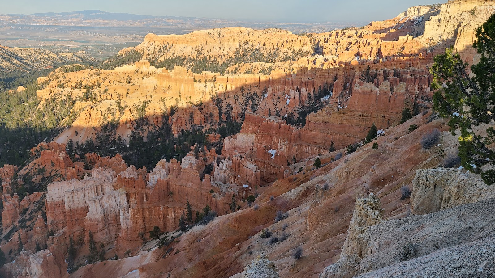
 There are even a few smaller natural bridges in this area.
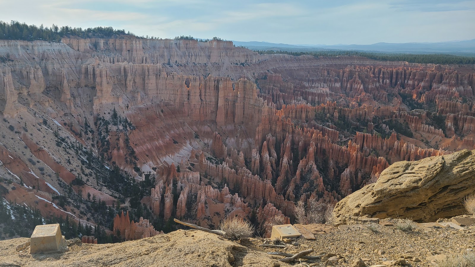
 You can just barely make out one of the hiking trails on the canyou floor.
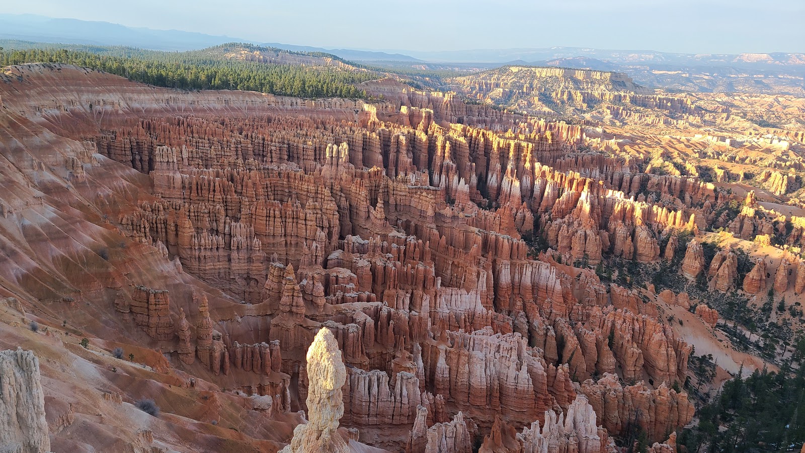
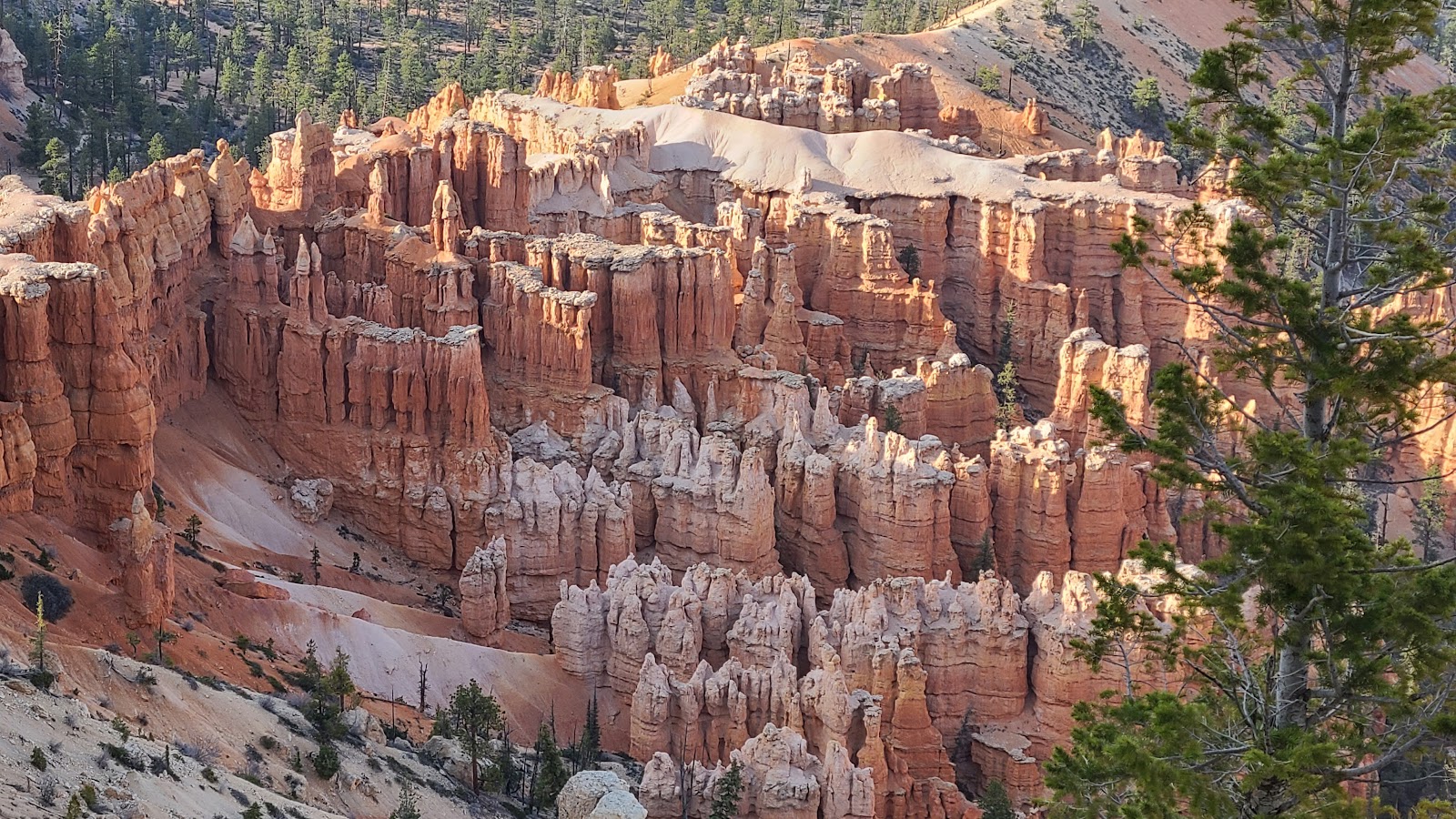 This is one of my favorite photos. We caught the setting sunlight just right.
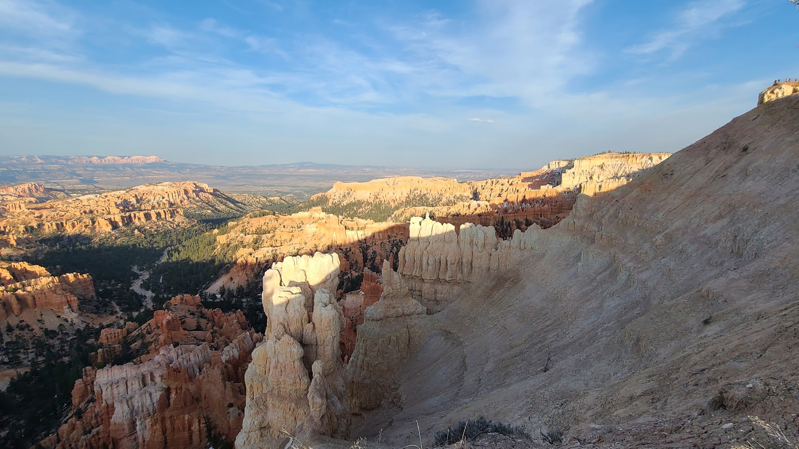
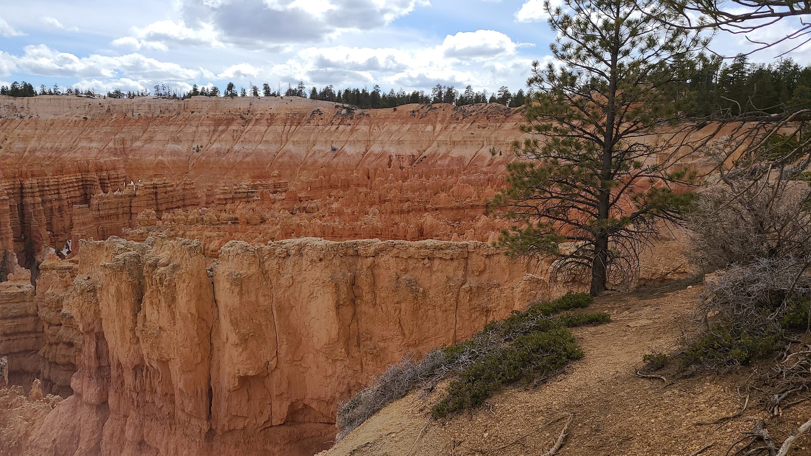
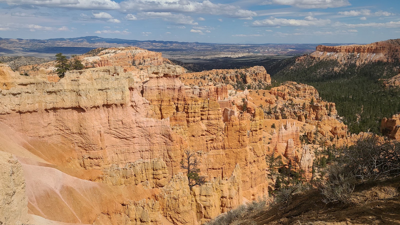
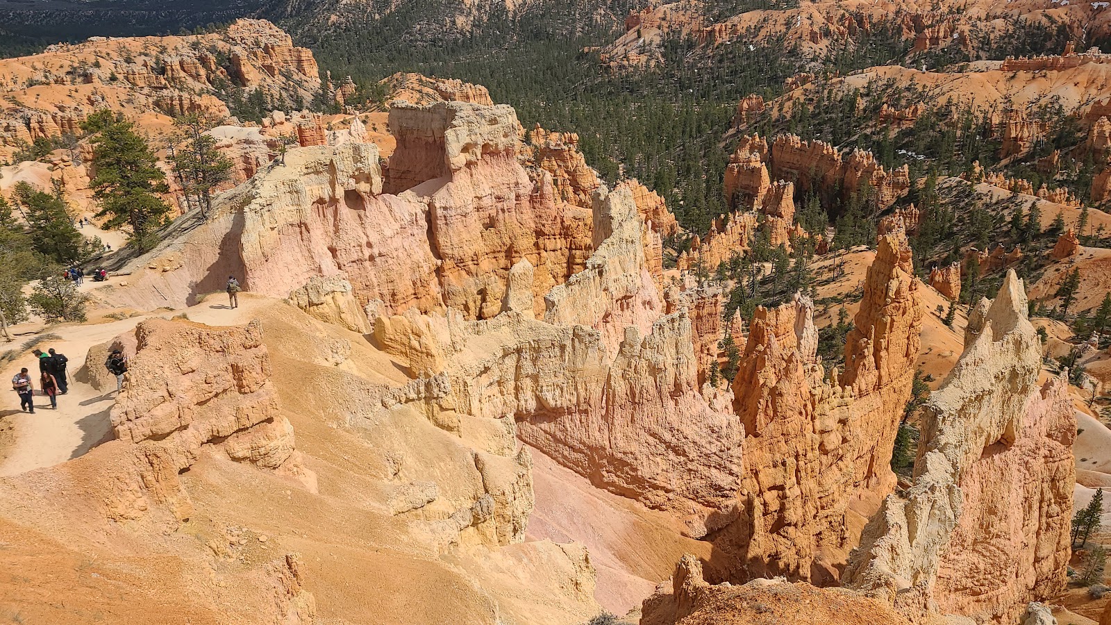
 This is the pathway out to Paria View (elevation 8176').
 It has a smaller canyon on the outside of the Amphitheater.
 It still boasts a beautiful view of more hoodoos.
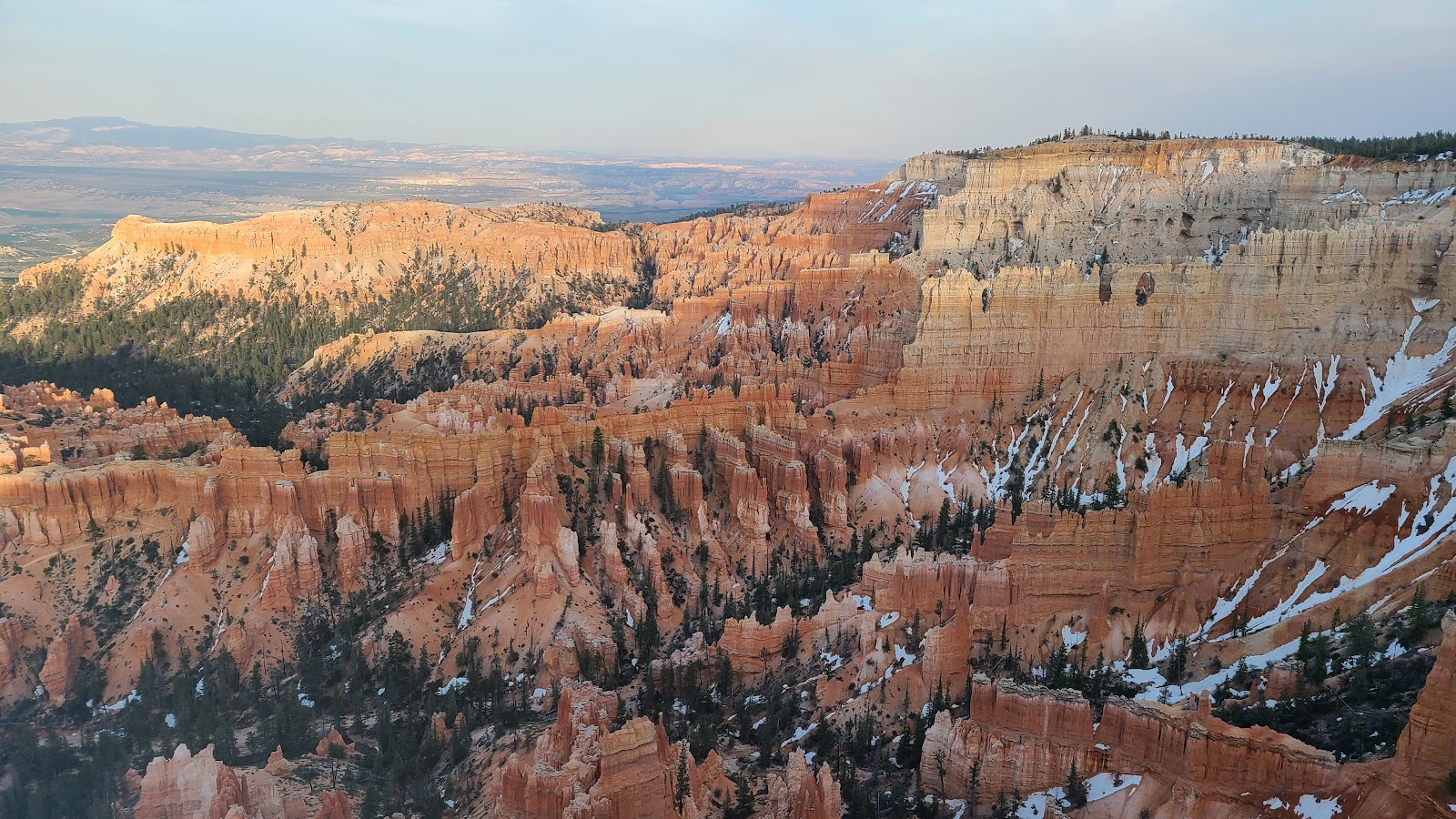
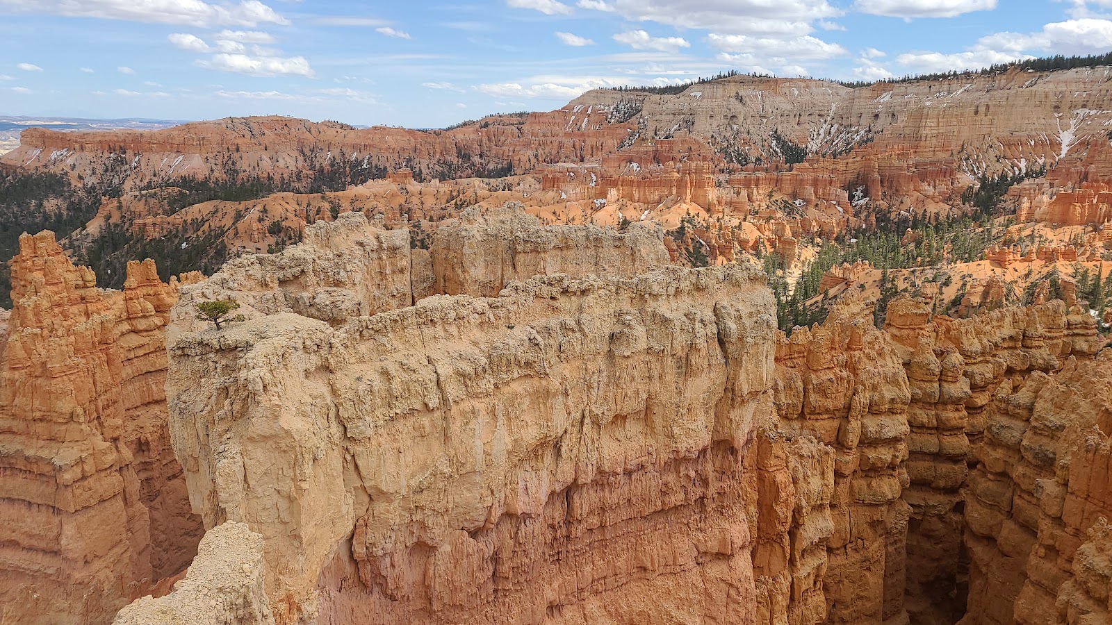
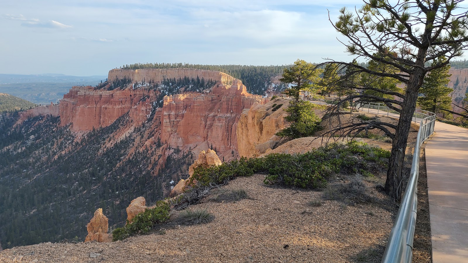
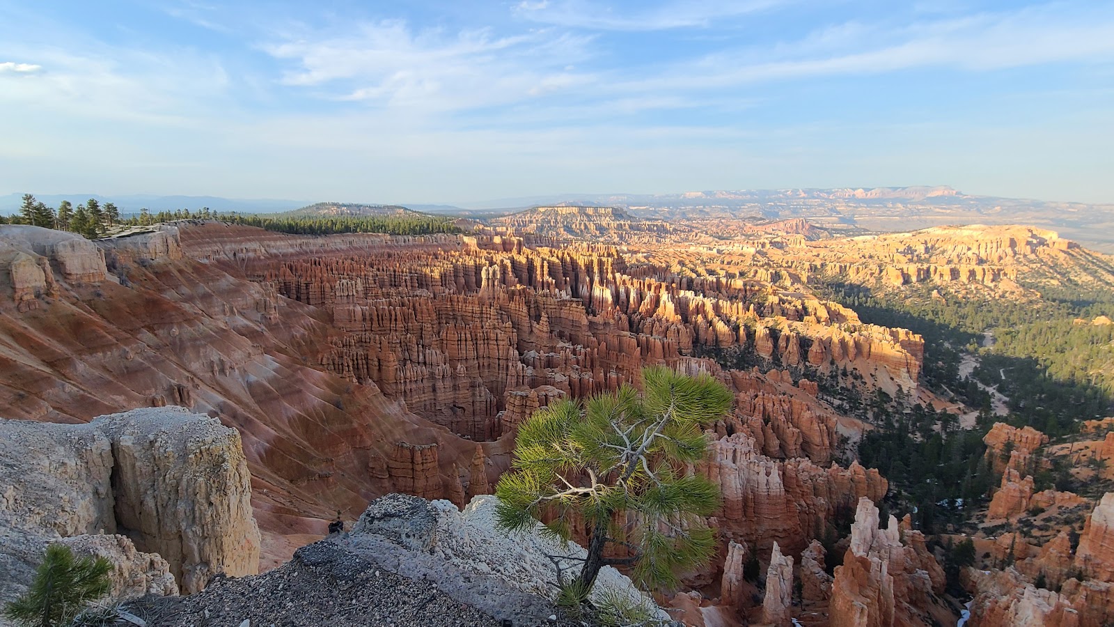 This is a view from the lowest level of Inspiration Point (elevation 8100').
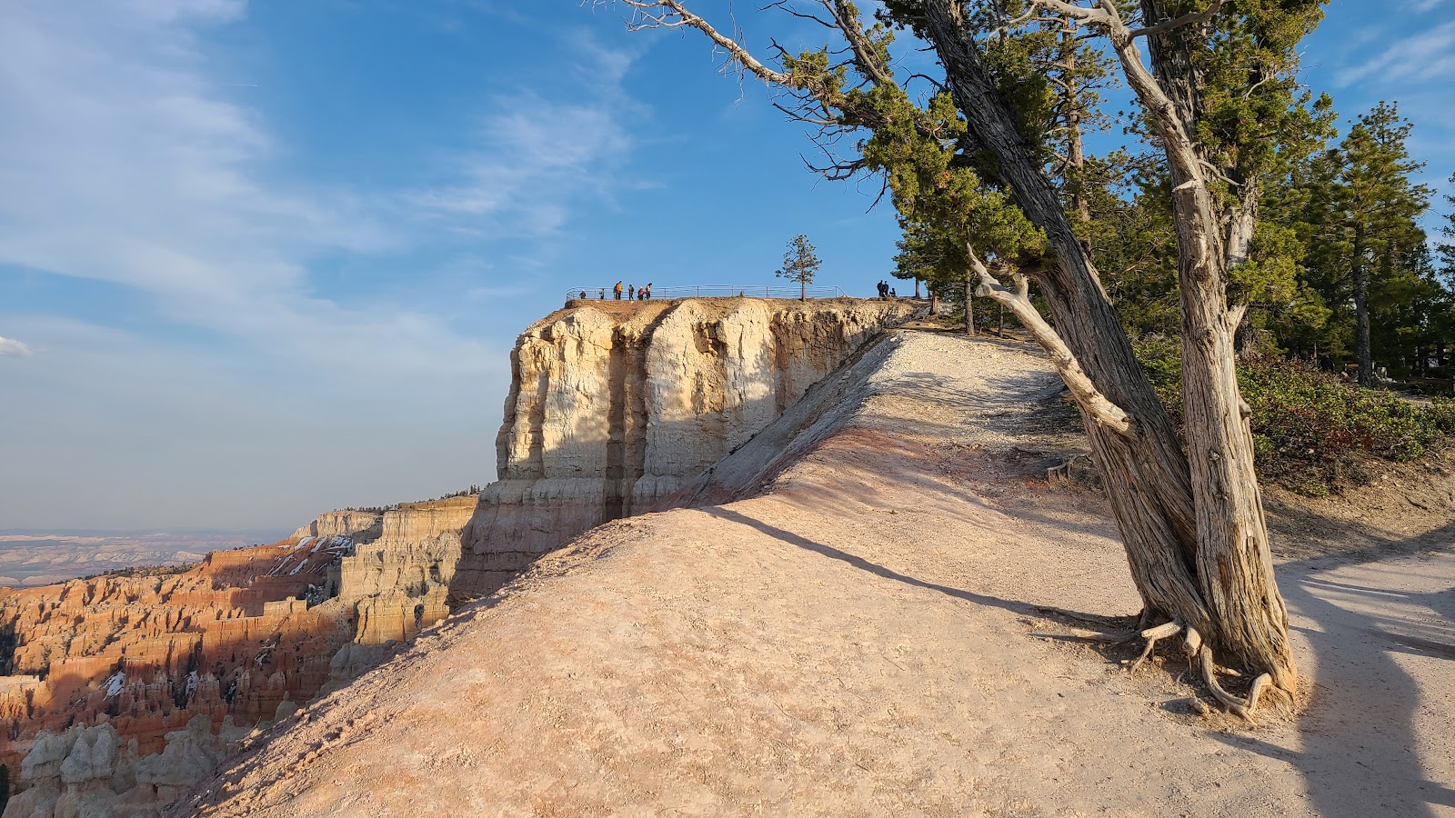 Nearing the end of the pathway up to Inspiration Point.
 Instead of going off trail and walking the edge of the rim,
Tricia elected to take the safe route and stay on trail away from the edge.
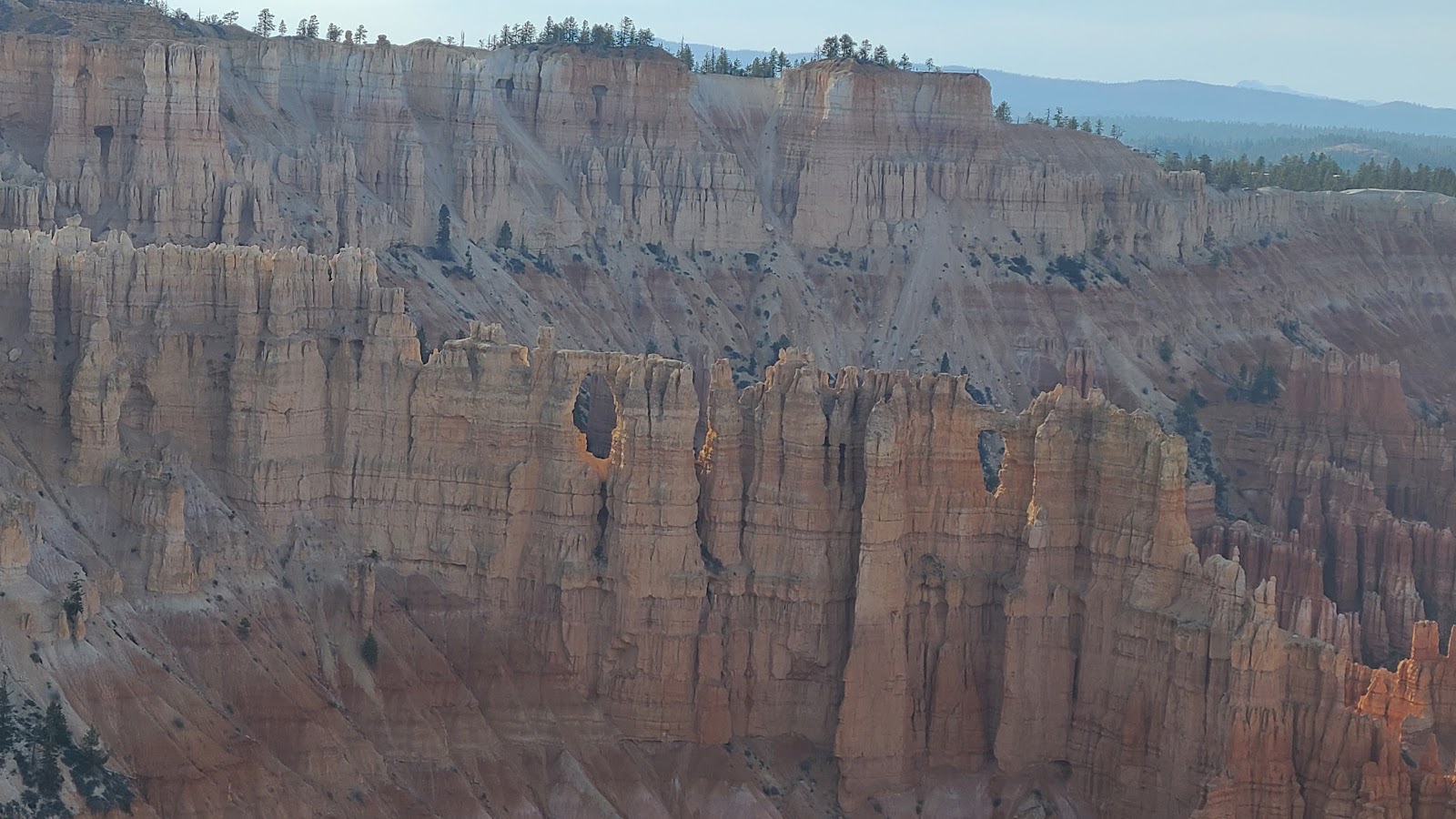
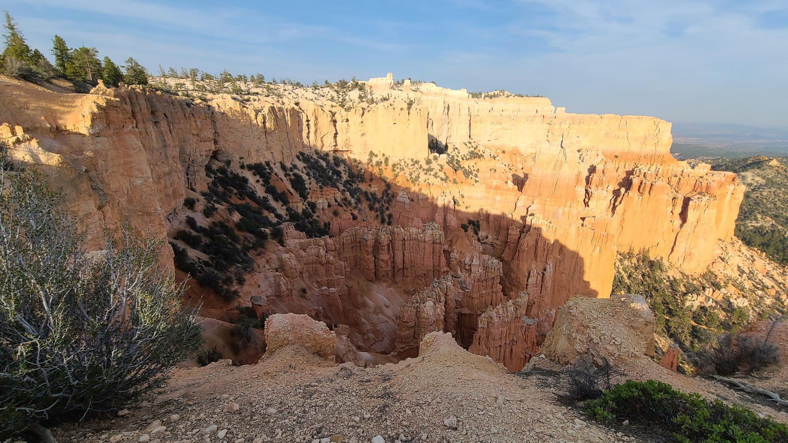
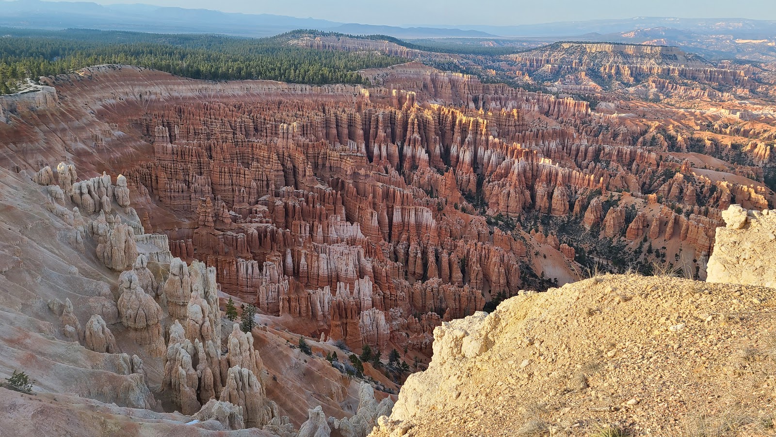 The views from the top of Inspiration Point.
 Time to head back down the path, it's clouding up and we're running out of daylight.
 That's it for today!
FRIDAY - For the last few days we've just been chillin' out in
THE POD and watching the snow flurries fall from the sky.
That's right, even though the temperatures are in the low to mid-40°Fs during the day, it's still dropping snow from the clouds overhead. I guess when you're at at elevation of nearly 8000' that's what happens.
If you are planning to visit Bryce Canyon National Park, you'll most likely have to travel upon Utah's Scenic Byway 12 to get here.
Scenic Byway 12's eastern terminus is on US-89, halfway between Panguitch and Hatch, UT and the western terminus is in Torrey, UT some 124-miles away.
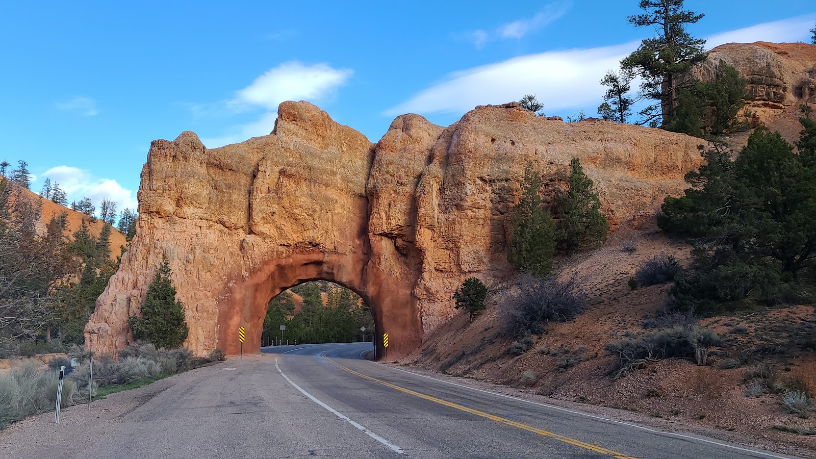
Just a short drive west on UT-12 and you'll see the first of two arches that were cut into the mountains in 1925 to make automobile access into Bryce Canyon from the west even possible.
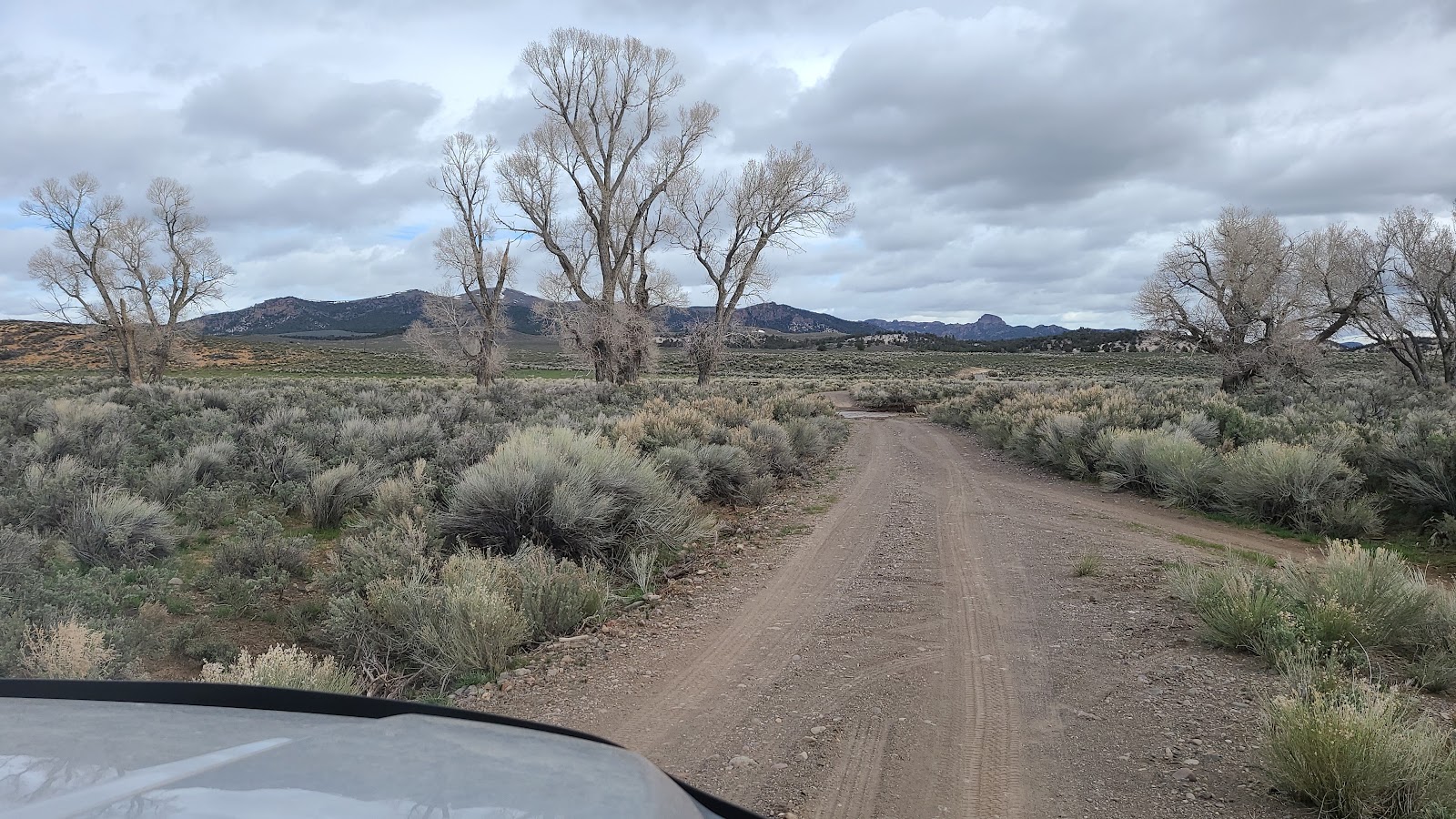
After snapping the photos of the arch tunnels on UT-12 we went in search of a nearby U.S. Forest Service campground that always gets good reviews on the Campendium website. It was kind of a last minute decision and we weren't exactly properly prepared to do so.
We saw a sign indicating that Tom's Best Spring was 12-miles down a well developed gravel road that travels through the Dixie National Forest. As soon as we turned off UT-12 we began seeing lots of people camping on both sides of the road.
You can do that in our National Forests, it's called Dispersed Camping.
It was a very scenic drive through the forest and after traveling the 12-miles down the gravel road we finally came to another sign telling us to turn left to get to Tom's Best Spring.
We had only traveled about 50-yards down the road when I saw something that I didn't like. It appeared there was a good amount of water flowing across the road just ahead.
Sure enough! That's too much water for us to try and cross if we don't absolutely have to. Guess we don't get to visit Tom's Best Spring campground afterall, not today at least.
By continuing just another 4-miles down the main road we found ourselves back on pavement and headed back towards
THE POD. When we arrived back home I fired up my old MacBook Pro laptop and went to the Campendium website to make sure we had the right place.
What I soon realized was that the gravel road we had been traveling upon was not only called Forest Road-117, it was Tom's Best Spring Road and the campground we were looking for were all those campers we saw at the very beginning of the road.
Oh well, we still had a nice drive out in the Dixie National Forest and almost got to see Tom's Best Spring near the end of the road.
SATURDAY - Yesterday we got a nice surprise visit from our friends Winston and VerJean. They are camped just 26-miles from here in the same park we will be moving to on Monday.
We knew they were passing through this general area of Utah, but had no idea they would be stopping by just to say HELLO!
Today we will be wrapping up our sightseeing here in Bryce Canyon National Park.
Just yesterday the 1-mile long road leading to Fairyland Point was opened, so we'll be taking that drive after we go to Subway to pick up some lunch.
Fairyland Canyon is located inside of the National Park, but outside of the entrance gate, so I imagine you could visit this wonderful overlook without ever having to pay the $35 entrance fee.
Fairyland Point is located at an elevation of 7758'.
We've been saving the best for last I suppose, because we still have the two most visited viewpoints of the park to check out, they're called Sunrise and Sunset Points.
We'll head out to do that right after we finish eating lunch.
In order to be able to visit these two locations on a Saturday, we're going to take the Shuttle Bus to each location because I don't know if there will be any place to park
ROVER.
Plus, since ROVER is right at the 20' limit for using the parking lot while the Shuttle Buses are running (8AM-6PM), we'll just play it safe and ride the bus.
PART 2
OF THE
BRYCE CANYON AMPHITHEATER VIEWPOINTS
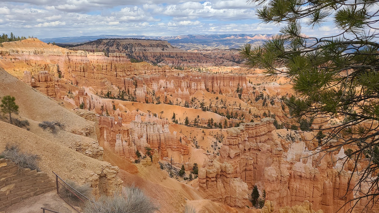
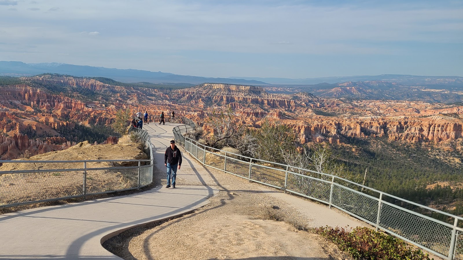
 The view from Sunset Point at an elevation of 8000'.
 With the sun peeking in and out from behind the clouds the scenery was constantly changing.
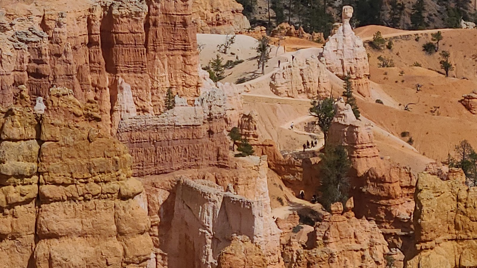
 The tall slender hoodoo in the center of this photo is called "Thor's Hammer".
 Here you can see the hikers on the Queen's Garden Trail from Sunrise Point.
 The Navajo Loop Trail down into the canyon from Sunset Point is currently closed.
 The park is repairing winter damage to the trail. Well maybe not right this moment!
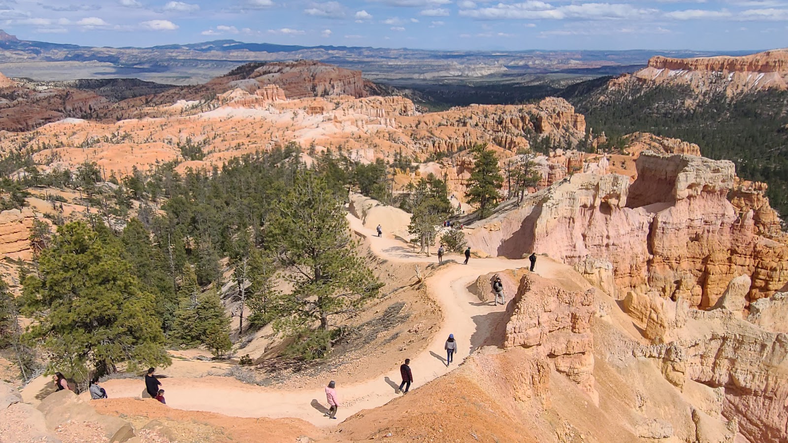
 We decided to walk the half mile long Rim Trail between Sunset and Sunrise Points.
 It was such a nonhazy day the faraway vistas were crystal clear.
 Getting closer to Sunrise Point we can clearly see the hikers now.
 The view from Sunrise Point at an elevation of 8017'.
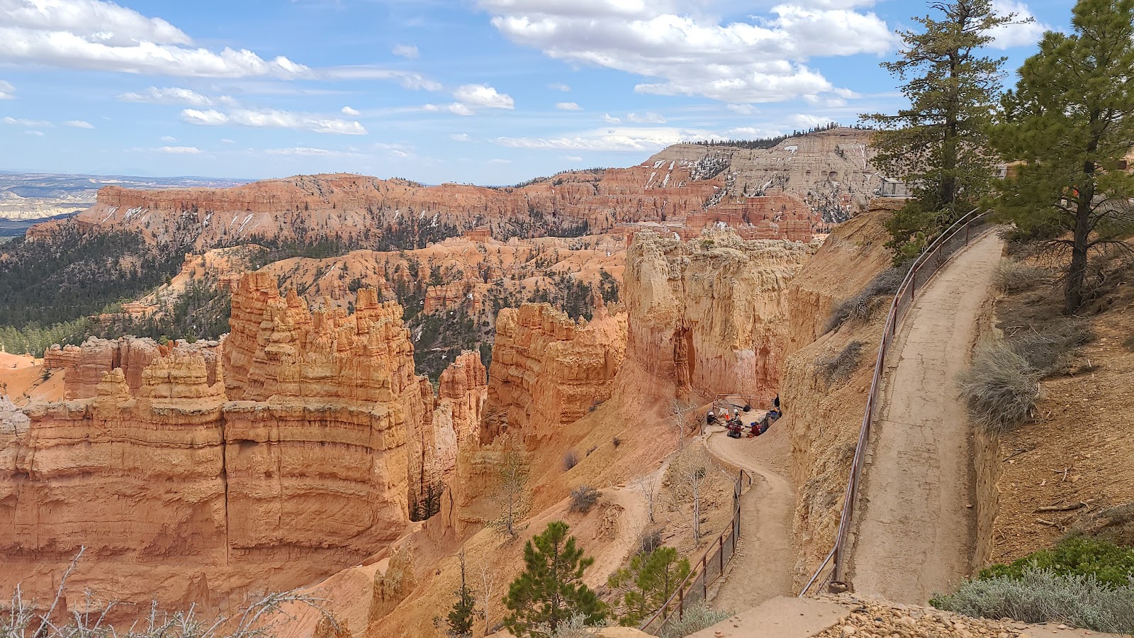
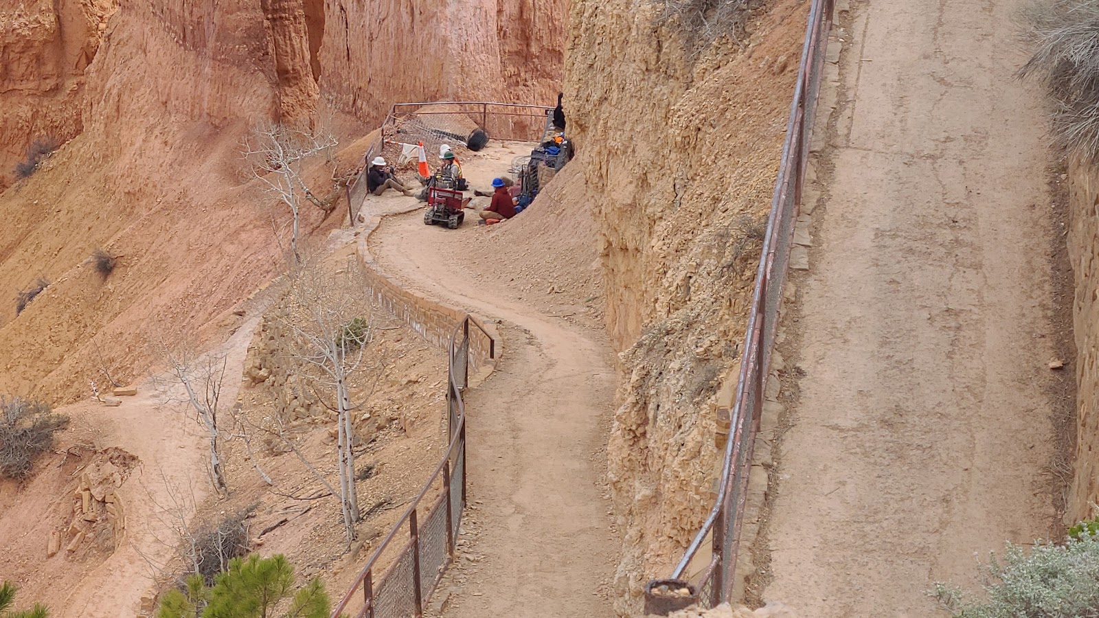
 The .9-mile Queen's Garden Trail heads 300' down into the bottom of Bryce Canyon.
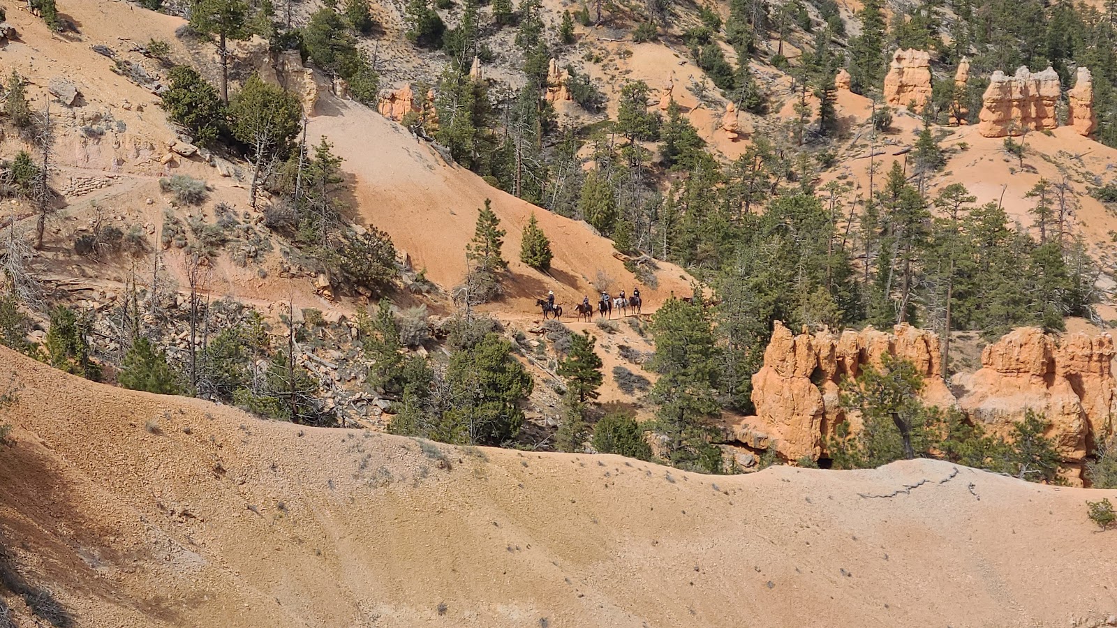 Now this is the easy way to get down and back up from the canyon floor...
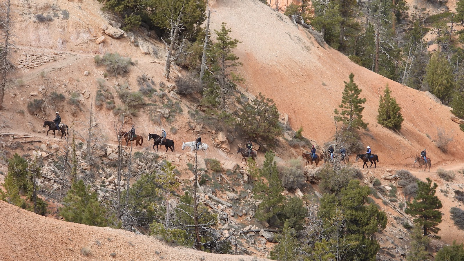 ...by taking a 2-3 hour horse back ride for $75-$100 each.
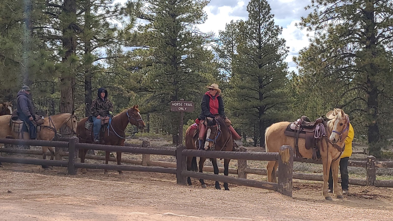 Here's the next group getting ready to head down into the canyon.
You may be wondering, why didn't Tricia and Phil do the horse back ride?
Well, we thought about it, but several years ago the horses got together and decided they were going to impose a strict 220-lb. maximum rider limit. I'm not going to name names, let's just say that currently ONE OF US does not fall within that limit, so the decision was made for us.
We have now visited 2 of Utah's Mighty 5 National Parks.
Stay tuned, because before the middle of June we intend to visit all five with a handful of Utah's premiere State Parks thrown in for good measure!
Would you like to be notified of new blog posts?