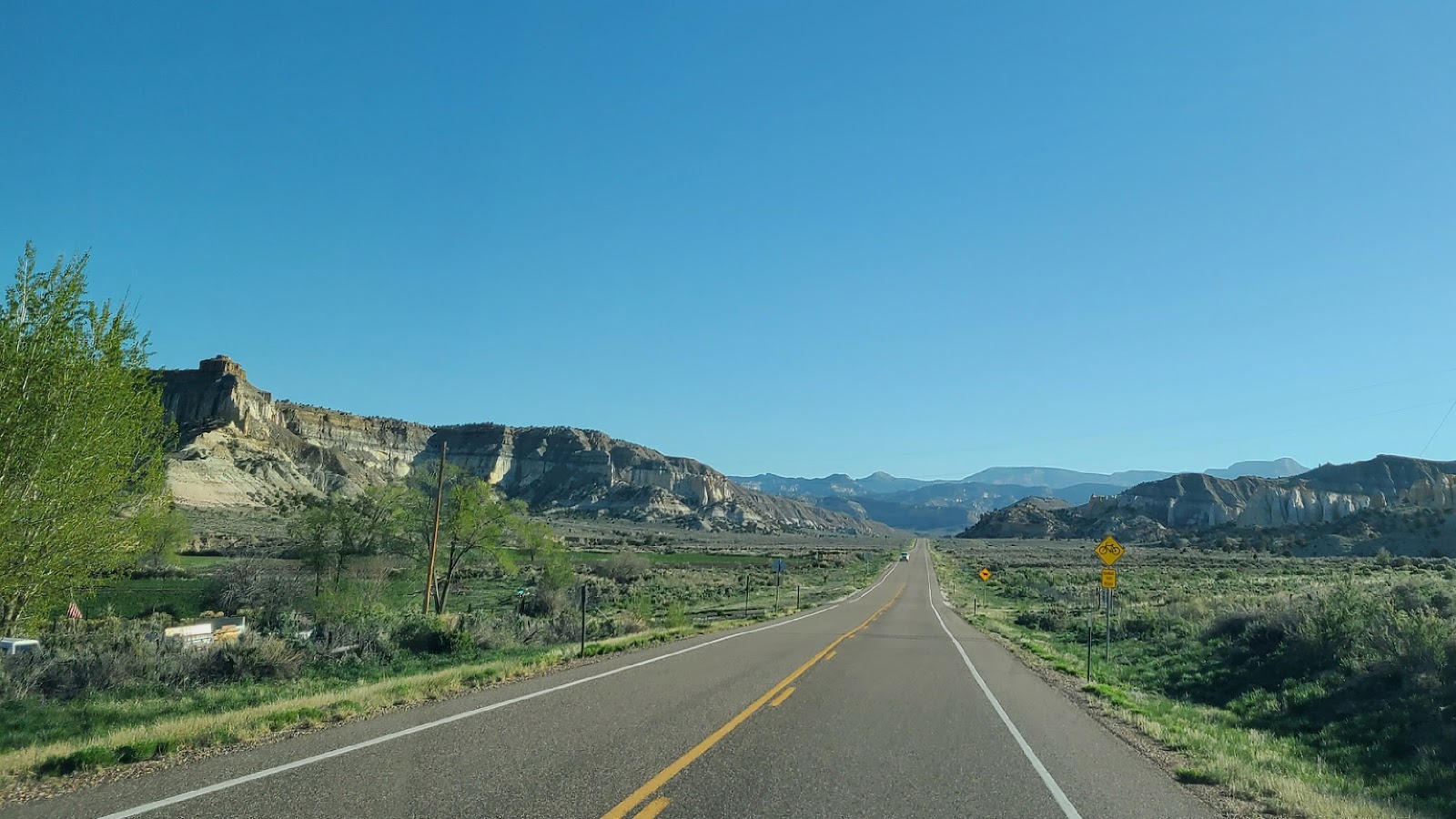
THURSDAY - After today's travels we have now negotiated 64.5 miles, which is just over half, of the 124-mile long
Scenic Byway 12 here in southern Utah.
Today's section has us slowing climbing up and over the Powell Point Summit at an elevation of just over 7500'. That's quite a bit higher than the 5700' of our campsite just outside of Escalante, UT.
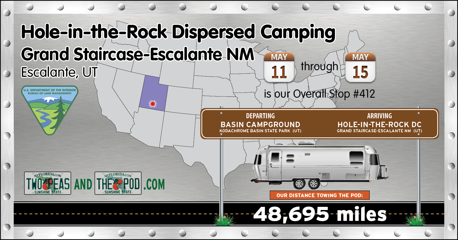
After stopping at the Bureau of Land Management office in the town of Escalante to receive our FREE camping permit, we proceeded another 5-miles down the road to the turnoff for Hole-in-the-Rock Road (aka BLM Road 200).
For the next 4-nights we will be camping for FREE inside of the Grand Staircase-Escalante National Monument. At 1.87 million acres it's the largest United States National Monument in the lower 48 states. In 1996 it was also the first National Monument to be administered by the Bureau of Land Management, currently there are 29 where the BLM is running the show.
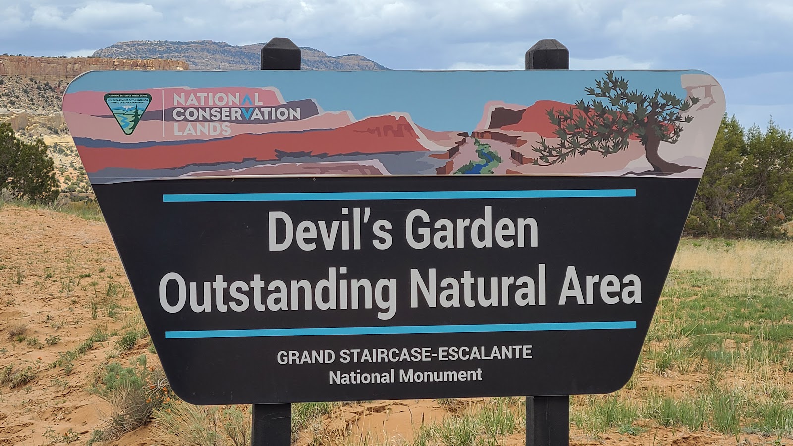
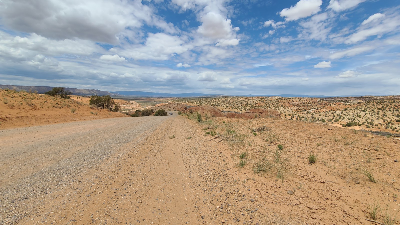
The sign near the turnoff for Hole-in-the-Rock Road from UT-12.
Somewhere down this road is our next campsite.
After scouting out several sites we ended up choosing this one.
Like most of the sites here ours came with a rock firepit, which we probably won't be using.
The view standing at the rear of our weekend campsite.
no·mad·i·ver·sa·ry
/ˌnō-ˌmadˈəˈvərs(ə)rē/
noun
|
That's right, today is our 5th nomadiversary! We've been traveling for 5-years as of today and haven't yet found any reason to stop.
|
18 5 12
Those are "our" Big Red Numbers!
All you Airstreamers out there know what I'm talking about.
All members of the Airstream Club International get to pick their own personalized membership number and we chose 18512.
Let me word it another way, 2018 MAY 12th. It's the date we left Broward County, FL behind to begin our new fulltime traveling lifestyle exactly 5-years ago today!.
FRIDAY - Today we've got some exploring to do! Hole-in-the-Rock Road is 56-miles long, stretching from UT-12 in the west until it dead ends in the east at the Hole-in-the-Rock Trailhead, which is located above Lake Powell on the Colorado River.
We won't be traveling the full length today, that's a lot of gravel road to endure, but we hope to make it 37-miles to our second sightseeing destination, or maybe we'll call it quits after just 12.5-miles to our first destination. We'll have to wait and see how it goes.
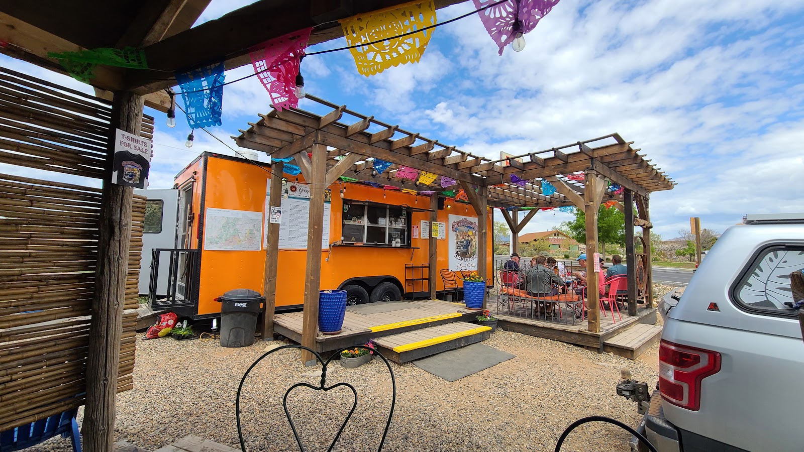
But first we need to fuel up, both ROVER and the TWO PEAS. Tricia spotted some interesting looking "Food Trucks" along the highway while passing through town, and they seem to get good reviews on Google, so we'll give one of them a try. Very seldom have we been let down by Google Reviews when it comes to somewhere to eat.
We ended up eating at Georgie's Outdoor Mexican Cafe. YUM YUM!
After our delightful lunch on the outdoor patio we headed back to Hole-in-the-Rock Road.
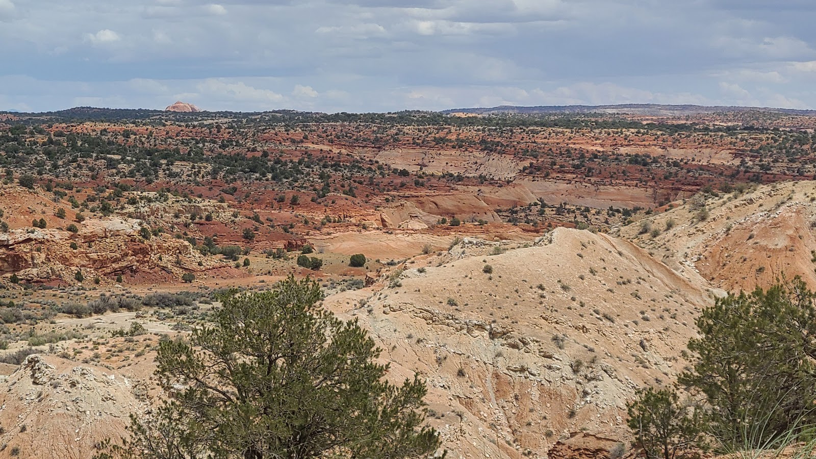
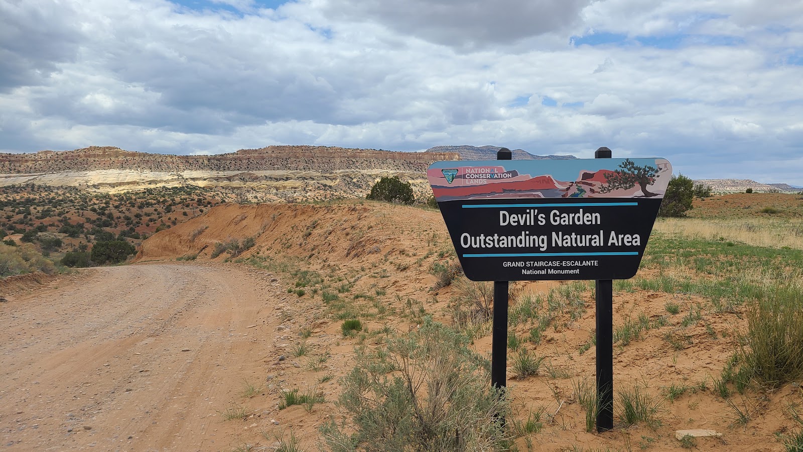
After 12.5-miles of bone jarring washboard gravel road we arrived at our first destination, the Devil's Garden Outstanding Natural Area. No kidding, that's the official name on the sign just before you arrive in the parking lot.
Even though the road was pretty rough, I'm glad we took the time to drive out and visit. I'm not so sure however that ROVER feels the same way!
THE DEVILS GARDEN
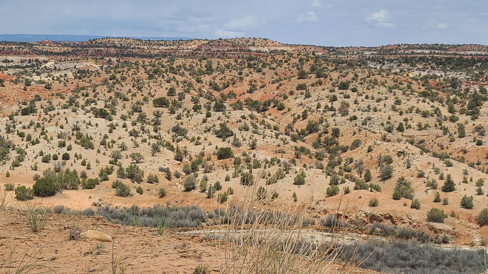
 12½-miles down this gravel road we'll find our destination.
 There's not much out here other than the beautiful scenery.
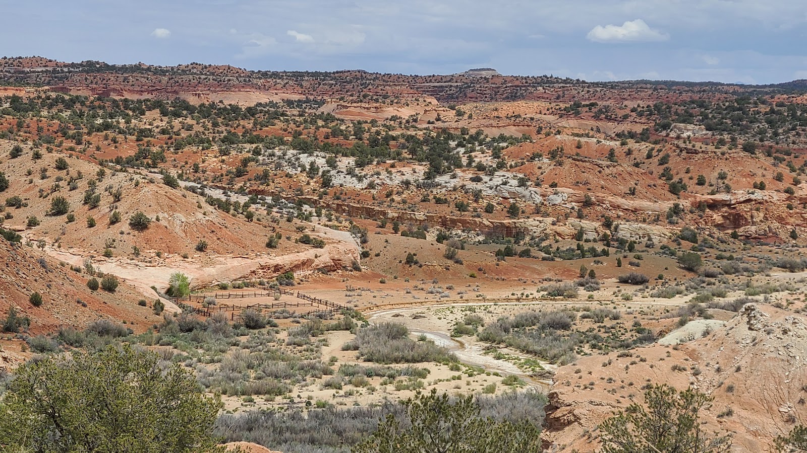 But occasionally we saw evidence of ranching activity.
 I can't believe we made it here. Only 45-minutes to travel 12½-miles with zero traffic.
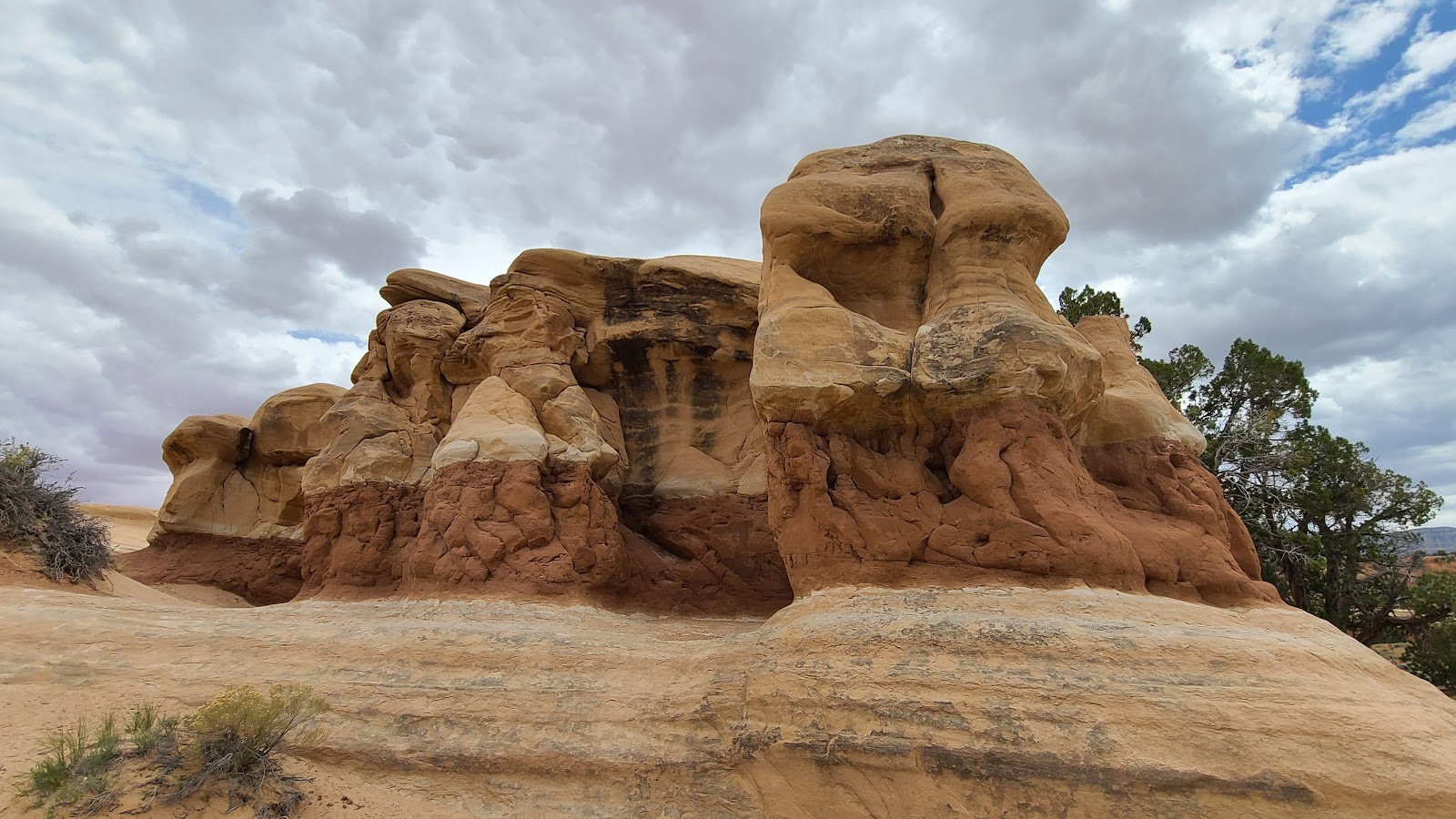
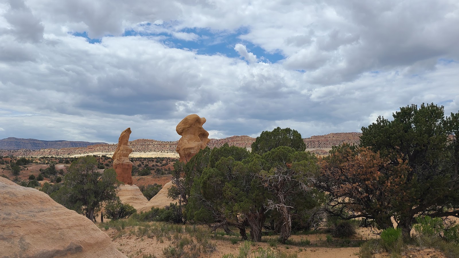
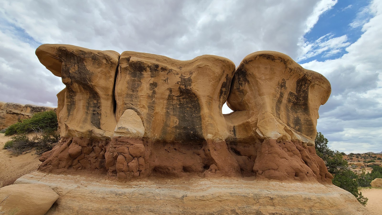
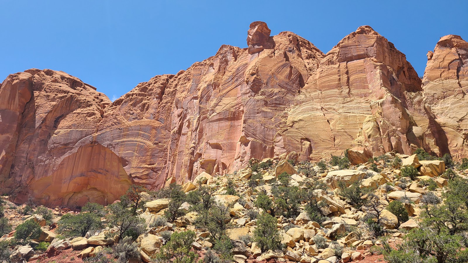
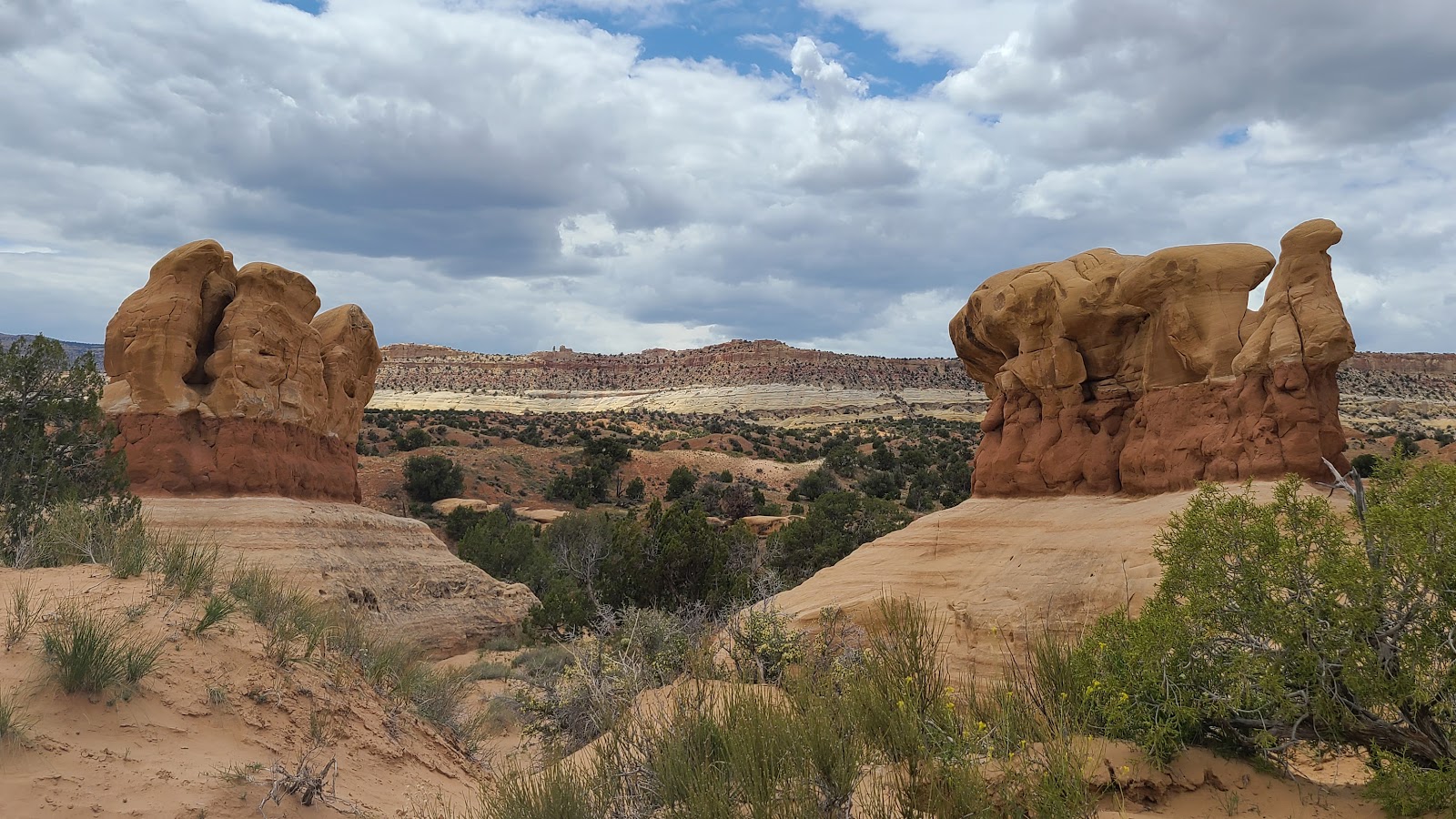
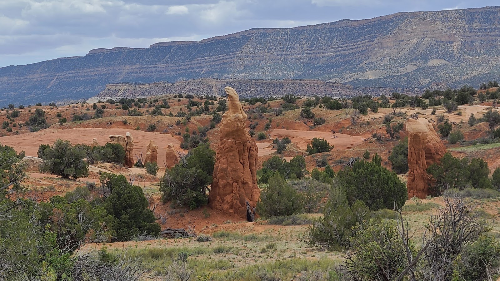
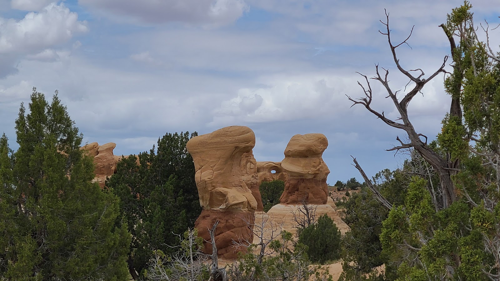
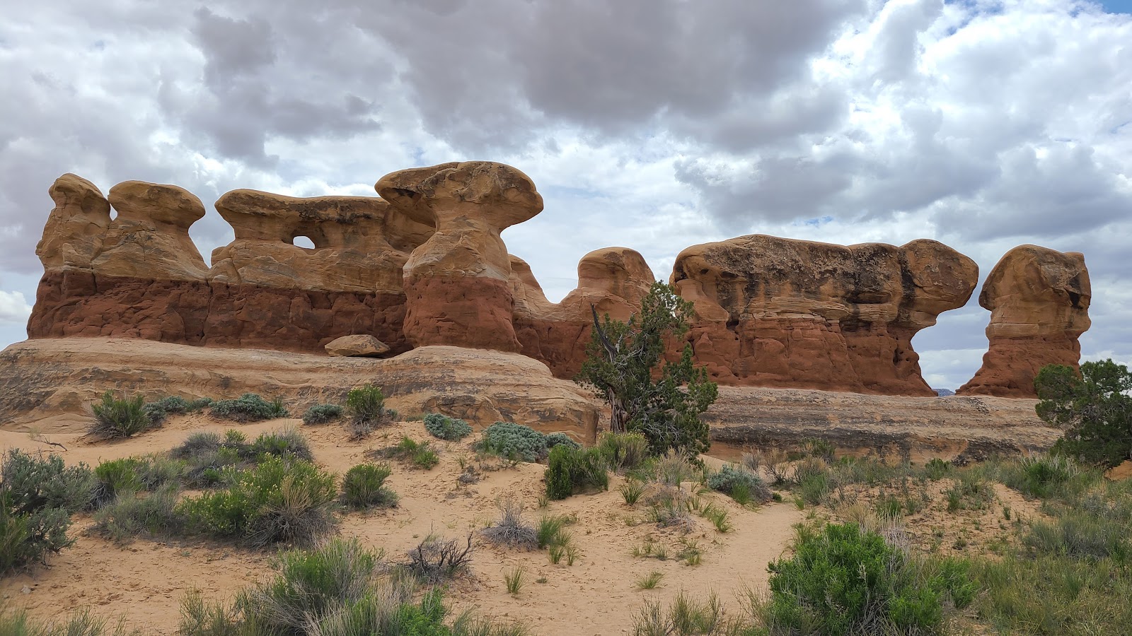 Right from the parking lot we could see rock formations that made it all worth while.
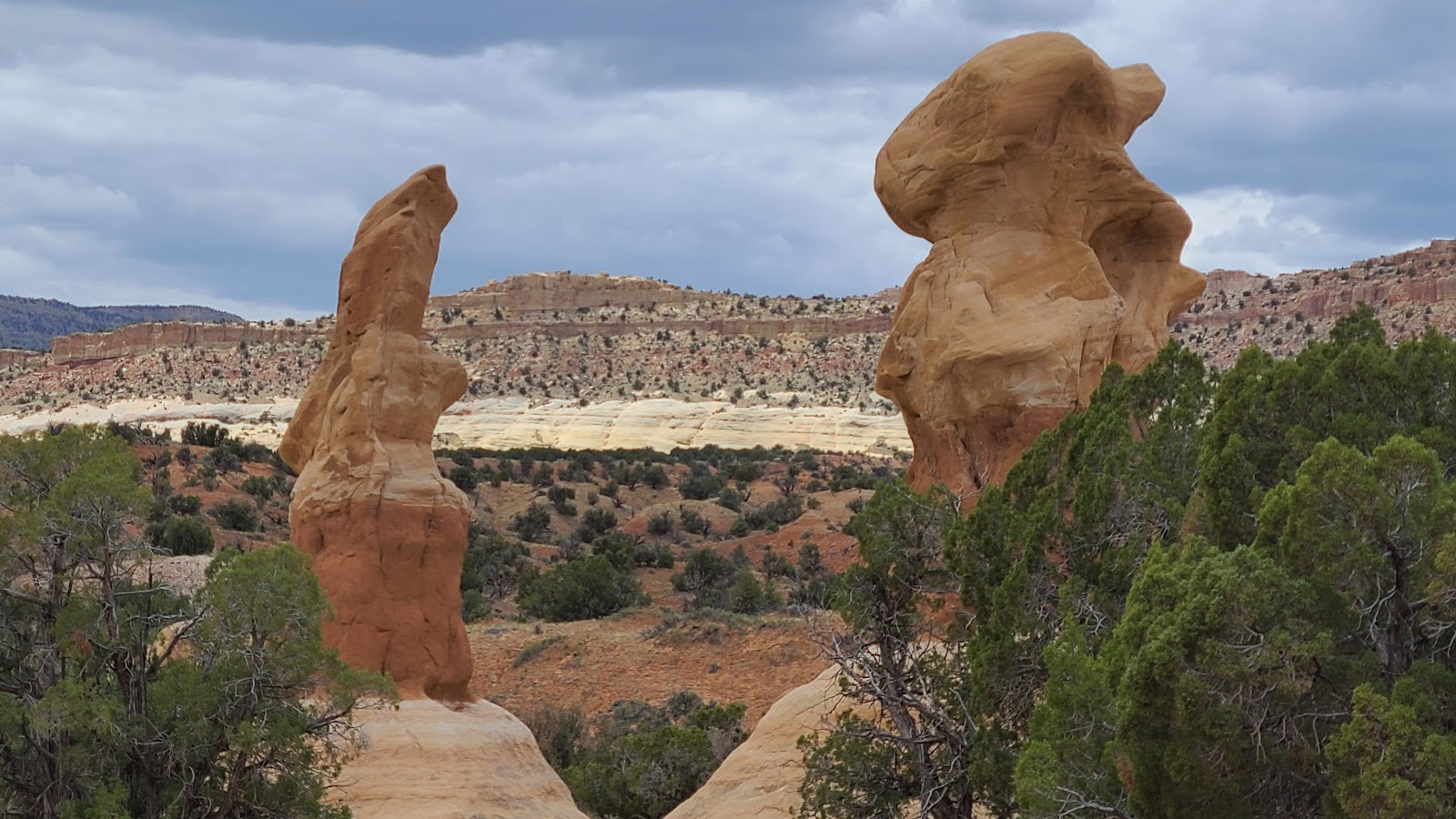
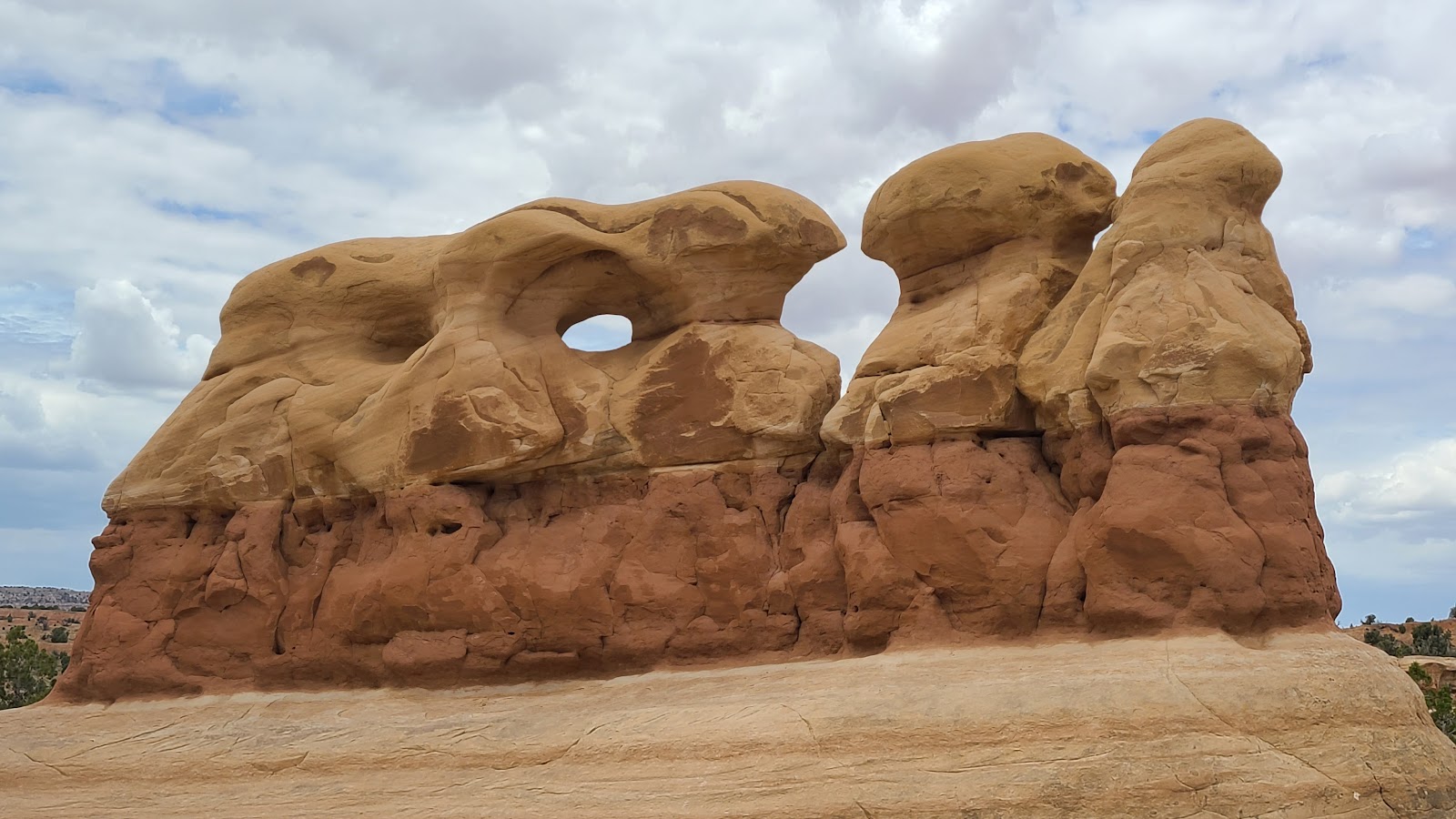
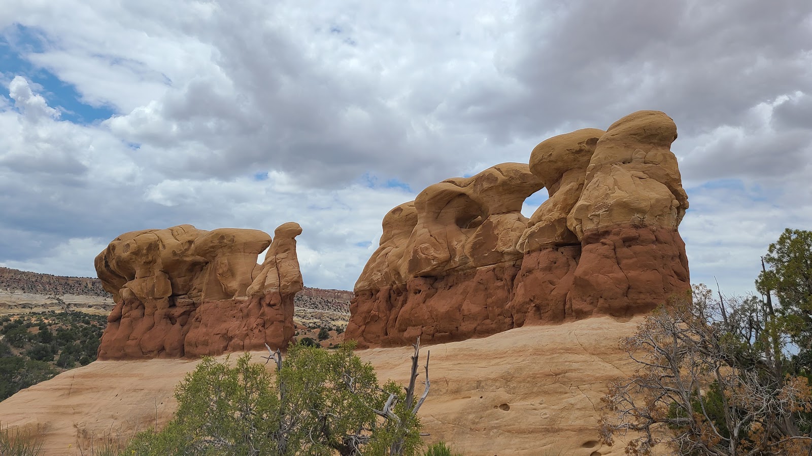 A rear view of the same formation.
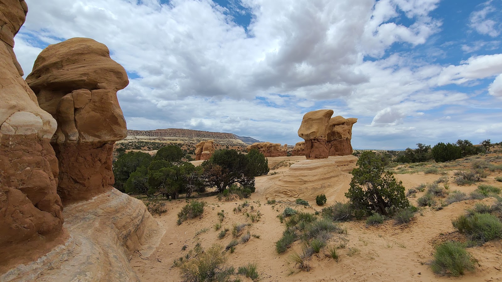
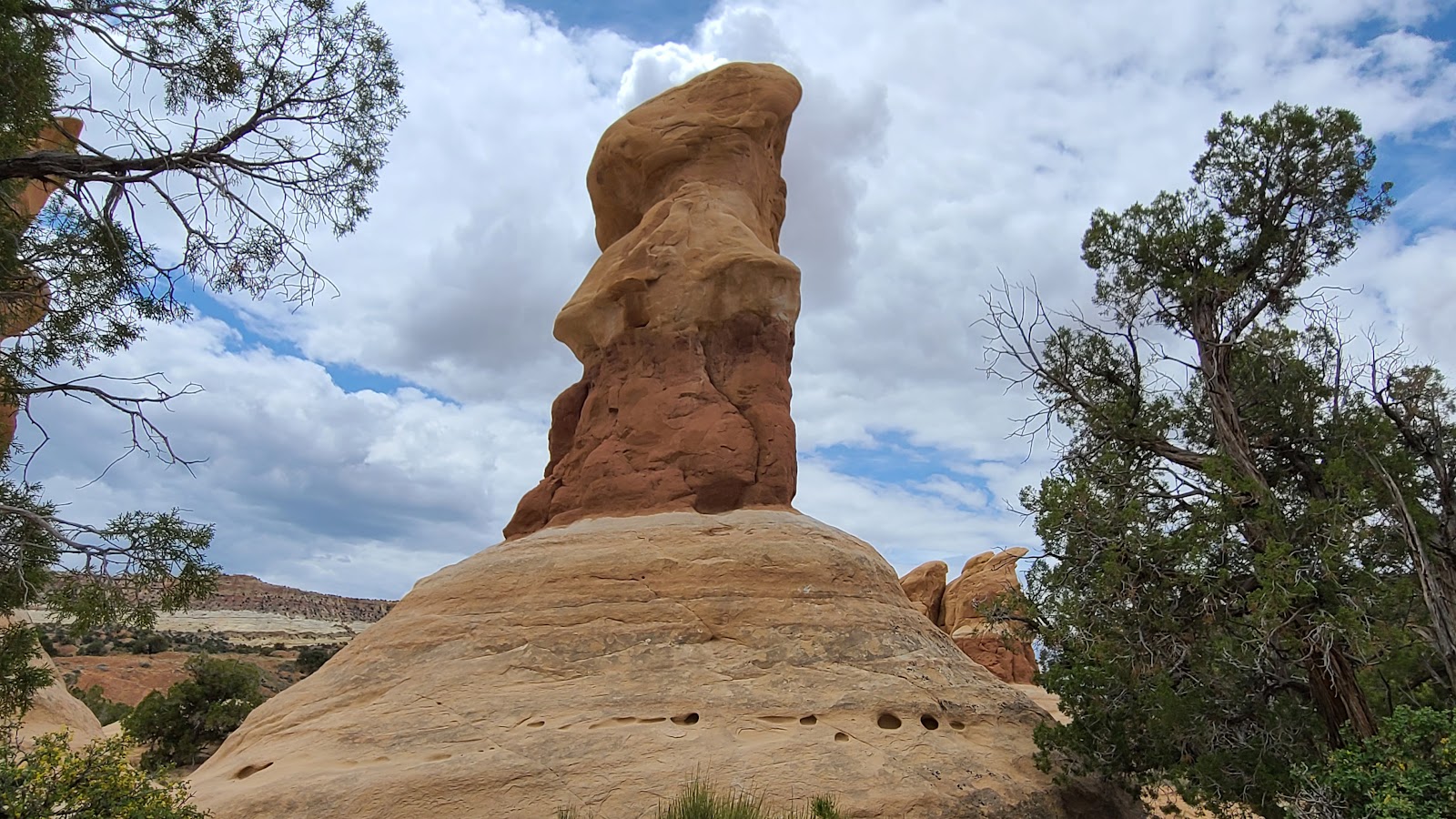
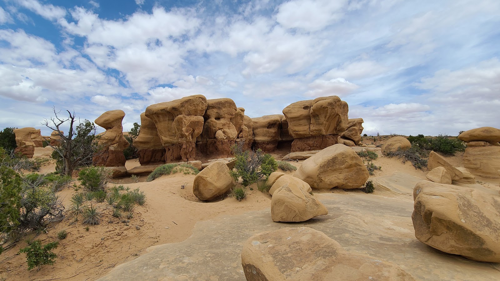
 There must have been hundreds of formation and no two the same.
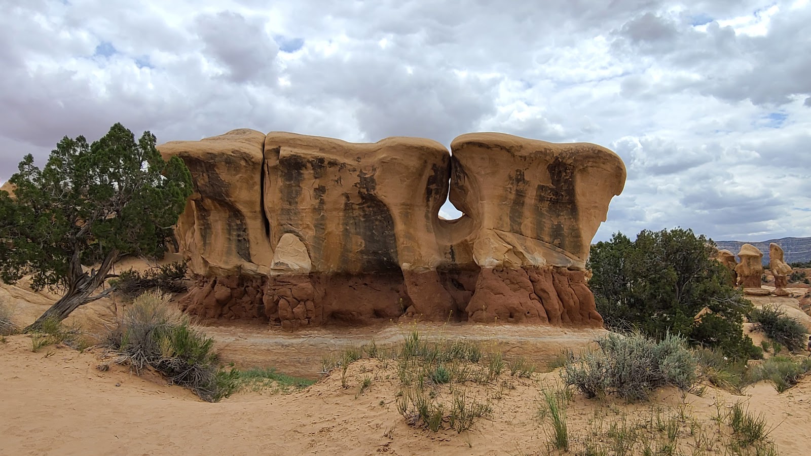
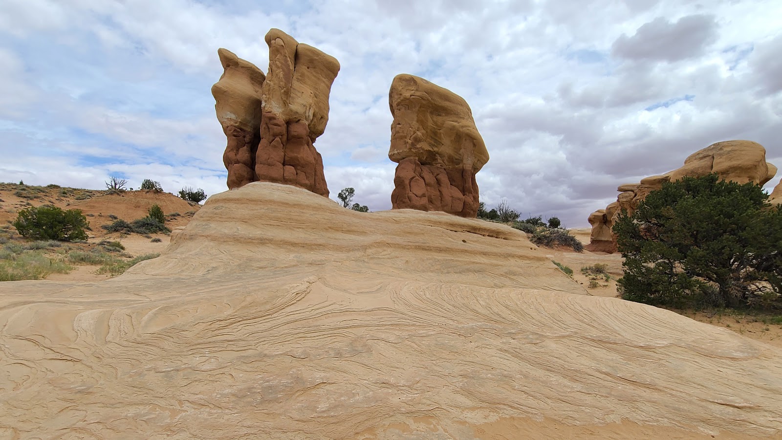 This grouping looked as if the were displayed on a pedestal.
 There are no marked trails to follow out here, just the footprints of others.
 We both knew better that to try and fit through this window in the rocks.
 This is the first of two "named" arches that can be found out here.
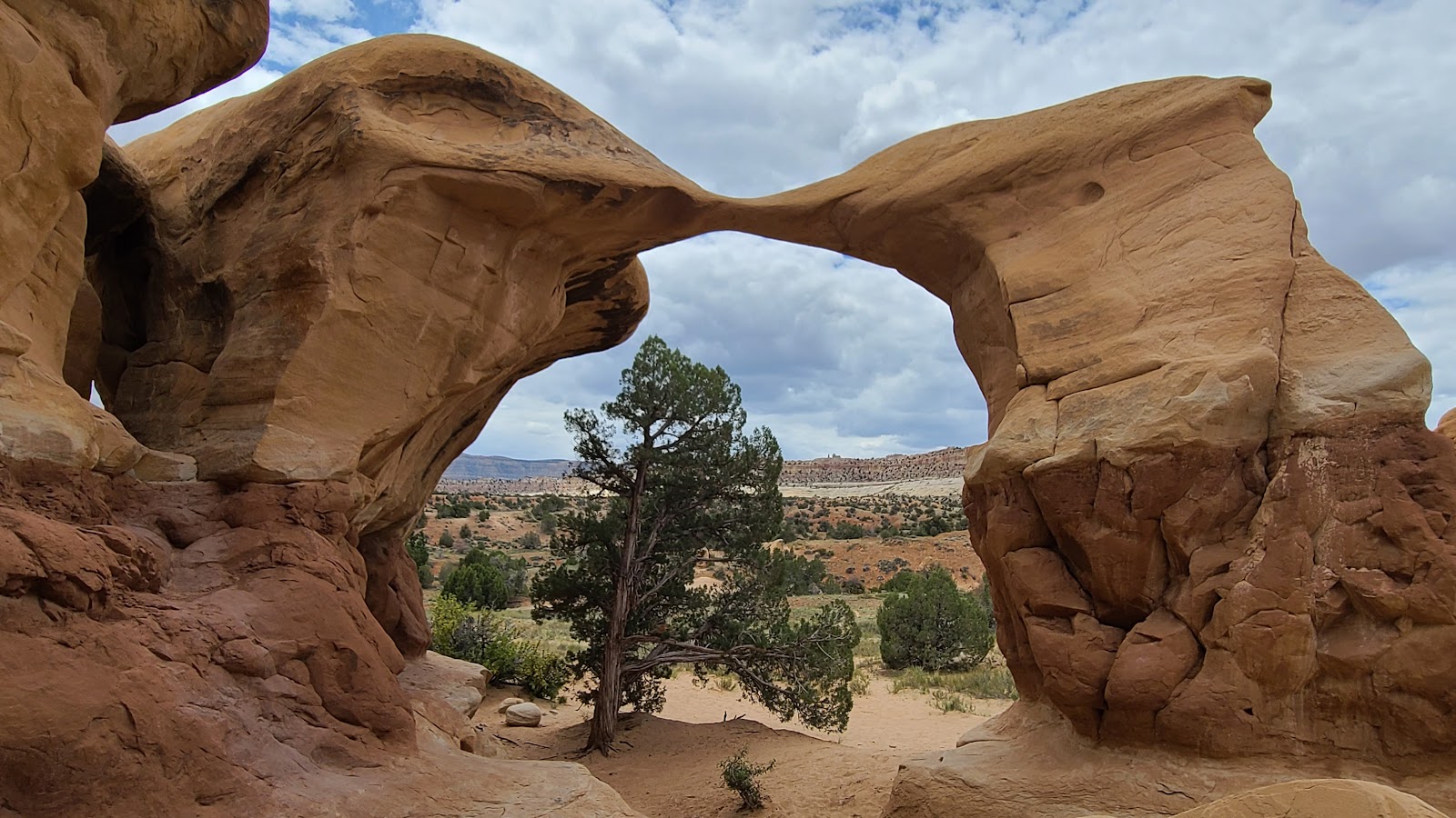 This one is called "Metate Arch". Metate is an ancient word for a mortar.
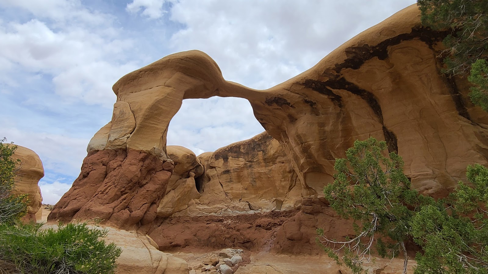 Another view of Metate Arch from the rear.
 In the center of the photo you can see "Mano Arch".
 Mano is an ancient word for a pestle, so together you have a mortar and pestle.
 These were shaped different than most of other formations found here.
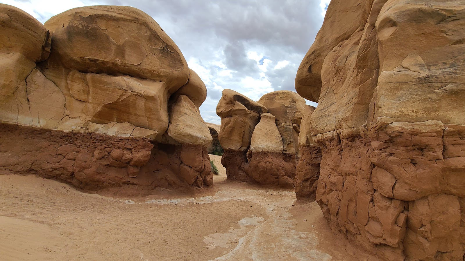
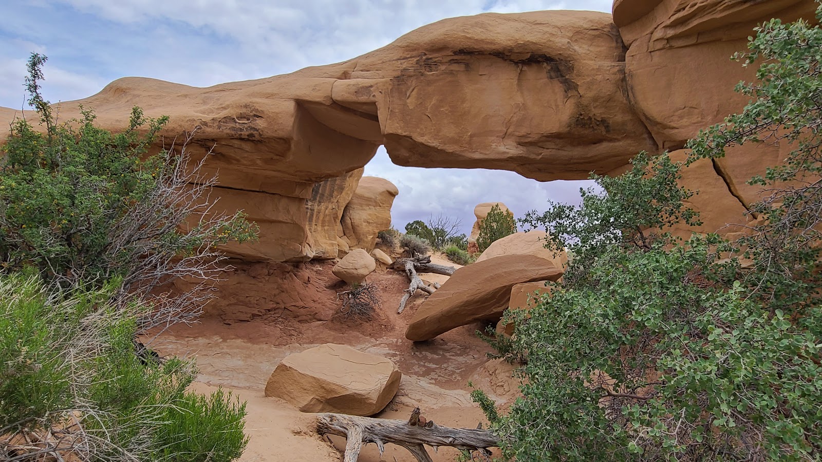
 Up ahead it looks as if the path goes right into the rocks.
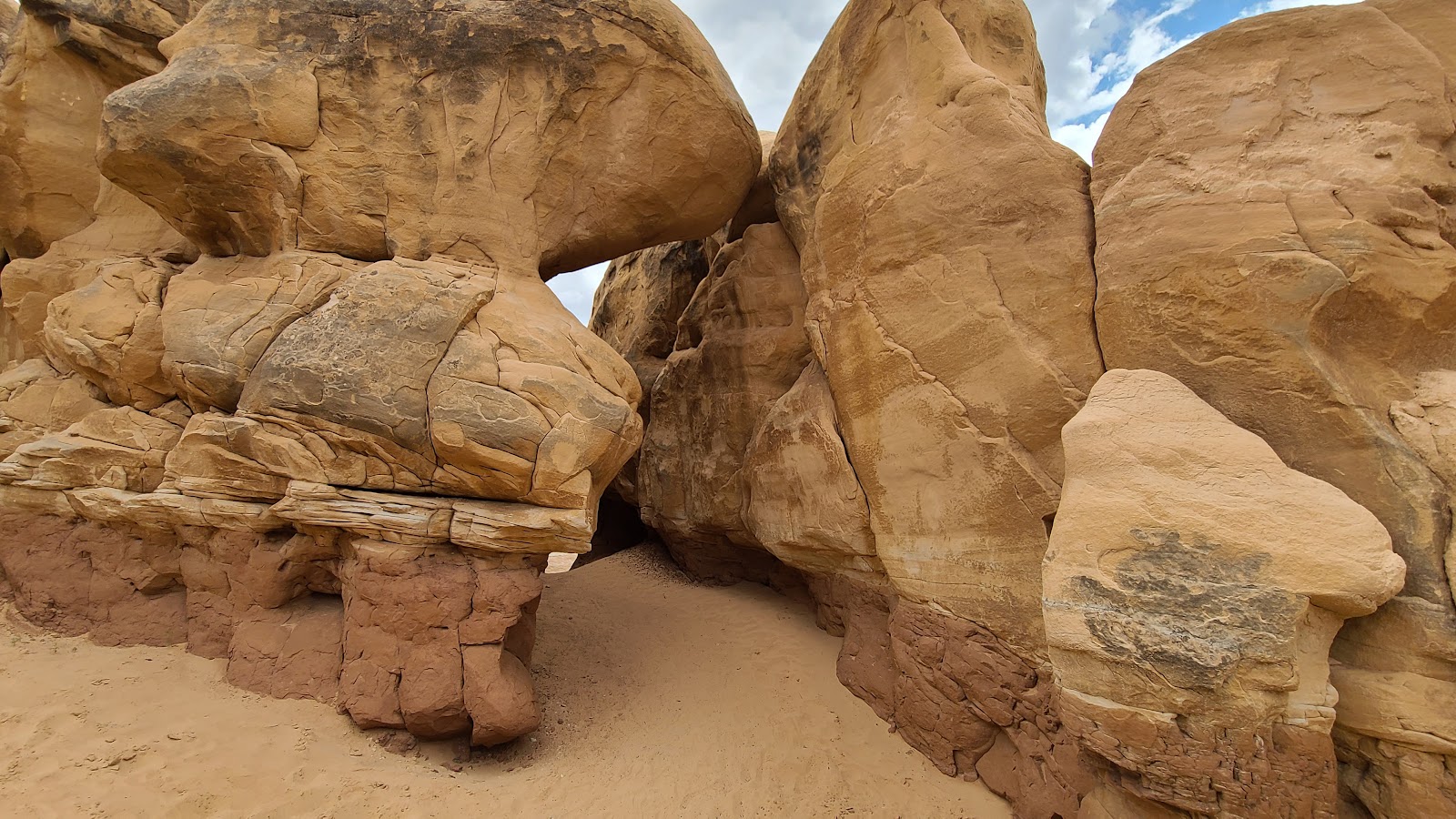 It does, but we can see through to the other side.
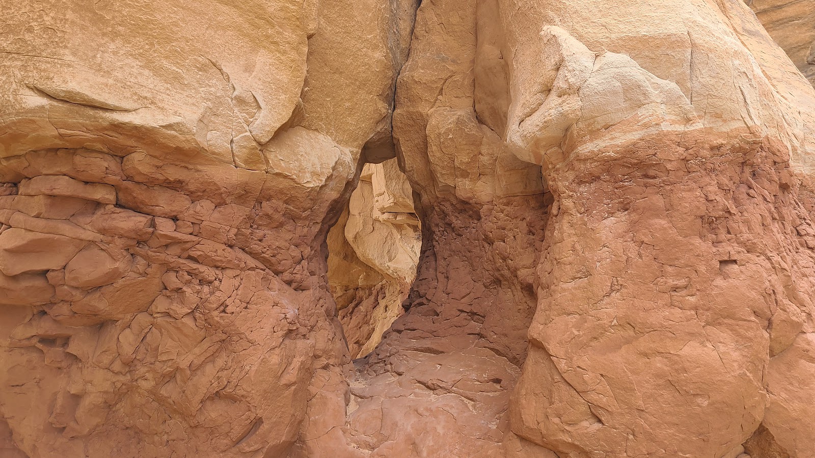
 Once inside we could tell the exit was going to be tighter than the entrance.
 But by turning sideways we both made it through just fine.
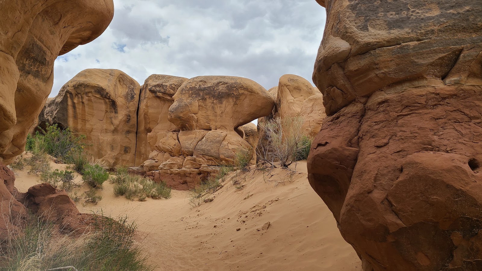
 There's just no end to the formations out here.
 The foot path just keeps on going.
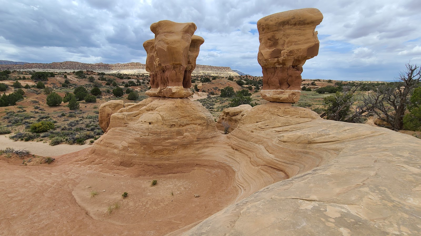 These two look precariously balanced and just a little bit top heavy.
 Hey, there's my new canine friend I met earlier today at the Visitor Center.
 Time to head back and see if we can locate ROVER again.
 I recognize that window in the rock up ahead, that's the way out of here.
 One more look at Metate Arch, this time it's a side view you're seeing.
 That's the window I saw and the parking lot is just on the other side.
After walking through the rock formations for about 45-minutes we decided it was time to leave.
On the way back to the parking lot we discussed if we were going to travel another 25-miles east on Hole-in-the-Rock Road to the second destination.
When we arrived back in the parking lot there was a BLM Ranger checking the trail log and getting ready to clean and resupply the bathrooms.
I asked if the road conditions improved any as you traveled further east? His reply was simply, "NO"!
That made the decision easy, we headed west and back towards the campground.
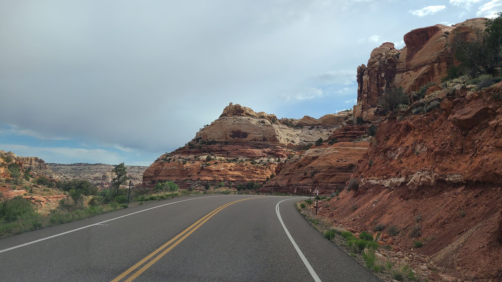
SATURDAY - Today we have another scenic drive planned, only this one is mostly all pavement, hardly any gravel roads today.
We start by heading 24-miles north on Scenic Byway 12 from Hole-in-the-Rock Road to the town of Boulder,UT. This stretch of the Byway is considered to be the "most beautiful paved road in Utah".
We'll just see about that and decide for ourselves.
SCENIC BYWAY 12
BETWEEN ESCALANTE AND BOULDER, UT
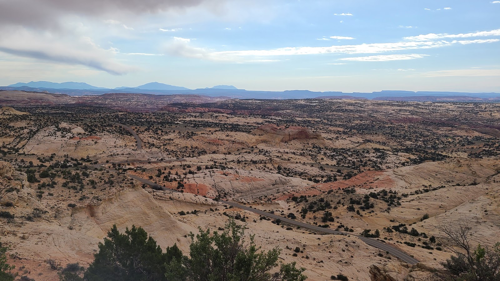 Our first stop was "Head of the Rocks Overlook".
 At the overlook there was this interesting rock formation on the other side of the street.
 A few more miles up the highway was an easy pullout, the Boynton Overlook.
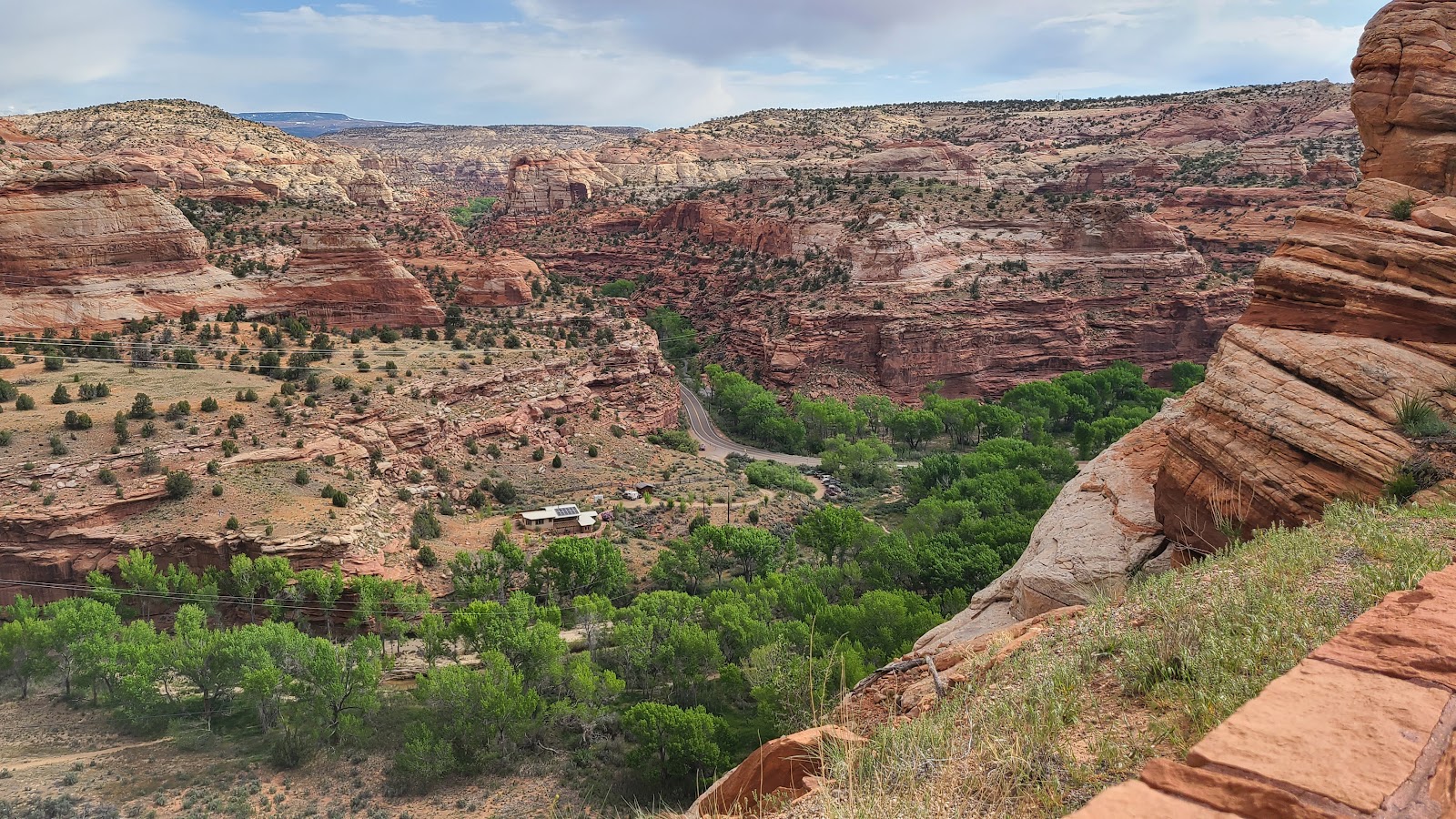 At the bottom of the overlook someone had built their home in the perfect setting.
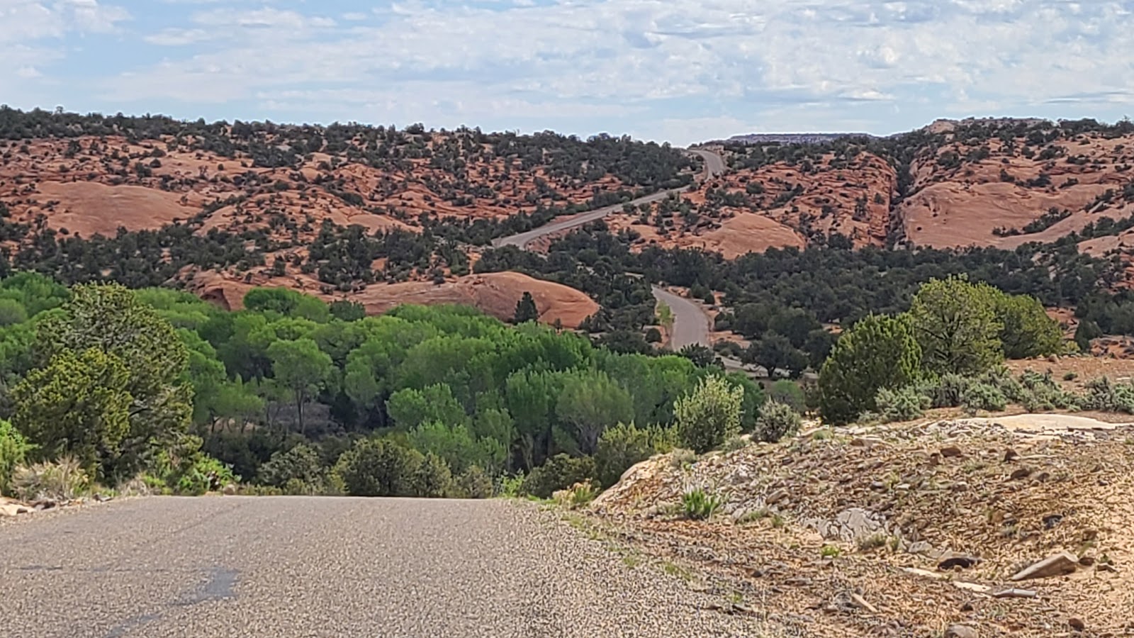
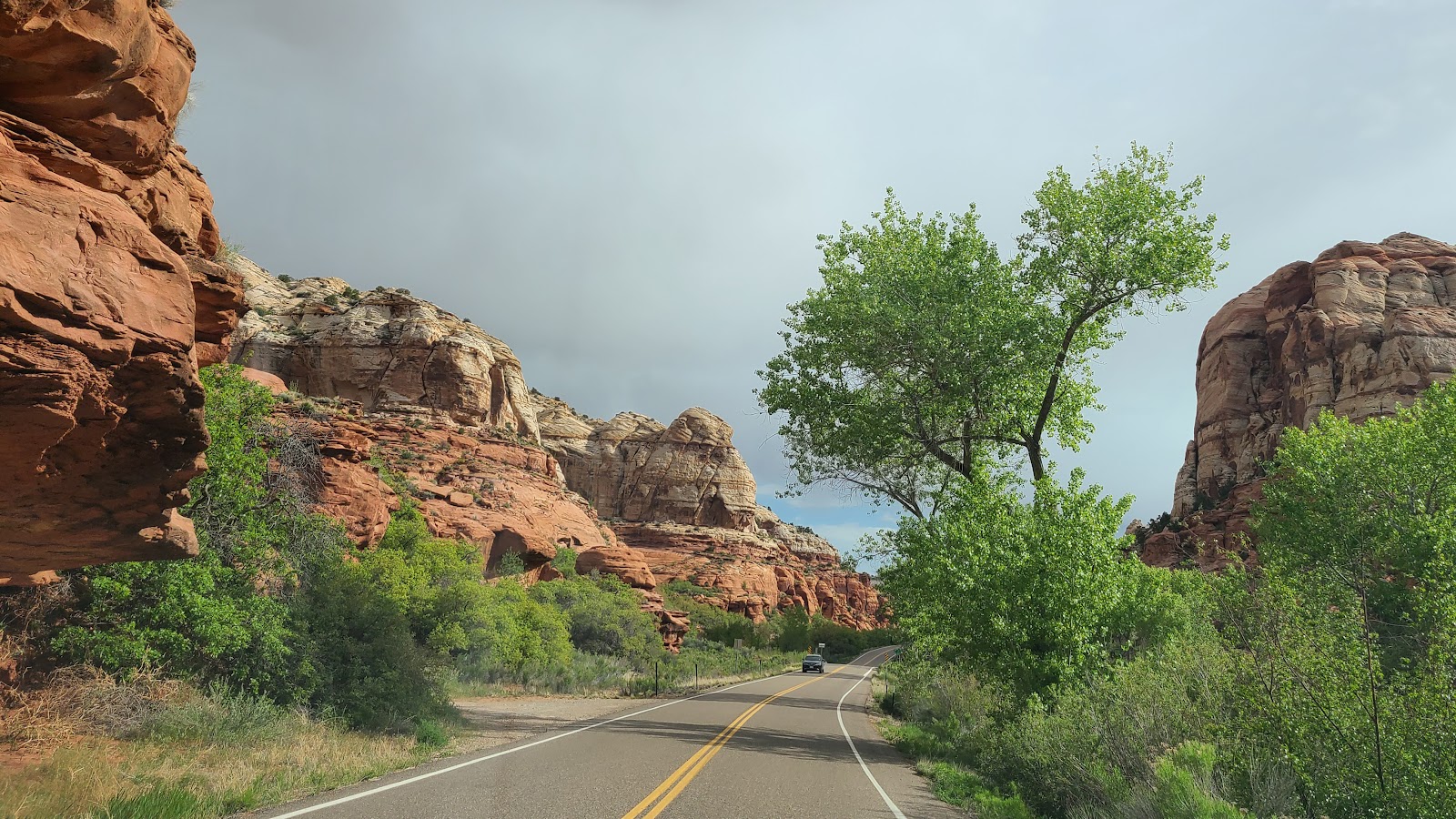 The further we traveled north the scenery just kept getting better.
 Down there is Calf Creek. Where is it? Just follow the winding string of green trees.
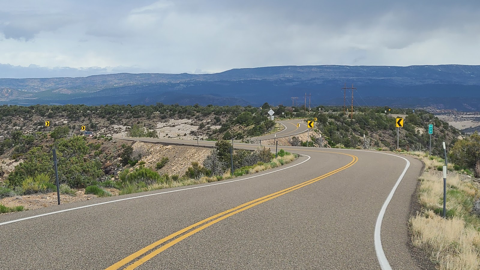 This section of the highway is called The Hogback.
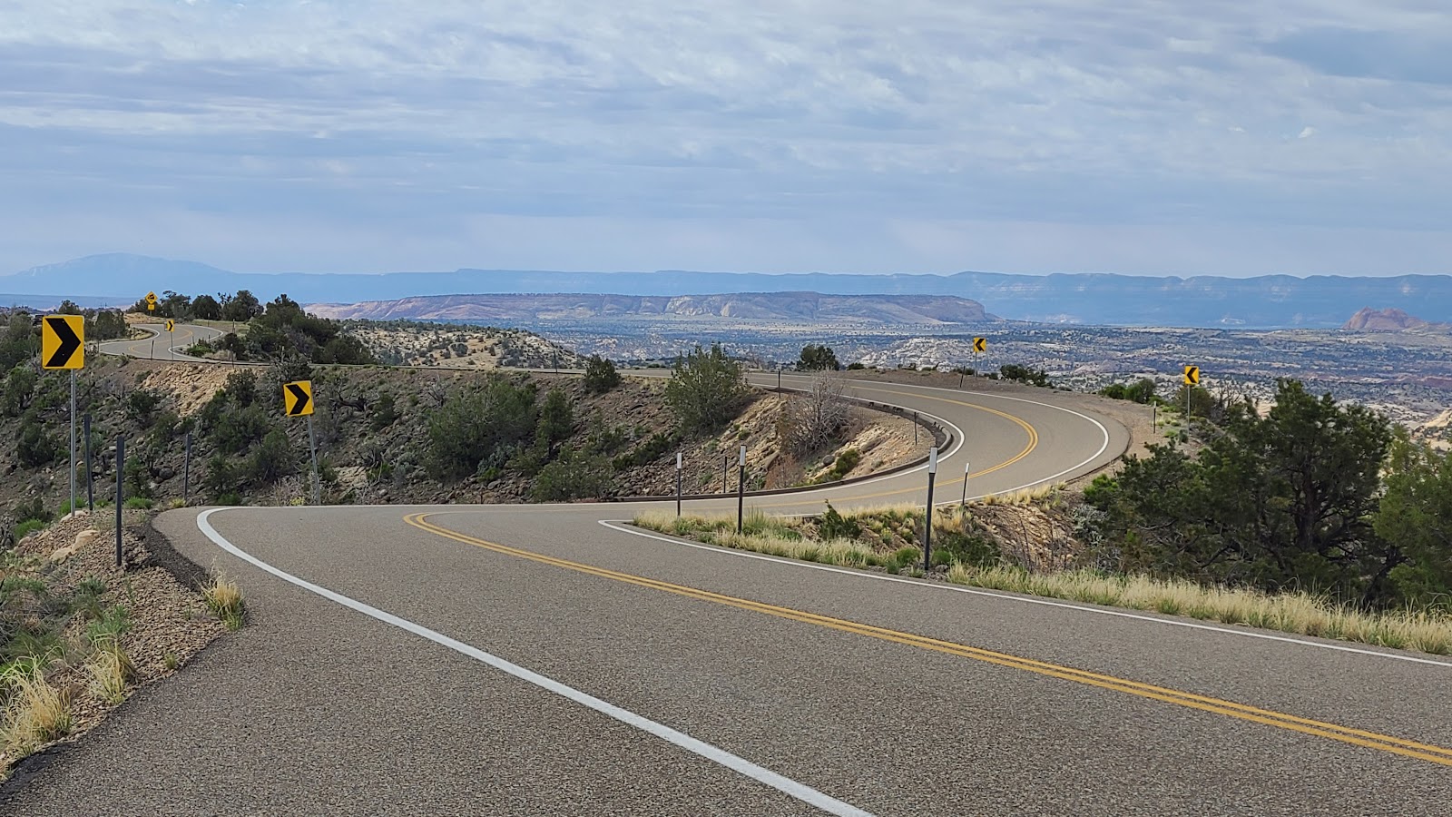 It winds it's way back and forth along the ridge far above the canyons on each side.
By 10:00AM we were turning off of Highway 12 and onto the Burr Trail Road. Our turn around destination is 36-miles down this road and unlike yesterday the first 30½-miles are paved.
The reason the pavement ends is because that is the point where we leave Grand Staircase-Escalante National Monument behind and enter Capitol Reef National Park through their unguarded back door.
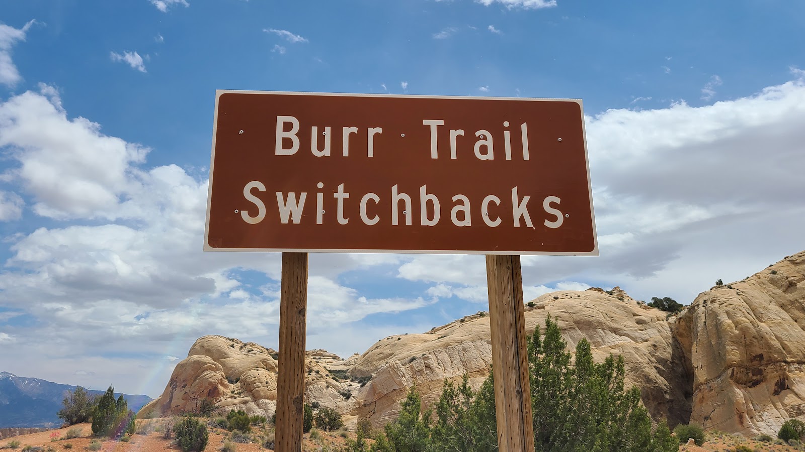
THE BURR TRAIL
 This paved road will be more pleasant to travel than yesterdays washboarded gravel road.
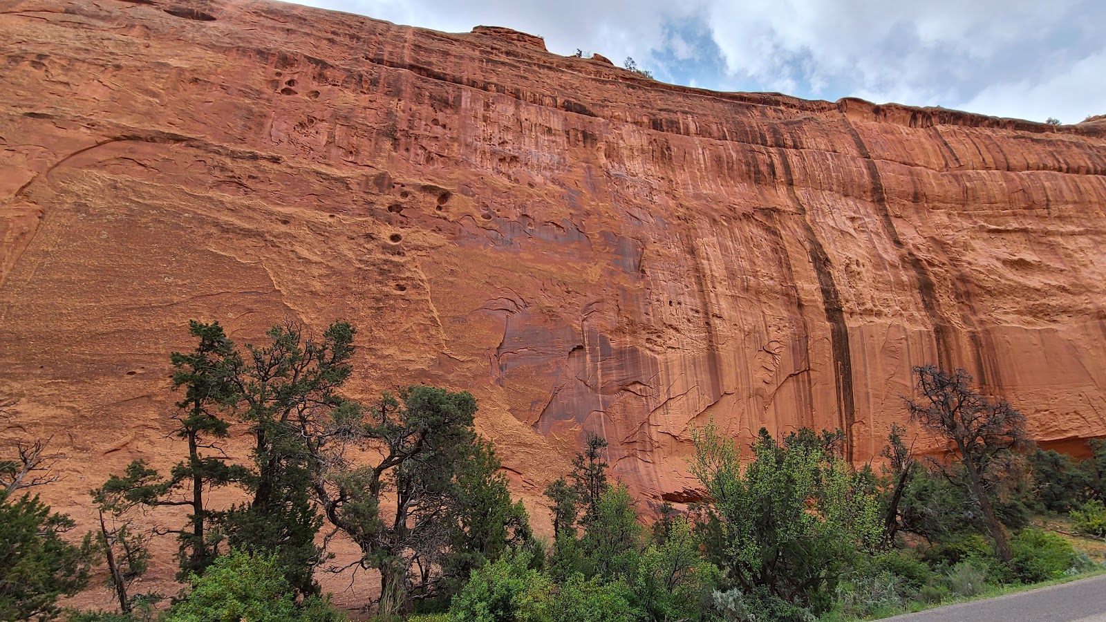
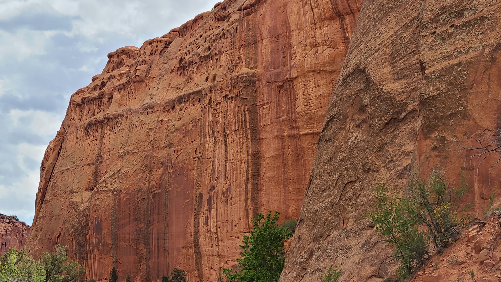
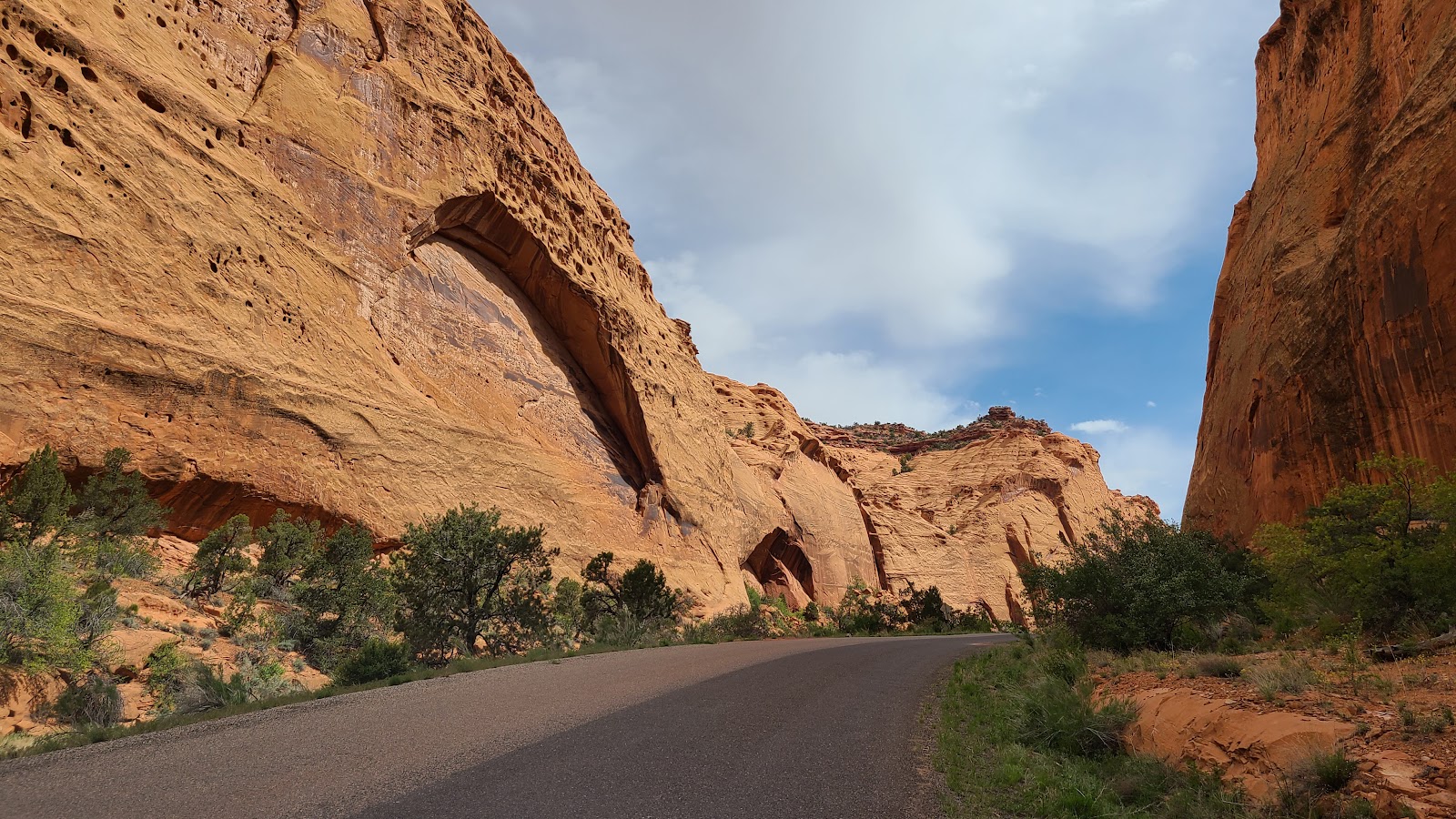
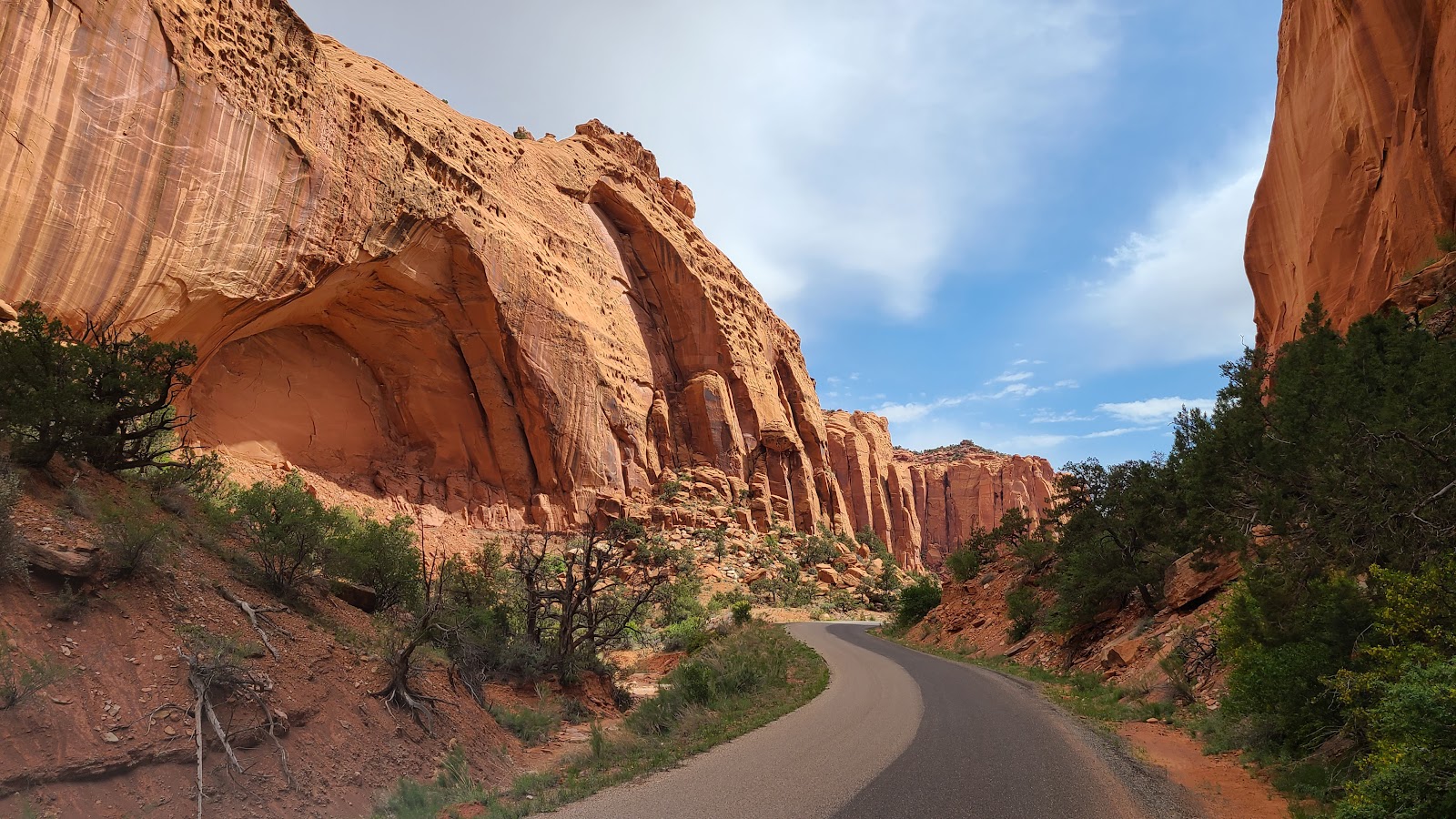
 It wasn't long before we were descending down into Long Canyon.
 It's easy to see why this is named Long Canyon, it went on for miles.
 The canyon walls are beginning to close in on us.
 Here's a closer look.
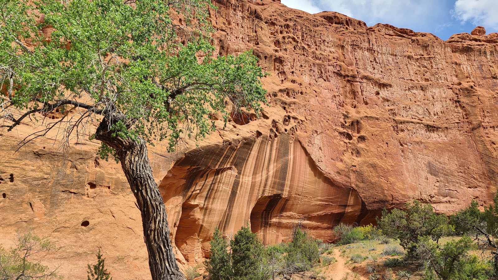
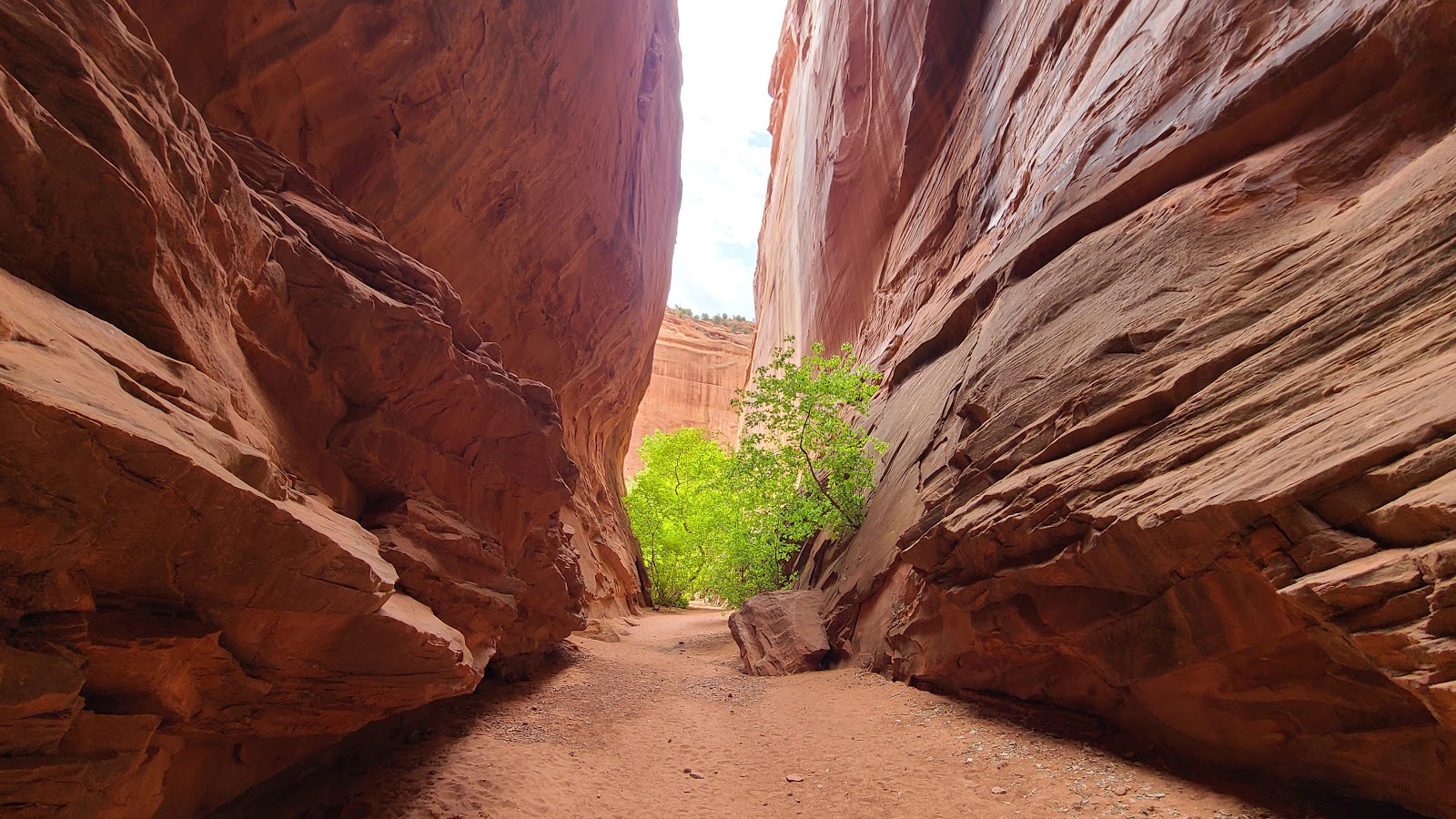
 We stopped here to do a short slot canyon hike, maybe 100 yards deep into the rock.
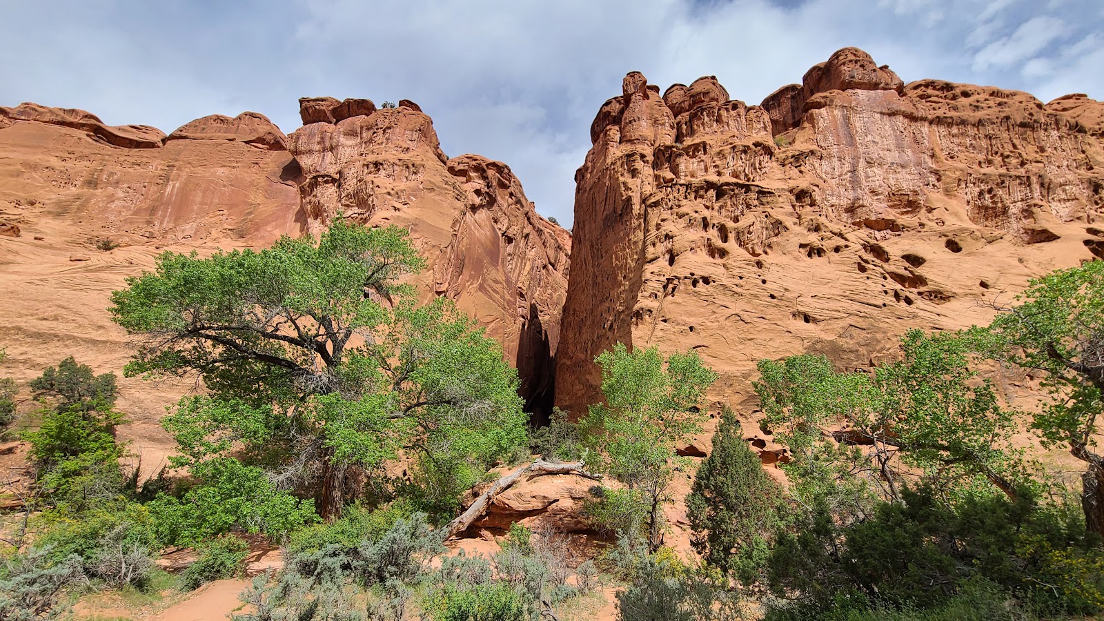 The canyon walls of the slot canyon looked to be about 500' tall.
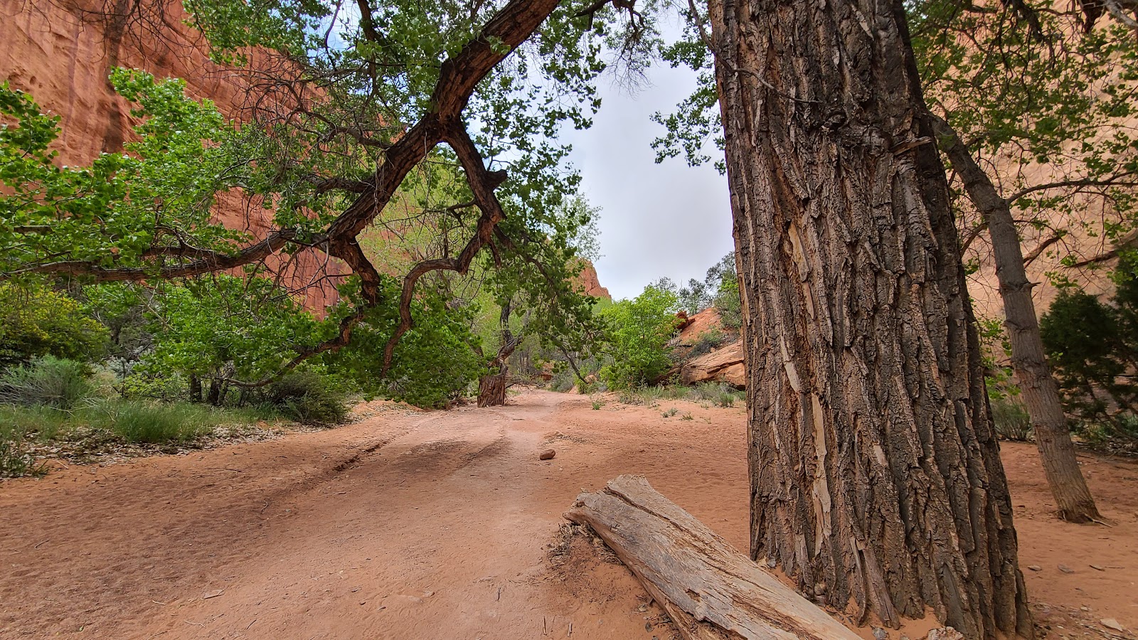
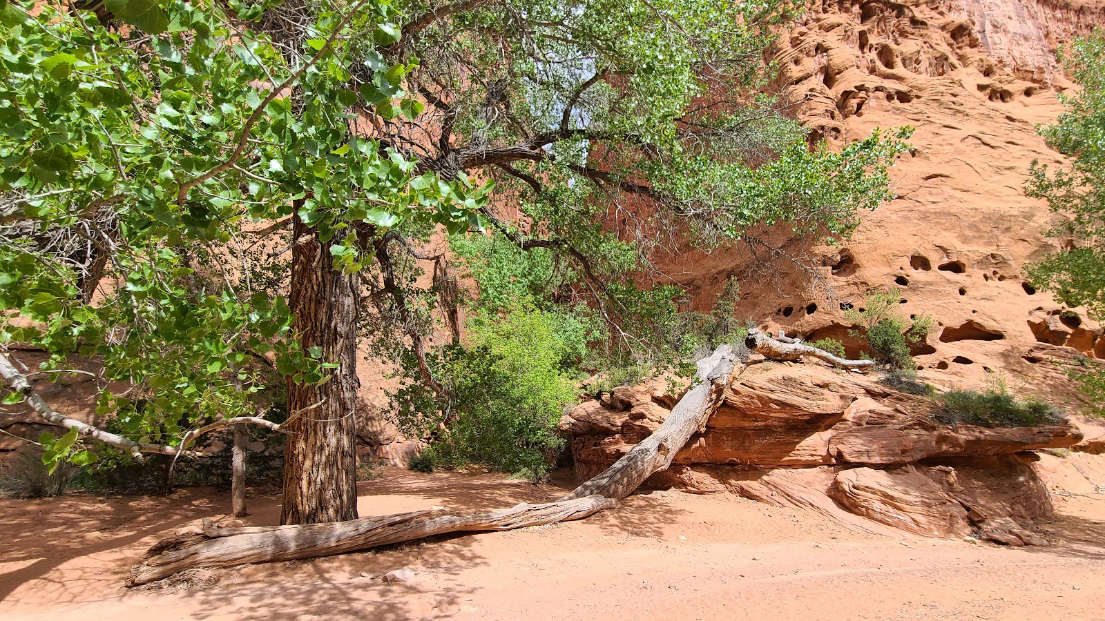 Behind that tree you'll find the hidden entrance to the slot canyon.
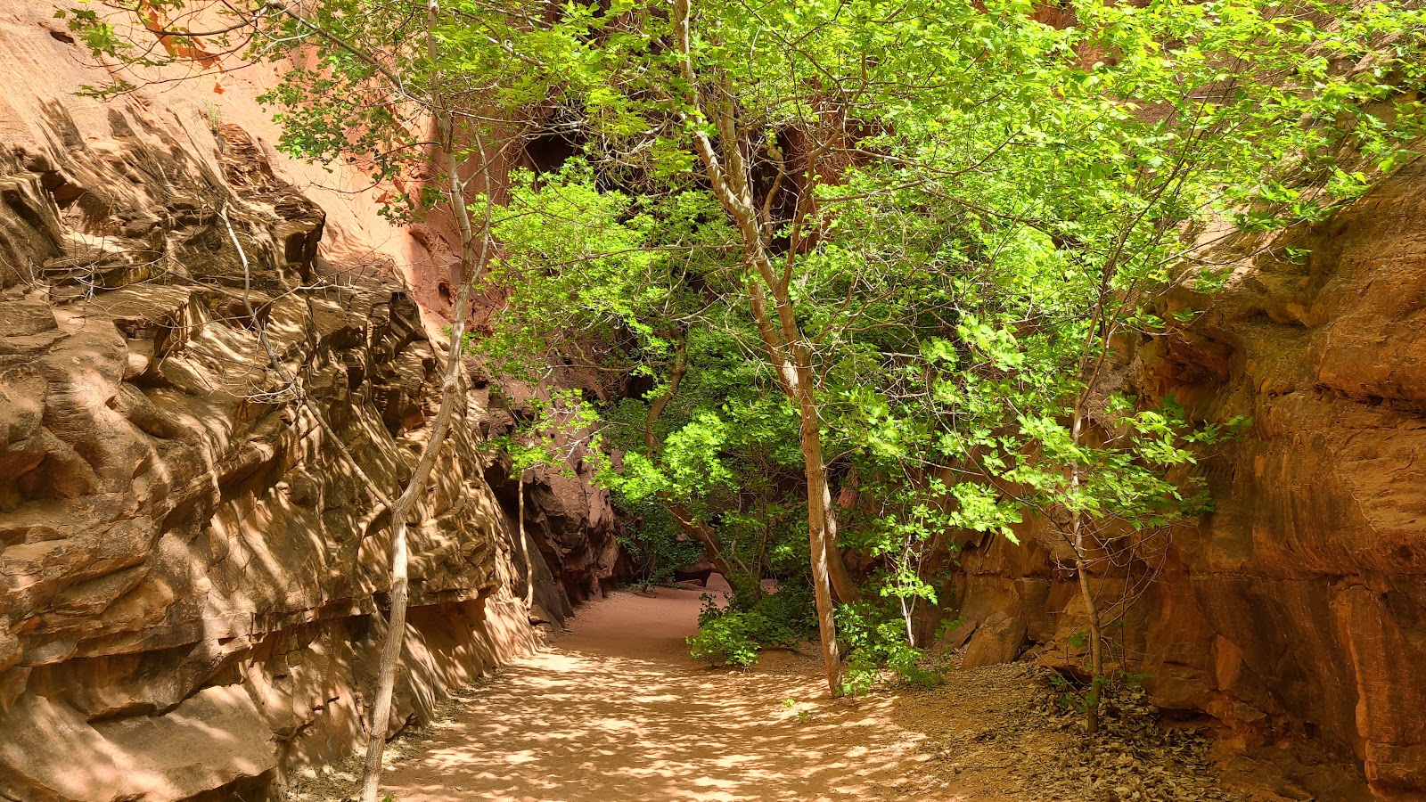 It's been a long time since water flowed through this eroded narrow canyon, ...
 ...you can tell by how many good sized trees are found in it.
 It looks like we're already approaching the end of this slot canyon.
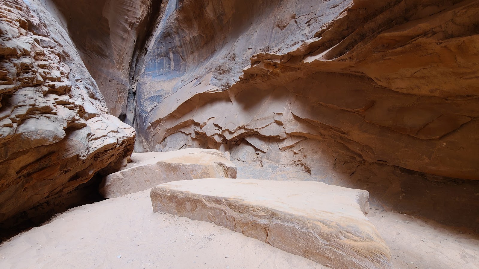 Yep, just behind these few boulders is the end.
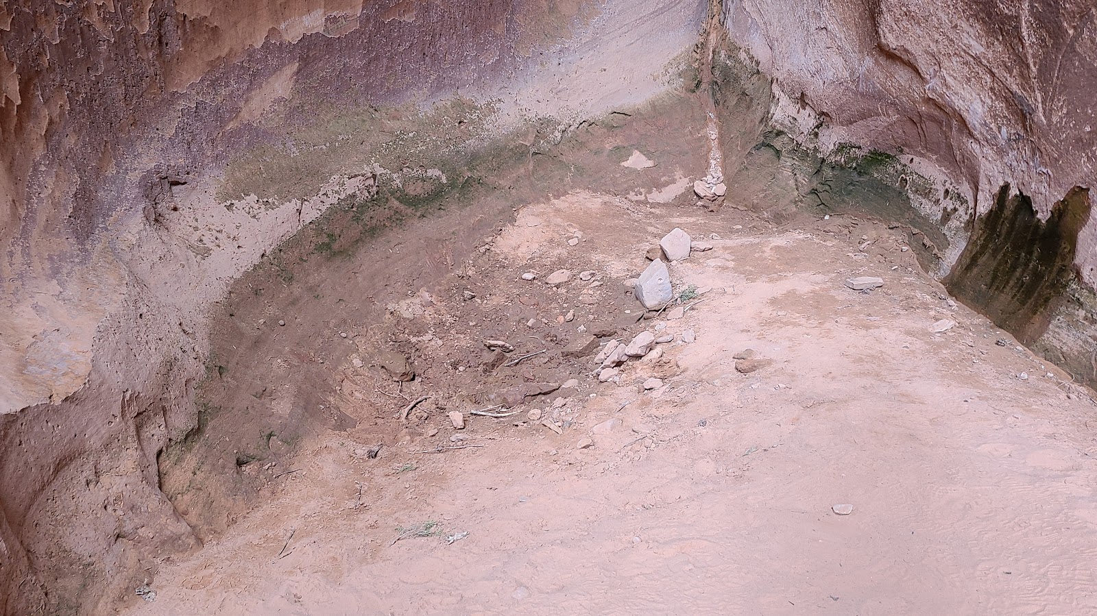 I expected to find a huge deep hole at the end, but nope, just a dry little indent in the floor.
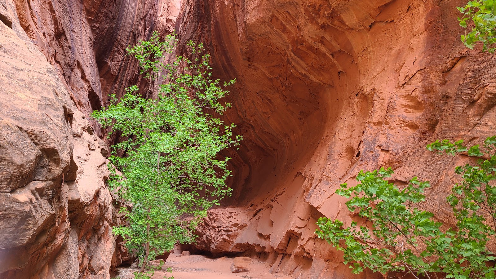
 Time to turn around and head out of here. Isn't that a pretty sight?
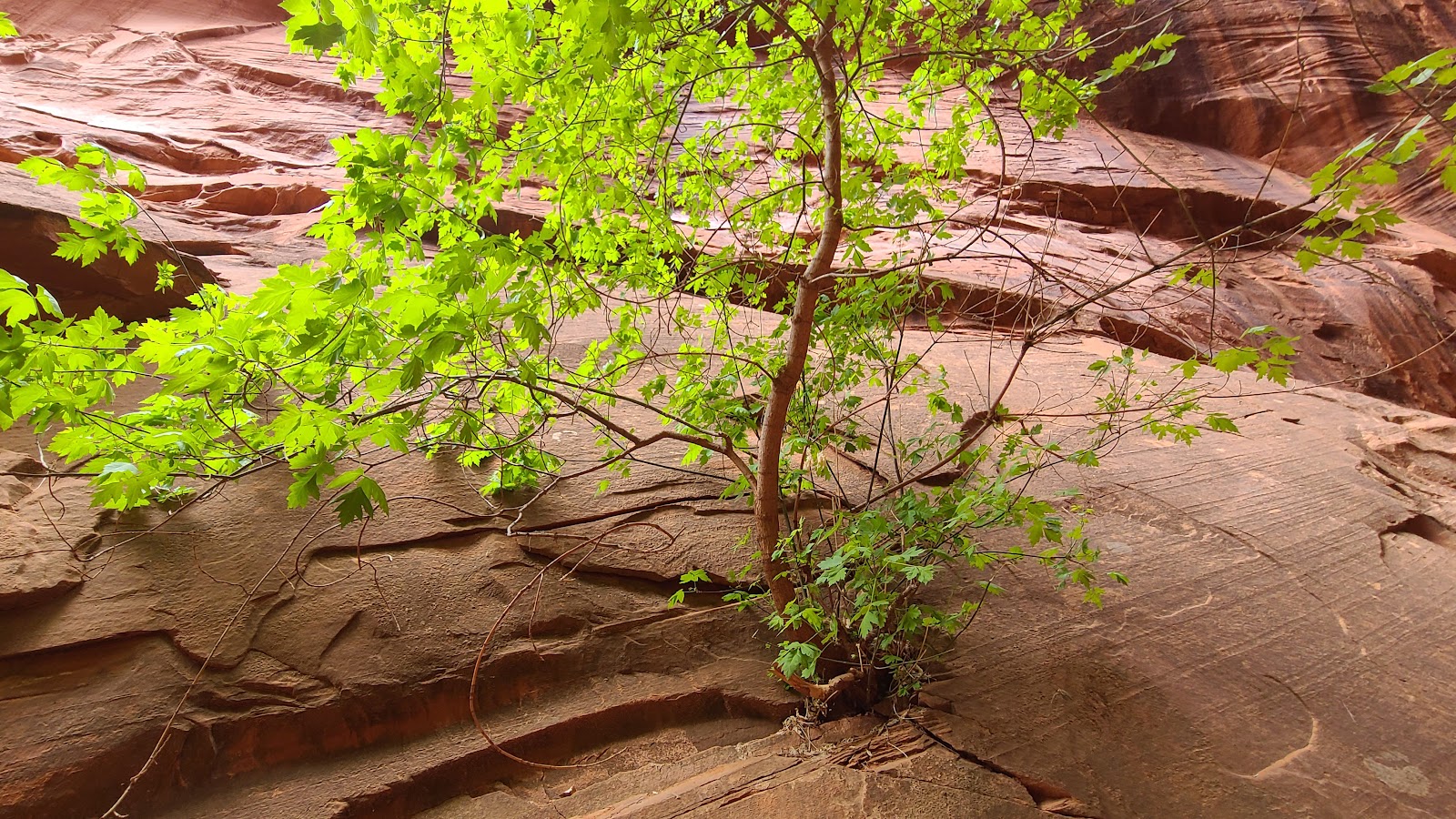 Tricia spotted the "small tree" growing right out of the rock wall.
 We're half way back to the parking lot now.
 The sun light shining through the leaves is just so darn pretty.
 These erosion holes make for great bird's nests.
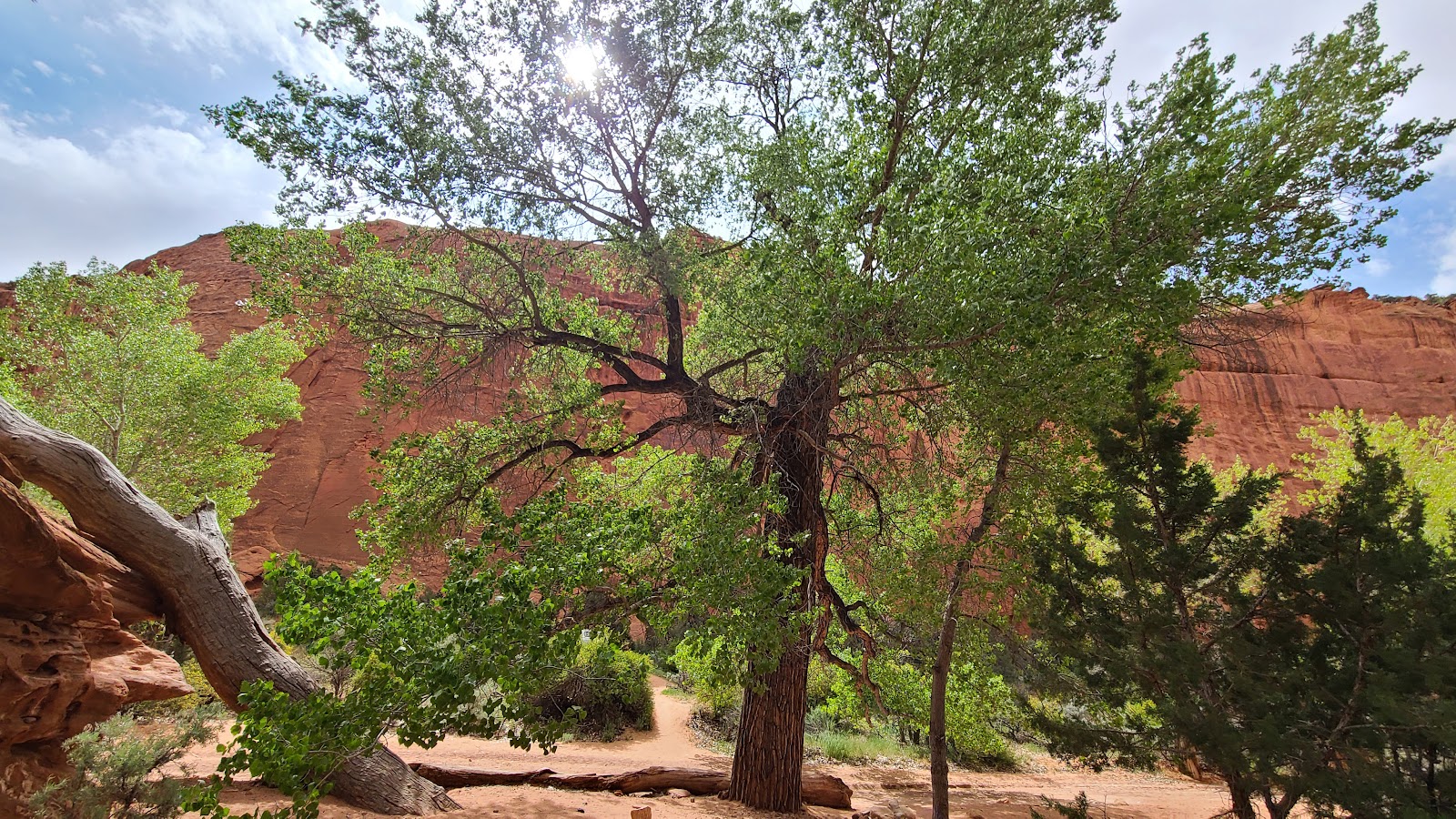 We're back to that big "old" tree hiding the entrance.
 Tricia was noticing just how thick the bark on this tree was.
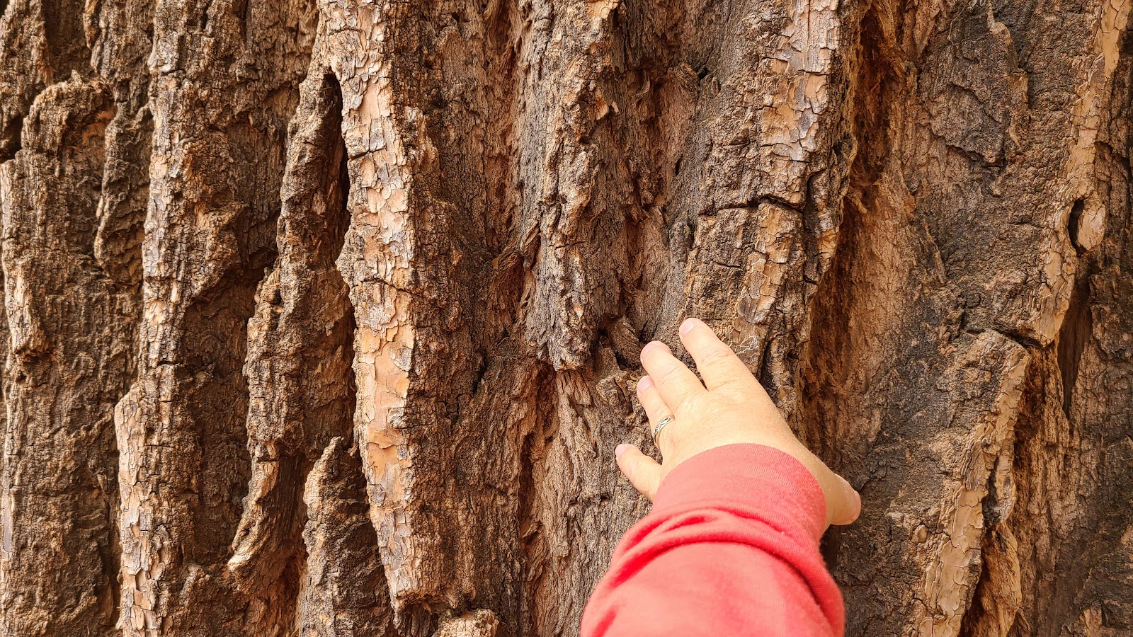 It's deeper than her thumb is long.
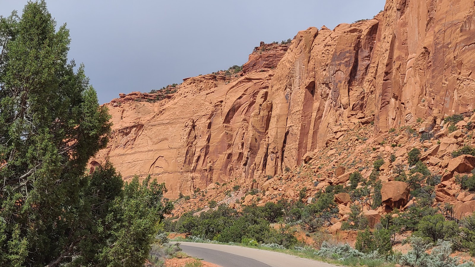
 Back on the trail now and we're still not through Long Canyon.
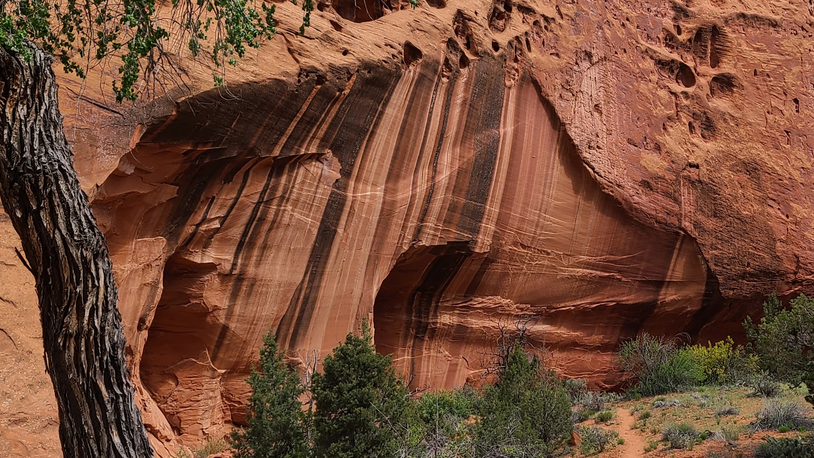
 All along the walls there are indents where the rock has just fallen away...
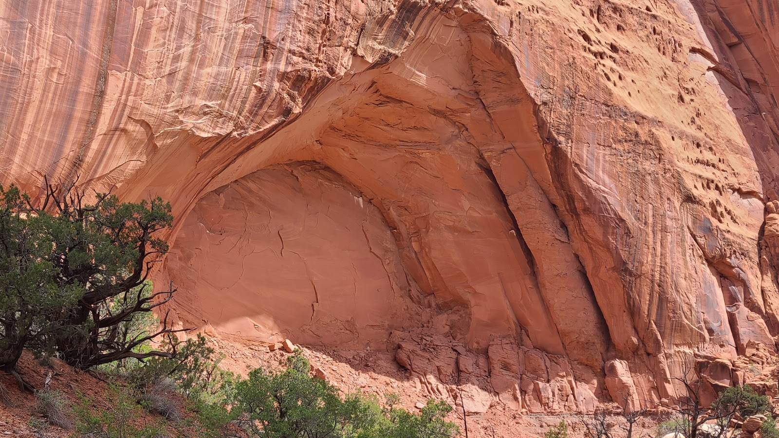 ...leaving behind these deep arch formations in the rock.
 Yellow, orange, pink and red rock all in one place.
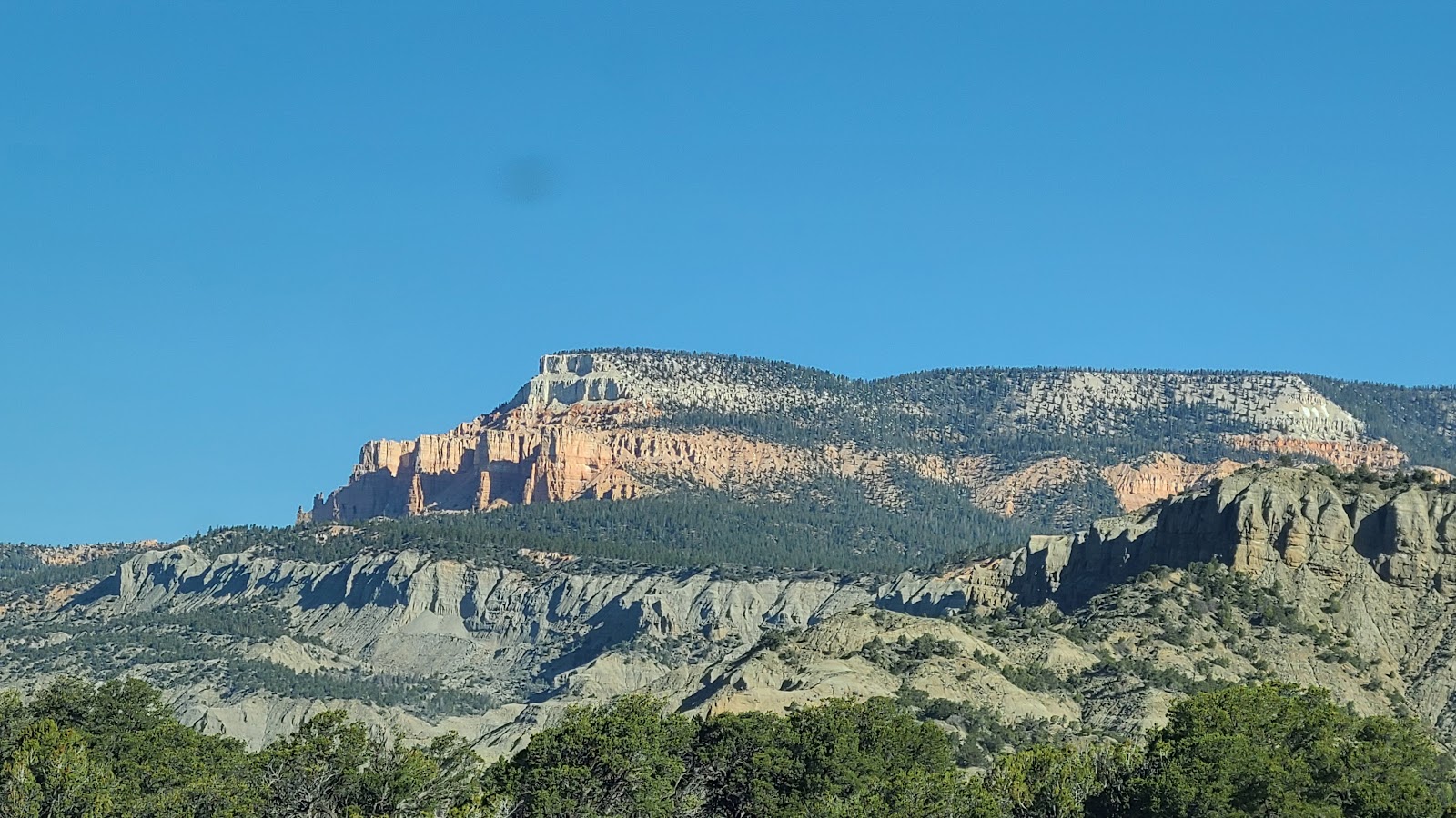
 These hoodoo formations remind me of Bryce Canyon, which is not that far away from here.
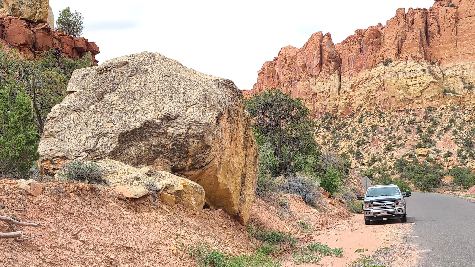 Now that's a huge hunk of rock that fell from the canyon wall.
 Finally we're out of Long Canyon and into some wide open space.
 Snow capped mountains in the desert? I'll never understand how that happens.
 We've left the National Monument and entered the National Park. Know what that means?
 No more pavement, it's all gravel roads from here to our turnaround spot.
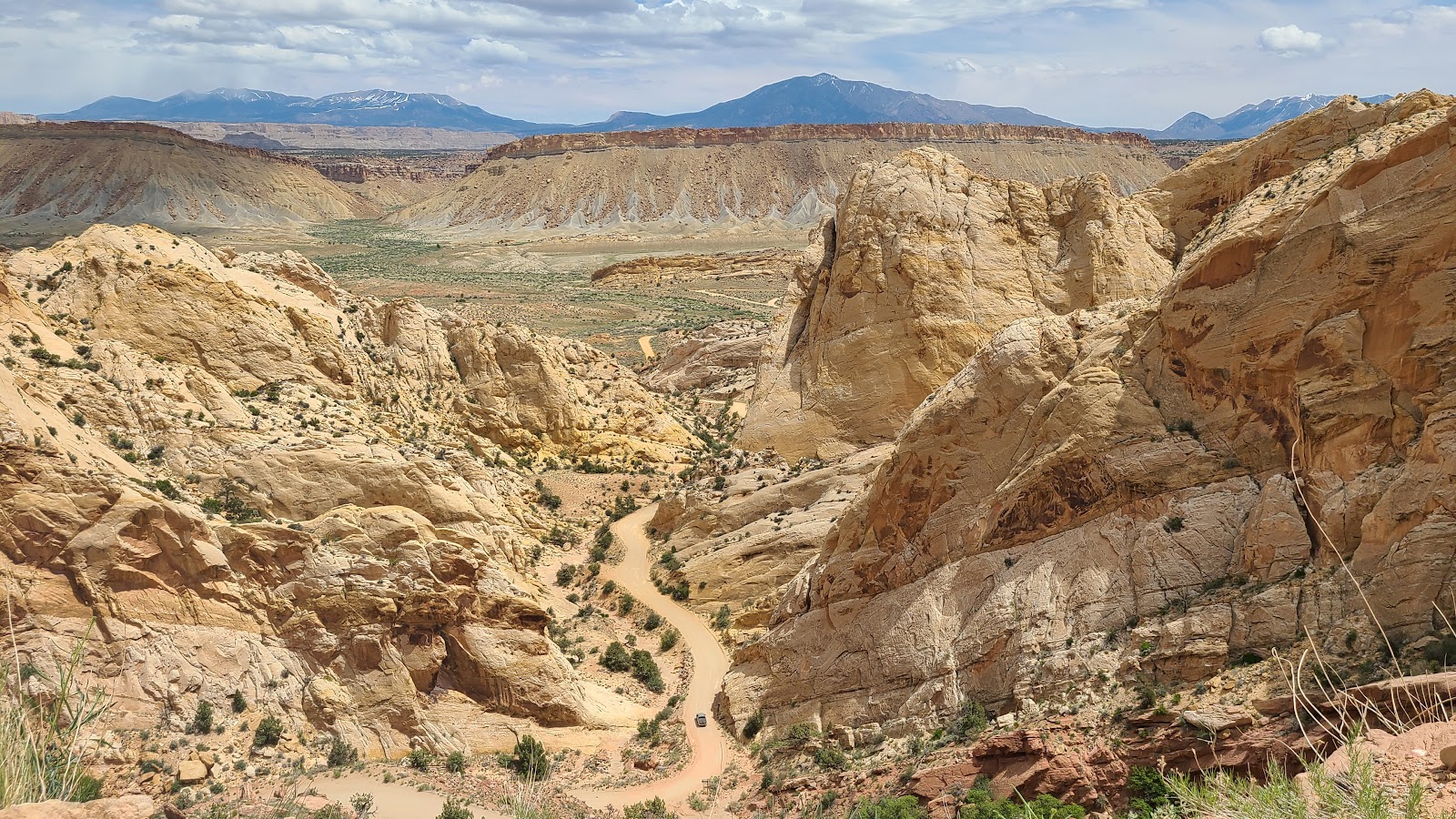
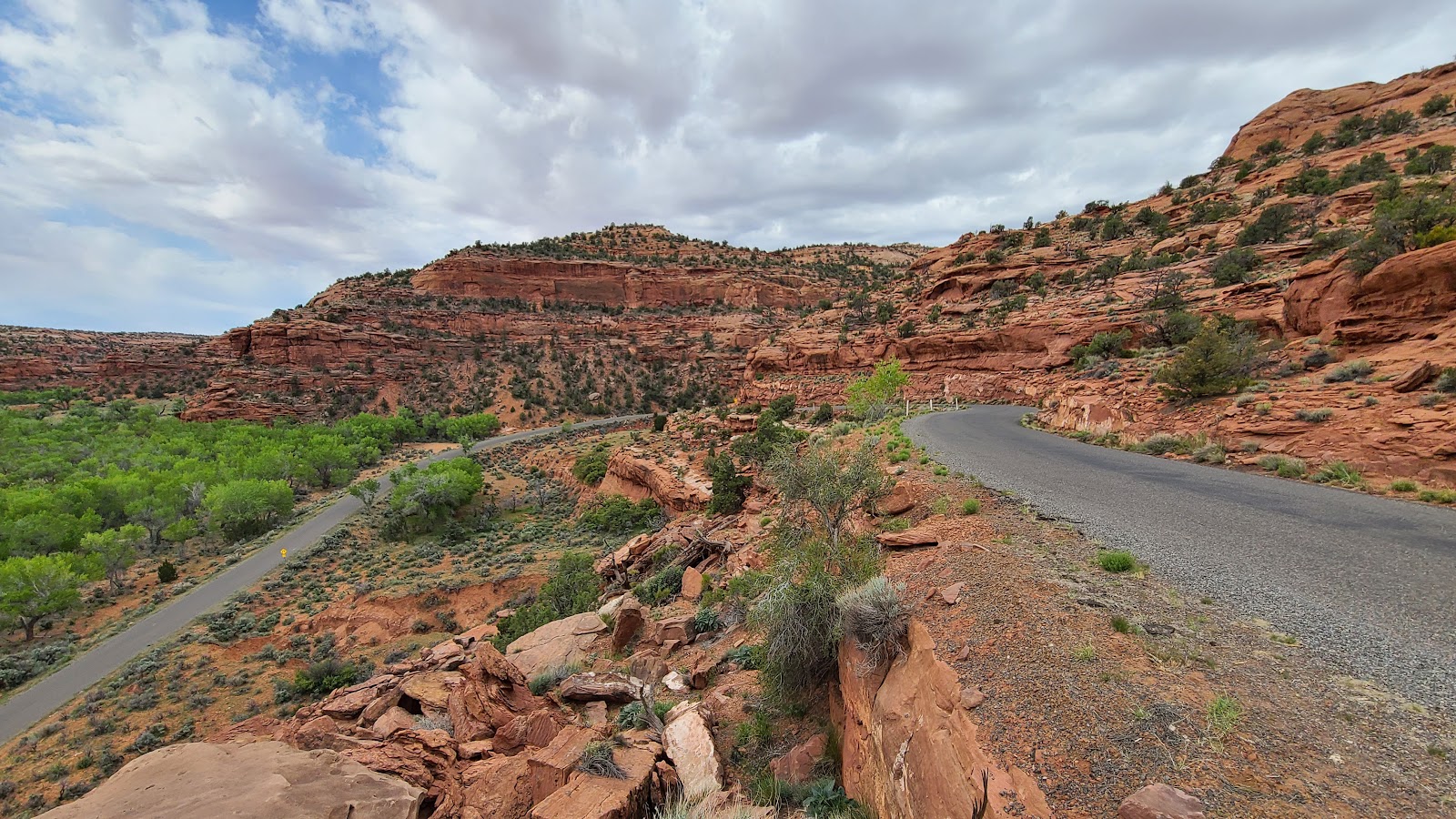
 And this is where we turnaround to head back home...
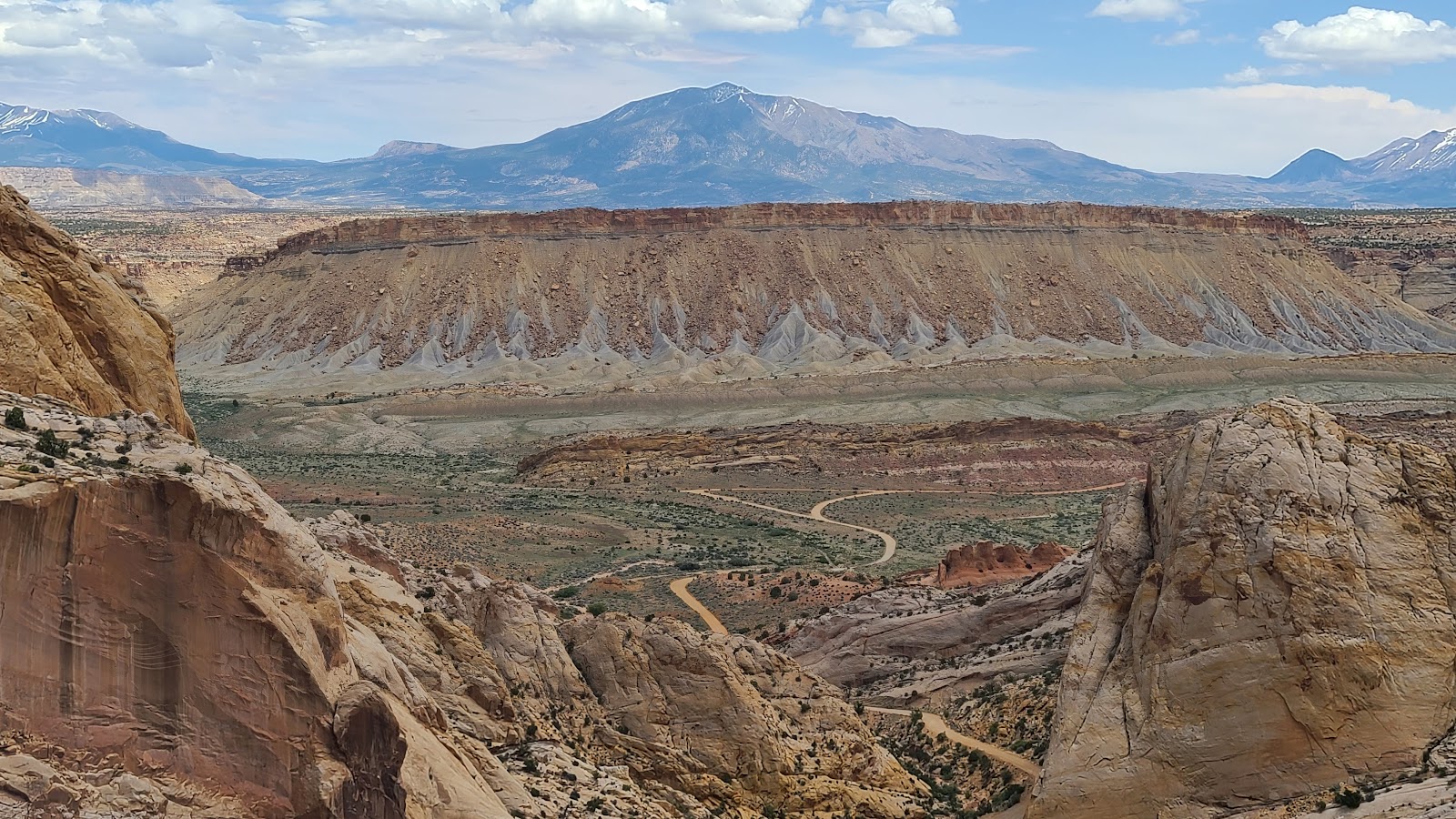
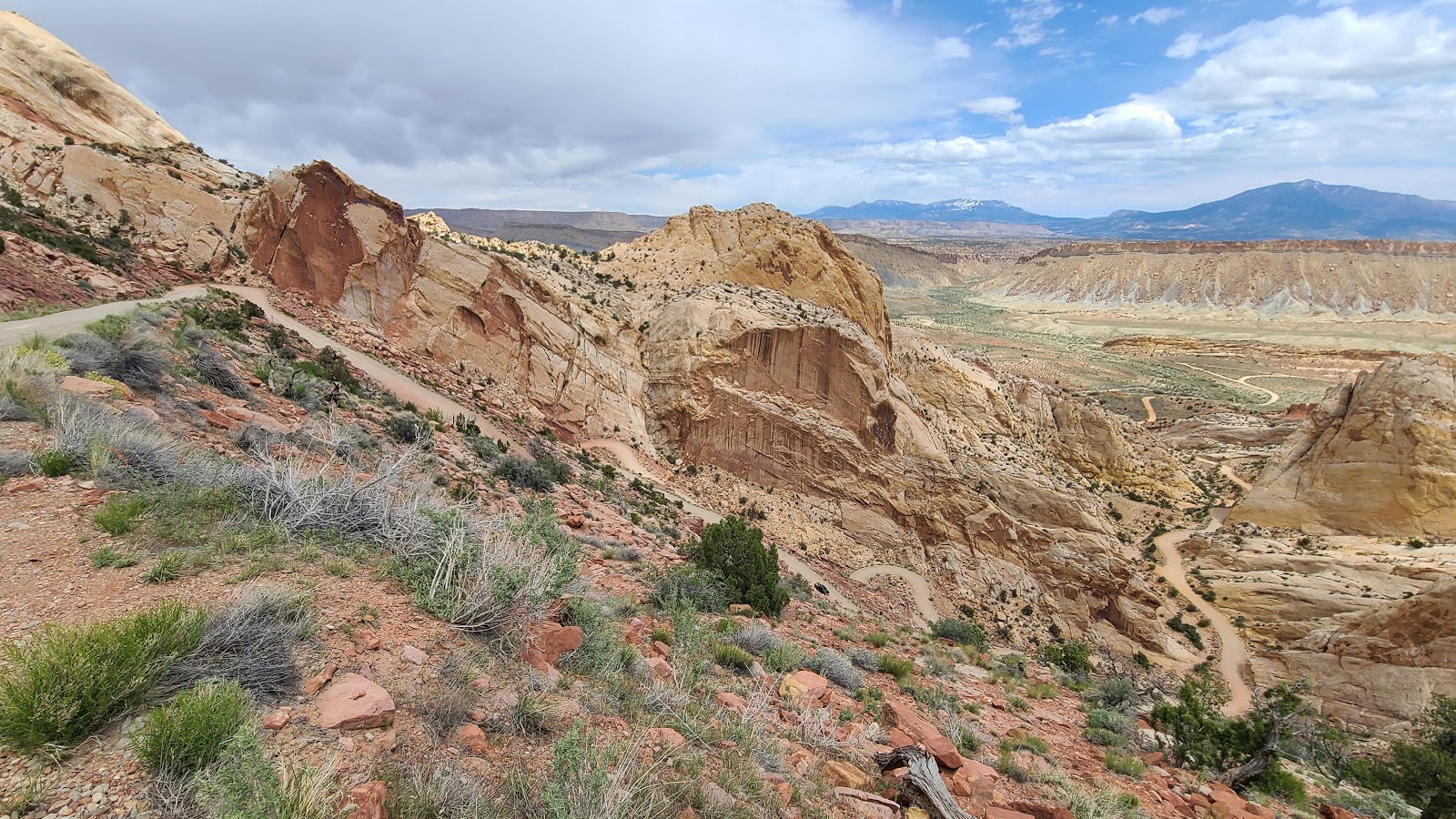 ...but not before we drive down the six switchbacks that will drop us down 750'.
 We took it nice and slow. No skidding around the corners for us.
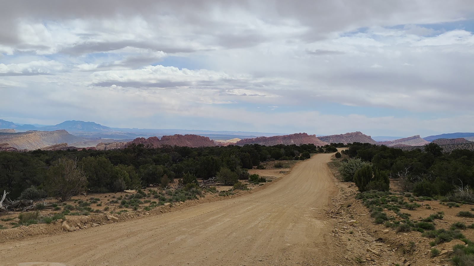
 At the very top of this photo where the road "V"s is where we're headed.
 But we still have four more switchbacks to go before we get there.
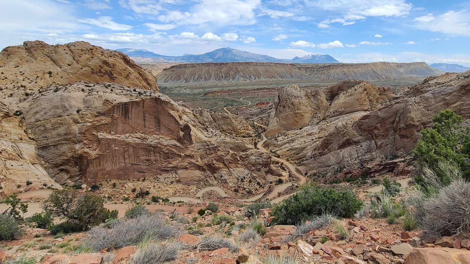
 Once at the bottom, our options of 30+ miles of gravel road don't seem appealing.
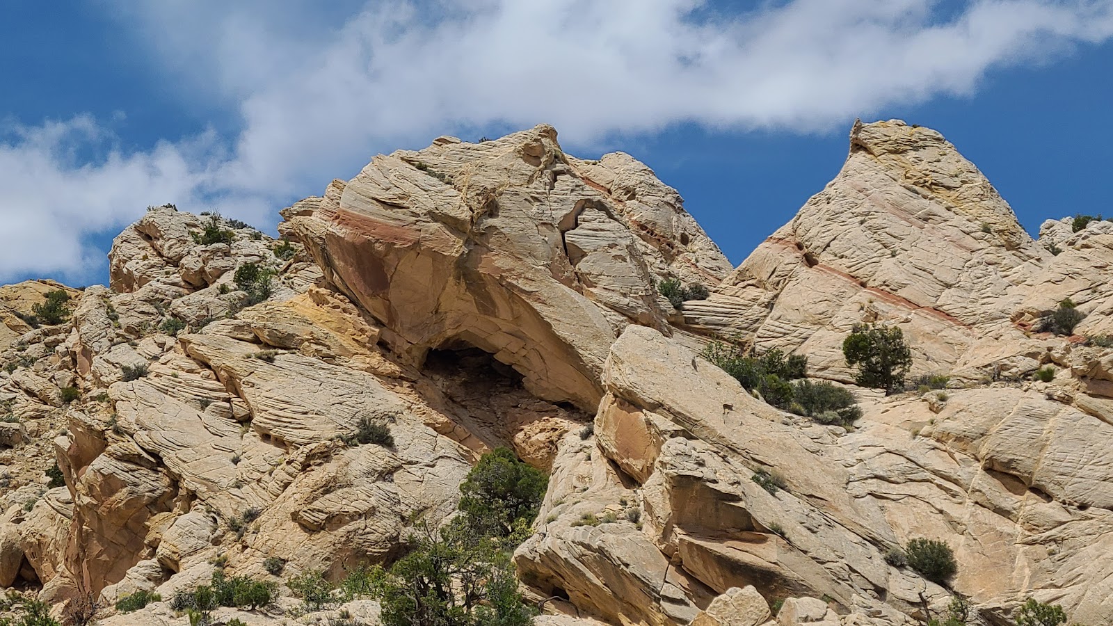 Look, a cave up there to explore! Nope, not for us today, it's after noon and I'm hungry.
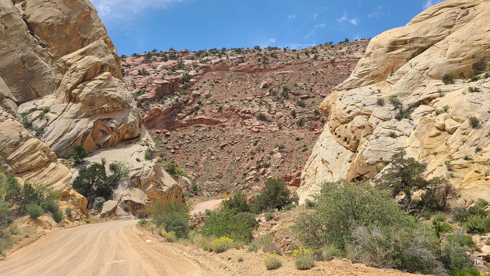 Now it's time to drive back UP those switchbacks and get out of here.
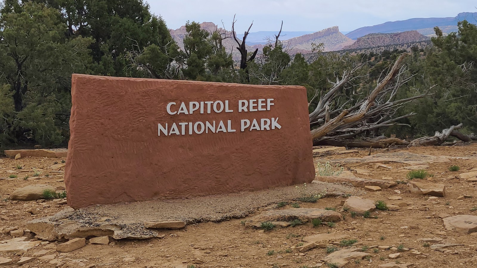
 That's all part of Capitol Reef National Park, our next stop in Utah.
 We made it back to the top, now let's go find some lunch.
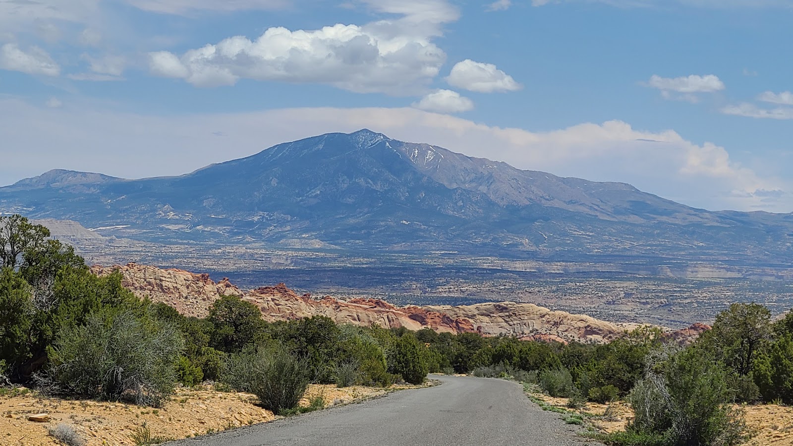 One last look back at the mountains of Capitol Reef National park.
 Still can't believe how beautiful this drive is.
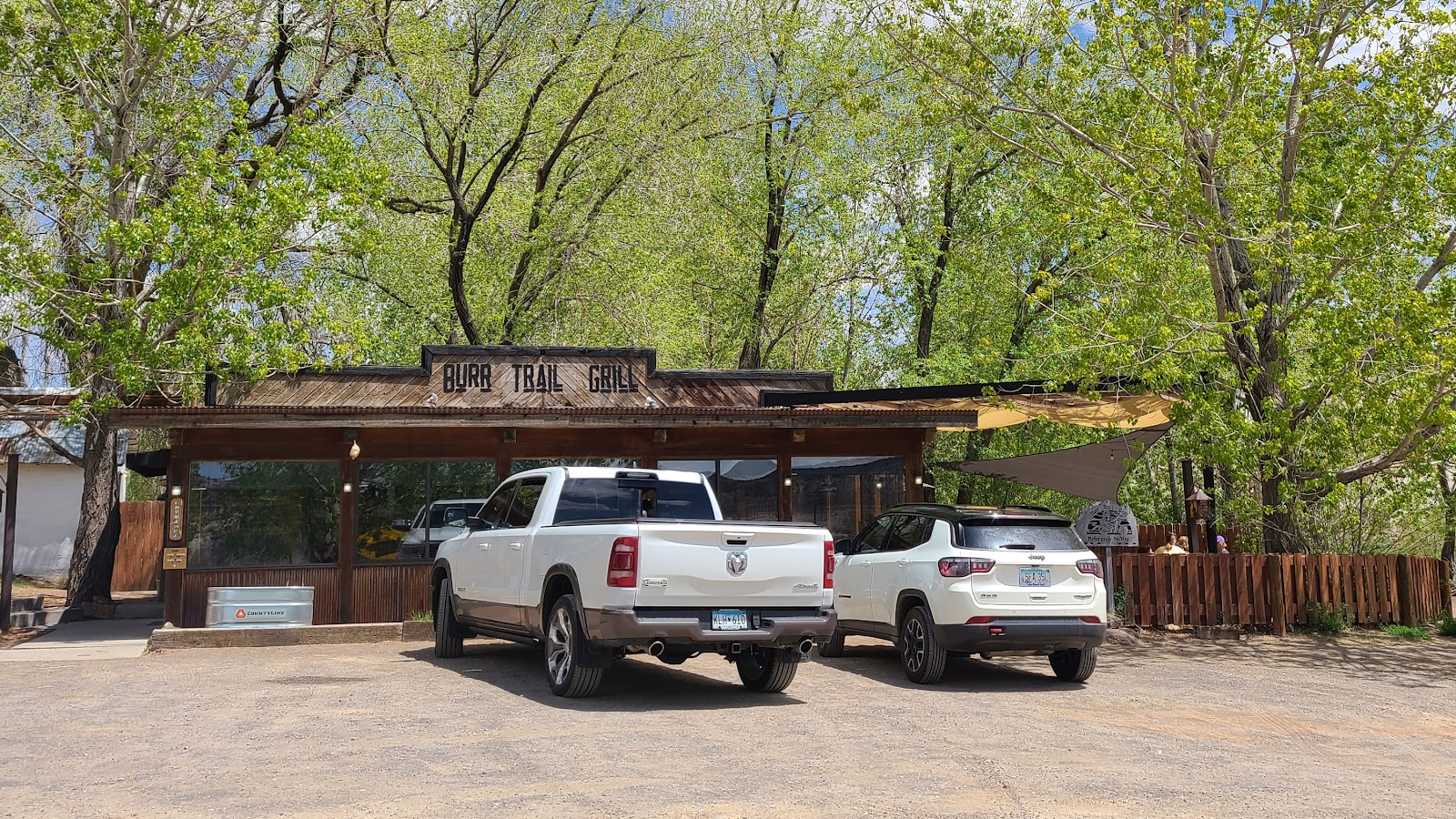
After our long day exploring the Burr Trail, I figured it was only proper that we enjoy a couple of gourmet cheeseburgers at the Burr Trail Grill here in Boulder, UT.
After 30-minutes of driving back up Highway 12 and nearing the turnoff for the campsite we saw that it was probably raining there. That's going to make for a muddy mess with all the sand surrounding
THE POD.
SUNDAY - Yesterday we took the easy drive between Escalante and Boulder along UT-12 which was completed somewhere in the mid-1930s.
Today we are going to drive from Escalante over to Boulder along the original wagon trail route, aptly named Hells Backbone.
For today's route we'll be traveling through the Dixie National Forest, instead of the Grand Escalante National Monument. At the top of the route we will be in elevations just above 9000', so I suspect we'll be seeing some of this past winter's snow still melting.
So much of southern Utah is federally owned land, that means it's reserved and preserved for us, the general public to enjoy for generations to come.
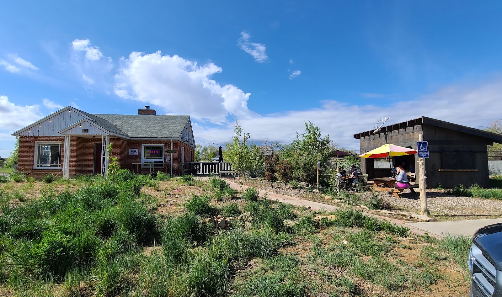
But before we get to the driving portion of today's activities we'll be needing some breakfast, and I know just where to get a delicious home cooked meal. No, not here at THE POD, but at Magnolia's Kitchen, which is location right on UT-12 in Escalante, UT.
As you can see from the photo
Magnolia's Kitchen is located in a small converted home. We ate our delicious home style cooked breakfast just behind that big picture window on the left side of the house in the original dining room.
They just opened 10-days ago and judging by the crowd of people here for breakfast this morning, locals and travelers alike (I checked the license tags on the cars outside), they'll be open for some time to come. We wish them great success!
HELL'S BACKBONE
IN THE
DIXIE NATIONAL FOREST
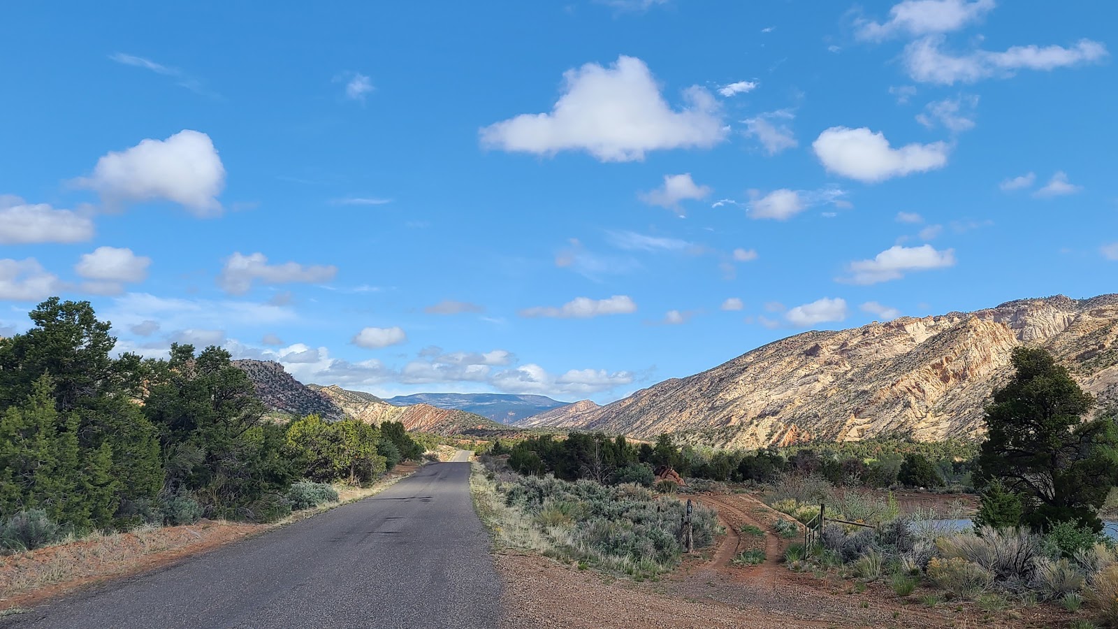 Hell's Backbone Trail started off easy enough with smooth paved roadways.
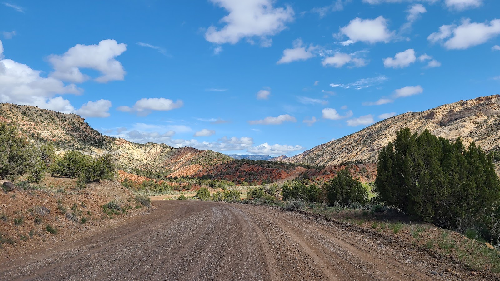 But we were soon traveling on the gravel roadway we expected to see.
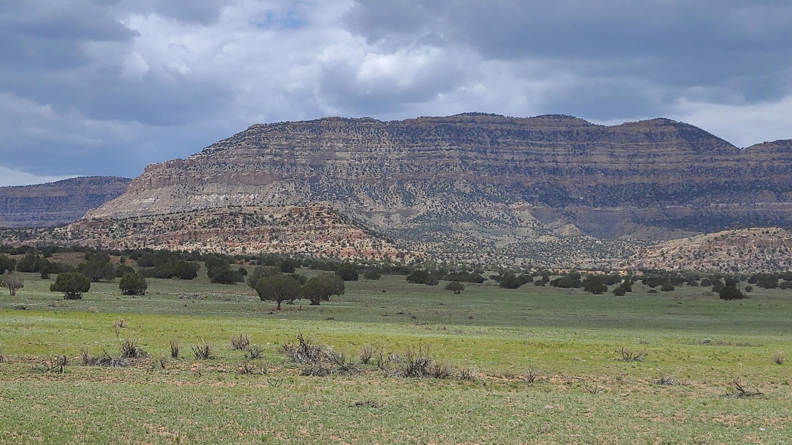
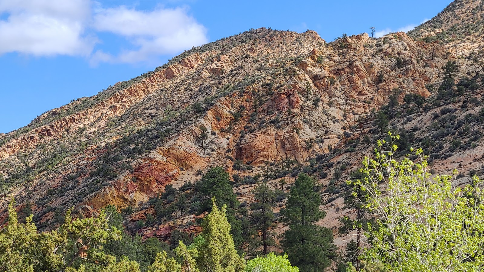
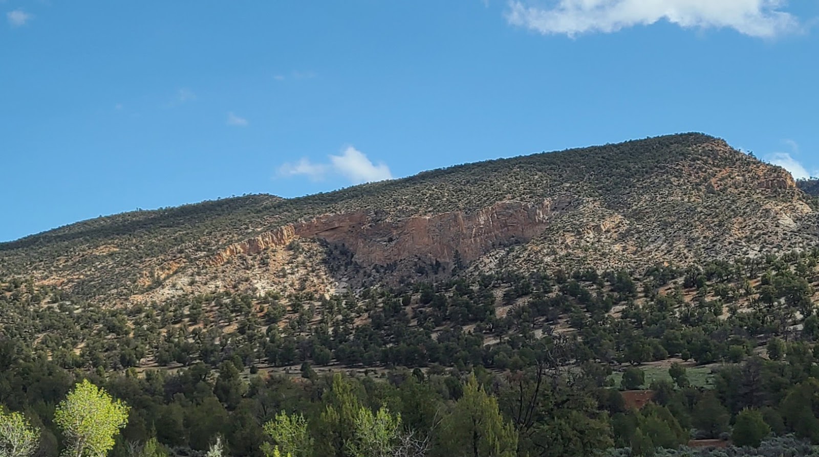
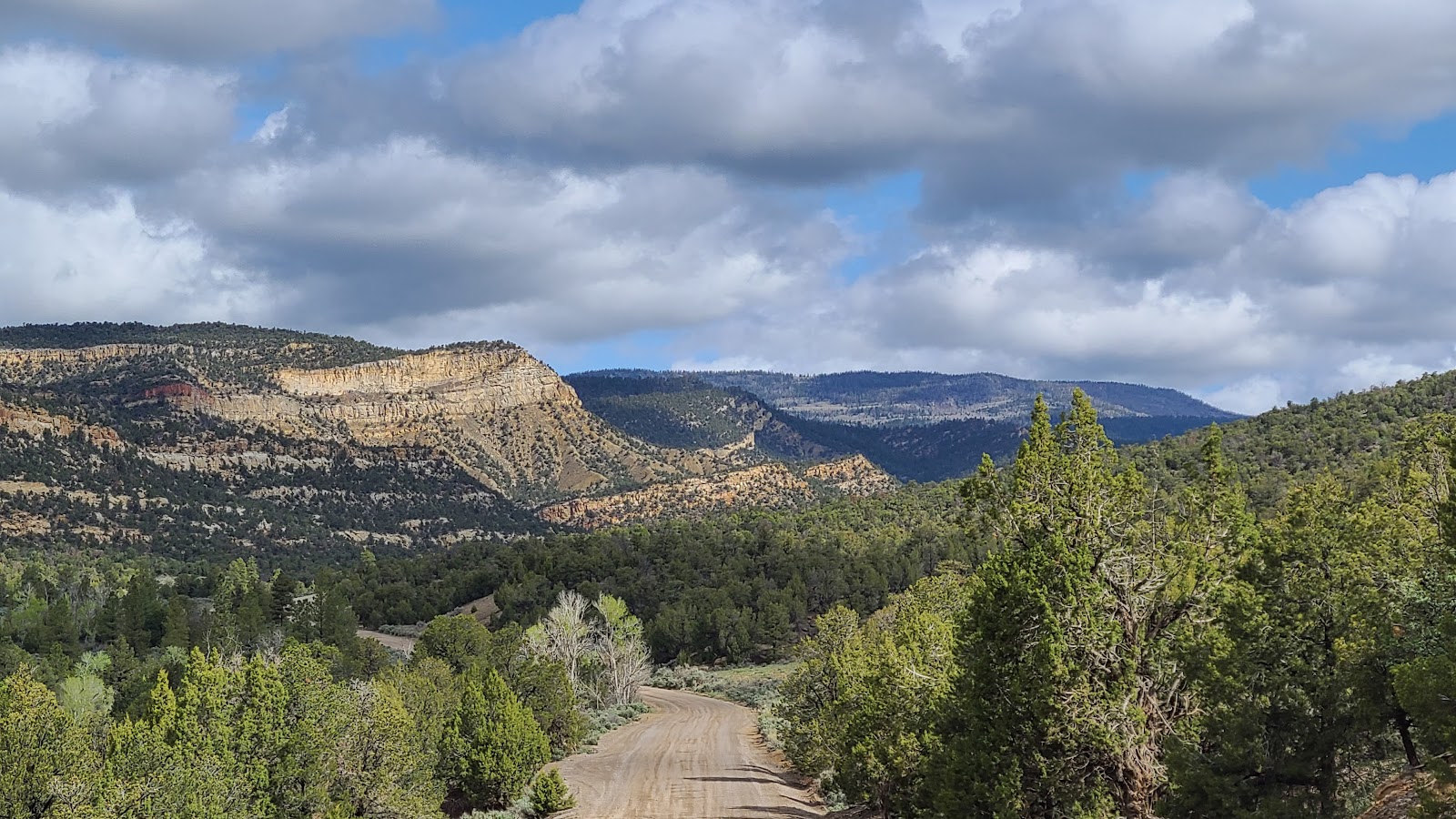
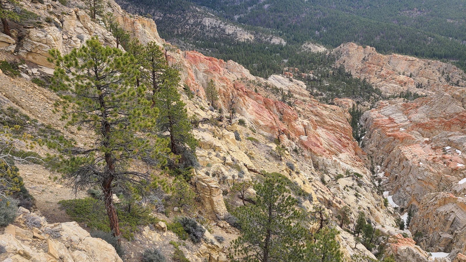
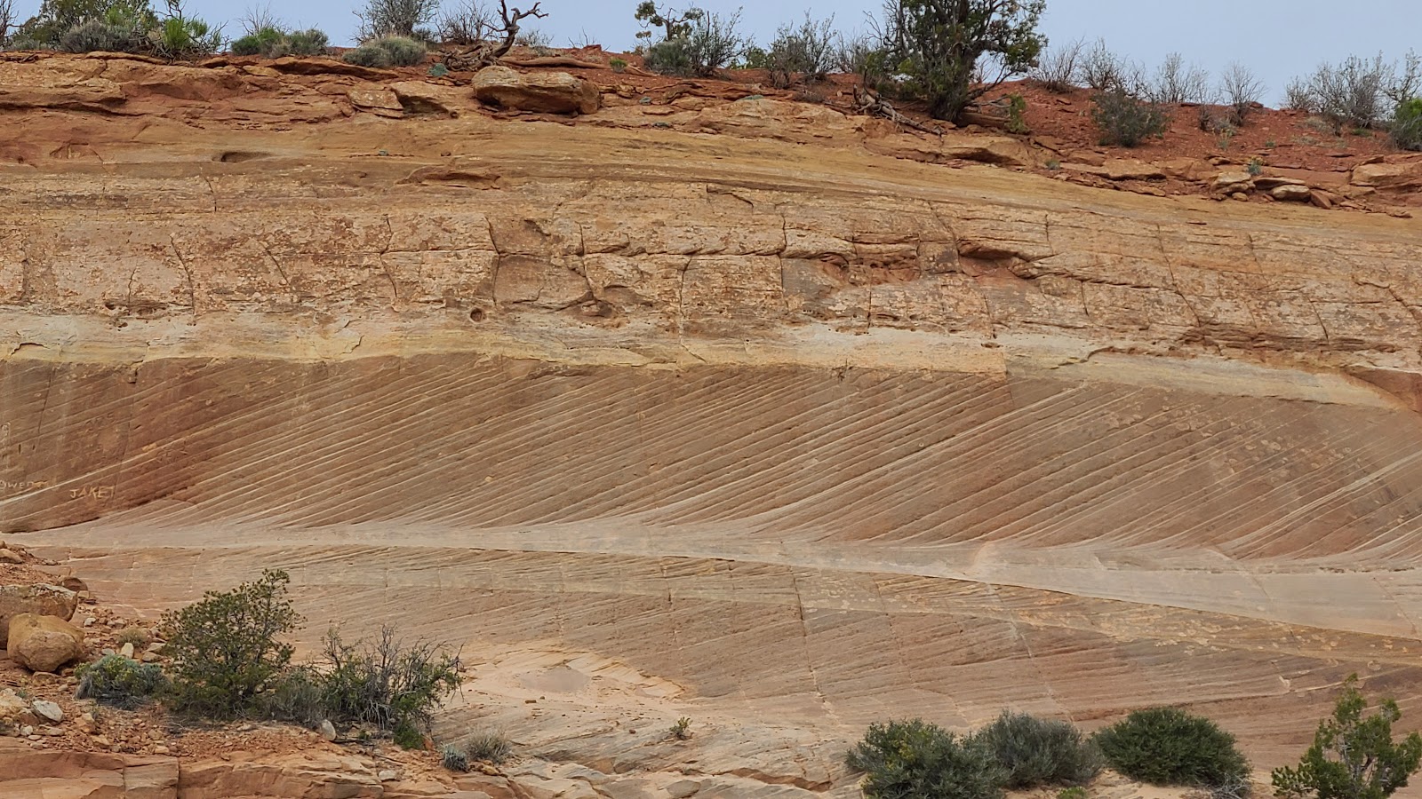
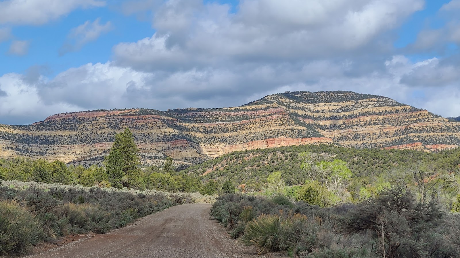
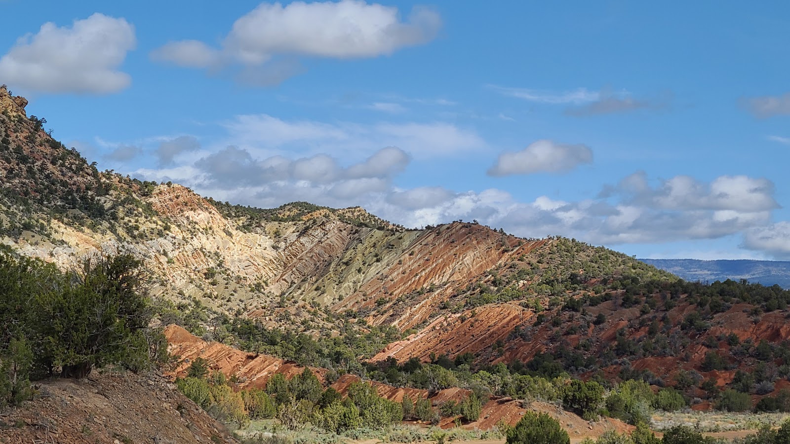 More of the stunning Utah scenery we've come to enjoy.
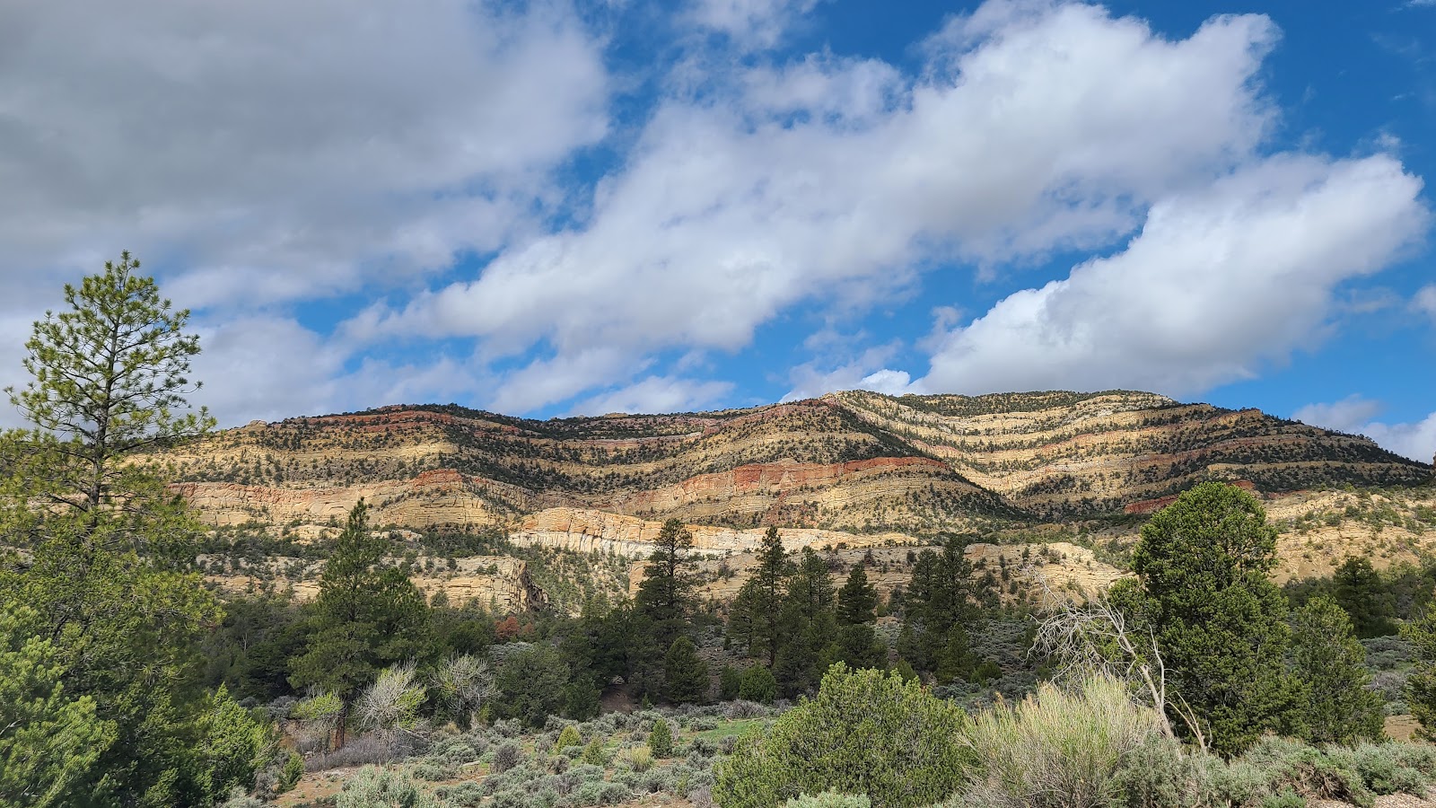
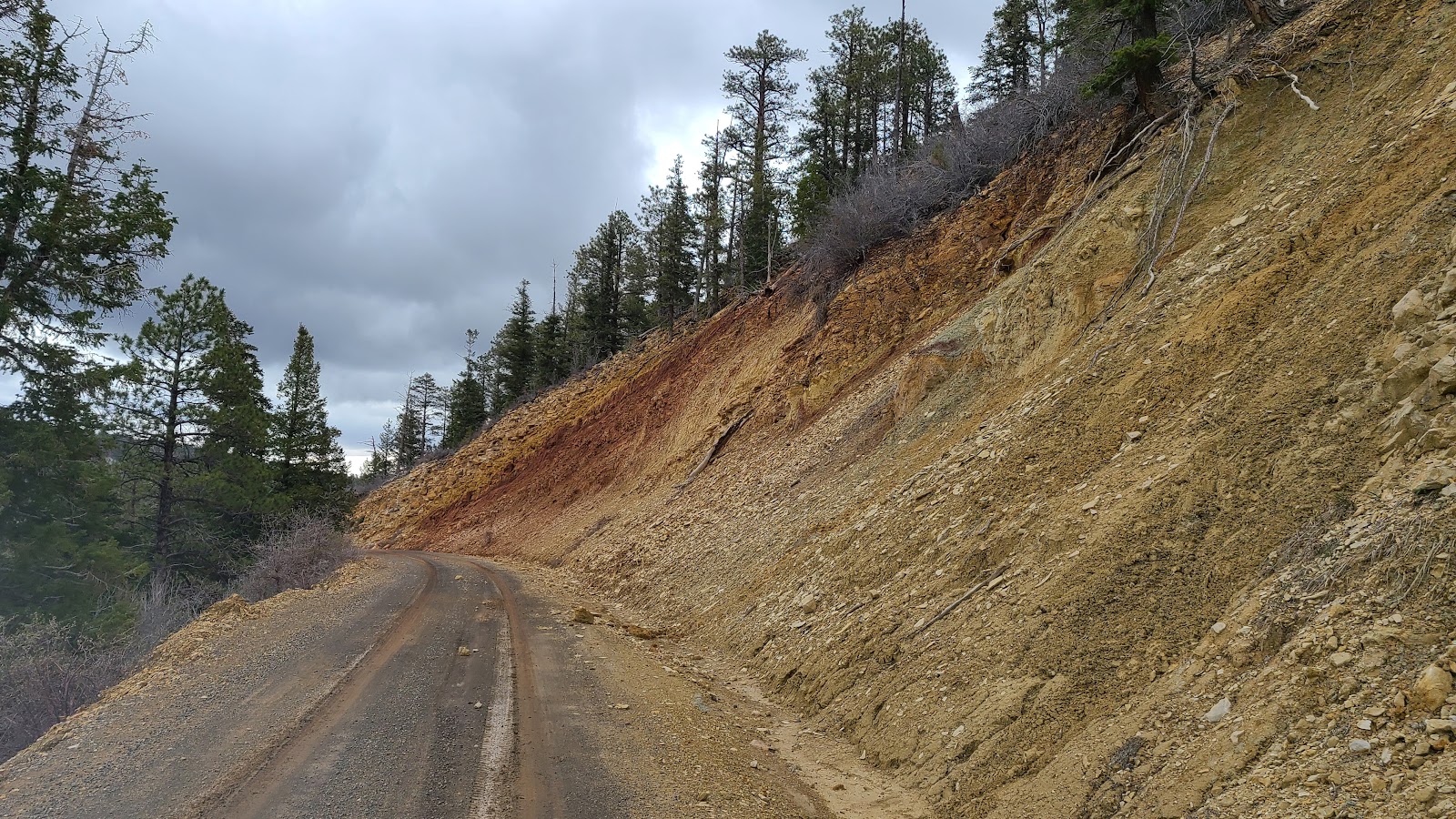
 Look at those striped colors in the hillside.
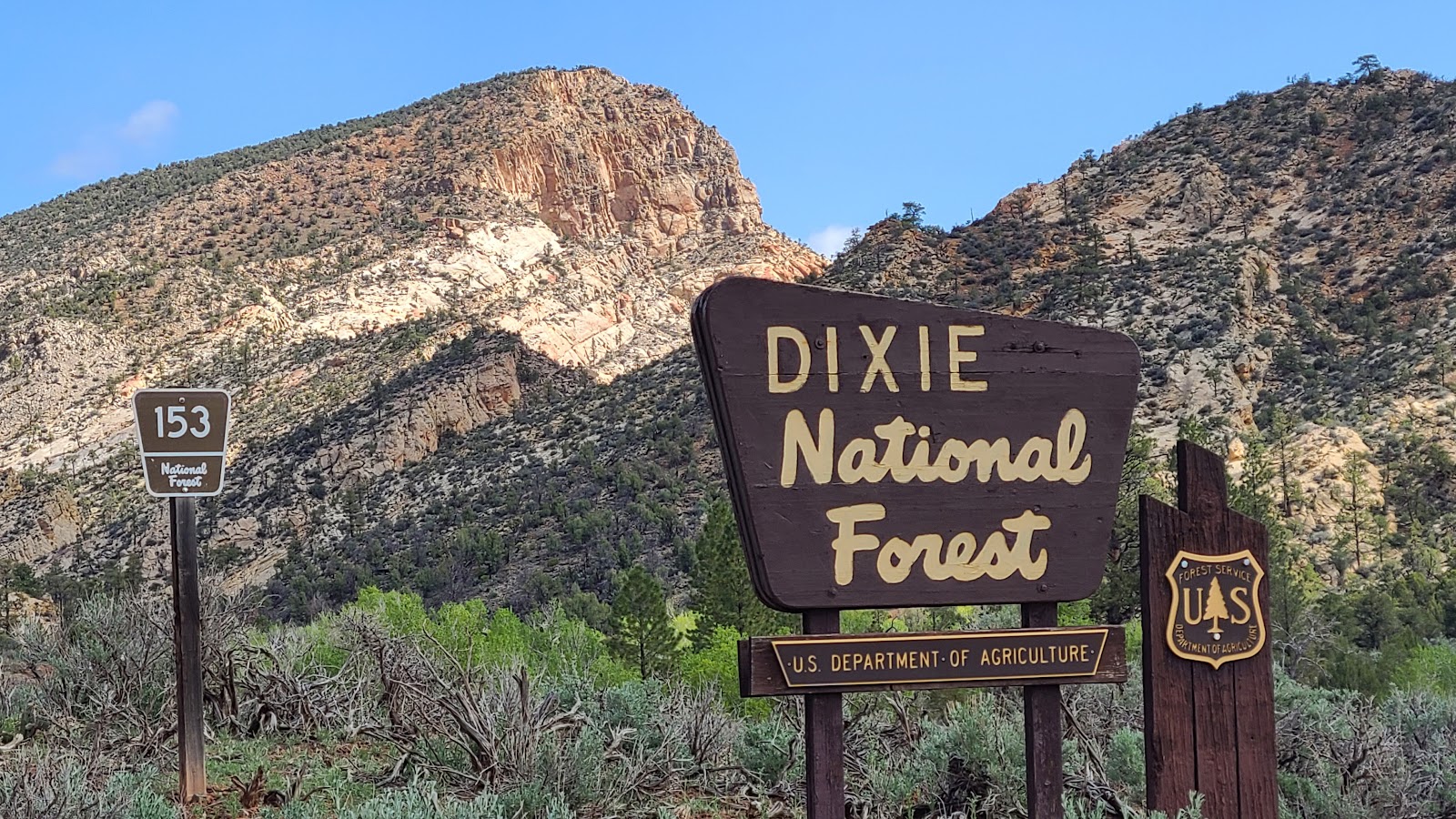 Soon we were passing by the Dixie National Forest boundary sign.
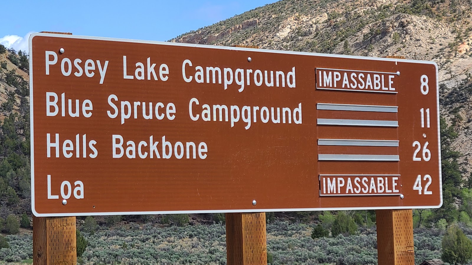 Looks like we won't be checking out Posey Lake Campground on this trip.
 The gravel roads are starting to get a little rougher and muddy in spots.
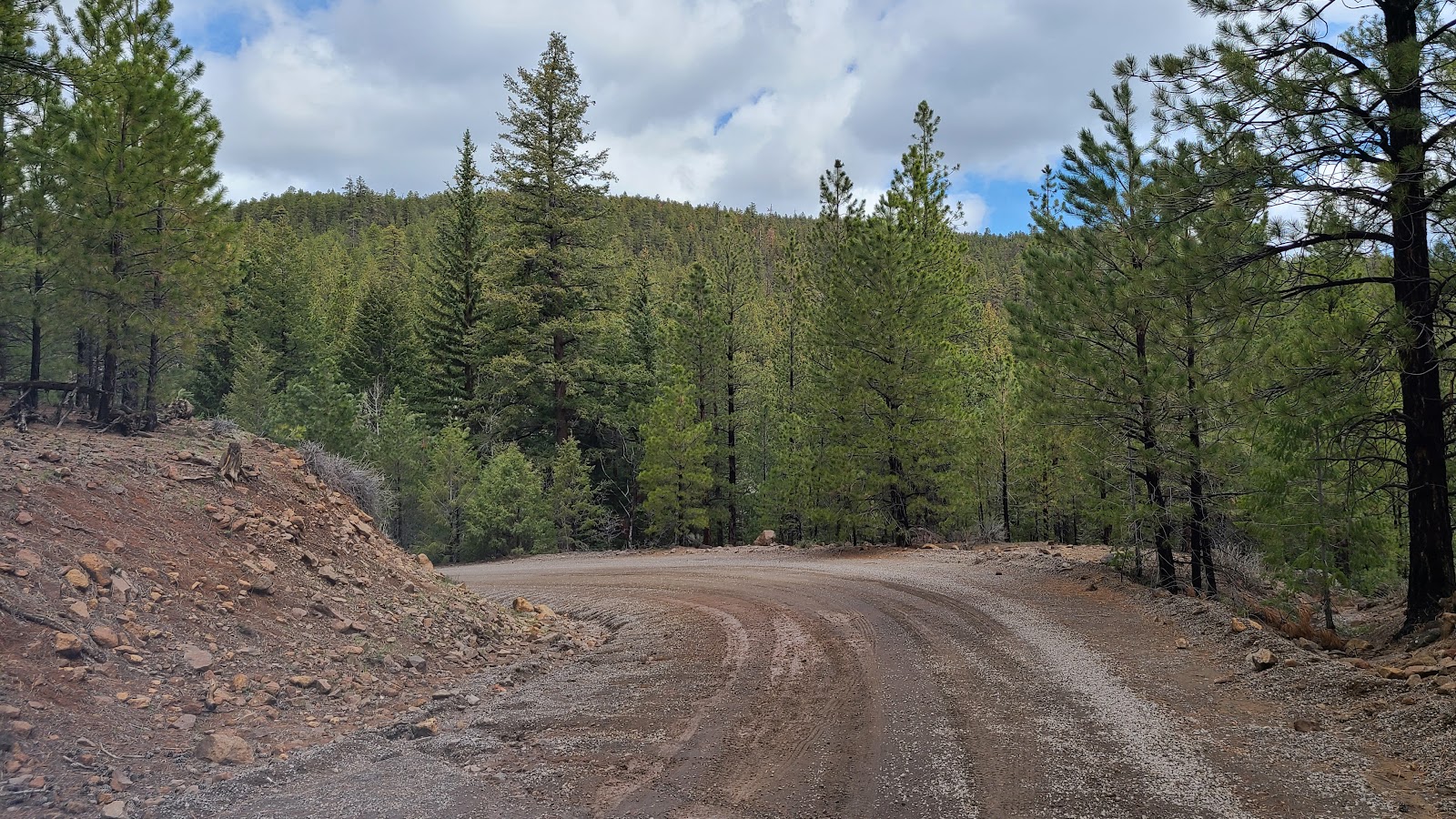
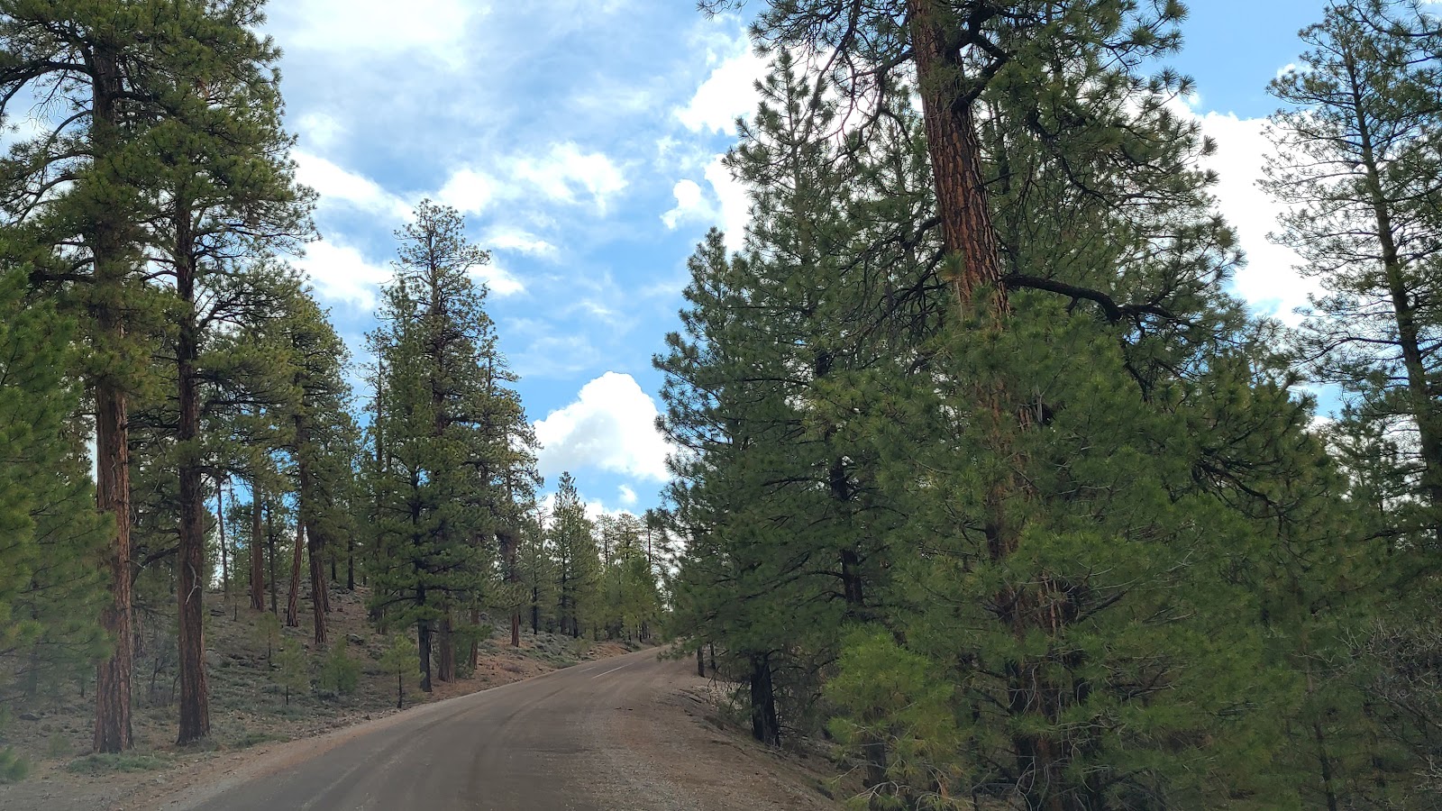 This route is quickly becoming little more than a trail through thick forestland.
 I told you we'd be seeing snow still on the ground! We are afterall above 9000' feet here.
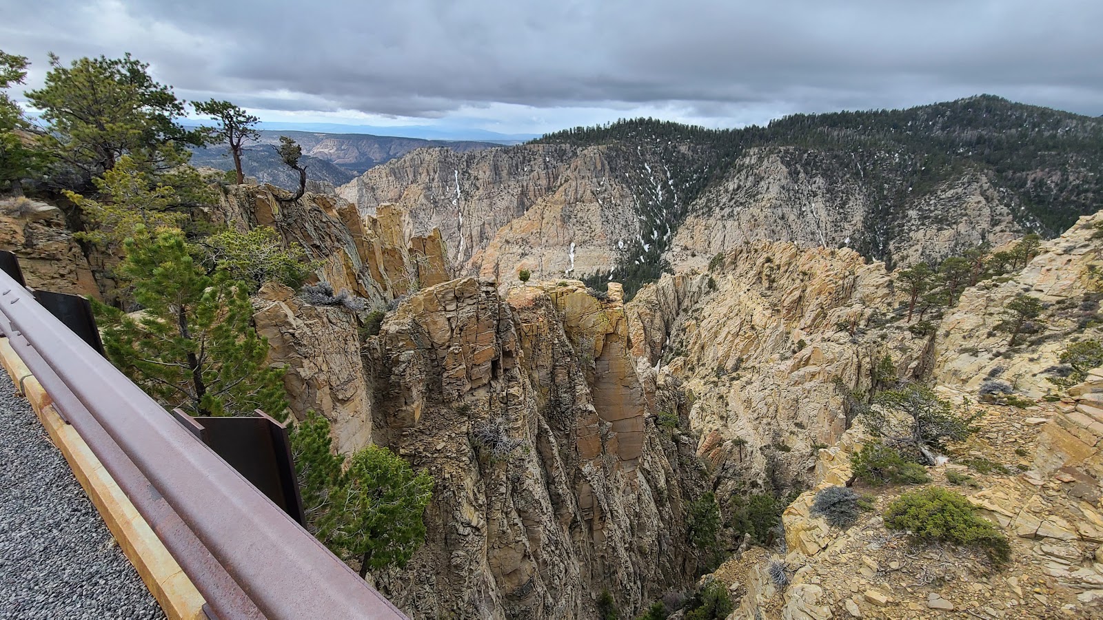
 Those clouds look to be carrying the promise of rain.
 Here we are! We made it to the Hell's Backbone Bridge, the 2005 version anyway.
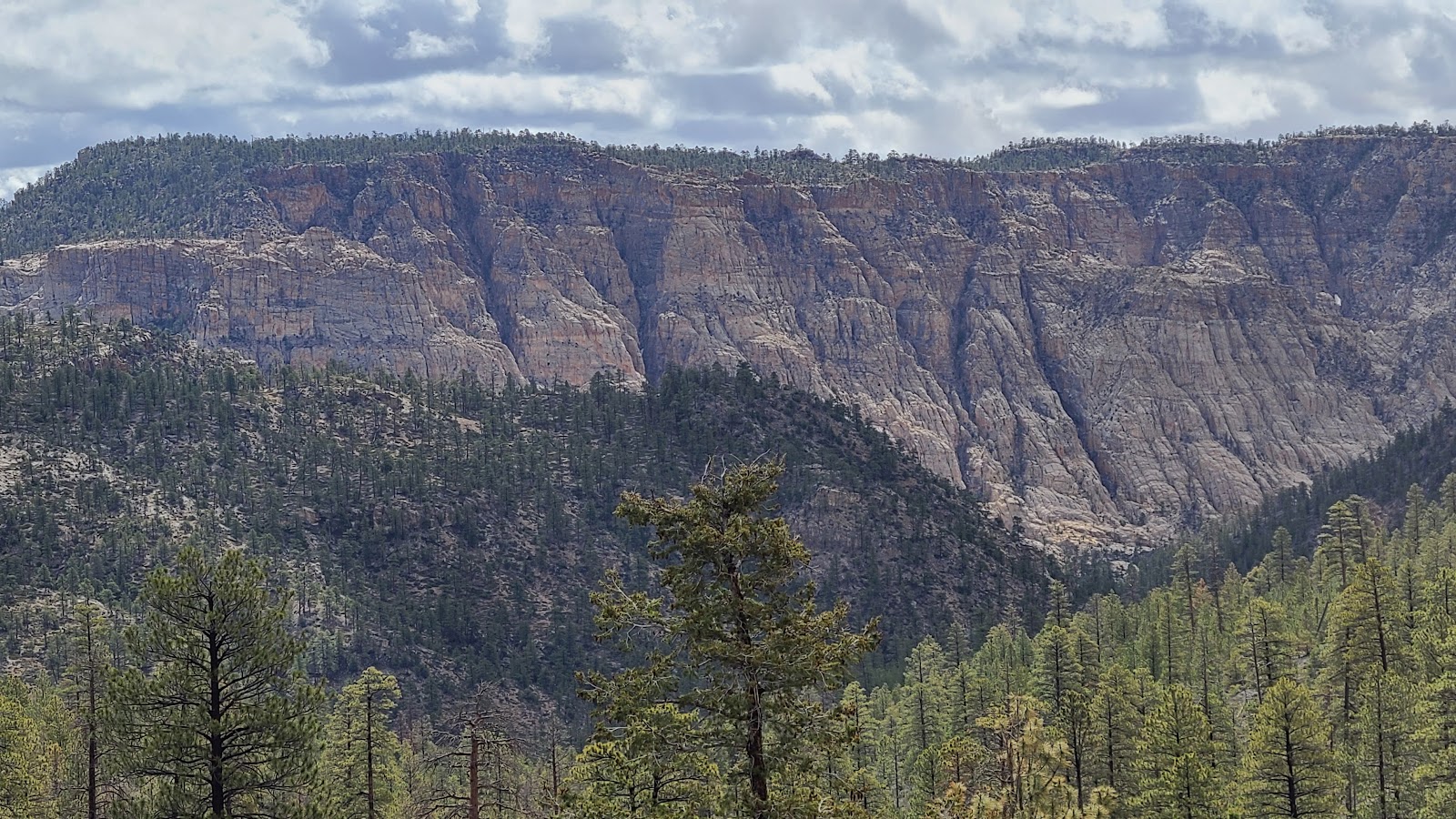
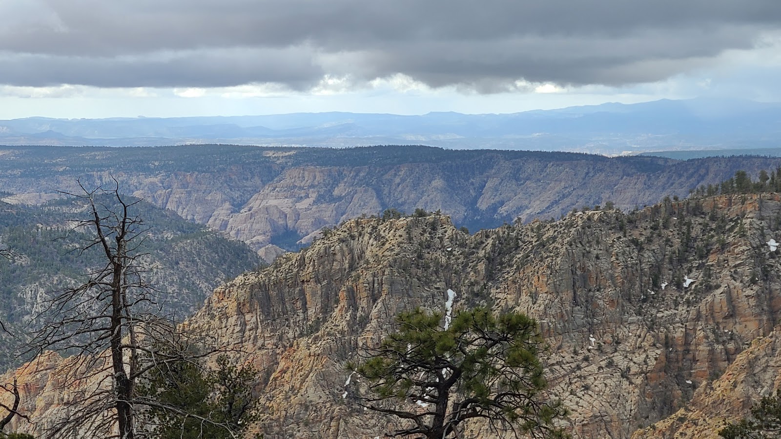
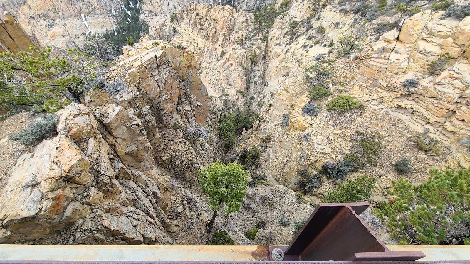 The bridge straddles a 1500' deep gorge.
 The original bridge was built in 1933 and made entirely of wood from the surrounding forest.
It remained as is until the 1960s when it was reinforced with steel and concrete
before being replaced by the present day steel and concrete bridge.
 Look how that tree is just trying to hang on to the side of the mountain.
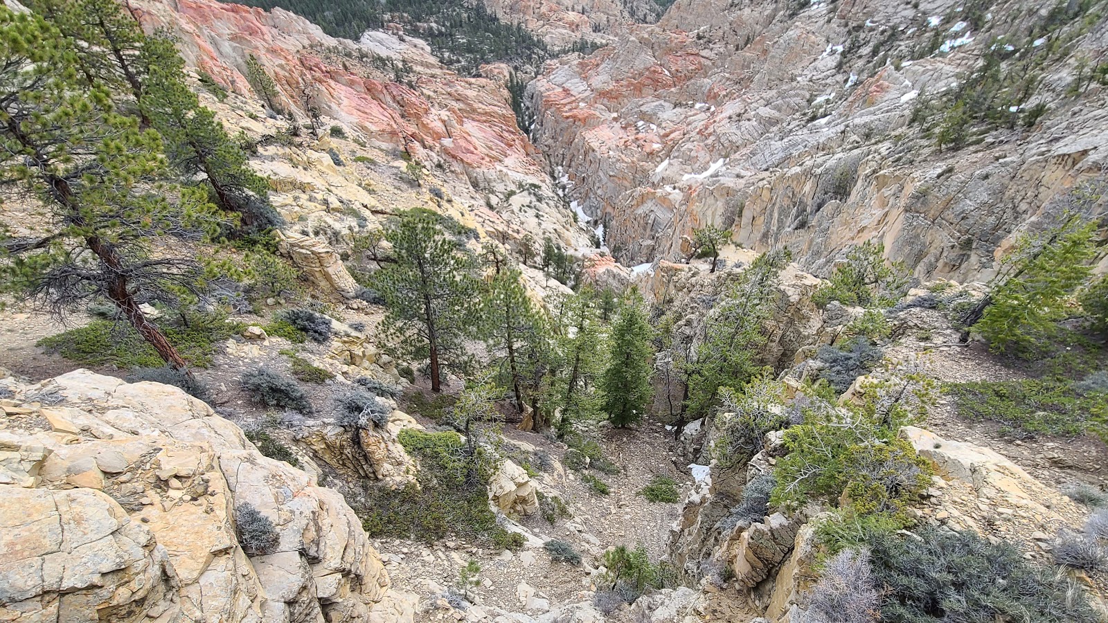 More photos of the scenery below the bridge.
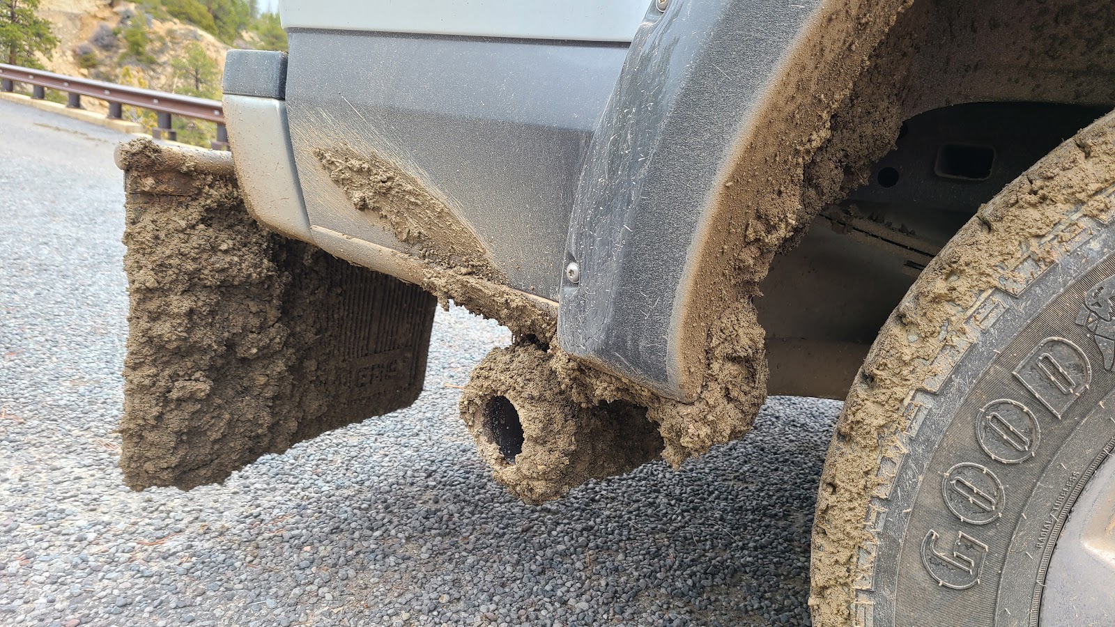 Looks like ROVER is going to need a bath before being put to bed tonight.
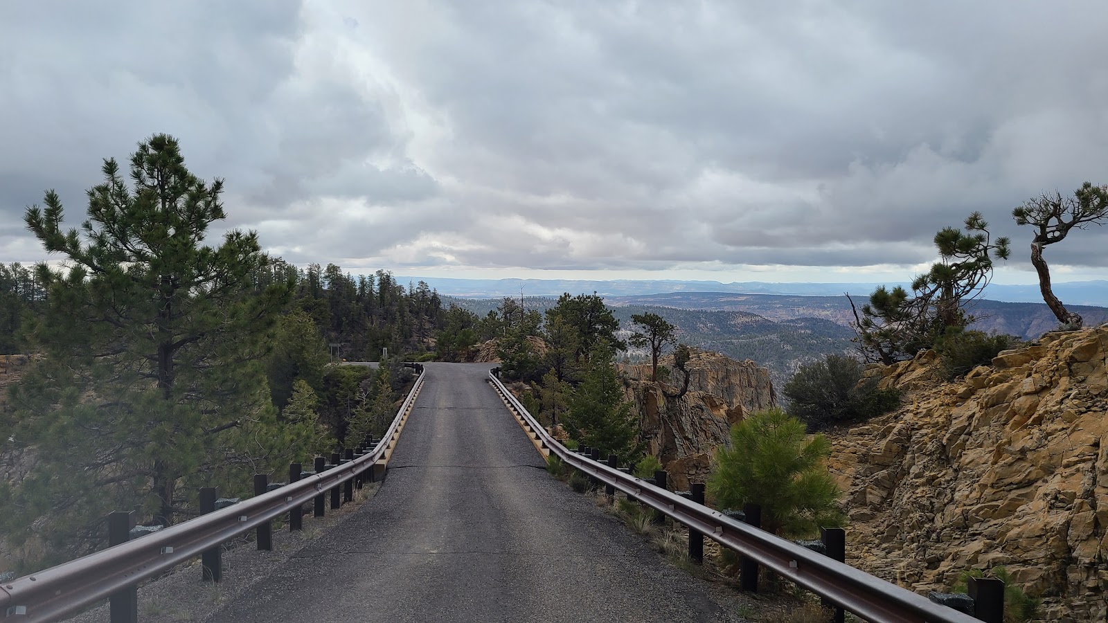
 Another muddy narrow section of road with a 500' drop off to the left.
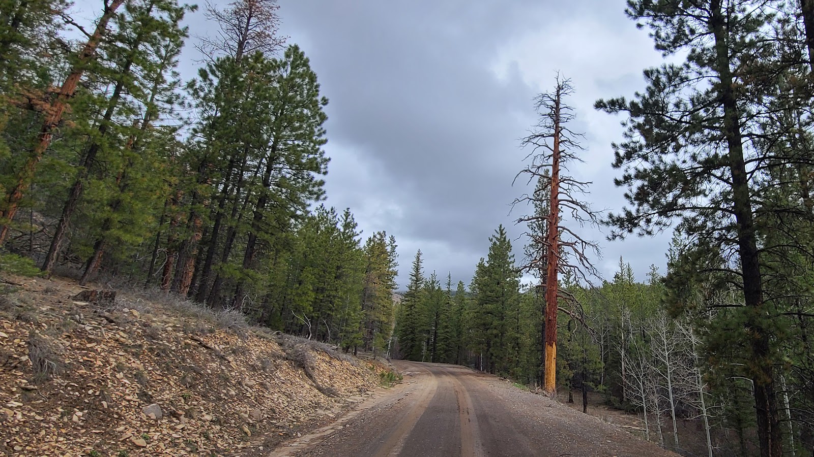 This poor pine tree suffered some king of terminal exposure.
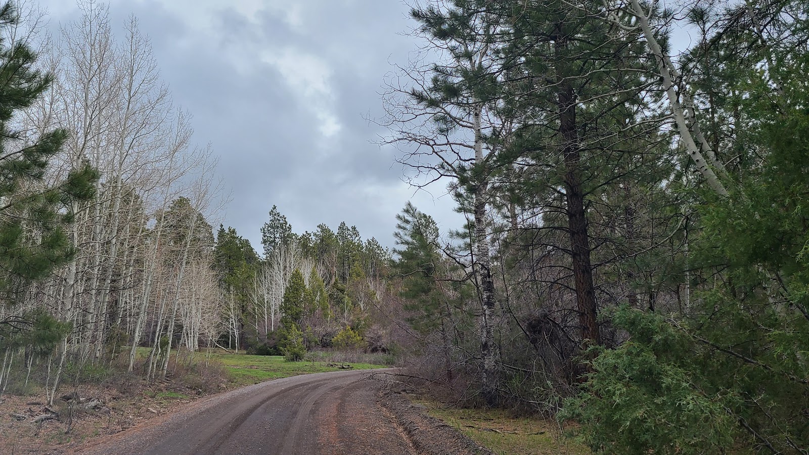 There was a wide variety of trees at this elevation.
 This fence is a reminder of the bygone days of ranching in the area.
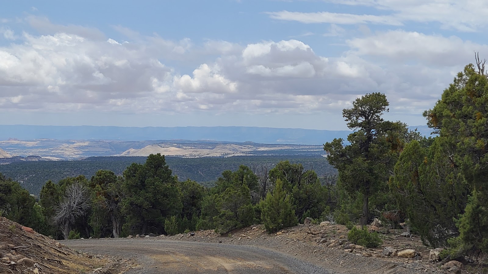 Nothing but downhill from here, all the way home!
Hell's Backbone is a horseshoe shaped road, starting and ending where it meets UT-12. You can drive it in either direction, north to south (Boulder to Escalante) or south to north, as we did.
We found the southern half the most scenic, with the mountains and open space, but the bridge and the forest is closer to the northern entrance. If you're going to travel the entire route like we did, it doesn't matter which direction you chose, but if I had it to do over I'd travel north to south.
The reason being you'll find higher road grades in the northern half, and I'd rather take them going uphill instead of down.
No matter which way you go, make sure to stop in at Magnolia's Kitchen for breakfast or lunch, you won't be disappointed.
In summary: If you're traveling between Escalante and Boulder on Highway 12, and only have time to do one of the three excursions we did, it's an easy choice.
Explore the Burr Trail! The first 30-miles are easily traveled in just about any RV configuration, but skip the last 6-miles and the switchbacks, unless you have a sturdy towed vehicle to go exploring with.
Would you like to be notified of new blog posts?