TUESDAY - We left our overnight parking spot around 10:00AM and made our way back through the town of Marfa.
Just before town we saw another of Marfa's Famous art installations. This one was a collection of shipping containers that have been assembled to represent a person reclined on a chaise lounge.
Can you see it? (HINT: head to the left and feet to the right)
It was originally displayed at the
Desert X Festival in the Coachella Valley of Southern California. After the festival closed it was disassembled, moved to Marfa, and then reassembled in this field at a cost of over $200,000.
We proceeded on into the center of town where you'll find a blinking red traffic light at the intersection of US-90 (east/west) and US-67 (north/south). If you're going to visit Marfa you'll have to travel on one of these two roads, they're the only roads that will get you to Marfa.
Anyway we came into town on US-90 West and then turned onto US-67 South to drive the 60-miles to the town of Presidio, TX at the Mexican border. The first 30-miles weren't terribly scenic, but the second 30-miles had us going up and down through several canyons before arriving in Presidio.
In Presidio we filled up with gasoline and purchased a few more grocery items before we headed east into the Big Bend Ranch State Park. Everything's bigger in Texas, right? Well Big Bend Ranch State Park is the largest Texas state park at over 200,000 acres.
In comparison, Adirondack Park in upstate New York dwarfs this park with it's 6,000,000+ acres. Adirondack Park is larger than the top two National Parks in the Lower 48 states combined (Death Valley at 3.4 million and Yellowstone at 2.2 million). You'll have to ignore the National Parks in Alaska because they are truly massive, the largest being Wrangell-St. Elias at 8,323,146 acres.
Before we entered the state park from the west side we had to stop at the Fort Leaton State Historic Site to pick up our camping permit.
If we would have entered from the east side we'd have needed to stop at the Barton Warnock Visitors Center.
Once inside the park we started making note of where we are going to return to explore further tomorrow with our only full day in the park. We are only going to be seeing the southern edge of the park where it follows the path of the Rio Grande River which separates the United States from Mexico.
The Rio Grande River! The opposite bank is in Mexico.
Closed Canyon Trailhead is off to the right. It's one of the locations we'll check out tomorrow.
That's only if we survive this roller coaster ride with THE POD in tow.
The campsites here at La Cuesta are nothing to write home about, but they are relatively inexpensive at $15 a night and there are only four of them to choose from.
They have made several improvements to the campsites since we checked this place out two years ago, mainly restrooms and garbage collection.
I'm not sure why the sign says RESTROOMS, there's only one toilet inside this small enclosure.
Next to Campsite #1 they've added a shade shelter with a spotting scope.
The scope is courtesy of the folks over at the Texas Bighorn Society.
WEDNESDAY - Today we set aside for sightseeing here in Big Bend Ranch State Park.
We've got several sites to visit that were recommended by the Park Ranger that checked us in yesterday.
First location is 10-miles back towards the western park entrance at the Hoodoos Overlook.
Who knew they had hoodoos in southwest Texas? We didn't!
Next is a short hike starting at the Closed Canyon Trailhead.
Finally a drive up the 15% grade of what is listed on the park map as simply the "Big Hill".
All done! It's time to head home for lunch and start writing up this blogpost.
BIG BEND RANCH STATE APRK
 These may technically qualify to be hoodoos, but they don't compare to ones we saw in Utah.
 Although the Utah hoodoos didn't have the Rio Grande River in the background.
 While at the Hoodoo Overlook we spotted these octillo in bloom.
 We can't wait to see these red blooms fully opened.
 The prickly pear cactus are also in bloom.
 Their blooms can be orange, yellow, red, or pink.
 Tricia asked me to pull over to the side of the road for this photo.
 So she could walk back and photo this yucca plant in bloom.
 This is a tamarisk tree in bloom.
 It's pink blooms will produce delicate white flowers.
 This palo verde tree will produce bright yellow blooms from these pods very soon.
 We stopped at one of the water access locations the canoe outfitters use...
 ...to snap these reflective photos of the mountains.
 This is the trailhead for the Closed Canyon hike.
 I'm going to make good use of that bench on the return trip.
 Approaching the entrance to Closed Canyon...
 ...where everything changes once you make the turn into the canyon.
 The 150' tall canyon walls are quite striking.
 The canyon just ahead seems to be quickly narrowing.
 This is where we turned around at about a half mile in.
 Returning to the canyon entrance.
 We stopped halfway up the "Big Hill" to grab this photo.
 The river is fairly low this time of year, making it difficult to paddle a canoe on.
 We're almost at the top of the "Big Hill" now.
 Thankfully ROVER had no issues transporting us up the hill.
 Here you can see the road heading east down the hill.
 Does this view of the Rio Grande look familiar to anyone?
 Are there any Kevin Costner fans who've seen that DOM rock before?
 That rock outcropping is where Kevin Costner threw a bottle of Dom Pérignon
towards the Rio Grande River in the 1985 film titled Fandango.
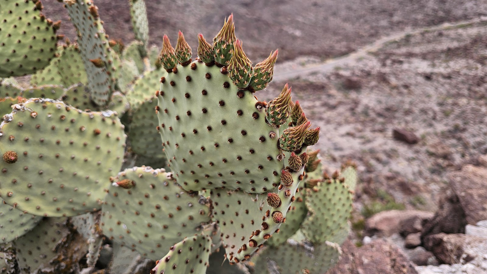 These prickly pear blooms are just starting to sprout.
 Nearly at the bottom of the hill on the east side.
 At the bottom of the hill on the east side is where you'll find this picnic area.
 More prickly pear in bloom.
 Just about back to THE POD, it's lunchtime.
Now that we've concluded our visit to Big Bend Ranch State Park,
it's time to slide a little bit eastward and revisit Big Bend National Park.
Would you like to be notified of new blog posts?