This morning we left behind the mountains surrounding Kartchner Caverns State Park.
Upon reaching the Interstate Highway in Benson we filled ROVER with gasoline and proceeded east on I-10. It wasn't long before we started seeing billboards advertising something called
"The Thing".
Every couple of miles there would be a series of four billboards, each one different, and each one asking you to leave the Interstate at Exit 322 and solve the mystery of The Thing. We didn't check in out, but I did notice the price of gasoline was 60¢ higher than it was at the exit before and after Exit 322.
It wasn't much later and we were leaving the Interstate and heading south on US-191 to our destination. According to our GPS the campground was somewhere 40-miles ahead, which would put us somewhere up in those snow capped mountains. I sure hope that isn't the case!
Fortunately we turned north at the foot of the mountains and headed back north for 10-miles and then entered the Chiricahua National Monument. There were still mountains, but nothing snowcapped like what we were seeing just a little while ago.
We've been told by several people lately that we will never get our 28-foot long Airsteam into the Bonita Canyon Campground. At both the entrance and exit of the campground there are deep depressions where the Bonita Creek crosses the roadway, fortunately both are made of concrete and currently the snow melt is minimal.
I could see why everyone thought it was a bad idea to bring the Airstream to this campground, but we did install a 3-inch lift kit on
THE POD for just this scenerio. If it were later in the spring, when the snow melt fills these crossings, I'm not sure I would risk bringing
ROVER through the crossings.
Safely in our Site #11 we found out it was highly unlevel (left to right) and we had to improvise a way to safely lift one side of the trailer 6½-inches over the other. I've always felt, where there's a will, there's a way!
Once THE POD was all set up we checked out the scenery just behind our site.
There are also a lot of different species of birds hanging around the campground,
but these Mexican Jays easily outnumber the rest.
TUESDAY - The Bonita Canyon Campground is at an elevation of 5350' and with the overnight temperatures falling below freezing
every night this week we've decided to cut our week long visit here to just three nights. The fact there is no cell phone service and with such dense tree coverage I'm unable to get the Starlink dish an unabstucted view of the sky to bring us internet service also factored into our decision.
That means today is about the only day we have to go sightseeing. While the canyon is beautiful, luckily there isn't a whole lot to do for a couple of non-long distance hikers like us.
Today we set out early to drive the 8-mile long scenic road along Bonita Canyon Drive, all the way to the top at Massai Point (elevation 6870 feet).
Here are some photos we took along the drive and on a few of the shorter hiking trails we found.
CHIRICAHUA NATIONAL MONUMENT
 How cold was it last night? How about this frozen waterfall icicle.
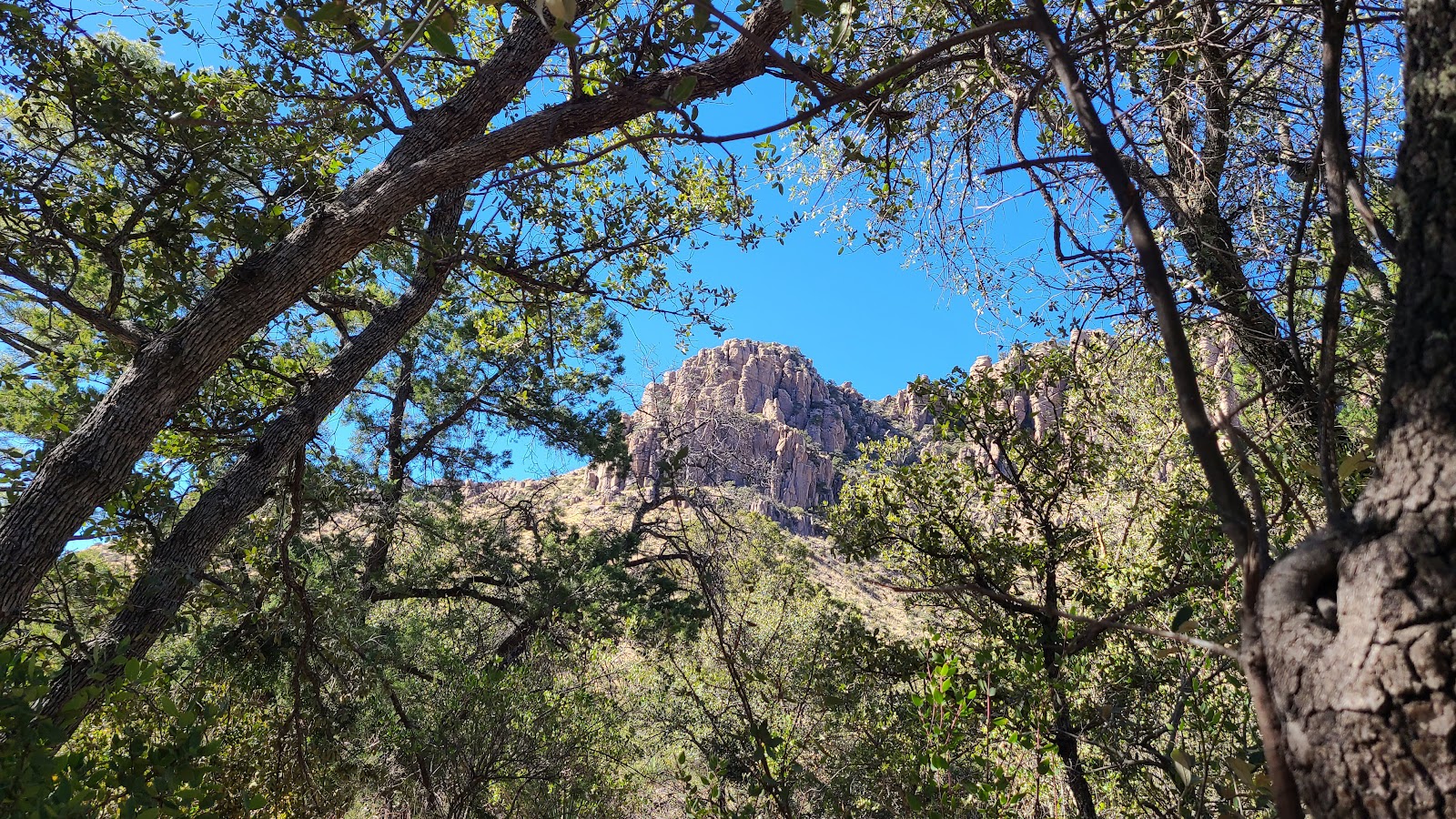
 The beautiful Bonita Canyon.
 Some of the beautiful rock formations found here in the park.
 The road ends here! Turn around or drive off the cliff.
 A long distance view of the desert below.
 Massai Point
 A unique viewing scope thats describes what's in the pipe's view.
 Each position has a different description.
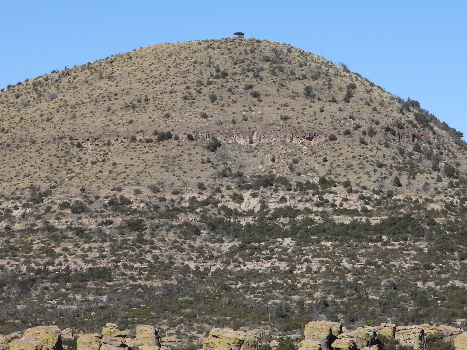 Sugarloaf Peak
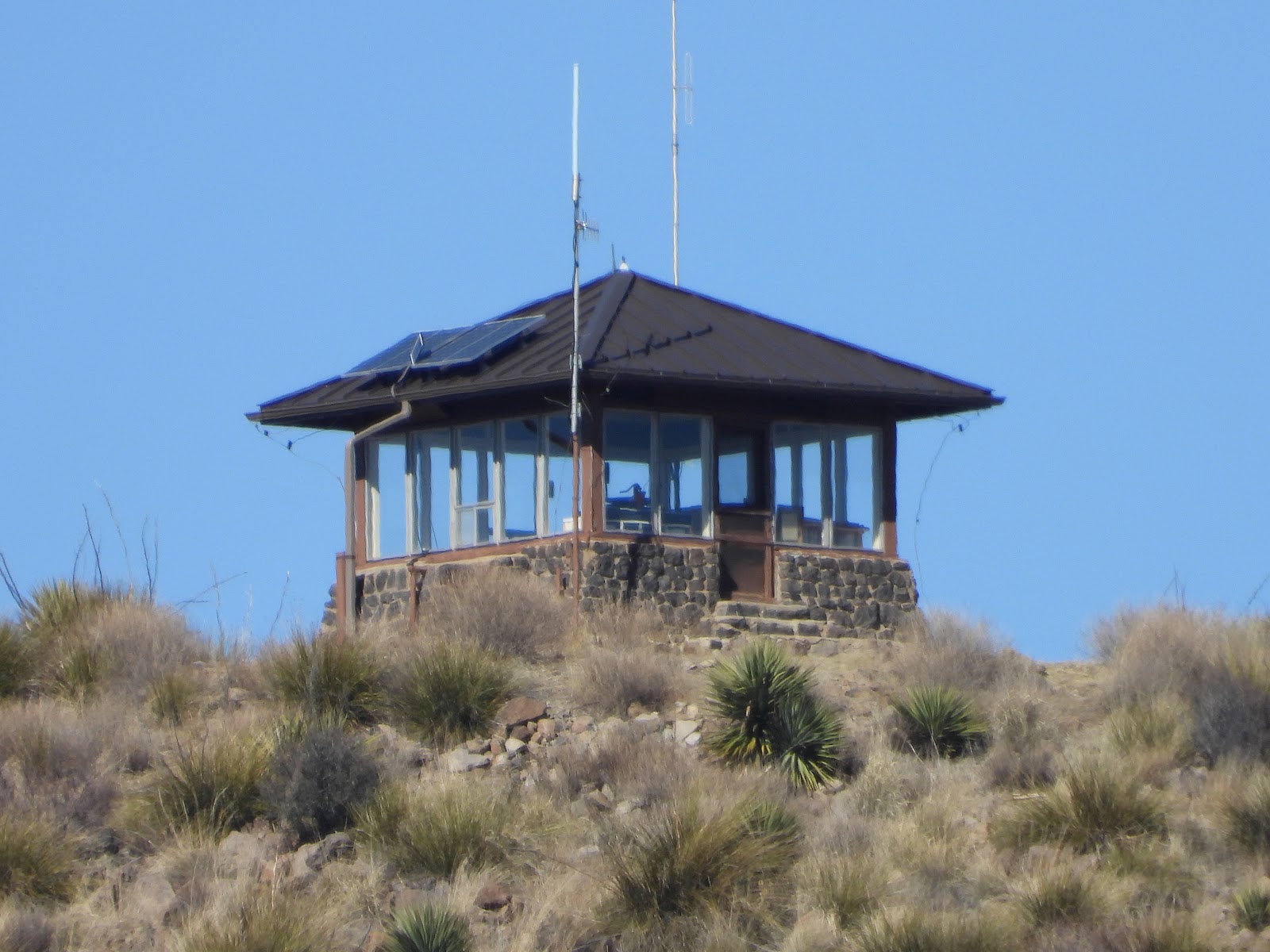 The fire lookout tower atop Sugarloaf Peak
 Next position to the right is Mica Mountain listed as in Saguaro National Monument.
It's been Saguaro National Park since 1994. This scope's been here a while!
 You can barely see the ridge line on this hazy day.
 The Totem Pole.
 Just couldn't resist including this photo of a dead tree.
 Heading back down now. Another view of Bonita Canyon.
 A short hike near the entrance brought us to the Historic Faraway Ranch property.
 The stables at Faraway Ranch
 The main house at Faraway Ranch is listed as a National Historic Site.
Would you like to be notified of new blog posts?