
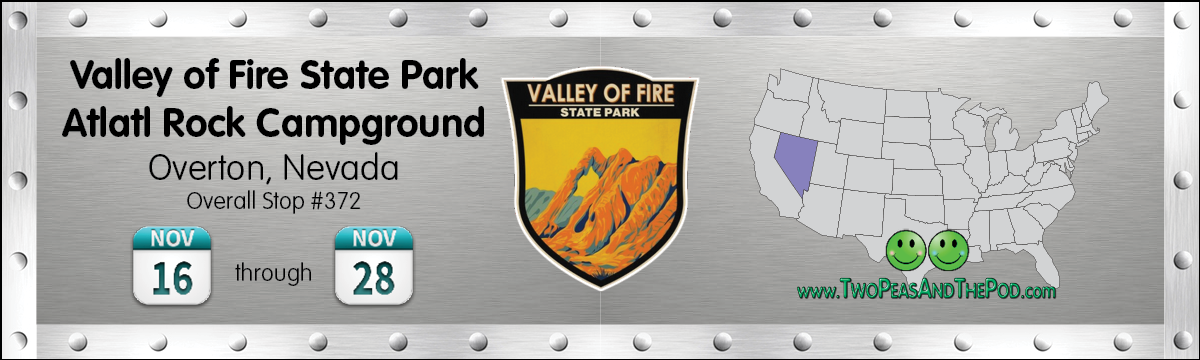
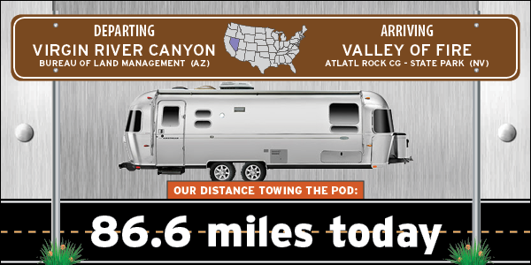
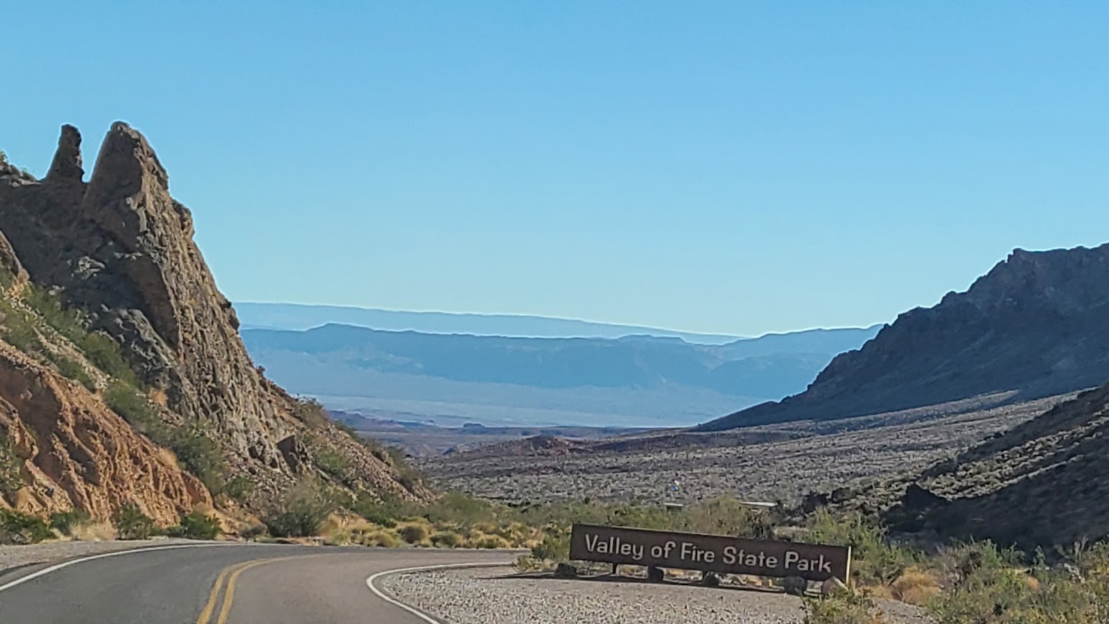
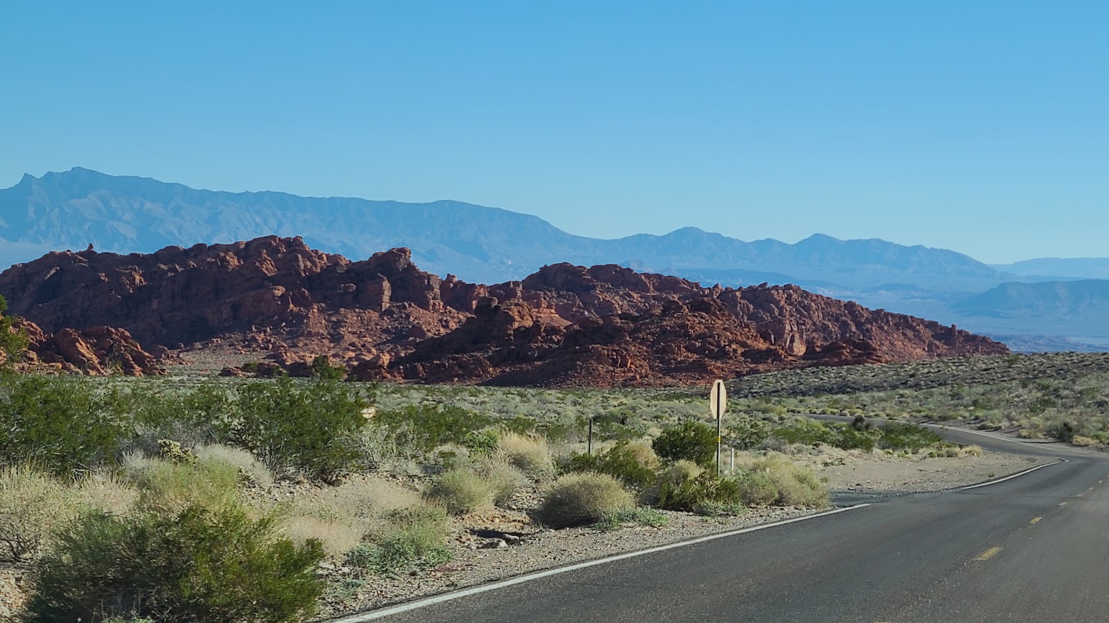
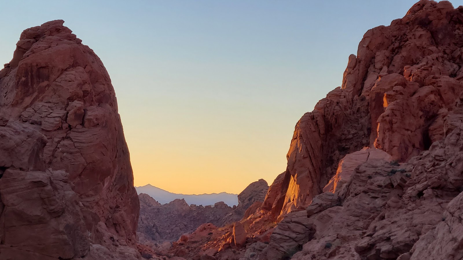
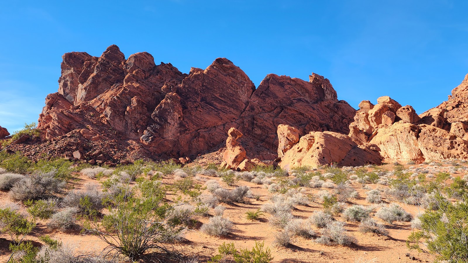
A short 18½-miles later we were crossing the state border back into Nevada. We are headed to, by all accounts, Nevada's top state park. It's Nevada's first state park, largest state park and most visited state park. For all you travelers you probably already know I'm refering to Valley of Fire State Park in Overton, NV which is located about 55-miles northeast of the Las Vegas Strip.
I must admit that when we arrived at the West Entrance Station there was a sign on the side of the road that read "CAMPGROUD FULL" and I became very disappointed. The Ranger saw our $250.00 Nevada All Access Pass hanging from our rear view mirror and just waved us on by, not mentioning there were no campsites available. I took that as a good sign and proceeded with high hopes.
There are two separate campgrounds here in the park. Atlatl Rock Campground has 44 sites and only 22 of them have water and electric hookups available. The nearby Arch Rock Campground has 29 sites (none with electric), but most of them are better suited for smaller trailers, Class B Vans and tenters.
We had our hopes set on claiming one of the 22 coveted electric sites, but would settle for one of the non-electric sites until we saw one come available.
Let me just say, I want to dispel that myth right now! We arrived here at Atlatl Rock Campground on a Wednesday in the middle of November, at 9:30AM (a full week before Thanksgiving) and found 5 of the 22 electric sites available to chose from. Additionally, a full half of the non-electric sites were also available. Same goes for the Arch Rock Campground, it was only half full.
Granted the sites with the best views were the ones already taken, but there are only a few sites here that don't have some kind of nice view.


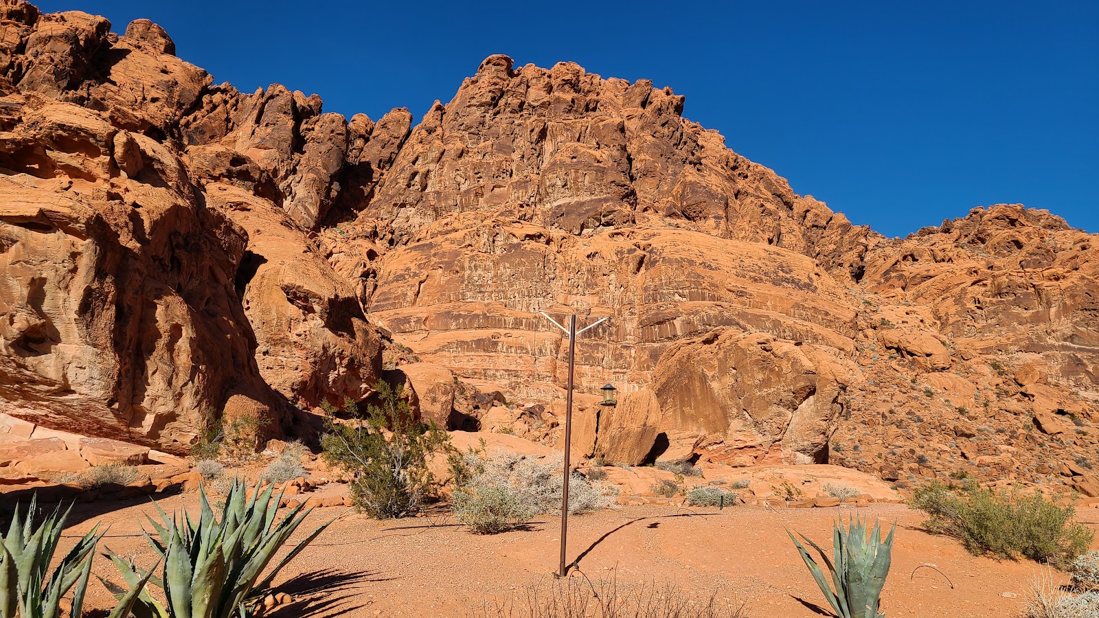
After unhooking THE POD from ROVER we leveled it up, plugged it in to the electric and then drove the 2-miles over to the Visitor Center to pickup a trail map, check out their little history museum about the park and of course wander around in the gift shop!
Behind the Visitor Center they have a beatiful rock garden, complete with a bird feeder. There was plenty of activity around the feeder today, between the birds and the squirrels, I don't think a single seed went to waste.

There were a dozen or so people that showed up for the hike and Tricia was the only one that spent the night in the campground. All the others drove in from miles away, I don't even want to think what time they woke up.
⬊ MANUAL SLIDESHOW CONTROLS ⬋
| SLIDE NUMBER | ||
|---|---|---|
| 1 | OF | 10 |
| SLIDE NUMBER | ||
|---|---|---|
| 2 | OF | 10 |
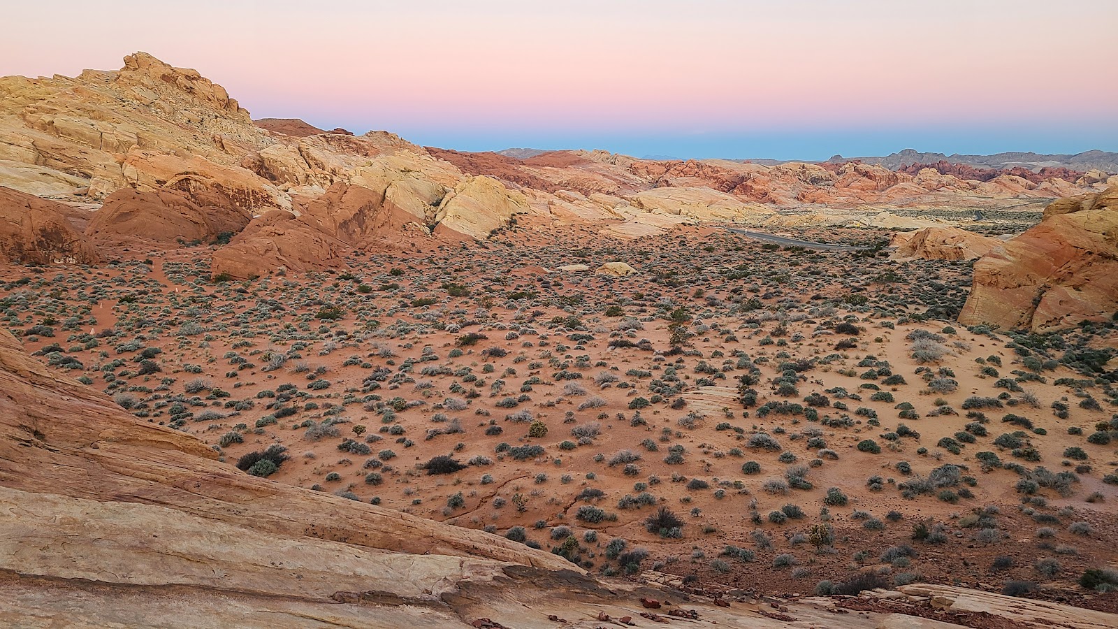 This is what Rainbow Vista looks like at 6:00AM.
| SLIDE NUMBER | ||
|---|---|---|
| 3 | OF | 10 |
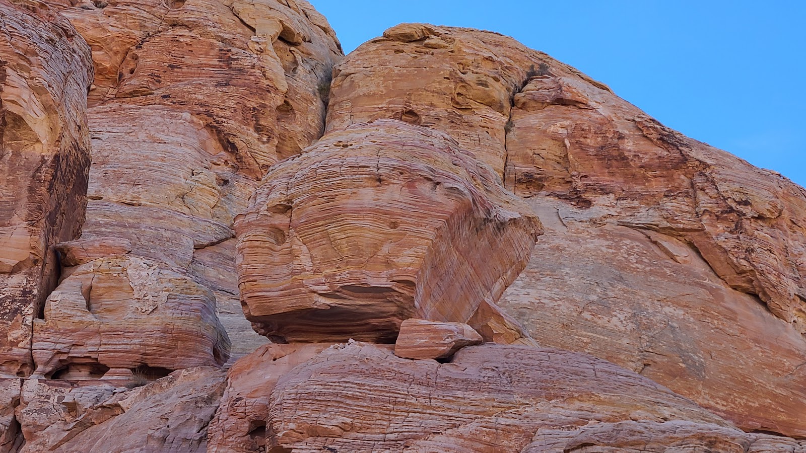
 All the rocks around here are tilted at very odd angles.
| SLIDE NUMBER | ||
|---|---|---|
| 4 | OF | 10 |
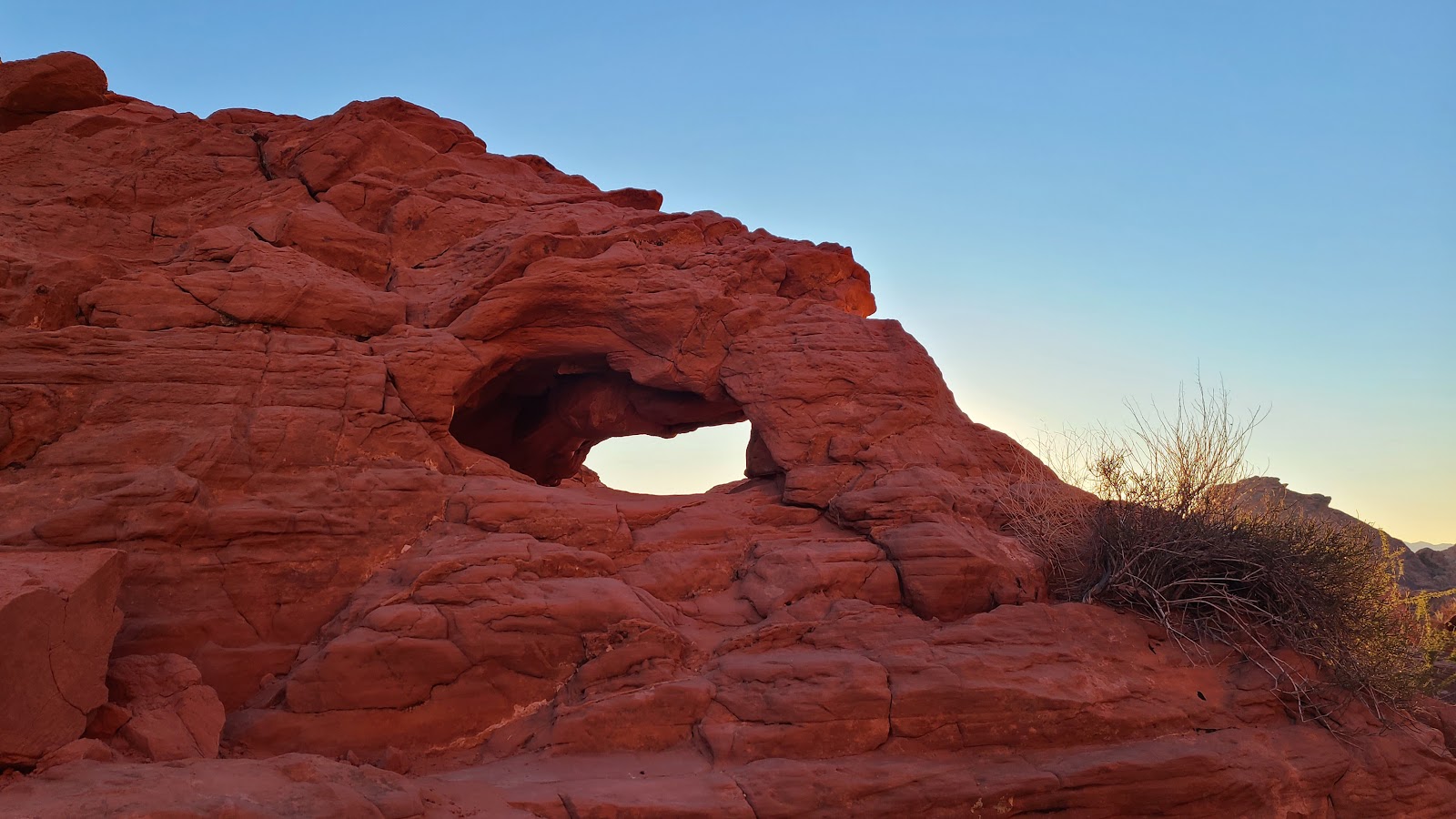
 There are even a few smaller arches.
| SLIDE NUMBER | ||
|---|---|---|
| 5 | OF | 10 |
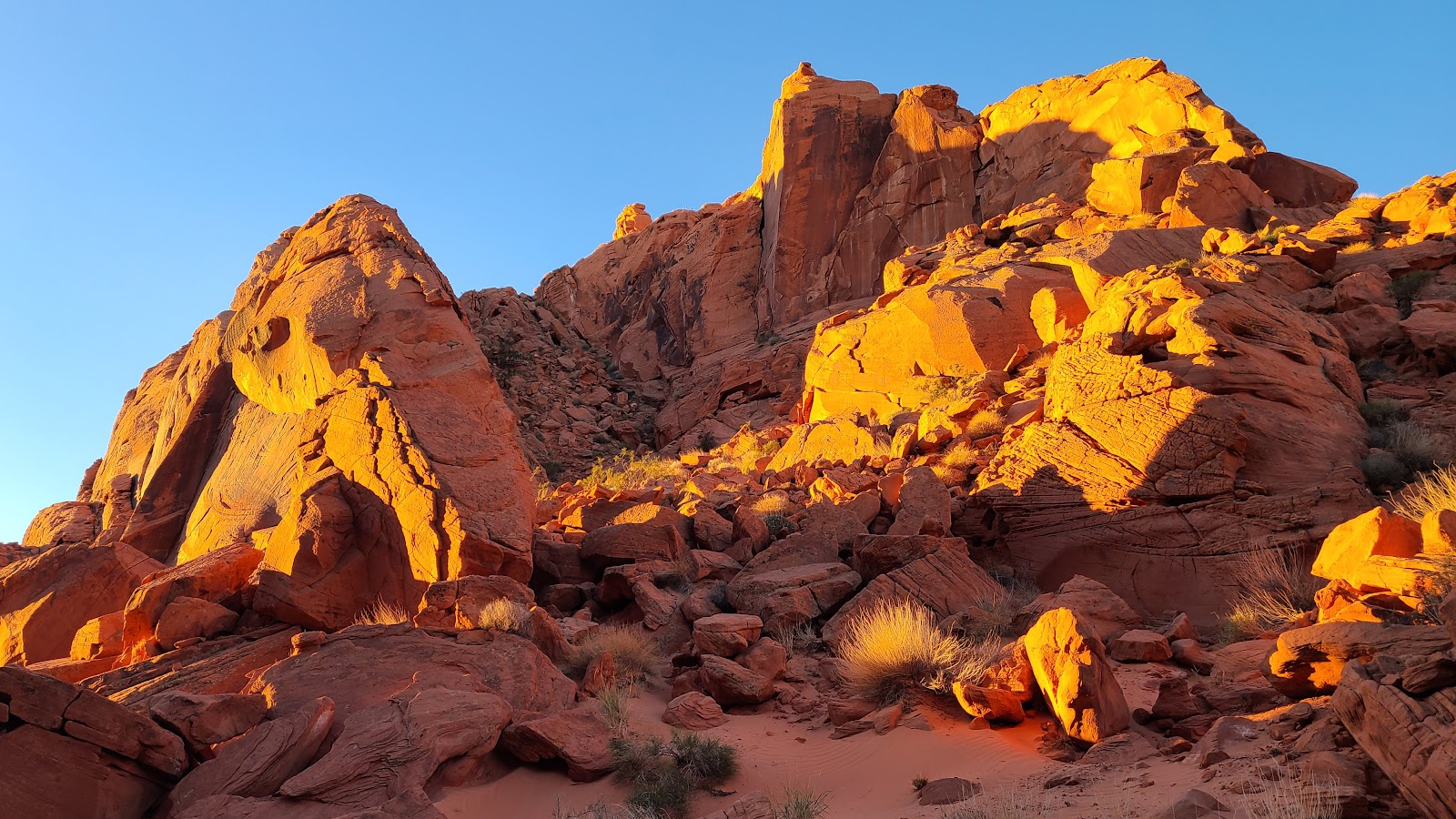
 The morning sun is just starting to illuminate the mountainsides.
| SLIDE NUMBER | ||
|---|---|---|
| 6 | OF | 10 |
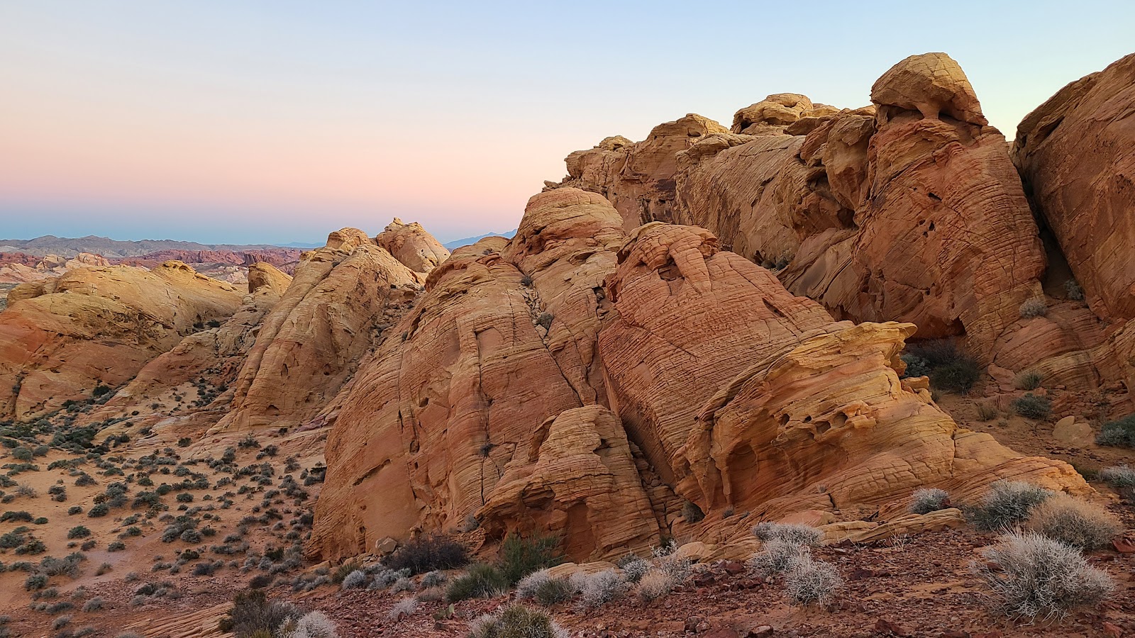
 Now the colors are really starting to shine.
| SLIDE NUMBER | ||
|---|---|---|
| 7 | OF | 10 |
| SLIDE NUMBER | ||
|---|---|---|
| 8 | OF | 10 |
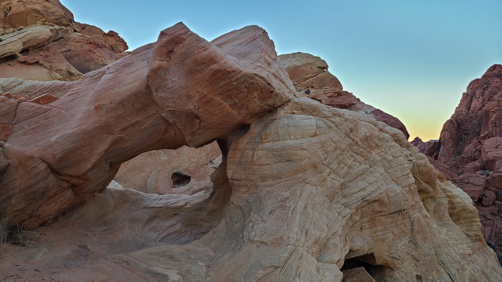
 Another small archway...
| SLIDE NUMBER | ||
|---|---|---|
| 9 | OF | 10 |
 ...with a deep valley below.
| SLIDE NUMBER | ||
|---|---|---|
| 10 | OF | 10 |

After chicken salad sandwiches for lunch we laced up our hiking boots and headed out the door. The weather is perfect for hiking today, temperatures in the lower 60°Fs and just a slight breeze to cool us off when out in the bright desert sun.
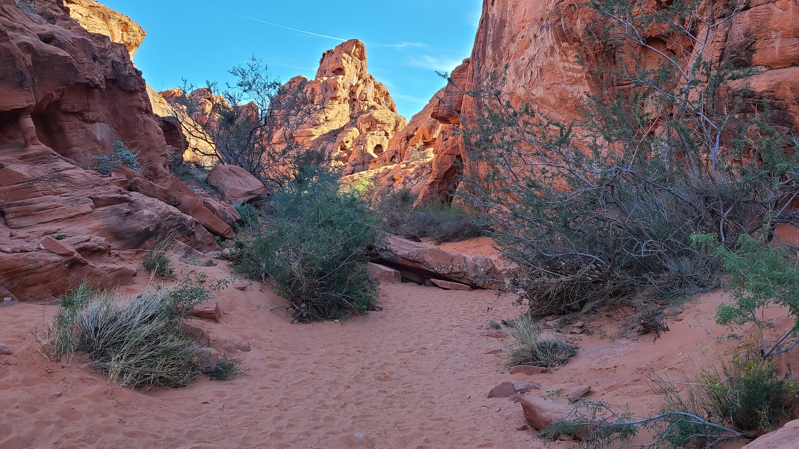
There is a 5½-mile long road that branches off the main road that travels east and west completely through the park. The road is called White Domes Road and nearly all the hiking trails begin from somewhere along this road. It's also where the Vistor Center is located.
It's a very scenic drive and once again I tried to video it going 25MPH, but came out with a less than ideal video. I'll share it anyway and am actively searching for a better solution for filming our driving videos.
| SLIDE NUMBER | ||
|---|---|---|
| 1 | OF | 20 |
| SLIDE NUMBER | ||
|---|---|---|
| 2 | OF | 20 |
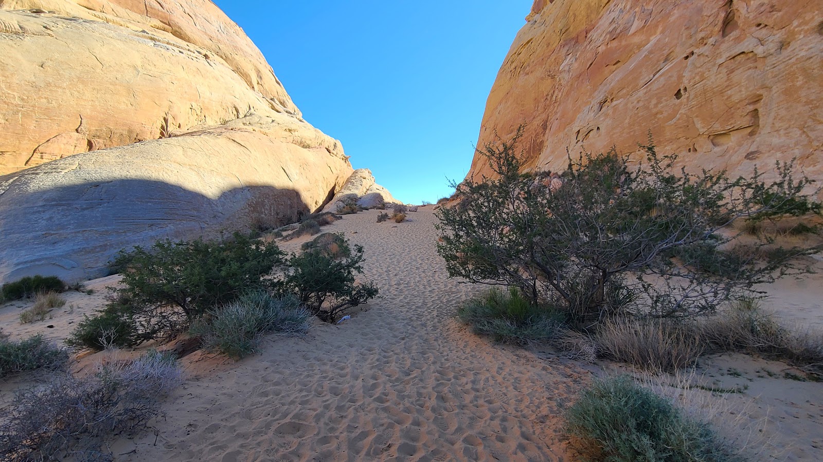 The hike started out as an uphill climb in the sand.
| SLIDE NUMBER | ||
|---|---|---|
| 3 | OF | 20 |
 Once over the ridge it turned into a downhill slide in the sand.
| SLIDE NUMBER | ||
|---|---|---|
| 4 | OF | 20 |
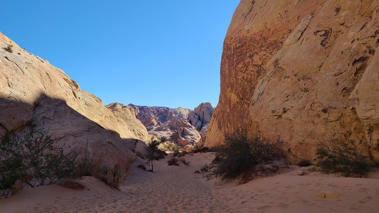
 Then the sand went away and it started getting rocky.
| SLIDE NUMBER | ||
|---|---|---|
| 5 | OF | 20 |
 We are headed all the way down the rocky path to the bottom on the canyon.
| SLIDE NUMBER | ||
|---|---|---|
| 6 | OF | 20 |
 Looking back up at what we just came down.
| SLIDE NUMBER | ||
|---|---|---|
| 7 | OF | 20 |
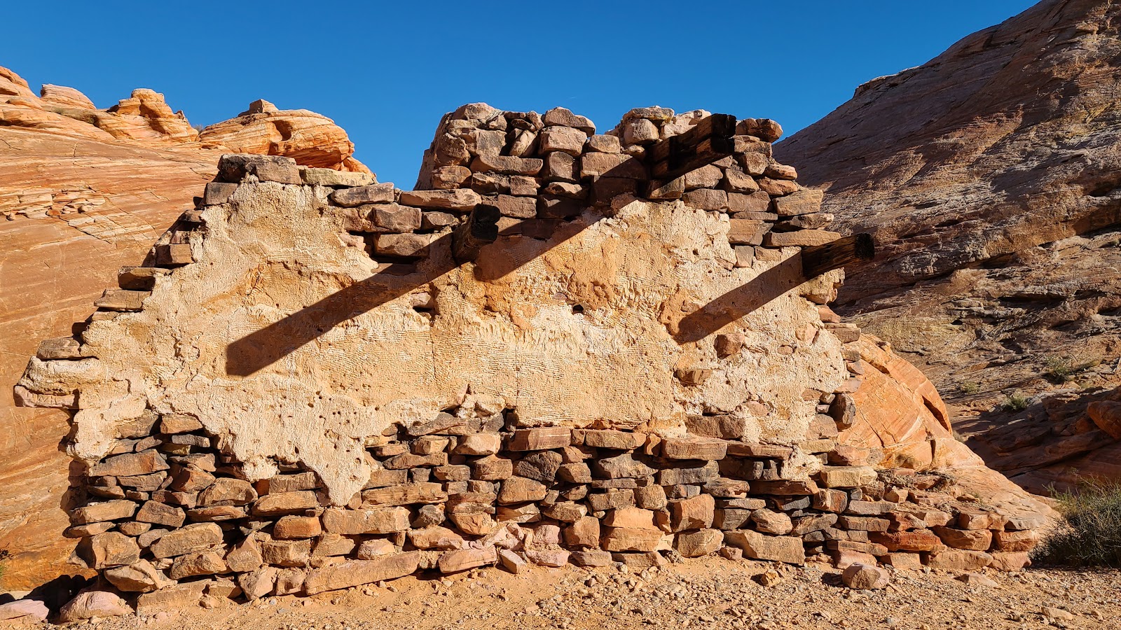 Many western themed movies were filmed here in the 1950s & 60s, this wall is all that's left.
| SLIDE NUMBER | ||
|---|---|---|
| 8 | OF | 20 |
| SLIDE NUMBER | ||
|---|---|---|
| 9 | OF | 20 |
| SLIDE NUMBER | ||
|---|---|---|
| 10 | OF | 20 |
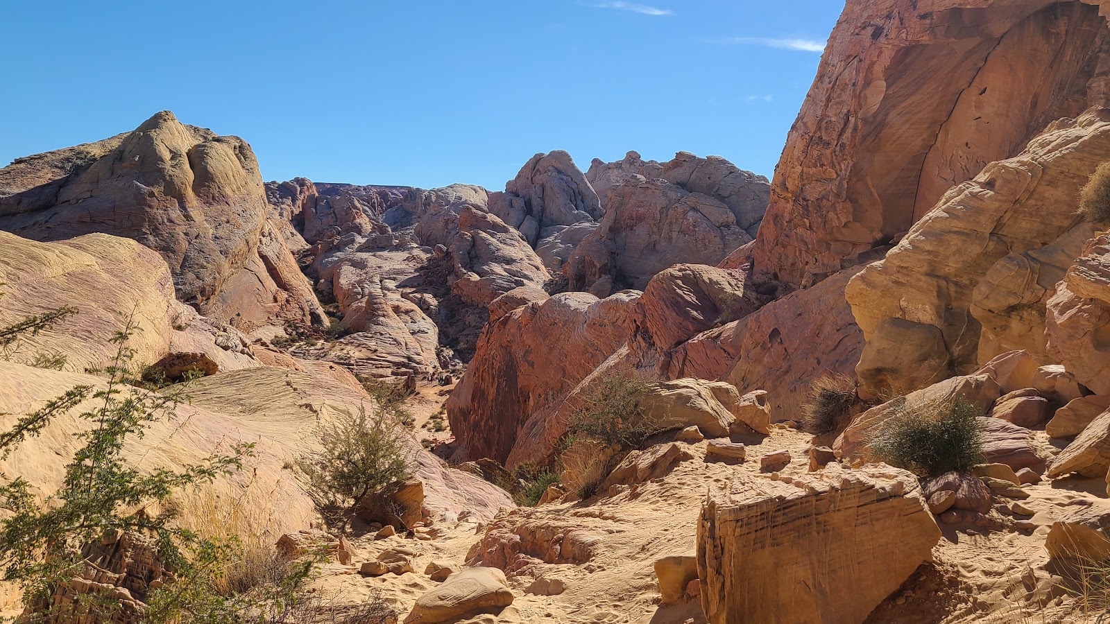
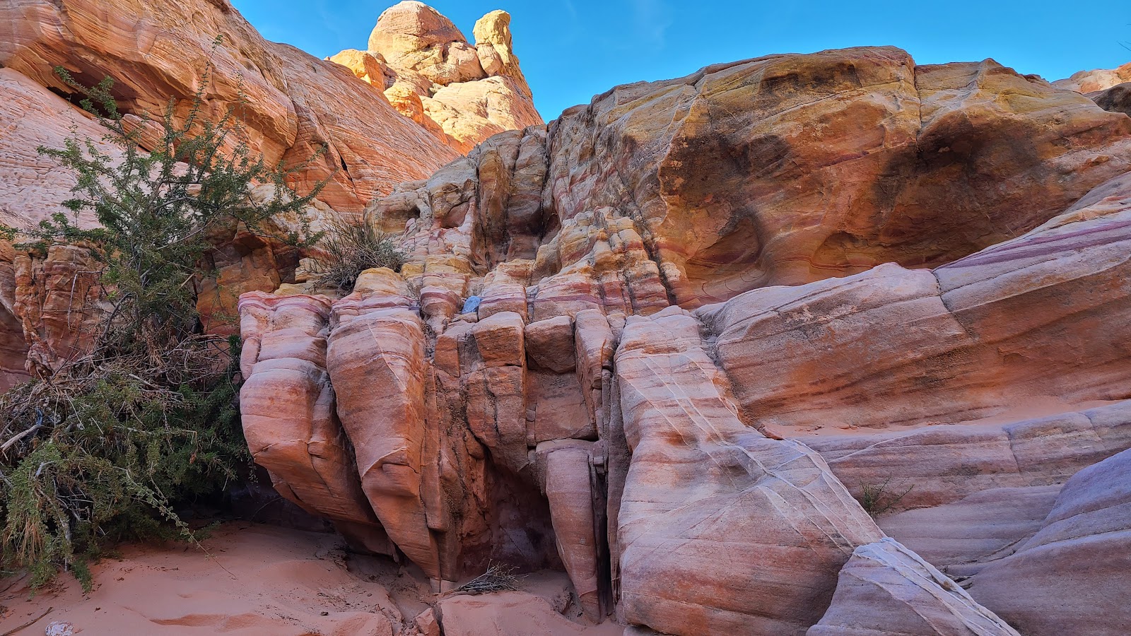
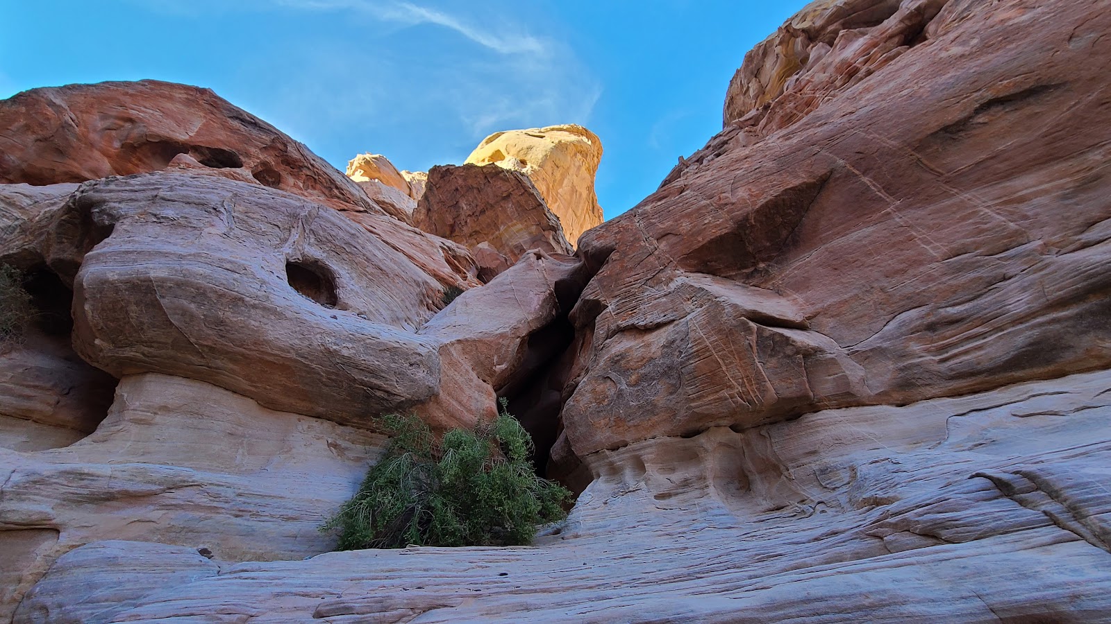
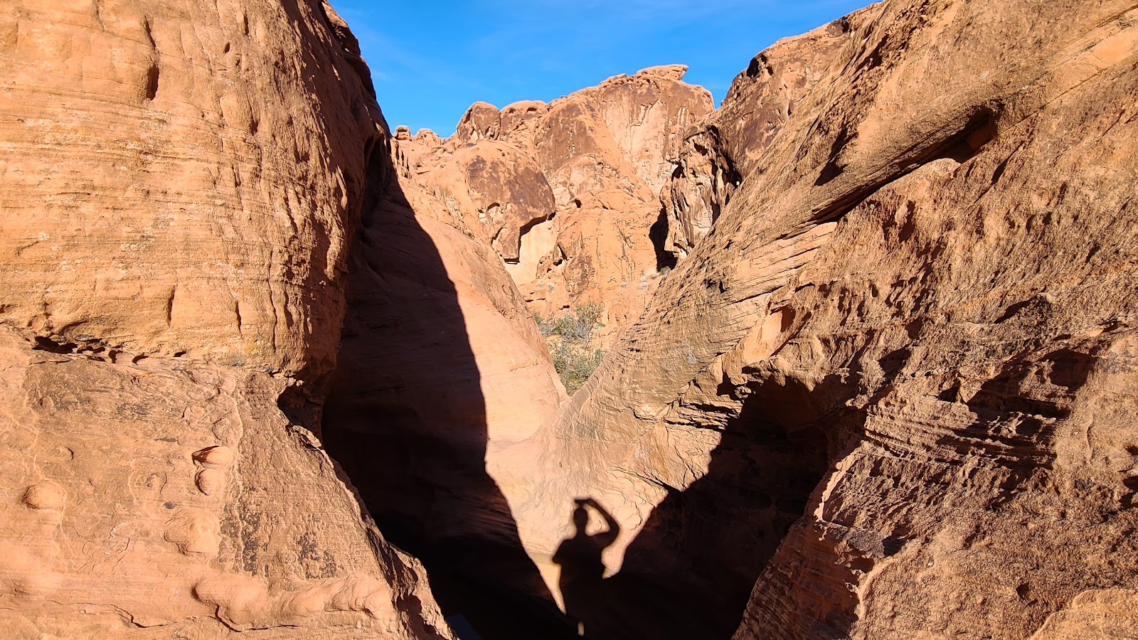
 Looks like we will be heading into a slot canyon up ahead.
| SLIDE NUMBER | ||
|---|---|---|
| 11 | OF | 20 |
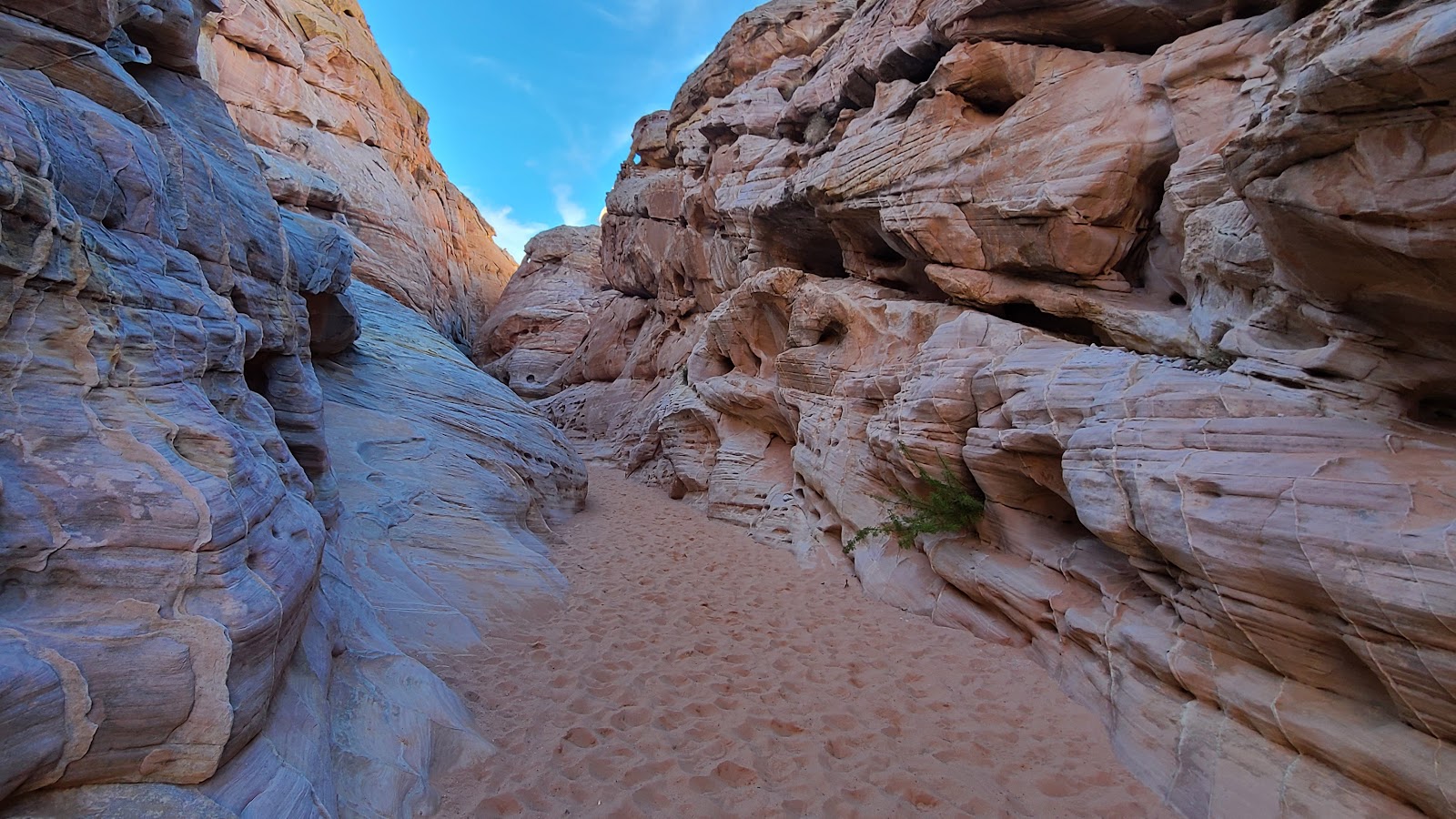
 Yep! But this one is wide enough that we don't have to squeeze through.
| SLIDE NUMBER | ||
|---|---|---|
| 12 | OF | 20 |
| SLIDE NUMBER | ||
|---|---|---|
| 13 | OF | 20 |
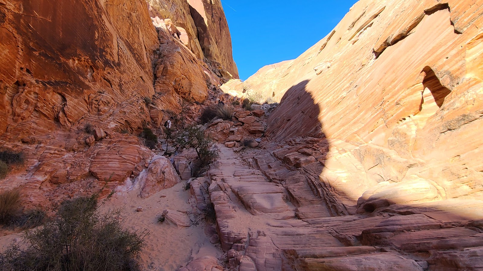
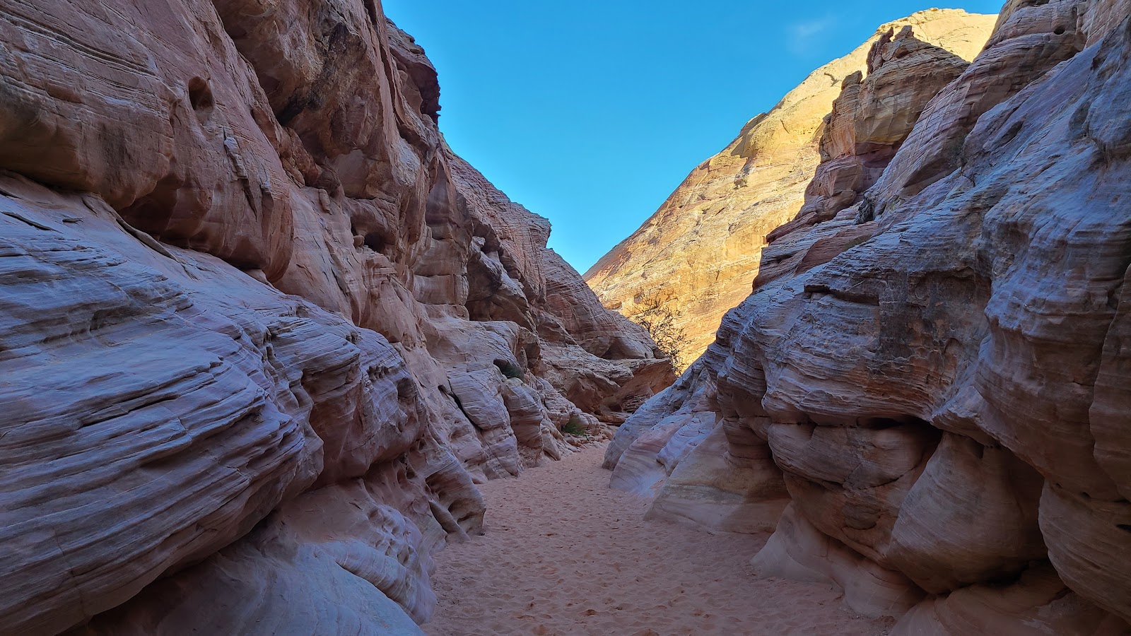 Exiting the slot canyon back into the warm sun.
| SLIDE NUMBER | ||
|---|---|---|
| 14 | OF | 20 |
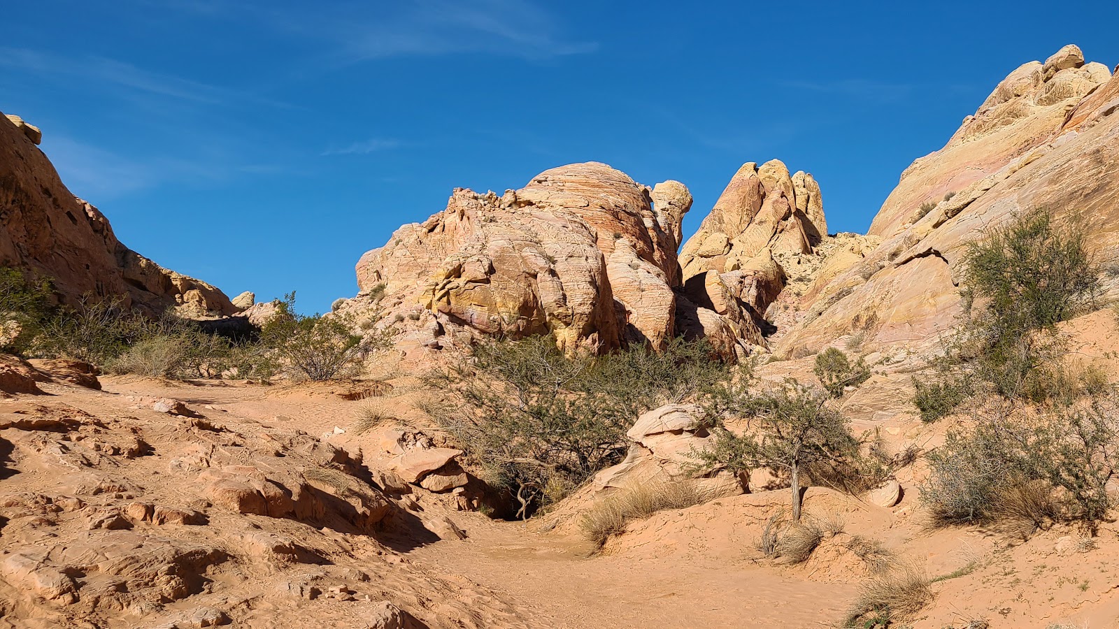 There is absolutely no shade for the rest of the hike.
| SLIDE NUMBER | ||
|---|---|---|
| 15 | OF | 20 |
| SLIDE NUMBER | ||
|---|---|---|
| 16 | OF | 20 |
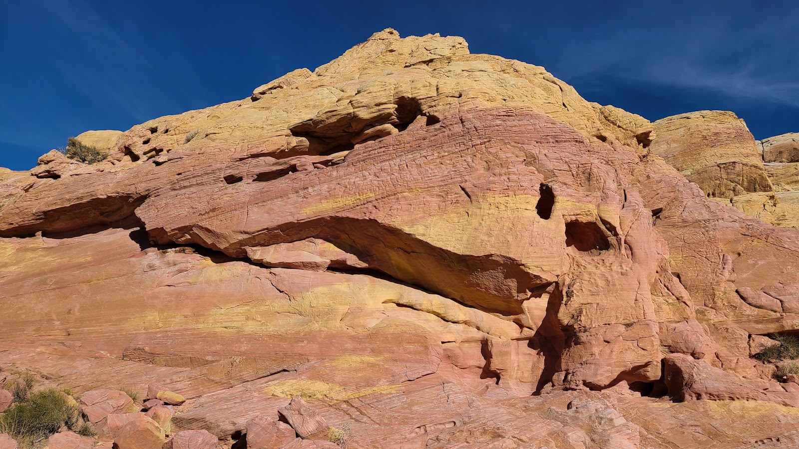
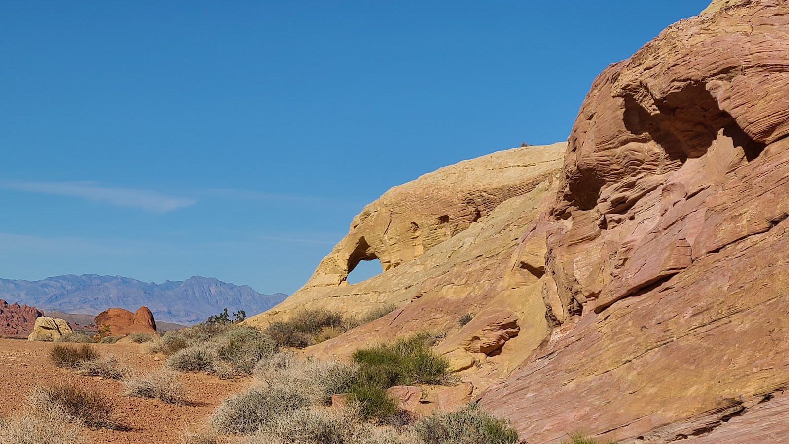 Look up ahead, there's an arch in the rocks.
| SLIDE NUMBER | ||
|---|---|---|
| 17 | OF | 20 |
| SLIDE NUMBER | ||
|---|---|---|
| 18 | OF | 20 |
| SLIDE NUMBER | ||
|---|---|---|
| 19 | OF | 20 |
 I knew we were close to the end when a car drove past this shadowy area just a few yards in front of us.
| SLIDE NUMBER | ||
|---|---|---|
| 20 | OF | 20 |


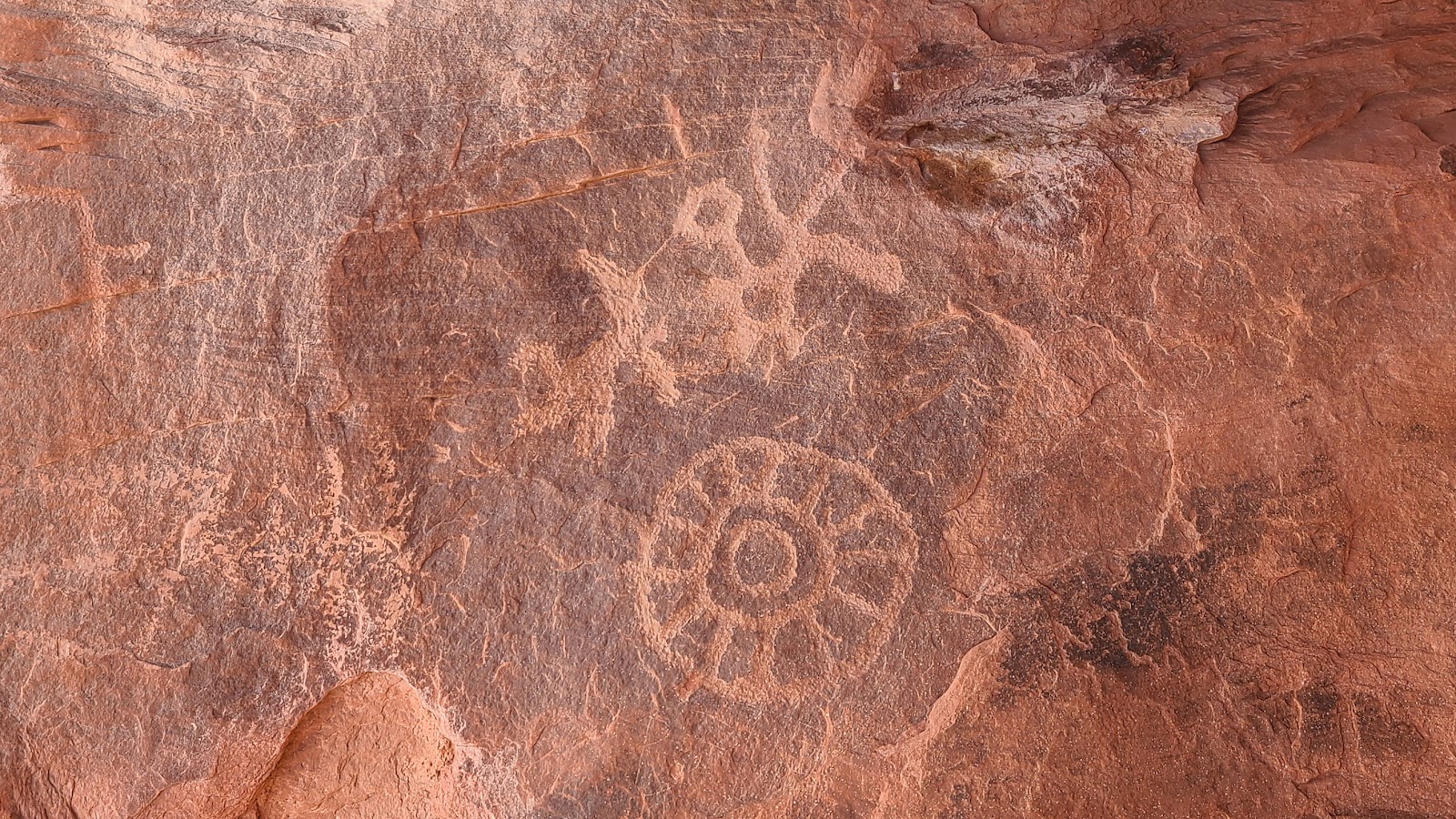
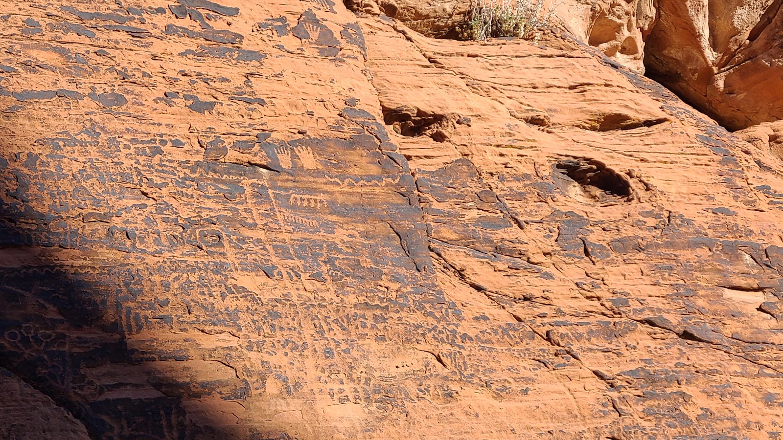
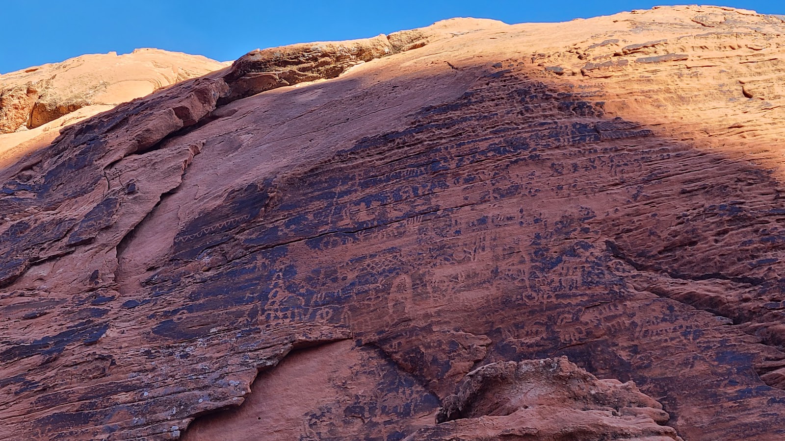
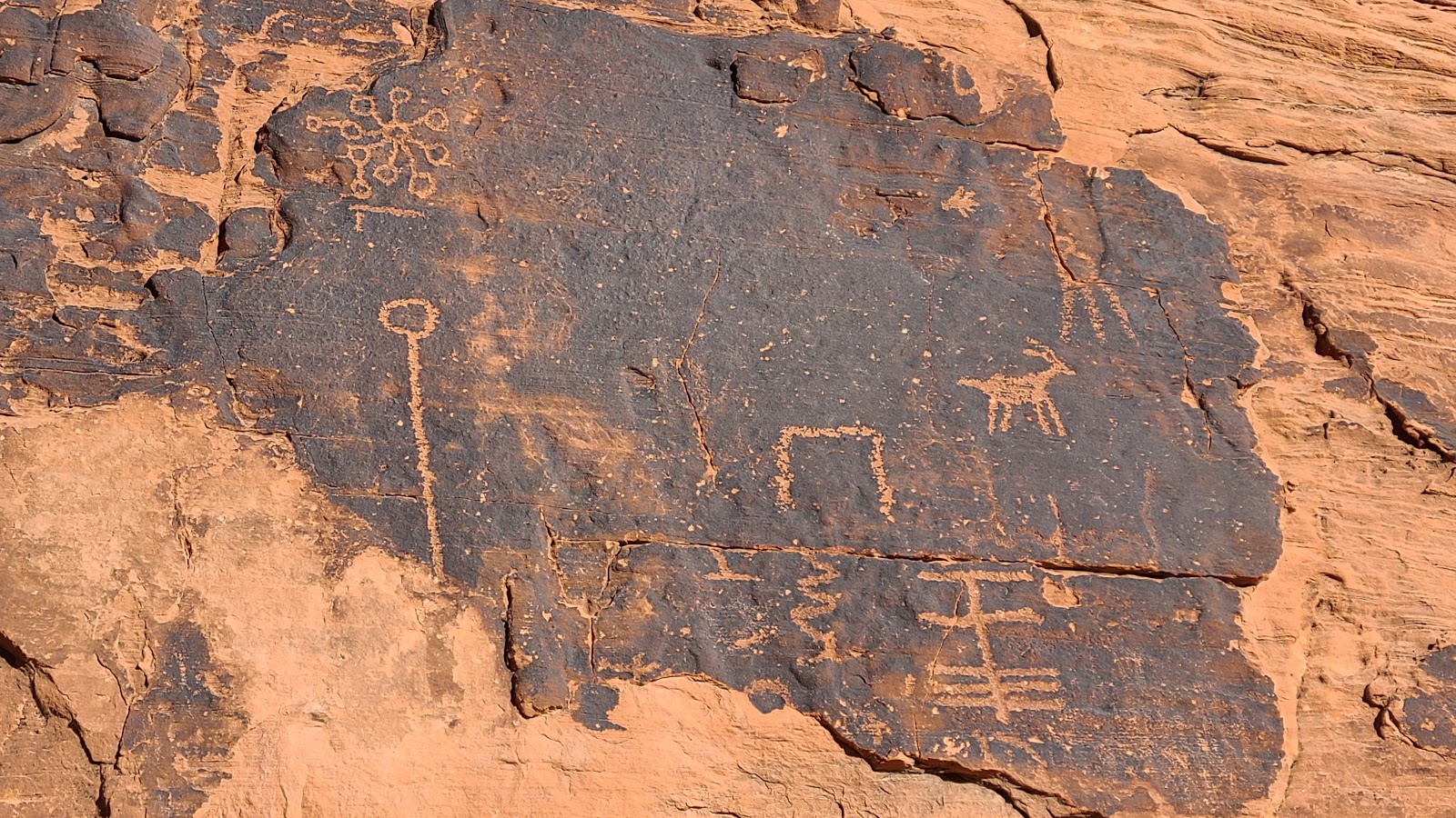
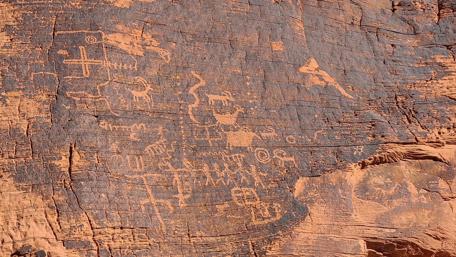
The two campgrounds in this park are named Atlatl Rock and Arch Rock. Today we went in search of the inspiration behind these two names and it wasn't hard to figure out, there are informational signs all over the place.
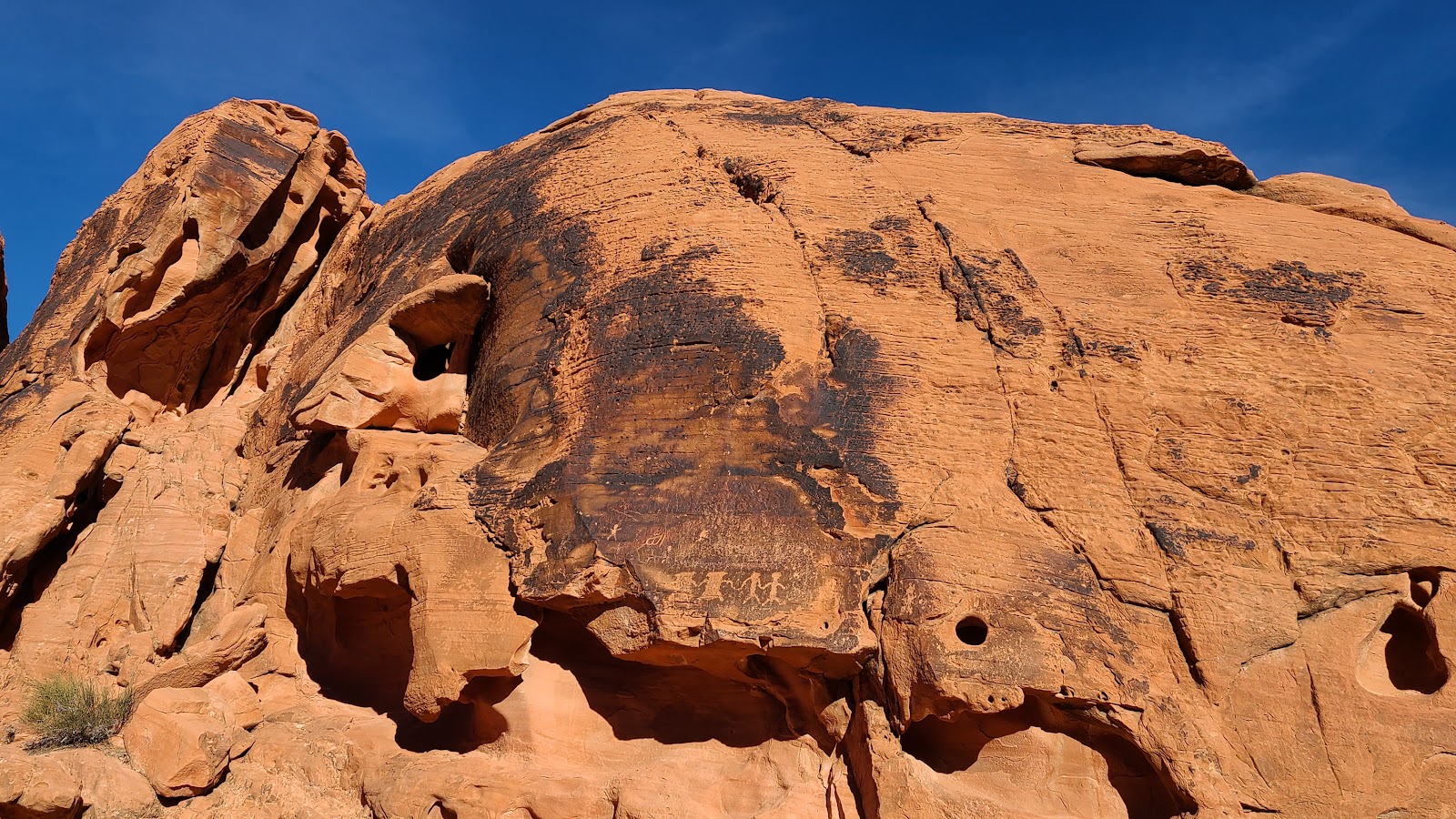
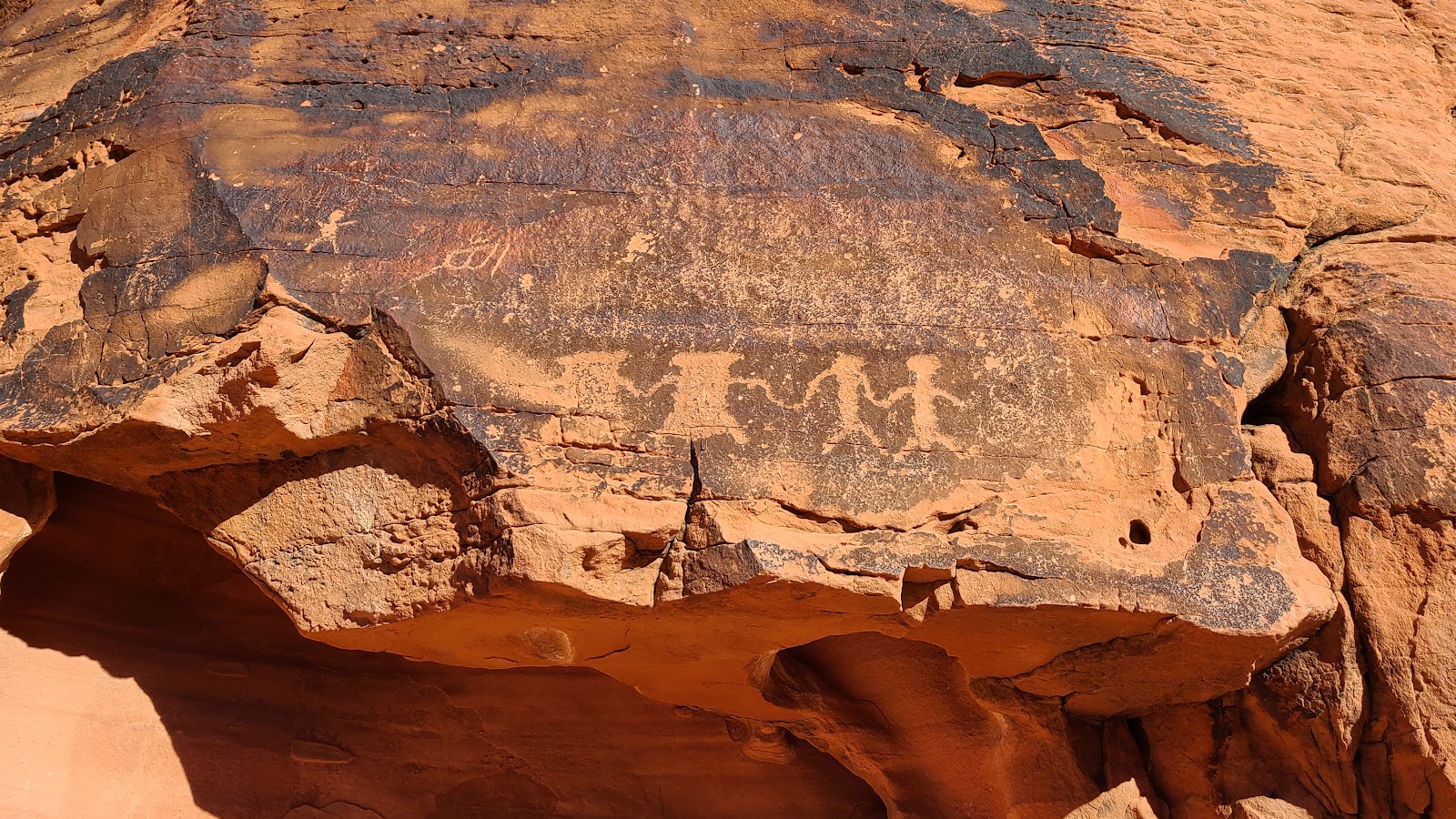
We are camped in Atlatl Rock Campground. In case you don't know, an atlatl is a device for throwing a spear or dart that consists of a rod or board with a projection (such as a hook) at the rear end to hold the weapon in place until released. The atlatl comes from the Aztecs, who used the weapon to enable their spears to penetrate the armor of Spanish invaders in the 1500s.
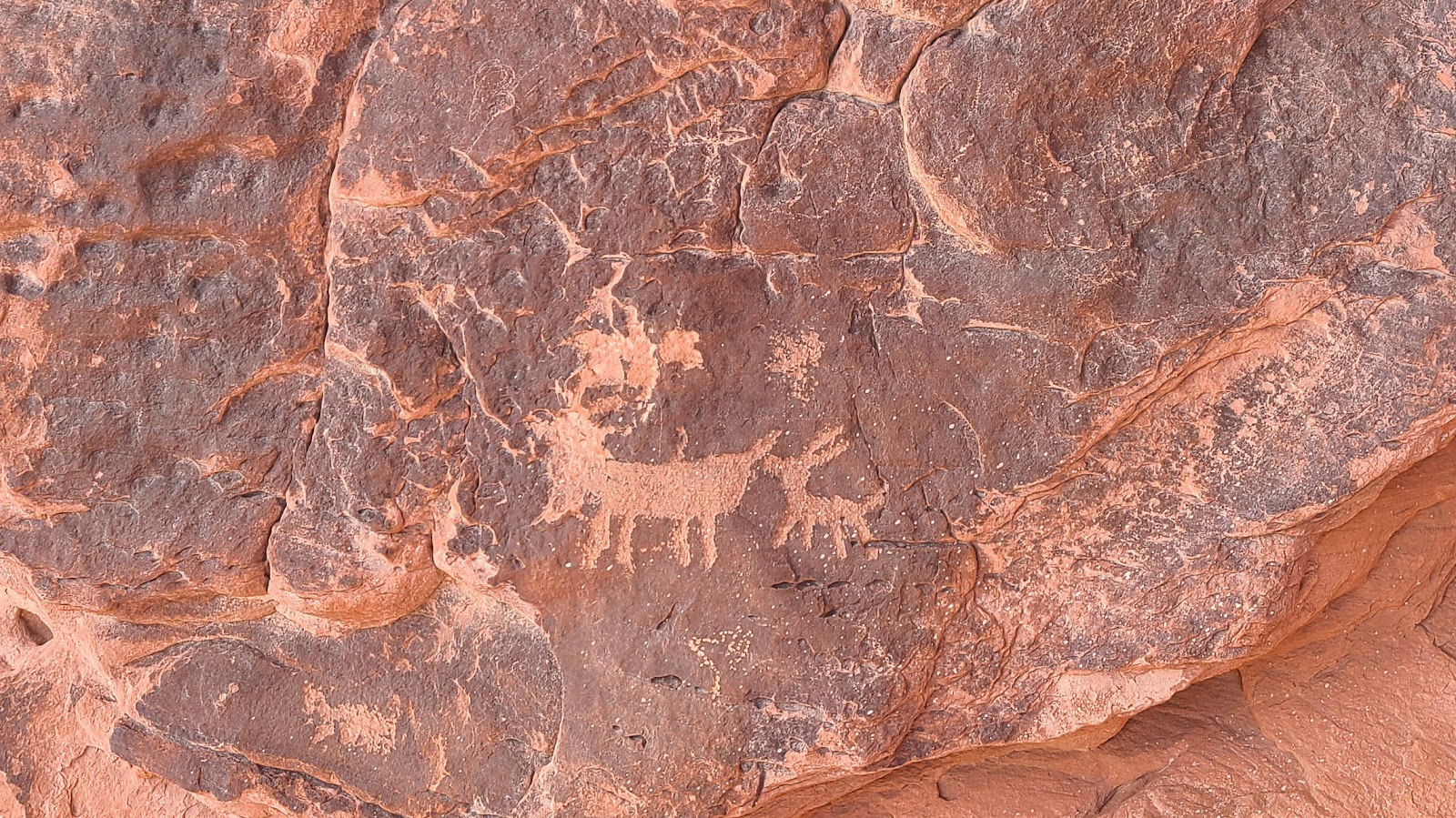
Sure you can see Atlatl Rock from the parking lot, but if you want to get a closeup look at the 4000 year old petroglyphs, you'll have to climb a few flights of stairs. Unfortunately, this also makes it easy access for the "graffiti artists" to deface them and put their marks all over the rockface.


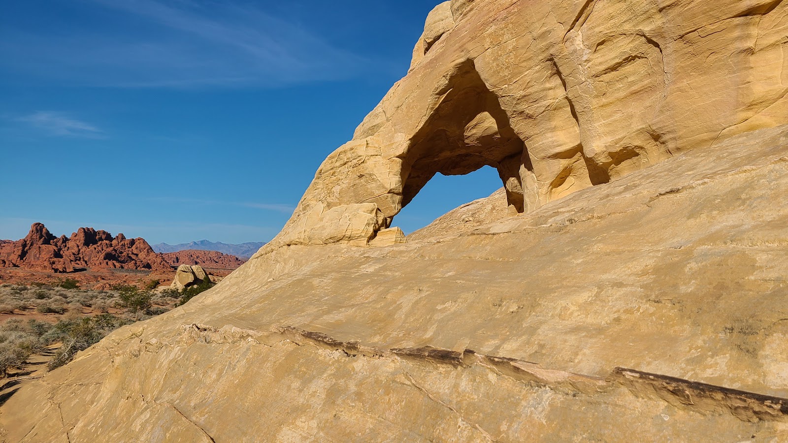
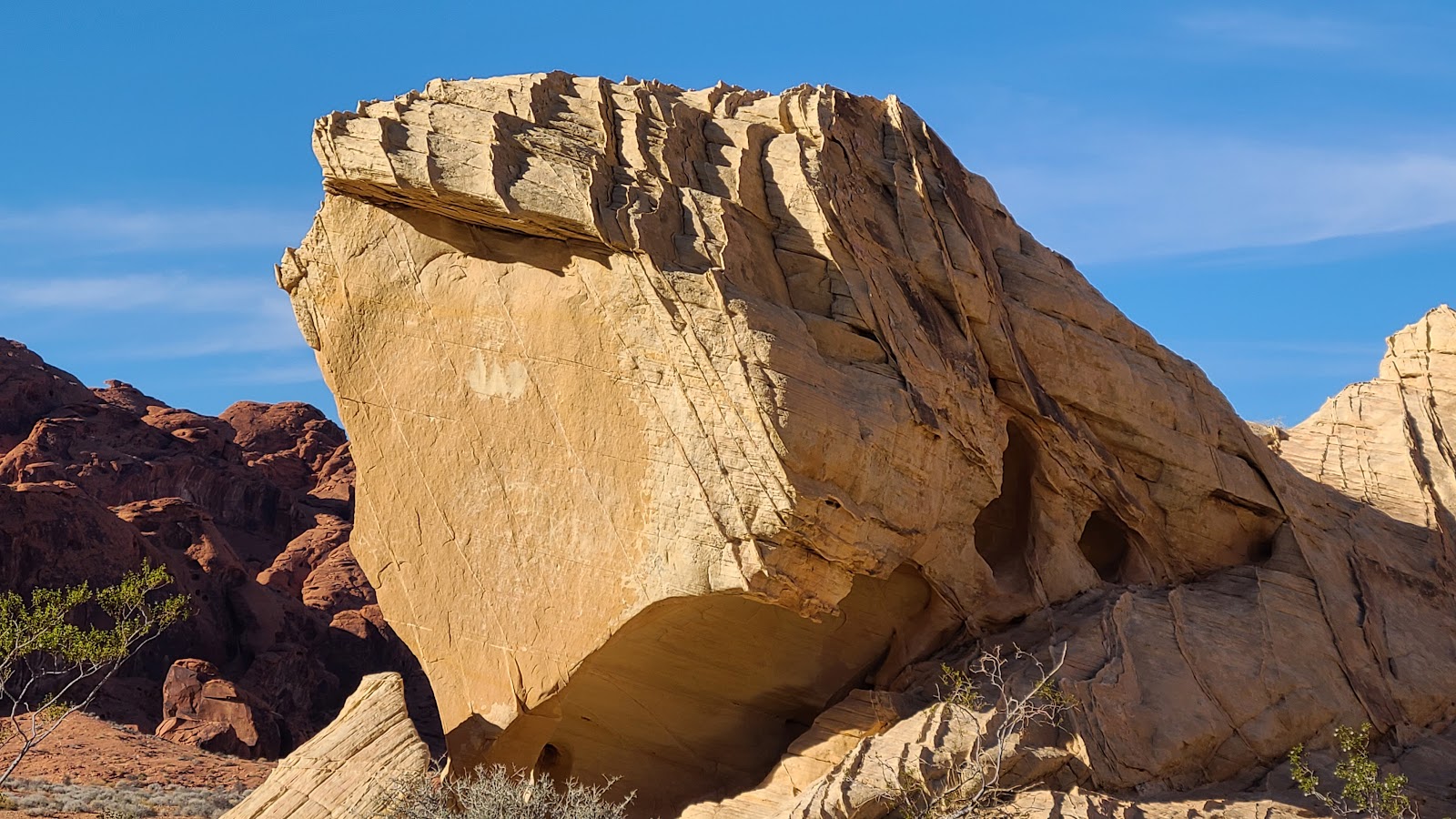
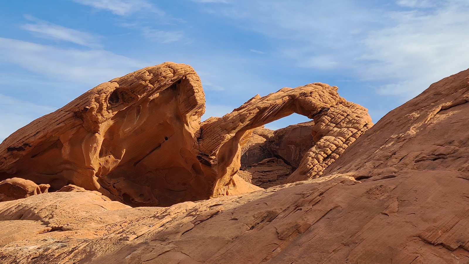
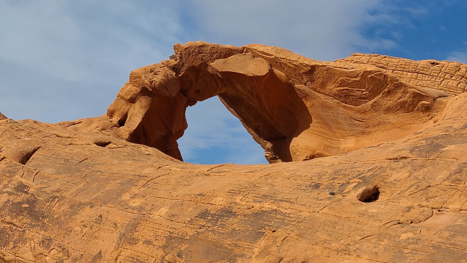
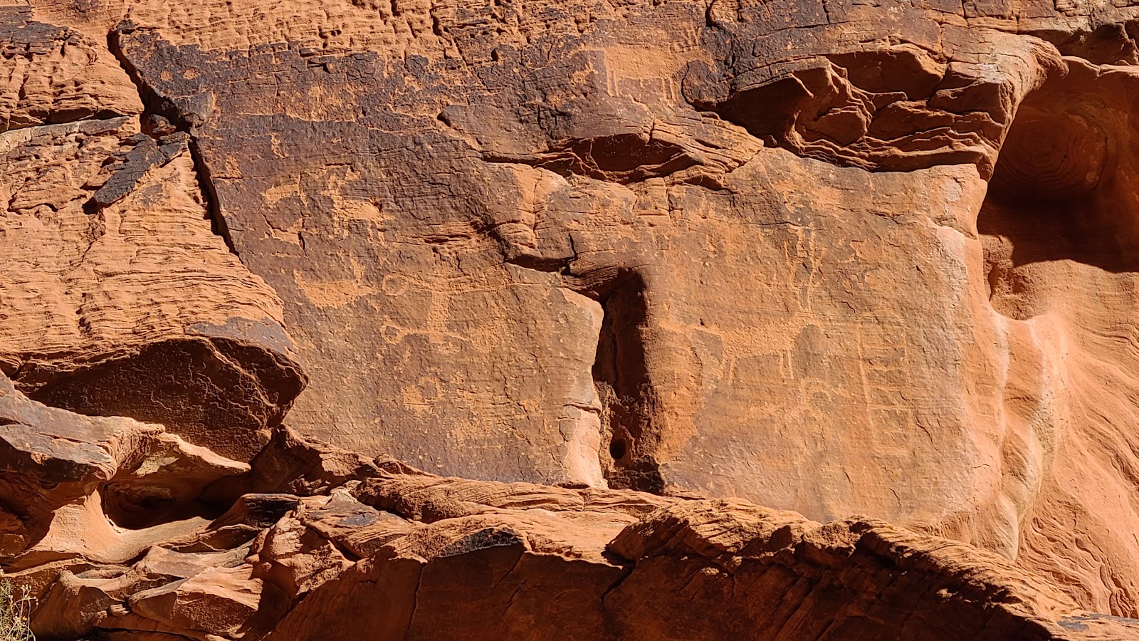
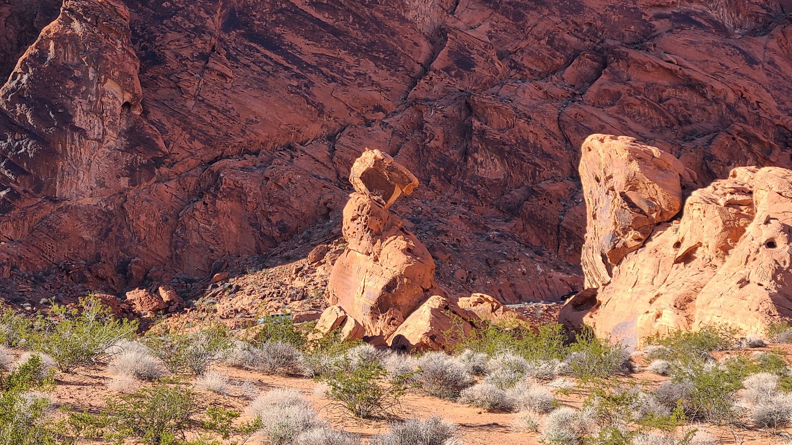
The second campground in the park is called Arch Rock. As you can imagine, it involves an arch rock in the near vicinity of the campground. Truth be told, there are hundreds of small (think basketball sized) arches in the rocks all around the park, but this is one of the larger examples.
It too can be viewed from the parking lot, but for what I consider the better view, you'll have to walk around to the back side of the rock.
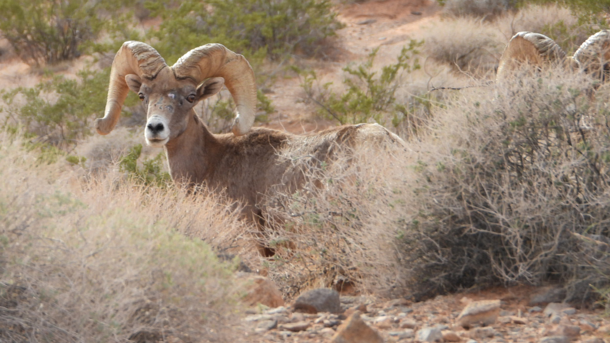
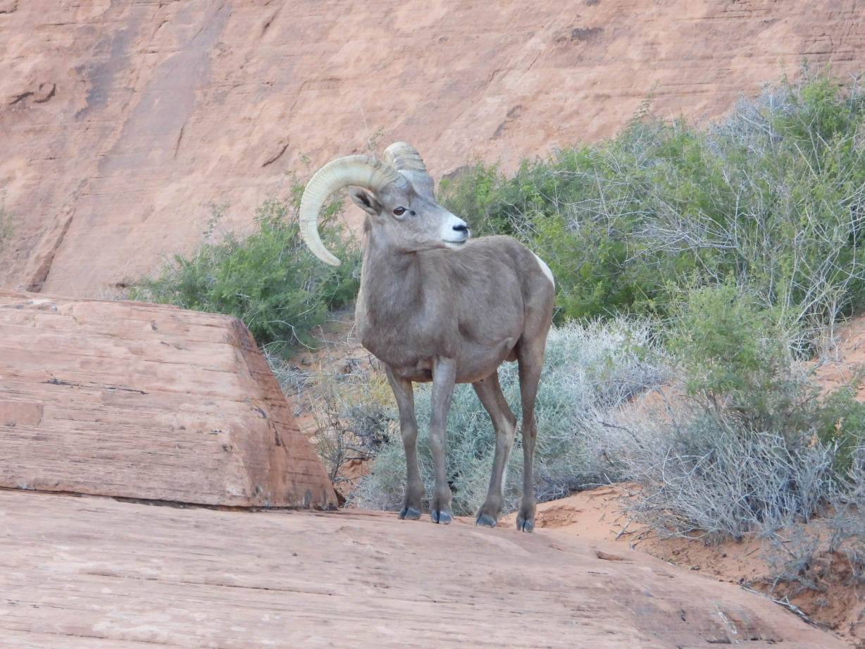
We thought we were all done sightseeing and were headed towards the park exit when Tricia was looking out the window at the side of the road and started yelling, "sheep, goats, sheep, goats!"
I had no idea what she was yelling about, my eyes were on the road, but I knew I needed to pull over so she could snap a few photos.
Turns out she spotted a trio of Bighorn Sheep grazing just a few feet from the roadway. Before long we were joined by a half dozen other cars on the side of the road to snap photos of the sheep. One lady thought it was a good idea to put her dog on a leash and approach closer to them while taking photos with her cellphone.
That didn't go well for all of us and I was the first to admonish her for her thoughtlessness, or maybe it was just plain ignorance, as to how the sheep would react to such an invasion of their space. Guess the grumpy old man is still alive and well and living inside my head and mouth.
We did get some decent photos and a video, thanks to Trica's steady hand and her long range zoom lens. These Bighorn Sheep are closely related to the Dall Sheep we saw while traveling through Canada and Alaska this summer.

They were usually just white dots on the mountainside.
Speaking of lunch, let's head into town like we planned and check out Criss Angel's restaurant named CABLP (pronounced Ka-blip) which stands for Criss Angel's Breakfast Lunch Pizza restaurant.
You may have heard of Criss Angel as the MINDFREAK magician. He does shows in nearby Las Vegas, but chose the town of Overton (pop. 5510) as the location for his restaurant.
With a name like that we had to try their pizza of course. Tricia had her standard Margherita Pizza and I chose the New York CAlzone. Both were tasty, and as such there were no TO GO boxes today!
Before leaving town we made trips into the Ace Hardware store, True Value store and Lin's Market grocery store.
On the way back to the campground I planned on checking out three FREE dispersed camping areas in case we are ever in the neighborhood again. The first location was on a Nevada State Wildlife Management Area outside of town, not our cup of tea! The second was a wide open mesa located of Bureau of Land Management (BLM) property which was a little further out of town, much nicer! And the third was located in north end of the nearby Lake Mead National Recreation Area, again not our cup of tea.
So the winner is Door #2, the BLM property, if we ever find ourselves visiting near here again! Because we usually strive not to visit the same place twice!

But today is Monday and the weekenders should have returned home by now. Guess that doesn't hold true on the week of Thanksgiving, because the campground is still completely full and the trailhead parking lot was full when we arrived just after lunch.
The fact that we are so close to Las Vegas may mean that we also are sharing the park trails with vacationers and not just the locals. We can't keep putting off hiking the trails until ideal conditions prevail, but we can try and see some of the less popular trails today.
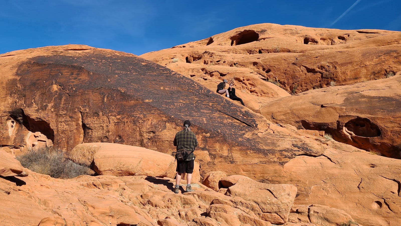
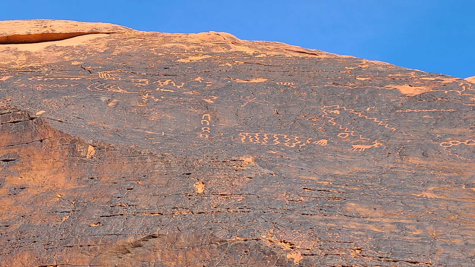
We've selected three short trails to go check out today. The first trail is called Mouse's Tank Trail, but I'll bet it's not for the reason you're thinking. To find out the real reason for the trail name you'll have to check out this LINK.
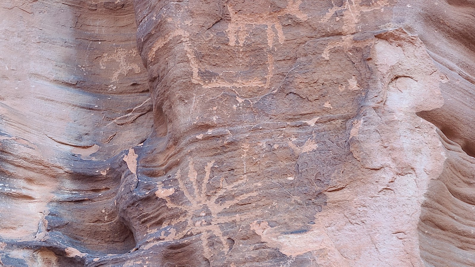
The trail is known for the hundreds of 4000-year old petroglyphs that are visible from the trail.
Next up is the very short Balancing Rock Trail and if you haven't guessed there is a balancing rock at the end.
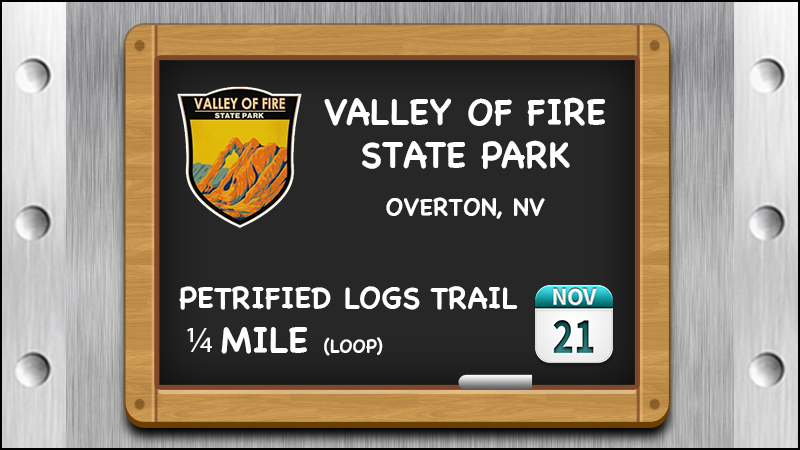
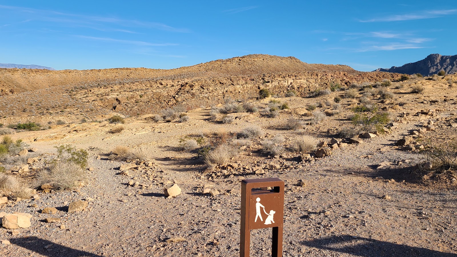
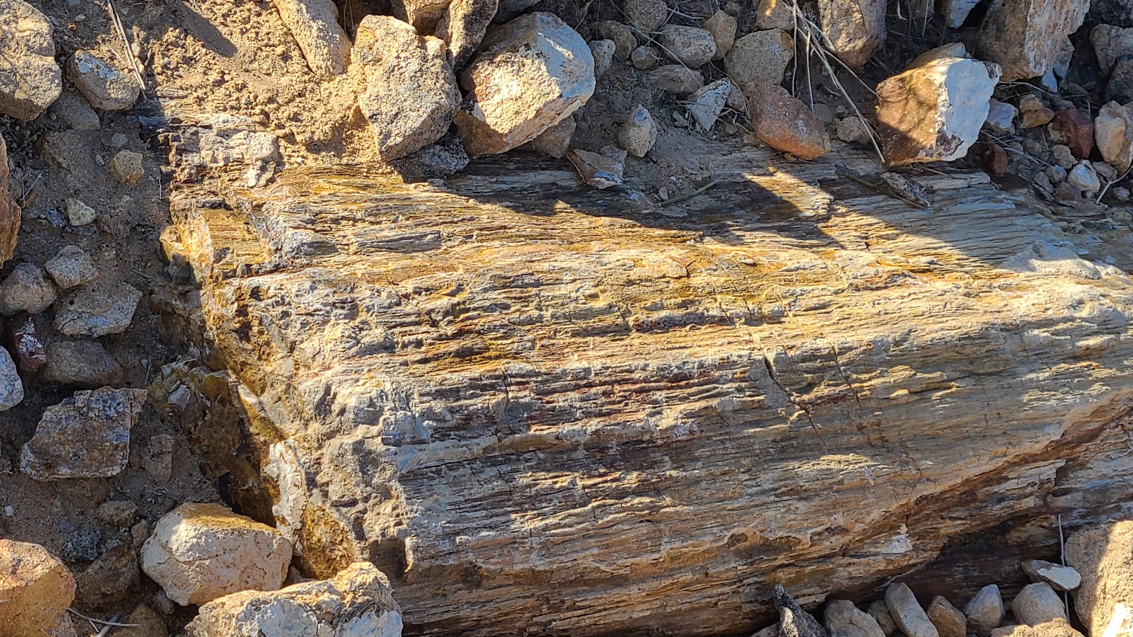
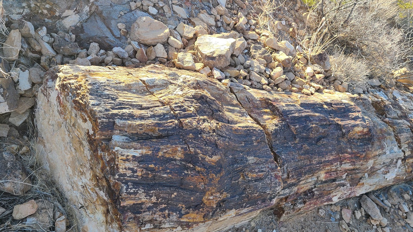
Last up will be the Petrified Logs Trail and once again, you guessed it, a dozen or more petrified logs are located along the trail.
| SLIDE NUMBER | ||
|---|---|---|
| 1 | OF | 35 |

| SLIDE NUMBER | ||
|---|---|---|
| 2 | OF | 35 |
 Like the guidebook described, this trail is covered with petroglyphs from end to end.
| SLIDE NUMBER | ||
|---|---|---|
| 3 | OF | 35 |
 Some are very elaborate, some are not!
| SLIDE NUMBER | ||
|---|---|---|
| 4 | OF | 35 |
 This couple should probably not be up there and off the trail.
| SLIDE NUMBER | ||
|---|---|---|
| 5 | OF | 35 |
 After about ten minutes is was obvious they were not coming down any time soon.
| SLIDE NUMBER | ||
|---|---|---|
| 6 | OF | 35 |
 Trying to take photos without them in it just wasn't working...
| SLIDE NUMBER | ||
|---|---|---|
| 7 | OF | 35 |
 ...so we heading on down the trail, there's so much more to see.
| SLIDE NUMBER | ||
|---|---|---|
| 8 | OF | 35 |
| SLIDE NUMBER | ||
|---|---|---|
| 9 | OF | 35 |

| SLIDE NUMBER | ||
|---|---|---|
| 10 | OF | 35 |
| SLIDE NUMBER | ||
|---|---|---|
| 11 | OF | 35 |
| SLIDE NUMBER | ||
|---|---|---|
| 12 | OF | 35 |
| SLIDE NUMBER | ||
|---|---|---|
| 13 | OF | 35 |
| SLIDE NUMBER | ||
|---|---|---|
| 14 | OF | 35 |
 The trail ends at Mouses's Tank. A natural rock water tank where rainwater collects.
| SLIDE NUMBER | ||
|---|---|---|
| 15 | OF | 35 |
 By turning around and heading back we saw more petroglyphs we missed on the way in.
| SLIDE NUMBER | ||
|---|---|---|
| 16 | OF | 35 |
| SLIDE NUMBER | ||
|---|---|---|
| 17 | OF | 35 |
 By far this rock had more petroglyphs than any other...
| SLIDE NUMBER | ||
|---|---|---|
| 18 | OF | 35 |
 ...and it looks so much nicer without that inconsiderate couple sitting on it!
| SLIDE NUMBER | ||
|---|---|---|
| 19 | OF | 35 |

| SLIDE NUMBER | ||
|---|---|---|
| 20 | OF | 35 |
 This trail is so short you can see the payoff at the end before you even begin.
| SLIDE NUMBER | ||
|---|---|---|
| 21 | OF | 35 |
 Halfway there now!
| SLIDE NUMBER | ||
|---|---|---|
| 22 | OF | 35 |
 I wouldn't want to be under that if it ever came sliding down.
| SLIDE NUMBER | ||
|---|---|---|
| 23 | OF | 35 |
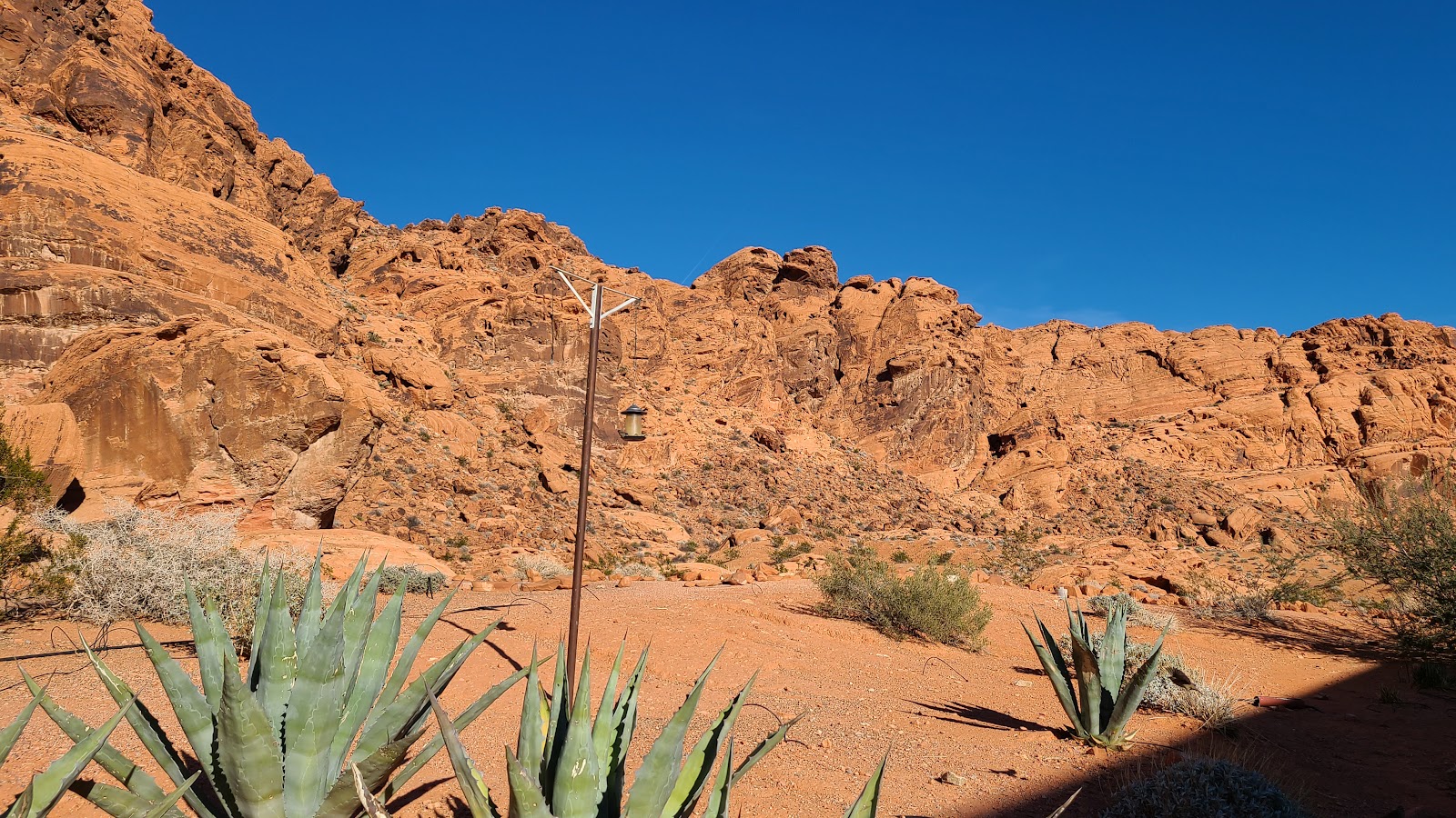
 The trail starts and ends at the Visitor Center, so we checked out the rear patio again.
| SLIDE NUMBER | ||
|---|---|---|
| 24 | OF | 35 |
 It's such a great place to sit and eat our ice cream sandwiches!
| SLIDE NUMBER | ||
|---|---|---|
| 25 | OF | 35 |
 There's always a lot of activity around the bird feeder to keep you entertained.
| SLIDE NUMBER | ||
|---|---|---|
| 26 | OF | 35 |
| SLIDE NUMBER | ||
|---|---|---|
| 27 | OF | 35 |
| SLIDE NUMBER | ||
|---|---|---|
| 28 | OF | 35 |
 This trail appears to be dog friendly, I'll have to pay extra attention to were I'm stepping.
| SLIDE NUMBER | ||
|---|---|---|
| 29 | OF | 35 |
 Nothing but wide open space and sunshine...
| SLIDE NUMBER | ||
|---|---|---|
| 30 | OF | 35 |
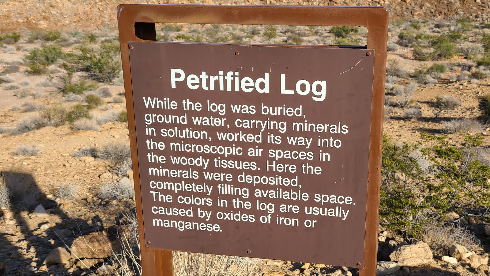
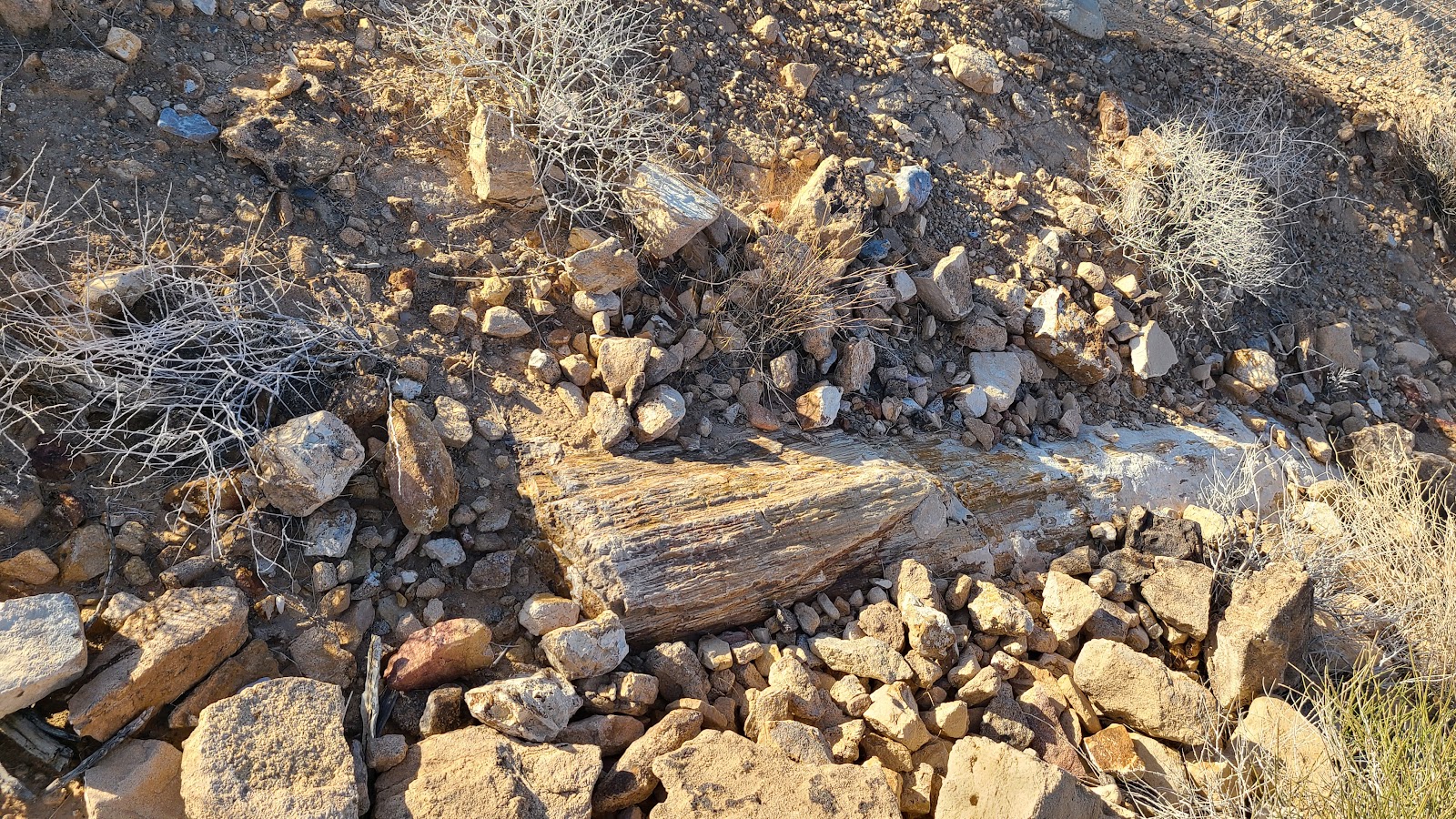 ...with a few signs and petrified logs thrown in.
| SLIDE NUMBER | ||
|---|---|---|
| 31 | OF | 35 |
| SLIDE NUMBER | ||
|---|---|---|
| 32 | OF | 35 |
| SLIDE NUMBER | ||
|---|---|---|
| 33 | OF | 35 |

| SLIDE NUMBER | ||
|---|---|---|
| 34 | OF | 35 |
 I've seen enough petrified logs, I'll meet you back at the truck!
| SLIDE NUMBER | ||
|---|---|---|
| 35 | OF | 35 |
Just because we were done hiking for the day doesn't mean the sightseeing was over with.
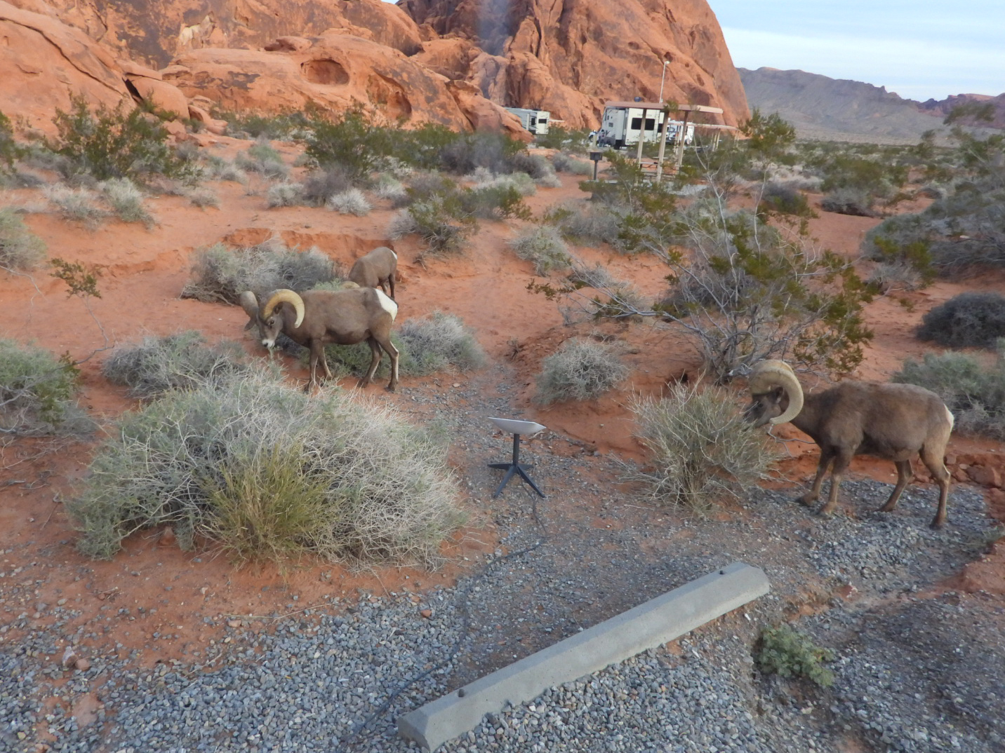
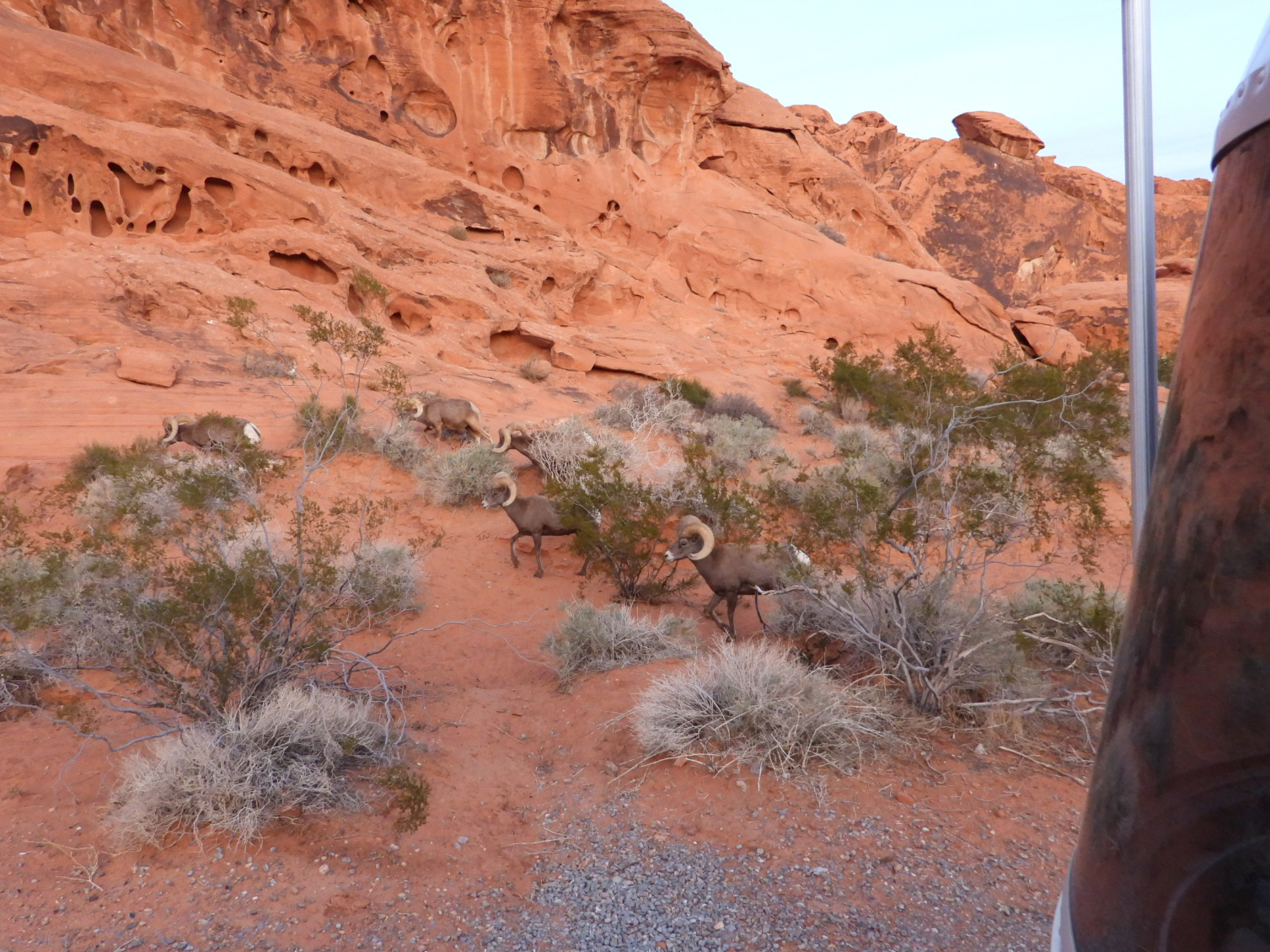
On our way back into the campground we saw several cars pulled off the side of the road, always a good sign there is something worth seeing.
This time it was well worth it! Just before we entered the campground there were a dozen longhorn sheep grazing just a few yards from the side of the roadway. In the next 15-minutes Trica took nearly 100 photos and short videos.
I've trimmed that number down quite a bit for you, so you'll only see the Top Five Photos and Top Five Videos here. You're Welcome!
SHOWN IN THE ORDER THEY WERE TAKEN


It was my turn to yell "Sheep, goats, sheep, goats" at Tricia who was still in bed. I told her to bring her cell phone and take some photos out the rear window. She was a little confused because we've been seeing wonderful sunrises out the front windows of THE POD for the last few mornings.
I hope they don't start chewing on the cord that connects my Starlink dish!
Would you like to be notified of new blog posts?


