

Miles and miles of flat cattle grazing scrub lands with only a few "tiny" towns like Eden (pop. 281), Farson (pop. 313), Boulder (pop. 170) and finally the "small" town of Pinedale (pop. 2262) along the route.
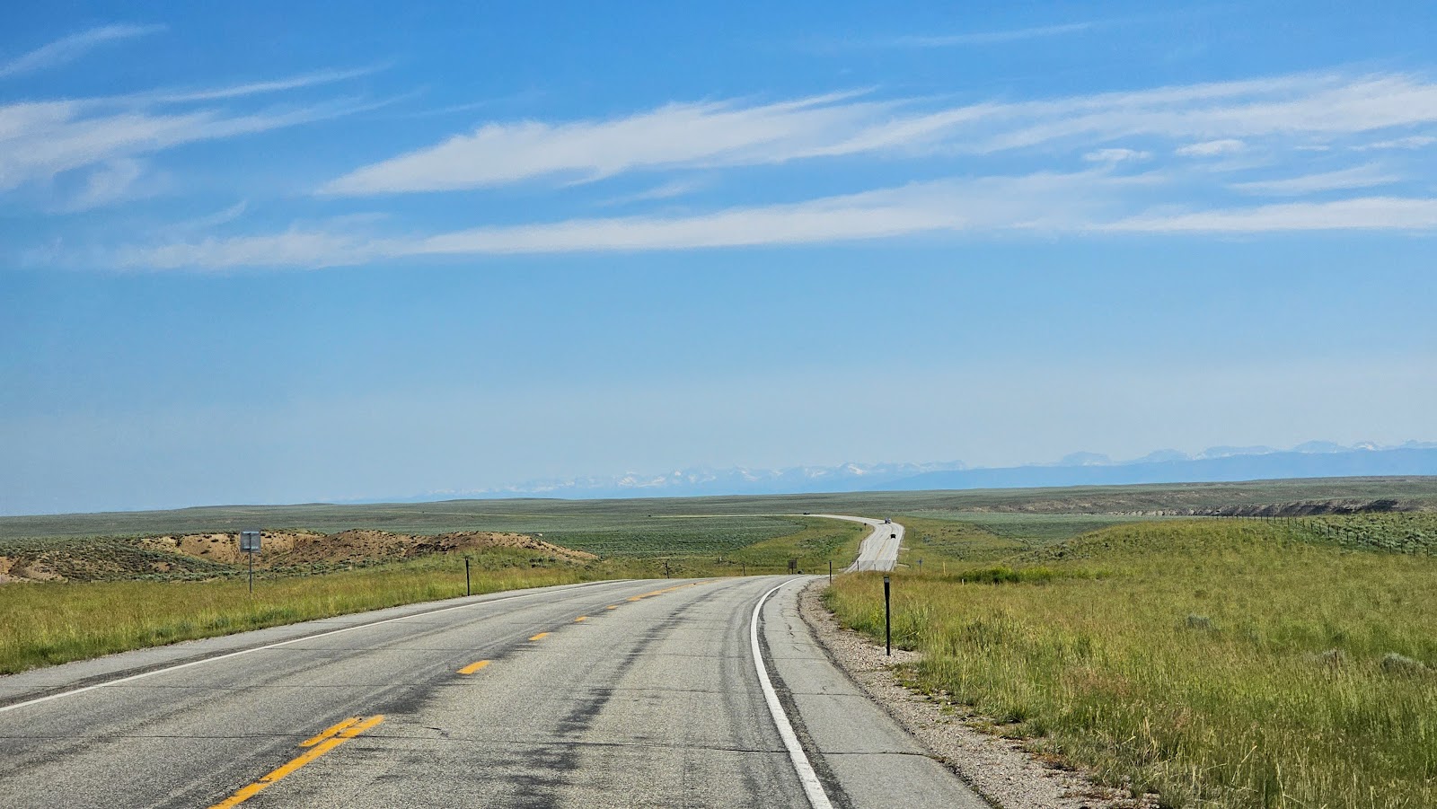
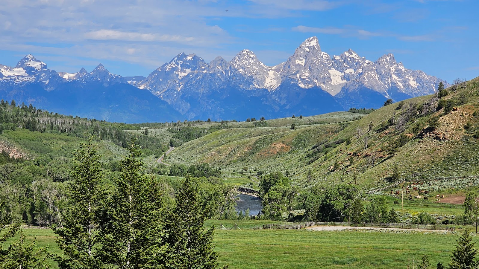
At least there were some snow capped mountains far off in the distance.
We knew there had to be some wide open, unpopulated spaces somewhere in the state of Wyoming, due to the fact that at 97,914 square miles it's our 10th largest state, but with only 576,851 residents in ranks dead last, 50th in population.
In comparison, Broward County Florida, where we are from, has a population of 1,944,375 packed into only 1,322 square miles. That's means that Broward County, at only 1.35% of the size of Wyoming has 3.37 people for each person in Wyoming!
Another fun fact I learned is that if you have a Wyoming telephone number, 307 is your area code. That's because the entire state only needs one area code to service all of it's residents.
The 2nd 100-mile stretch of today's route was entirely different, and in a good way!
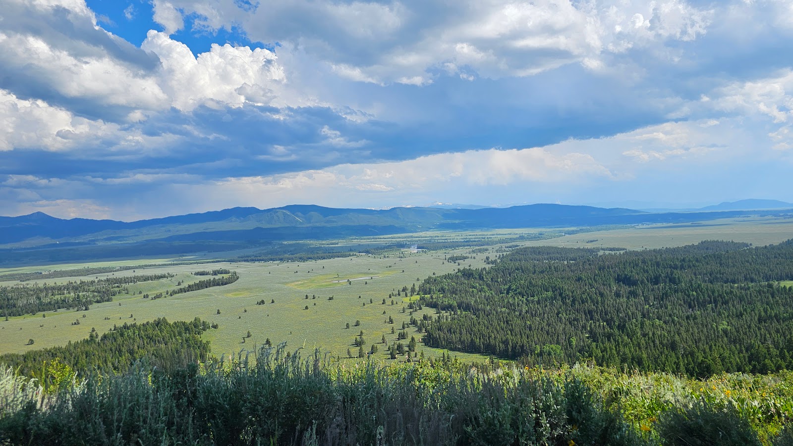
Not long after traveling through the town of Pinedale we found ourselves entering the Bridger-Teton National Forest.


I assume after visiting either Grand Teton or Yellowstone National Park, or better yet, both!


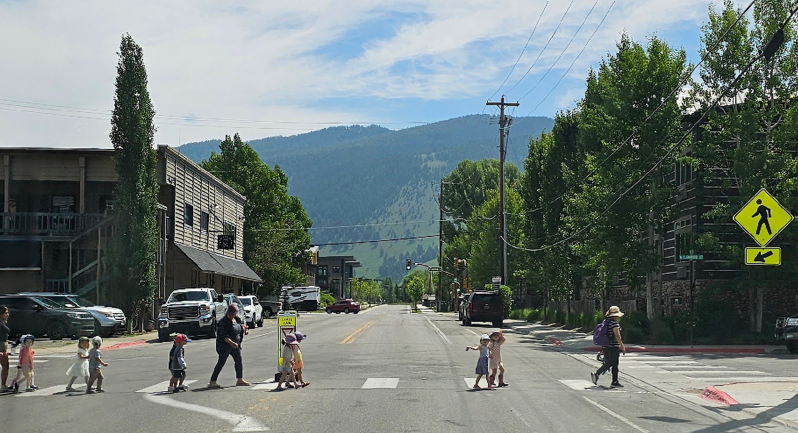
A little further down the road we found ourselves in the "big city" of Jackson, WY (pop. 10,849) where we crossed paths with a herd of 10 preschoolers and their 3 adult handlers. They were all very welcoming, but the first two little girls even waved and blew us kisses!
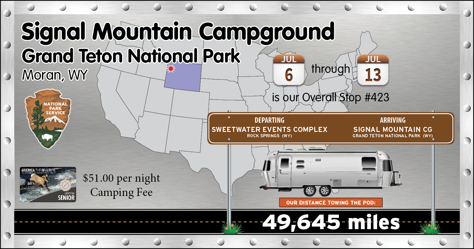
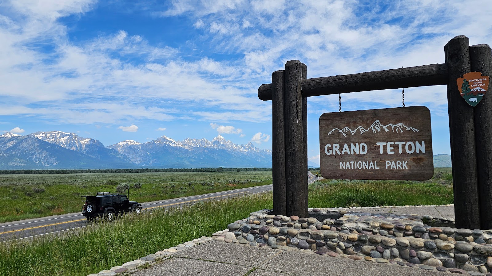
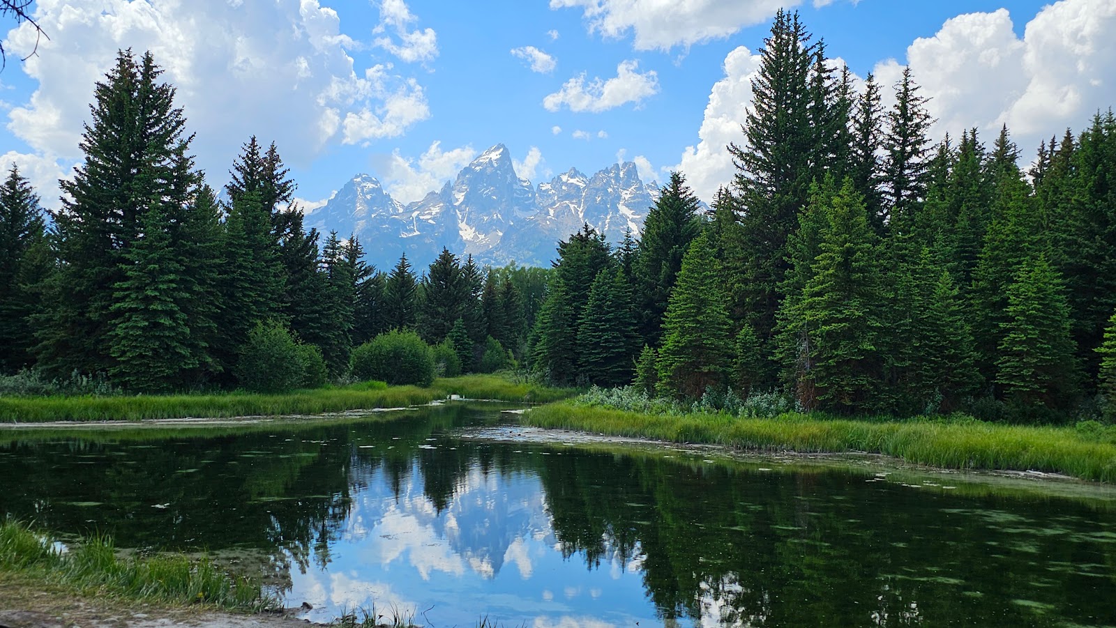
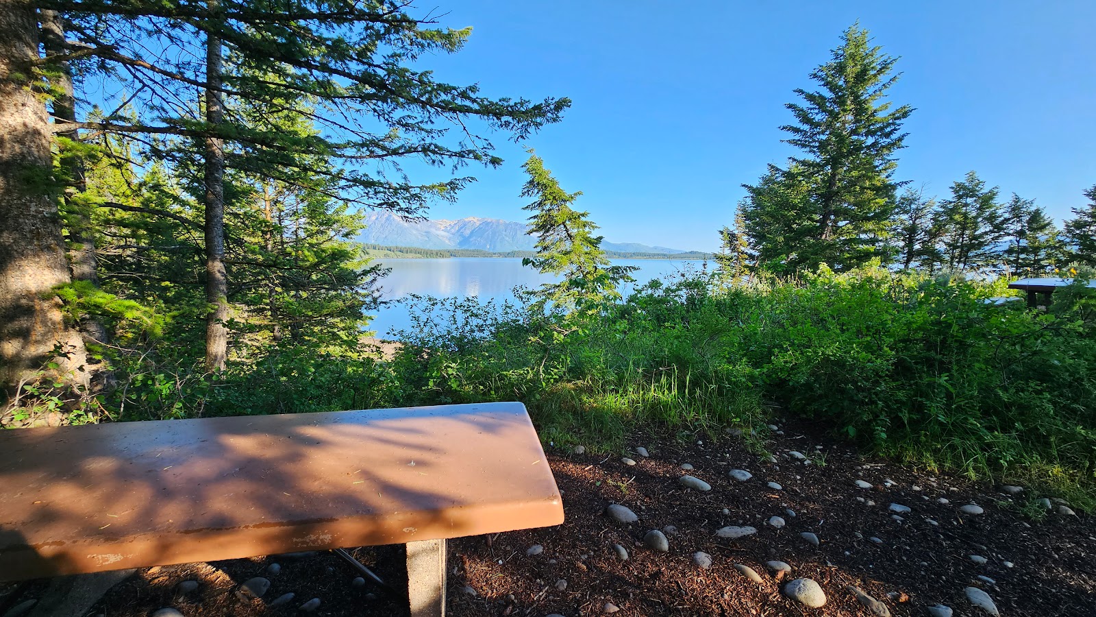
It wasn't too long after leaving Jackson we were within sight of our final destination for today, Grand Teton National Park. The park is tall and skinny from north to south, and our campsite for the next week is very near the center of the park, so we still have nearly 35 miles to go once we enter the park from the south.

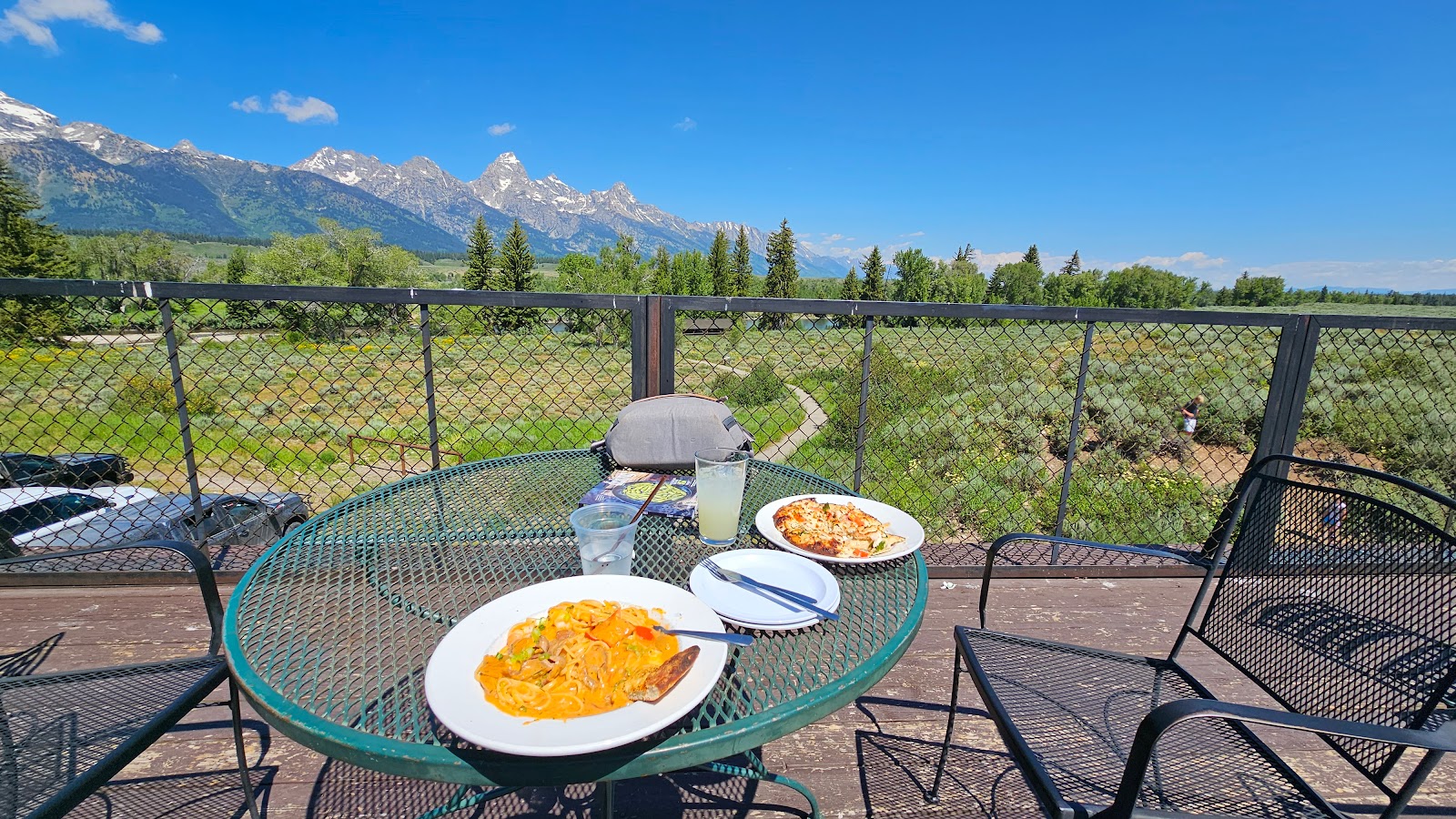
Once we were all set up after "squeezing" THE POD into our campsite, they have a 30' limit here and we measure 28', we headed over to the nearby Signal Mountain Lodge to eat lunch at the Trapper Grill.
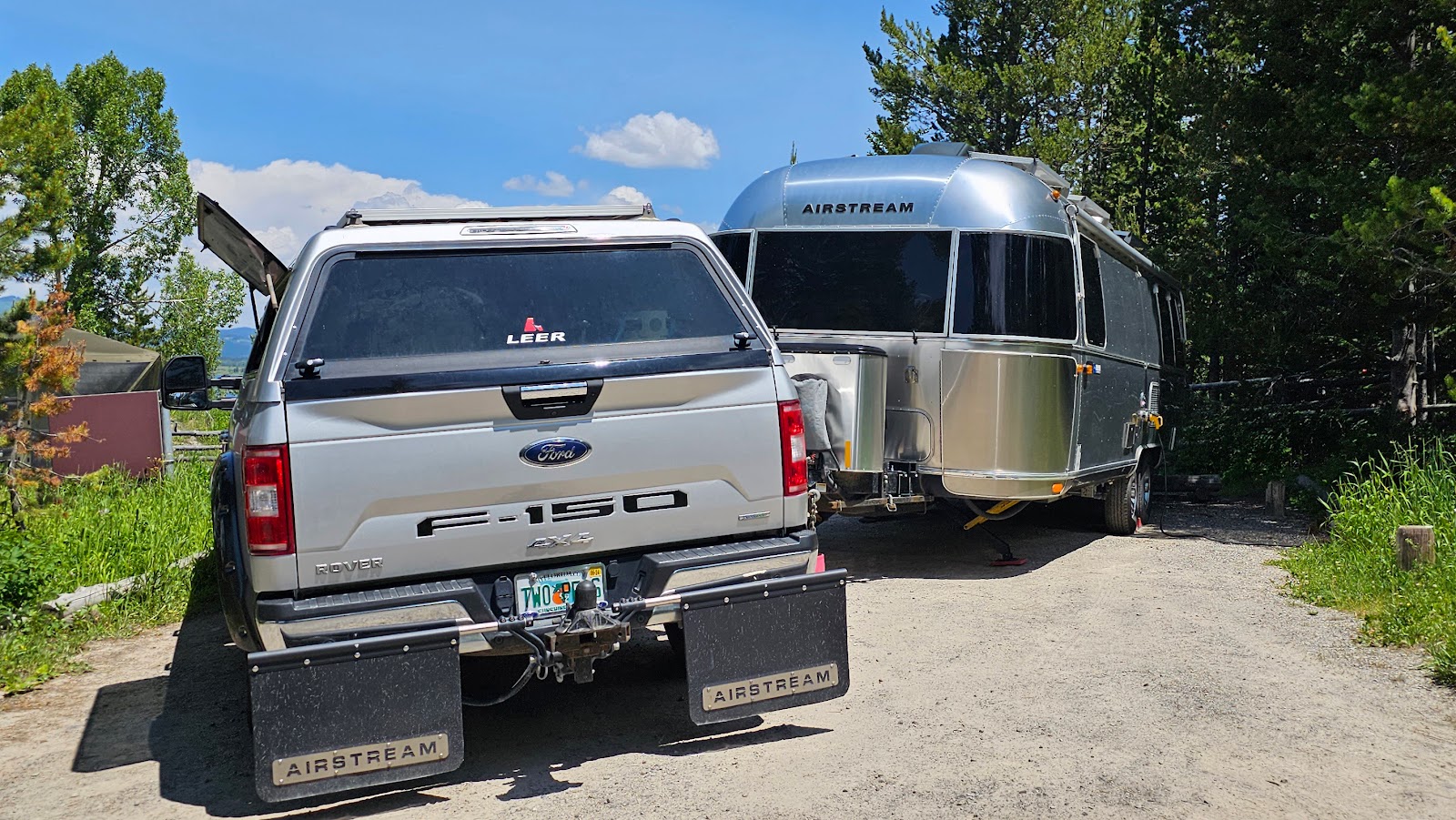
it has more to do with negotiating the tight quarters of the roads and trees in the campground.
After lunch we were going to drive up to the Coulter Bay Visitor Center to get my Passport Book stamped and watch the park's movie, but I forget my sunglasses back at THE POD so we made a short detour back to the campsite. I'm so glad we did!
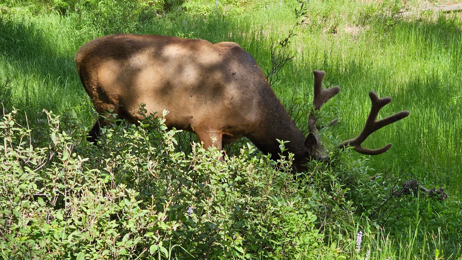
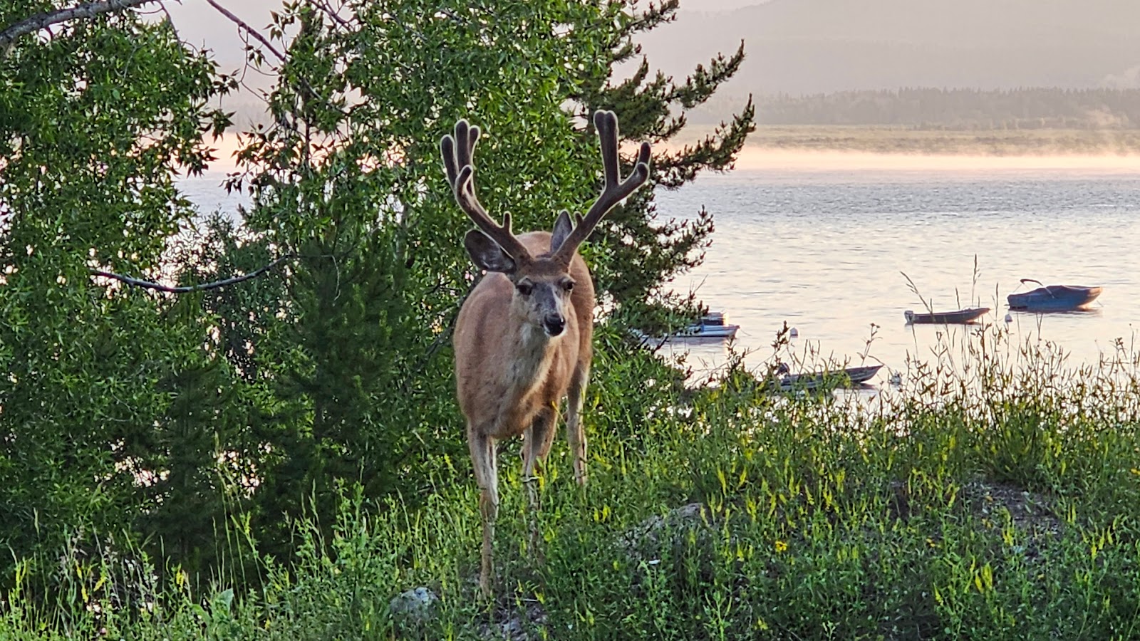
At the entrance to the campground I spotted what I thought was a large moose, but it turned out to be a large elk instead, we've seen many of these.
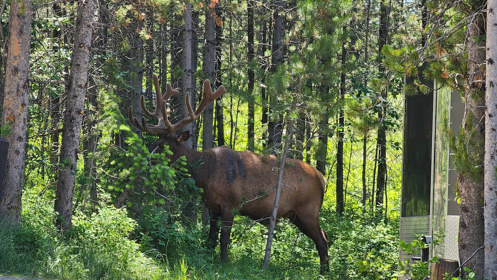
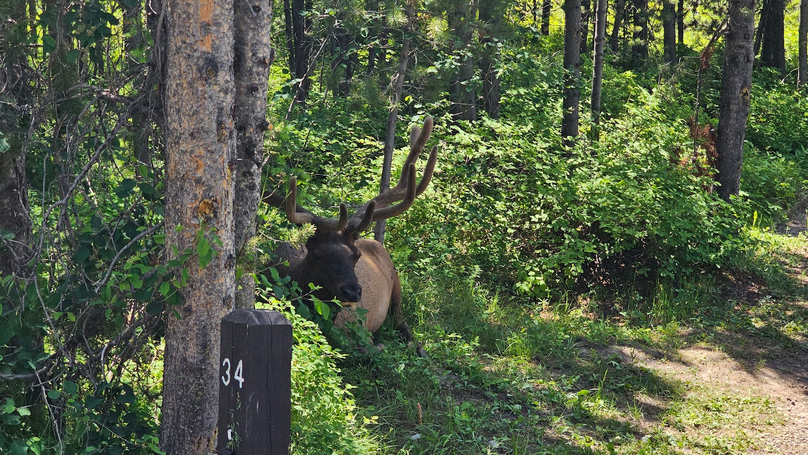
and have this guy pop up out of the bushes to welcome you back home?
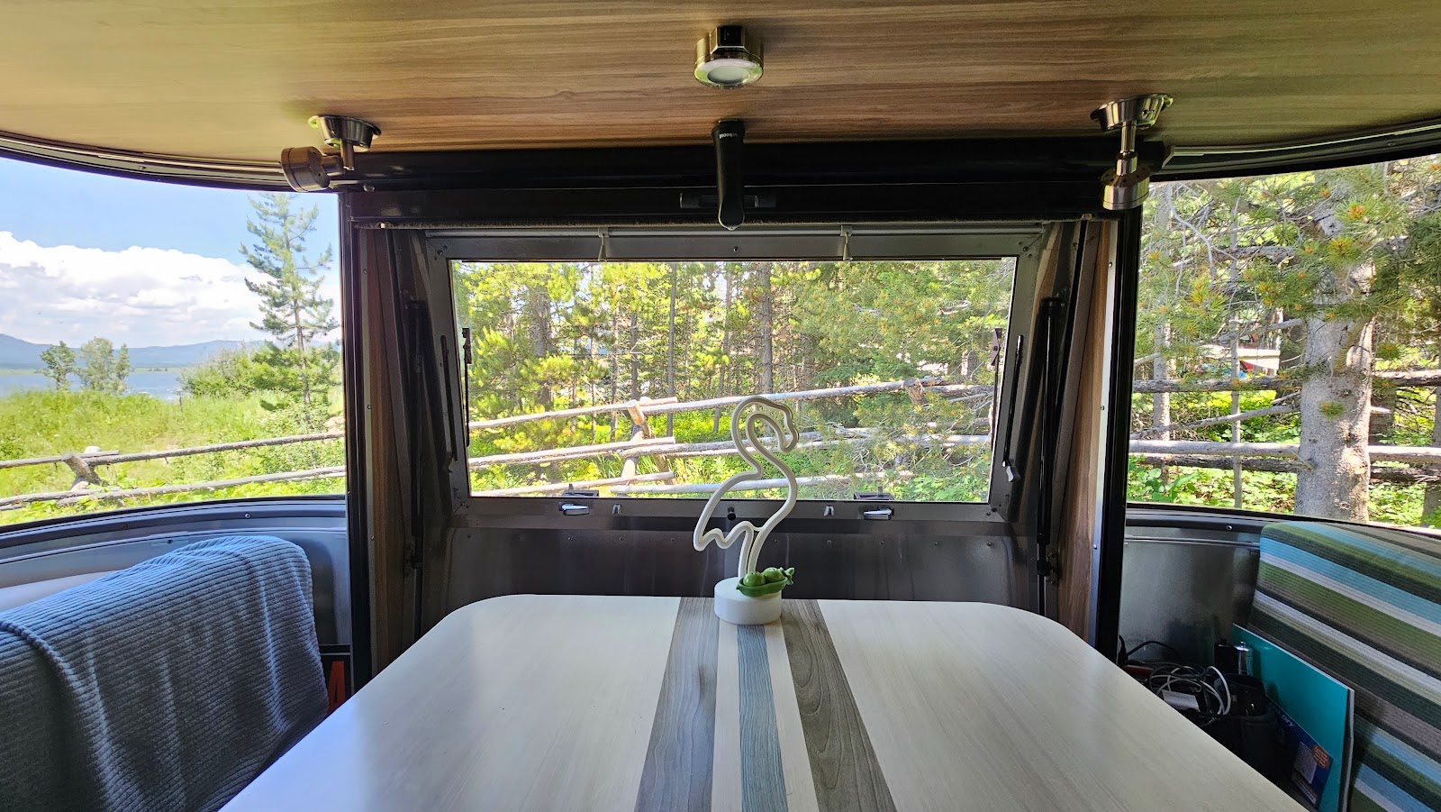
P.S. - Tricia took this second photo while "standing" in our newly repaired sunroof.

That way we could revisit all the wonderful pullouts we had to skip yesterday while towing THE POD to the campground.


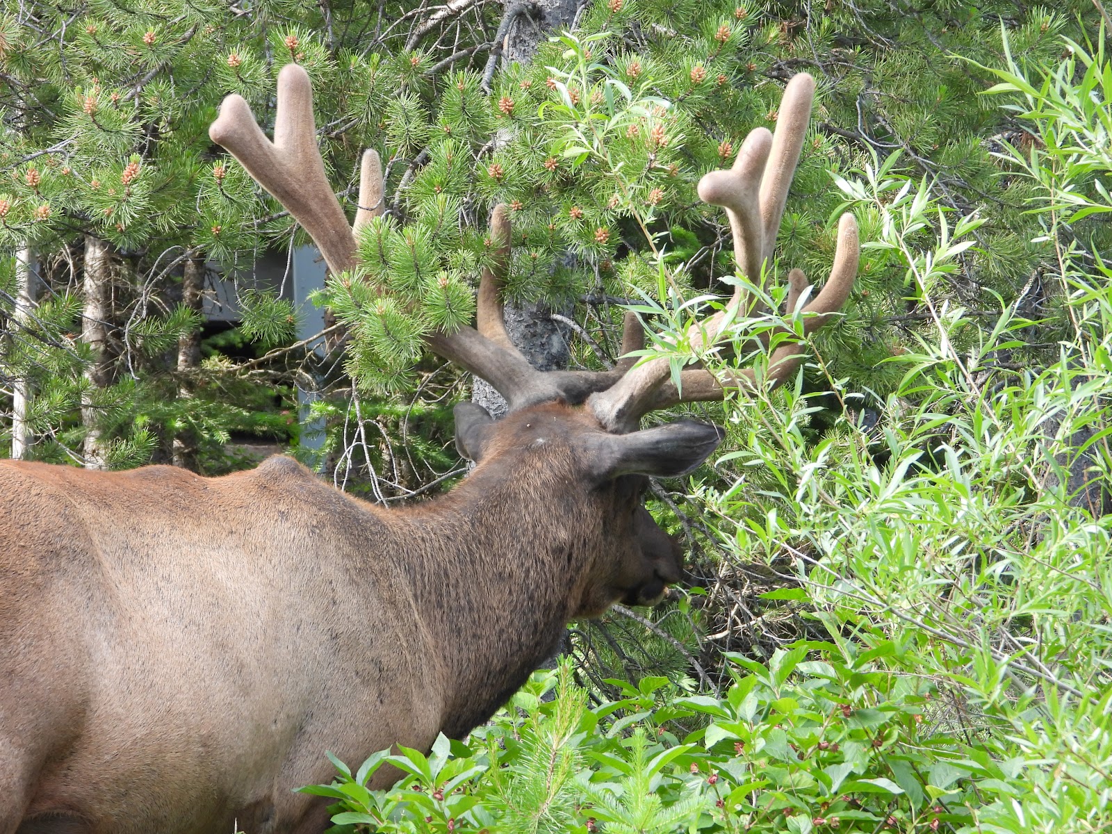
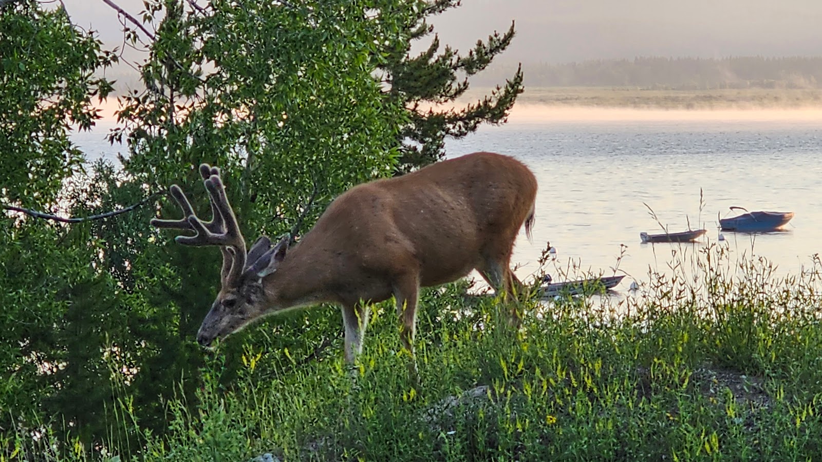
And I'm so glad we were lazy this morning, because at 8:00AM we had a visitor. Spotted right outside our trailer window was this large beast with huge antlers.


Thanks in part to Elroy's visit this morning, we were just a little bit late getting started with our sightseeing endeavors.
On our way out of the campground we drove through the back loops of the campground and spotted this 1976 Airstream tucked tightly into one of the sites.

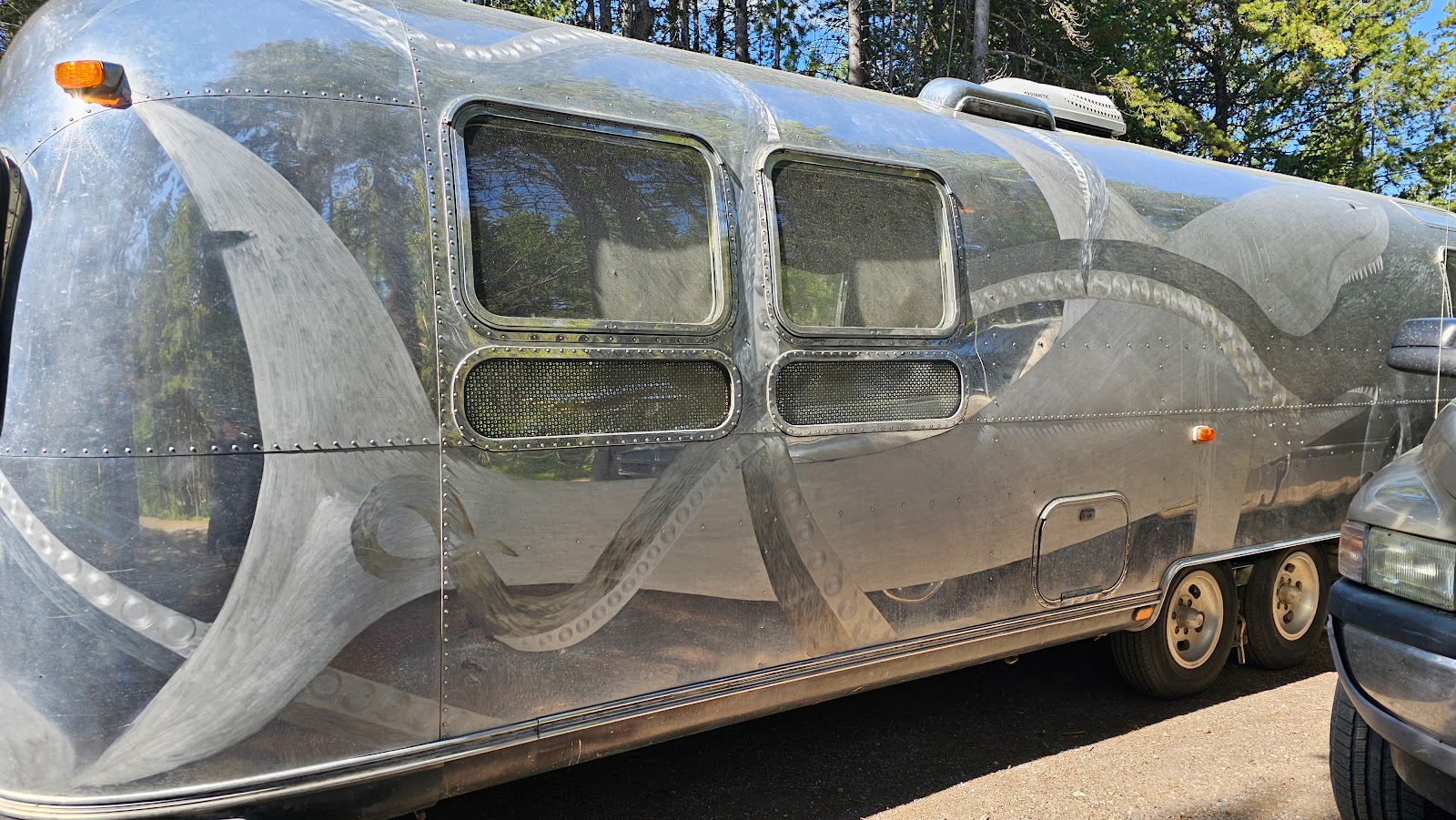
I really like what he did, and he was successful in his efforts to conceal the imperfections, but I don't think I could ever do that to THE POD for any reason.
After speaking with the gentleman about his talent for etching for about 15-minutes we finally headed for the campground exit. Tricia wanted me to see for myself the beauty of the mountains from the boat launch area so we headed down the road in that direction.
And guess what we found? Elroy munching on roadside grass on the boat launch road.
Elroy never even lifted his head as the car approched and passed by. In addition to his lack of fear of humans, he also isn't afraid of cars or trucks apparently. That might not be a good thing for his health and well being.
WOW! 18 individual photos shared this morning and we haven't even begun our "official" sightseeing for today. Guess I'll create a slideshow for the rest of today's activities.
PARK OVERVIEW
|
||||||||
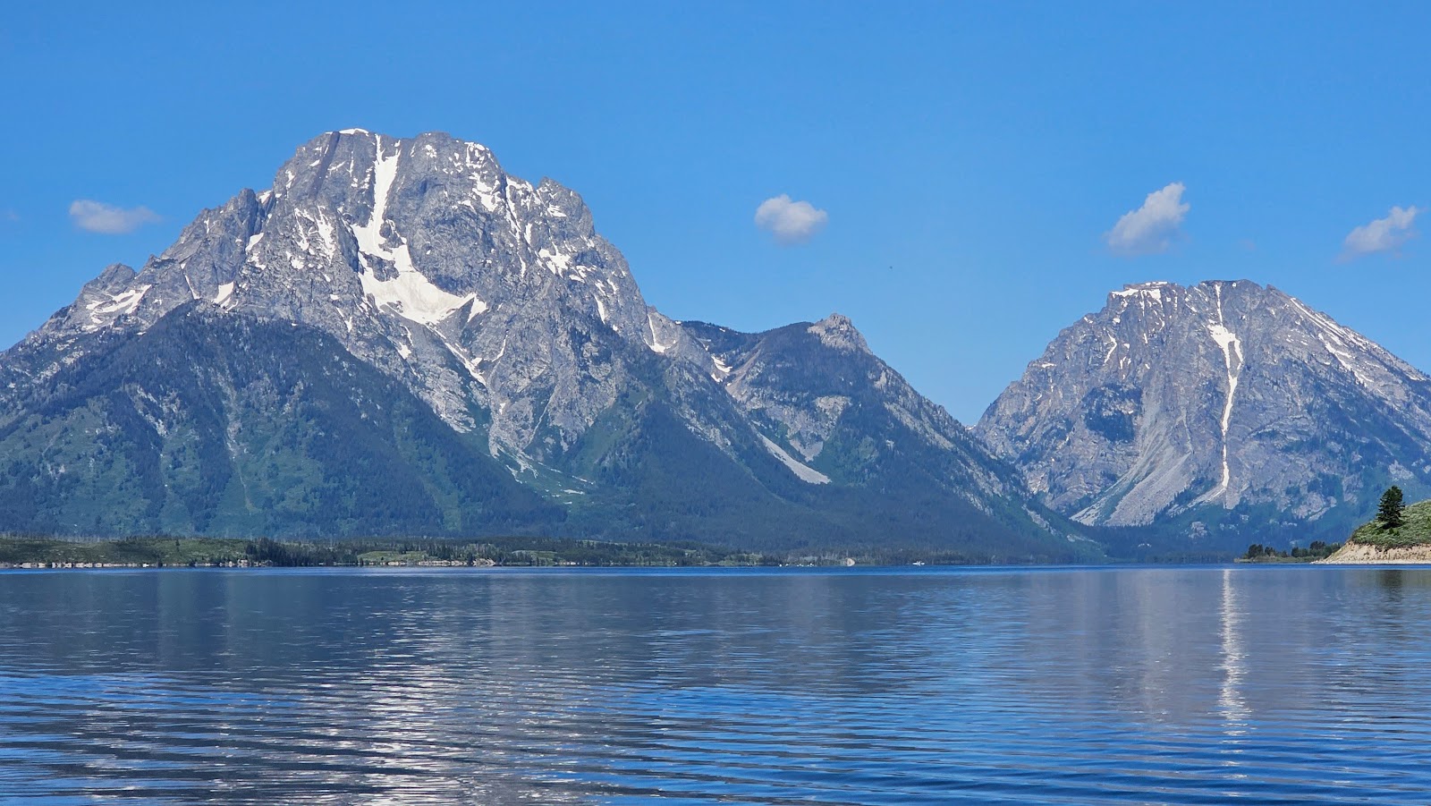
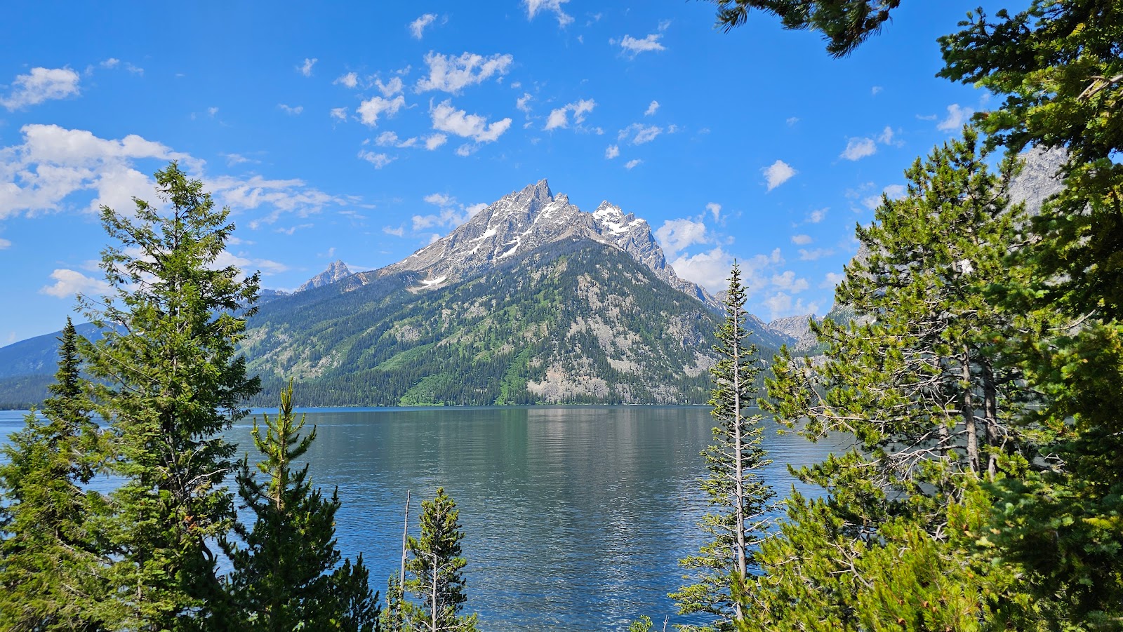
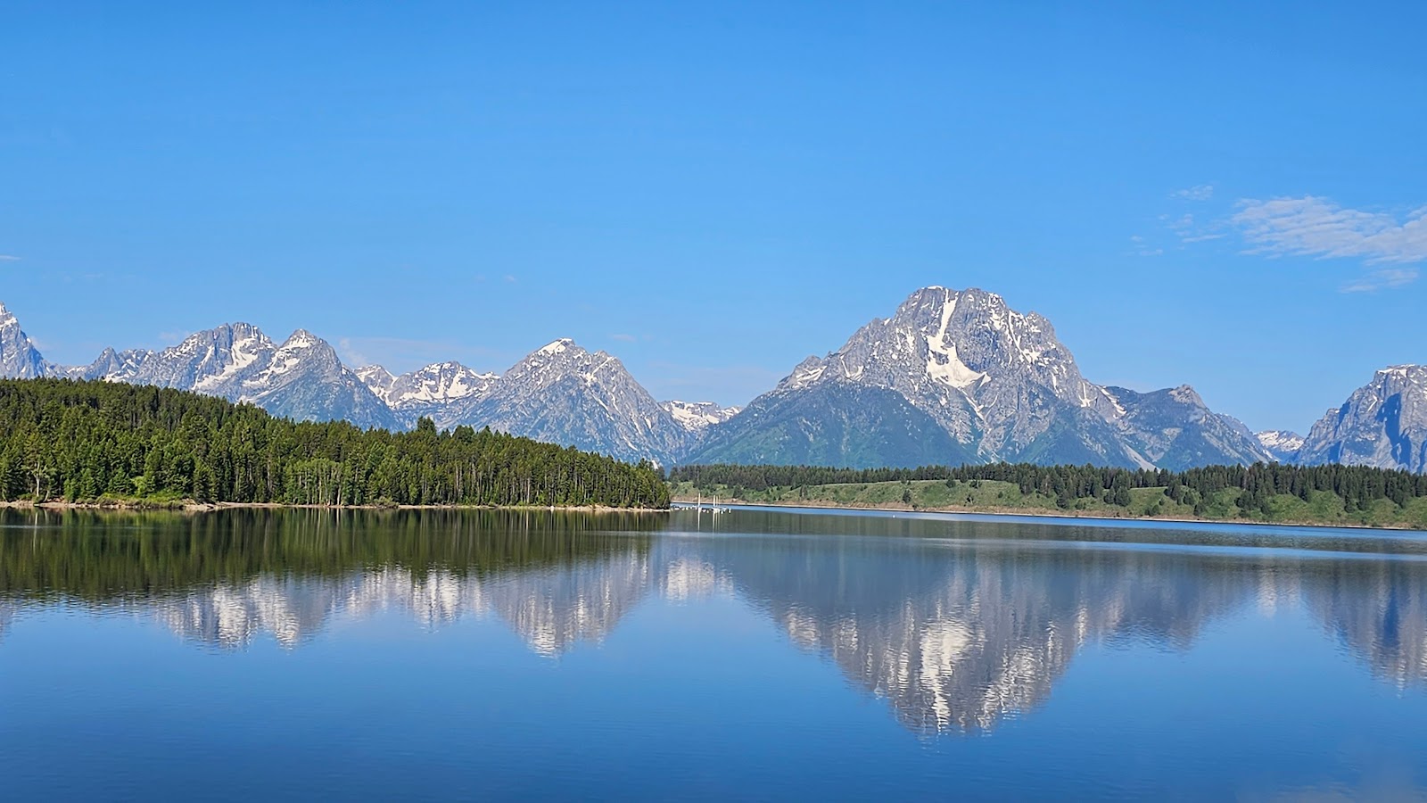
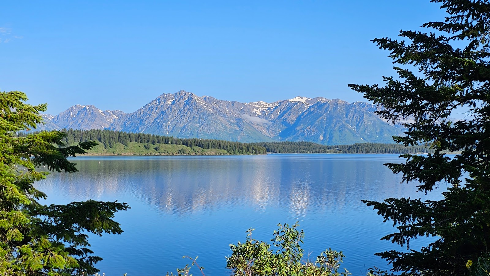
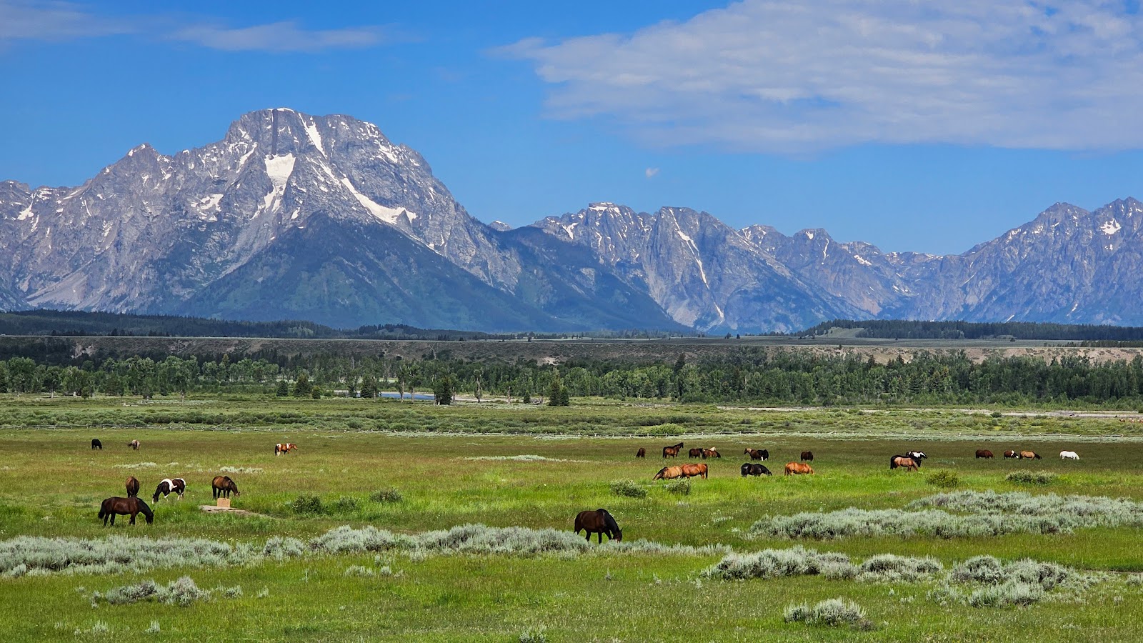
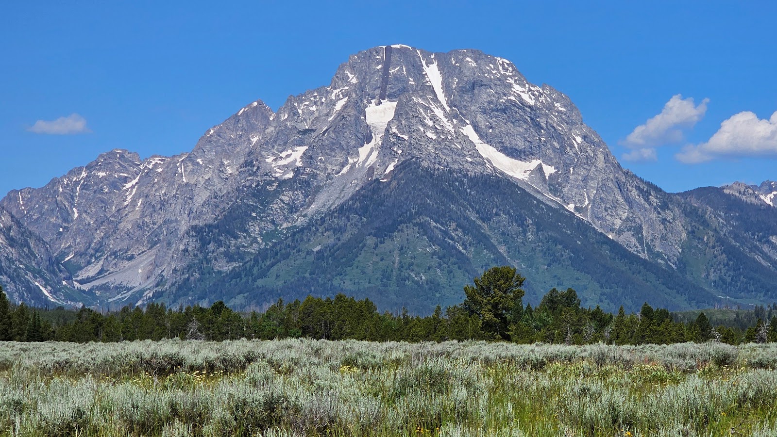 That's Mount Moran, named for Thomas Moran, an American western frontier landscape artist.
At 12,610′ it rises some 6,000 feet above Jackson Lake below it (not seen in this photo).
|
||||||||
 All the stops in the park are well marked by easy to read signs.
|
||||||||
|
||||||||
|
||||||||
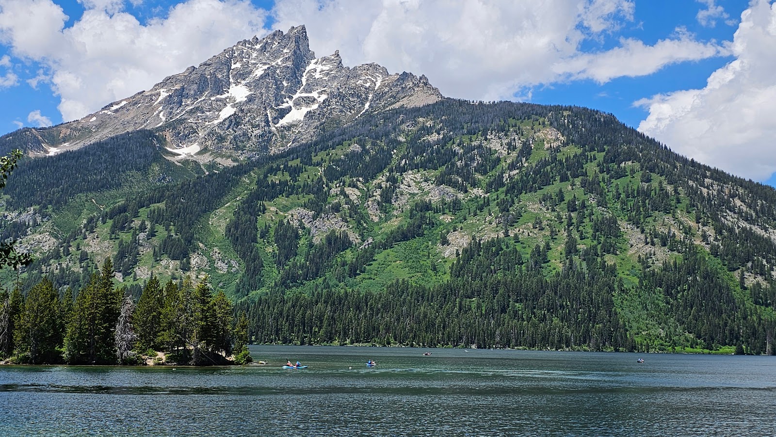
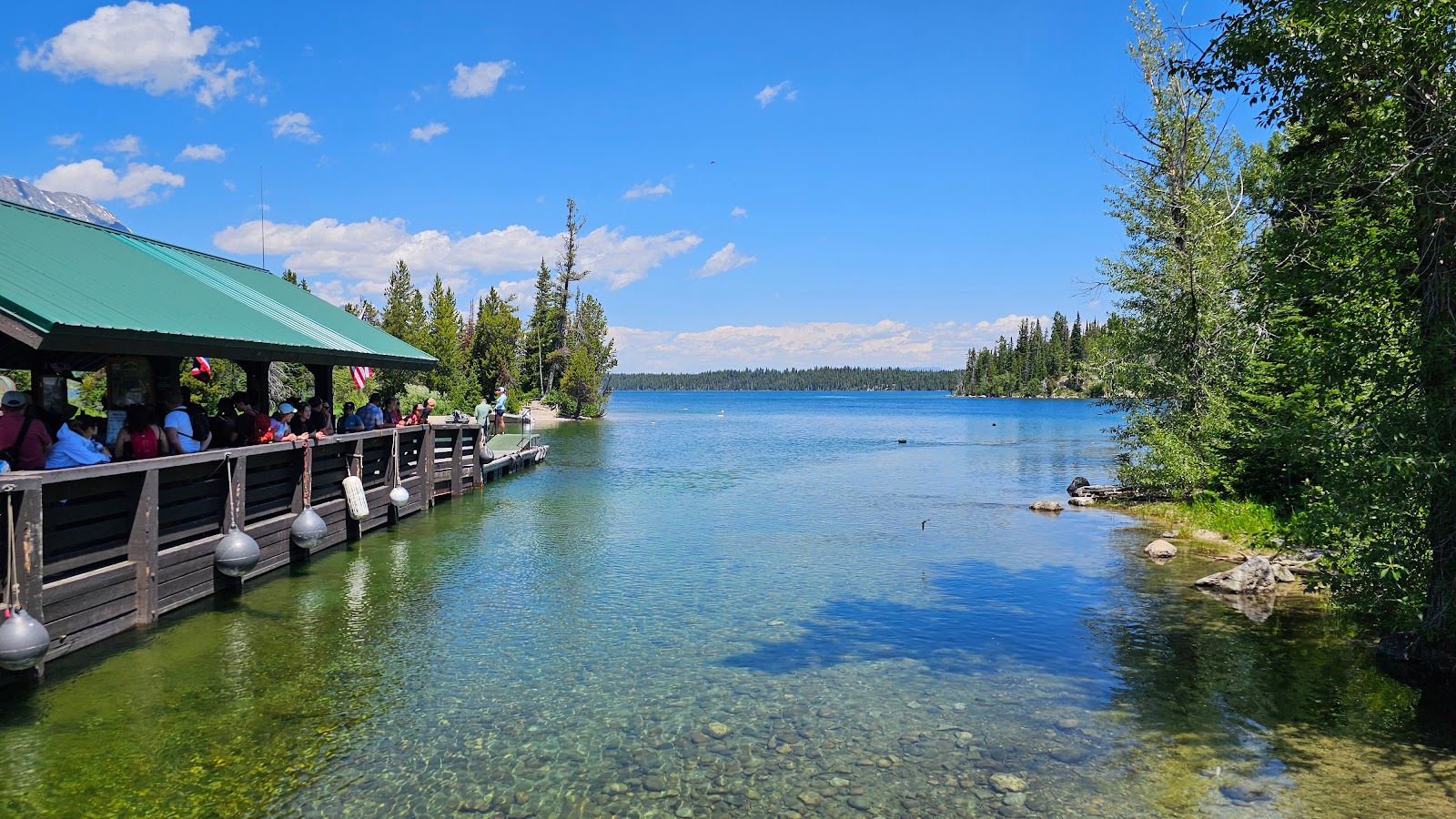
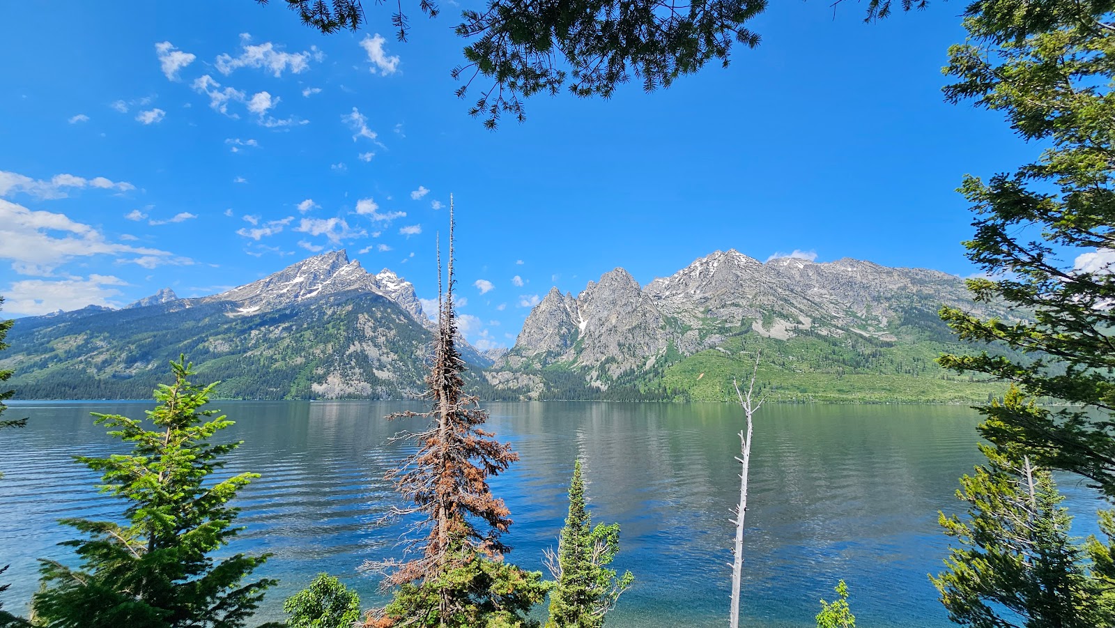 This is the shoreline of Jenny Lake.
|
||||||||
|
||||||||
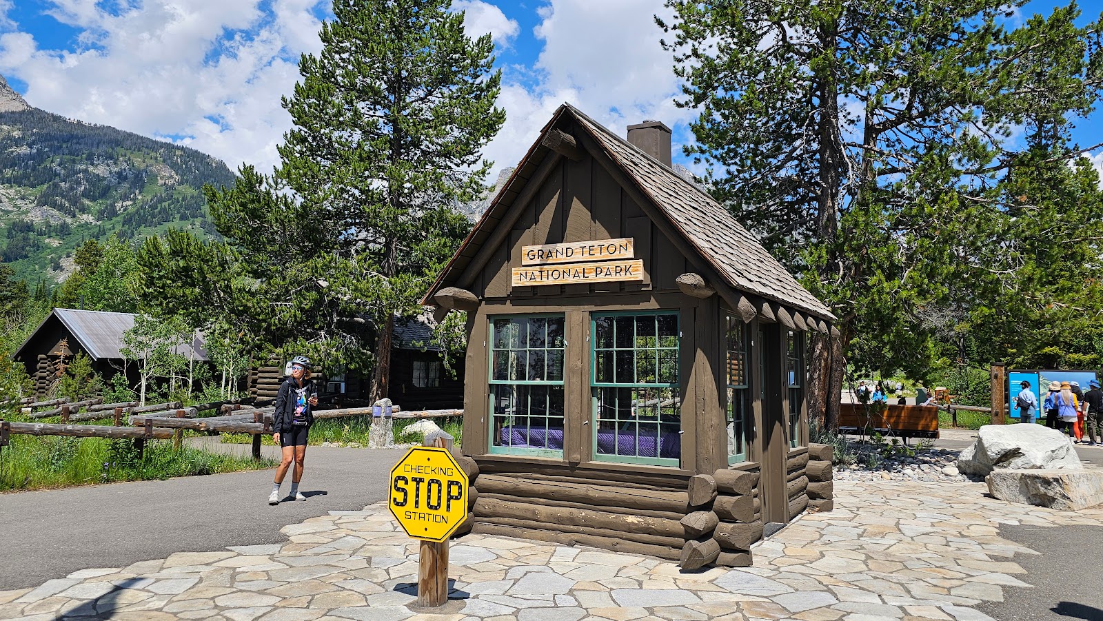 This small building was the original Entrance Station for the entire park.
|
||||||||
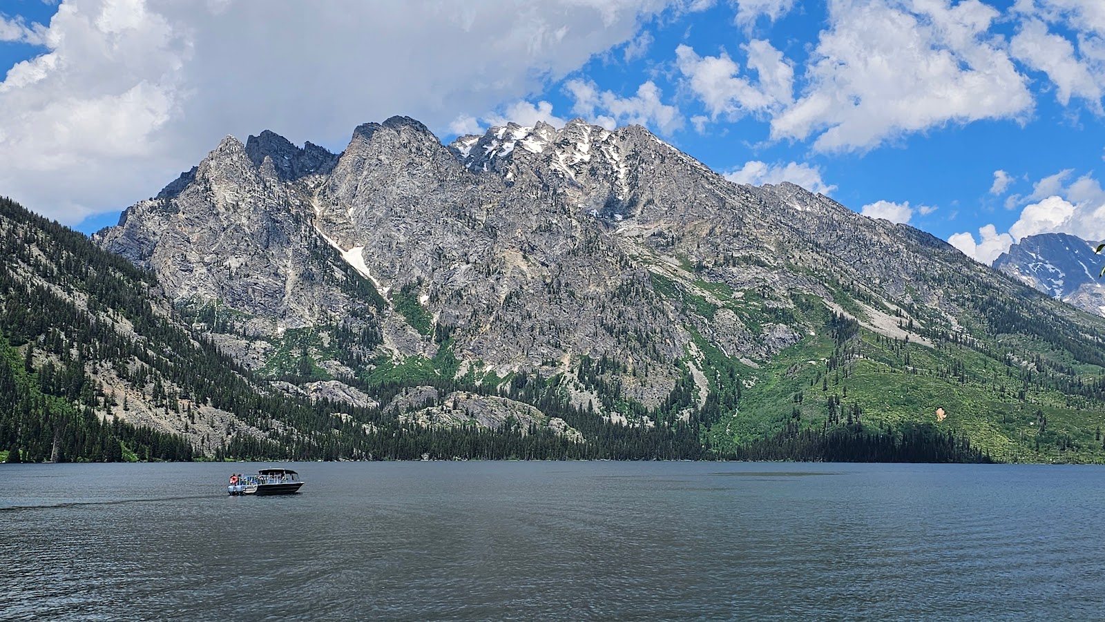 There is a $20 round trip Boat Shuttle to Hidden Falls and Inspiration Point
located on the opposite bank of Jenny Lake...
|
||||||||
 ...or you can rent a kayak and/or canoe and paddle over yourself.
Your other option is to hike the 2+ miles to get over there.
|
||||||||
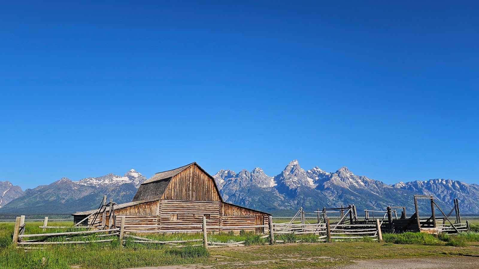
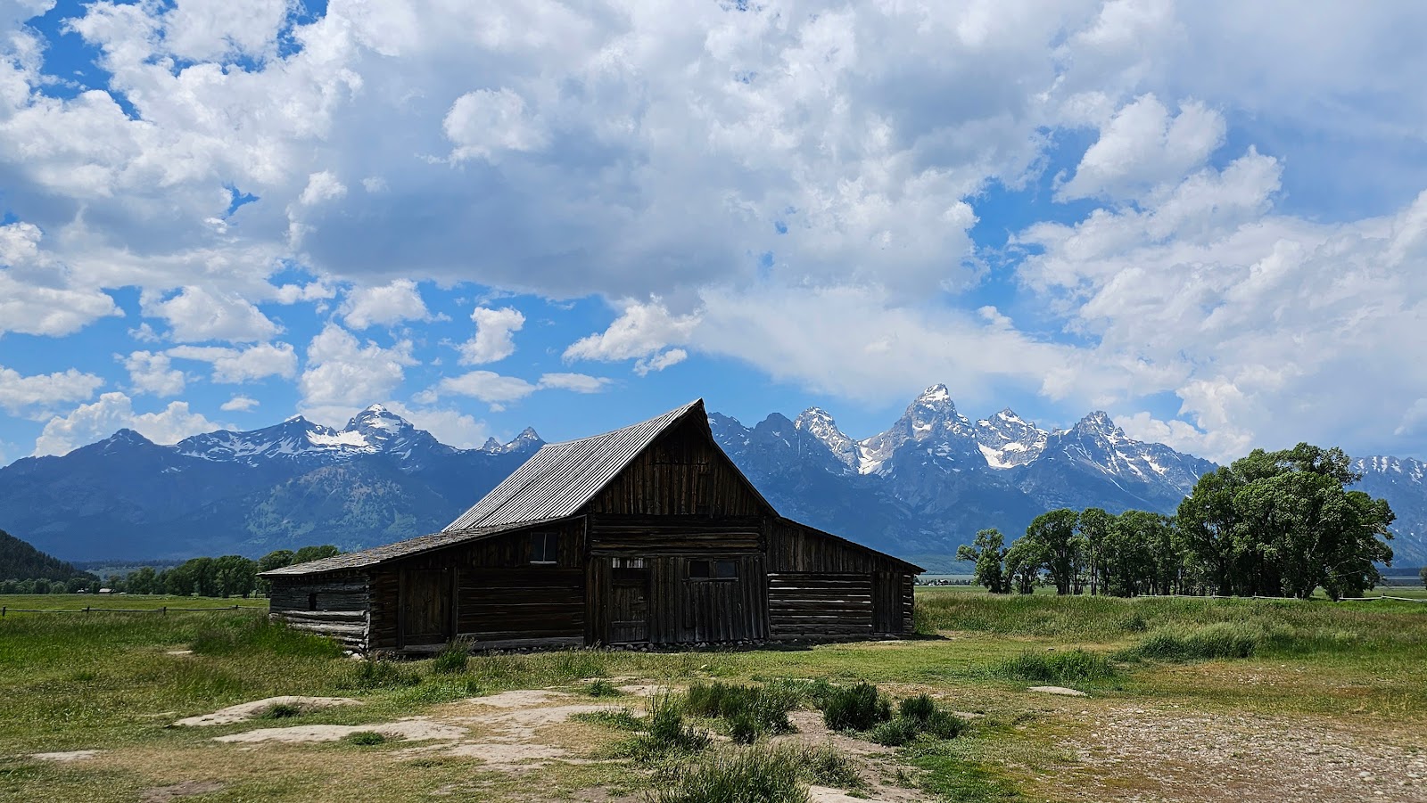 This is the iconic T.A. Moulton barn, the "most photographed barn in the world".
|
||||||||
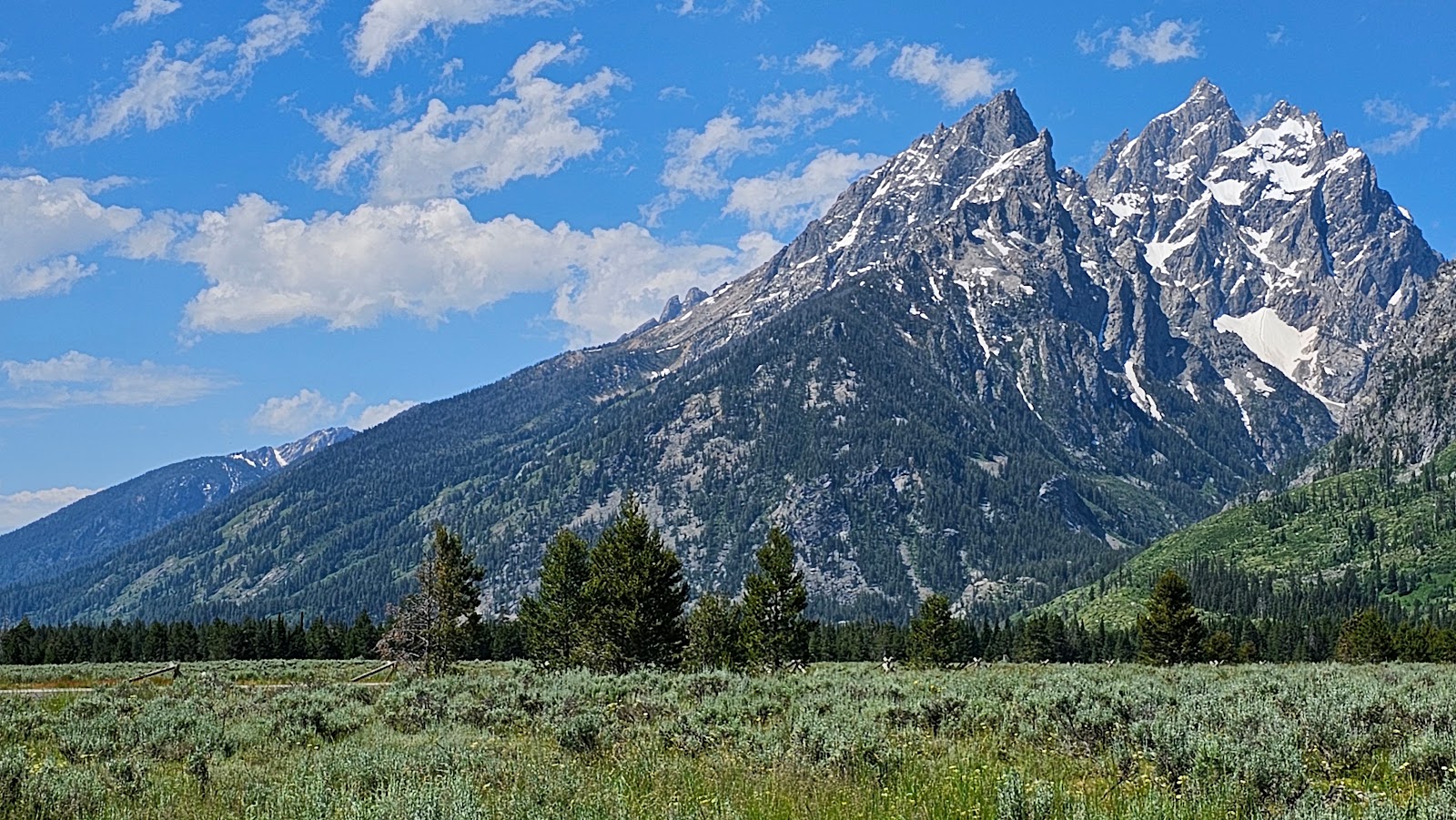
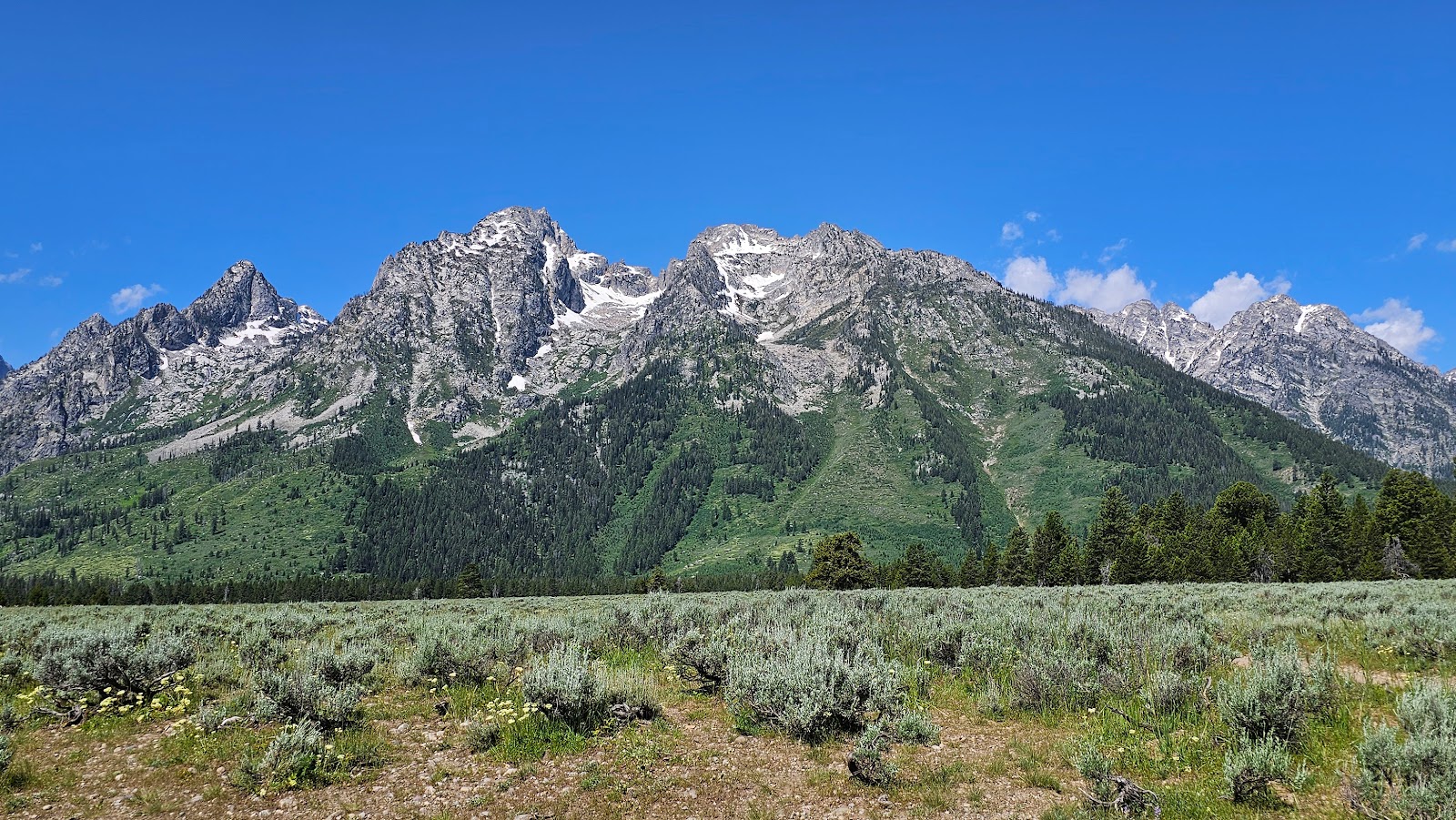
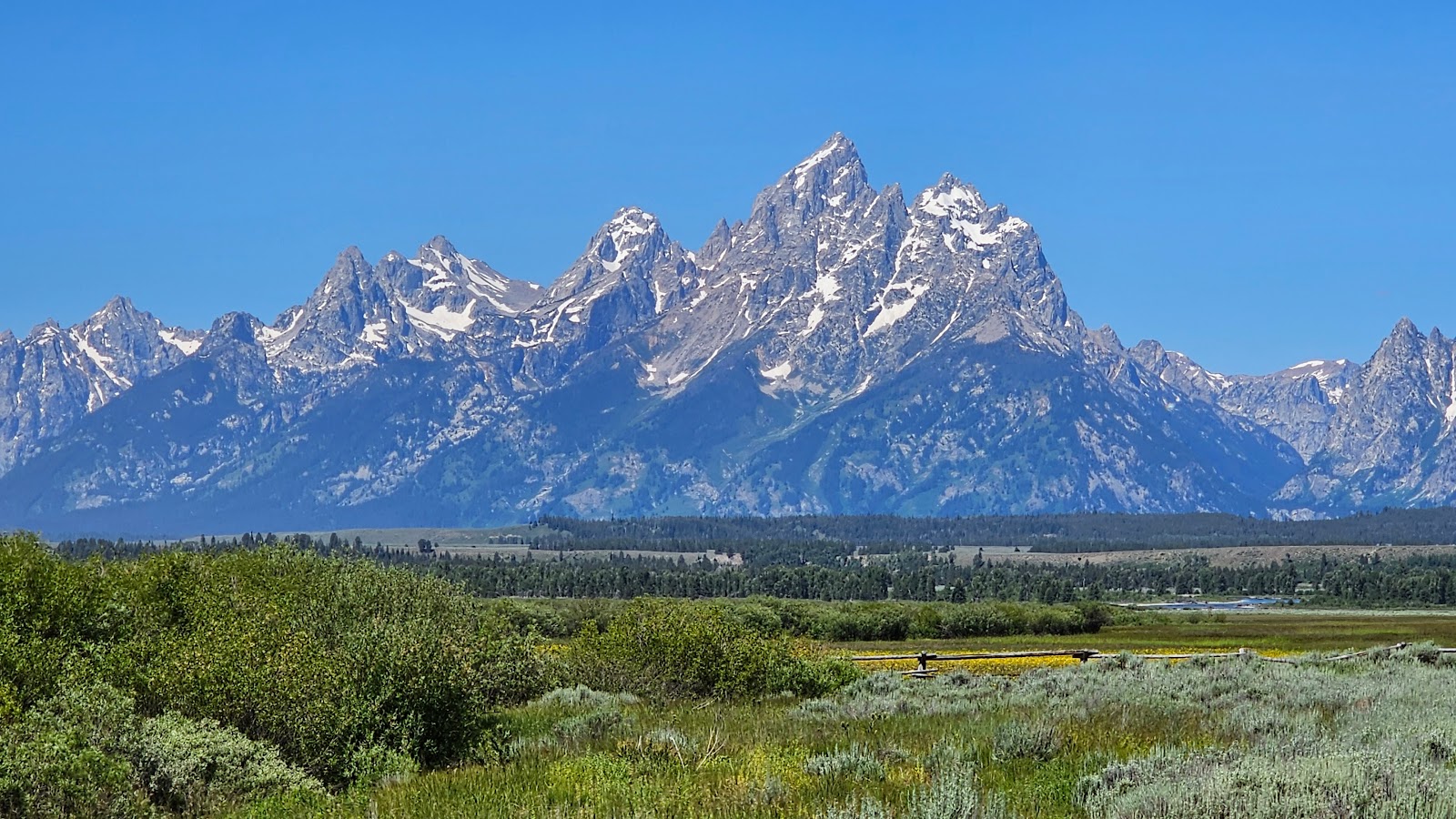
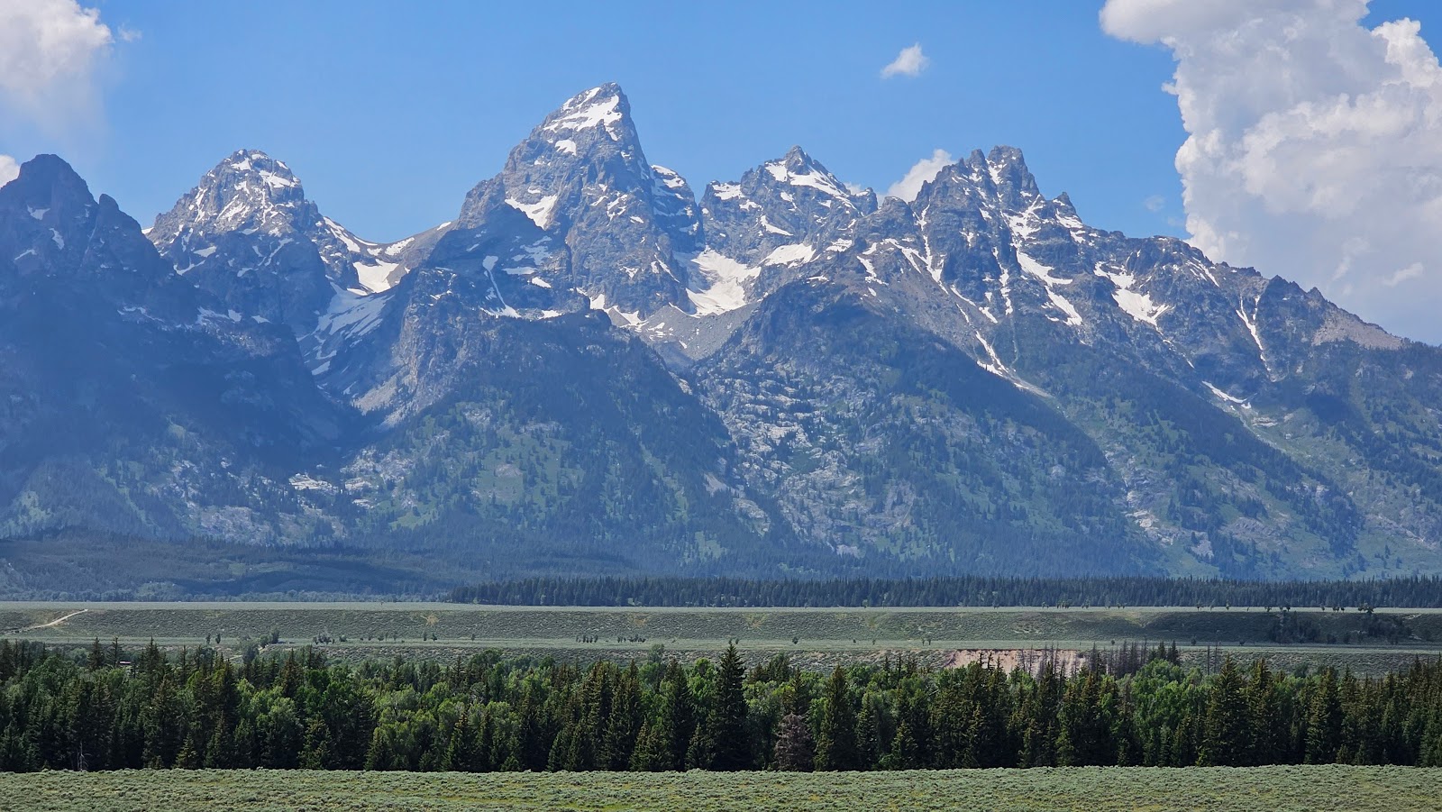 A distant view of the three prominent peaks of the Grand Tetons.
|
||||||||
 This photo was taken at the Schwabacher Landing site.
|
||||||||
 Another view from Schwabacher Landing.
|
||||||||
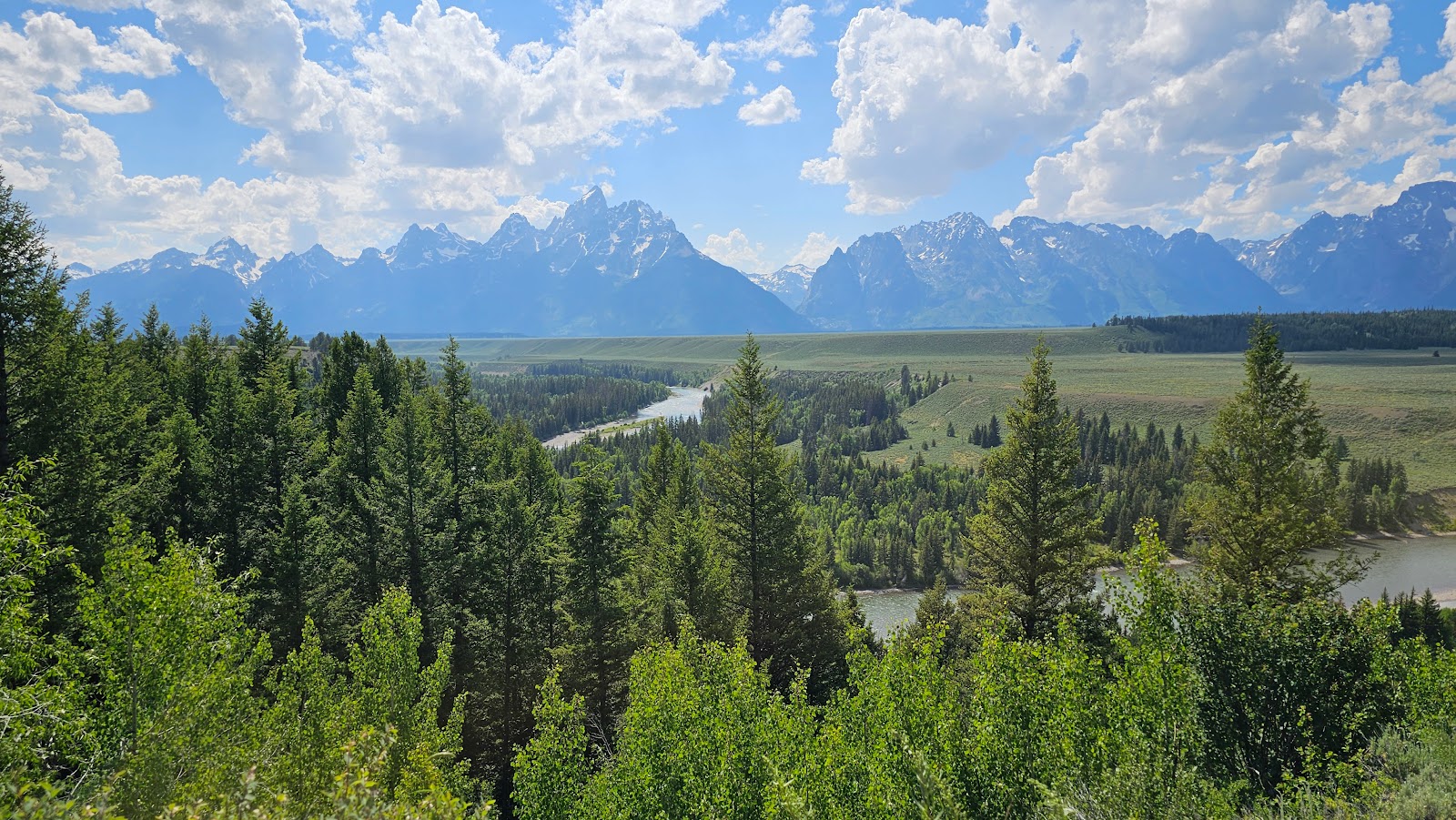 This photo was taken at the Snake River Overlook.
|
||||||||
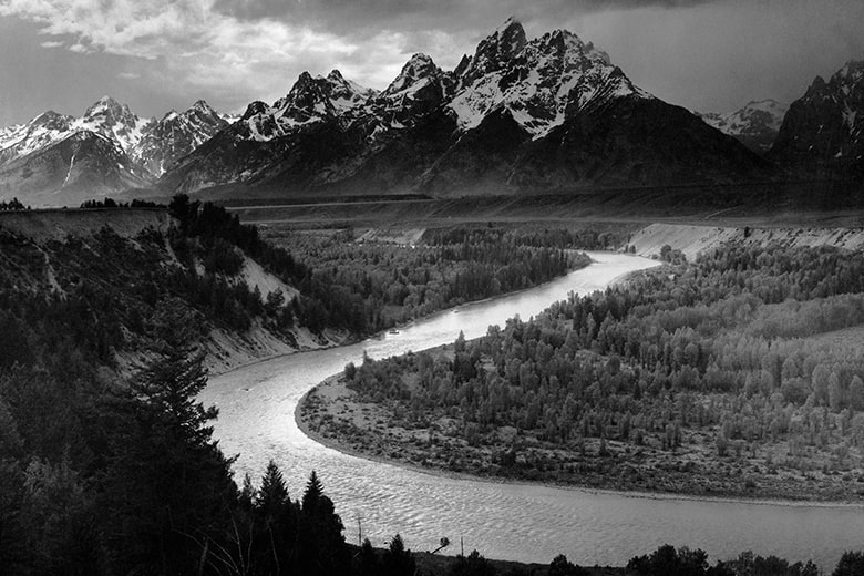 This is the famous Ansel Adams photo from 1941 of the exact same overlook.
|
||||||||
 Here is Tricia's offering from 2023, some 82 years later.
Notice there are a lot more trees now hiding the river.
|
||||||||
 We decided to drive 5-miles to the summit of Signal Mountain...
|
||||||||
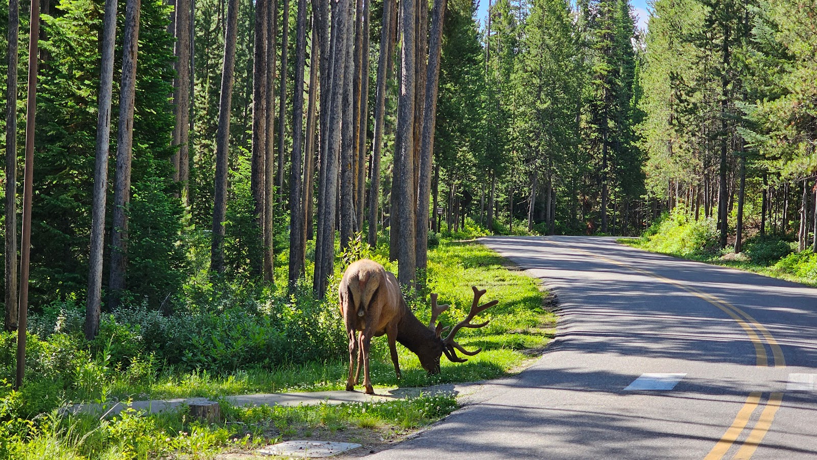
 ...and wouldn't you know it, at the beginning of the drive up we spotted Elroy eating again.
|
||||||||
 From the summit we had some amazing long distance views...
|
||||||||
 ...and some pretty decent short distance views to go along with them.
|
||||||||
 Looks like we'll be seeing some rain in the next hour or so.
|
||||||||
 I wonder if this is why they call it Signal Mountain?
No, it's been called Signal Mountain since 1891.
|
||||||||
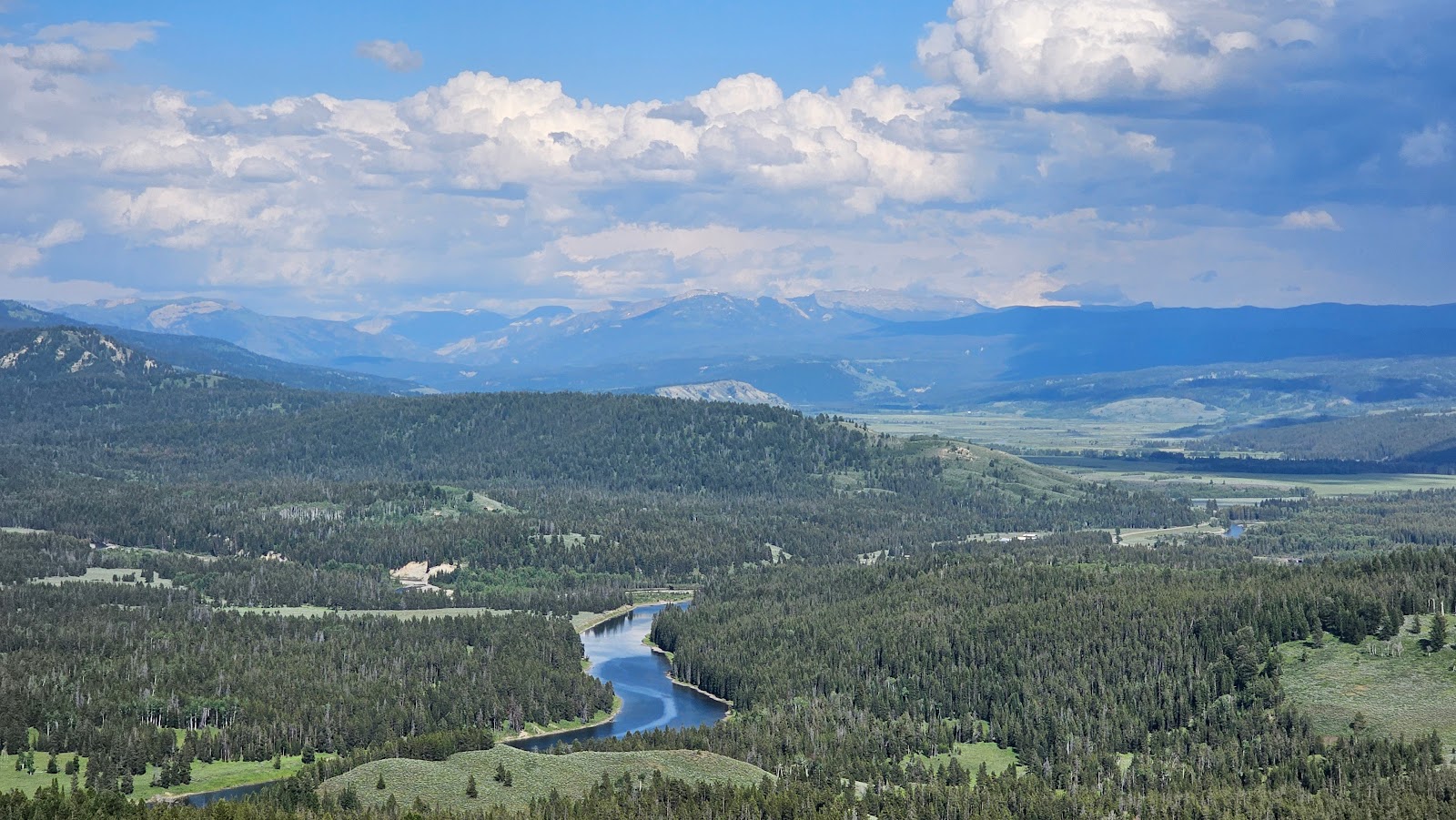 The Snake River far down below.
|
||||||||
 What a beautiful ending to a splendid day.

Remember, this was just a "first look", an overview of sorts.
You'll be seeing lots more photos of most locations seen in this slideshow in the days to come.

At 5:00AM it started lightly raining for a short period of time. Then at 6:00AM it rained again, harder this time, but by 6:30AM it had let up enough that we could get out and start exploring.
JACKSON LAKE DAM
AND
OXBOW BEND TURNOUT
(PLUS A COUPLE OF BONUS LOCATIONS)
|
||||||||
 As you can see, everything was still dripping wet when we headed out this morning.
|
||||||||
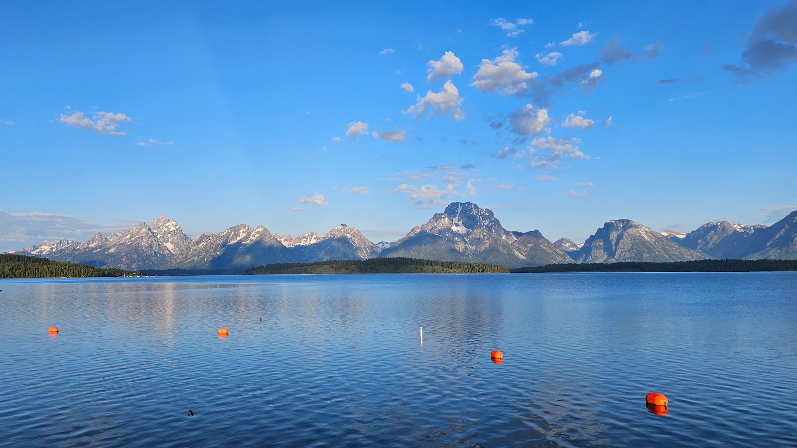 This is the Jackson Lake side of the dam.
|
||||||||
 All those boats over there are moored very near our campsite.
|
||||||||
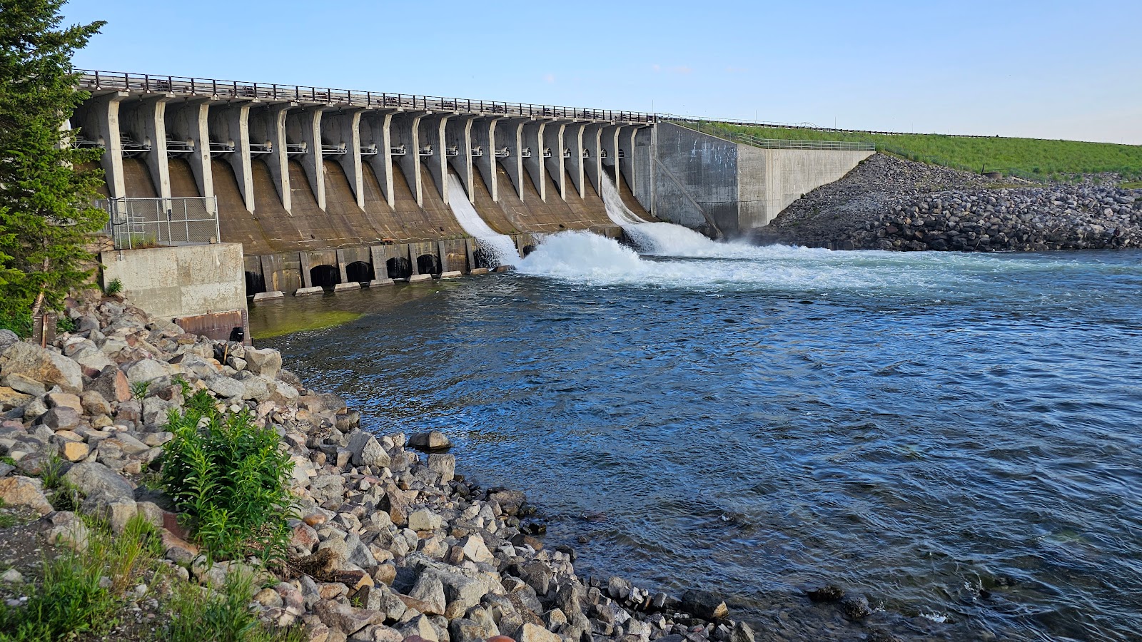 This is the Snake River side of the dam.
|
||||||||
 There seems to be a lot of fishing activity on this side of the dam, some are even human.
|
||||||||
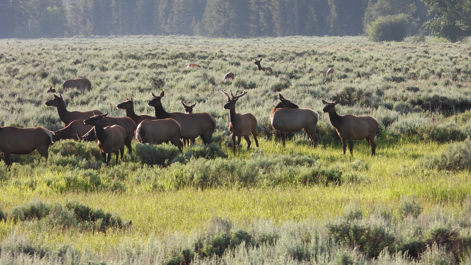
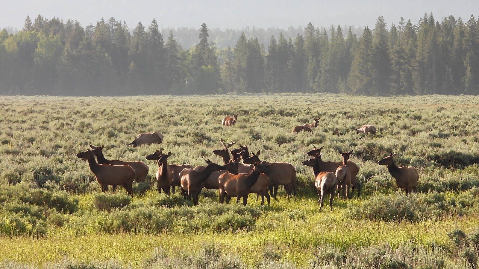 Near the intersection of Teton Park Road and US-191 we spotted this small herd of elk.
|
||||||||
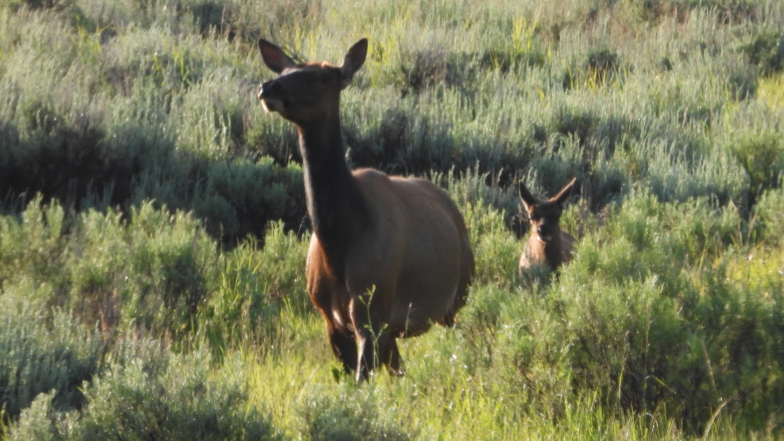 There were several elk fawns in the group, some still sporting their spots.
|
||||||||
 There was one male elk in the center of the herd. Could it be Elroy?
|
||||||||
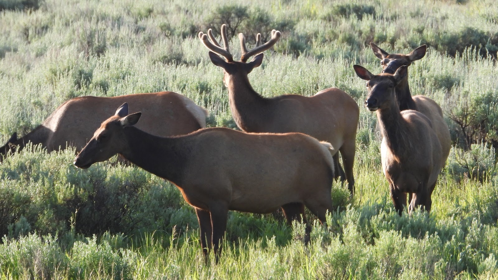 Nope! No bald spots on his left shoulder could be seen.
|
||||||||
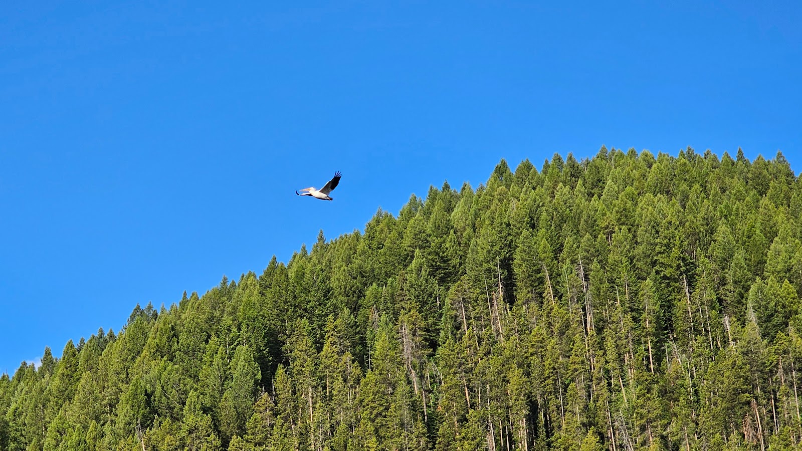 I guess that White Pelican is done fishing and heading home.
|
||||||||
 We were told by a ranger not to skip any of the seldom visited side roads we ran across.
This one led down to the previous location of the Cattleman's Bridge across the Snake River.
|
||||||||
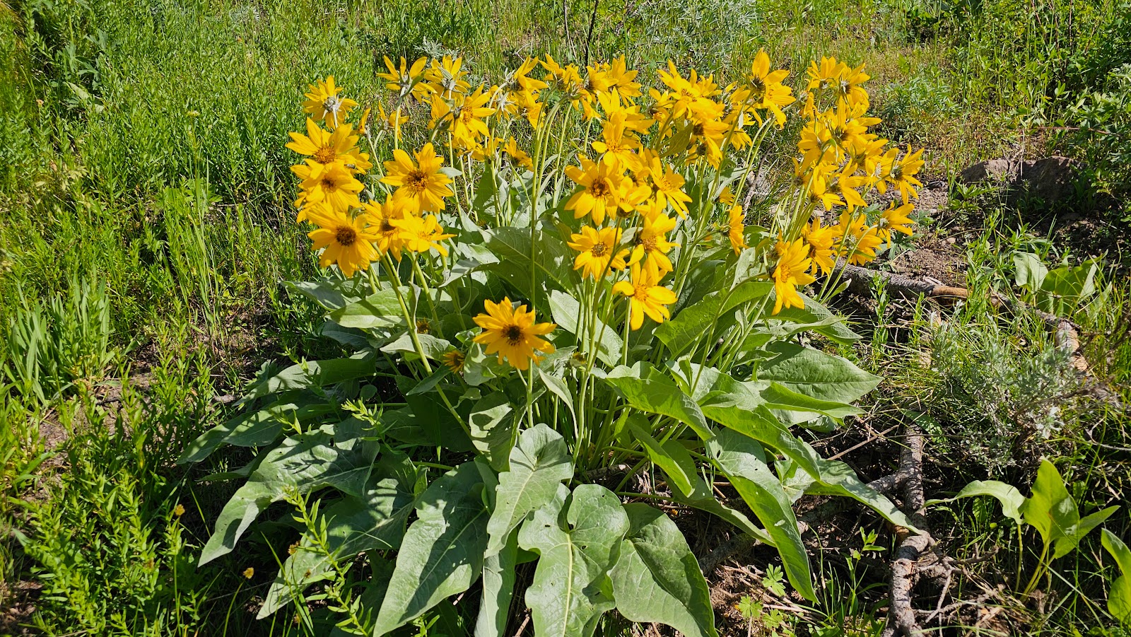
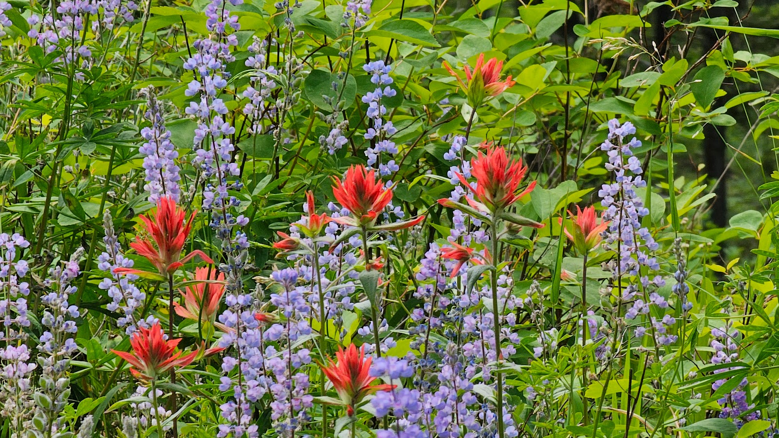
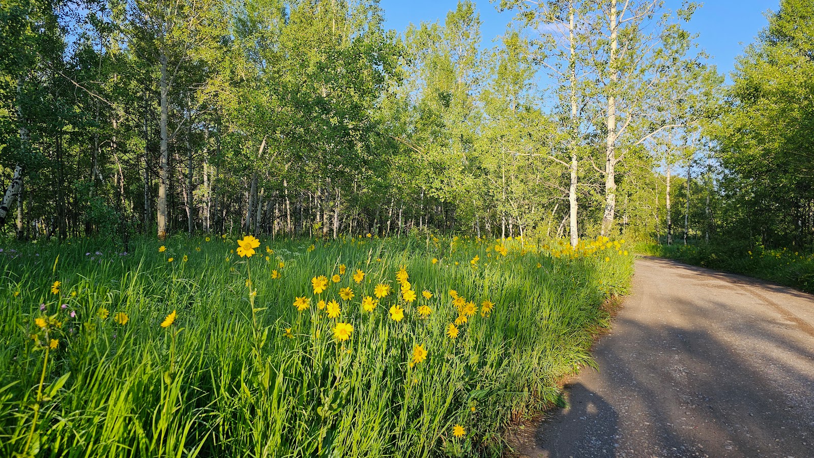
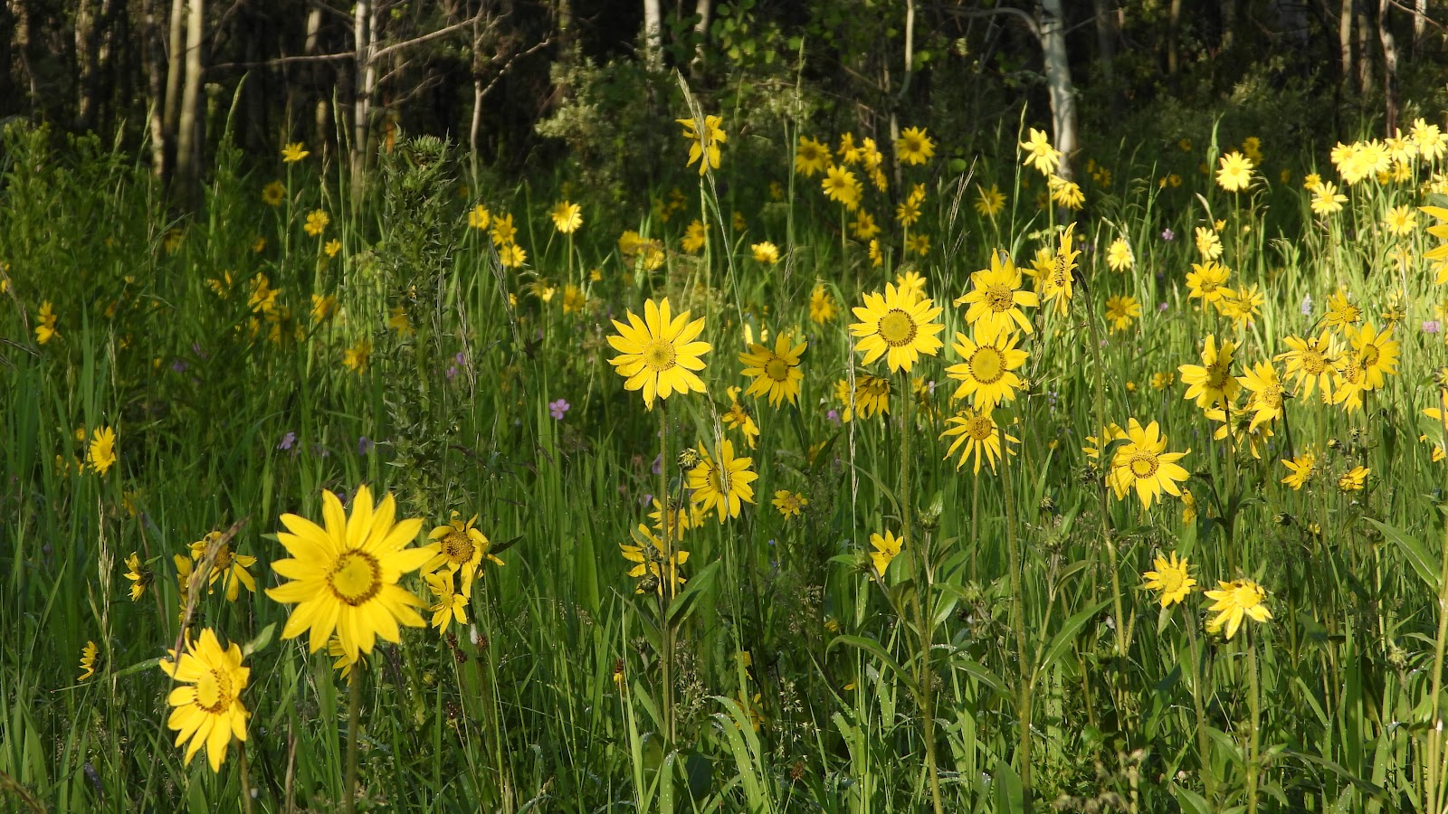 There were also a lot of these yellow flowers along the road. This is a front view.
|
||||||||
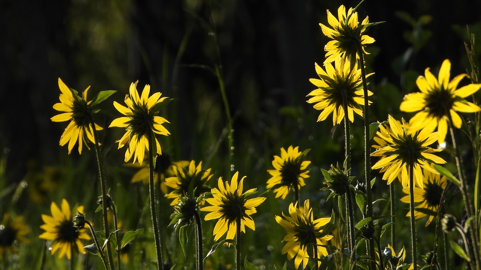 This is a rear view with the sun shining through the delicate petals.
|
||||||||
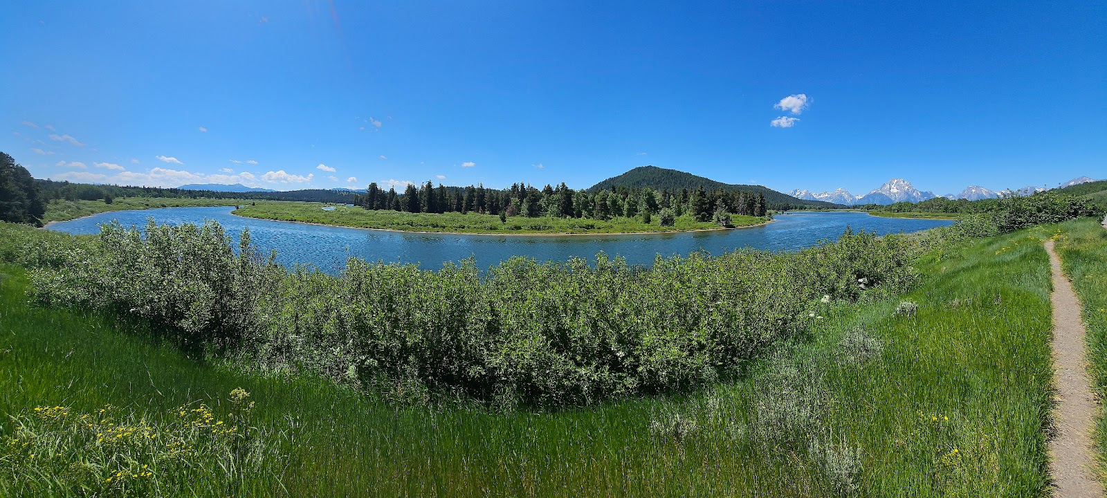
 This is the Oxbow Bend Turnout location.
|
||||||||
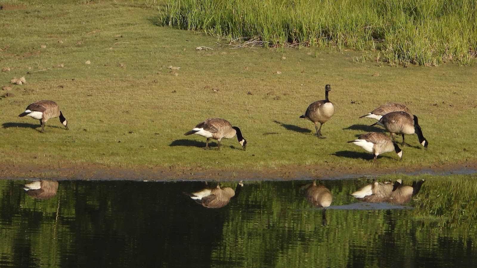 What are these Canadian Geese still doing in Wyoming. Isn't it time to go home!
|
||||||||
 They don't appear to be heading anywhere else anytime soon.
|
||||||||
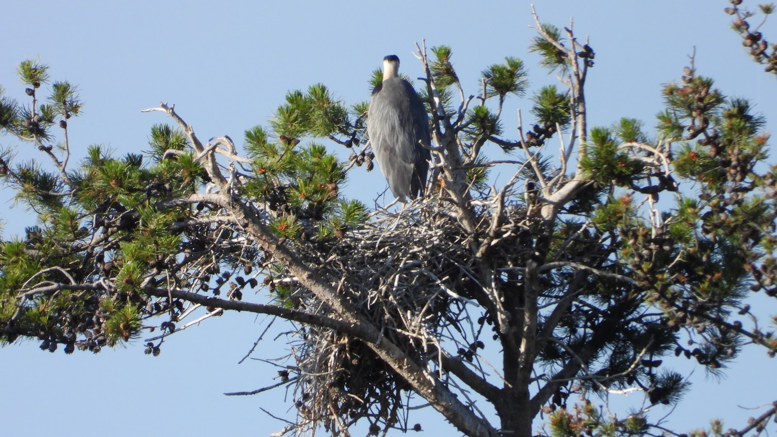 Thanks to a family who hired a local guide to show them around the park,
we learned of a Great Blue Heron nest high up in a tree. We would never have spotted it otherwise!
|
||||||||
 Time to clean up after a big breakfast I guess.
|
||||||||
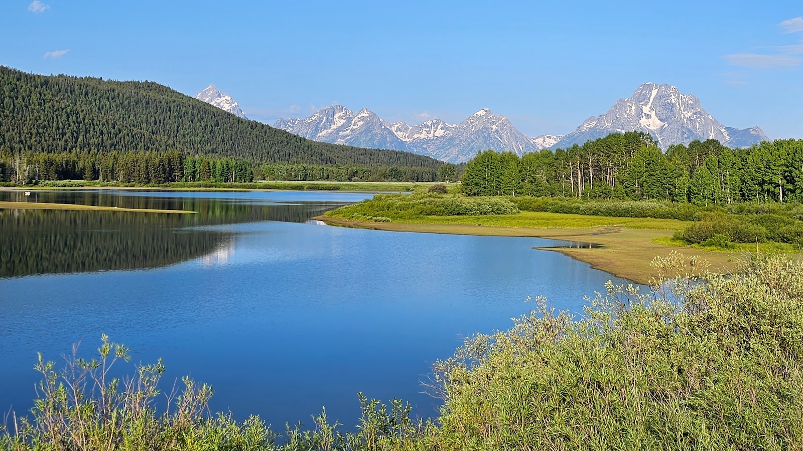
 Mountain reflections as seen at the Oxbow Bend Turnout.
|
||||||||
 This photo is from a roadside parking space halfway back to THE POD.
|
||||||||
 We then took the turoff for the Chapel of the Sacred Heart and found this quiet place.
|
||||||||
 It had several picnic tables with awesome views.
|
||||||||
 It's 8:00AM, let's head home and eat some breakfast for ourselves.
I spent most of the day writing the blogposts for yesterday and today, which includes going through all of Tricia's photo and hopefully selecting the best of the best to share with you.
I also took time to make a big batch of my Brunswick Stew recipe. I'll eat two servings while here at Signal Mountain and freeze the rest for future meals.
with an even earlier start, so as of 6:00PM I'm taking the rest of the day off.

The logistics of Grand Teton National Park, the generally north/south mountain range and the eastern side of that range being the location of nearly all the park's scenic views, means it's best photographed during the less harsh early morning sunshine.
Being in northwestern Wyoming in the summertime means sunrise today was at 5:49AM and sunset isn't until 9:05PM. That makes for a long day of sunlight, but around 10:00AM each day it begins to get cloudy and by noon it is very hazy making long views of the mountains hard to photograph clearly.
Getting up early isn't the challenge for us, it's getting ourselves ready and exiting THE POD that always seems to be the most difficult part of the day.
TODAY'S ITINERARY:
1) Photograph the barns on Mormon Row
2) Check out the paid USFS campground of Atherton Creek on scenic Gros Ventre Road
3) Check out the FREE 5-day USFS dispersed camping at Toppings Lake
4) Enjoy lunch on the upper patio of Dornan's Pizza & Pasta Co.
5) Take the 1-hour Scenic Boat Tour on Jenny Lake
6) Drive the scenic Moose-Wilson Road (currently only open weekends)
7) Check out the Elk Antler Arches on the Jackson Town Square
8) Taste the award winning Wild Huckleberry Ice Cream of Moo's Gourmet Ice Cream
T.A. MOULTON BARN ON MORMON ROW
AND
JENNY LAKE SCENIC CRUISE
(PLUS SEVERAL BONUS LOCATIONS)
|
||||||||
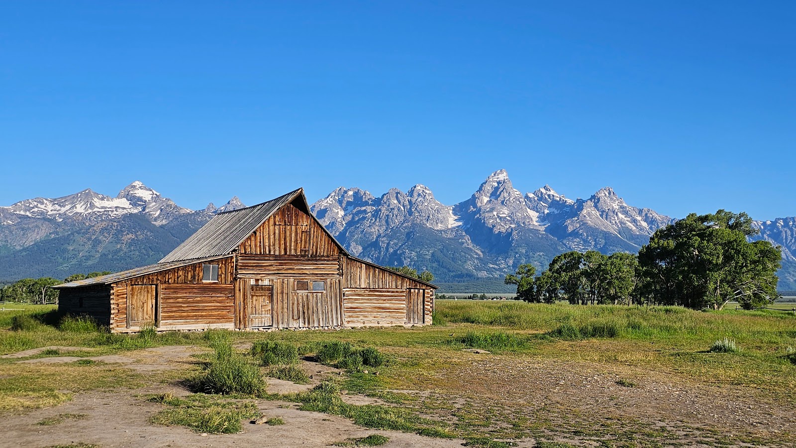 This, the T.A. Moulton barn, is the most photographed barn in America, if not the world.
|
||||||||
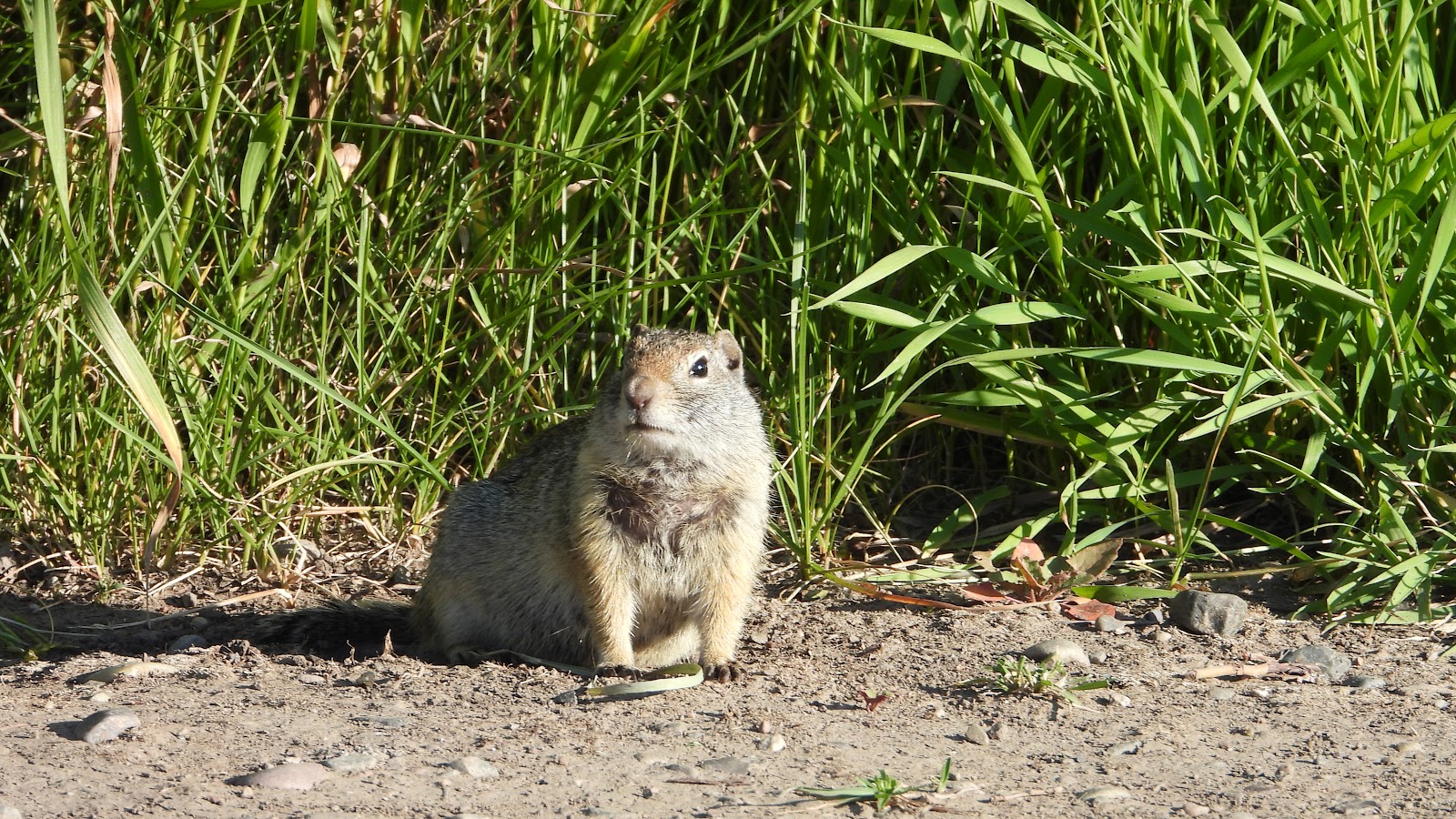 We were not alone here. There were dozens of ground squirrels running all around.
|
||||||||
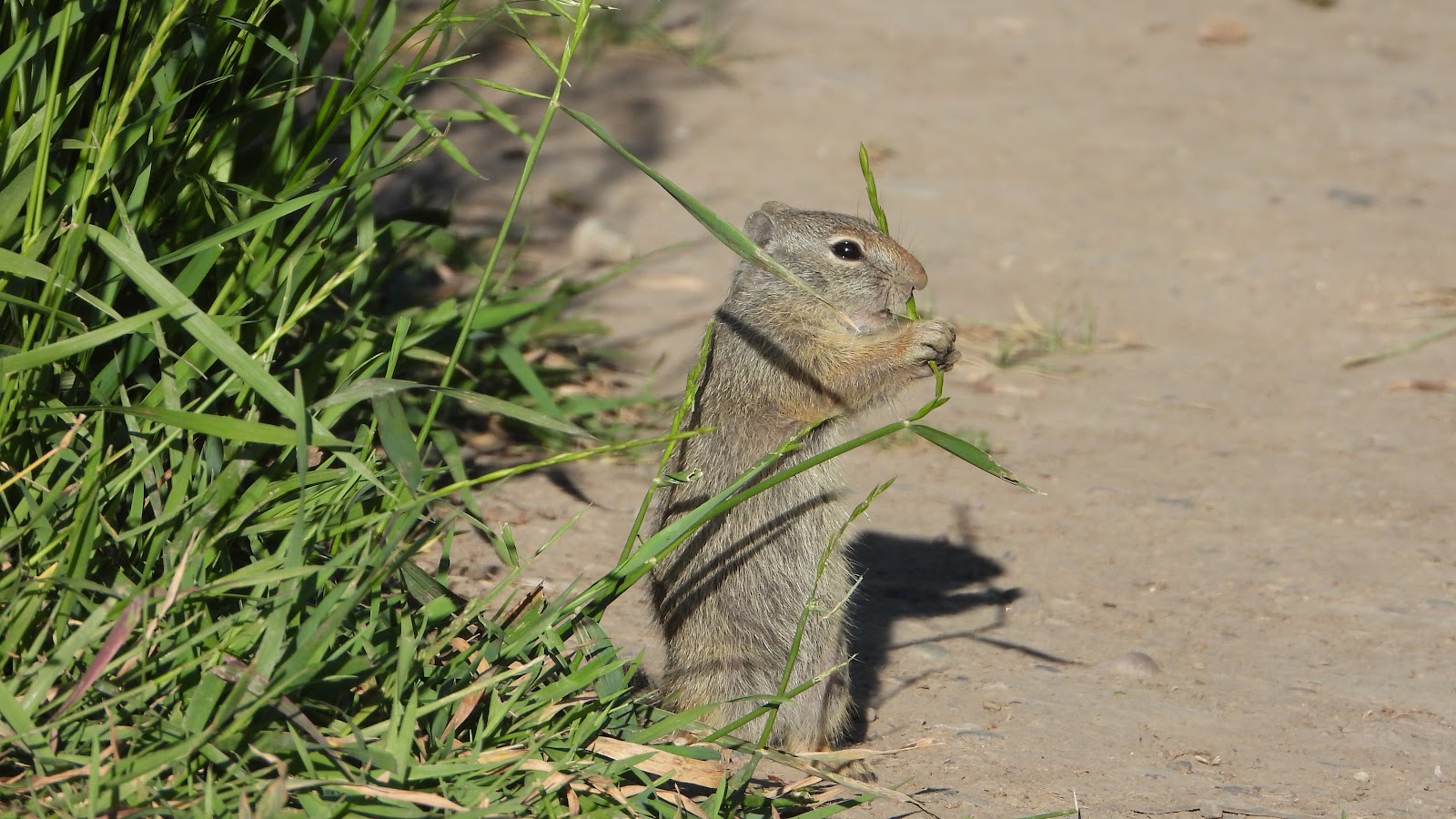 This one was enjoying breakfast as we watched.
|
||||||||
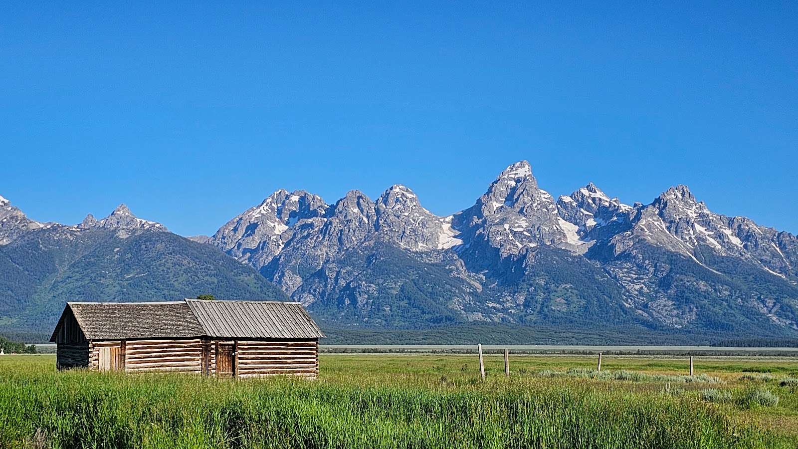
 This, the John Moulton barn (T.A.'s brother), is the 2nd most photographed barn in America.
It just so happens to be just a short distance down the road from T.A.'s barn.
|
||||||||
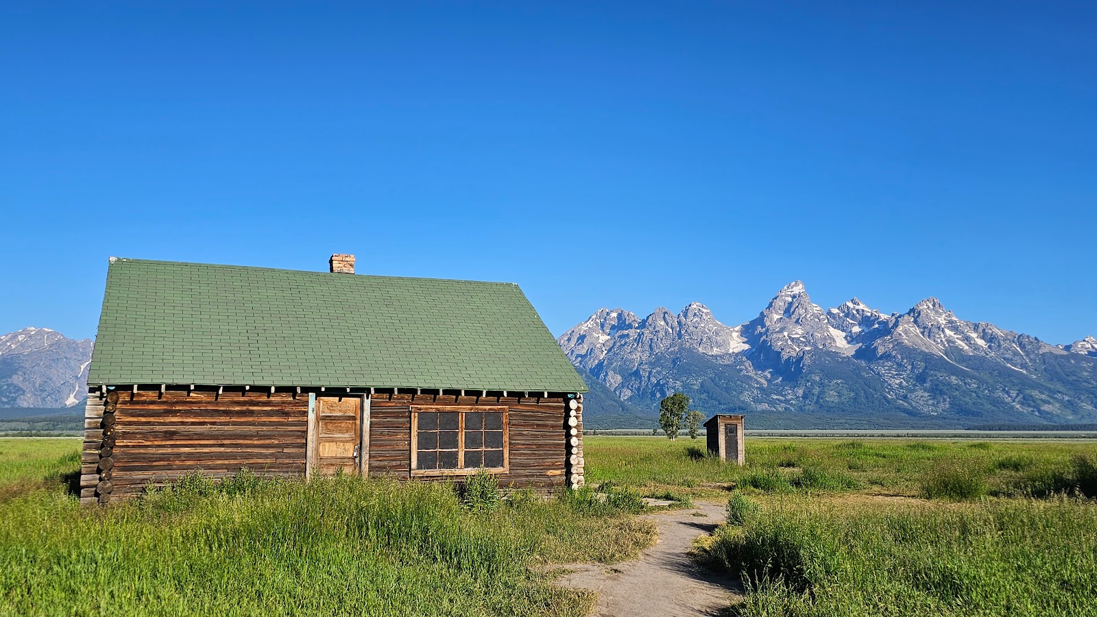
 On John Moulton's homestead there are still several outbuildings standing.
|
||||||||
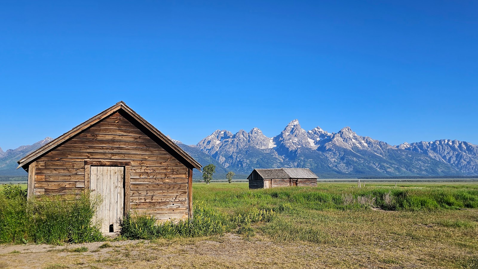 These make just as interesting of a photo as the barns do, thanks to the backdrop.
|
||||||||
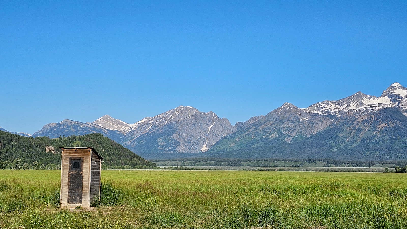 An outhouse with a view. I'd turn it 180° and leave the door open, but that's just me.
|
||||||||
 Some minor restoration work is being done to preserve the Moulton's home.
|
||||||||
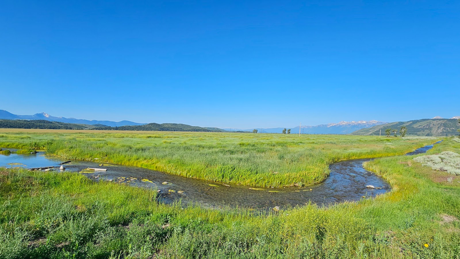 This is the Kelly Warm Spring run where we spotted more baby ducks (video to follow).
|
||||||||
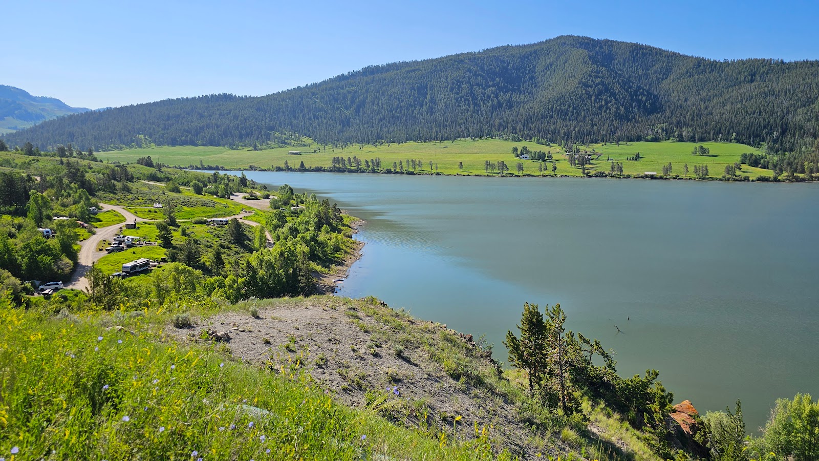 Below is the Aperton Creek Campground on the Lower Slide Lake of the Gros Ventre River.
|
||||||||
 Just stunning! No further description needed.
|
||||||||
 Another great photo! Good job, Tricia.
|
||||||||
 It doesn't always need to have a Teton view to make a great photo.
|
||||||||
 Not "wild" horses, but still a great photo.
|
||||||||
 Lunch on the upper patio of the Dornan's Pizza & Pasta Company.
Tricia had the Mount Moran Pizza and I had the Tri-Tip Gumbo Pasta!
|
||||||||
 Another view from the Upper Patio of Dornan's.
|
||||||||
 Waiting on the dock of Jenny Lake for our scenic cruise.
|
||||||||
 Here comes our cruise ship (boat) now with Captain Thomas at the helm.
|
||||||||
 Out on Jenny Lake we were able to get up close to the base of the Grand Tetons.
|
||||||||
 This glacier carved canyon is over 5000' deep.
|
||||||||
 There are hiking trails that will take you deep into Cascade Canyon.
|
||||||||
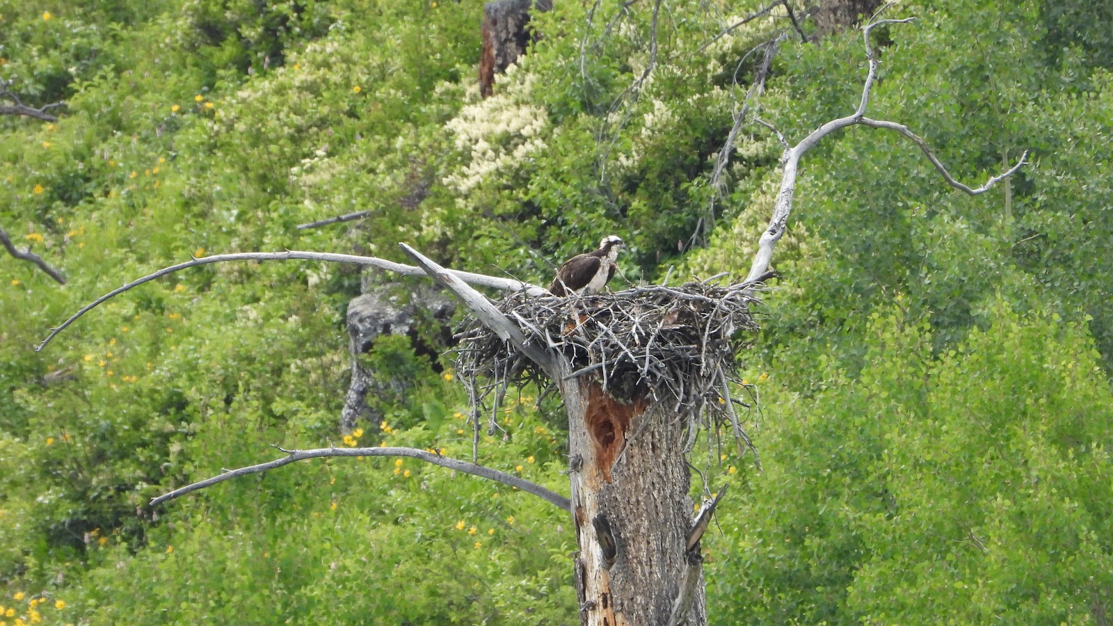 We didn't have any bear or moose sightings on our late afternoon cruise,
but we did spot an osprey nest high up in a tree.
|
||||||||
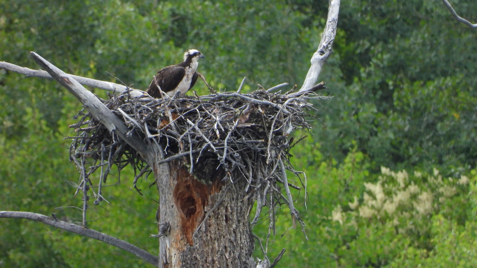 There are babies in the nest, we just didn't catch them with the camera.
|
||||||||
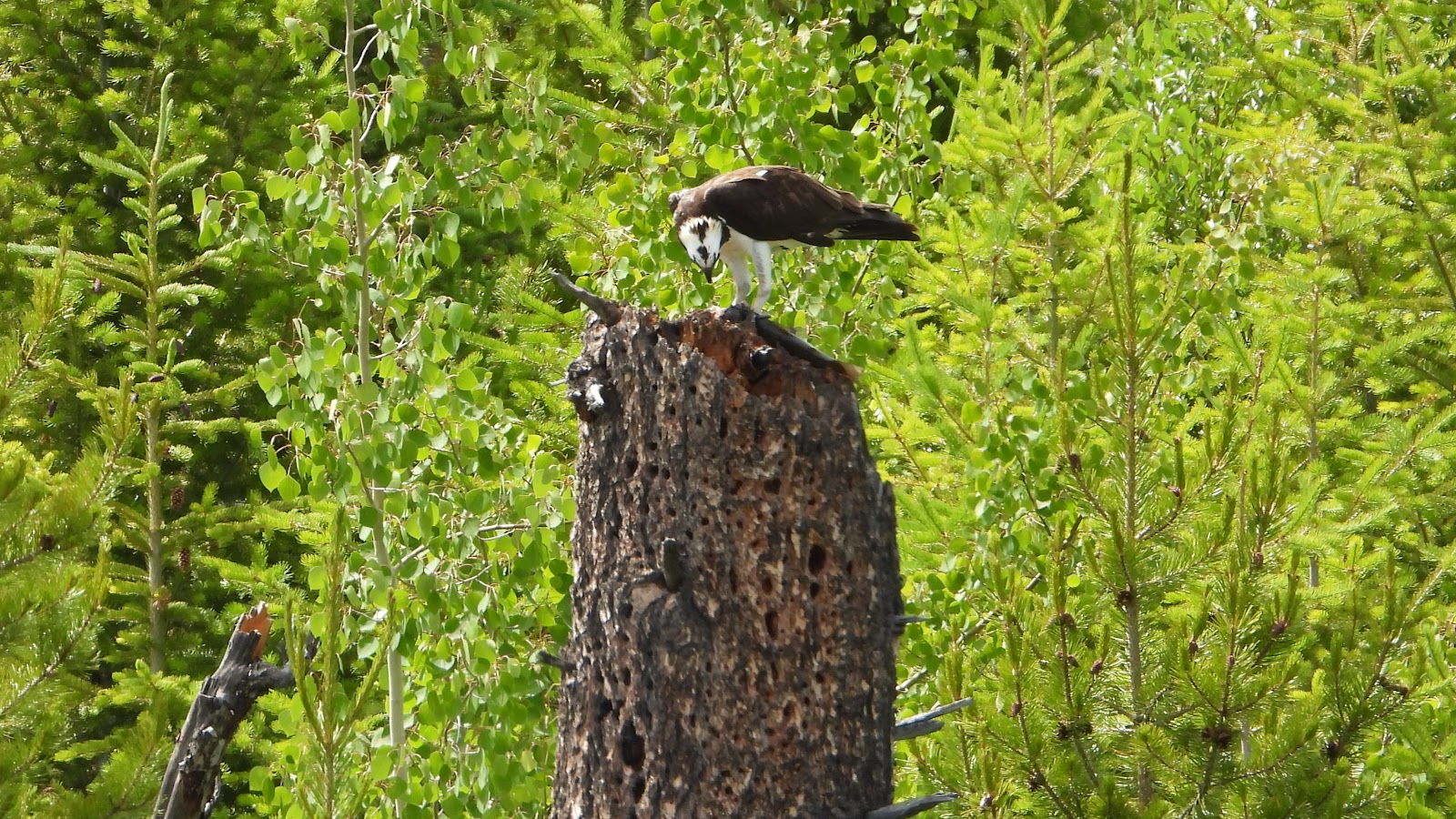 Here's another osprey chowing down on some fresh caught fish (probably lake trout).
|
||||||||
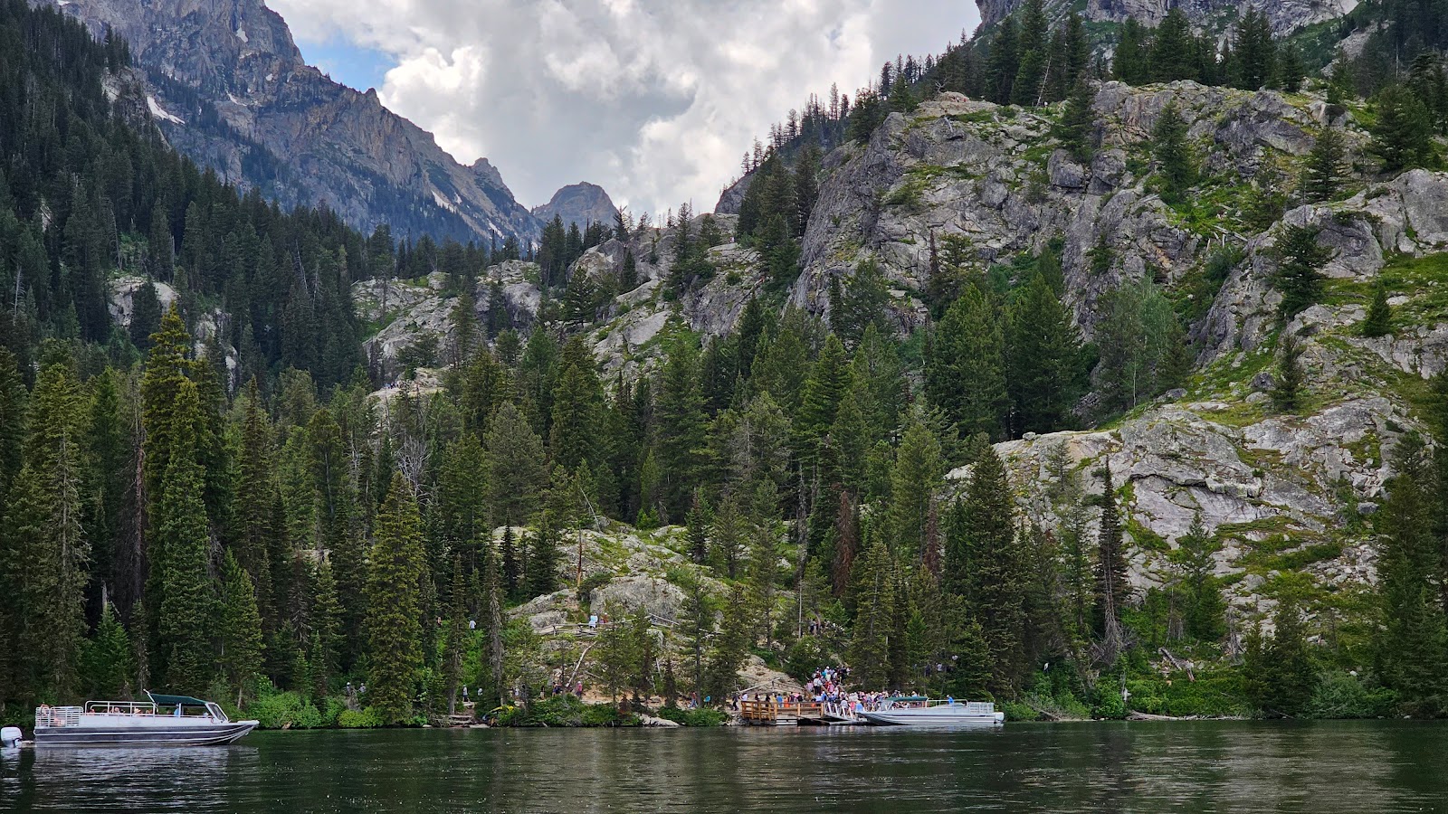 Here's the "Shuttle Boat" landing on the far side of Jenny Lake.
Nearly an hour wait to return to the Visitor Center, I'm glad we're on the "Scenic Cruise" boat.
|
||||||||
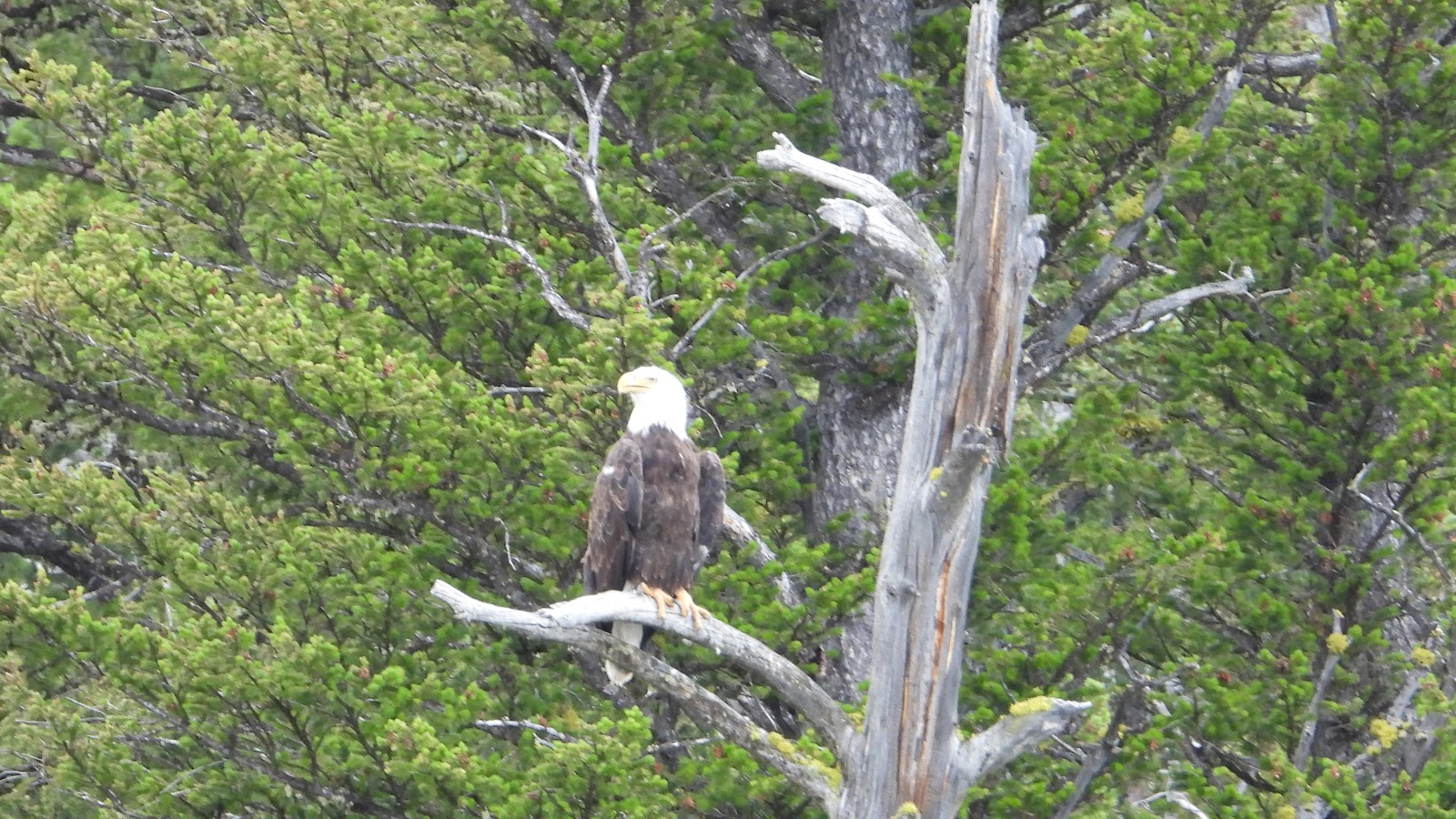 Another wildlife sighting was a Bald Eagle high up on his perch.
|
||||||||
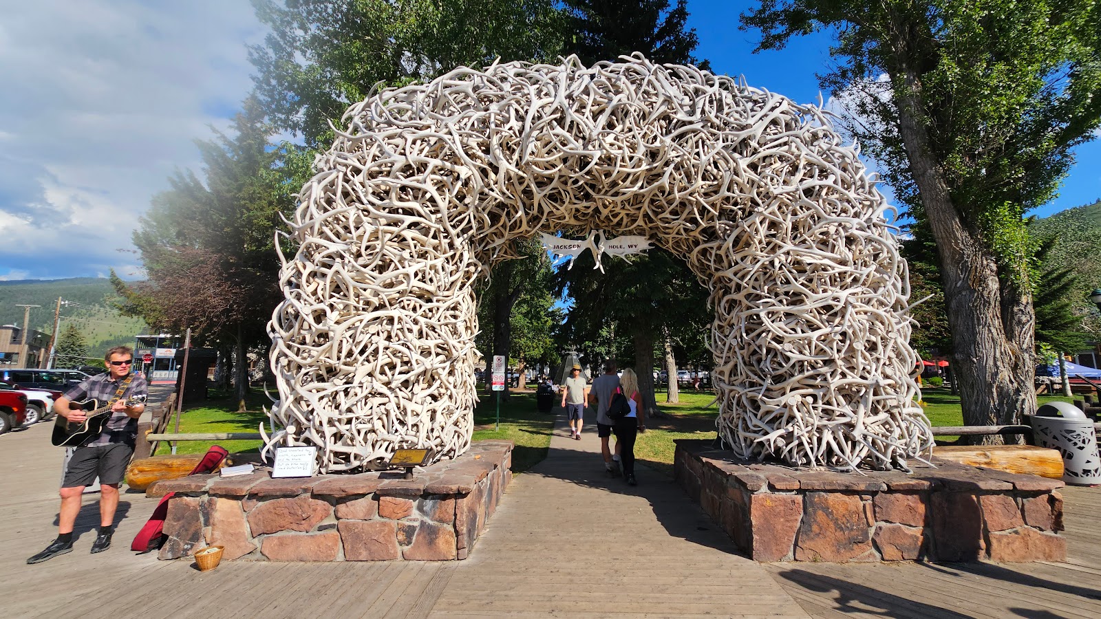
 There we are under one of the famous Elk Antler Arches of The Jackson Town Square.
There are four of them, one in each corner of the Square.
|
||||||||
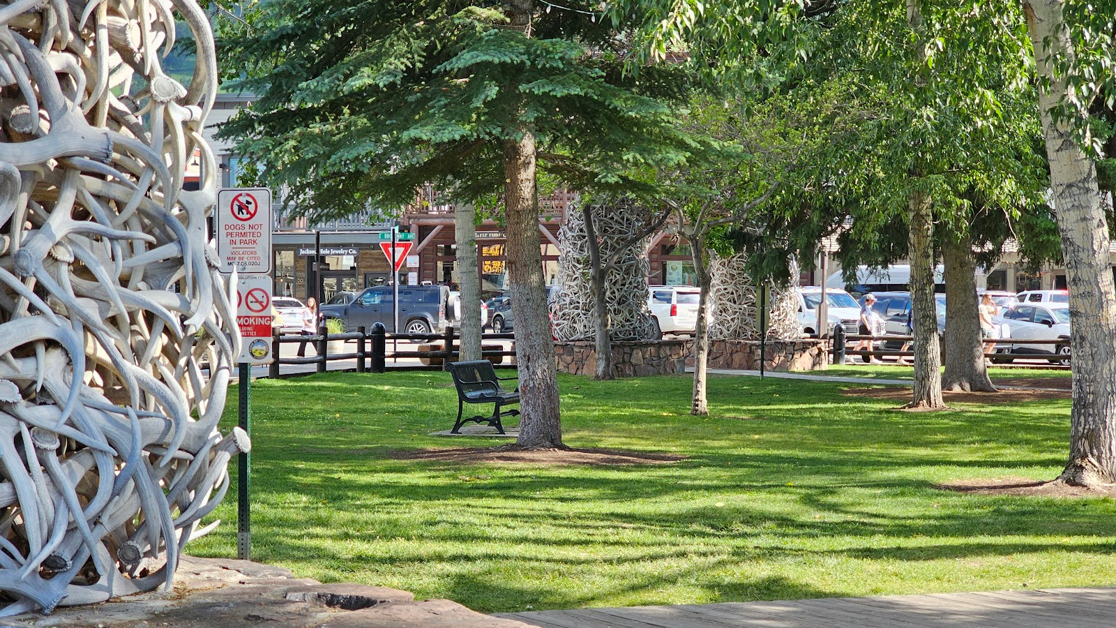 There is plenty of shade and seating in the center of The Square.
|
||||||||
 There were even two street musicians located around The Square.
|
||||||||
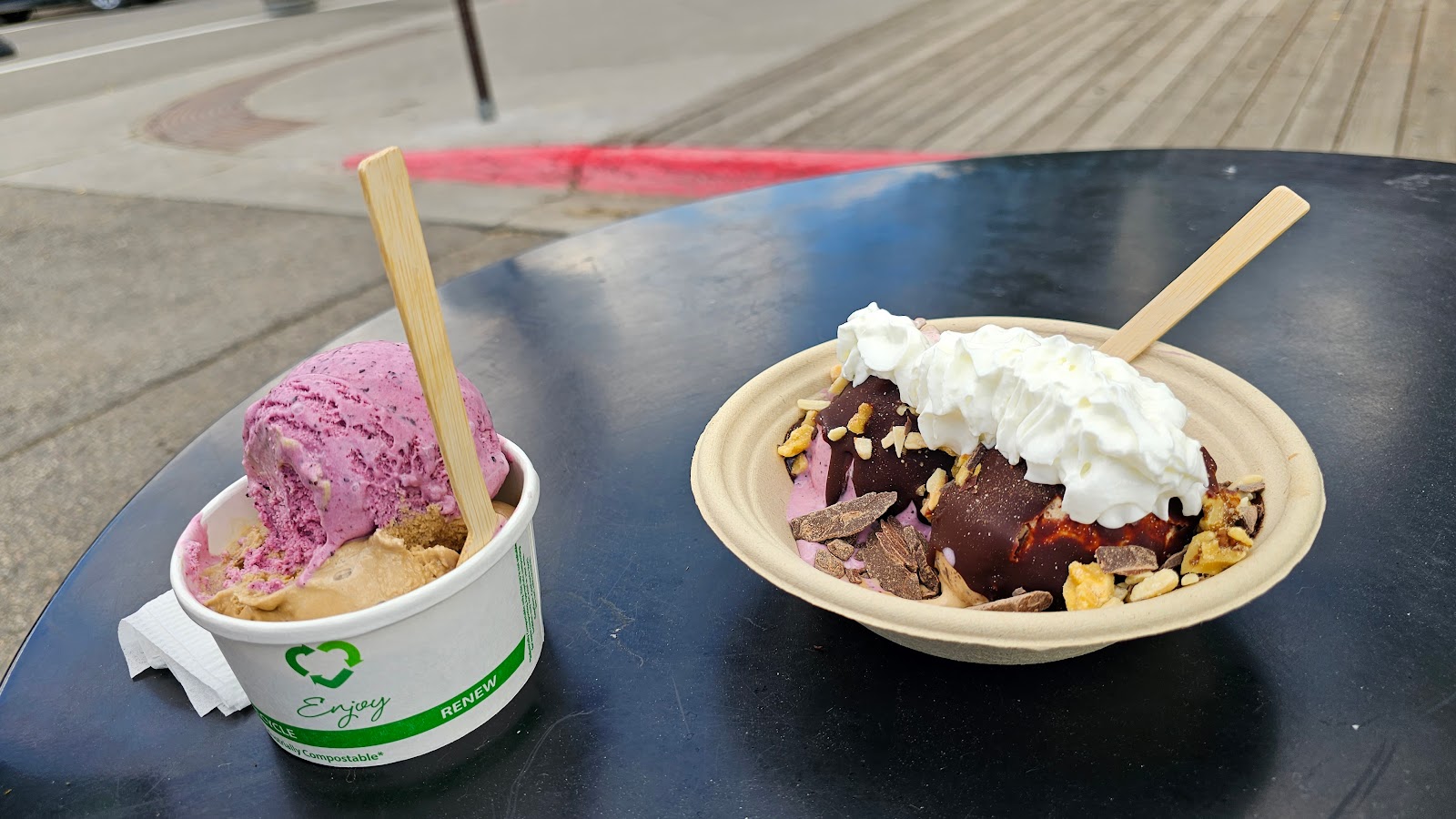 We're also here to sample the Food Network's "Best Desert in Wyoming" Award Winner,
the Wild Huckleberry flavor from Moo's Gourmet Ice Cream.

She did her normal walking route from the campsite, down to the boat ramp, and then back. It's about a 15-minute ½-mile walk each way, so all of the following photos were taken between 5:45AM and 6:15AM this morning.
EARLY MORNING IMAGERY
|
||||||||
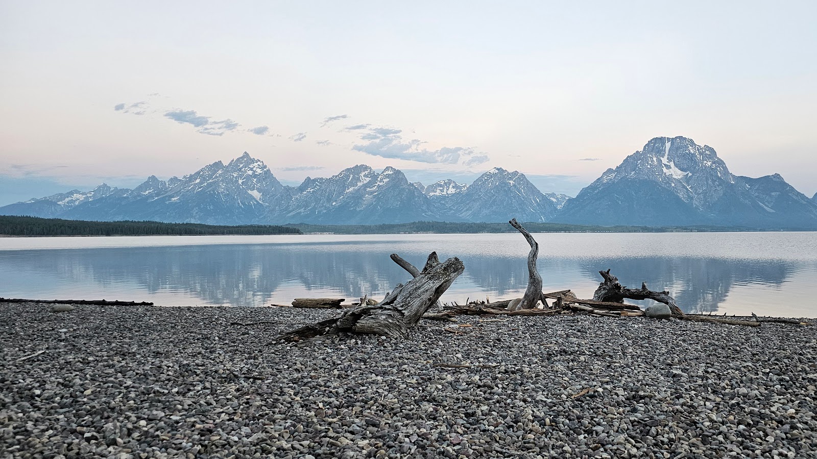 "The Beach" on the shoreline of Lake Jackson at Signal Mountain boat launch.
|
||||||||
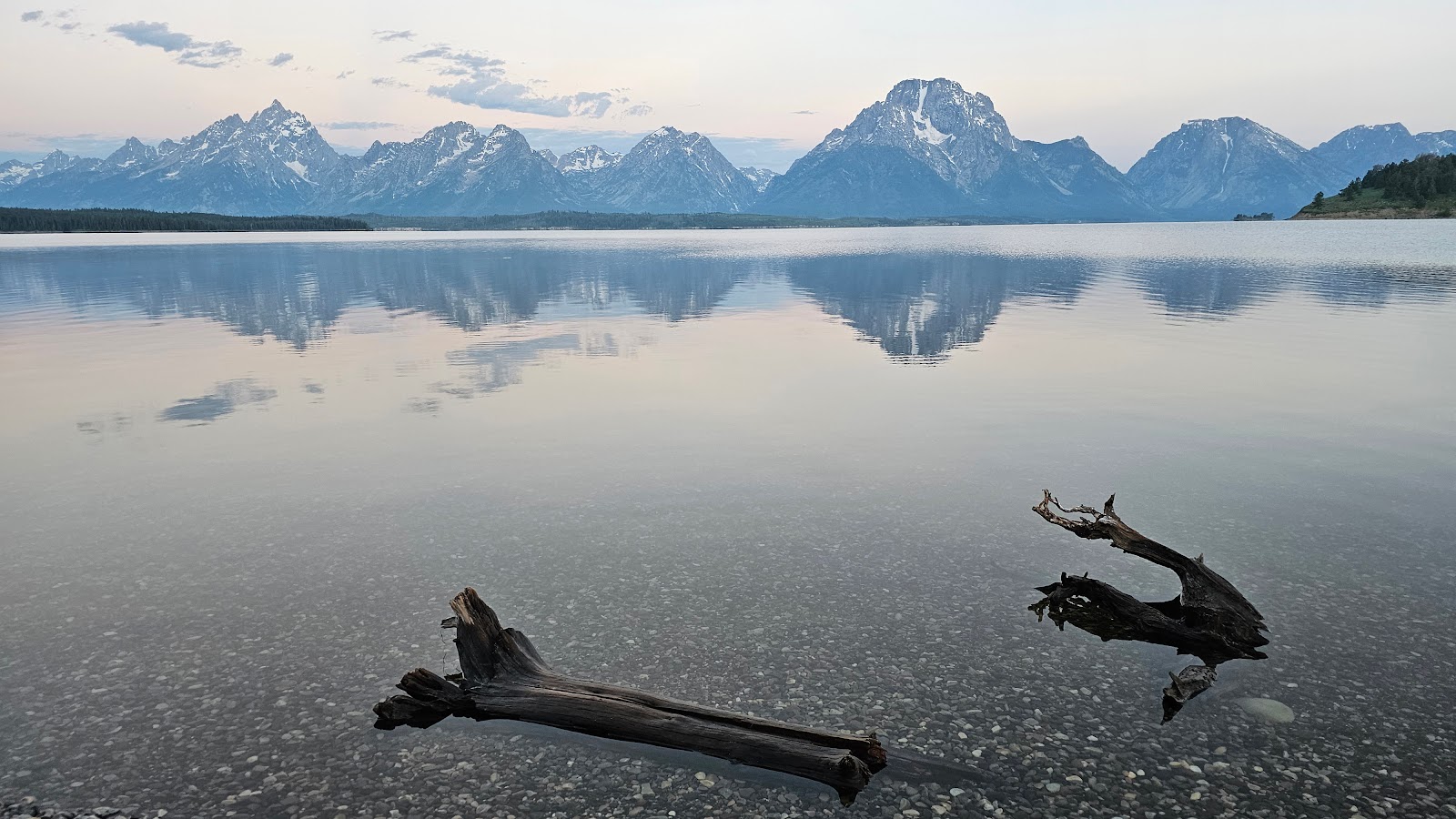 No sand, no surf and 58°F water! Not our idea of a beach, we're from Florida afterall.
|
||||||||
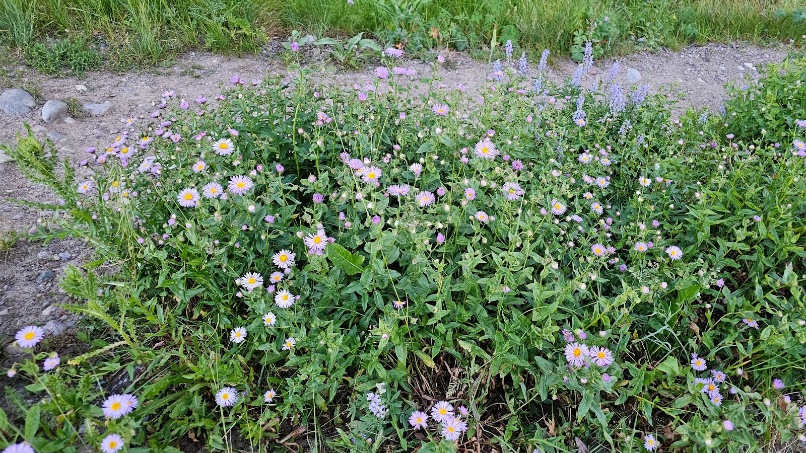 There were many flowing plants along the roadway to the boat launch.
|
||||||||
 Imagine that, another purple flowering plant (Tricia's favorite color)!
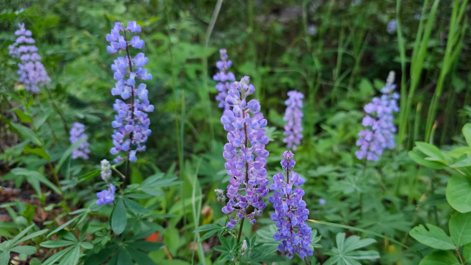
|
||||||||
 Who's that trying to blend into the background behind our campsite?
|
||||||||
 That's not Elroy! No bald spots on the left shoulder and look at that face.
|
||||||||
 Both sides of the face seem to be badly discolored or scarred.
|
||||||||
 Guess what we'll name this one if he shows up again in our travels.

Afterwards Tricia had left overs so we took them back to THE POD to place in the fridge.
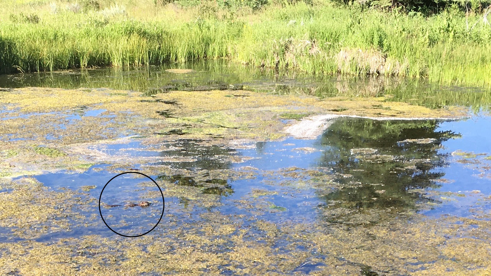
Next we headed straight over to Schwabacher Landing to see if we could spot the moose family that is rumoured to hang out there. No such luck, but I did catch a quick photo of a playful otter with my 7-year old iPhone SE (1st generation).

Another popular spot for moose sightings is at the first pullout heading south on the Moose-Wilson Road near the southern end of the park.
We just missed seeing one here on Sunday when we drove the entire road down into Jackson for our ice cream treat.
Today, no moose were to be seen!
It's getting too late in the day to expect to see any large wildlife, so we'll turn our attention to visiting some historic locations here in the park.
Menor's Ferry and the Cunningham Cabin will finish out our morning quite nicely, the best thing is they are "guaranteed to be there" when we arrive. Although later we learned that all the buildings at Menor's Ferry are padlocked shut during the week, so we had to settle for peeking in the windows today.
MENOR'S FERRY HISTORIC DISTRICT
AND
THE CUNNINGHAM CABIN
|
||||||||
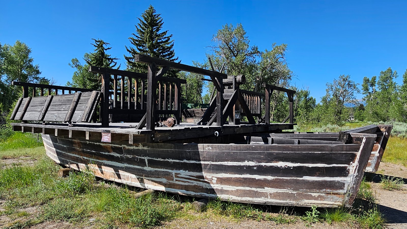
 This is a replica of the ferry that Bill Menor ran from 1894-1918.
|
||||||||
 It ran across the Snake River on a rope and used only the current to propel it across.
|
||||||||
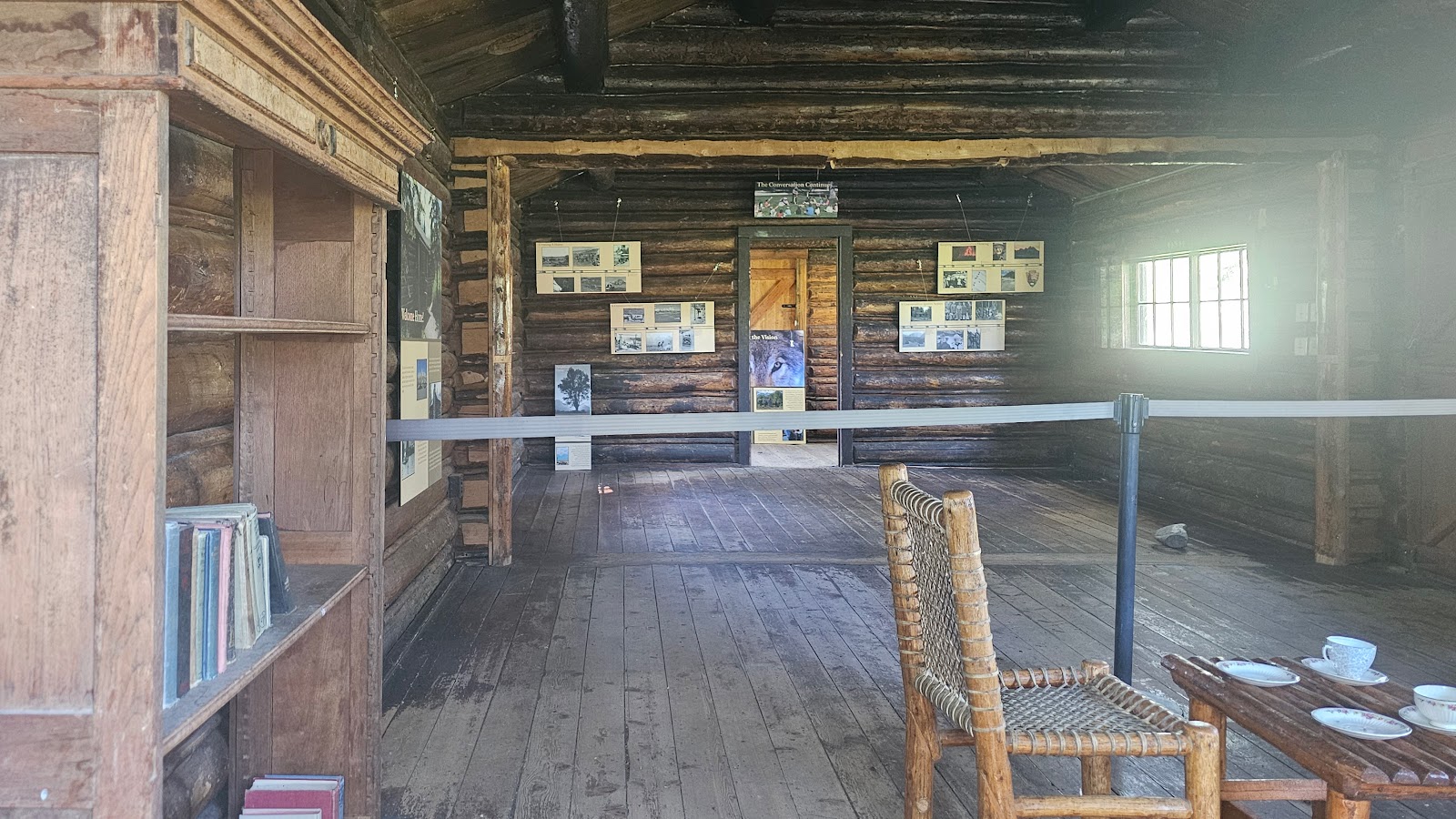
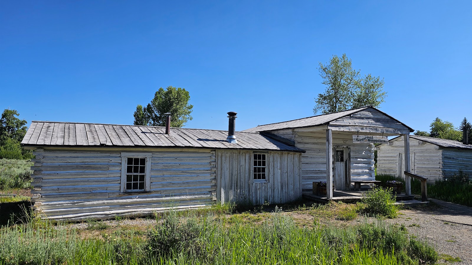 This is Bill Menor's cabin and store, built in stages between 1894 and 1905.
|
||||||||
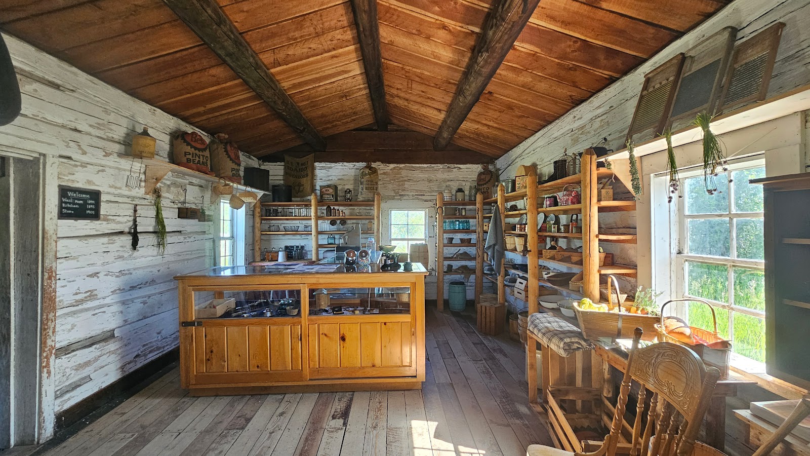 The right hand section contain a small general store.
|
||||||||
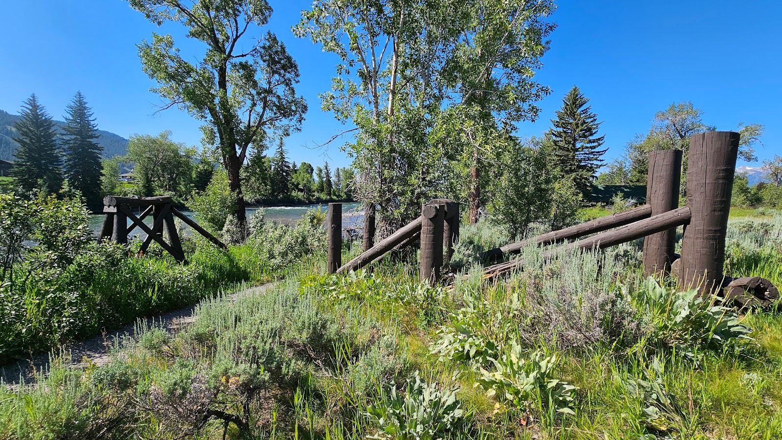 This is a replica of the large pier used to anchor the rope on each side or the river.
|
||||||||
 This was Bill's storehouse and root cellar
|
||||||||
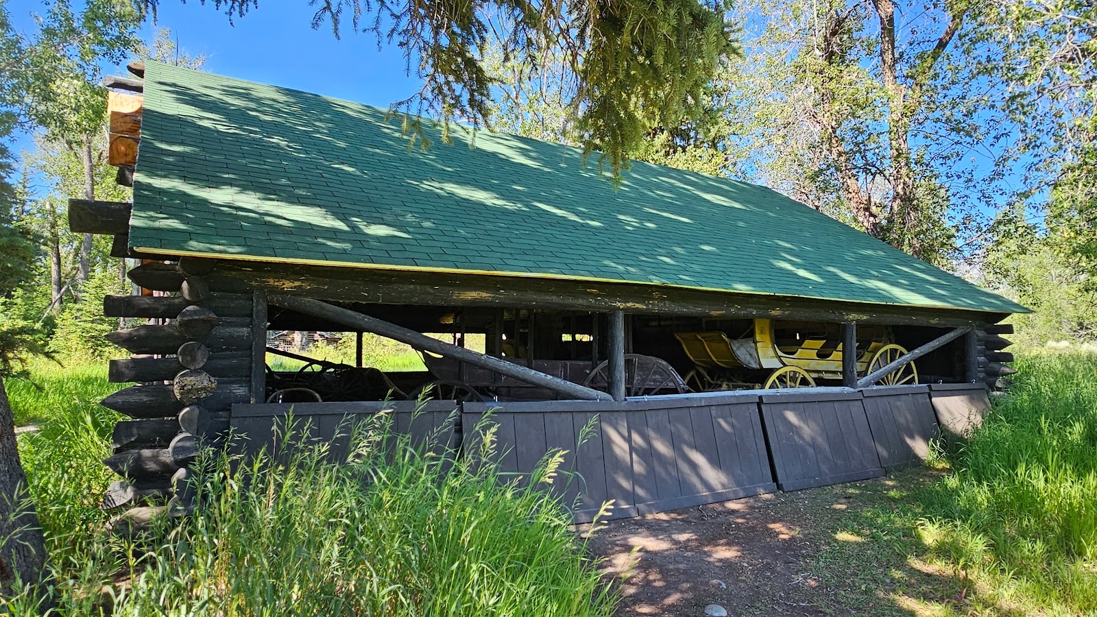
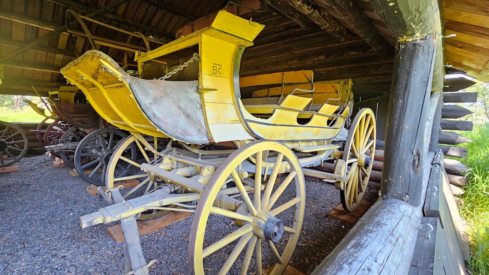
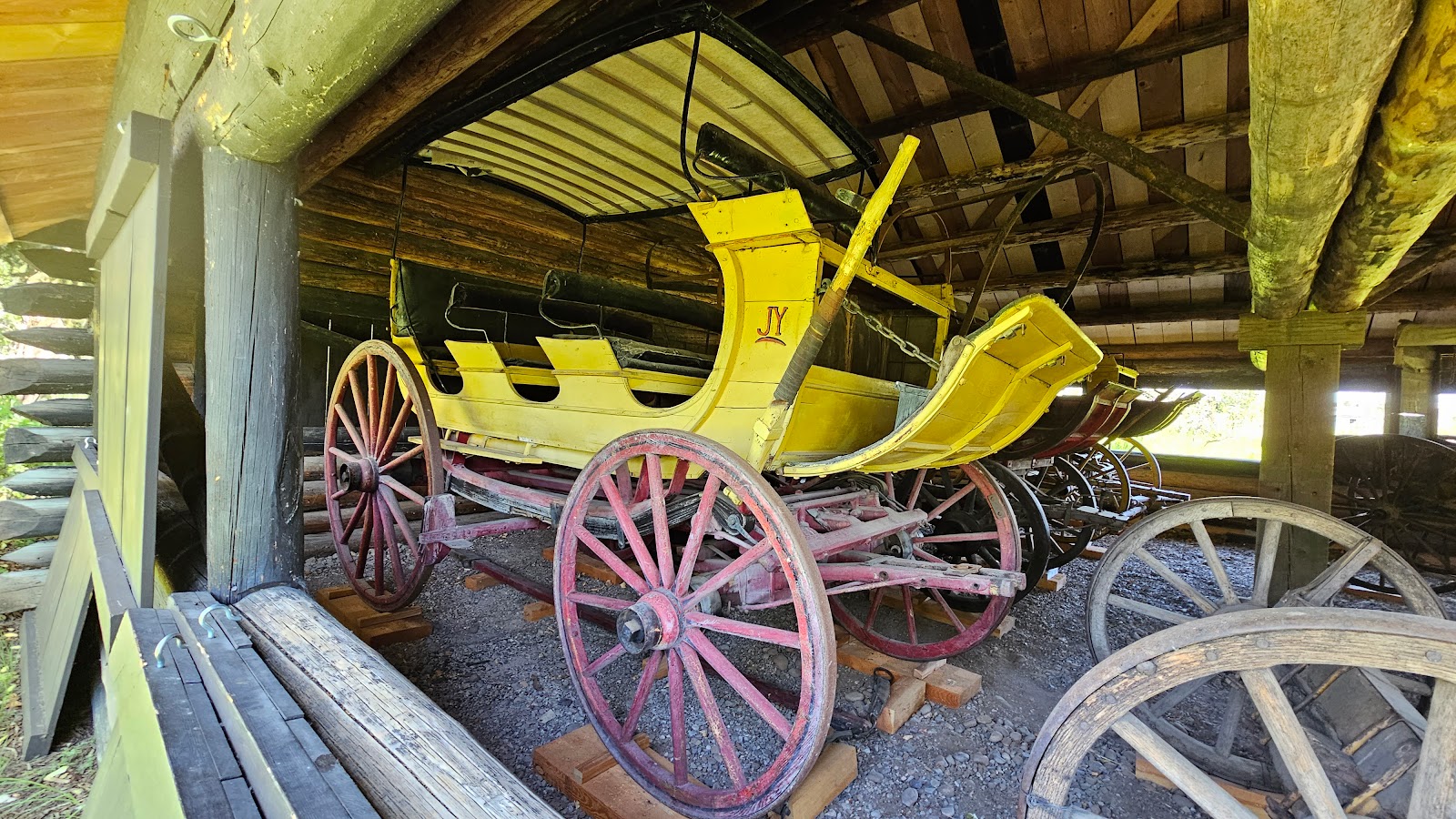
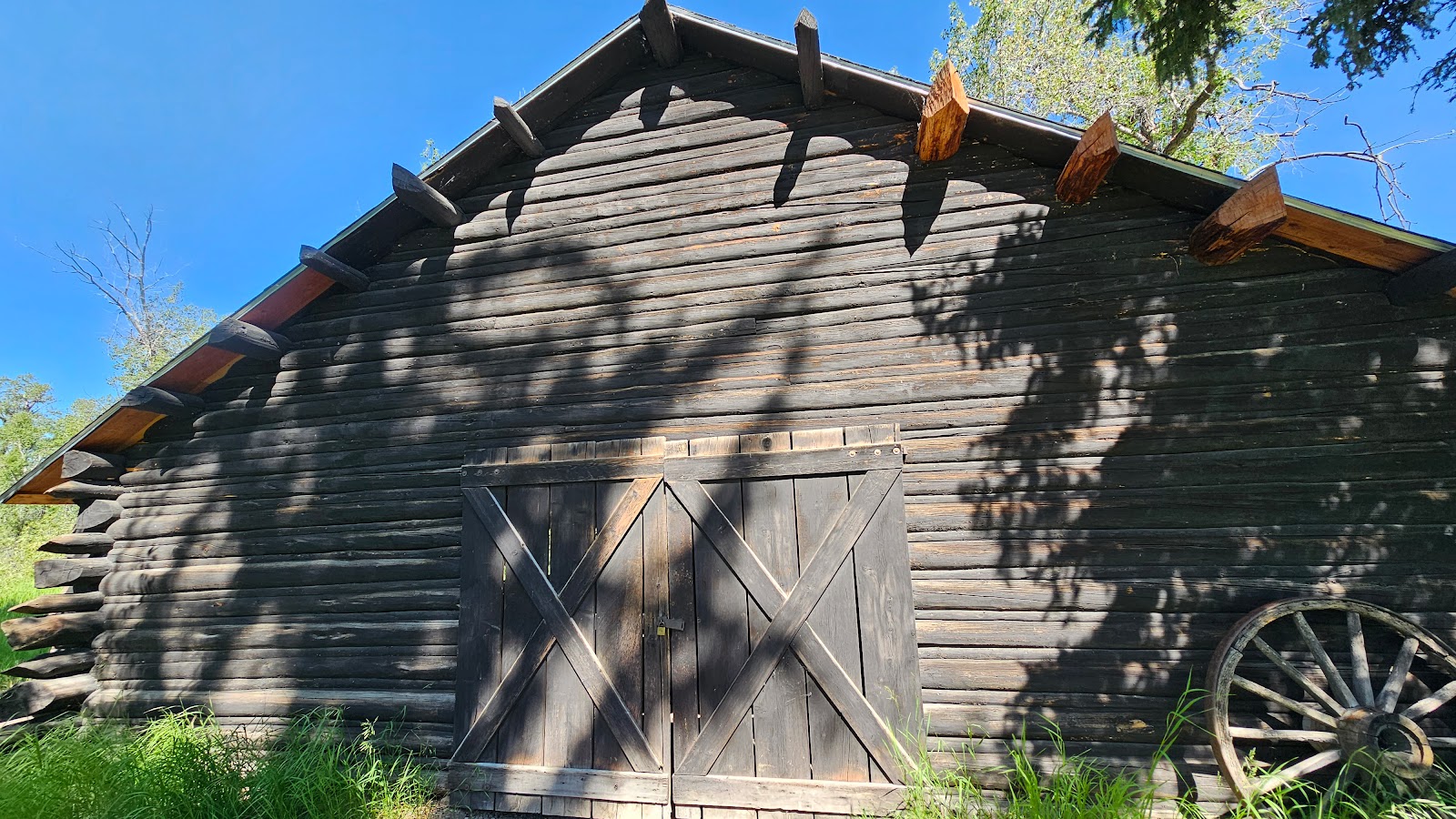 This was originally the blacksmith shop, but today it's used as a carraige house.
|
||||||||
|
||||||||

|
||||||||

|
||||||||
|
||||||||
|
||||||||
 This is Maude Noble's cabin, she bought out Bill Menor's homestead in 1918.
|
||||||||
 A very important meeting took place in this cabin in 1923.
|
||||||||
 The 1929 creation of Grand Teton National Park was started during this 1923 meeting.
|
||||||||
 In 1927 a bridge downstream made the ferry obsolete and in 1929 the property was sold.
|
||||||||
 Since 1929 this property has been part of the Grand Teton National Park.
|
||||||||
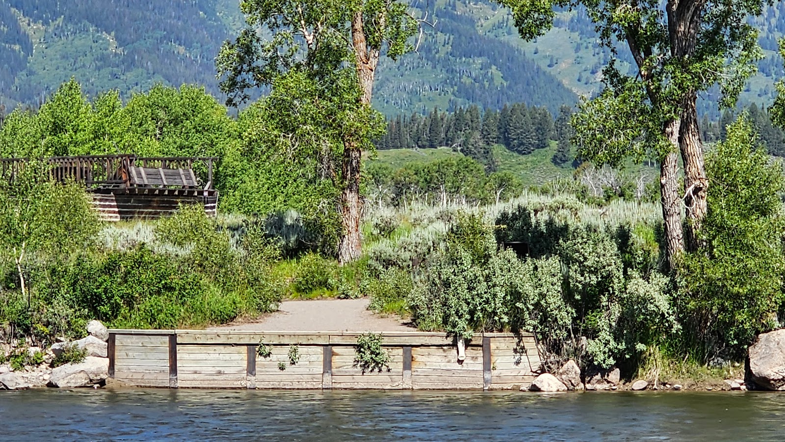 From the opposite bank of the Snake River you can see where the ferry dock was located.
|
||||||||
 Also from the opposite shore you can see the magnificent backdrop of the homestead.
|
||||||||
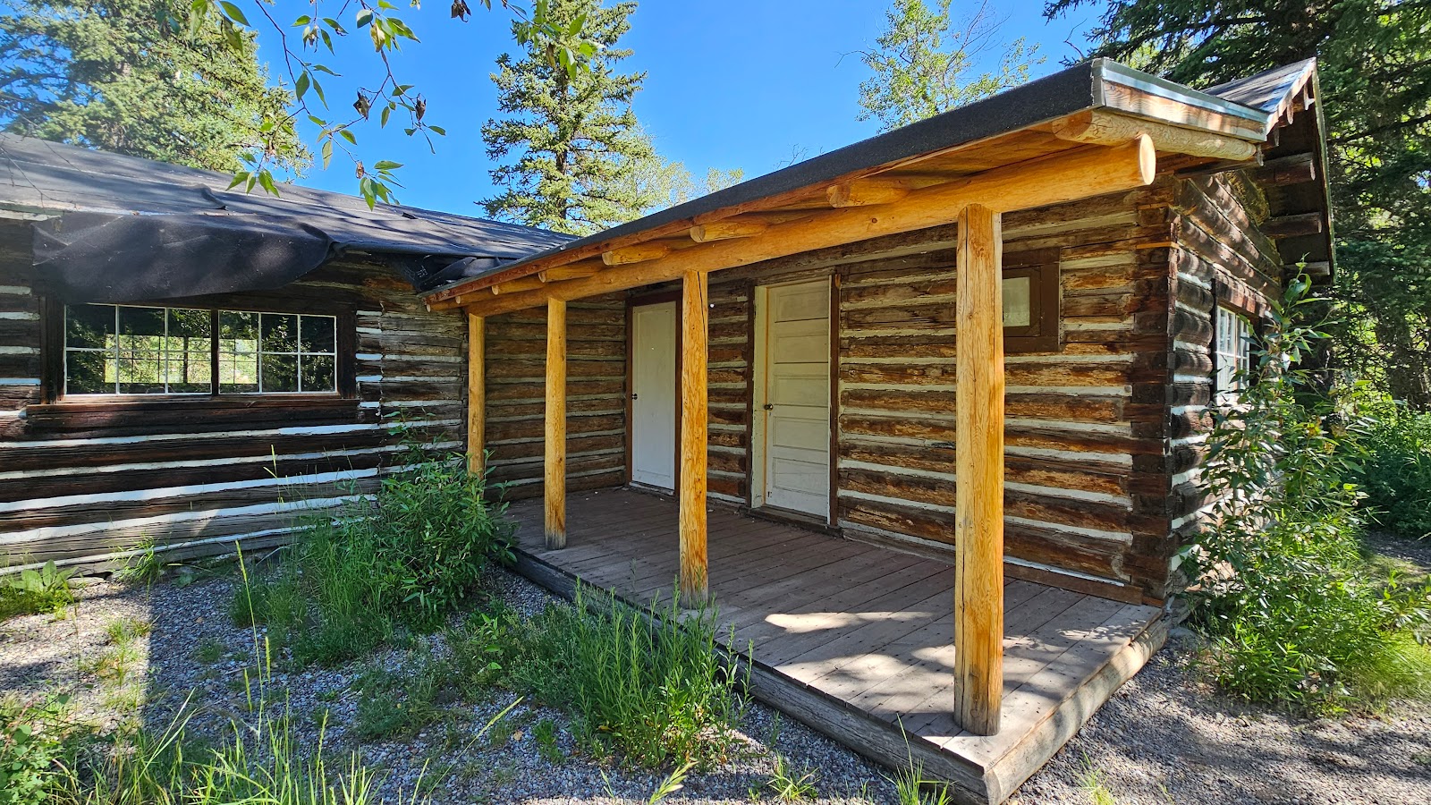
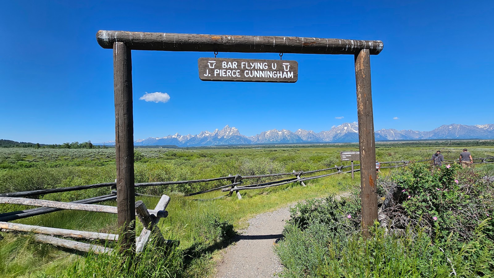 The Flying U Ranch was established in the 1880s by J. Pierce Cunningham.
|
||||||||
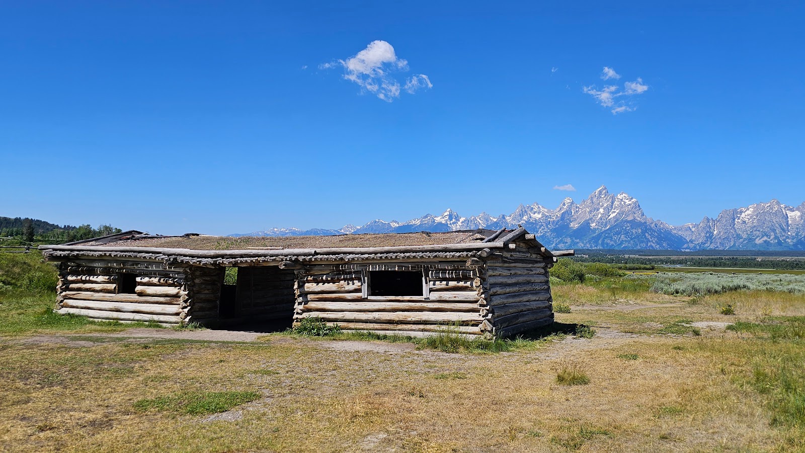 The Cunningham's cabin is the only structure still standing on the homestead.
|
||||||||
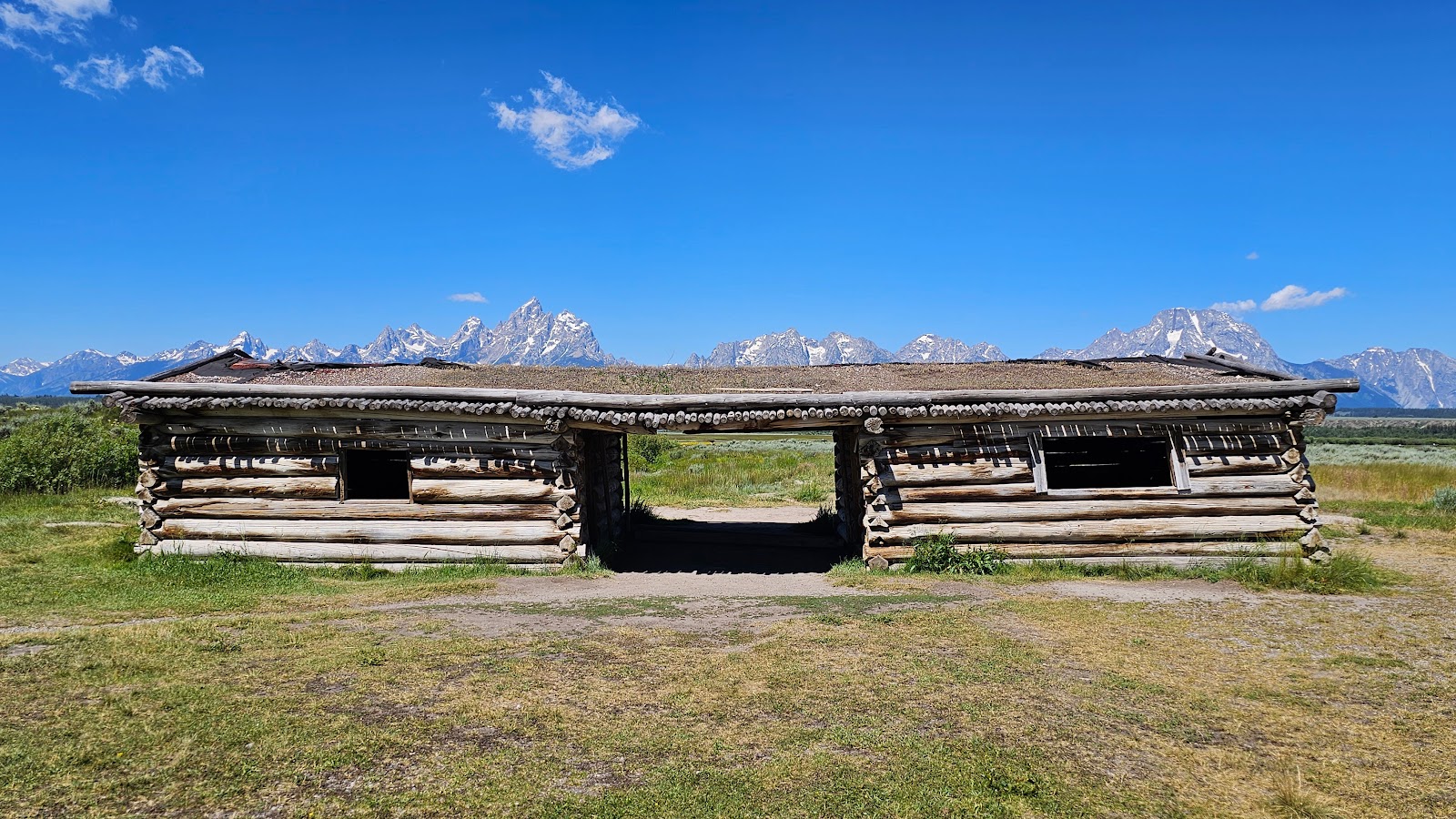 The cabin is of a "dogtrot" style, two separate cabins joined by a breezeway.
|
||||||||
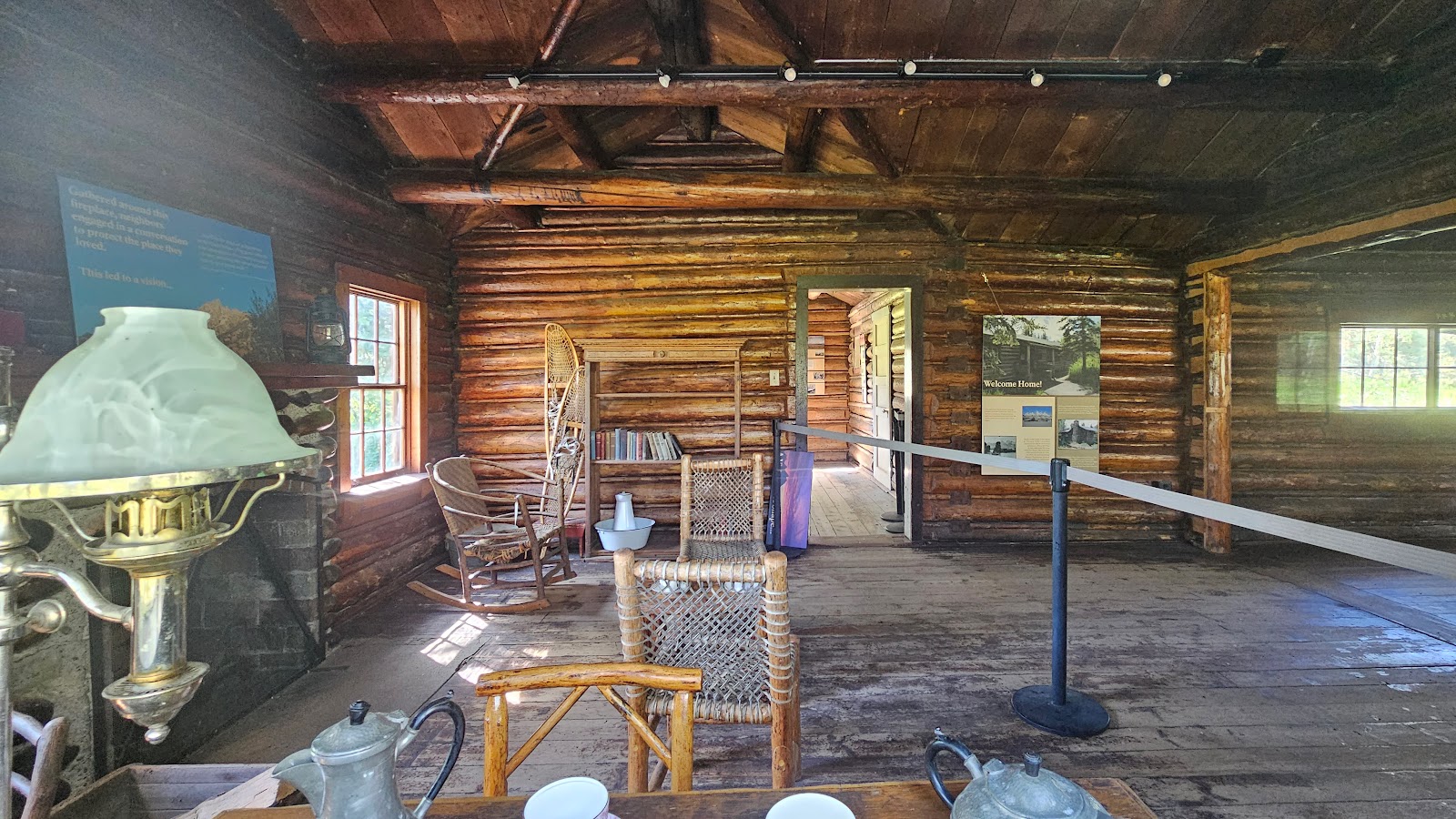
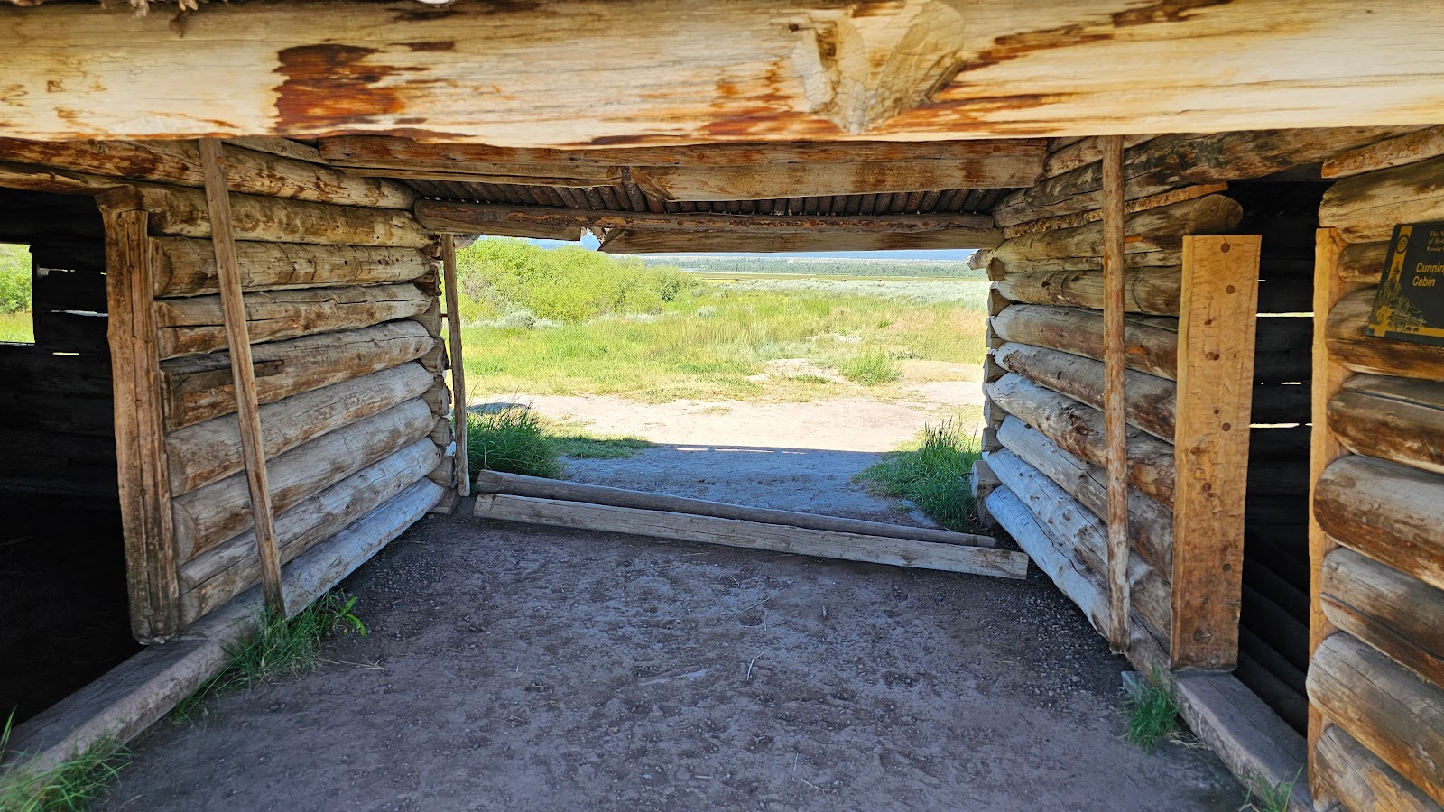 The breezeway roof was very low, even I at 5'7" had to duck my head to enter.
|
||||||||
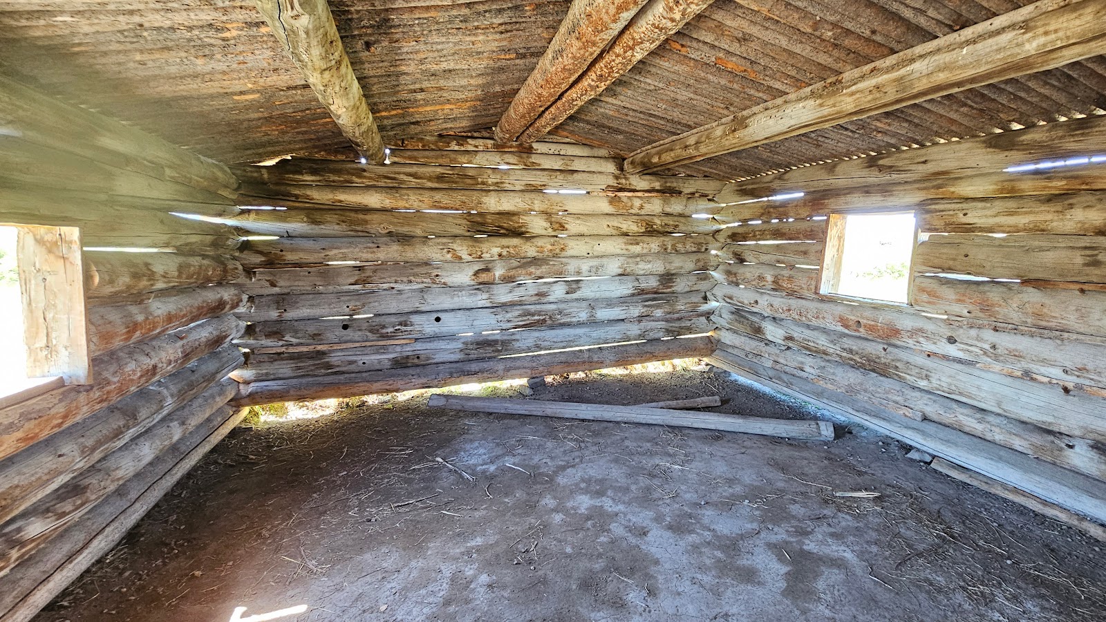 The floors were dirt. They were wetted with water, compacted and then swept.
|
||||||||
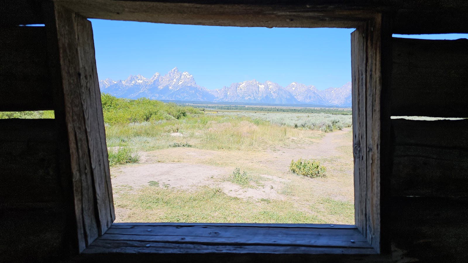
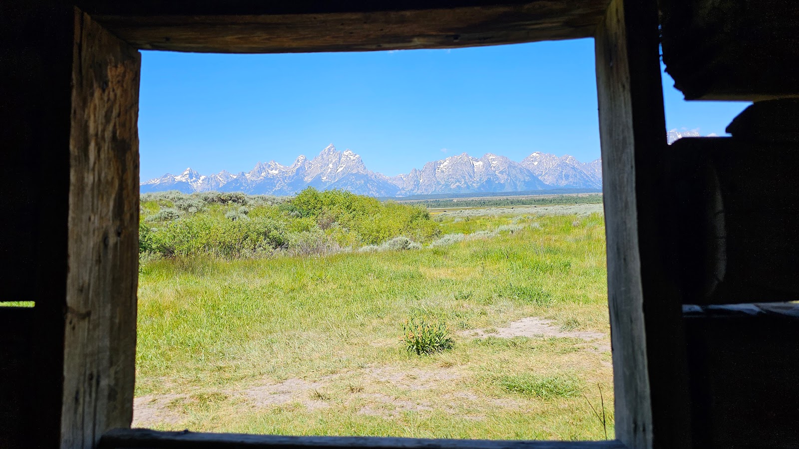 One thing this cabin didn't lack were great views from the windows...
|
||||||||
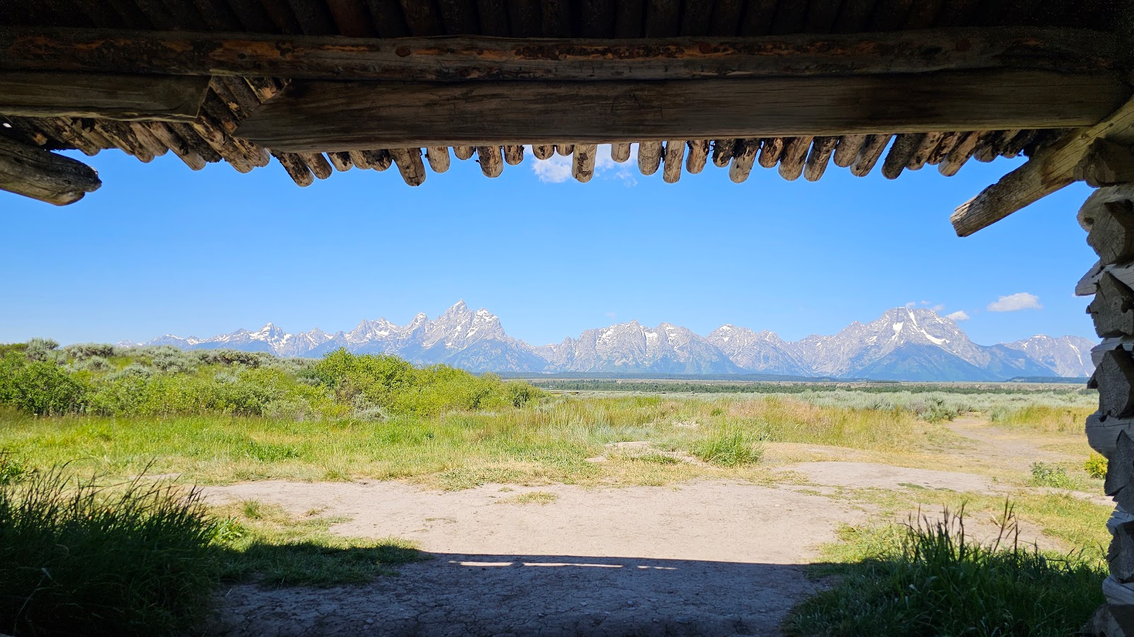 ...or from sitting under the breezeway.
|
||||||||
|
||||||||
We may have been shutout seeing moose or black bear this week in Grand Teton National Park, but I'd say we got our fill of up close encounters with elk and now bison this week.
I offer you seven short videos taken over the space of 30-minutes of what I'm going to call:
"BISON JAM"
GRAND TETON FLAVOR
but they were always several hundred yards from the roadway.
Today was very different, quite a few of them were maybe just 10-yards from the road.
They are born late March-May and are orange-red in color, weighing 30-70 pounds.
Bison are the largest mammal in North America.
Male bison (called bulls) can weigh up to 2,000 pounds and stand 6 feet tall.
Both parents are "extremely" protective of their young!
They can spin around quickly, jump high fences and are strong swimmers.

We're moving just a few miles north where we'll spend the weekend before heading to our next National Park (#27 of 51 for us).
If you've looked at a map, I'm sure you've already guessed where that'll be! It's the granddaddy of them all, our nation's 1st National Park.
Would you like to be notified of new blog posts?


